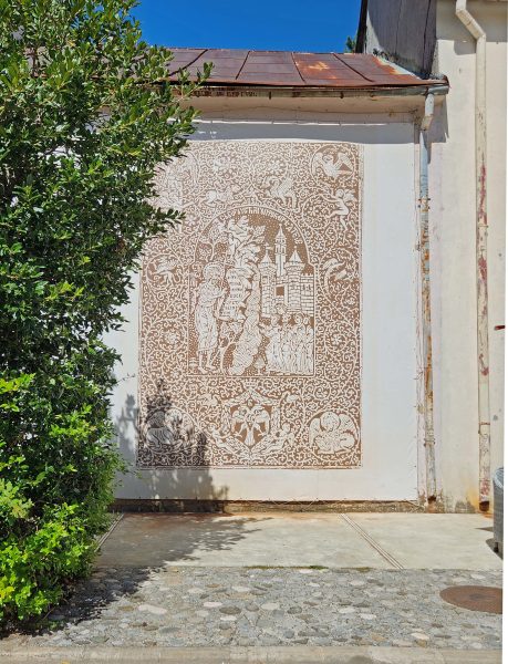
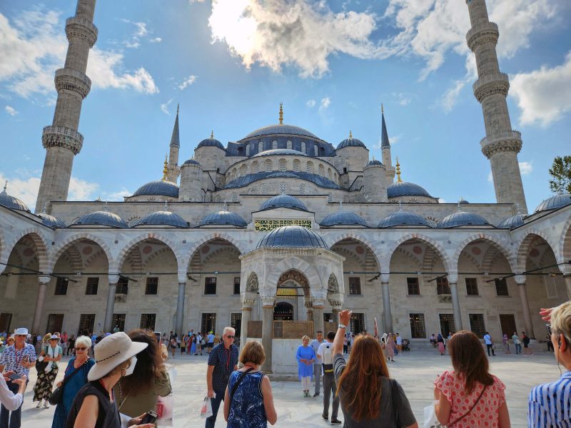
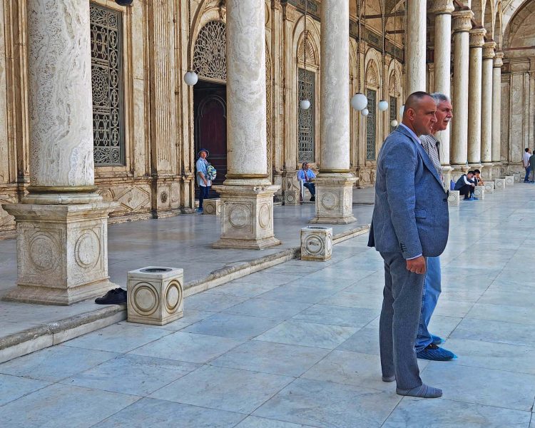
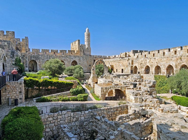
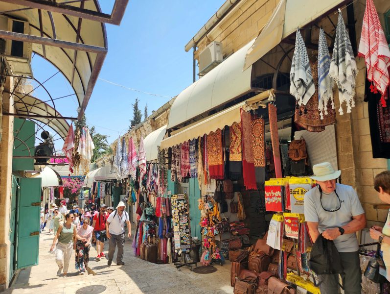
Murano, a small island just north of Venice, has been the home of Venetian glassmaking since the 13th century. It took 50 years to become a master glass blower, and masters usually began learning the trade in their early teens by working with their fathers and grandfathers. Glassmakers were so well respected in the 13th and 14th centuries that they had heightened social status. As of 1376, the law affirmed that if a glassmaker’s daughter married a nobleman, there was no forfeiture of social class, so their children were nobles.
In 1291, a law confined most of Venice’s glassmaking to Murano to remove the threat of a disastrous fire in Venice. Conveniently, this isolation had other benefits as well. First, it prevented the spread of Venetian glassmaking expertise to potential competitors, because either leaving the island without government permission or revealing trade secrets was a crime punishable by death. Second, the confinement simplified government monitoring of glass industry imports and exports.
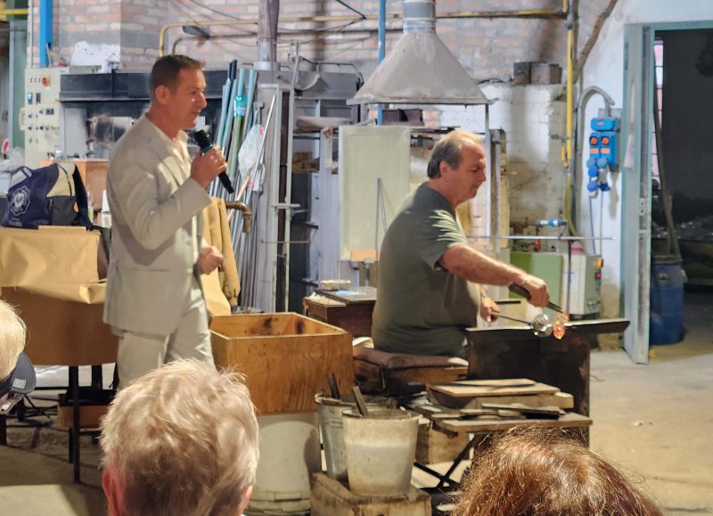
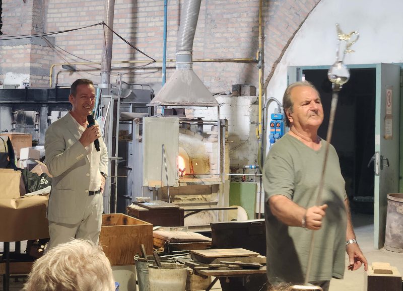
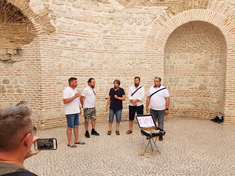
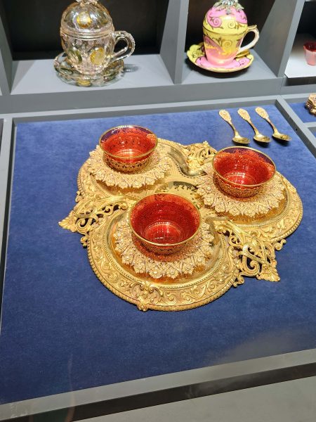
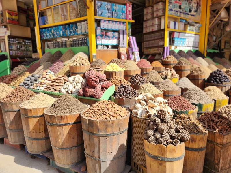
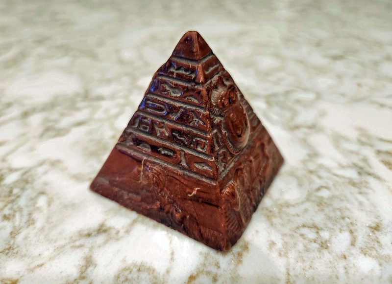
Venetian glass is made with a soda-lime “metal” in an extremely complicated process that produces a shiny, rock-hard vitreous substance. The glass is typically elaborately decorated with glass-forming techniques, gilding (lots of 24-karat gold), enamel, or engraving. It’s breakable, but it’s more resistant to breakage than lead-based glass. The manager at the glass-blowing shop we visited held a beautiful Venetian glass goblet about 18 inches above a Venetian glass mirror and dropped it. It landed with a crash and a gasp from our group of observers, but neither the goblet nor the mirror cracked or broke. At the sound of the group gasp, the manager (the guy holding the microphone in the photos below) grinned and said, “I just love to scare people that way.”
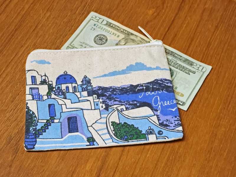
The single stemmed glass that the manager dropped (or others like it) could be purchased for $155. A small jewelry pendant made of Venetian glass might cost around $30; a large vase can cost thousands of dollars. The high cost of Venetian glass is mostly due to the labor involved in making this complicated, heavily decorated glass; the price of the materials is a distant second. Ted and I looked at a glass sculpture that was about 15-18 inches high. We thought it would look nice on our dining room table, but $6,000 was too much to pay for it, even with free shipping. We were not allowed to take pictures of anything on display in the shop, but you can search “Murano glass images” to see what this kind of glass looks like.
One of the shop’s master glassmakers provided a demonstration of glassblowing. I’ve seen glassblowing demos before, but never by a glassmaker who worked this quickly. He made a vase in roughly two minutes.
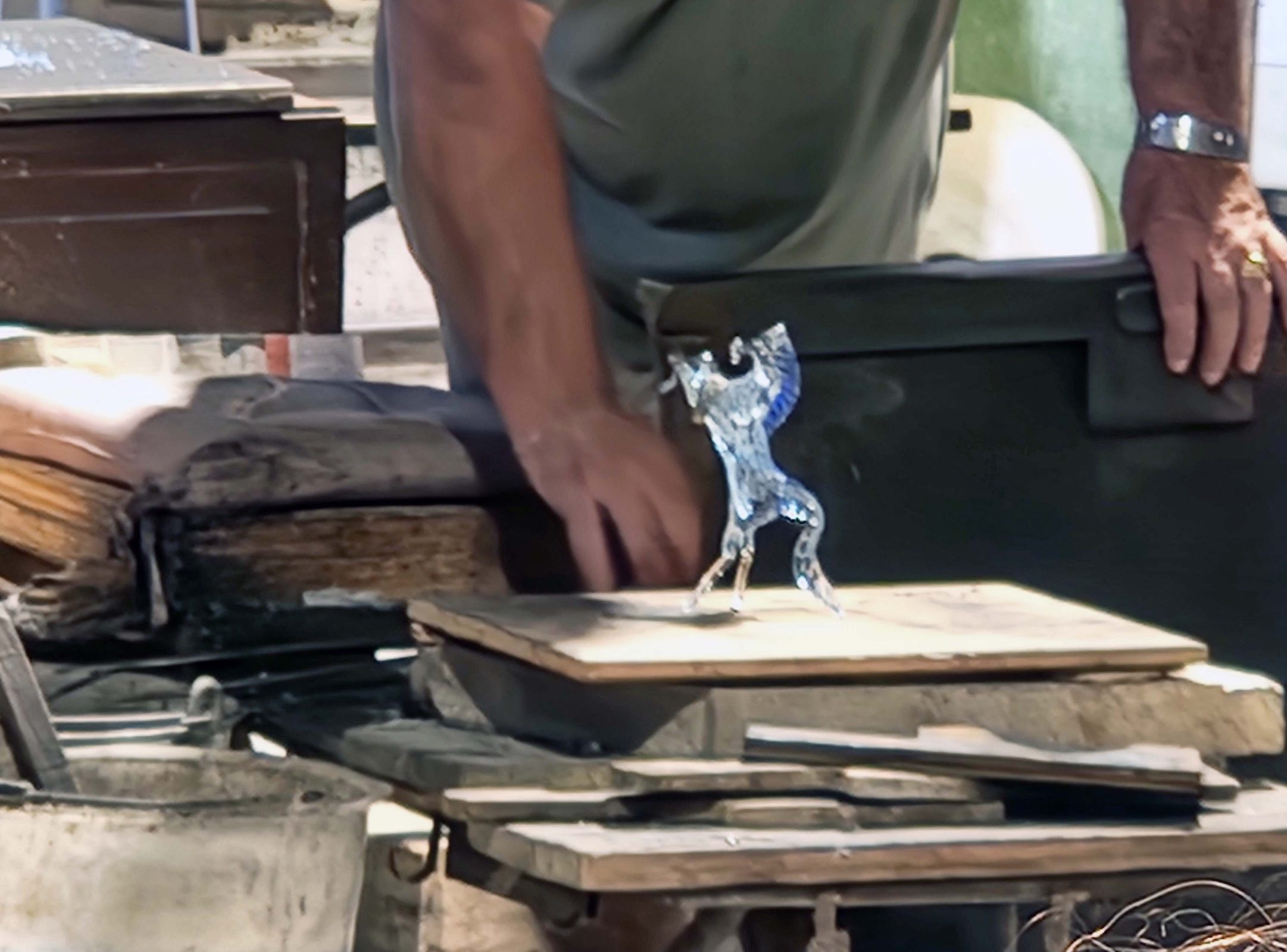
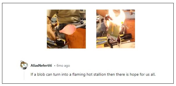
After the vase, the glassmaker shaped a prancing horse, a.k.a., a Ferrari horse, inspired by the original drawings of Leonardo di Vinci. Again, it took him about 2 minutes. He had a blob of hot glass, quickly tugged on it and bent it with his pliers, made a few quick snips, quickly pulled and sculpted it with another tool, then set it down to show us a glass horse with a flowing mane and tail.
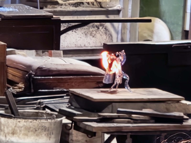
To demonstrate how hot the glass was after the horse was formed, the glassmaker dropped a piece of cloth on it. The cloth immediately burst into flames and became ashes. The moral of the story: Don’t touch hot glass! FYI, a larger Ferrari Murano glass horse costs $6,950. A small one like the one in my photo, sells for $3,995. You can buy them online.
I found an internet video showing a Murano glassmaker forming a prancing horse, followed by an interesting comment.
As our water taxi took us through the Venetian Lagoon to San Giorgio Maggione Island today, we saw a boat delivering new sofas to Venice.
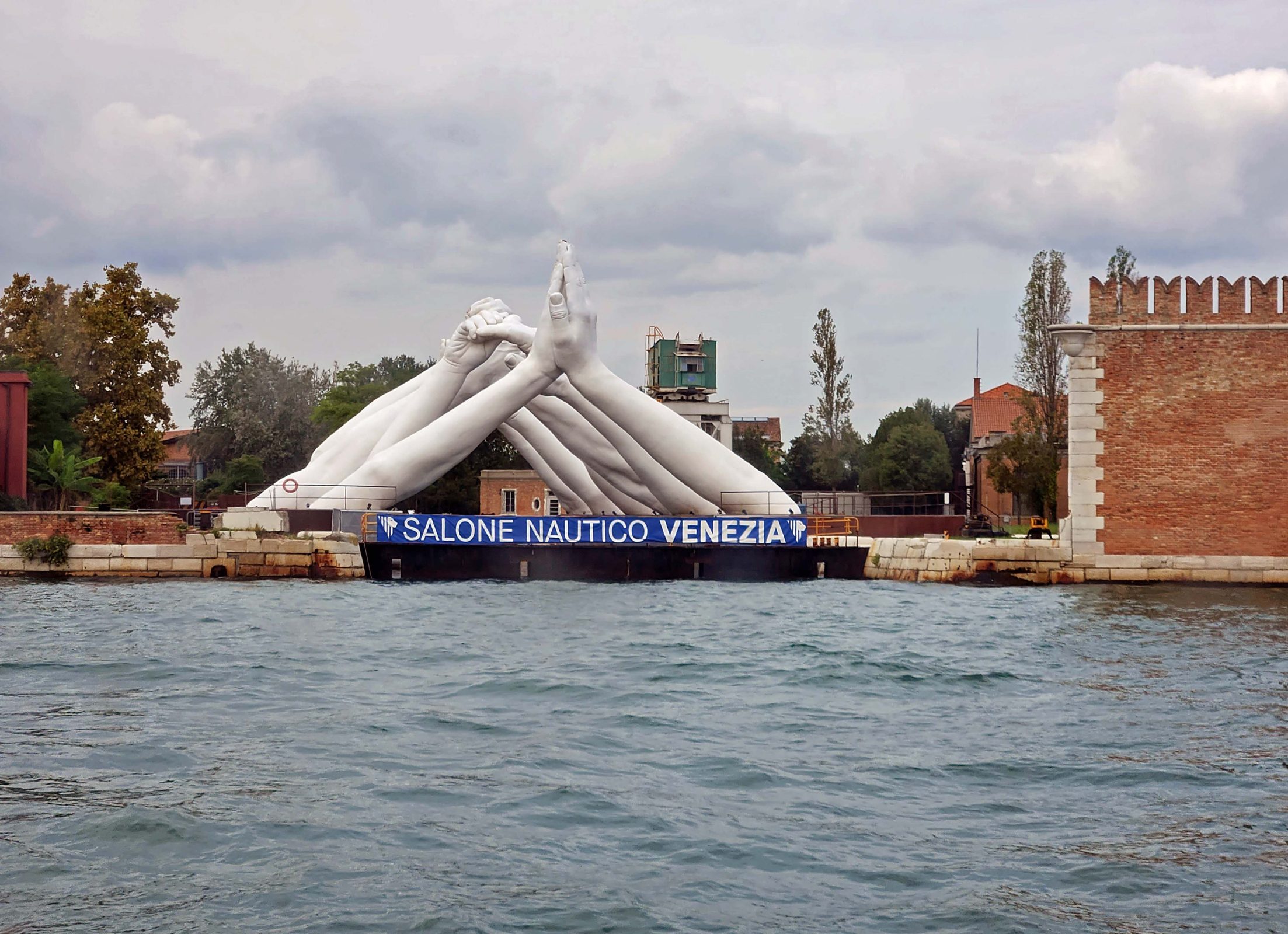
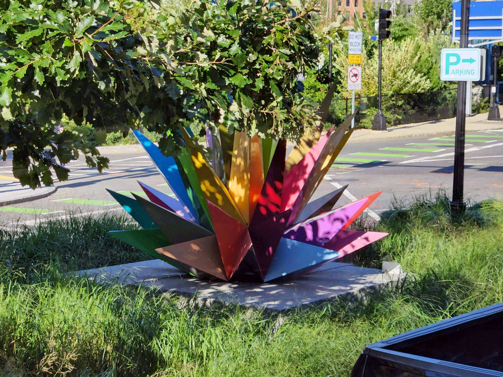
This sculpture is called “Building Bridges.” It features six pairs of hands, each pair different from the others, bridging the water as a symbol of the commonality humans share. Each pair of hands depicts one of humanity’s six universal values: Friendship, Faith, Help, Love, Hope, and Wisdom.
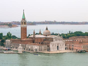
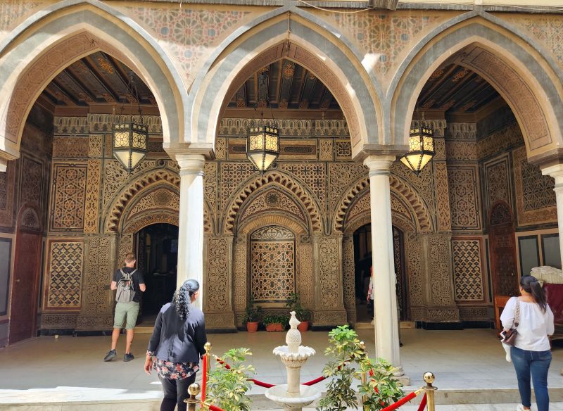
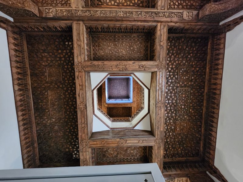
San Giorgio Maggiore (St. George Major) Island is very small and has a very large 16th century Benedictine church. The church is a counterpart of St. Mark’s and faces St. Mark’s Square across the basin in Venice. There wasn’t much room to take pictures of the church, so I pulled this one from the internet. In addition to the church, the island is the headquarters of an arts center and an open-air theater, and is also known for its library. The island and the church are popular subjects for painters and are featured in some of Monet’s paintings.
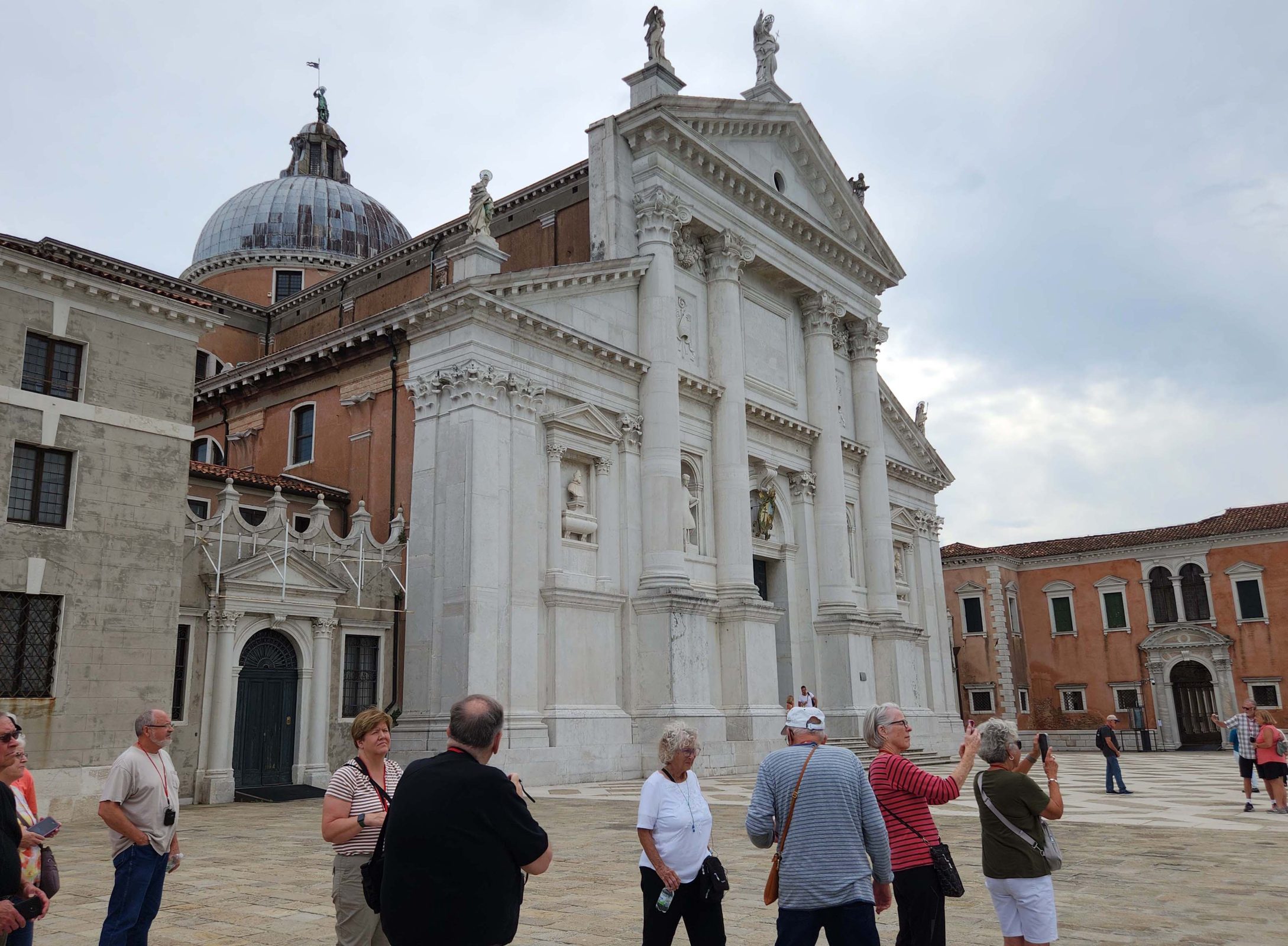
This is a closer view of the front of the church, which you can also see in the picture above.
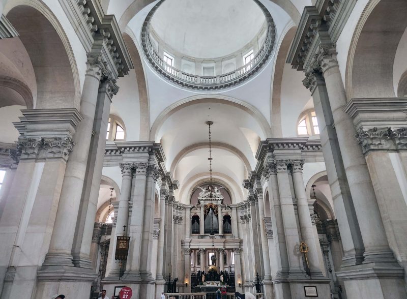
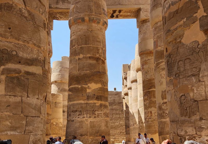
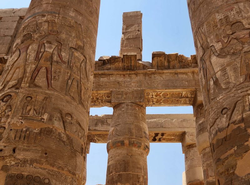
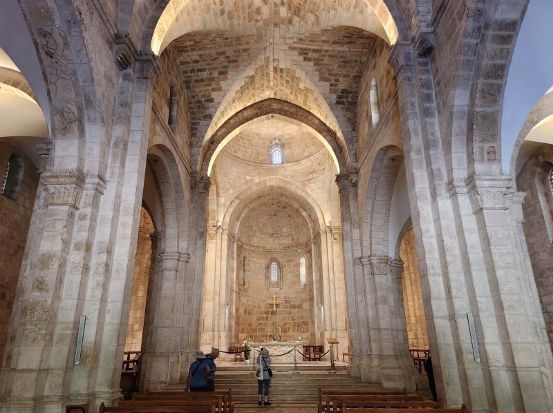
The interior of the church is very white and very bright. It features massive columns in the nave.
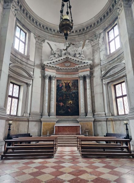
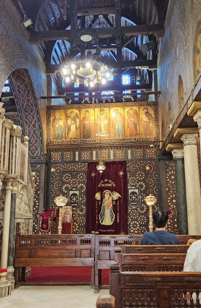
This is one of the small chapels within the church.
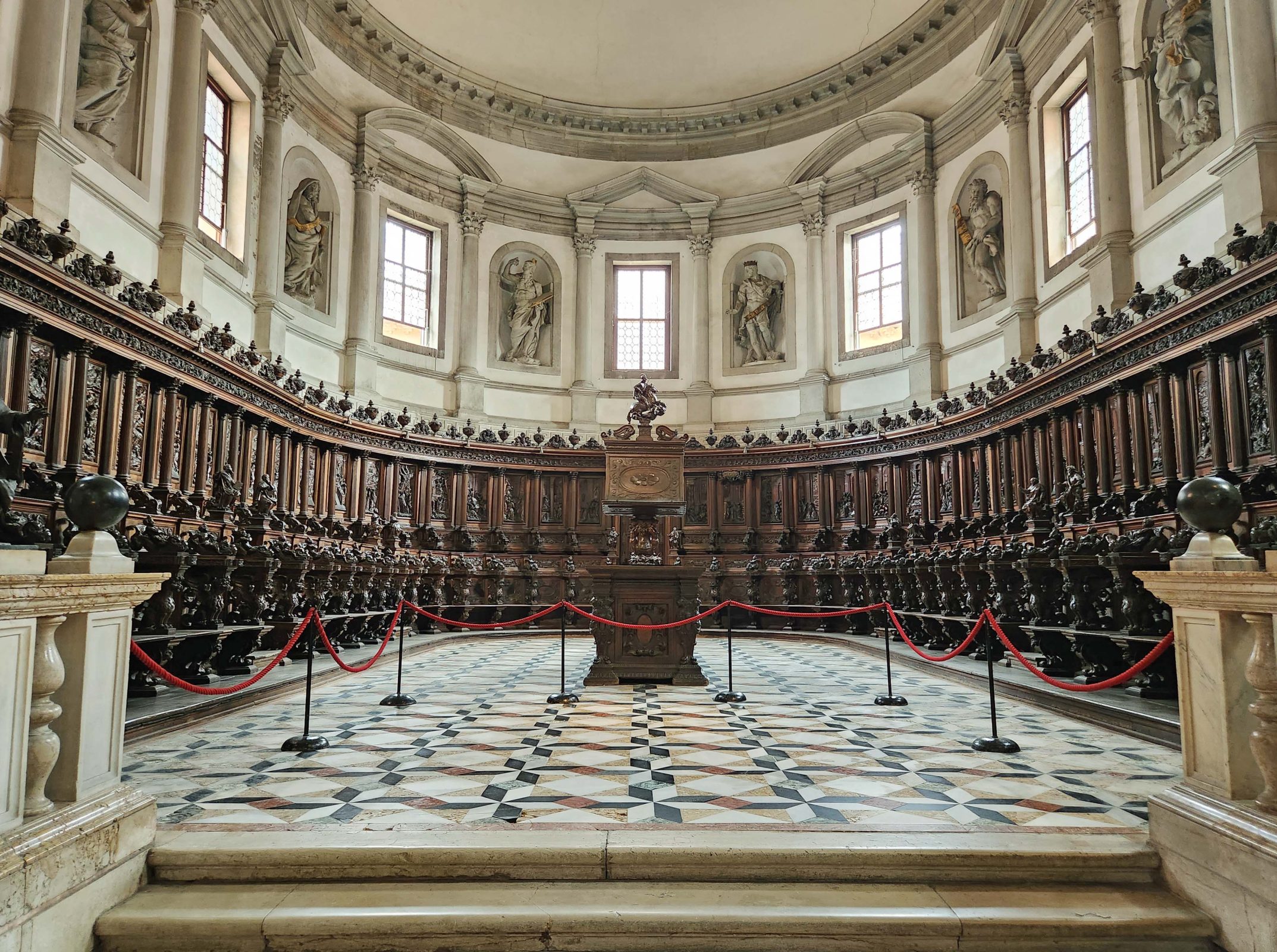
There are 48 choir stalls in this apse, and each one is carved with a scene from the life of St. Benedict.
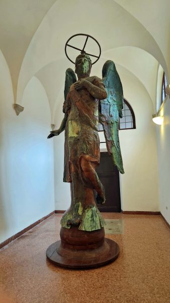
A statue similar to this one of St. George, made of wood and bronze, used to stand on top of the bell tower at the church. Lightning struck the statue during a wedding and the wood caught fire. It is unknown if that was a bad omen for the bride and the groom. Much later (many years?—also unknown), a man said he saw an angel, just like the one that was struck by lightning, hovering over the church. Could that be a good omen? Again, unknown. The hovering angel turned out to be a helicopter setting a replacement statue on the bell tower. There may be no deeper message here than “a statue was struck by lightning, burned, and was replaced,” but the omens and the hovering angel contribute to a nice little story.
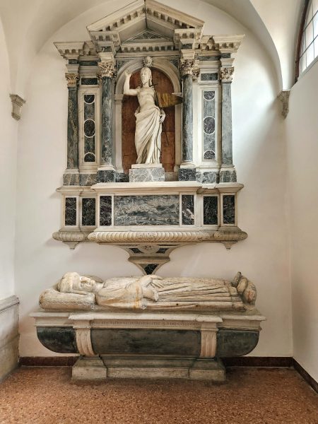
I don’t remember if this particular sarcophagus and/or statue is St. Stephen, but the church claims to have the relics of St. Stephen in its possession. Several other churches make a similar claim. If all the claims to St. Stephen’s relics are true, St. Stephen had 2 heads, 4 arms, and 3 legs. At one point, the Pope of the time said that the relics in these churches will work with prayer as long as the people who are praying believe they are the true relics.
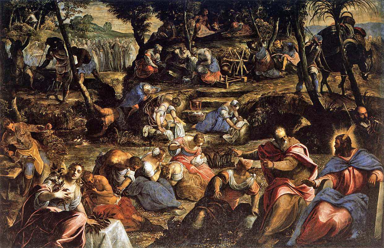
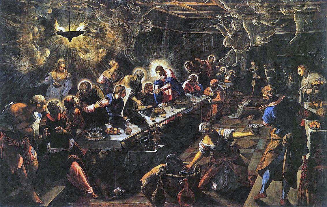
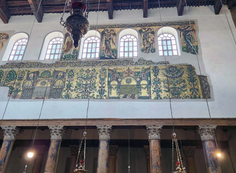
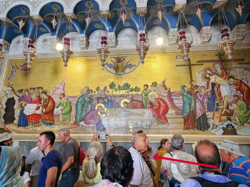
The church has two magnificent paintings by Jacopo Tintoretto: The Jews in the Desert and The Last Supper. I took photos of them, but they were so large (more than 12 by 18 feet) and hung so high, that my pictures weren’t very good. I found them online and was surprised to see that they are available for downloading if I provide the following credit:
By Jacopo Tintoretto-Web Gallery of Art: Image.
The paintings looked much brighter in person, and their size added to their impact. Both have dozens of symbolic representations. Simplified, The Jews in the Desert, painted in 1593, depicts the Israelites’ scorning of the manna, which led to setting up the bronze idol. The Israelites are washing their clothes at the foot of Mt. Sinai; Moses and Aaron are talking in the lower right corner.
Again, simplifying the symbolism in the painting, The Last Supper, painted in 1594, shows winged apparitions that characterize the Eucharist (the bread of angels) and the mystery of transubstantiation (turning bread and wine into the body and blood of Christ). Jesus has a large halo; eleven of the disciples have smaller halos (Judas does not); and John, the beloved disciple, sits to the right of Christ. There are conflicting opinions about which figure is Judas.
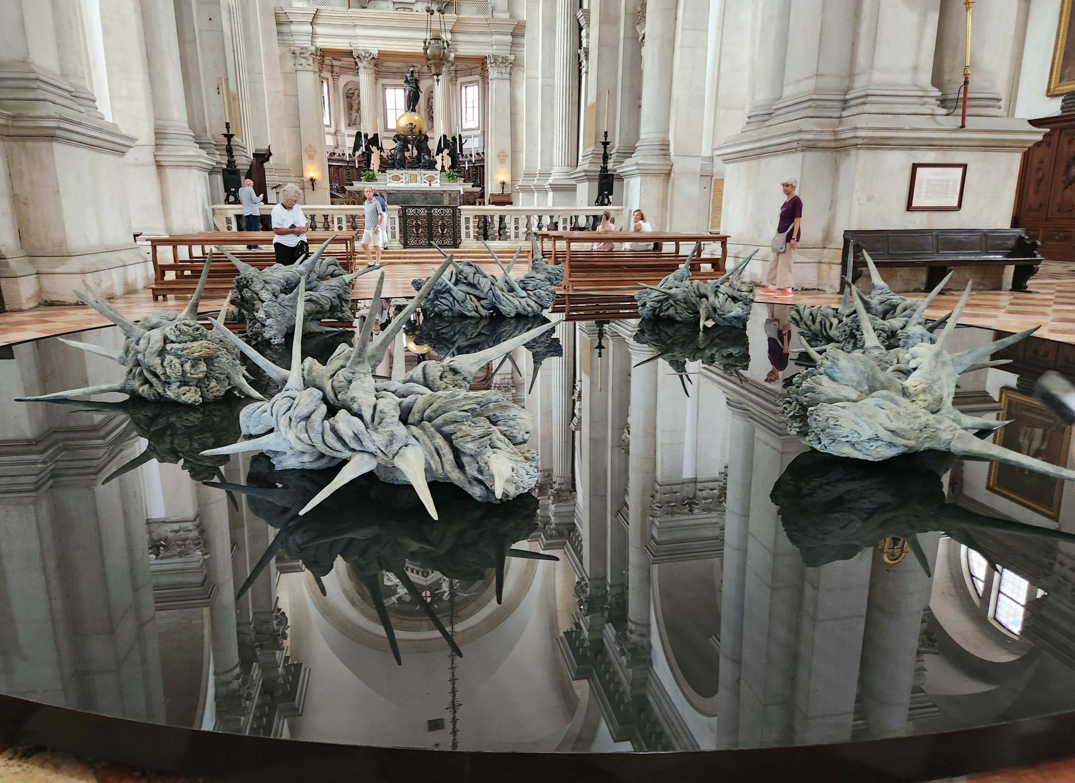
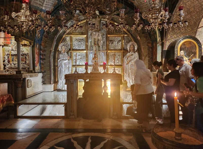
I was impressed and moved by Tintoretto’s paintings, but my favorite piece of art in the church was “Belonging,” a bronze installation with crowns of thorns in the center. It is positioned under the dome of the nave. Our entire group thought the base was a mirror because it so perfectly reflects its surroundings, but our guide told us she discovered it is water because, one time when she was conducting a tour, the installation had been drained. It looked so still and so solid that I was tempted to dip my finger into it for proof of its liquidity, but I knew it would take forever for the surface disturbance to disappear—and I’d probably be ejected from the building. That might have been a not-so-good travel story to tell.
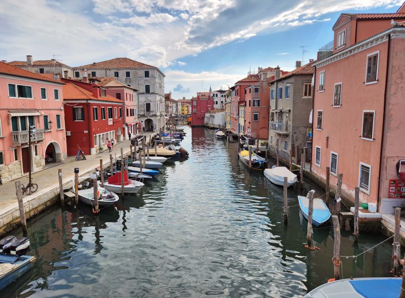
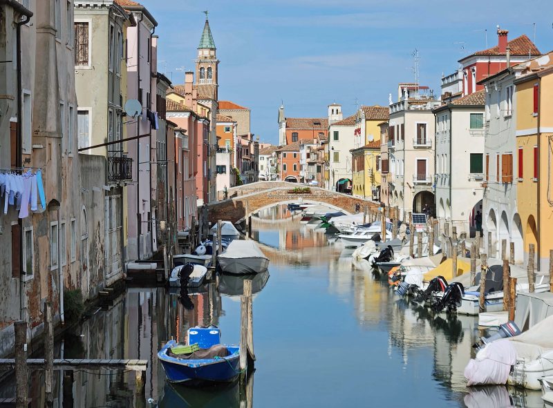
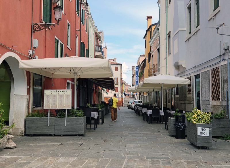
Like Venice, Chioggia is built on wooden piles in the marshy Venetian Lagoon and, because of its canals and bridges, it is often called “Little Venice.” There were fewer canals and fewer bridges in Chioggia, but the city was definitely reminiscent of Venice.
Along this canal, you can see decorative laundry hanging outside the windows of one home, just like in Croatia.
Ted and I spent over two hours walking around Chioggia. It was about a mile from our ship, but it was a pretty walk and even included a bridge over a canal. There were lots of bicyclists, families, and tourists doing the same thing we were doing: enjoying a relaxing day in a charming city.
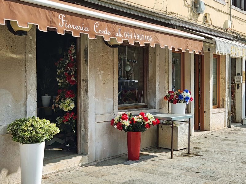
The main street was a typical main street with shops, cafés, pharmacies, etc. We saw this pretty flower shop and were surprised to learn that all the flowers sold here are artificial, because they looked so real.
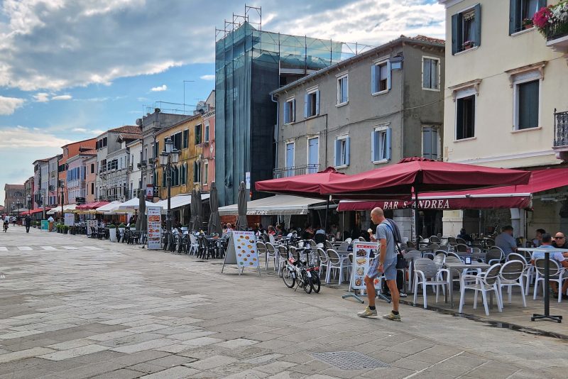
About a half-mile stretch of the main street was dedicated to cafés on one side, with shops on the opposite side. This must be a safe city. There are two bicycles parked in front of one of the cafés and they are not in a bike rack, they are not locked in any way, and no one is sitting immediately beside them to watch them.
Maybe these cafés didn’t fit on the main street. They were around the corner on a side street. FYI, “No bici” means “no bicycles,” of which there were many in the city.
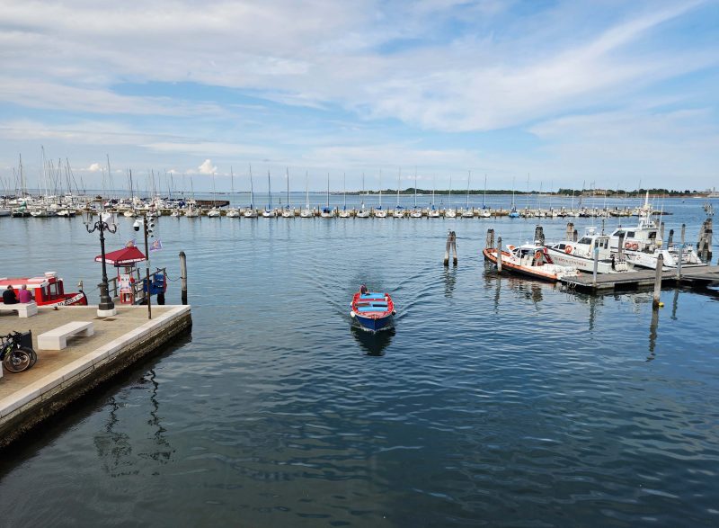
The city dock for small watercraft was at the end of the main street. The dock was also an entrance from the Venetian lagoon to the city canals. About a block inland from the dock, there was a bridge over the entrance canal and there were benches on the bridge. Ted and I just sat there for awhile, talking with each other, and enjoying the beautiful weather and the views of Chioggia.
Cruise ships are no longer allowed to dock in Venice for several reasons. Environmentally, they cause pollution in the lagoon, and the waves they generate are eroding the underwater structure of the city. They are also dangerously large.
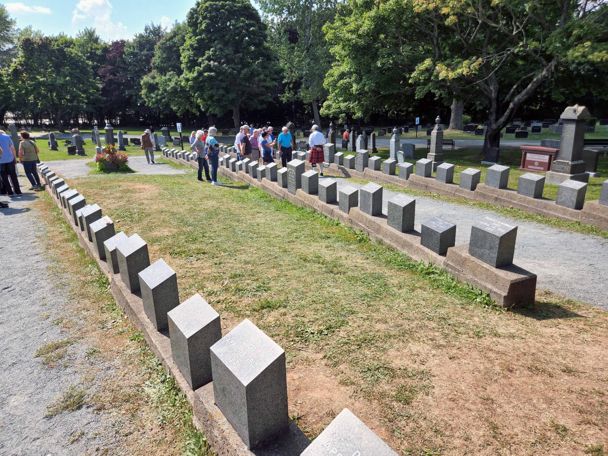
Venetian citizens opposed to cruise ships docking at the city port won their case in 2019, when a large 100,000-ton 13-deck cruise ship experienced engine failure while docking in Venice. Two tugboats were assisting the ship, but lacked sufficient power to control it. The cruise ship slid against a sightseeing boat just as passengers were disembarking over a short gangplank. People were caught on the walkway as the smaller vessel was dislodged from the pier, and five people were injured falling or trying to run away.
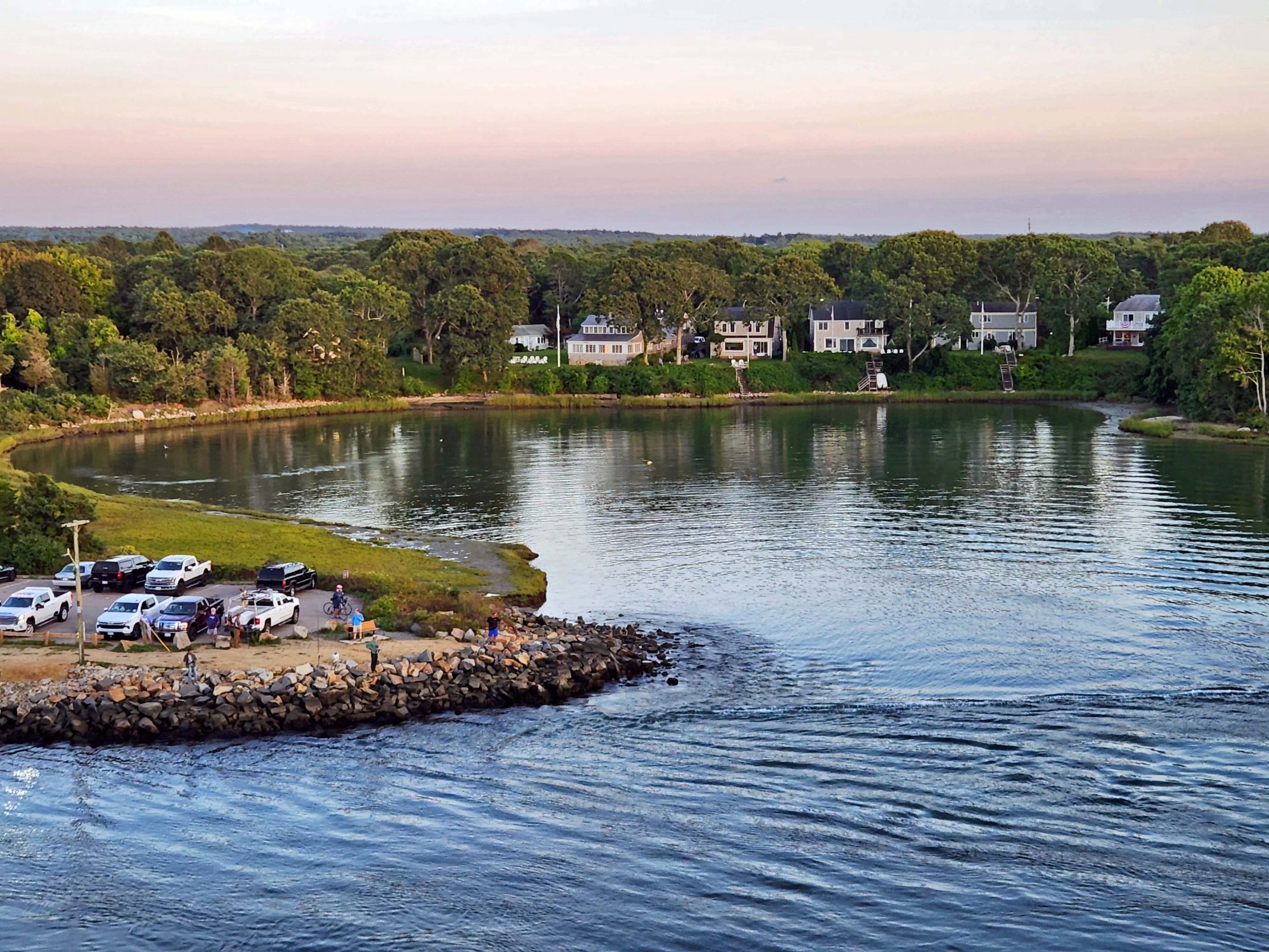
Cruise ships now have a choice of two nearby ports at which they may dock for passengers to visit Venice. One of those ports is located in an industrial area about 30 minutes from Venice by water taxi; the other is located at least 1.5 hours from Venice by water taxi, but it’s in the charming city of Chioggia, where our ship docked. The water taxi ride could be completed in less time, but there is a 12 mph speed limit in the lagoon to prevent erosion from strong wakes and to reduce noise pollution for residents along the lagoon. (For the record, I totally support Venice’s policy changes.)
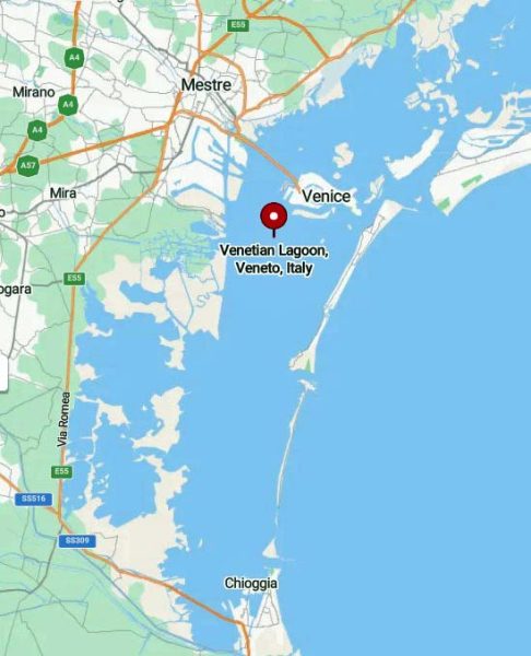
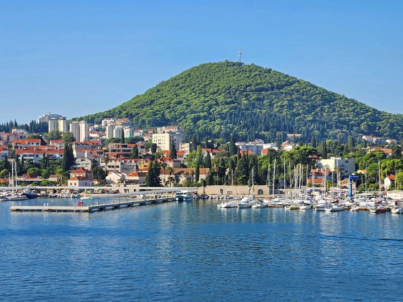
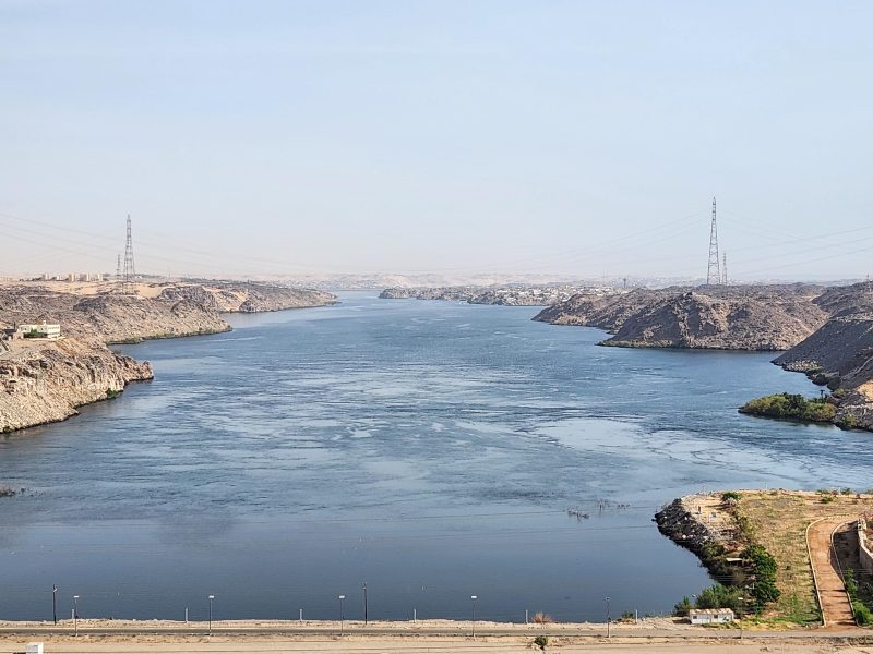
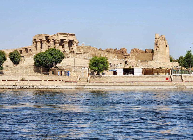
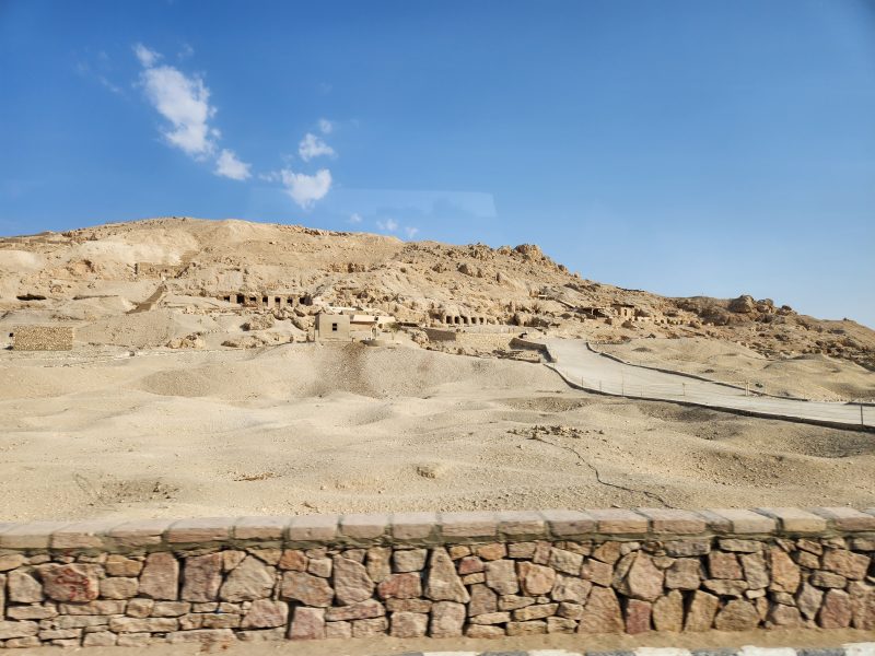
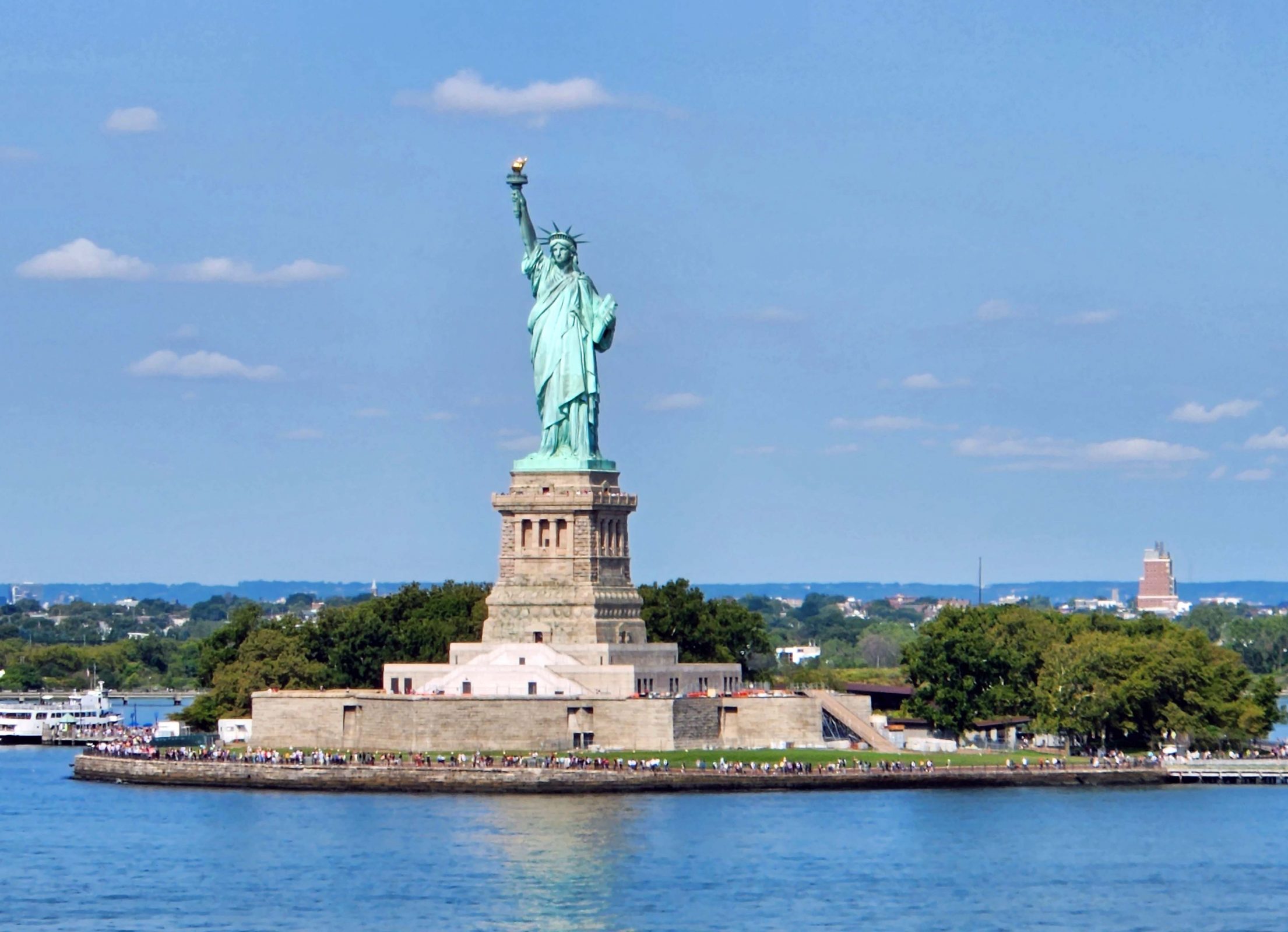
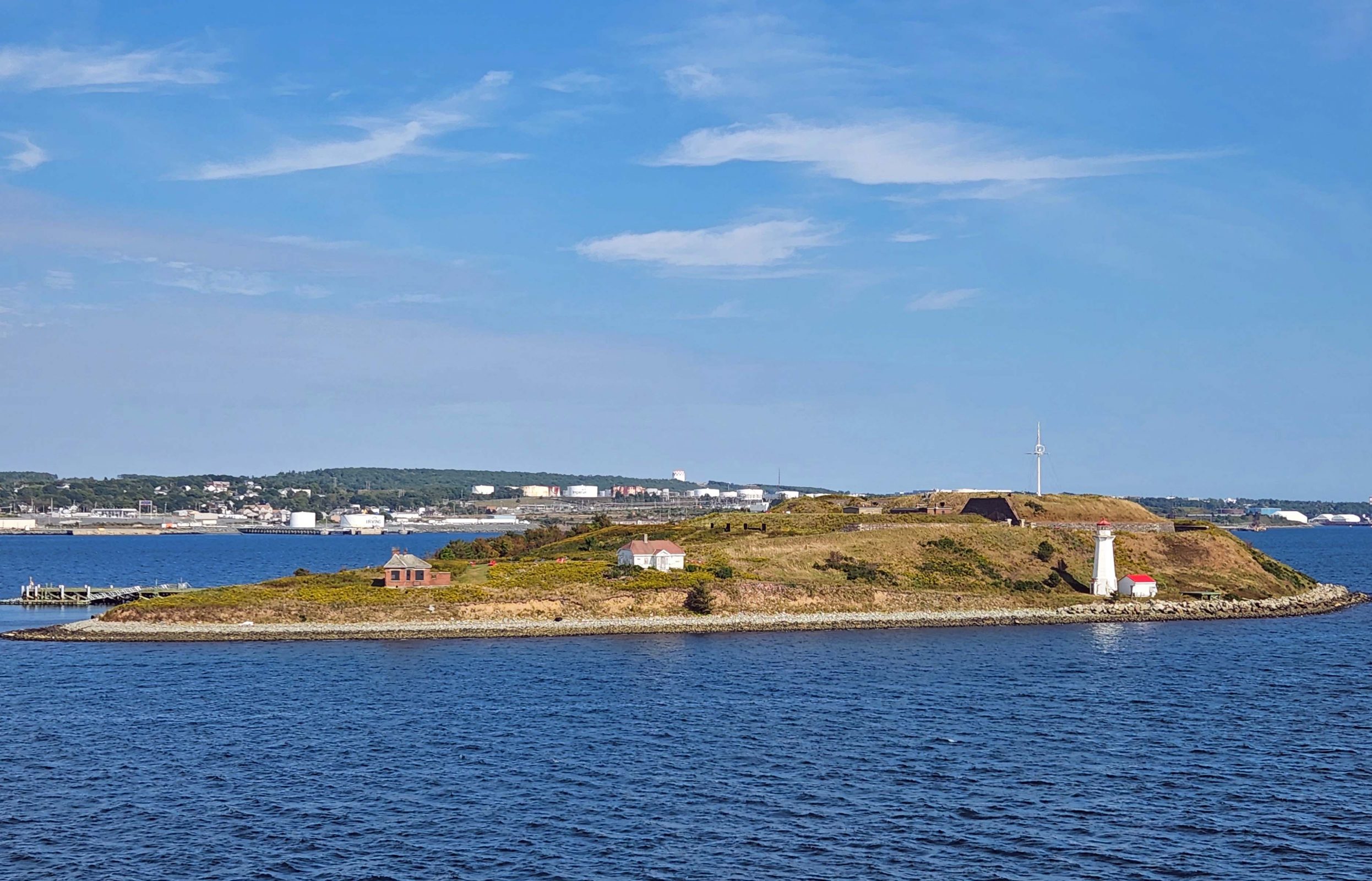
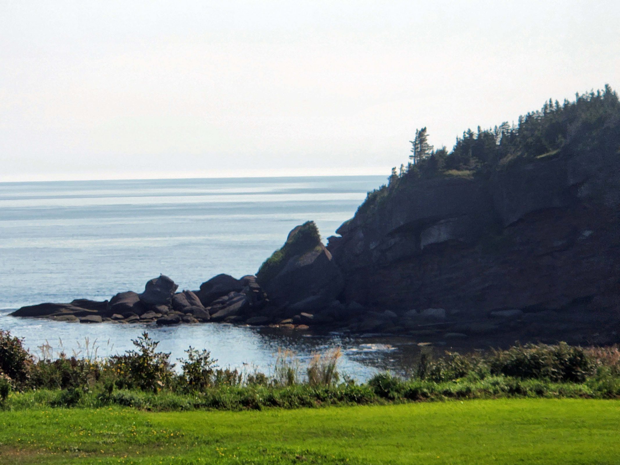
Venice is in the upper center and Chioggia is in the bottom center of the map below. The larger of the two islands just north of Venice is Murano, the home of Venetian glassmaking and the destination of an upcoming shore excursion for Ted and me. There’s a narrow horizontal island on the south side of Venice with a tiny island at its eastern tip. That tiny island is San Giorgio Maggione Island, another upcoming excursion destination for us.
The water taxi took us for a scenic cruise from Chioggia to Venice through the Venetian Lagoon on the inside of those long, narrow islands shown in the center of the map. The gray line along the edge and running the length of the long islands might be a road, but we saw walkers and bicyclists—not cars—on it.
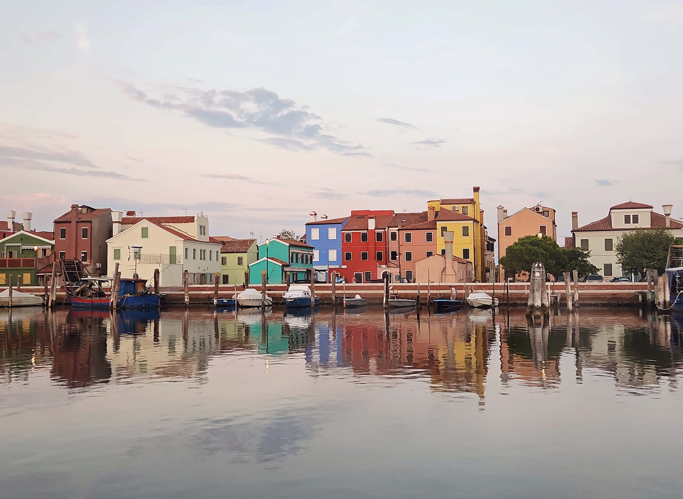
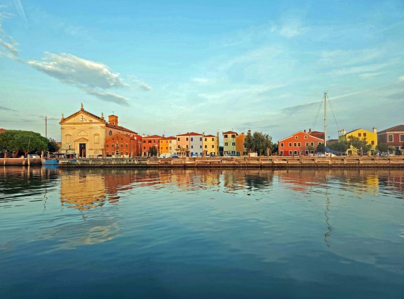
All the way from Chioggia to Venice, the long islands were dotted with colorful villages. In some places, we could see across the islands to the water on the other side.
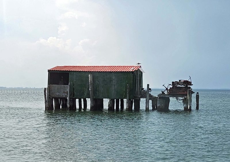
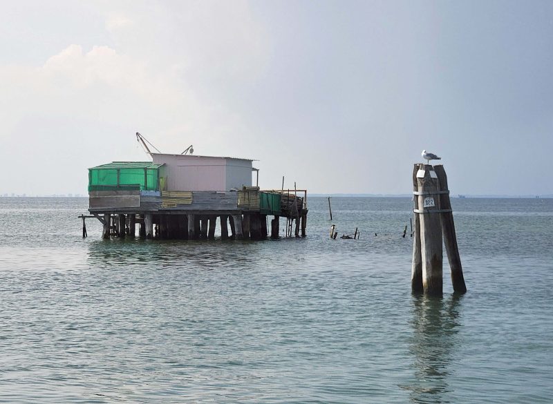
The colorful villages were on our right and there were fishing shacks and wooden triad channel markers on our left as we traveled to Venice. Each wooden triad has a numerical location marker nailed to it. Before the convenience of GPS, boaters in need of assistance or rescue could radio a rescue team and give them the number posted on the nearest triad to direct the rescuers. The triad in the second photo below is marked number 122.
Ted’s and my first sight of Venice included (for my meteorologist husband) an anvil cloud. We were lucky, though—the thunderstorms stayed north of Venice, and we had a sunny day.
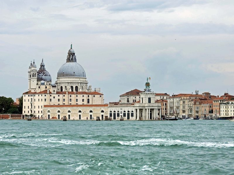
The white, red-roofed building on the left is Venice’s old Customs Building and includes a museum inside. The large dome is the Santa Maria della Salute Church, commonly known as the Salute.
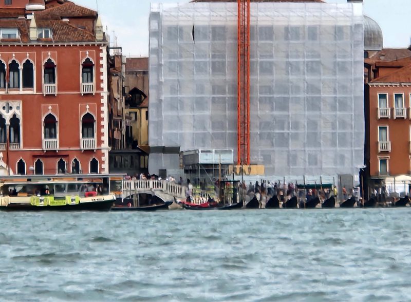
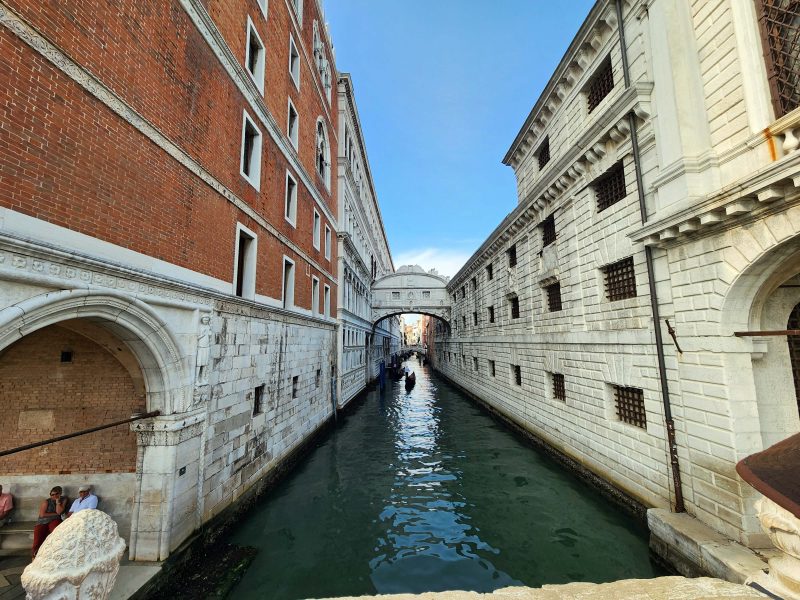
The Bridge of Sighs is the arch in the left center of the picture below. The red building on the left used to be the courthouse where criminals were tried and sentenced. The building on the right is wrapped and under construction now, but was formerly the prison. Convicted and sentenced prisoners were taken directly from the courthouse to the prison, and crossing the Bridge of Sighs was their last taste of freedom.
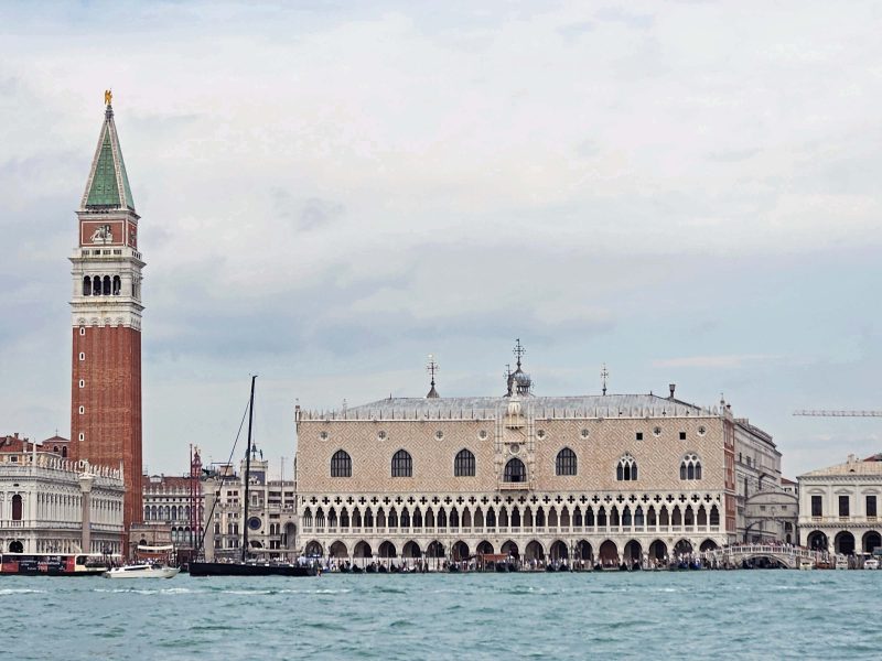
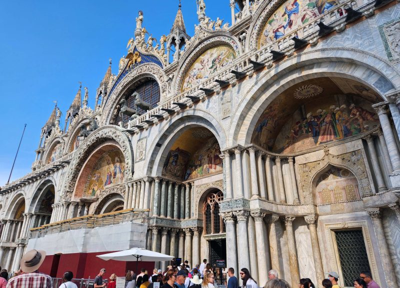
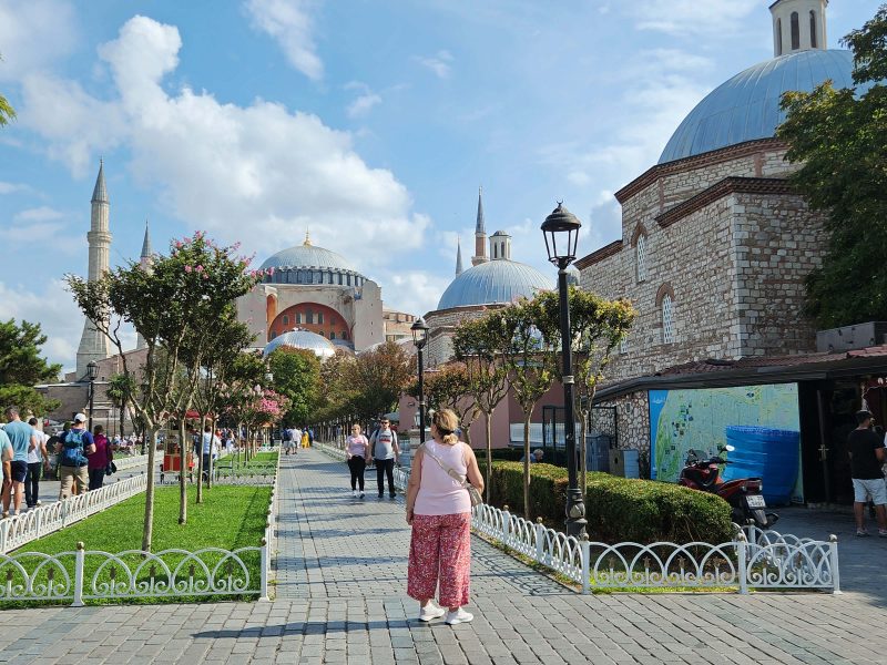
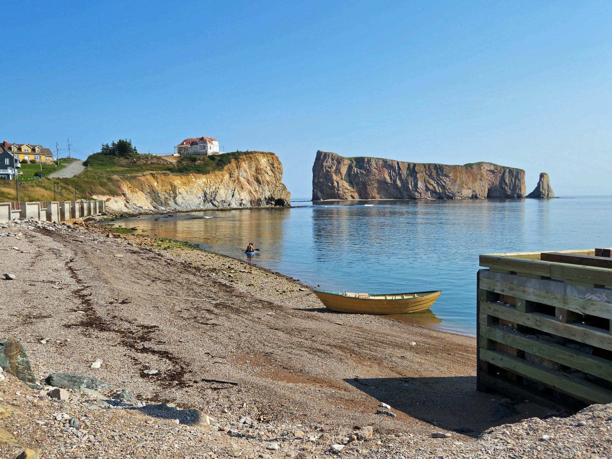
St. Mark’s Square (the Piazza San Marco) is the most renowned piazza in Venice. The bell tower is an iconic landmark of Venice. The light colored building is St. Mark’s Basilica. I took this picture of the piazza from San Giorgio Maggiore Island.
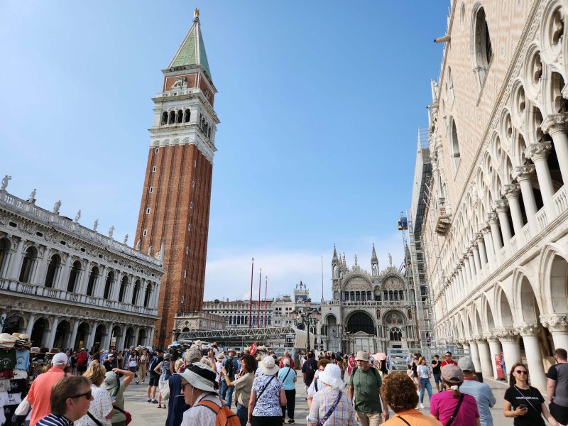
This picture was taken up close while standing in St. Mark’s Square. All that white on the right side of the photo below is part of the front of St. Mark’s Basilica. You can tell by the crowd that the piazza is a popular place.
This is the main entrance to the basilica. It faces the bell tower and is in the invisible foreground of the photo above. The basilica is huge, and the piazza is small, so a view of the entire front doesn’t fit in my camera lens.
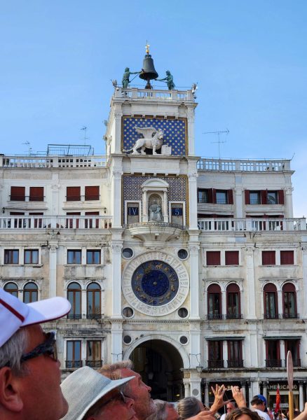
This photo shows the Clock Tower in St. Mark’s Square.
Venice is an archipelago of 118 islands, separated by canals and linked by over 400 bridges. If you cross a bridge, you’re walking to a different island. Because Venice is set in a marshy swamp (who picked this location???), it is a floating city, built on huge wooden piles driven deep into the ground, down to where there is hard clay strong enough to support the buildings. Still, you can’t fight Mother Nature, so Venice is sinking at a rate of about 2mm per year, and research shows it is also tilting slightly.
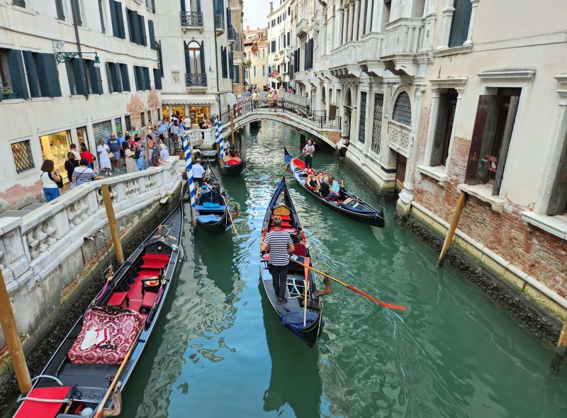
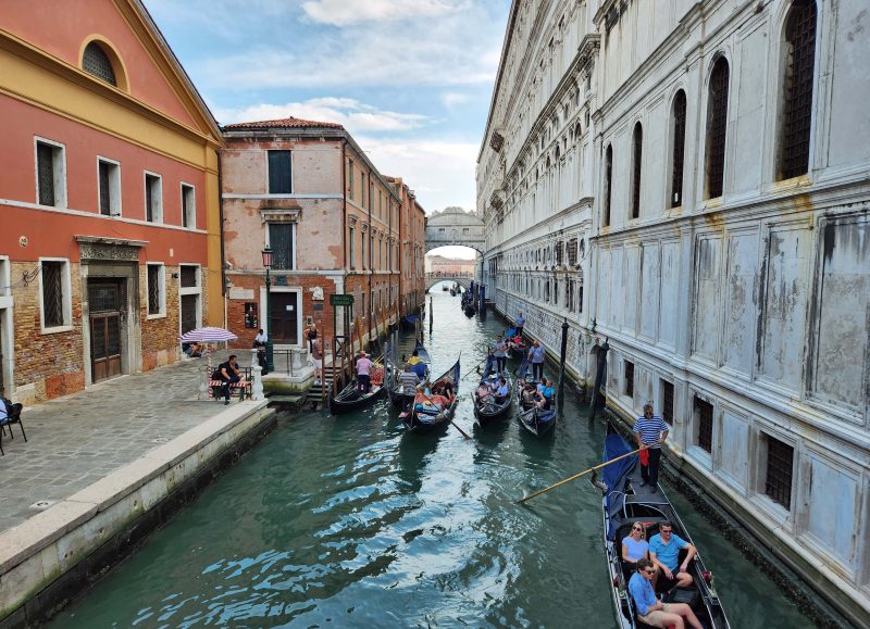
The gondolas of Venice with singing gondoliers sound so-o-o romantic until . . . you see traffic jams of gondolas without the slightest note of song in the air. A 30-minute gondola ride costs about $90 per person during the day and about $130 per person at night. They looked as romantic as a ride at Six Flags, but apparently, the spirit of riding in a gondola in Venice must be taken into account.
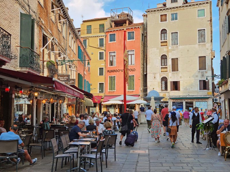
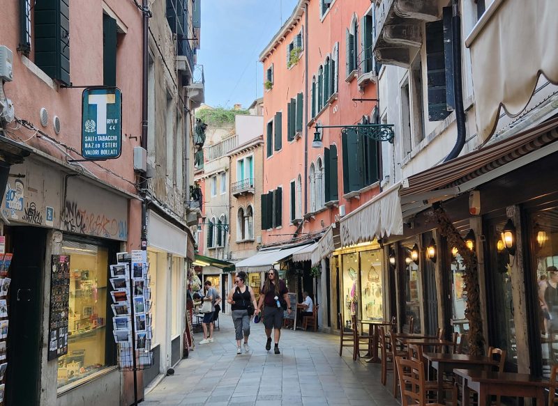
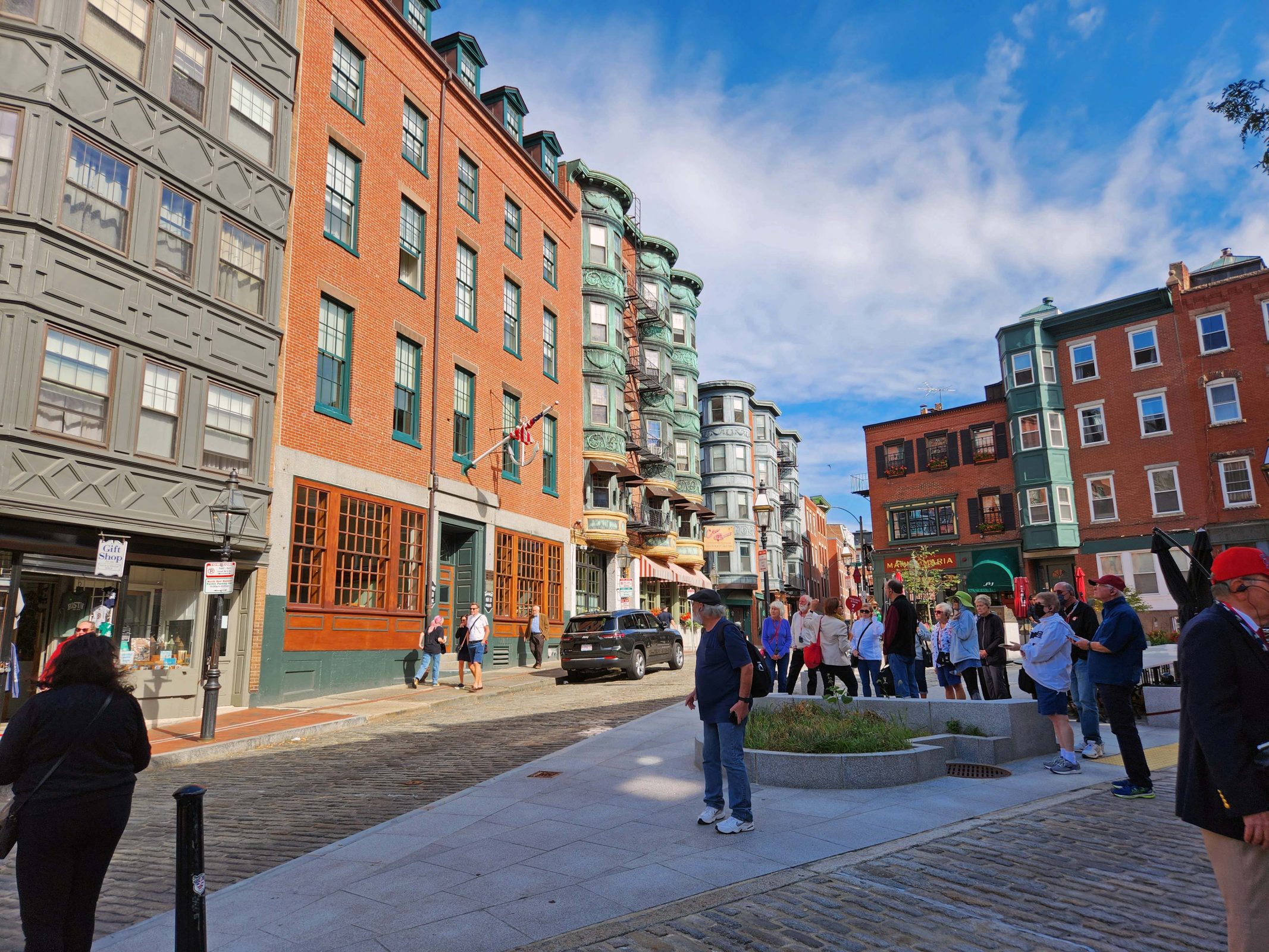
The area of Venice is surprisingly small. Nearly all of the city is within a 20-minute walk from St. Mark’s Square, where we started. Ted and I were surprised to find ourselves at the other end of the city so quickly. Luckily, there were a lot of interesting streets, so we just walked wherever it looked interesting, knowing that it would be easy to find our way back to the water taxi dock.
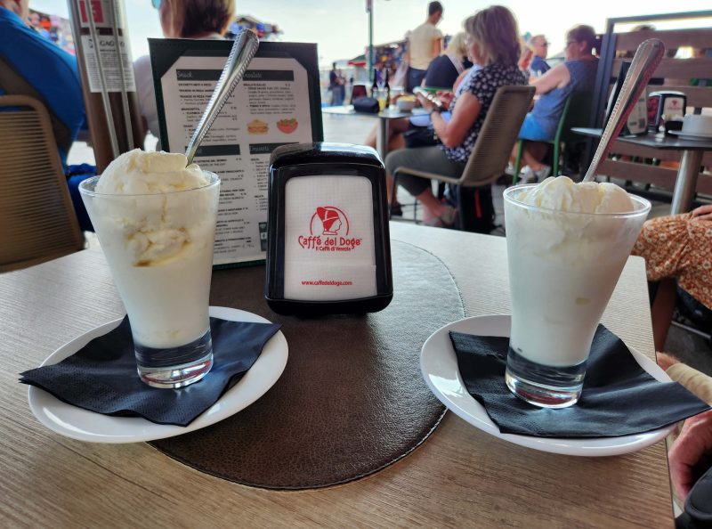
Today, we learned about gelato. If you’ve ever seen trays of gelato temptingly heaped above the upper edge of the tray, so that just thinking about having some of that tempting gelato makes you drool, stop drooling. That’s “tourist gelato” according to Italians. “Real” gelato, for those with discriminating taste, is always low in the tray, requiring you to lean over to see it and to pick your flavor. During our stroll around the city, Ted and I stopped at a sidewalk café for a cool dish of gelato. I don’t know if the waitress brought us “real” gelato or “tourist” gelato, but it tasted good on a warm afternoon in Venice.
Ted and I are not the people who make vendors rich. Although we’ve bought things in some of the places we’ve visited, it’s not our mission to purchase a souvenir from every place we visit just to prove we were there. Venice turned out to be one of the places we bought something.
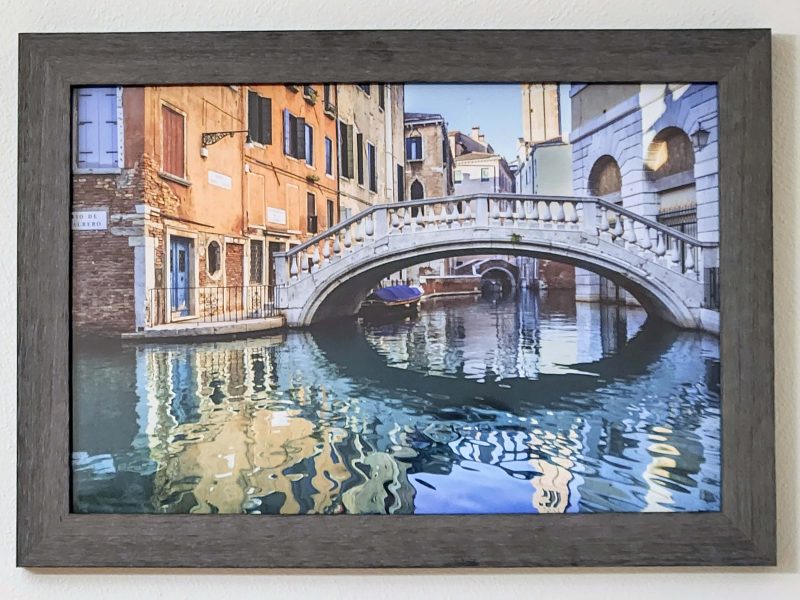
Almost as soon as we arrived in Venice, we saw a sidewalk artist’s display and both of us said, “I like that picture.” It isn’t large, so we knew it would fit in our carry-on size suitcase, but we didn’t account for the protective cardboard the vendor slipped it into. Thanks to security checks, we don’t travel with scissors, but the Guest Services folks on our ship had scissors and a box cutter, and they cut the sturdy cardboard down to our suitcase size. Now the picture is hanging in our dining room.
People everywhere have a great sense of humor and I enjoy finding evidence of that when we travel. On Ted’s and my 2023 BT, I found lots of things to smile or laugh about. Here are a few.
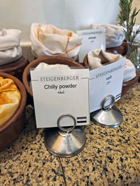
We visited several spice markets in Egypt. (FYI, they smell really good!) At a group dinner in a Cairo hotel, this sign had the wrong English homophone for the name of the spice. Or maybe it was a cold powder.
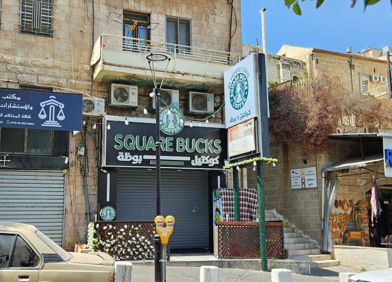
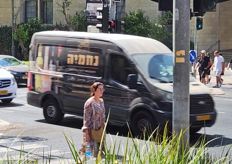
Want a cup of coffee? Stop at Squarebucks in Jerusalem.
Another “smile sign” was this one in Egypt for Kentucky Fried Camel–a local joke.
When we were at the Cairo airport for our flight to Istanbul, Ted saw this sign in the men’s room over a low urinal. It’s important to accommodate children.
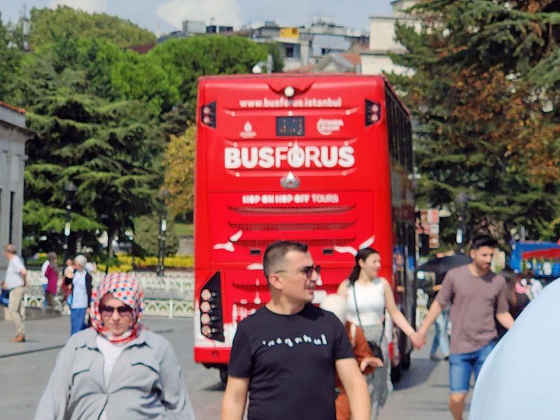
I saw this bus while we were walking around Istanbul. The city is located on the Bosphorus Strait. Get it?
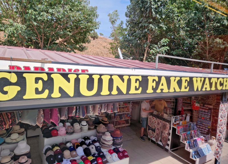
Who could resist an oxymoron like this near Ephesus, Türkiye?
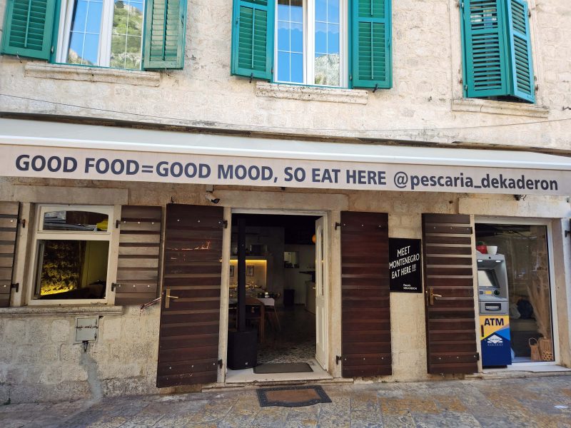
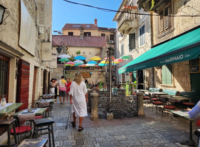
Wondering where to have lunch in Kotor, Montenegro? This is the place.
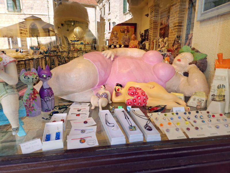
After lunch, you might want to go shopping in the Old City of Kotor to buy a souvenir like this.
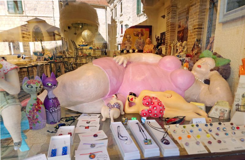
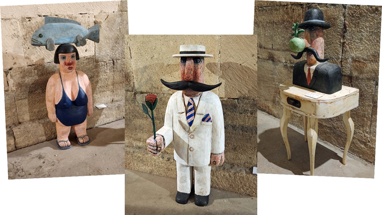
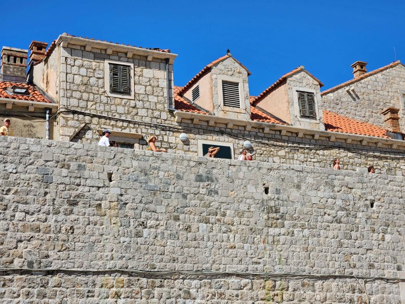
We saw these works of art (?) at an art exhibit in Dubrovnik, Croatia.
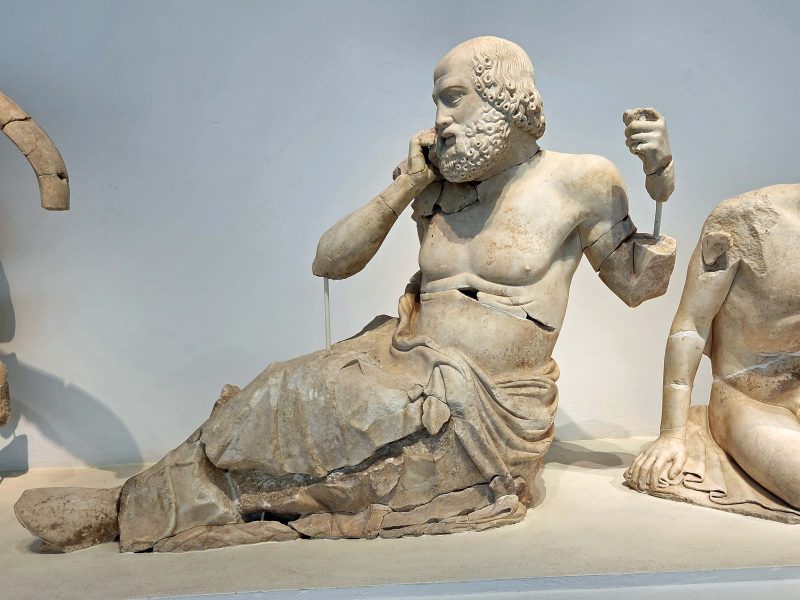
This statue of the Old Diviner was discovered in the excavation of Olympia, Greece. The nickname for it is “Zeus Talking on His Cell Phone.”
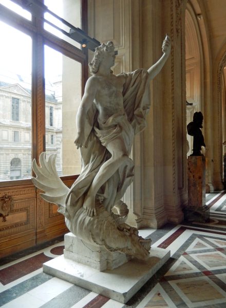
It reminded me of the statue of Apollo that Ted and I saw in the Louvre in 2016. In case you don’t recognize it, this is “Apollo Taking a Selfie.”
Yes, “Laughter is the closest distance between two people.” –Victor Borge
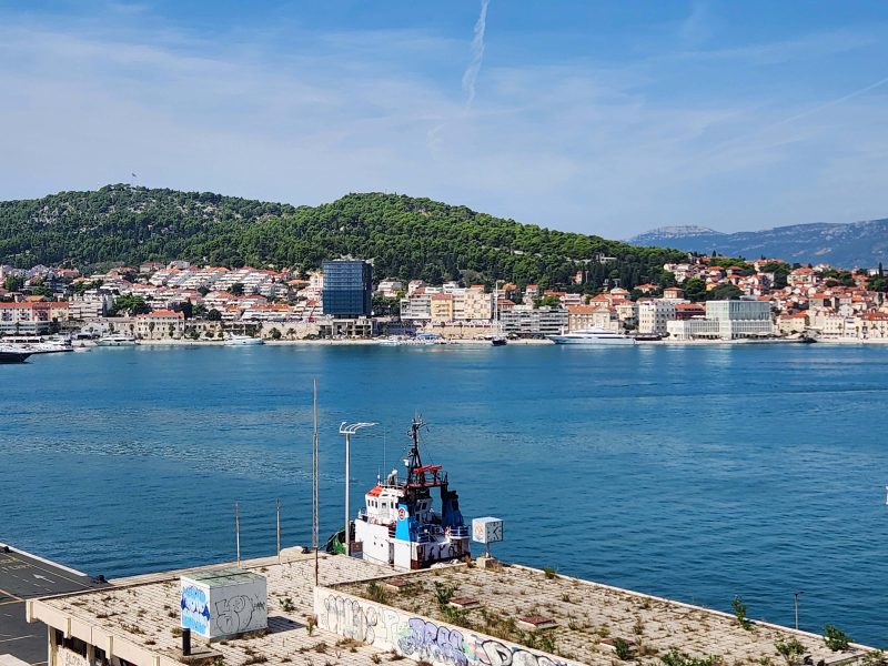
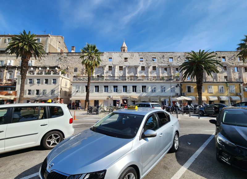
Split is located on a peninsula on the eastern shore of the Adriatic Sea. It is one of Croatia’s oldest cities and the second-largest city in the country after the capital, Zagreb. The city’s name evolved from the Greek Spalatum to Roman to Venetian and to Slavic before the Habsburg Monarchy settled on Split. The easy version of this evolution is the legend that says the city is named after a local flower. The picture below was our view of Split from the ship.
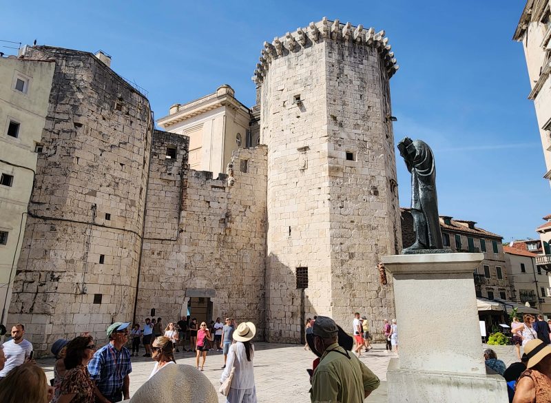
The dominant structure of Split is Diocletian’s Palace, built at the end of the third century as a retirement haven for the emperor Diocletian. It also included housing for a military garrison. It is the best-preserved palace from the late Roman antiquity and has become the Old Town of Split.
A statue of Marko Marulic stands beside the Central Palace Tower. Marulic was the national poet of Croatia as well as a lawyer and a judge. He lived in the 15th century and coined the term psychology. He was one of the most dynamic and influential theological and devotional writers of the Renaissance–and yet, even as an undergraduate English major with a master’s degree in English, I’ve never heard of him. Is he weeping because of my ignorance?
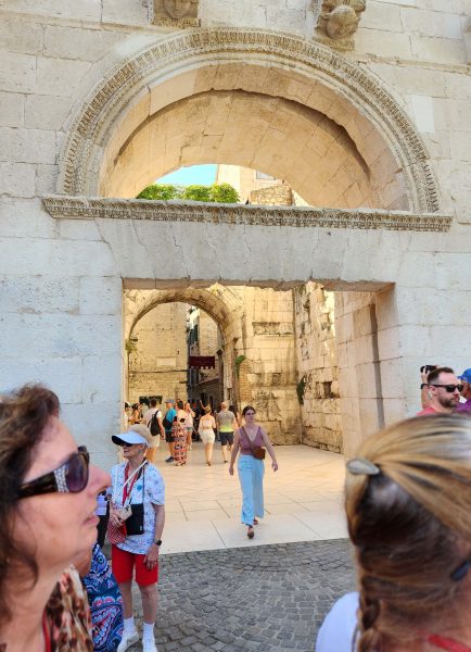
Diocletian’s Palace had four gates. The gates themselves did not survive, but the stone pillars and arches can still be seen. The Golden Gate on the north side of the palace was pretty in the afternoon light.
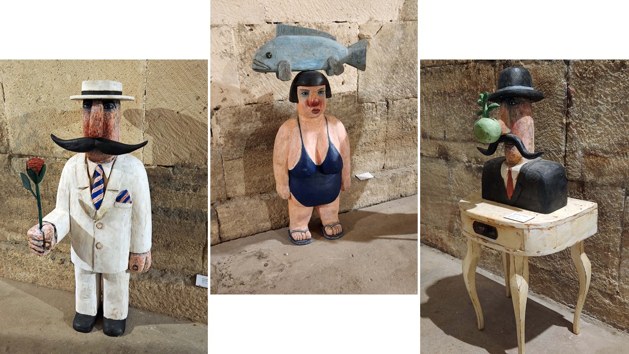
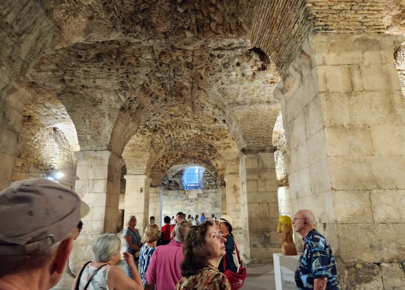
Split city life is interwined with life at the palace. For example, the Ethnographic Museum is inside the palace and the ancient basement hallways are lined with shops. There are many empty rooms in the palace that are used for local events. During our visit, several of the rooms featured an unusual art exhibit.
The cellars of Diocletian’s Palace are sometimes called the basement halls. Because it is situated on a hillside, the cellars were built to level the palace and to elevate the emperor’s apartments above them. The cellars were used for food and wine storage and gave the emperor access to the palace without having to disembark his ship. Here’s a picture of one of the basement halls.
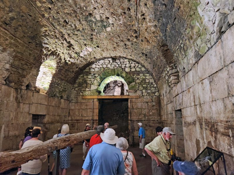
The palace cellars have a labyrinth of secret corridors called the lost tunnels. The long, horizontal log-like object in this tunnel was another of the unusual pieces from the current art exhibit.
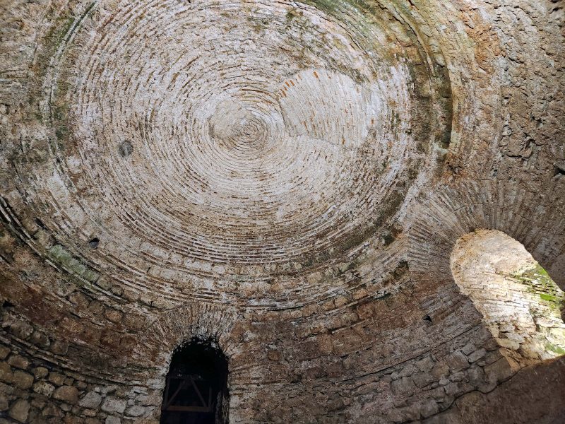
One of the basement rooms had a circular, slightly domed ceiling.
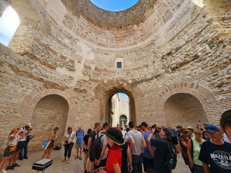
The room pictured below is called the Palace Vestibule or the Rotonda or the Atrium—take your pick. It was once the formal entrance to the imperial apartments. The acoustics in the room are wonderful, so people like to go there to sing.
In the summer months, klapa groups perform folk songs in the Vestibule/Rotunda/Atrium, taking advantage of the acoustics to present a cappella performances. A klapa group has a first tenor, a baritone, and a bass singer. Voices can be doubled, up to a dozen male singers. Sometimes there are female groups, but the male and female groups do not generally perform together. We were here in September, so I guess it didn’t count as summer because this klapa group sang “Nearer My God to Thee” which is hardly a folk song. Whenever I hear that hymn, I can’t help thinking about the band playing that song while the Titanic sank—probably not the klapa group’s intended reaction.
We left the palace, aka the Old Town, through this gate in the palace wall.
People still live in the Old Town of Split but the palace, which includes the entire Old Town, is a UNESCO World Heritage Site like Dubrovnik. That means, just like Dubrovnik, it’s mostly Airbnbs and it’s hard to renovate or to sell a building because of the preservation regulations.
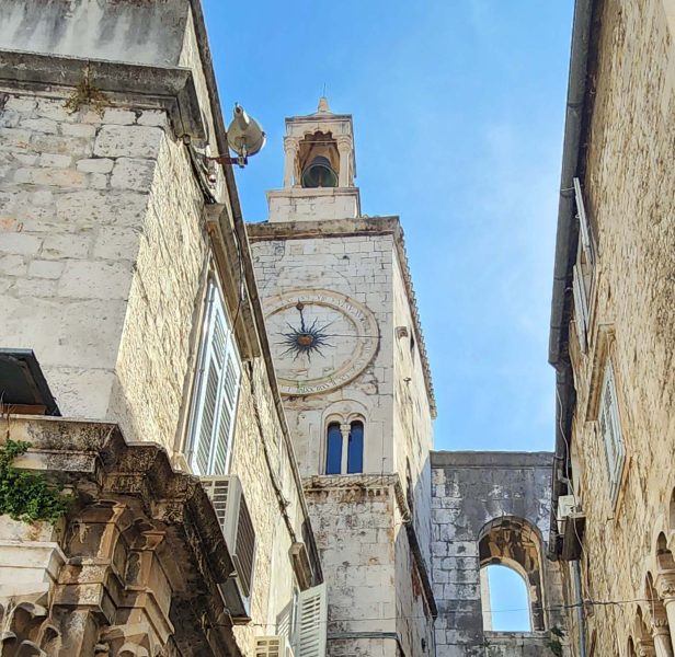
Just outside the palace is People’s Square, the heart of Split. It was originally named Saint Lawrence’s Square in the 13th century, but no one calls it that. This was the first inhabited part of the city outside the palace and is still the center of public life in Split, with bars, restaurants, and shops.
The city clock on the bell tower in People’s Square has been keeping time for centuries. It has an unusual face with 24 hourly markings, rather than twelve. The hours are inscribed in Roman numerals. Hour 12 is at the top and hour 24 is at the bottom where we are accustomed to seeing hour 6. The black arm with the indicator at the end tells the time—almost noon.
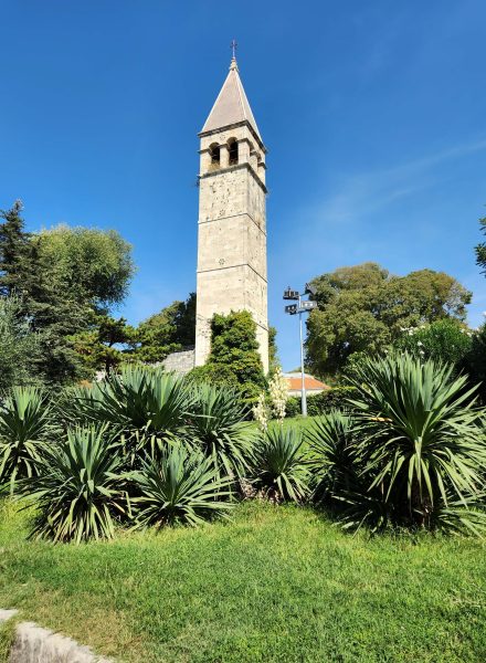
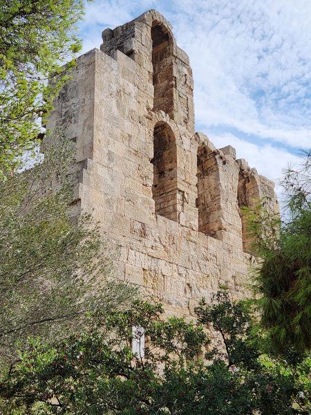
The St. Arnir Bell tower near the Golden Gate was once part of a Benedictine monastery at this site, but the monastery was destroyed by fire in 1945 and only the chapel and the bell tower survived. I think it makes a pretty picture against the blue sky.
Dubrovnik, “the pearl of the Adriatic,” is one of the world’s most beautifully preserved medieval cities. George Bernard Shaw described it as “paradise on earth.” At the southernmost tip of Croatia, Dubrovnik is very picturesque, making it the most visited place on the Adriatic coast.
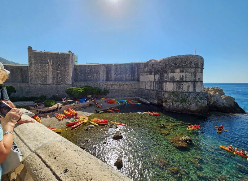
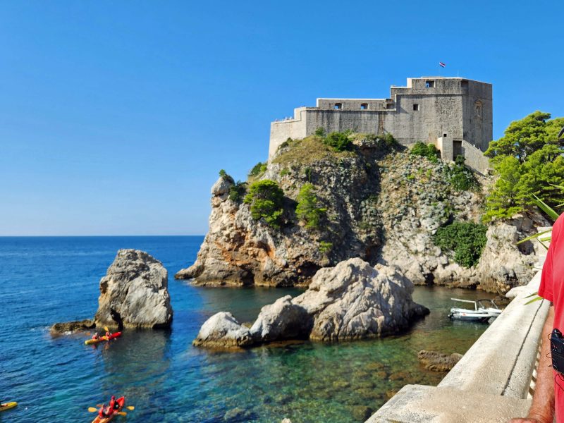
Fort Lovrijenac (don’t you love those Slavic spellings?), or St. Lawrence Fortress, also called “Dubrovnik’s Gibraltar,” overlooks the two entrances to Dubrovnik: the land and the sea. The Venetians wanted to build a fort on this spot in the 11th century to keep Dubrovnik under their power, but the people of the city beat them to it, building the fort themselves in just three months. When the Venetian ships arrived with building materials, they were told to leave, and the Venetians lost their power in Dubrovnik. It looks like kayaking is a popular activity in the fortress area.
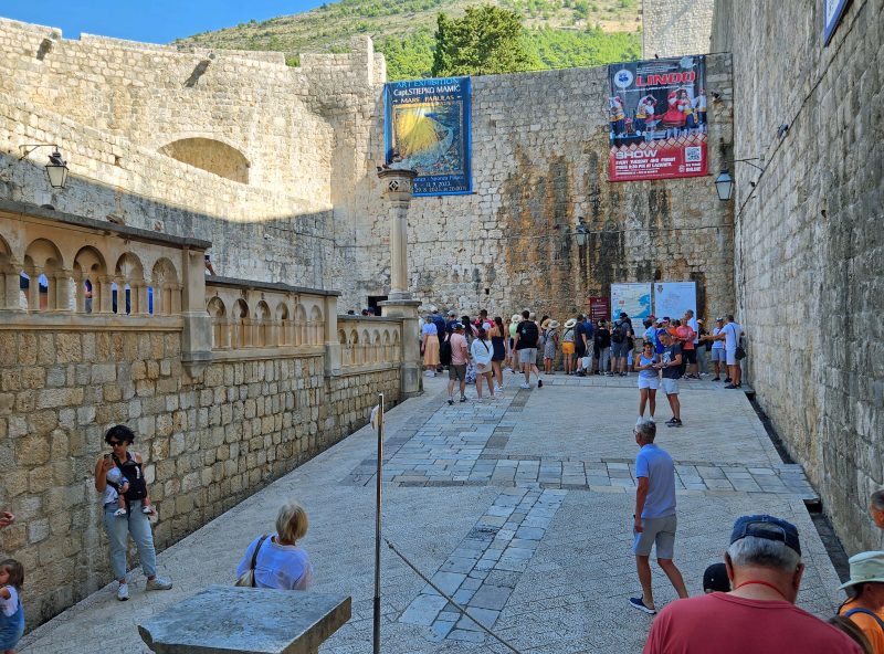
A wall surrounds the Old City of Dubrovnik. It was built as a fortification to defend the city against the Ottoman Turks. For about €35 each, it’s possible for visitors to walk all the way around the Old City on the top of the wall. The distance around the wall is about 1.3 miles and can be completed in just over an hour if you hustle. Most people take 2-4 hours, with stops to take pictures of the Old City or to stop for refreshments at one of the three cafés along the way. There are 1,080 steps to go up and down as you walk on the wall, sometimes with 25-50 steps in a segment.
The entrance to the wall is at the Pile Gate, shown in the picture below. After purchasing a ticket, there are 75 steps to climb to reach the walkway at the top of the wall.
There were people walking everywhere along the wall.
As we walked around the Old City, we came to this corner at the city wall. It was one of the settings for the “Game of Thrones,” so fans of that show might recognize it.
Dubrovnik receives little summer rain, so in the distant past, residents had to collect rainwater from their rooftops and store it in cisterns. In 1438, Onofrio della Cava, a Venetian architect, was hired to build an aqueduct system to bring water to the city from a mountain stream about 7.5 miles away. Onofrio’s contract stated that his compensation would be penalized for every drop of water lost along the aqueducts. The final result was flawless. The city was so impressed, they hired him to design a sewer system as well.
The aqueduct system still works and was updated in the late 19th century to supply water directly to homes. Thanks to Onofrio, Dubrovnik has had a clean and constant water supply for nearly 600 years. The pipes are cleaned every few years, and photos have been taken to show how strong the structures still are. Given the ancient Romans’ brilliance in designing early water systems, this is probably not surprising.
The Onofrio Brunnen Fountain is the ending point of Dubrovnik’s 1438 aqueduct system. Onofrio designed this fountain with 16 sides. The “maskeron” design has a unique stone-carved masked face with a faucet projecting out of its mouth on each of the 16 sides. Originally, there were also statues around the dome, but they fell in an earthquake. The fountain still provides clean water for drinking and for filling water bottles, like the lady in the picture is doing.
All of the Old City is a UNESCO World Heritage Site, so nothing can be changed, making it difficult to update things. To sell a protected building, it must first be offered to the government. If the government doesn’t want it, it’s expensive to buy and often hard to sell because of the UNESCO rules.
Today, about 1,500 people live in the Old City. Most places away from the main street require using some of the city’s 5,423 steps. As a result, older people tend to move into the new city and rent their Old City houses as Airbnbs.
There are no elevators in the Old City buildings, so if you buy a large/heavy item like furniture, it needs to be carried up steps, like the washing machine shown in the photo below. The more steps it needs to be carried, the more it costs to get it there. Our guide said the owners of this washer are probably waiting for the “strong guys” to show up to complete their washer delivery.
Everyone has a washer, but few people have a dryer because the weather is so good for so much of the year that it’s much nicer to dry clothes outside on the balconies. In fact, we saw so many balconies with colorful laundry swaying in the breeze that the laundry looked like part of the city’s décor.
The streets of Dubrovnik are reasonably level across the mountainside but require some of those 5,000+ city stairs to go uphill or downhill to reach a parallel level street. Where the streets are level, sidewalk cafés and shops abound.
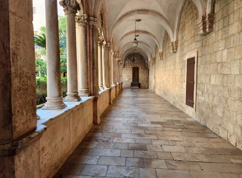
Early Dubrovnik had its own bishop, so there is a cathedral in the Old City, as well as a monastery that was established circa 1225. We were able to walk around the grounds of the monastery and to visit the museum on the premises. The photo below shows the Capital Hall leading to the vestry. The columns on the left support the belfry.
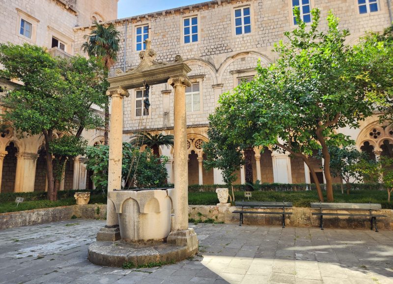
The courtyard of the monastery was very peaceful and soothing, with an old well in its center. The columns in the background, like those in the photo above, surround the courtyard.
At the time of the Black Plague (1347-1351) people didn’t know about germs (discovered in 1676), but they figured out that people caught the plague from each other. As a preventive measure, Venice required ships arriving from infected ports to sit at anchor for 40 days before landing. Quaranta giorni is Italian for a 40-day period and evolved into the word quarantine.
The Venetian quarantine rules discriminated against ships and travelers from certain countries. Dubrovnik broke the Venetian rule in 1377 and required only 30 days of isolation in a nearby town or island before entering the walled city. The Dubrovnik guidelines were more just and fair, as well as successful, and they soon prevailed around the world. The arrow in the photo below indicates Dubrovnik’s quarantine building—outside the Old City walls—where new arrivals stayed during the Black Plague.
One of my favorite things about cruising is that travel between destinations happens overnight while I’m sleeping. While the captain navigates, Ted and I have dinner and enjoy ourselves until bedtime. There’s no checking into a motel or unpacking our suitcases for an overnight stay. In the morning, we open our stateroom drapes and see a new sight. It’s always a happy surprise because it’s always a new place that’s unfamiliar to us.
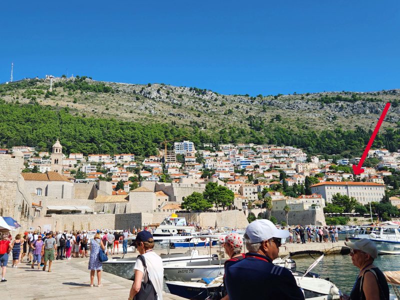
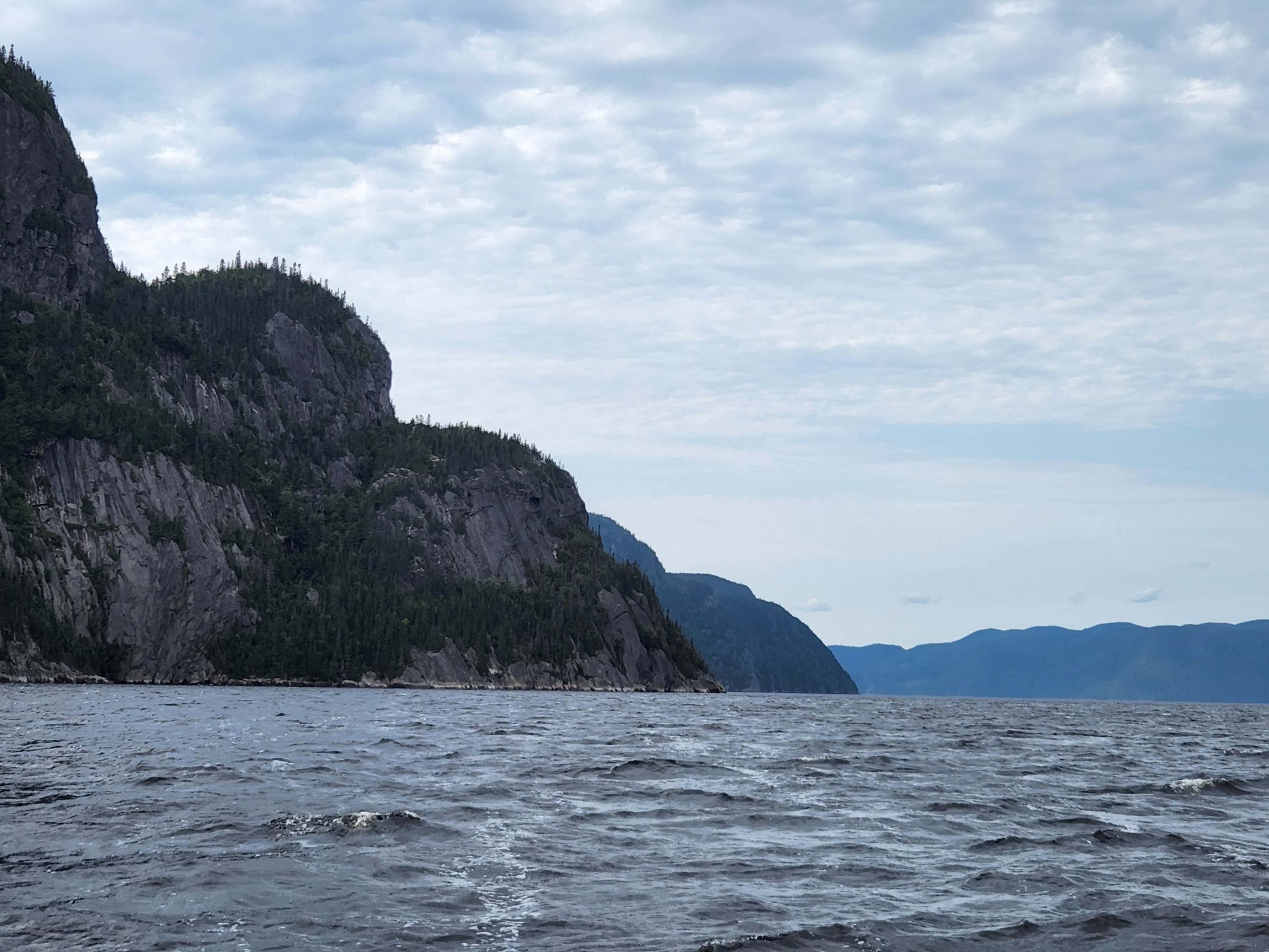
Today, we woke up in Kotor, Montenegro. The city is located at the tip of a 17-mile-long inlet that extends from Kotor to the Adriatic Sea. Below the water of the inlet is a submerged river canyon often called Europe’s southernmost fjord, and above the inlet, towering cliffs soar upward. Imagine waking up, opening the drapes, and seeing this outside our stateroom window. You can see the sunlight appearing on the mountaintop in the right center of the photo below, but this side of the near mountain and our ship were still in shadow.
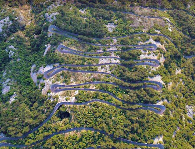
Today’s onshore excursion was a bus ride from Kotor to Cetinje by way of a serpentine road up Lovćen Mountain, a drive described as one of the most famous and most beautiful in the world. I downloaded this aerial view picture of the road from the internet because there’s no better way to describe the path we took upward. The serpentine part of the road is just over 5 miles long and has an average 5 percent grade with 30 hairpin turns for an elevation gain of 1,388 feet.
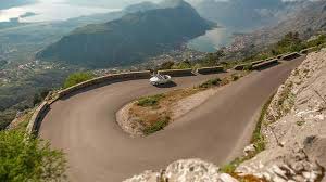
Here are two more internet downloads. This photo shows what the hairpin curves looked like.
The photo below shows how a bus fits on the road. The curves were tight, and the bus needed the full width of the curves to make the 180-degree turns. I think there must have been sensors and signals along the road to let drivers in both directions know if a vehicle was approaching the blind curves so the drivers could stop to allow the right-of-way to the oncoming vehicle at the turn. As we made our way upward, I saw a bicyclist pedaling uphill. Bravo!
The serpentine road, originally a caravan trail, goes through the Lovćen National Park, part of the Dinara Alps. Along the way, there was a zipline with a lot of empty space beneath it as it stretched from the top of one ridge to the top of another in the national park.
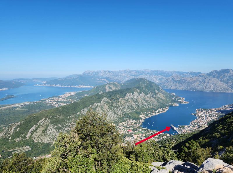
At the 25th turn of the road, there is an overlook point with beautiful views. In the photo below, the Kotor inlet and the city of Kotor are on the right side of the ridge and the Adriatic Sea is on the left. The arrow in the photo indicates our ship. Our route took us gradually upward from the ship clockwise along the inlet to about halfway along the ridge, then back to Lovćen Mountain and seriously upward.
Here’s another beautiful view at the 25th turn.
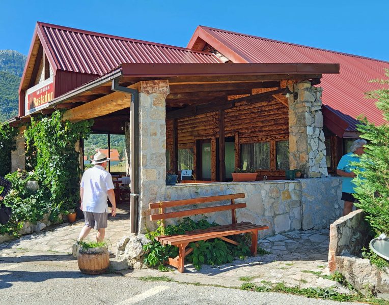
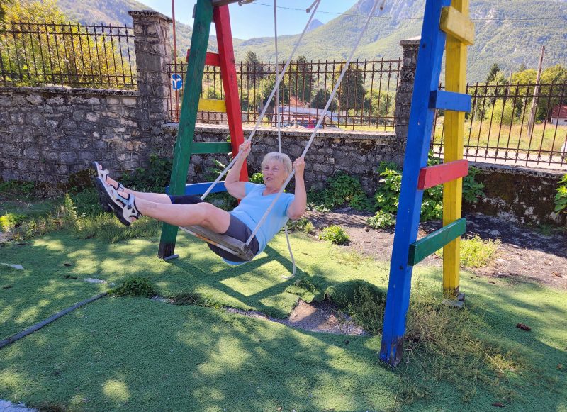
It took us 1.5 hours to reach the 30th turn at the summit of Lovćen Mountain. We stopped at the summit restaurant (not “a” restaurant, but “the” restaurant) in Njegši, a tiny mountain village, for an early lunch (10:30 a.m.). The restaurant offered us the locally produced specialties of bread, ham, cheese, and wine. It was delicious!
The village beside the restaurant is even smaller than the little town in which I grew up. My hometown had about 200 residents; Njegši has a population of 35.
There was time to look around the area after lunch, and I found a deserted playground with a swing. I love to swing, and it must have shown because, while I was deciding whether I should do it or not, a fellow traveler nearby said, “Oh, go on. You know you want to.” So I did.
Our next stop was the beautiful Old Royal Capital of Cetinje at the other end of the Kotor-Cetinje serpentine road. In Cetinje, we visited King Nikola’s Museum. King Nikola introduced sweeping reforms to Montenegro in the early 20th century, but I don’t remember what any of them were. (I’m sure Google can tell you if you care.) Centinje, however, was a pretty little town where Ted and I were content to slowly amble around the streets, looking at the pretty village and stopping for ice cream cones. We had that early 10:30 lunch, you know.
I wish I knew more about this wall decoration. I just took the picture because it was so pretty.
The statue in the center of this photo is dedicated to Ivan Crnojevic, a medieval ruler of Zeta from 1465-1490. Zeta encompassed parts of present-day northern Albania and Montenegro, and Cetinje was the administrative seat of Zeta.
We needed to return to our ship, but we did not re-trace our route down the serpentine road. Instead, we drove in a loop, passing beautiful mountain scenery and then driving through the coastal city of Budva, the party capital of Montenegro. It’s too bad we didn’t stop to party.
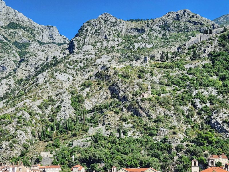
Back in Kotor, we had time to visit the Old City. Kotor was a well-fortified city, protected by ramparts, towers, citadels, gates, bastions, forts, cisterns, a castle, and ancillary buildings and structures. Whew! You can see the city wall in the photo below. It’s in the upper right quarter of the picture, and you can follow its zigzag path down to the Old City.
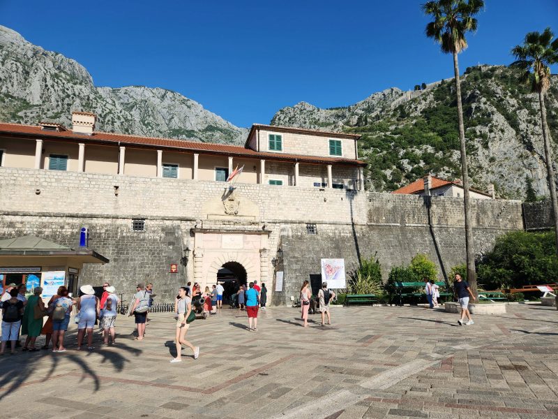
Here’s a picture of the main entrance to the Old City. The Old City itself looks like a fort, doesn’t it?
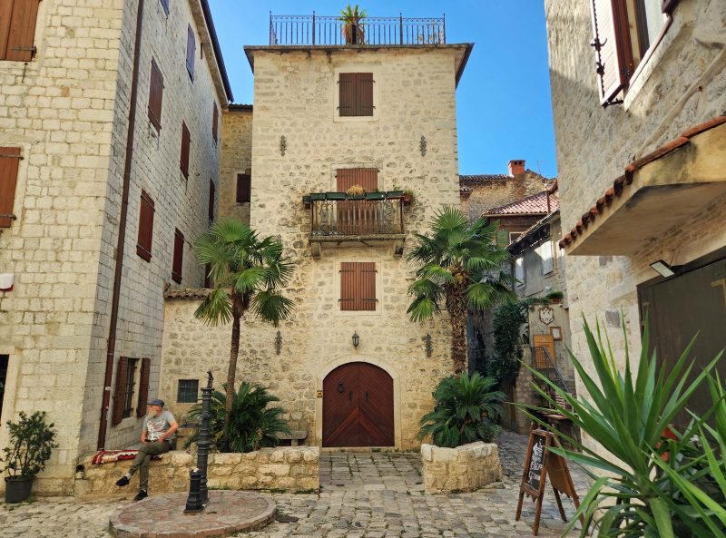
These houses are called “fortified houses,” but I’m not sure what their specific fortifications were.
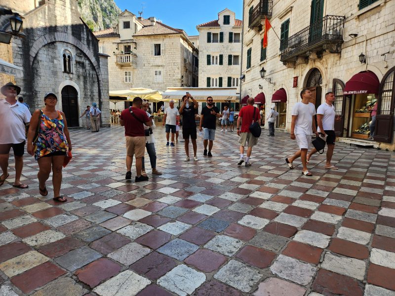
This is the Old City Square—where the action is.
There were lots of restaurants, souvenir shops, jewelry stores, and pretty cafés in the Old City.
While we walked around, we saw the restaurant and souvenir shop pictured below and couldn’t help laughing at both.
After leaving the Old City, we took a short walk along the inlet and then went back to our ship for dinner.
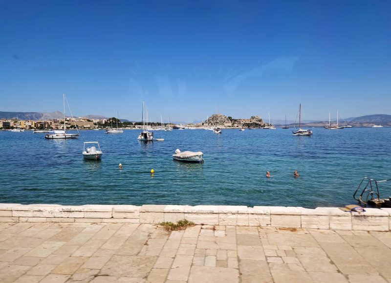
Corfu, located in northwestern Greece, is the seventh largest of the Greek Islands. It’s a very picturesque place to visit and, for a change, there were no ruins to tour. Corfu has served as a backdrop for fables and myths, and it’s where Odysseus is said to have stepped ashore during his epic voyage.
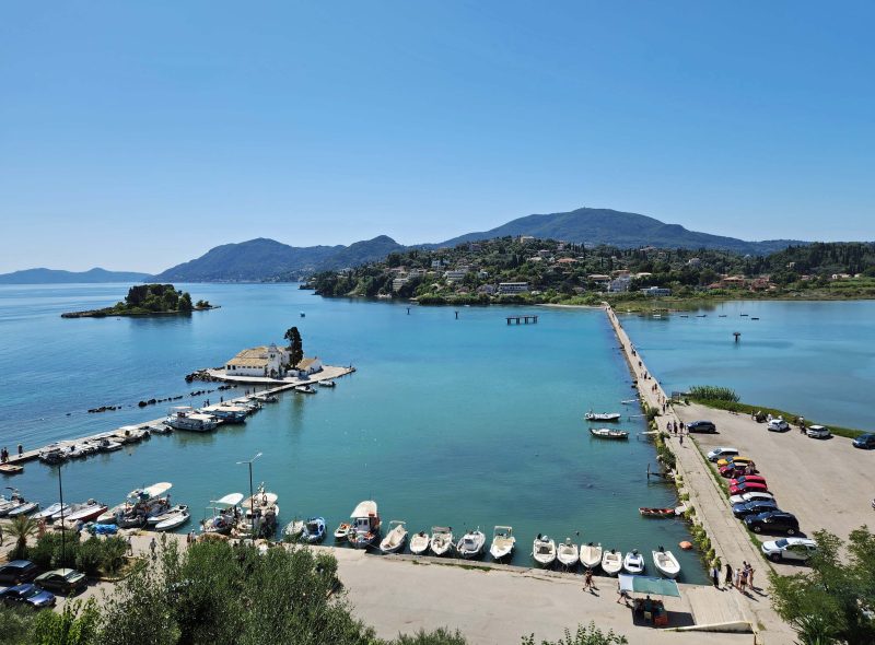
We stopped at a vantage point in Kanoni to view the harbor and tiny Pontikonisi (Mouse) Island in the center left of the photo below.
The Aegean Sea is beautiful. Because there are so many Greek islands, the distance between them is not great. As a result, public ferries and private boats are popular for inter-island travel.
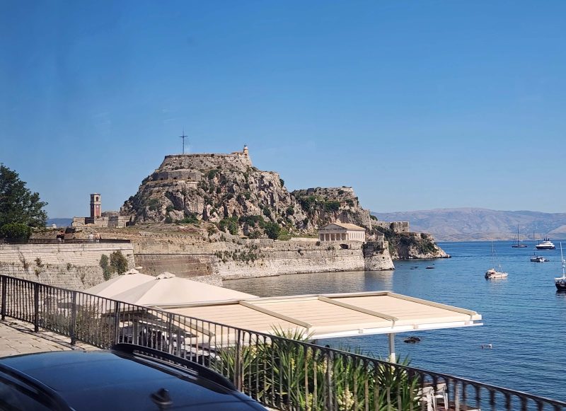
The Old Fortress of Corfu is visible atop a stony hill. It’s one of the most impressive fortification works in Greece.
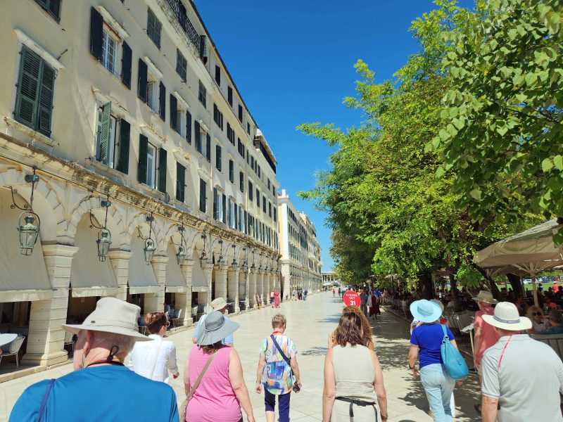
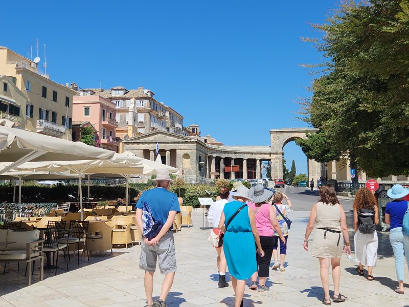
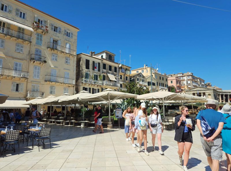
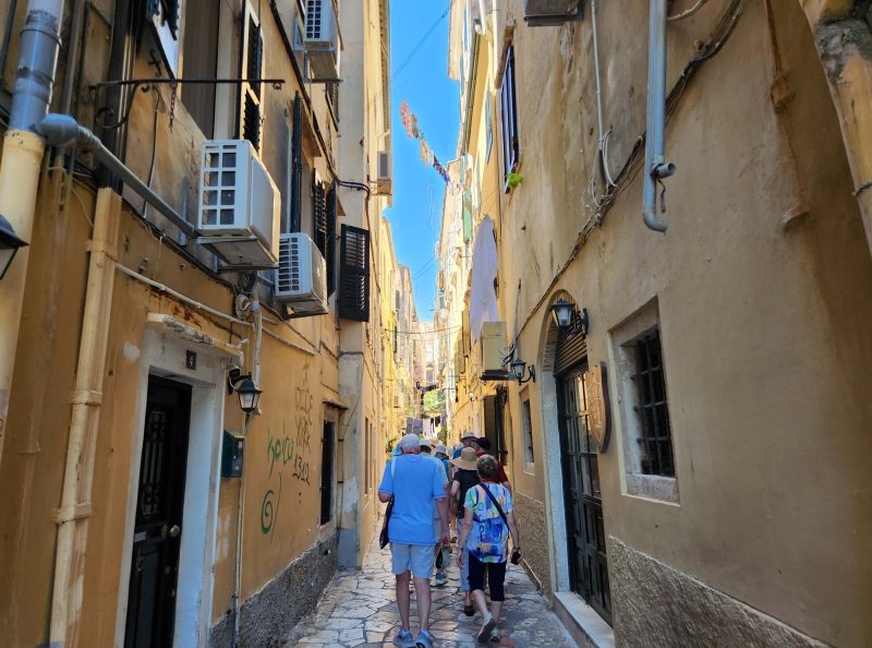
We spent the afternoon walking around Corfu’s Old City. All of Europe is so old, I think every city has an Old City tourist district. The equivalent in the U.S. would be the Historic District—an area filled with historic buildings, shops, and restaurants.
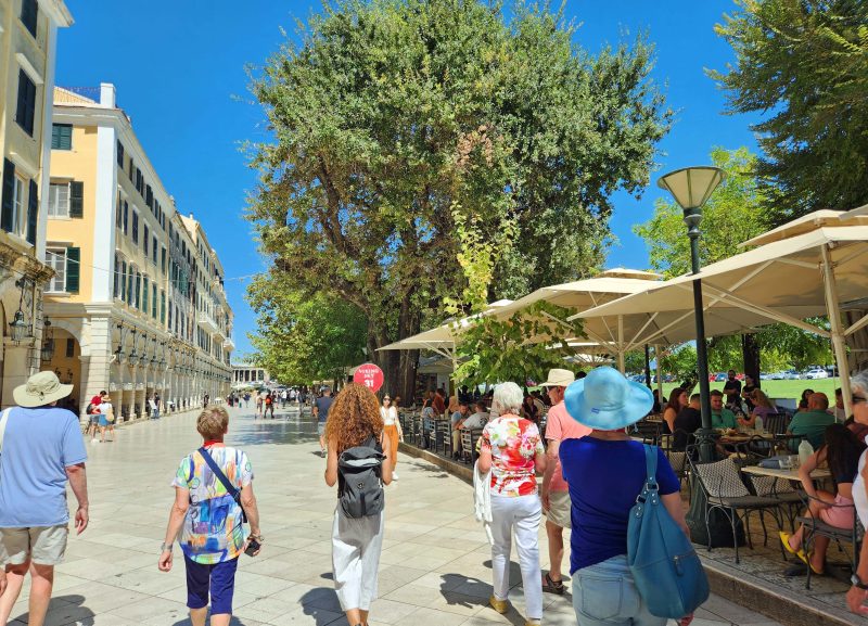
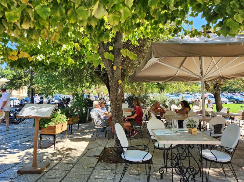
The Liston, pictured below, is a lovely Old City promenade, once reserved for the local aristocracy. Along the promenade on the left, below, is the Liston Stone Colonnade that has restaurants and snack bars beneath its portico. Similarly, the opposite side of this part of the Liston (on the right, below) is lined with outdoor cafés, making this a popular place during the day and at night.
The Liston faces the Spianada Square, a large tree-bordered park barely visible on the right of the photo below. The Spianada is one of Europe’s largest public squares, and it’s one of the most central and popular sites of the city. I wish I had a better picture of the park, but that’s life. It’s still a good memory for me.
Farther along on the Liston, in the right center of the photo below, you can see the Old Ancient Arch. (So is there a New Ancient Arch?)
The cafés along the Liston were filled with people sitting idly, sipping beverages, and enjoying conversation. It was a perfect day to be outdoors.
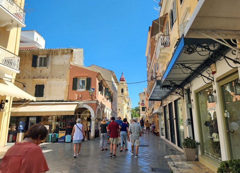
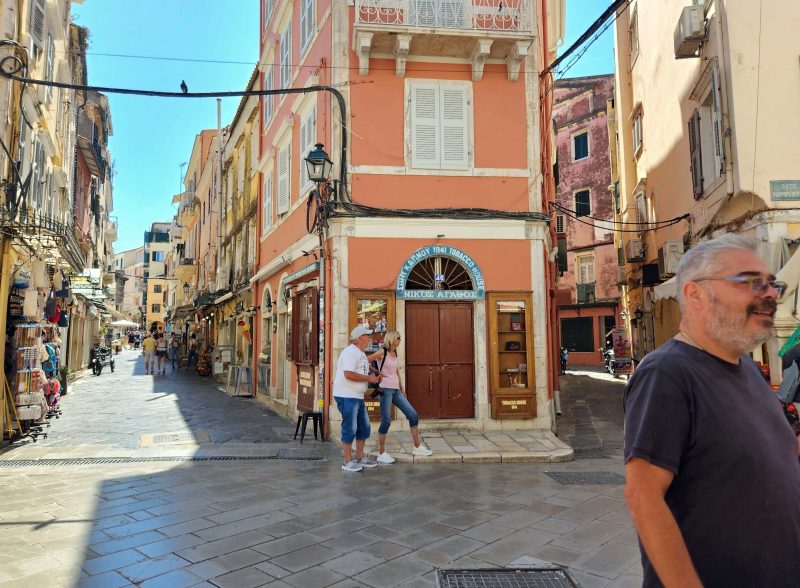
Here’s a picture of the Old City’s main street.
I always enjoy walking in the old cities. The streets are never a grid of “blocks”; instead, they usually have an irregular pattern that seems to grow with the buildings, rather than the other way around.
Ted’s and my enjoyable time in Corfu ended with a travel adventure. When we finished walking around Corfu, we headed for the shuttle bus that would return us to our ship at the port. The bus dropped us off in a different place than we had boarded it, and no one told us which of the many buildings we needed to enter to pass through security to the port. We finally figured out the right building, but it was a ferry station and there were no signs indicating which of the many lines for the various ships and ferries was the right one for us. Other passengers were having the same problem and there was a lot of shifting from one line to another.
We eventually found the right line by recognizing some of our fellow passengers, and we shared the common experience we’d all had figuring out where to go. When Ted and I reached the gate, we had a problem: I couldn’t find my ship ID card. Without the card, you’re not allowed to proceed to the ship—not even with a passport. After some language challenges, the gate officer figured out what we were trying to explain and told us they needed someone from the ship’s staff to verify my passenger status. That was a pretty simple fix, but it probably took half an hour to send a message to the ship, get it to the right person, and have that person walk the quarter mile from the ship to where we were waiting. During that time, Ted and I chatted with the employees and others at the gate and enjoyed getting to know them a little bit. They suggested we skip the ship and just stay in beautiful Corfu. One of them even offered to take us home for a Greek dinner.
Eventually, the ship employee arrived, verified my status as a passenger, and walked back to the ship with us to escort me onboard through the ship’s security. Our first stop onboard was the guest services desk to get a new ID card for me. That took about three minutes. The staff was very calm about it, so I guess I wasn’t the first person to lose my ID card. As she handed me my new ID card, the concierge joked that at least I wouldn’t have to sleep outdoors that night, to which I joked back that I’d already had an offer at the dock to spend the evening with a local family.
People are wonderful wherever you go. That’s another reason Ted and I enjoy traveling.
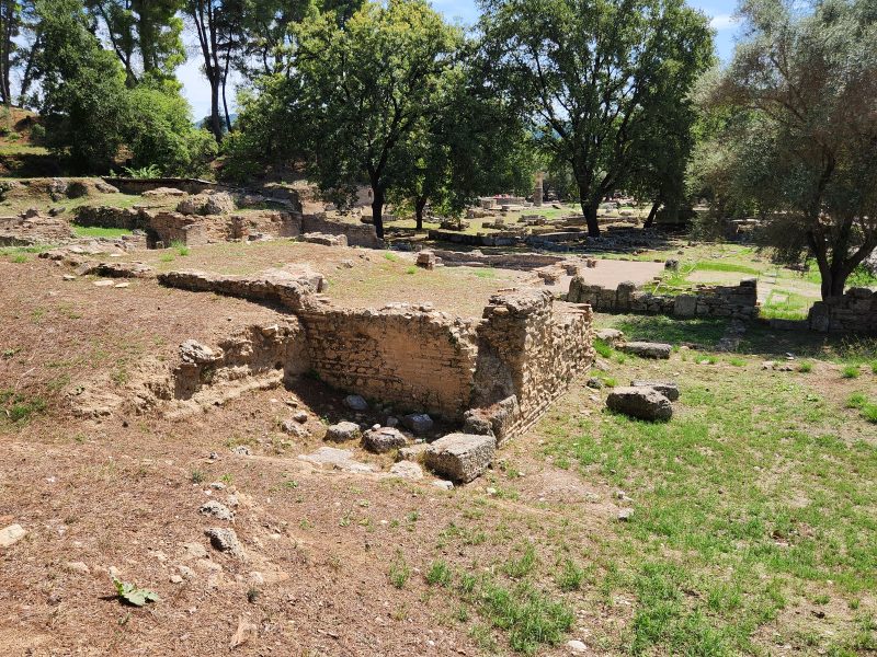
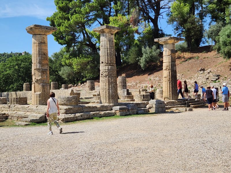
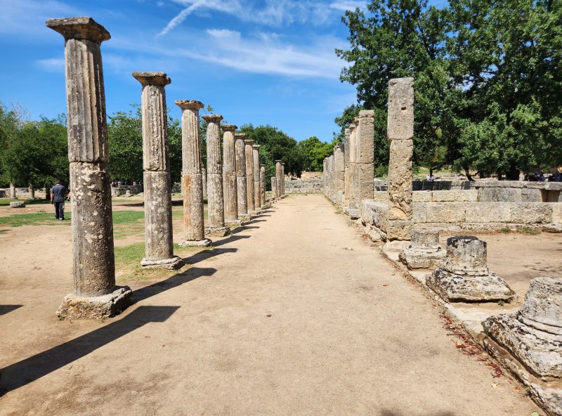
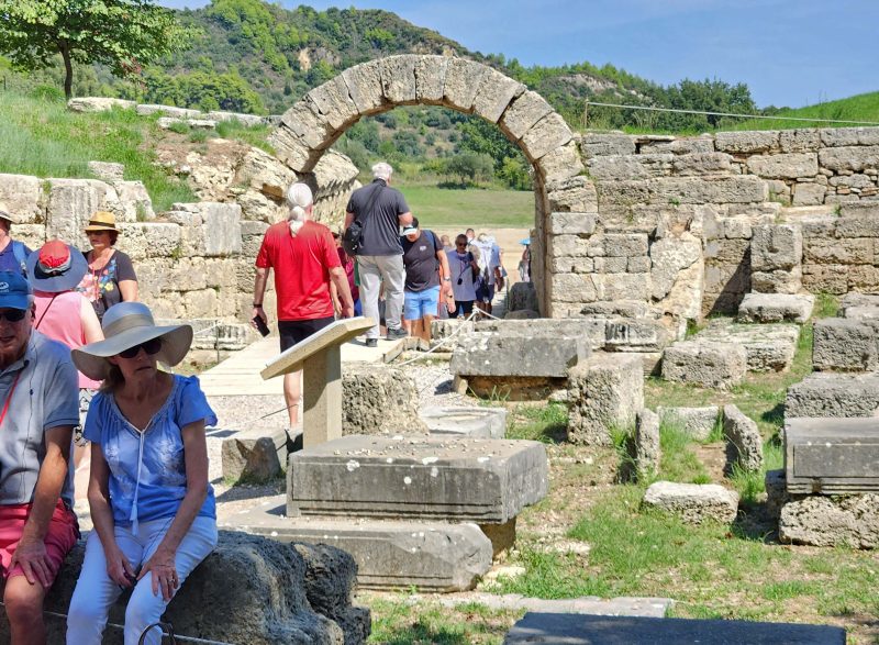
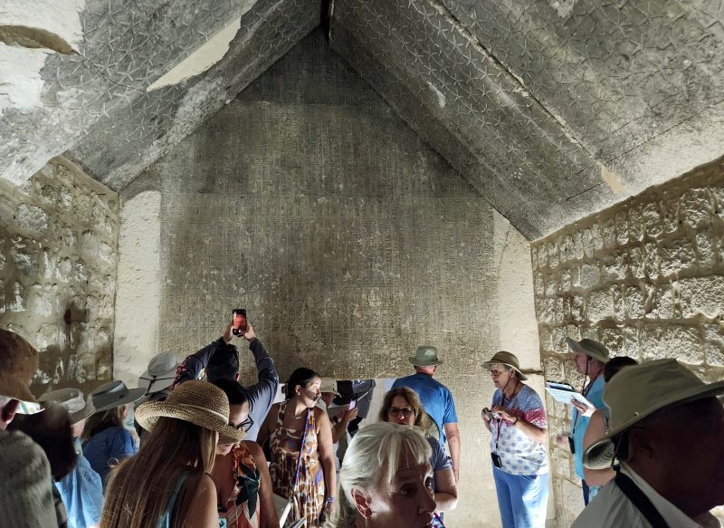
The Olympian Altis—in Greek religion, the sacred grove of Zeus—is a quadrangular area walled on three sides and bounded by the Kronion Hill, a small mountain, on the fourth. Within the Altis is one of the highest concentrations of masterpieces from the ancient Greek world, including the unidentified (to Ted and me) ruins pictured below. The area was destroyed by earthquakes in 522 and 551 AD and, in the years after the earthquakes, it was covered by 20 feet of dirt until the French began excavating the site around 1829. Just for fun, picture carefully digging 20 feet of dirt out of this entire area (a teaspoonful of dirt at a time if you’re an archeologist?) to expose the buried ruins.
Below is a picture of the ruins of the Temple of Hera, the oldest temple in the Altis. It was originally a joint temple of Zeus and Hera until a separate temple was built for Zeus.
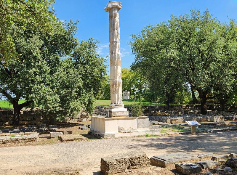
A second column originally stood beside the one pictured below inside the Votive Temple of Ptolemy II. Each column was over 30 feet high. Atop the columns were golden statues of the prince of Egypt, Ptolemy II Philadelphus, and his older sister and second wife, Arsinoe II. (Sister and second wife???) Although sibling marriage was a traditional practice of the Egyptian pharaohs, it was shocking to the Greeks, who considered it incestuous. The temple was built in honor of the prince and his wife/sister. (The picture isn’t crooked–the tower leans.)
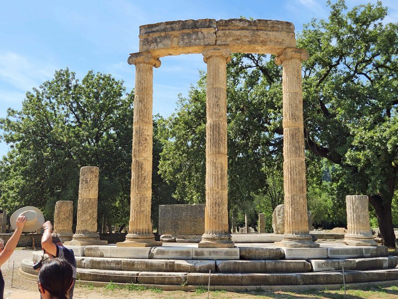
The photo below shows the ruins of the Philippeion, originally a circular monument celebrating Philip’s victory at the battle of Chaeronea. Within the monument were ivory and gold statues of Philip II of Macedon and members of his family: Alexander the Great (Philip’s son), Olympias (Philip II’s fourth wife), Amyntas III (Philip’s father), and Eurydice I (Philip’s daughter). It was the only structure in the Altis dedicated to a human.
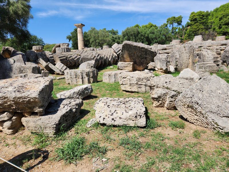
The largest and most important building in the Altis was the Temple of Zeus. All that remains of the temple after the earthquakes are the single standing pillar and the rubble on the ground, as seen in the photo below. The pillar stood inside the temple and held a 40-foot tall gold and ivory statue of Zeus, one of the Seven Wonders of the Ancient World. The sculpture showed Zeus, the god of the sky and the chief Greek deity, seated on an elaborate throne holding a figure of Nike (the goddess of victory) in his right hand and a scepter in his left.
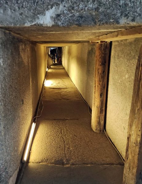
The Echo Stoa, a colonnade, was the boundary of the east side of the Altis. Its popular name was the Echo Colonnade because a spoken sound in the colonnade was echoed at least seven times. There was a narrow passage between the colonnade and the east Altis wall. East of the wall was an embankment that separated the stadium from the Altis and blocked the view of the finish line on the field from the sanctuary. A covered entrance through the embankment—essentially a stone vaulted tunnel—connected the stadium to the Altis and was used by the athletes and the umpires.
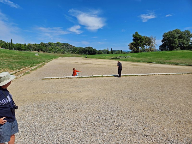
The first Olympic games were held in the stadium in 776 BC as part of the Festival of Zeus. The games continued every four years until 393 AD when they were discontinued, perhaps in connection to a fire that destroyed the Temple of Zeus at that time. Another possibility is that the Roman Emperor Theodosius I (who ruled Olympia at that time) banned the games because they celebrated the god Zeus, and Theodosius wanted to promote Christianity.
The photos below show the entrance gate to the stadium and the stadium field. The field was wide enough to accommodate 20 runners at a time. The stone starting lines at each end of the field are still in place. Earth embankments on the east and west sides of the stadium could accommodate up to 40,000 spectators. The only stone seats were on the south side and were used by the chief judges and high officials. The north side was bounded by the Kronion Hill.
Check out the wife preparing to take a picture of her “Olympian” husband at the starting line on the field.
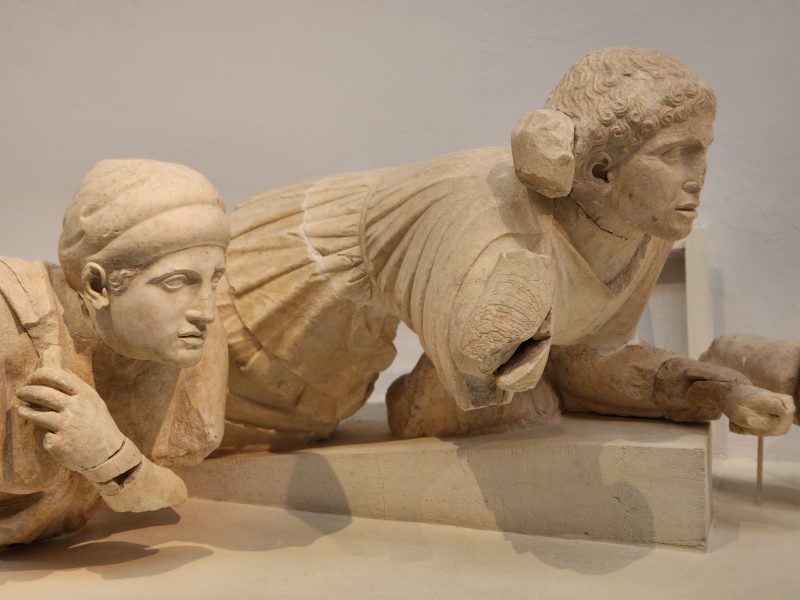
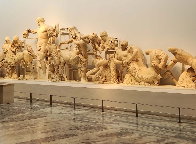
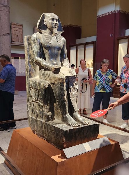
The second tour stop of the day was the Archeological Museum of Olympia. Among the displays was the sculpture of the Lapith women (below) that originally decorated the Temple of Zeus. The Lapiths and the Centaurs were mythical tribes of northern Greece and had a battle at a wedding feast. The Centaurs (half horse, half man) drank too much wine and attempted to abduct the Lapith women. The women in the sculptures are portrayed as anxiously watching the battle.
The photo below shows a part of the decoration from the west pediment of the Temple of Zeus. It represents the battle between the Lapiths and the Centaurs in Thessaly (the one the Lapith women were watching) and is symbolic of the Greek victory over the barbarian Centaurs, or analogously, the victory of reason over man’s savage nature.
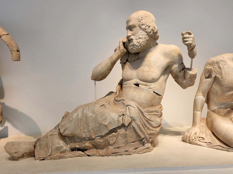
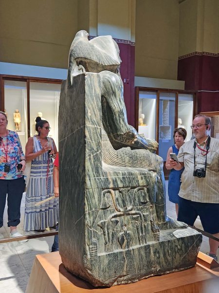
Here’s a picture of the Seer, aka the Old Diviner. It was on the north corner of the west pediment of the Temple of Zeus. The Old Diviner’s intense facial expression is unique for this early period of classical art. To make ancient classical art like this more fun, the popular current name for this sculpture is “The Seer calling Zeus on his cell phone.”
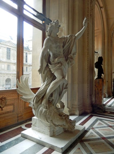
This reminded me of Ted’s and my visit to the Louvre, where we saw the statue titled “Apollo Defeats the Serpent,” now nicknamed “Apollo taking a selfie.”
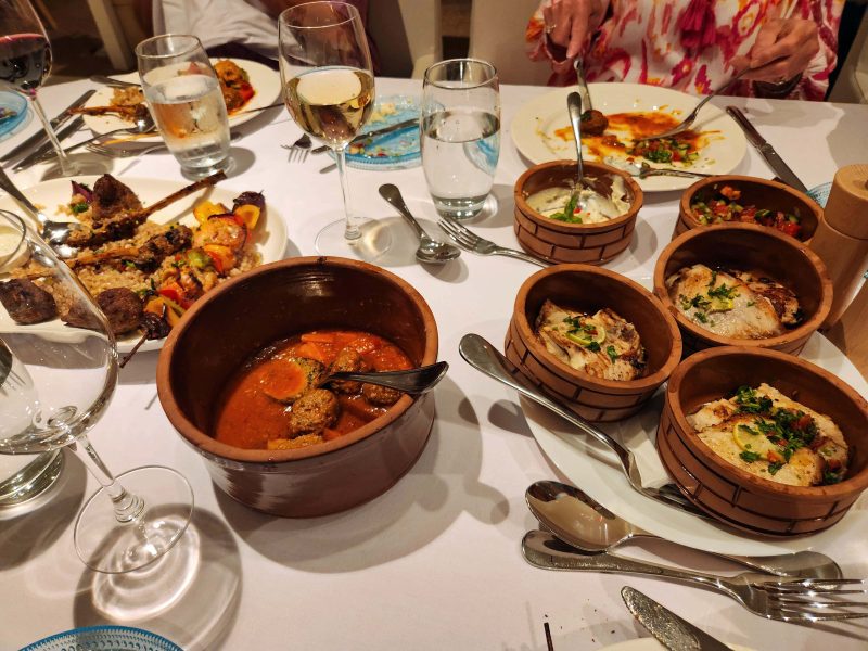
One of the things I enjoy when Ted and I travel is trying new foods. Even better is pre-paid food, like on a cruise. You’ve already paid for it, so you can eat it or not. If you don’t like it, you can choose something else at no additional cost.
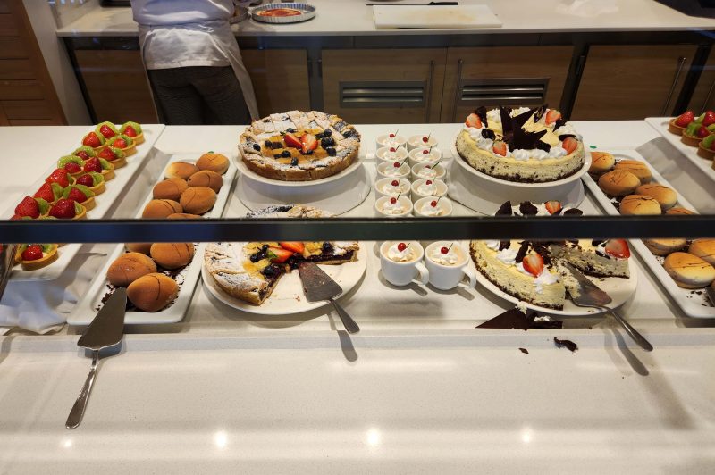
One day, out of curiosity and with nothing else we needed to do at the time, Ted and I counted the choices presented at the dinner buffet on the ship. There were 139 different foods and beverages available–and that was at only one buffet! The two buffets always offered most of the same items, but there were usually several unique offerings at each. What an opportunity to try something new at no risk! Beer and house varieties of wine were included with meals; higher-end wines and mixed drinks were not.
Sushi Bar: 17
Cold bar (salads / salad ingredients / salad dressings): 28
Hot bar (entrées / vegetables / sauces / soups): 27
Breads: 5
Desserts: 4 (sometimes there were 6, but not on the night we counted)
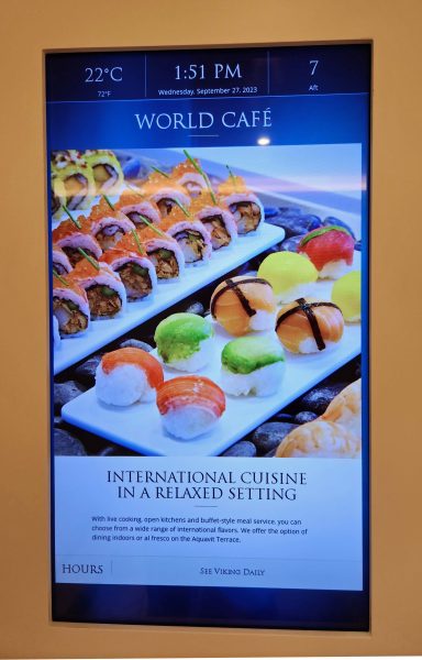
The items listed above include only the buffet, not the other two casual restaurants or the two upscale restaurants also included with the cruise fare. Here’s the menu screen at the entrance to the buffet. Notice that it offers “International cuisine in a relaxed setting.” That means you may wear shorts, jeans, and/or T-shirts to dinner, unlike the upscale restaurants that require “casual elegance” in dress. (An oxymoron if I ever heard one!)
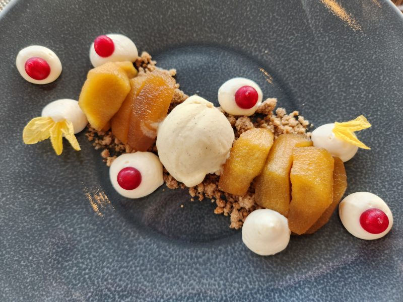
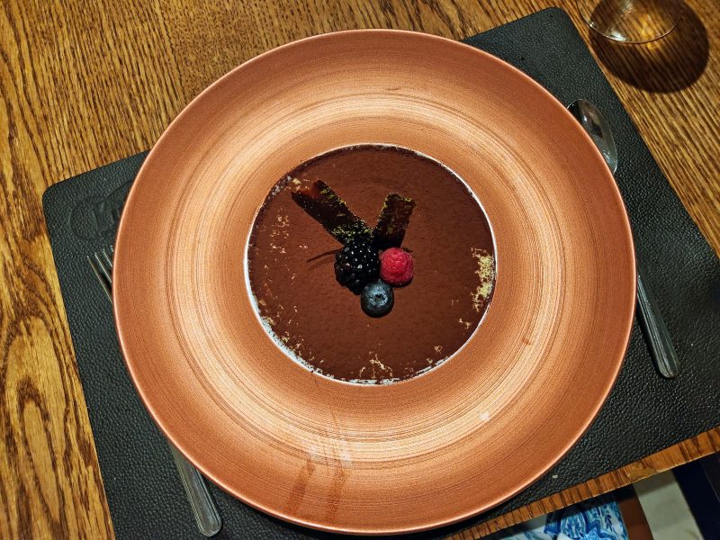
The desserts were always tempting. Fortunately, the portions were small, so trying two (or as many as you wanted) wasn’t unreasonable.
I get a kick out of Ted when we’re presented with different foods than we prepare at home. Although he is a far less selective (i.e., “picky”) eater than I am, he’s more comfortable in the safety zone of familiar foods that he’s seen and eaten before. For example, he wouldn’t try a purple poi dinner roll in Hawai’i because it was purple. After all, who eats purple bread products? The second time we had poi rolls, he dared to try one—maybe because I didn’t become gravely ill after I ate one the first time. If I can get him to try something he’s never seen, heard of, or tasted before, he usually enjoys it.
Even with all those food choices and a different menu every day, some foods on the 2023 BT were exceptional. Here’s an Egyptian meal we had for a family-style dinner as we cruised on the Nile River. The meatballs were out of this world, and everything else was deliciously spicy too. It took some coaxing to get Ted to try more than the meatballs. The meatballs were “safe” because he’d seen and eaten meatballs before, but he gets full credit for bravely trying some of the other dishes and admitting that they were good.
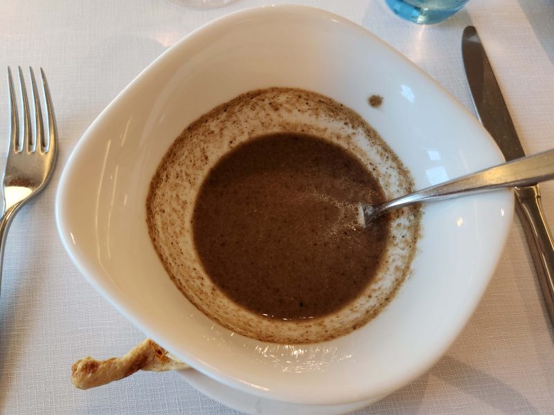
I don’t like to eat mushrooms because of their texture, but I like the flavor that mushrooms add to food. If I have a recipe that requires mushrooms, I use sliced fresh mushrooms so I can pick them out when I eat the food. After being assured there were no mushroom pieces in it, I ordered a bowl of mushroom soup as an appetizer one evening. (Ted declined—he’s never had mushroom soup.) It was delicious, but as the volume of the soup decreased in the bowl, it looked like mud or silt left behind. It was so good, I got Ted to try it the next time it appeared on the menu. He liked it too. BTW, that’s a bread stick poking out on the lower left side of the bowl.
These desserts in Istanbul get my vote for Best Presentation. Choc-o-holic Ted chose the chocolate, but didn’t want the currants, so I ate those. The squiggly thing in the center is a delicious custard.
I chose apples with meringues topped with currants (they look like marshmallows) and ice cream in the center. Both desserts were wonderful. With really good food, I always think I’d like to have some more, but it always turns out to be just enough.
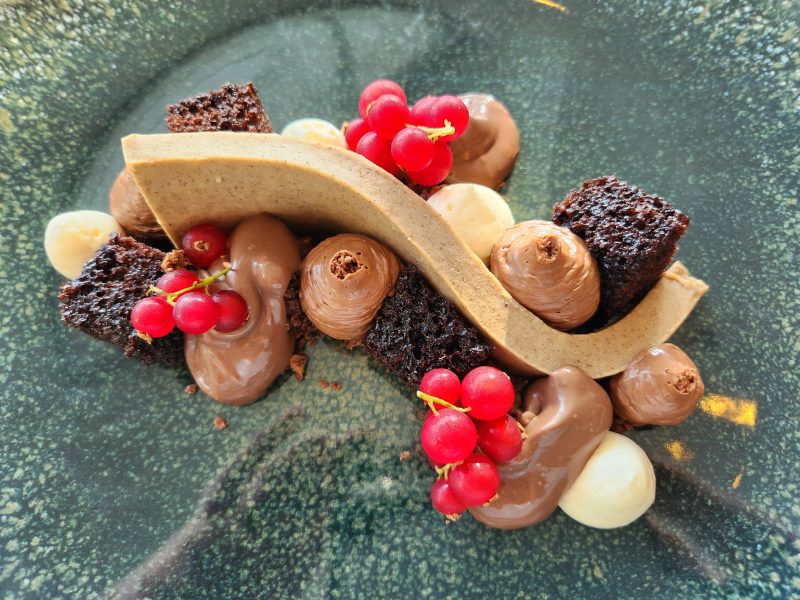
While I’m on the subject of desserts, we had this chocolate mousse in Cairo. Mmm, mmm, really good!
For a long time, I had no interest in cruising because all I ever heard people talk about was the shopping and the food. I’m not a big fan of shopping as an enjoyable pastime; it’s more of a utilitarian thing for me—find what you need, buy it, and go home. Neither do I like to “pig out” on food. Ted and I only took our first cruise because we wanted to visit Glacier Bay in Alaska and there was no way to get there without a ship. We tried to schedule a day trip out of Juneau, but a storm knocked out the dock and it wasn’t expected to be repaired for at least a year.
Our travel agent convinced us to take a cruise to Glacier Bay with the admonition that, “You don’t have to only shop and eat.” It was so true! Instead of shopping, Ted and I like to walk around and possibly meet some people from the area we’re visiting, and at meals, we make healthy choices. Those people who only talk about the food were right about one thing, though: cruise food is really good! On this cruise, we overheard a couple at another table talking about their buffet choices and the husband remarked, “You really can eat healthy on a cruise, can’t you?” Yes, you can—and you don’t have to shop either!
Ted and I visited the Parthenon replica in Nashville, TN many years ago; now we’ve seen the real thing atop The Acropolis in Athens, Greece.
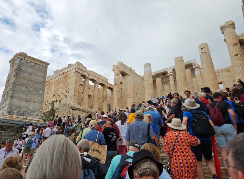
Due to thunderstorms and lightning, The Acropolis opening was delayed for two hours on the day of our visit. It’s a popular tourist site, tickets are required to enter, and naturally, everyone with a ticket for the day wants to get in, so when we arrived at our scheduled 9:30 a.m. ticket time, there was a long, backed-up line. Ticket sales to The Acropolis are capped at 20,000 per day, and I’m sure they were sold out, in spite of the rain. It took over an hour just to reach the ticket gate where we could finally head for the top of The Acropolis. I wonder what it was like before ticket sales were capped.
An acropolis is simply the highest hill in a city, but The Acropolis in Athens is capitalized and referred to as “The Acropolis” because it’s such an important site. Truth time: The Athens Acropolis is really the second highest hill in Athens, but it was chosen as the site for the Parthenon because there was a spring on the hill—something that was lacking on the highest hill, the real acropolis.
There are several buildings atop The Acropolis in Athens, the most famous of which is the Parthenon, originally a temple dedicated to Athena, an ancient goddess and the patroness of Athens. Temples were usually built on the acropolis because it was believed the gods liked to live there, but the top of the highest hill is a good defensive position too, so the Parthenon also served as a fortress and as a treasury. Later, the Parthenon was used as a Christian church, and after that, as a mosque.
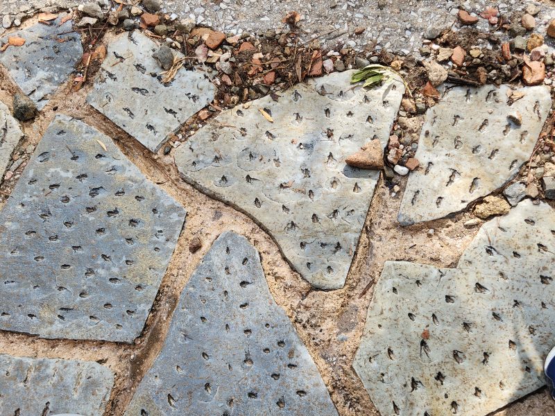
Given the excavations Ted and I have seen in Israel, Egypt, Türkiye, and Greece, I think it’s safe to say there’s a lot of rock in this part of the world. (There are a lot of earthquakes too, given all the ruins we saw of cities destroyed by earthquakes.) Walkways are often made with paving rocks, which become very slippery when wet. To reduce pedestrians’ risk of slipping and falling, the paving rocks sometimes have wedged holes in them. Surprisingly, that really helps, and we were grateful for those holes as we inched our way uphill to the ticket gate in a light drizzle.
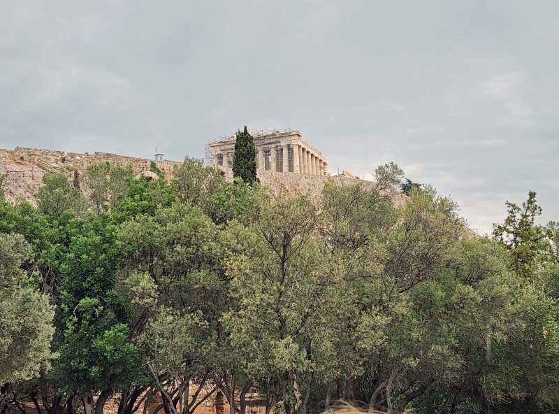
Along the way, we had our first view of the Parthenon. It was definitely a thrill.
After passing through the ticket gate, we began our upward trek to the top of The Acropolis. The people you see in the photo below are not eagerly surging up the stairs to the top of The Acropolis; they are moving in slow motion. The way to reach the top of The Acropolis is to: (1) Climb up a step or two; (2) walk between the guide ropes across the wide staircase (65-75 feet?) to the opposite side of the stairway; (3) repeat this zigzag pattern until you reach the top of the 80 steps and arrive at the grand entrance—the Propylaeum—on the plateau of the rock. Allow at least one hour to complete the climb at the pace of the hundreds of people ahead of you.
While you are going uphill, the same number of people are doing the same thing between the same guide ropes, but in the opposite direction because they are going down The Acropolis. It’s kind of like being at Disney World, only far more crowded because two lines are moving in opposite directions within the same space. It was hard to enjoy the view on the way up or down because we had to watch our feet to avoid stumbling down a stair or bumping into someone else and causing them to stumble. Do not consider stopping along the way. You will probably be trampled or pushed aside.
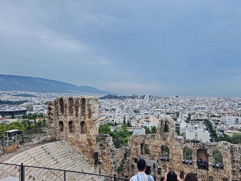
As we were climbing the hill on the pock-marked stones (photo above), we could see the exterior of the ancient Acropolis theater.
From the top of The Acropolis, we could look into the theater, where we saw a crew preparing the venue for a weekend concert. They really built these ancient theaters to last. In most of the ruins we’ve visited, the theater still stands in recognizable form and is still used for concerts and other events. I guess the theory is, “Why build a new one if the old one still works?”
One of the buildings at the top of The Acropolis (shown below) is the Temple of Athena, the patroness of Athens and the goddess of wisdom, handicraft, and war.
At the top of the 80 steps, we were greeted with the pile of rubble pictured below that used to be the Propylaea—a building complex that functioned as the monumental ceremonial gateway to The Acropolis.
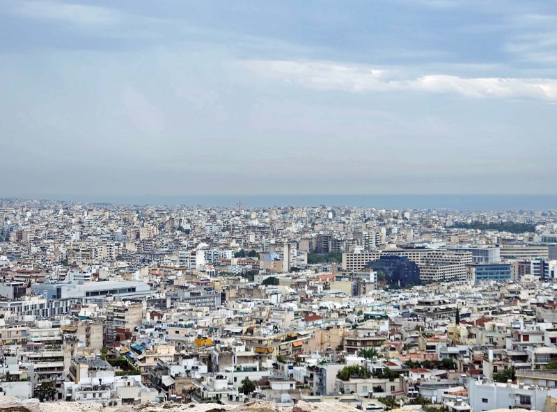
From the top of The Acropolis, we had a beautiful 360-degree view of Athens and the Aegean Sea.
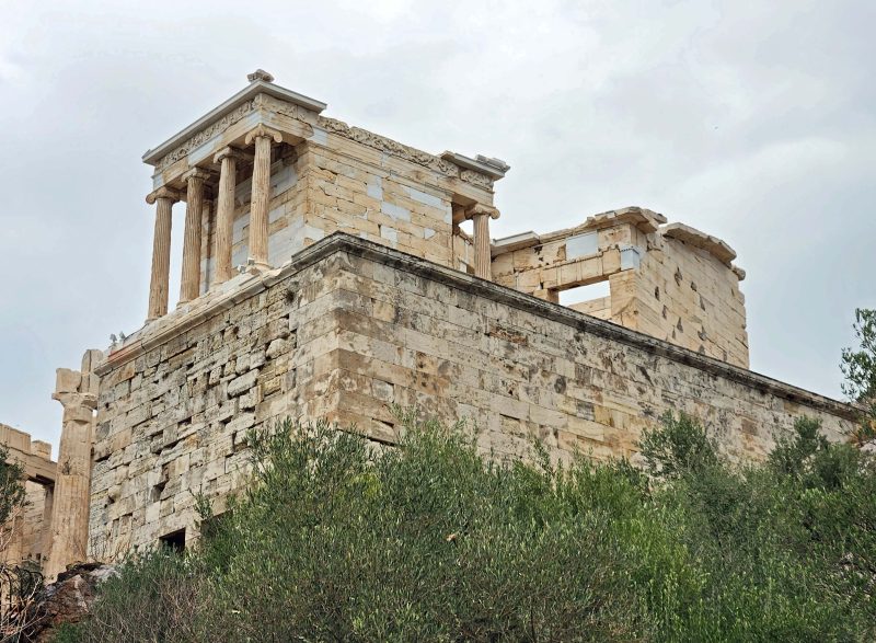
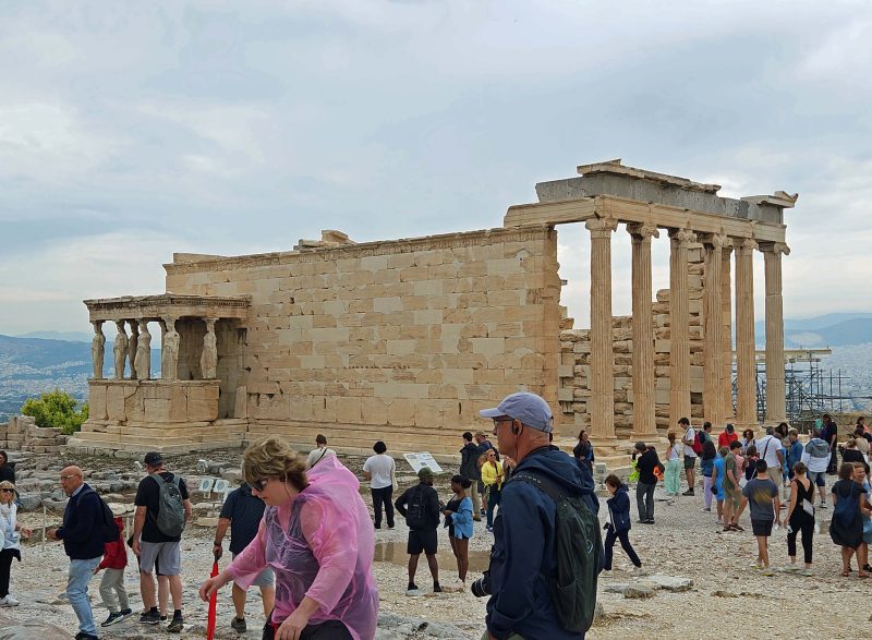
Another of the buildings at the top of The Acropolis is pictured below. It’s the Temple of Erechteion, a mythological king of Athens. The temple is famous for its detailed design. If you look closely (or zoom in), you’ll see that the pillars of the left portico of the temple are statues of the caryatids—six maidens representing the women of Caryae who were doomed to hard labor because their city sided with the Persians during their second invasion of Greece in 480 BC. In this case, their hard labor requires them to support the roof of the portico forever—or until an earthquake knocks it down.
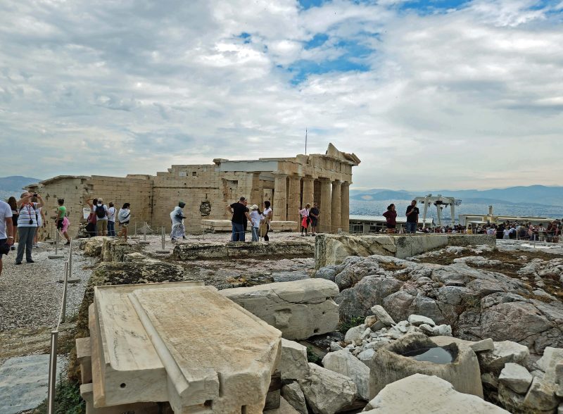
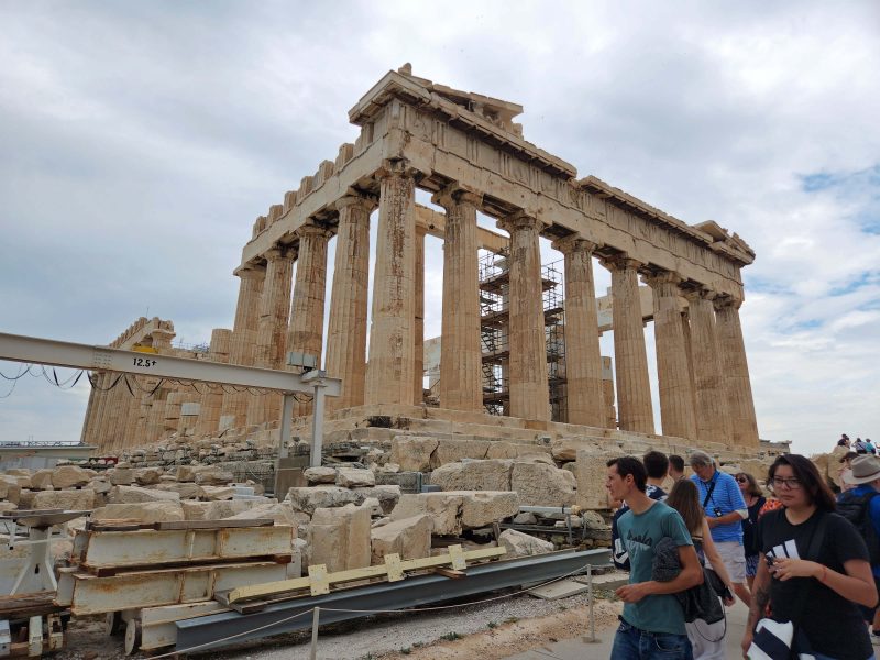
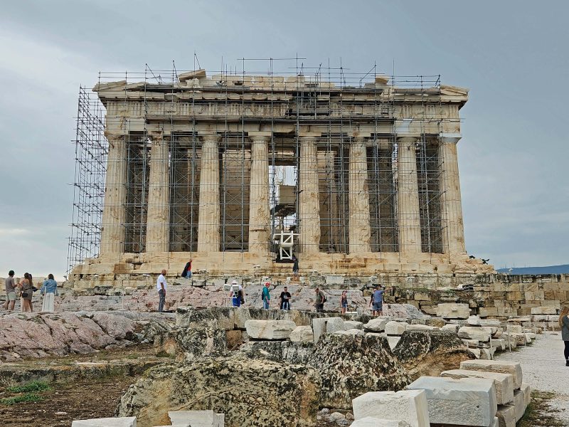
I saved the best for last: the Parthenon. This 2,500-year-old structure (completed circa 438 BC) is the most recognizable building of Greece’s golden age. With the cooperation of the Greek city-states, the Parthenon was completed in only nine years. The building was intended to be the chief shrine to Athena. It also served as the treasury for the Delian League, a confederacy of Greek city-states whose purpose was to form a military alliance to protect Greece from the Persians. Athens, the strongest city-state, pledged its massive navy to protect all members unable to protect themselves. Raise your hand if you think that sounds similar to NATO.
A 2,500-year-old building has a lot of history, so let’s jump roughly 2,100 years ahead of its completion to the Morean (Ottoman) War and the 1687 siege of The Acropolis by the Venetians. The Venetians bombarded the Parthenon with cannon fire, striking the western façade alone with approximately 700 cannonballs. The Ottomans had been using the Parthenon as an ammunition dump and, not surprisingly, the barrage of cannon fire caused the stored gunpowder to explode, severely damaging the center of the Parthenon, destroying most of its walls, and leaving nothing of its roof. Over time the building gradually collapsed, and the last pillar fell in 1852.
In 1975, the Greek government began a large-scale project to restore the Parthenon. Previous restoration efforts damaged much of the stone, and about 50 percent of the original architectural decoration is lost. Greek structural archeologists consciously decided not to completely rebuild the Parthenon, but to restore it to an earlier state as much as possible. Nearly 50 years after it began, the restoration project continues.
The scaffolding and heavy equipment required for the Parthenon reconstruction project detracts from its appearance, but the building is huge and very impressive.
You can get an idea of the scale of the Parthenon by looking at the people in the photo below. The Lincoln Memorial in Washington, D.C. was modeled on the Parthenon in Athens, and obviously, so was the replica in Nashville, TN. 😊
Before Ted and I navigated our way down the crowded stairway (looking only at the back of the person ahead of us and at our feet to keep from stumbling) I took this picture of the Philopappos Hill Monument, a Greek mausoleum, dedicated to the aristocratic and well-connected first-born son of a Greek prince. It’s the pillar at the top of the tree-covered hill.
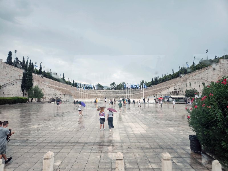
Following our time at The Acropolis, we had a brief city tour of Athens and passed the Panathenaic Stadium. The stadium was originally built as a racecourse in the 6th century BC and hosted the Panathenaic Games, held every four years to honor the goddess Athena. The Panathenaic Games were likely a rival of the Olympic Games, held in Olympia, Greece.
This site was originally built around 300 BC and has a long history too, so I’ll jump ahead to the late 19th century. The Greek government sponsored a refurbishment of the stadium prior to the first modern Olympics in 1896. The opening and closing ceremonies of the 1896 Olympics were held at this site and were viewed by a crowd of about 80,000 spectators. The stadium was used again for the 2004 Summer Olympics and for the 2011 Special Olympics World Summer Games. In my photo below, the stadium looks like an ice rink, but that’s rainwater. If you need proof, check out the people with umbrellas.
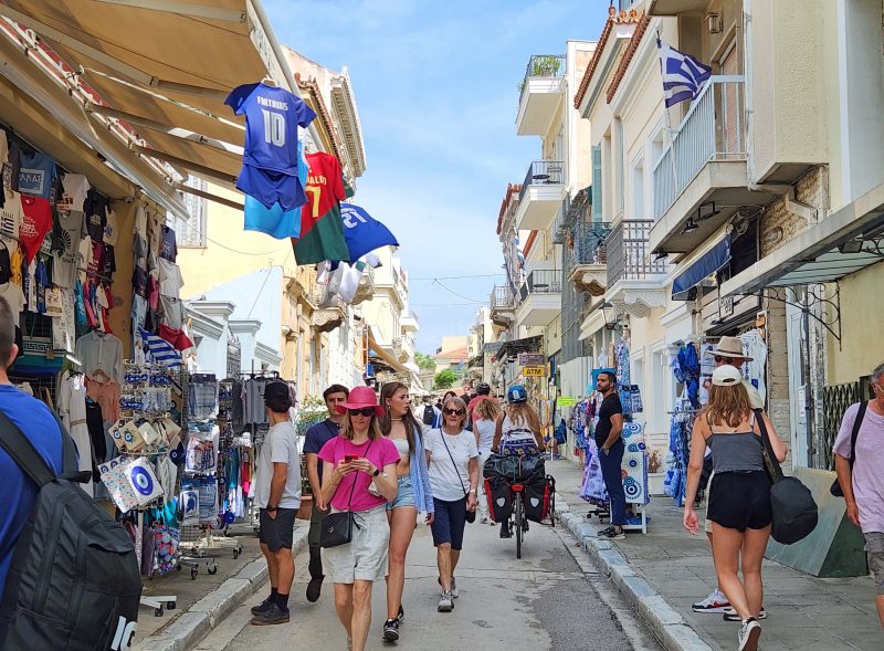
We and most of our travel group (excluding the die-hard shoppers) skipped the free time downtown and the shopping part of the day due to the continuing light showers. The next day, Ted and I (and many of our shipmates) visited the Plaka District, the oldest section of Athens, located at the base of The Acropolis. It’s described as “a village within the city, an island for those who don’t have time to visit the Greek Islands.” Most of the streets of the district are closed to automobile traffic and it’s a very nice neighborhood of homes, shops, and restaurants.
The weather was sunny and beautiful, and we enjoyed our time much more than we would have in the previous day’s rain. We even bought a small, zippered case, not because we really needed a zippered case (although we’ll use it), but because it was inexpensive and we wanted to change our €50 bills for lots of smaller denominations to use for tips. Mission accomplished!
Dinner onboard featured Greek food tonight. I had moussaka for the first time. It’s basically a casserole similar to lasagna but layered with meat and vegetables instead of meat and pasta. Not surprisingly, “Cautious Ted” selected something more familiar to him for dinner, but when I told him the moussaka was delicious, and when he didn’t see any signs of me dying from eating it, he tried it and agreed that it was very good.
Since the first time Ted and I cruised with Viking, we’ve been impressed with everything: the 1:2 crew/passenger ratio; the service; the friendliness of the staff; the maintenance; the atmosphere; the food; the stateroom’s heated bathroom floor and full-size shower; the generous stateroom storage space; the amenities including the spa and salon (haircuts and styling, massages, etc.), a stocked mini-fridge in the room, higher-end restaurants, and room service; the beverages–fruit juice, soft drinks, and coffee all day and all night; beer and wine at meals–all included; and whatever else can impress travelers. On shore, a port city tour is always included; other excursions have an additional cost. Everything on a Viking cruise is about the guests and spoiling them.
Let’s start with maintenance. There are no trashcans onboard except in the staterooms and the public bathrooms. Passengers are not expected to clean up after themselves. Just leave your dirty dishes or napkins, etc. on a table and your used towels at the pool or the hot tub. A staff member will pick up the items within minutes.
Cleaning the floors and picking up trash is only the beginning of keeping the ship clean. Going to the atrium one afternoon, we saw a staff member wiping down all the walls inside the elevator. Windows are washed at least twice weekly–more often, if needed. I never saw a window spattered with saltwater spots for more than a short time before it was washed. As Ted and I relaxed in the Winter Garden with our coffee and hot chocolate one morning, we saw a staff member polishing (not dusting) the grand piano in the room. As we passed through a lounging area, we saw a housekeeper dusting the black scrollwork decorations you see in the photos below. He was using a damp cloth and his finger to get into every opening. He reminded me of the Marines: he left no dust behind.
Every room on Viking ships has a veranda and every veranda and its outdoor furniture is cleaned daily and washed at least once weekly—more if needed. One day, Ted and I were standing on our veranda and noticed a little damage on the railing. We joked that it was time to get a new railing.
We were only kidding, so we never mentioned it to anyone else, but when we went out on our veranda after returning from our excursion of the day, we had a new railing.
Another day, as we were leaving on a shore excursion, we noticed a large black smudge on the side of the ship. It was probably the result of the ship bumping against the black rubber tires along the dock that protect docking ships from damage. Ted and I looked at the smudge (noticeable because it was about six feet in diameter and the only dark spot on the white ship) and joked again, “Uh-oh! Better scrub that off.” When we returned from our shore excursion, crew members were painting over the smudge. Another day, we saw crew members washing the exterior of the ship.
Crew members are constantly on patrol to keep things nice. People always feel comfortable moving furniture around to suit the situation. Maybe they don’t want to face the sun, or they want to form a conversational group or something. After they leave, however, it’s only minutes before a crew member straightens things up so that it looks nice for the next people who want to spend time in that area. There is never a feeling of “Why do the passengers always have to move the furniture and make more work for me?” It’s always more of a “I’m glad you enjoyed yourselves. I’m going to make this nice for the next person.”
Used beach towels are replaced with identically folded and properly positioned clean towels, and back rest pillows are properly spaced and placed against the dining room bench seats. This is true of furniture throughout the ship. Notice how the deck chairs and the dining room chairs are all in alignment. Everything always looks clean and new and ready for guests—and it always looks inviting and comfortable.
One of Ted’s and my favorite things to do onboard is to sit in the ship’s Winter Garden in the morning with a cup of coffee (Ted) and a cup of hot chocolate (me). Sometimes we shift the chairs around to keep the sun out of our eyes, but they are always re-positioned soon after we leave and our recyclable cups have been disposed of. If we sit in the atrium or anywhere else on the ship to read, chat, or just relax, a passing staff member will offer to bring us a beverage.
One night, as we came to dinner, Ted and I noticed duct tape on the frame of the dining room doorway. It looked like something might have bumped the edge trim and loosened it. When we returned for breakfast the next morning, the duct tape was gone and there was no sign of any damage. Yes, I took a picture, but only because Ted and I were joking with each other about how soon the damage would be repaired and I wanted a timeline. We expected the repair within 24 hours, but overnight was even faster.
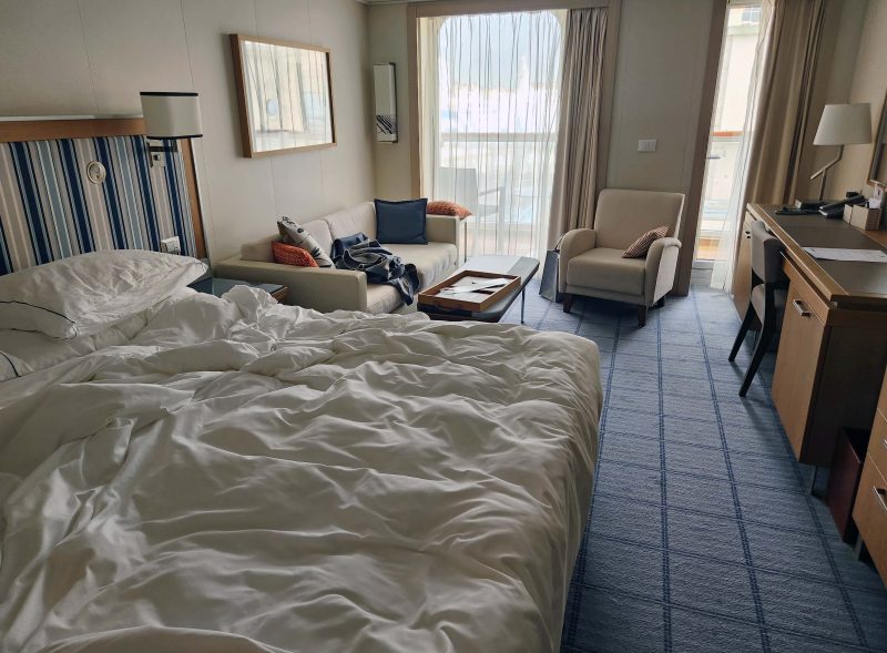
Staterooms are kept immaculate too. I would straighten things up a bit (top photo below) when we left our room in the morning, but it didn’t help to try to do more because that meant the stewards had to re-do what I’d done so that things would be arranged in “the Viking way.”
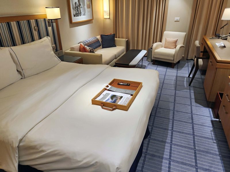
This photo shows how the room is straightened for daytime use. Except for some of our things that we leave out, the room looks exactly as it did when we first boarded the ship.
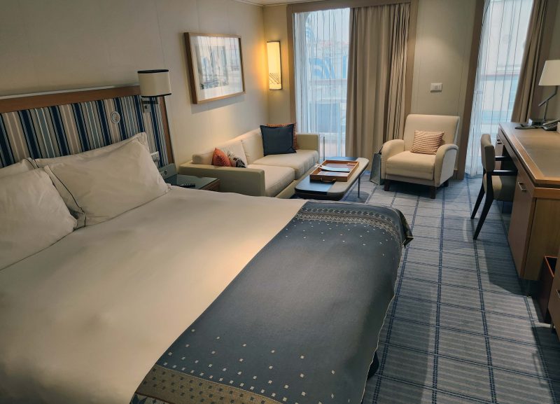
While we are at dinner, the stewards do a turn-down and deliver any official messages (and sometimes gifts) Viking sends us. After dinner, the stateroom looks like this.
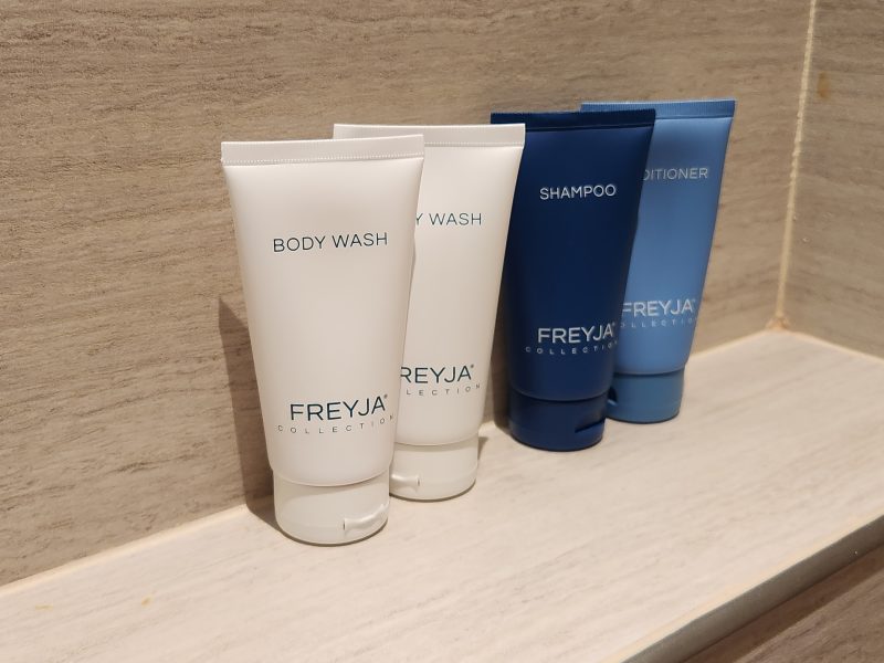
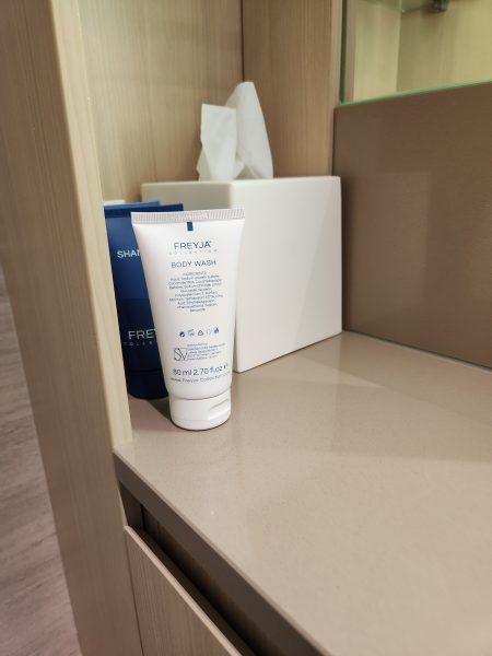
Details are important in the bathroom too. No matter where on the vanity shelf or in the shower we leave the Viking toiletries, when we return to the room, they are always placed in this order in the shower and on the vanity top with all the labels facing forward. Details, details.
The entire Viking cruise experience is amazing, but the best part is the crew. They are always happy, polite, and pleasant (maybe they fake it when they don’t feel great, but it doesn’t show). They always greet everyone they pass with a “Good morning/afternoon/evening, sir/madame,” and if you look the least bit uncertain, they immediately offer assistance. One day, as Ted and I were leaving the dining room after dinner to attend a theater event, one of the staff members, as usual, wished us a good evening. I wished him a good evening in return, saying I knew he’d be working, but I hoped he’d have an easy shift. He humbly replied, “I am lucky. I have work.” Wow! Such a simple statement, but filled with gratitude and meaning.
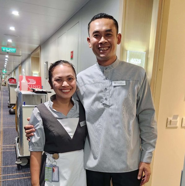
The staff members we know the best are always our room stewards because they work on our deck all day every day, so we see them the most. Here are Ali (left) and Citra (‘chee-tra), our stewards for our 30-day Mediterranean cruise. At home in the Philippines, Ali lives with her grandmother and uses her salary to help her grandmother financially. Citra, from Bali, is married and has a young son and daughter. After a few years with Viking, he will return to Bali permanently.
The four of us became very good friends, and Ali and I hugged each other repeatedly when Ted and I left the ship. Ali and I both had tears in our eyes, and she told me, “You are my other grandma.” Citra (a man) was more reserved and shook our hands to say good-bye. Note: Citra knows the steward we had for six weeks on our 2019-2020 Australia/New Zealand cruise. That steward’s name was Alvin, and he introduced himself to us as “My name is Alvin. I have two brothers named Simon and Theodore.” (Get it? Haha!)
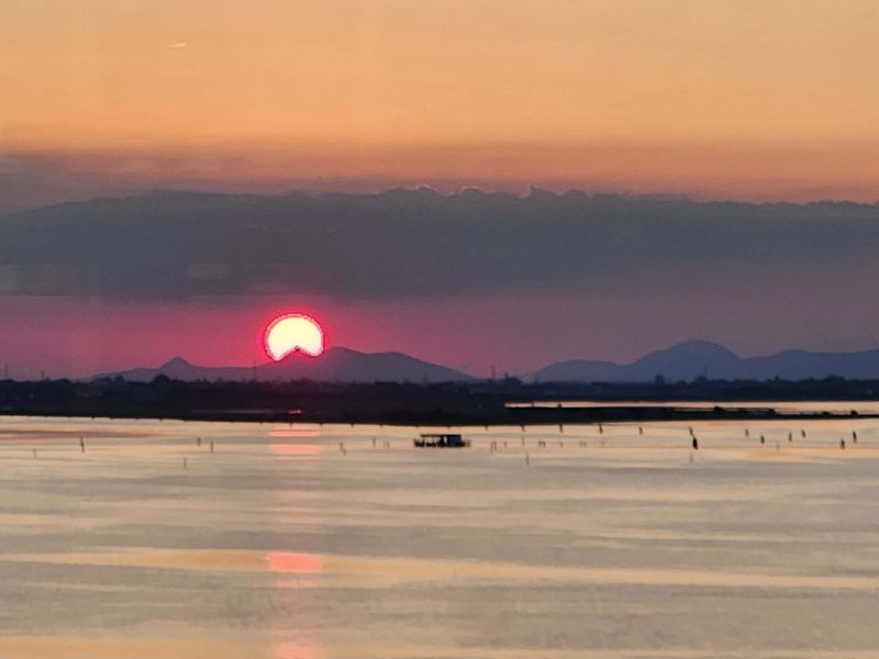
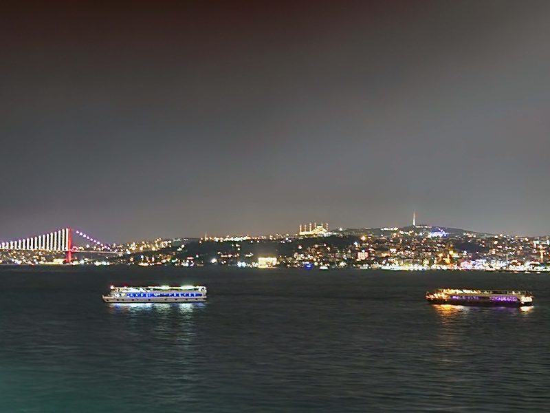
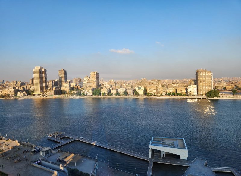
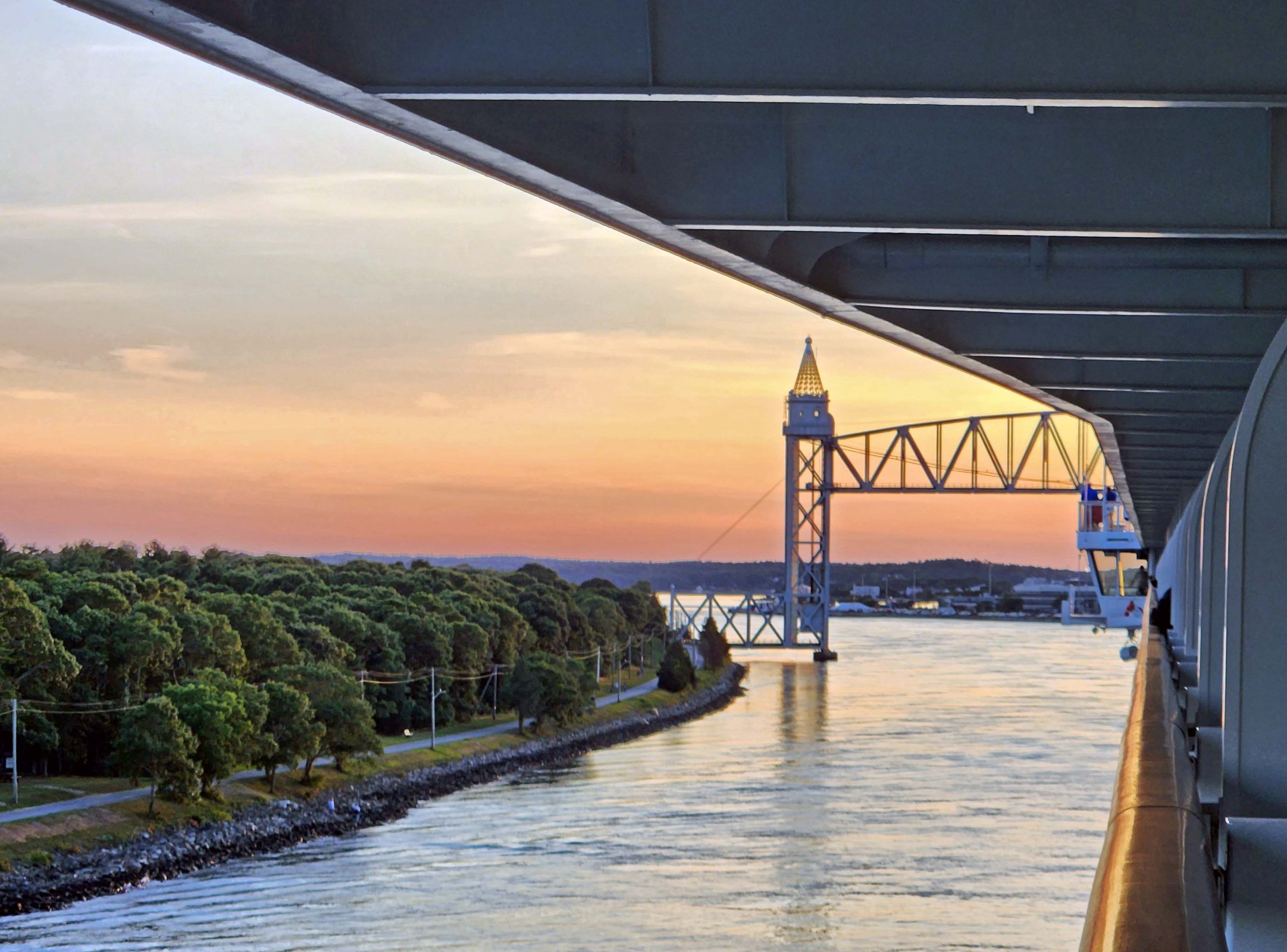
Viking ships have lots of clean windows, providing beautiful views as we cruise. Here’s a sunset we saw over the lagoon at Venice. Never stop exploring.
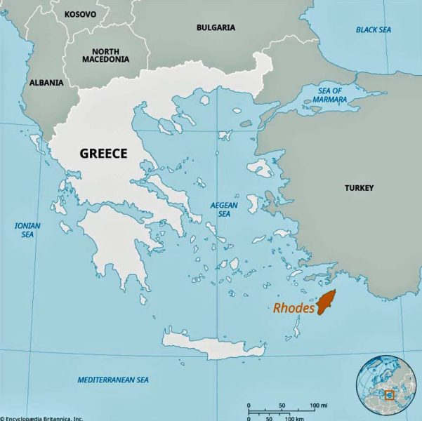
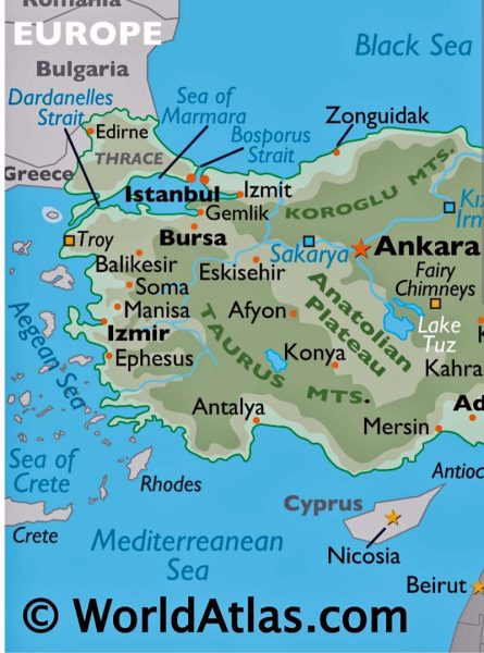
Rhodes, Ted’s and my first stop in Greece on the BT, is one of the southeastern Greek Islands near Türkiye (see the map below). When I looked at the map and saw all those islands in the Aegean Sea–227 of over 700 islands are inhabited–it made perfect sense that Ted and I saw so many ferry lines and boats at the five ports we visited on the shores of the Aegean Sea–Rhodes, Crete, Athens, Olympia, and Corfu.
Rhodes’ historic quarter is Europe’s largest active medieval town, although the island is probably most famous as the site of the Colossus of Rhodes, one of the Seven Wonders of the Ancient World. The Colossus was a statue of Helios, the sun god, and stood beside the harbor. It was about 108 feet tall–the tallest statue in the Ancient World. Experts affirm that it was technically impossible for the Colossus’ legs to have spanned the harbor entrance, as it is often shown in drawings. If that were true, the statue would have fallen over. It took 12 years to build the statue, and it was destroyed by an earthquake 54 years later (around 225 BC) when it collapsed at the knees and fell onto the land beside it. The remains lay on the ground for over 800 years and were so impressive that people travelled to see them. It was said that 900 camels were needed to remove the debris from the area.
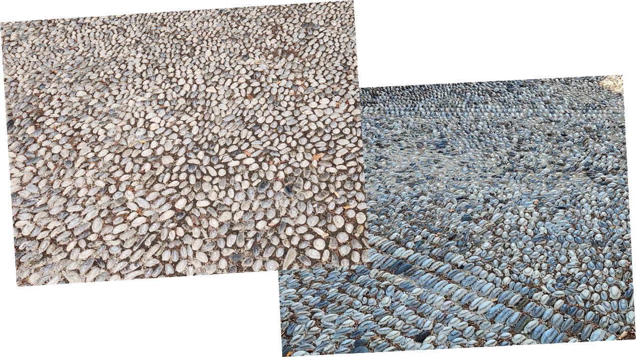
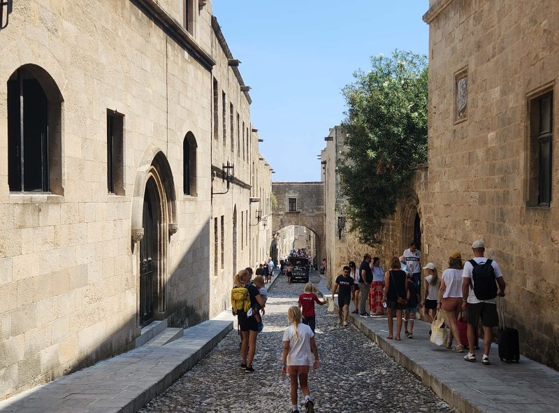
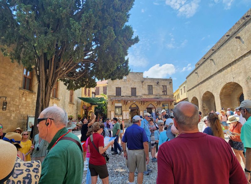
Rhodes is called the “Island of the Knights” because the Knights of St. John ruled it for two centuries (1310-1522) and made it a model of the medieval European settlement. The Street of the Knights, the main street in the Old City, is paved with colorful cobblestones, and is one of the best-preserved medieval streets in Europe, with shops along both sides of it.
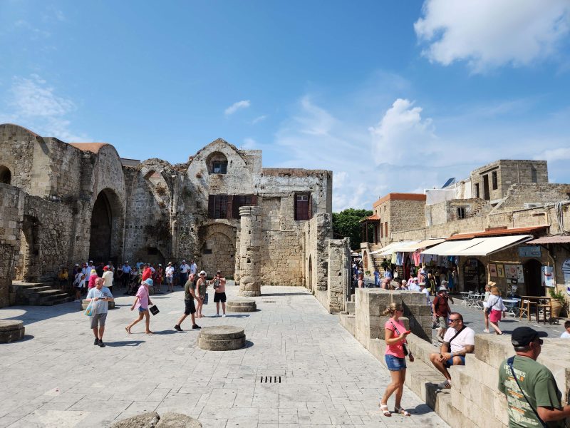
The first significant building we saw on the Street of the Knights was the Church of the Virgin of the Burgh. (Was there a contest to come up with the longest possible name for the church?) The church was ruined by World War II bombardments, so only three apses remain. (FYI in case you don’t know, an apse is a semi-circular area with a half-dome ceiling, like some churches have in the front of the sanctuary for the choir.) The church has been partially restored but is no longer in use for worship. The photo below shows the entrance to the church, with the remains of the main building on the left.
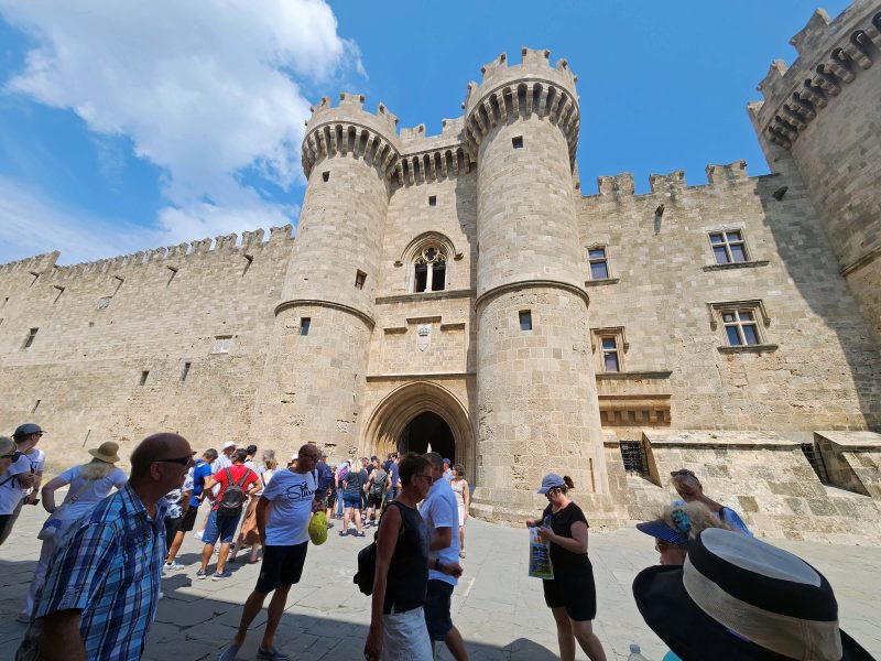
The Street of the Knights ends at the largest structure on Rhodes: the Palace of the Grand Master of the Knights of Rhodes. (Is everything on the island required to have a long name?) This is a picture of the Street of the Knights as we left the Palace.
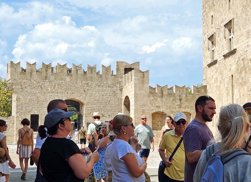
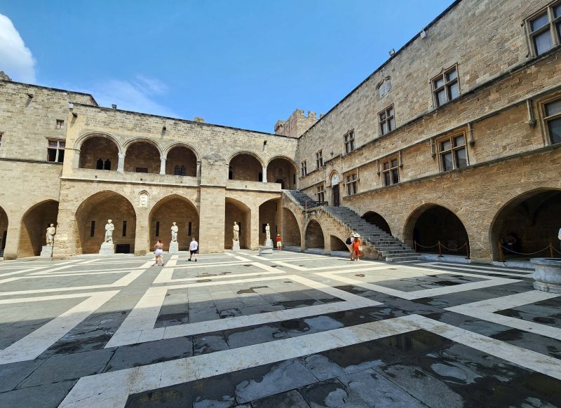
The Palace was built on the foundation of the temple of the sun god, Helios and, in medieval times, served as the residence of the governor and as the administrative center of Rhodes. Here are some pictures of the Palace of the Grand Master, etc. It was grand.
The palace had beautiful inlaid mosaic floors. I took pictures of some of them.
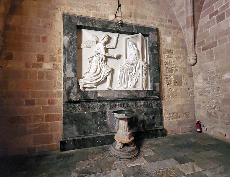
It’s no surprise that there are a number of sculptures in the Palace. This is a wall sculpture of the Annunciation, when the angel told Mary she would be the mother of the Savior.
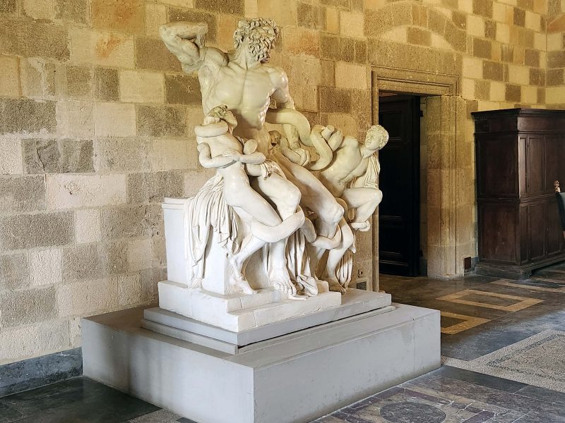
During our Palace tour, we also saw this statue of Lacoön and His Sons. Lacoön was a Trojan priest and allegedly had intercourse with his wife in a sacred temple, thus desecrating the building. To punish him, the gods sent serpents to strangle him and his twin sons, as depicted in the sculpture. Note: You can also see another mosaic tile floor.
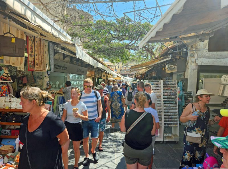
Our last tour stop was (as always) the city market. As I mentioned in an earlier post, I’m not much of a shopper, but Ted and I enjoy walking outside in the sunshine on a beautiful day. When we’re in an unfamiliar place like Rhodes or anywhere else, there’s always the added anticipation of discovering new sights.
When we returned to our ship, we freshened up, changed our clothes, and headed for a mysterious “private event” to which we’d been invited. We didn’t know what to expect, but it turned out to be a reception to thank those of us onboard who were staying for 3 and 4 weeks of the cruise from Istanbul to Barcelona. That was about 40 of the 930 passengers, with only about a half dozen of the 40 (including us) staying for the full 30 days. The event included hors d’oeuvres and champagne, and the entire crew—managers and up—were in dress uniforms to show their appreciation for us. It was nice to spend time getting to know some of the people we’ll be mingling with for the next 4 weeks.
As our cruise progressed and we chatted with various people, it seemed like none of the “long-term” cruisers (including us) knew that the cruise was a combination of four week-long segments, with boarding and disembarkment points at Istanbul, Athens, Venice, Rome, and Barcelona. On the other hand, the “short-term” (one or two-week) cruisers didn’t know it could be a month-long cruise. Ted and I wonder if the cruise was advertised in a variety of ways—maybe an ad for four weeks and four other ads for one week each? We boarded the cruise in Istanbul and disembarked in Barcelona, but some passengers left, and others joined us at Athens, Venice, and Rome along the way.
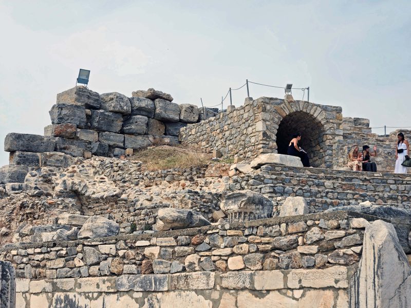
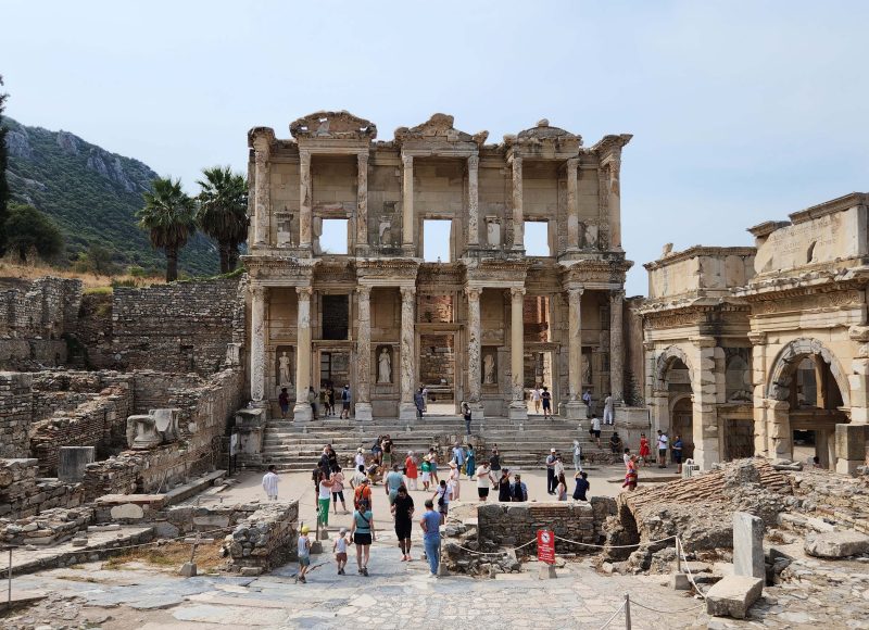
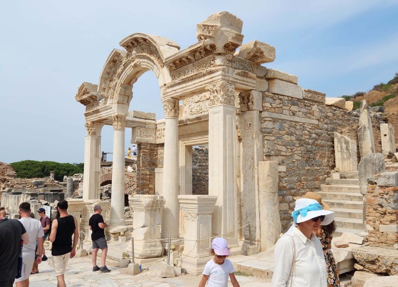
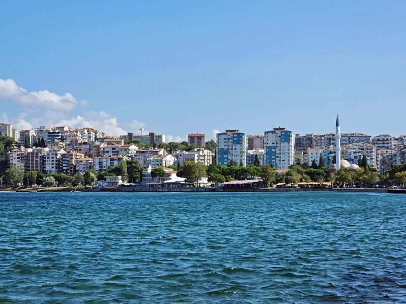
Ephesus is one of the best-preserved ancient cities in the world. At one time, the city included one of the Seven Wonders of the Ancient World—the Temple of Artemis, which was destroyed by arson in 356 BC. Ted and I found it far more interesting than the “purposely minimalistic” ruins of Troy.
Ephesus was the fourth largest metropolis of the ancient world, with a population of about 200,000 at its peak. The city is in a major earthquake zone and was destroyed by earthquakes and rebuilt four times. Finally, a massive earthquake, the decline of the harbor, and Arab invasions forced the population of Ephesus to relocate. About 20-30 percent of the ancient city has been excavated, reaching back to the 10th century BC.
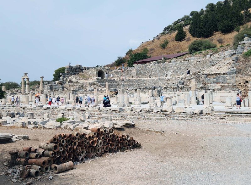
We entered the city through the Magnesian Gate at the top of Curetes Street, the main street of Ephesus. The ruins in the photo below used to be shops.
Beyond the shops was a residential area. Jesus’ mother, Mary, lived in a small stone house in Ephesus before she died, and St. John is said to have preached here. St. Paul also lived in Ephesus and wrote his letters to the Ephesians and the Acts of the Apostles here. The buildings shown below are what is left of some Ephesian homes (not Mary’s, St. John’s, or St. Paul’s).
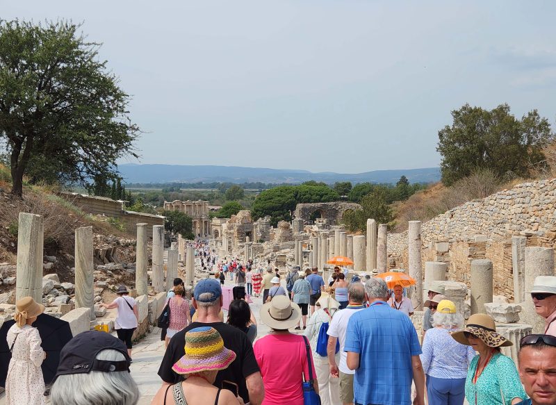
Below you can see Curetes Street. The Aegean Sea used to be at the low end of the street, but silt from the sea has filled in the area. The Aegean Sea is now about three miles beyond the end of the street. Curetes Street was lined with shops, and the columns formerly supported a roof over the street to protect pedestrians from the sun and the rain.
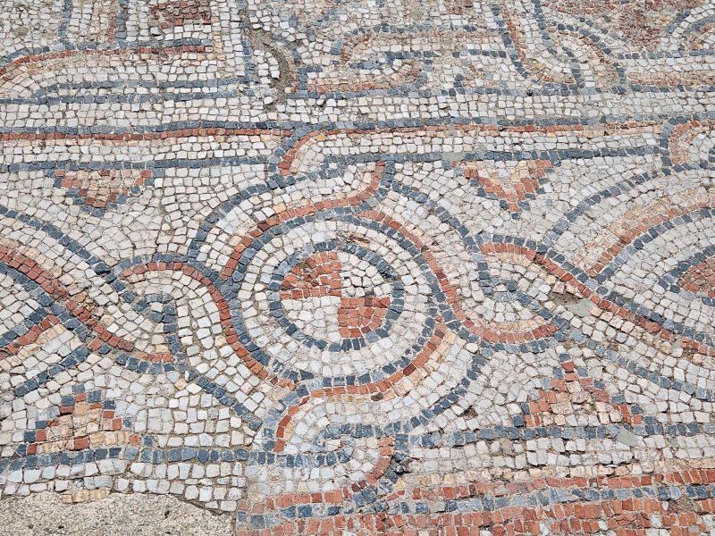
A large portion of Curetes Street is beautifully paved with marble.
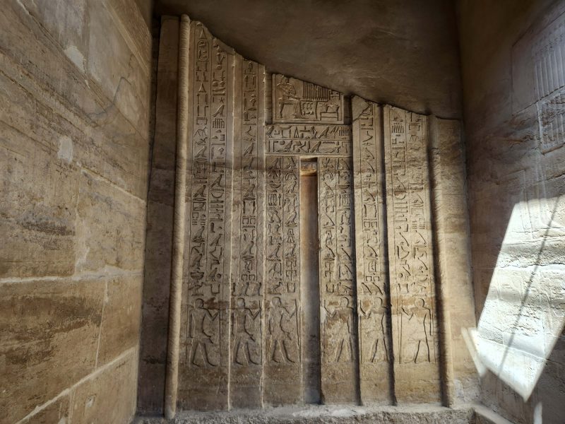
Midway along the main street is the façade of the Library of Celsus, the most recognizable building in the city, built to house 12,000 scrolls.
The photo below shows the ruins of Ephesus’ city hall. It looks like it was a beautiful building.
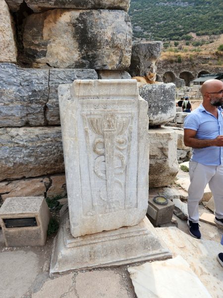
The carving on the stone shown below indicates a hospital.
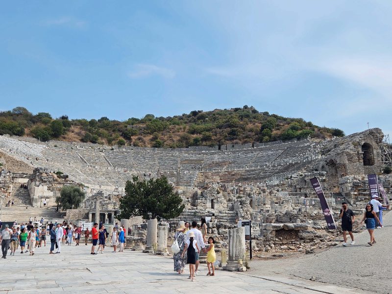
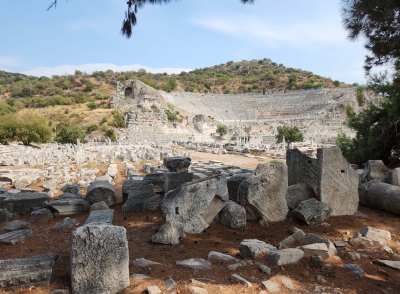
Here’s a picture of the Great Theater, which seated 25,000 people. Until recently, it was used as a concert venue and hosted Elton John, Ray Charles, Sting, Diana Ross, and many others. In 2018, however, preservationists feared that the volume of concert music would damage the rock (literally rock music?), so the setting was closed to concerts. Quieter public events are still held there.
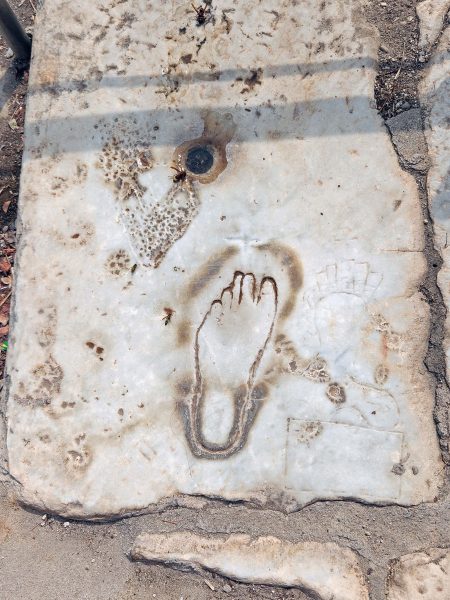
The stone shown below is an ancient advertisement for a bordello in Ephesus. The left foot carved into the stone meant the brothel was on the left side of the street. To know if it was worth the walk, you could place your left foot in the footprint. If your foot was smaller than the one on the stone, you would be declared underage and denied entry.
At the lower gate of Curetes Street, we saw this assortment of rocks. It looks like a cemetery to me, but this was the site of a gymnasium, an important part of the culture. Gymnasiums (i.e.. schools) were used as educational centers, as places for training in mental and physical activities, and for teaching young men about art, sports, literature, drama, and speech. You can see the Great Theater in the background. Because this gymnasium was built so close to the theater, it is thought to have been used to train theater actors.
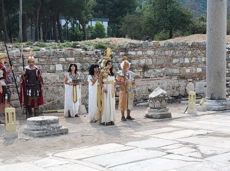
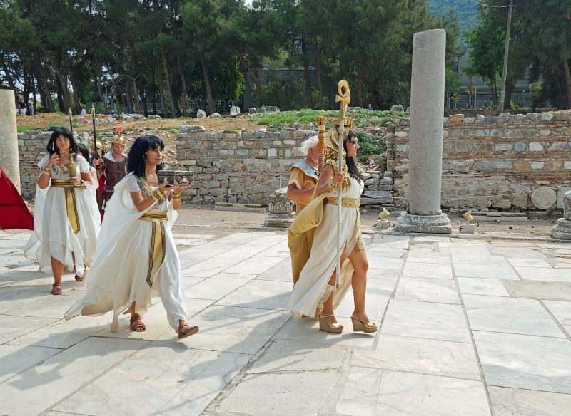
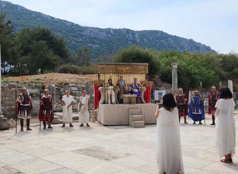
Near the end of our walk through Ephesus, a portion of the street was cleared and a theatrical troupe gathered and walked toward a platform in a procession.
At the end of the procession, there was a presentation given in what appeared to be a ceremony (we couldn’t hear the voices well enough to understand them—if they were even speaking in English), and then the “important” people climbed the platform and the others paid homage to them. The performance lasted about 15 minutes and was interesting to watch.
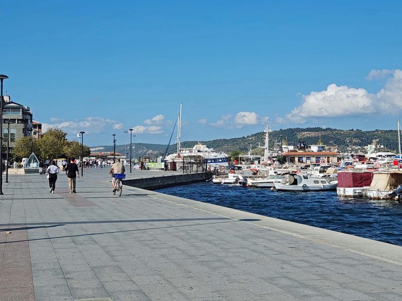
We left Ephesus at the lower gate and finished our day with a drive through the beautiful Turkish countryside.
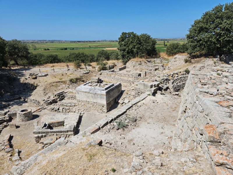
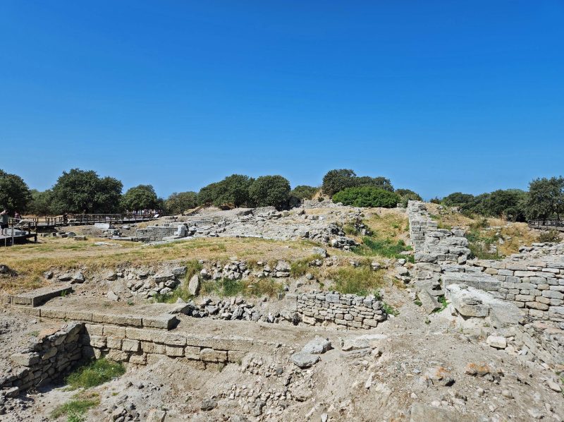
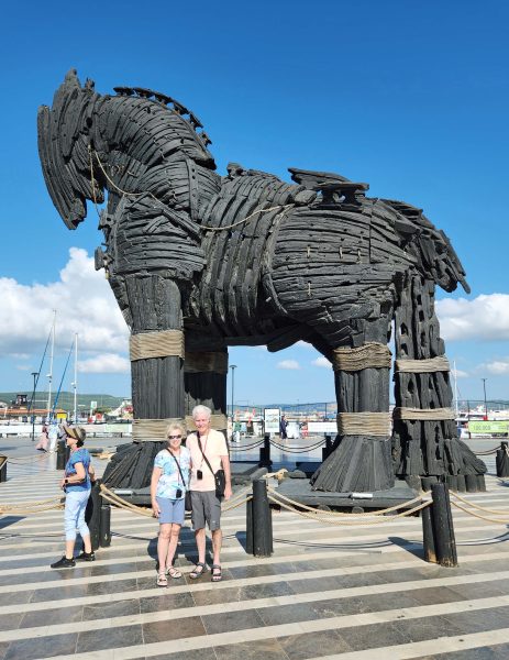
Today, Ted and I visited the ruins of Troy which date back as far as the Bronze Age. The excavated ruins have been kept “purposefully minimalistic,” which made it hard for Ted and me to picture an actual city existing here. Frankly, we found it kind of boring, but it was nice to spend time outside in weather cooler than 100 degrees. Here’s a summary of what we saw on today’s excursion.
Troy is believed to be the site of the war described in Homer’s Iliad and Odyssey. The ancient city was strategically located at the southern entrance to the Dardanelles, a narrow strait linking the Black Sea with the Aegean Sea (map). There was also a land route from Troy northward to the European shore over the narrowest point of the Dardanelles. As a result of its location, Troy became an important and powerful trading center between the east and west and, during the Bronze Age, between the north and south.
The water and wind conditions also worked in Troy’s economic favor. The winds through the entrance to the Dardanelles are strong and so is the surface current that flows through the Dardanelles. Flat-bottomed, square-rigged ships had to wait for favorable southerly winds to blow through the strait—conditions that occur for only a brief time in the summer. While the ships were moored at Troy waiting for a southerly wind, the Trojans charged tolls for mooring as well as for passage through the strait.
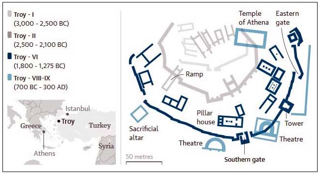
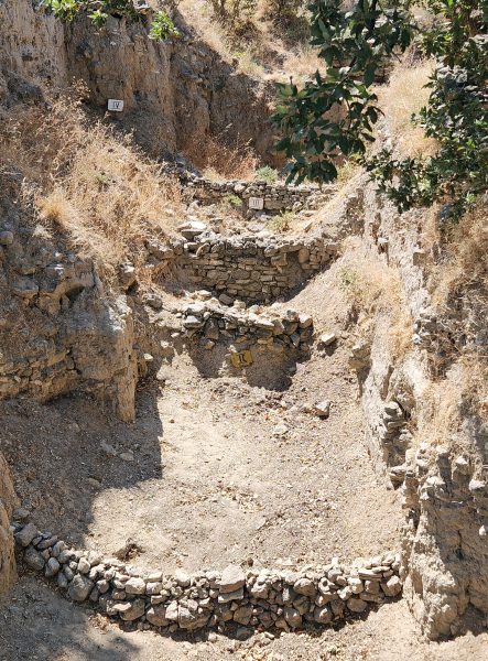
Twentieth century excavations show that as many as nine cities were built on the site of Troy. Here’s a map of how archeologists believe the cities were laid out over the years from 3000 BC to 300 AD. I think the ruins we saw were the most recent in layers VIII and IX. (That’s 8 and 9 in Arabic numerals.)
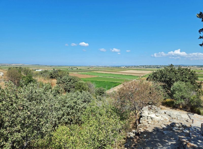
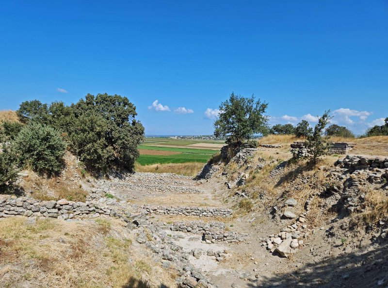
Over time, the Dardenelle Strait narrowed, due to the silt left behind after frequent floods. If you look closely (or zoom your screen) you can see a very narrow blue line–the strait–at the horizon in the photo below. I took this picture from the ancient seaport location of Troy which is now approximately five miles inland.
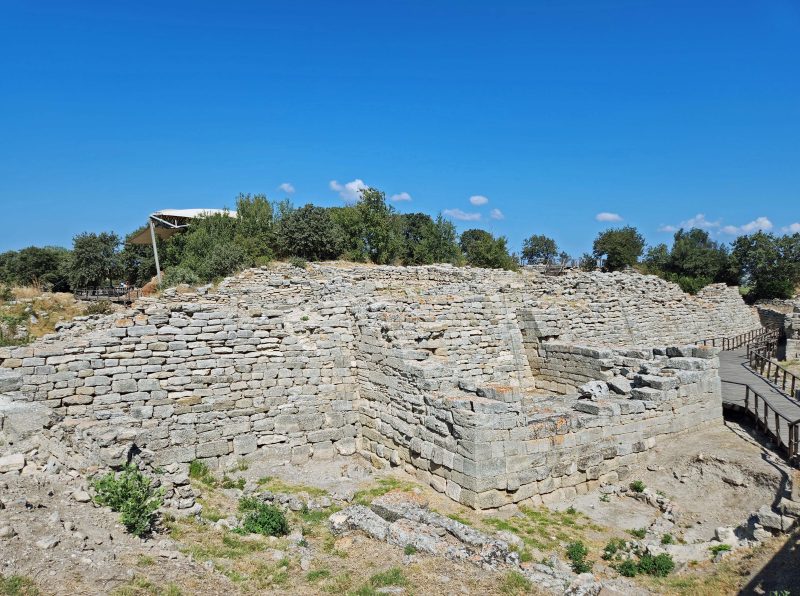
The photo below shows the ruins of one of Troy’s theaters. In contrast, you can see the rooftop of the modern-day visitor’s center in the upper left.
This area of Troy is believed to have been a site for offering sacrifices to the ancient gods.
Thanks to the “purposefully minimalistic” excavation and my lack of archeological knowledge, I have no idea what is shown here, so call it what you will. I call it “ruins.”
The photo below shows part of what is known as Schliemann’s Great Trench. There are markers on three of the “steps” indicating levels II, III, and IV of the rebuilding of Troy. (That’s 2, 3, and 4 for those who are Roman numeral challenged.) The Great Trench is 56 feet deep and 230 feet wide. Schliemann, one of the first archeologists to excavate Troy, began his work by digging this trench. In the process, he destroyed everything in the trench; as a result, it serves as an example of how not to excavate a site. Because it illustrates such a big mistake, it has become a notable point of interest. Go figure!
Here’s another view of Schliemann’s Great Trench in the opposite direction, facing the Dardanelle Strait.
Çanakkale, the city nearest to Troy, is a modern contrast to the ancient ruins. (Note: As a non-archeologist, I have no trouble picturing this as a city.)
Çanakkale’s waterfront is a pleasant place to walk, with lots of boats, refreshment stands, etc.
The waterfront also features—what else?! –a Trojan horse.
Türkiye is the only country in the world that is located on two continents: Europe and Asia. It is separated by the Bosporus and the Dardanelles Straits. The city of Istanbul is also located on two continents. On the map below, you can see that there are two red dots indicating Istanbul—one on each side of the Bosporus Strait.
What a treat to be in Türkiye! There’s green grass and blue water instead of tan rocks and sand, and the temperatures are only in the upper 80s. Türkiye is a large country, and we’ve only seen the landscape from the airport to Istanbul (about an hour’s drive), but what we’ve seen is very pretty. Here are pictures of Istanbul by day and by night, looking from one side of the Bosporus Strait to the other, from Asia to Europe.
Istanbul is apparently a very busy port for both commerce and pleasure. At one point, as we looked through the Bosporus Strait, Ted and I counted at least 30 vessels in the water within our sight. It was hard to be accurate, because they were all in motion.
Our first tour stop the next day was the Sultan Ahmed Mosque, also known as the Blue Mosque. It’s one of the most majestic Ottoman mosques and is called the Blue Mosque because of the blue tiles that decorate the interior walls. It also has blue domes.
Here are pictures of one of the mosque doorways and the main courtyard with a minaret in the background. The number of minarets signifies the importance of a mosque: one minaret indicates that the building is a mosque; two minarets are decorative; four minarets indicate a large mosque. The Blue Mosque has six minarets.
The pictures below show the beautiful interior tiled walls.
Shoes are not allowed in mosques, so whenever we visited a mosque, we were given paper booties to put over our shoes. Worshippers must wash their feet before entering the mosque. The picture below shows a wudu, or ablution area, for that purpose. The worshipper sits on the brown-topped stool, rests his/her feet on the table against the wall, and then washes them with water from the spigot above the table. This is part of an Islam ceremony of purity and cleanliness before worship. It is traditional for Muslim men and women to pray separately either in different parts of a room or in different rooms.
After our time in the Blue Mosque, we walked about three-quarters of a mile to the nearby Topkapi Palace Museum. Along the way, we walked down the avenue of trees shown below. Aren’t those trees unusual? No one I asked (including Google) knew what species of tree they are. The best I got from Google was “photo at Topkapi”; everyone else just said, “I don’t know.” Given the light bark, maybe they are some kind of poplar.
On our way to the palace, I turned around and took this picture of the Blue Mosque.
The Topkapi Palace was built in 1465 and originally served as the administrative center of the Ottoman Empire and as the primary residence of its sultans. In 1923, a government decree transformed the palace into a museum. The palace has four main courtyards, hundreds of rooms and chambers, and many smaller buildings within its walls. This entrance to the palace is the Gate of Salutation. It leads to the second courtyard.
The museum is a popular place and was very crowded. Ted and I only went through two rooms—the armory and the jewels—before we decided to leave the hot, crowded building and walk around the grounds a bit before joining some of our fellow cruise members in a shady courtyard. Pictures of some of the displays are below.
Our last stop of the day was the Grand Market. It was definitely grand! There were four long wings like the one pictured below. The bazaar featured leather goods and jewelry, although there were a few shops offering other items.
I didn’t personally touch any of the leather goods to determine their quality, but from the appearance of the jewelry displays (definitely not Tiffany!), I doubt if it was high-quality leather. As in Aswan, if we paused to look at the merchandise, a vendor was instantly at our side, coaxing us to come into the store.
The evening entertainment onboard our ship, the Viking Sky, was Turkish folk dancing and whirling dervishes. A dervish is an initiate of the Sufi Muslim religious order who has taken vows of poverty and austerity. The whirling is part of a Muslim ceremony to glorify God and to seek spiritual perfection.
The dancers were very good, but they weren’t as much fun as the whirling dervish who performed onboard our Nile River cruise ship. When he finished his performance, he folded his decorated skirt into a bundle the size of a newborn and handed it to a young woman who than carried it around the room so that each of us could look, touch, and/or hold it. I did all three and it was heavy!!—maybe 15-20 pounds. Enjoy the video below. I don’t know why I stopped recording when I did, but I wish I’d continued a little longer. It has music, so turn on the sound.
When Ted and I scheduled our 2023 BT for August and September, we knew it would be hot in Egypt. St. Louis gets hot in the summer with lots of humidity as well, so we figured we could handle the dry heat of Egypt. Not true!
Our first taste of heat was in Israel, and it was only a little worse than July in St. Louis. It was obvious, however, that the natives went indoors during the hottest part of the day. We, on the other hand, had an eight-hour tour every day of our stay in Jerusalem. On the bright side, it wasn’t crowded outdoors in the afternoons. The best we could do to stay cool was to stand in the shade as much as possible. Yes, Jerusalem was pretty hot, but then we went to Cairo and learned what real heat is like.
Cairo, Giza, and New Orleans are all at 30o north latitude, but unlike Cairo and Giza, New Orleans has greenery and water to cool it, even though the water adds humidity to the air. Luxor is at 25o north latitude, and Aswan is at 24o north latitude, similar to Miami and Phoenix. I think we can all agree that, relatively speaking, Miami with its water and greenery is relatively more comfortable in the summer than Phoenix in the Sonoran Desert.
Now, back to Egypt. The Sahara Desert begins on the western edge of Cairo, within the city limits and not too far west of the Nile River, and Giza is a western suburb (in American terms) of Cairo. The portion of Giza we visited was all sand and rock—no greenery, lakes, or rivers—and the only shade was beside a small desert building such as a ticket office, a rest room, or a souvenir stand (or under an umbrella, like the dogs in the photo below).
The desert sand and rock have been exposed to sunlight for thousands of years and have been holding on to that absorbed heat for just as long. As a result, while the sun beats down from above, all that rock and sand radiate stored heat from below. Talk about a heat island! Here’s what shade in Egypt looks like in the Valley of the Kings and at the Step Pyramid (dogs).
Viking was wonderful about supplying us with cool water at all times. The tour buses had cases of bottled water in the luggage compartment and a refrigerator in the bus interior. We were free to take as many bottles as we wanted. Ted and I averaged about one bottle per hour each. Fact: None of the 82 people on our Nile River cruise suffered from dehydration. Frequent rest room stops weren’t necessary—all of us sweated so much, we didn’t need them often.
Here are the temperature forecasts for Cairo and Aswan while we were there. We were told that, in Aswan, the temperature can reach 130 degrees in summer, but will drop below 110 degrees in September. Whoopee! (We were in Aswan on August 27.) The numbers below do not include a heat index, nor do I even want to know what it was. People told us that the temperatures would cool off quickly in September and you can see the truth of that in the Cairo forecast. I took that screenshot on August 30. My advice: plan your trip to Egypt between September and April. It was a relief to arrive in Türkiye, where the temperatures were only in the upper 80s and where there was water and greenery for cooling.
Ted’s and my bar for “How hot is it?” has been Komodo Island (latitude 8o south), where we took an excursion to a wooded area surrounded by water to see the Komodo dragons, and drank five bottles of water in an hour! We had to change our bar to Egypt. If it’s not as hot as Egypt, it’s not that bad.
Ted’s and my Nile River cruise ended in Luxor. From there, we flew to Cairo and spent a night in a hotel with our fellow river cruisers. It was our last day with this group of people. We and three other couples exchanged email addresses so that we can stay in touch. The following day, Viking took us all from the Cairo hotel to the airport to travel to our next destinations—home for most of the group; to Istanbul for Ted and me where we’ll embark on a 30-day Mediterranean cruise from Istanbul to Barcelona.
I was nervous about our arrival in Istanbul because of the lack of English we’d experienced in Israel and in Egypt as well as the absence of a Viking guide to walk us through the local security processes. Ted and I agreed that most people at the airports go from the plane to the baggage terminal to the exit, so we decided to follow the crowd. Sure enough, there were very few signs printed in English, but we followed the crowd, as planned. If we got off-track, there was always someone in a staff uniform who used international gesture language to tell us where to go—one hand up with the palm out for “stop,” then an extended arm with a pointed index finger for “go over there.”
At the terminal exit, there was a booth with English language signs (at last!) indicating we could boost the local economy by paying them to reserve a hotel, arrange a city tour, rent a car, etc. for us. There was another English-language sign that said, “Spend as much as you can. Leave Türkiye green.” We gave the booth attendant the name of our transport service and he directed us to our transfer company just outside the exit door. The transport agent also spoke English. We showed him our printed reservations, we got on the indicated bus, and we arrived at our hotel. Well, that was easy! We set our travel bar for “Can we do it?” at “We made it through the Istanbul airport, so we can handle anything.”
For unknown reasons, Viking would not transfer us from a river cruise to an ocean cruise, but our travel agent made reservations for us at the hotel where all the guests for the Viking Mediterranean cruise were staying. That made it easy for us to board our bus for the Viking transfer to the ship the following day. We knew for sure that we were in Türkiye when we entered the hotel lobby and saw the hookah at the door.
There was no problem checking in at the hotel, but the staff was adamant about refusing us the Viking group dinner and breakfast. It took at least three or four different hotel staff members and another two Viking staff members to convince the hotel staff of our Viking group membership meal privileges. We didn’t get the group dinner, but the restaurant dinner we had on our own that evening was the best meal of our entire trip, so no worries.
After we checked out of our room the next morning and were waiting for our Viking bus to take us to the ship, we walked around the public areas in the hotel lobby to pass the time. At one point, a nice lady in an upper-level hotel uniform came up to us and said she would like to introduce us to the hotel manager. We wondered how we rated that, but thought, “Oh, well, . . .”
Three men in suits approached us and the lady introduced us to the manager. We shook hands and then one of the other men introduced himself as the head of the accounting department. Still puzzled at the attention, we smiled and shook his hand too. We all chatted for a bit and then the third man said, “I apologize. You aren’t who we thought you were,” and all three men abruptly left. Huh???
The woman downplayed the (near house arrest?) incident by asking if we’d had a pleasant stay, if we’d enjoyed the full breakfast, and if everything about our stay had been good. Ted and I decided that, in some way, we must have resembled someone who didn’t pay for the hotel charges. It was weird.
We left the hotel on our assigned bus, boarded our ship, and had lunch, followed by a relaxing afternoon onboard with some time spent unpacking our things for our 30-day stay.
On our fourth day in Cairo, we visited the Church of the Virgin Mary, aka, the “Hanging Church,” in Old Cairo. This part of Cairo is also called Coptic Cairo because it was a stronghold of Christianity in Egypt before and during the Islamic era. (Coptic is a generic term for Egyptian Christians.) The church was probably built around 690-692.
The courtyard at the entrance to the church has decorations scattered on its surface.
This is the front entrance to the church.
The Hanging Church is not actually suspended. The nave of the church is built on top of the gates of an old Roman fortress and there is an open passage between the gates and beneath the church. You can’t see the open passage through the scratched plexiglass in the photo below, but it’s there.
The church is beautifully ornate inside. Here is an icon of the Virgin Mary at the altar.
This is one of the stained-glass windows in the building.
Here are two of the church ceilings.
In the first century, women did not have equal stature to men, so they had to remain out of sight of the men. (On a personal note, 20 centuries later, we’re still waiting for equal stature.) “Windows,” like the brown box in the left photo below, allowed women to look into the church’s courtyard without being seen by the men.
This picture shows the window box from the inside. From my photo distance, you can see blue sky and a darker building beneath it, but if you go up to the window to look through the openings, it’s possible to identify things in the courtyard.
As we were driving back to our hotel, we passed this cemetery. The box-like structures are burial units. Families of the deceased add “rooms” to the units over time, much like the pharaohs did with their tombs and temples, but in a far more humble manner. Some of these rooms are currently used by homeless people for shelter. According to Hanan, homelessness is not a great problem in Egypt because there are laws requiring the wealthy to care for the poor, and because other laws prohibit demolishing any structure that is more than 100 years old. Homeless people are allowed to live in vacant structures and, in Cairo, there are over 1,200 areas designated for “irregular dwellings” that do not need to meet building codes. As a result, homeless people may build shacks or other structures in those areas without penalties. There is, mathematically, more housing than is needed in Egypt, but not all of it includes a safe environment, safe drinking water, or wastewater treatment. Even though these residents may not be homeless, they do not necessarily have a good quality of life.
Every city and country has monuments to its heroes. This memorial honors the unknown soldiers who died to defend Egypt.
The tower on the right in this photo commemorates Egypt’s former president, Gamal Bidel Nasser.
We’ll be back in Cairo in nine days to fly to Istanbul but, first, we are going to fly to Luxor tomorrow to begin our eight-day cruise on the Nile River. Here’s my favorite picture from the last four days. I think it clearly says “Egypt.”
Ted and I saw some interesting vehicles on our BT. Jerusalem has a desert climate, so rainfall is scarce. As a result, Jerusalem is a very dusty city. I think vehicle owners see no point in trying to keep their vehicles clean, so they clear the windshield and go. I’ve never seen as many dirty vehicles as Ted and I saw in Jerusalem on our 2023 BT. I mean every car and every truck! It’s probably like living alongside a gravel road. You can wash your car, but as soon as you take it on the road, it’s dirty again. Practicality wins.
While Israeli vehicle styles tended to look like those in most major cities, Cairo and Aswan had a great variety of transportation modes, varying from sedans and large modern buses to three-wheeled mini-cars to donkey-drawn carts to handcarts propelled by human feet. They all shared the streets with no apparent rules of the road.
The street in front of our Cairo hotel had four lanes of traffic moving in each direction. There were no painted traffic lane lines, no stop signs or stop lights, and no marked crosswalks. One couple in our group wanted to cross the street to stand on the banks of the Nile River and said it was like taking your life in your hands to do that. Hanan told us later that “it’s easier to take a cab and make a u-turn than it is to cross the street in Cairo.”
The traffic seemed to move smoothly, but with the constant sound of horns—some long, some short—as cars moved forward, smoothly gliding from one lane to another, as if it was a dance. From our upper-story hotel window, it looked like a video game. I suspect there was a “horn code” with different horn signals to tell adjacent drivers, “Don’t change lanes because I’m passing you” and “Ok, thanks for letting me know.”
There was likely to be a horse- or donkey-drawn vehicle or a handcart in the traffic, but it was generally ignored, and the cars just beeped their horns (probably in code) and went around it. We occasionally saw a vehicle driving against the traffic in an outer lane, but the other drivers went around it as easily as they did the handcarts. Other times, we saw vehicles parked in the outermost traffic lanes (either side of the road) and drivers of cars simply weaved around those as well. If you needed to make a left turn, the secret seemed to be to do it with confidence. If you entered the intersection with confidence, oncoming drivers slowed or stopped to allow you to turn, then proceeded with their weaving and horn-honking. I asked Hanan what kind of traffic laws were in effect, and she said that, basically, you just drive as you please, but speed limits are very strictly enforced.
Mini-sized vehicles were everywhere in Egypt. I saw several at a single intersection in Aswan. Notice the absence of lane markings and stop lights at the corner.
In Esna, we saw this horse-drawn buggy. The cart on the right is donkey-drawn. Heavy traffic didn’t bother them. I wish I’d been able to photograph at least one of the manual pushcarts we saw.
This donkey-drawn wagon was rolling along in Aswan.
Little trucks were plentiful too. This vehicle looks like the front half of a motorcycle with a two-wheeled wagon attached.
This little truck in Athens is also three-wheeled, but includes a cab. We saw a lot of these carrying loads higher than the side rails. As long as the load was balanced, there seemed to be no height limit. Sometimes, there were people sitting on top of the loads, even if the load was higher than the truck bed.
This truck in Qena, with three men sitting on the top, is underloaded, compared to others we saw. Maybe they just completed a delivery.
Mini vehicles transporting large numbers of people were also a common sight. Is there a contest to see how many people fit on a motorcycle? The motorcycle in the photo below has only four people on it. (The mom is holding the baby.) We saw no helmets and no visible fear of traffic danger. During one of our pre-excursion onboard talks, the speaker told a joke about motorcycles in Egypt.
A policeman stops a motorcycle and asks the driver, “Do you know you have six people on this motorcycle?” The astonished driver replies, “Six?! What happened to Ahmed?!”
If a vehicle is too full, people simply hang outside of it, like these folks in Aswan.
We saw so many station wagons like this one that I asked what they were. I learned that this is an Egyptian national taxi service. You can go to the taxi station and buy a ticket to travel to any city in Egypt in these cars. There were a lot of these on the roads in the early mornings and late afternoons, so I think they might also be used as local taxis for people going to work and coming home afterward.
Thank goodness we always had a professional driver for our excursions, so that we didn’t have to figure out the roadway protocols in Egypt, or ride with five other people on a motorcycle.
Our Nile River cruise excursion today took us to the Aswan High Dam, one of the top 10 dams in the world. As we went from place to place in Egypt, it was nice to see lots of beautifully colorful bougainvillea along the road on our routes.
The Aswan High Dam, which formed Lake Nassar, is an engineering feat that protects the fertile land along the Nile River from flooding. At 300 miles long, Lake Nassar is the second-largest man-made lake in the world. The photo below shows Lake Nassar behind the Aswan High Dam. We were standing on the dam, so it was impossible to take a picture of it. The dam is made of granite, not concrete, so it’s technically a 365-foot-high pile of rocks. Granite from this area was shipped downriver from Aswan to Cairo to build the Great Pyramids of Giza.
The SUE (Soviet Union-Egypt) Friendship Monument (below) is near the dam. It represents the friendship between Egypt and Russia and commemorates Russia’s assistance in constructing the Aswan High Dam. Although the U.S. and some European countries contributed to the cost of the Aswan High Dam, Russia was by far the largest contributor. The monument’s shape suggests the lotus flower which closes at night and goes beneath the water, then rises again to open the next day.
After visiting the dam, we went into downtown Aswan and stopped at a spice market. It smelled wonderful! I was surprised that Aswan appeared to be a cleaner, more dynamic, and more prosperous city than Cairo, Egypt’s capital city.
The indoor store must have offered every spice imaginable. The photo below shows about half of the store.
The main downtown market was the nicest and largest one we’ve seen so far (photo below). It was similar to an outdoor shopping mall in the U.S., but with Egyptian products and determined vendors. The market is two miles long, with shops on both sides of the walkway. The lattice top keeps the walkway (relatively) cool, making it pleasant to walk and browse. Of course, the vendors had to do their thing, so if we even glanced into their shops—and it’s hard to avoid looking—they rushed out to the walkway to offer us their wares. Unlike the foot vendors we’ve encountered, these shop vendors were less aggressive and did not follow us down the walkway—they needed to tend the goods in their shops.
After our time in the market, we sailed for an hour on the Nile River in a felucca—a wooden, single-sail boat like those in the photo below. While we were sailing, a half dozen boys 8-10 years old swam out to our boat on paddleboards, put their arms over the sides of the felucca to anchor themselves, and sang to us.
The awning over the boat and the river breeze through the open sides provided us with a lovely ride. Even here, we couldn’t escape the vendors. The table in the right center of the photo below has a cloth over it covering items that were later revealed for sale.
Our felucca passed the Old Cataract Hotel and Elephant Island, named for its rocks (below). Aswan is at the first of six cataracts (waterfalls) on the Nile River. The rocks on Elephant Island reminded me of those in Elephant Rocks State Park in Missouri.
The Aswan dam was the southernmost point of our Nile River cruise so, after our felucca cruise, our ship turned back to the north, heading downstream toward Luxor. On the way to our Edfu stop, we passed the Kom Ombo Temple of Sobek. Say “Kom Ombo” aloud. Pronounce it the way it looks. Isn’t it fun? Doesn’t it sound African?
We docked in Kom Ombo that night, but did not go on any organized excursions in the city, so I took a picture at the dock where there was—what else?—a market.
Whew! For our BT, Ted and I woke up at 4:00 a.m. on Tuesday, and arrived in Tel Aviv just before noon, local time, on Wednesday. We spent Thursday, Friday, and Saturday taking daily eight-hour tours in Jerusalem and Bethlehem in upper-90s heat. Sunday was a travel day from Jerusalem to Cairo. Monday and Tuesday included two more consecutive days of 8-hour tours in Cairo and Giza with temperatures in the low 100s. On Wednesday, we were awake at 4:00 a.m. again to fly from Cairo to Luxor and, upon our midday arrival, headed out in the 108-degree heat for a four-hour tour in Luxor before boarding our ship to begin our Nile River cruise on Thursday. Can you spell “exhausted”?
Hanan told our group that “you aren’t here for vacation; you’re here to learn.” I can’t speak for anyone else in the group, but Ted and I were there for a vacation, hoping to learn new things from our travels.
Today featured a tour of a nearby temple, but after ten long days of travel and walking outdoors in the heat, Ted and I chose to take the day off. Besides, we toured the second largest ancient temple in the world (Karnak) two days ago. We had a wonderfully relaxing and quiet day onboard the ship with a half dozen other people who also chose to skip today’s temple tour.
Because we took the day off, I have no tour information to share, but here are a few notes about Egypt in general.
The restrooms on our Egyptian tours have been—interesting. Hanan tells us in advance which ones are awful and should be avoided and where a (relatively) nicer alternate is located. Most of the restrooms don’t have toilet paper, so Hanan told us to always carry some with us. An attendant sits outside the restroom door, offering a roll of toilet paper for users to take inside and to return when they leave. You don’t get the roll until you pay the tip—about $1.00. Instead of giving the attendant a tip, we were told to simply say “Viking” and to make a “V” with our fingers so the attendants would know we were with the Viking cruise group and would give us the roll of toilet paper tip-free. Before leaving, our three guides paid the attendants a flat fee for the restroom use. Even so, some of the attendants asked us for more money. I guess it doesn’t hurt to try, does it?
Many places in Egypt still farm and produce goods using the same methods they used 5,000 years ago. That explains the hand-pushed carts we saw on the busy streets, along with the cars and the buses.
A lot of buildings have rebar extending out of the rooftops. Most buildings had rugs and/or laundry hanging on the railings, indicating that the buildings were inhabited, but I couldn’t figure out a reason for the rebar, so I finally asked Hanan if she knew its purpose. Well, . . . not surprisingly, no one anywhere, including Egypt, likes to pay taxes and everyone everywhere uses any tax loopholes they can. Egypt’s tax laws don’t tax buildings that are unfinished. If rebar extends above the top of the building, the building is technically ready to add another story, thus qualifying the building as incomplete–even if it’s inhabited–and making it tax-free. It’s not very attractive, but it’s cost-saving for the building owners!
As we drove from place to place during our river cruise excursions, we saw banana trees and papyrus. Papyrus likes to grow in the marshy soil along the banks of the Nile River. Yes, papyrus is still used to make specialty writing paper, especially for artists and calligraphers.
Vendors were annoying in Egypt. I understand that they are trying to make a living, but they’re so aggressive! Their prices are very flexible, and bargaining downward is easy, but very time-consuming. For example, Ted and I wanted to purchase a mini pyramid as a souvenir of Egypt. The vendor immediately went into his spiel. We politely listened, then offered what we thought it would be worth in the U.S. (about half the vendor’s price). The vendor pretty much ignored our offer and, instead, became chatty with us. “How many women live in your house? How many children?” etc. Our answers were “one” and “zero” at this time. Then he went into his story about how many women and children he supports, and why he needed us to pay more for the pyramid. (I think the message was that, even though he knew the product wasn’t worth the price, he wanted more money out of sympathy for his plight.)
We liked the pyramid we’d selected and we wanted to purchase it, but it was nearly a 30-minute process before he came down and we went up to an agreeable price. I’ve heard people say they love doing that kind of bargaining, but I’m not fond of shopping. I like to know what I’m after, go where I know I’ll find it, pick it up, pay for it, and go home. I don’t like bargaining, and I hate buying a car just because of that. On the bright side, as my Aunt Ruth would say, if stuff like this didn’t happen, we wouldn’t have stories to tell, and I just told a little story.
I like the picture below. It provides a glimpse of what we saw in the small Egyptian cities. Naturally, there are buildings with exposed rebar on the roofs.
Today started very early for some of the people on our Nile River cruise. I’m not sure how far away the hot air balloon ride was, but the bus leaving for the balloon site departed from our dock at 3:30 a.m. The balloon ride excursion was weather-dependent, and the go-no-go decision wouldn’t be made until the departure time. Luckily, the weather was good, so our friends didn’t get up early for nothing. Ted and I have already experienced (1) a hot air balloon ride; (2) the Great Forest Park Balloon Race; and (3) the Albuquerque Balloon Festival, so we slept in until 6:30. When we got up, we saw hot air balloons across the Nile from us. Maybe some of our group members were in them. We couldn’t ride in them like the early birds did, but we could enjoy how beautiful and peaceful they looked.
Today was another major highlight of our visit to Egypt. We visited the Valley of the Kings and the Valley of the Queens near Luxor. On our way, we passed the excavation sites pictured below, as well as many others. As Hanan said, “There is something under everything in Egypt.” As a result, excavations usually yield results. In fact, the Egyptian government is moving people out of the Valley of the Kings to allow for more excavation. The picture below shows part of the excavation of the Lost Golden City at Aten.
I don’t know what’s being re-discovered in this photo, but that’s pretty much what the landscape looked like all the way along our route in the Sahara Desert.
When we were at the Step Pyramid and I learned that we were going to go into the tomb, my first thought was “Great! It will be cooler down there.” That was so-o-o-o not true! I was hoping for cave-like temperatures of 55 degrees (I would have settled for 85 degrees), but that was not to be. The reasons: (1) There’s a lot of heat in the air; (2) there is probably at least as much heat in the sand and the rocks that hold the desert heat; (3) the tombs have little air circulation inside; and (4) the tombs have been storing heat over the centuries just like the sand and the rocks. The result: It’s even hotter underground. Amazingly, it was a relief to come out of the tombs into the 110-degree heat!
The kings chose this area for their tombs because it was hidden and would therefore prevent robbers from finding the treasures in the tombs. By this time, the pharaohs had given up on labor-intensive pyramids. In addition, pyramids were essentially a beacon to grave-robbers, clearly announcing “Come in, come in. There’s a lot of good stuff in here for you to steal!” There are more than 60 pyramid-less tombs carved into the rocky hills in the Valley of the Kings. Our first stop was King Tutankhamun’s tomb (photo below). The pyramid-shaped pile of sand and rock over the entrance was added after the excavation of the tomb.
Typically, kings added to their tombs over the years of their reigns. King Tut died when he was 19, having ruled for only nine years, so his tomb is small. The photo below shows King Tut’s sarcophagus. The tomb was discovered in 1922 and, after scientifically examining the mummy, the mummy was replaced in 1926 and is still inside the sarcophagus.
Three coffins were discovered inside King Tut’s sarcophagus. The outer two were made of wood, covered in gold and semiprecious stones. The third (inner) coffin held the king’s mummified body and was made of solid gold. The image of a pharaoh is that of a god, and the gods were thought to have skin of gold, bones of silver, and hair of lapis lazuli, so the death mask of Tut that we are familiar with shows him in his divine form in the afterlife. It is regarded as one of the masterpieces of Egyptian art. (It was one of the things we could not take pictures of in the Egyptian Museum in Cairo.) Below are pictures of some of the hieroglyphs inside King Tut’s tomb. King Tut’s tomb is less splendid than many of the other tombs. Its main claim to fame is that it is the only tomb archeologists found intact, with a literal treasure trove of artifacts inside, as well as the undisturbed mummy.
The next tomb we visited was that of Ramses II. He lived to be around 90 years old and reigned as pharaoh for 66 years, so it’s not surprising that his is one of the largest tombs (26 rooms) in the Valley of the Kings. All of those rooms were cut into the subterranean rock!
Ramses II was one of the greatest pharaohs of Egypt and ruled during Egypt’s Golden Age. He is known for his military and cultural accomplishments, his good leadership, and the monuments and temples he built, including the Karnak Temple. On a personal note, he had over 200 wives and over 100 children. It makes you wonder when he had time to do any of those other things he is remembered for.
In the photo below, you can see a hallway in Ramses II’s tomb. The tomb is so large, there are other hallways branching off from this one.
Here are close-ups of some of the beautifully detailed hieroglyphics in Ramses II’s tomb.
We left the Valley of the Kings and moved on to the Valley of the Queens, where over 90 tombs have been discovered so far. The queens had to be buried separately from the kings, so the Valley of the Queens is on the opposite side of the mountain from the Valley of the Kings. It was originally intended to serve as the burial grounds for the royal queens of ancient Egypt, but princes, princesses, and other high-ranking nobility are also buried in the Valley of the Queens. Question: Does anyone besides me think it’s odd that the men liked women enough to have 200+ wives and to father 100+ children, but could not tolerate women enough to be buried beside them after they were dead?
The most beautiful and best-preserved of all the tombs in the Valley of the Queens is that of Nefertari, the first of the Great Royal Wives of Ramses II. Nefertari always wanted to be a man and wore men’s clothing; as a queen, she wore a king’s crown. There were other queens in Egypt, but Nefertari was the only female pharaoh, and she very successfully ruled Egypt for 20 years.
Nefertari’s tomb has been described as the “Sistine Chapel of Ancient Egypt.” All the hieroglyphs we’ve seen in the tombs we’ve visited are in their original state. The dry climate of Egypt and the fact that the tombs are underground provide ideal conditions for preserving artifacts like these. Some of my photos of Nefertari’s tomb are below. It is, beyond a doubt, an extremely beautiful place to visit—more like an art museum than a tomb.
After spending most of the day admiring hieroglyphs underground, we came up for (hot) air and visited the Colossi of Memnon, two massive stone statues of Pharaoh Amenhotep III that have stood in front of the Mortuary Temple of Amenhotep III to guard it since 1350 BCE. The temple was originally the largest and most opulent in Ancient Egypt (larger than Karnak), but very little of it is left today, except for the Colossi. Now, I guess they guard the temple ruins.
Our last stop of the day was at the house of British archeologist and Egyptologist, Howard Carter, the man who led the team that discovered the tomb of King Tut. The house was not remarkable, so I didn’t take any pictures of it. The best thing about the Carter House was that it was surprisingly cool inside (relatively speaking), with spacious rooms and a lovely breeze—yes, a real breeze! —on the front porch.
And that concluded our time in the Valleys of the Kings and the Queens. I mentioned in an earlier post that much of the stone for the Great Pyramids was quarried near Luxor and shipped to Giza. Obviously, the desert is filled with sandstone and granite, but this area also has a great deal of alabaster, and alabaster factories are plentiful. One of them is shown in my picture below.
You need a lot of extra time to deal with security checks at the airports in Israel and Egypt, so today, Ted and I had to wake up at 4:00 a.m. (yawn) for our private charter flight from Cairo to Luxor. I’ve never been on a charter or a private flight before, and our flights from Jerusalem to Cairo and from Cairo to Luxor qualified for both. We’ll have another private chartered flight from Luxor back to Cairo at the end of our Nile River cruise.
A private chartered flight sounds awesome but, in reality, it was a well-used ordinary passenger plane from a commercial charter company—there were no lounge chairs, no gold fixtures in the bathrooms, no fully-reclining seats, nor any other luxury amenities. The private part of the flight was that it was a small jet and, including Viking personnel and 80 cruisers-to-be, we filled the plane. The good part was that, even though the flight took less than two hours, we were served a full, hot meal for lunch. It seemed like a treat at the time, but I suspect the meal was included as a time-saver because, when we arrived, we put our luggage on one bus and rode in a different one. Our luggage went to the ship for our Nile River cruise; we passengers embarked on a four-hour tour of the Karnak Temple—one of the Egyptian sites our guide, Hanan, helped to excavate.
As we drove from the airport to the temple, we crossed the Avenue of the Sphinxes which was buried under sand for centuries. This avenue includes 1,050 sphinxes in the 2.25 miles it traverses between the Karnak Temple and the Luxor Temple. Sphinxes originated in Egypt and had three distinct types: The Androsphinx had a lion’s body with a person’s head; the Criosphinx had a lion’s body with a ram’s head; and the Hieracosphinx had a lion’s body with a falcon’s or a hawk’s head. Here’s a photo of one part of the Avenue of the Sphinxes.
Luxor has been the spiritual capital of Egypt for 15 centuries. The visitor’s center outside the temple complex had a model of the Karnak Temple (photo below). This temple is the second-largest in the world (the largest is in Cambodia) and was embellished for 1,500 years by 30 pharaohs. The entire complex includes 26 temples and could fit the equivalent of ten cathedrals within its walls. It also had a huge sacred lake (the blue rectangle in the photo below). Most of its construction is not unique, but its size and the number of its features are vast.
The building in the photo below was near an entrance to the temple. The columns are described as “megaliths.” Well-named.
The part of the temple shown below is referred to as the ancient avenue. If you look at the photo of the model (above), this view looks through the left wing of the temple.
The obelisks shown below are called tekhenu and are usually placed at the entrance to a temple. The Karnak Temple originally had approximately 20 obelisks; these two are the largest to survive.
The columns in the photo below were in the Great Hypostyle Hall. They are decorated with religious scenes showing the pharaohs in the company of Egypt’s gods. There is a progression of scenes on every wall, column, and gateway in this hall. The hall has 134 massive columns arranged in 16 rows. Most of them are 33 feet high, but 12 of them are 69 feet high and 10 feet in diameter. They once supported a towering ceiling.
These criosphinxes (ram-headed) signify the god Amun, lord of Karnak.
This small room was a place for high-ranking personnel (priests and pharaohs) to pray and/or to meditate. The shaft of light probably has some religious meaning. There is also a sun god’s shrine in the Karnak Temple complex. It was built to focus sunlight on the shrine at the winter solstice, but we were there in August, so we didn’t see that.
The statues in this hall are “Ramses II as Osiris.” Ramses II was one of the pharaohs who enlarged the Temple of Karnak. He commissioned this hall in which he is portrayed (repeatedly, in case the gods didn’t get the message) as Osiris’ mummy. Osiris, the god of the dead, was one of the most worshipped and respected gods in the Egyptian religion, and was the first mummy in history; therefore, every mummified body afterward followed in the steps of Osiris. One of the prevailing tenets of the Egyptian religion was the desire to enter the realm of Osiris after death, and these statues illustrate Ramses II’s desire to do that.
Ted and I quickly learned that, in the Sahara Desert, the sun has been warming the sand and rocks for millennia, and the sand and rocks have been efficiently storing that heat. In Egypt, while the sun beats down at 110 degrees, the heat also reflects upward. The natives we saw didn’t seem to be suffering (i.e., sweating or tiring) as much as we were, so acclimatization probably makes a big difference in tolerance for the heat.
Having been a member of the excavation team at the Karnak temple, Hanan is justifiably proud of what has been discovered at this site. After we’d walked around the temple for the scheduled four hours in the 108-degree afternoon heat, Hanan offered additional supplemental information to anyone who was interested and would like to follow her. She also suggested that some of us might prefer to wait on the bus. I hope her feelings weren’t hurt when all of us headed for the bus. In our defense, we’d all been up since 4:00 a.m. for our flight to Luxor. The bus took us to our air-conditioned river ship where we unpacked our things for our eight-day cruise, showered, and enjoyed a delicious onboard dinner with our friends.
Our third day in Egypt took us to Giza, directly across the Nile River from Cairo, where we saw pyramids and sphinxes. Pyramids were built as temples to the gods to glorify life after death, most famously as monuments to house the tombs of the pharaohs. There are 118 pyramids in Egypt. In Egyptian culture, a sphinx represents the solar deity and symbolizes royalty and sacred status. There are thousands of sphinxes in Egypt. Their purpose is to guard the tombs and to ward off tomb raiders. Given the number of tombs available for tours, that didn’t work out too well.
It was date season, and we saw lots of ripe dates hanging from the date palm trees all along the route to Giza. Dates are a popular and important source of food in this part of the world because they dry and store well and, best of all, they’re said to be delicious. (I don’t like dates. Just give me some raisins, please.) Egypt produces more dates than any other country in the world.
The first pyramid we saw today was the Pyramid of Djoser (silent “D”). When it became visible from our bus windows, there was an audible, excited intake of breath from the group. A pyramid! This is what we came to Egypt to see! The Djoser Pyramid is usually referred to as the Step Pyramid, for obvious reasons. (See the photo below.)
The Step Pyramid was designed by the first named architect, Imhotep, around the 27th century BCE. Imhotep used stone in place of mud brick, wood, and reeds. It was the first pyramid and the first stone building in history. The burial chamber is at the end of a central shaft about 130 feet below the surface of the ground. The pyramid was part of a complex described as a “vast city of the dead” with a mile-long wall that was originally 34 feet high. Imhotep was later worshipped as a god for his remarkable craftsmanship in this complex, and today, this pyramid is the oldest important stone building in Egypt. The photo below shows where we entered the tomb of the Step Pyramid. There are wooden crossbars on the ramp to keep people from slipping on the steep ramp as they enter and exit the tomb.
After we reached the bottom of the ramp and some stairs, we walked through this tunnel/hallway, . . .
. . . to the central part of the tomb.
These are some of the hieroglyphics we saw inside the tomb.
The Collonade Entrance to the Djoser Complex was originally lined with 20 pair of columns. This was the first appearance of stone columns in architecture—also designed by Imhotep.
Ted and I thought Jerusalem was hot, but that was before we came to Egypt. Don’t tell me about dry heat! When the temperature is above 100 degrees and the sun is reflecting off the rocks and the sand, I think dry heat might be worse than heat with high humidity.
We had a chance to cool off in our air-conditioned bus as we left the Step Pyramid and drove to a rug-weaving factory. The factory hires children to do the weaving because these silk rugs have 400 stitches per square inch, and the children have small fingers that fit more easily between the vertical threads. (No one mentioned child labor laws and I wasn’t going to ask with all the security and rifles around.)
These are some of the beautiful rugs these children weave. Naturally, they were available for purchase.
After a delicious lunch, we headed for the highlights of the day: the Great Pyramids and the Great Sphinx. The Great Pyramids of Giza are the last surviving Wonder of the Ancient World. The first sight of them is breathtaking. Pyramids, as I previously mentioned, are tombs. These three pyramid/tombs were built for three generations of Egyptian kings: Khufu, his son Khafre (the statue in the Egyptian Museum with the falcon on his head), and his grandson Menkaure. Some smaller pyramids at Giza were constructed for these kings’ wives and mothers.
The Great Pyramids of Giza are unbelievably huge and took 27 years to build. The largest was 481 feet tall (about 45 stories) but has lost 31 feet from its top and now stands at 450 feet tall. You can see the flat top where the capstone is missing.
There is consensus that the Great Pyramids were built by paid laborers, not by slaves. Building them required 5.5 million tons of limestone, 8,000 tons of granite, and 500,000 tons of mortar. The granite likely came from Aswan, 530 miles upstream on the Nile. If you’re wondering how many stone blocks are in the largest pyramid, the answer is 2.3 million. (I’m not the one who counted them.) For scale, zoom the photo below to see people climbing on the pyramid below the large hole on its side and standing at its opening.
Here’s a close-up of one of the Great Pyramids. The surface used to be covered with limestone to make it smooth, like it is near the top.
Near the Great Pyramids, it was possible to buy a ticket to ride a camel. Several members of our group did that.
Until I saw it, I didn’t realize that the Great Sphinx was within walking distance of the Great Pyramids. How handy for sightseers!
The Great Sphinx was carved from a single piece of limestone. It was built by Egyptian farmers who needed to be fed during the spring months of the annual Nile flooding, hundreds of years before the Israelites (slaves) came to Egypt.
Giza and Cairo are across the Nile River from each other, so we could see Cairo from Giza.
Hanan told us the vendors at the Great Pyramids are extremely aggressive. She advised us to just say “no” and to keep walking. Ted and I can testify to the vendors’ aggressiveness. As we were walking away from the Pyramids to get a better picture of them, a man invited us to join him and his camel, Moses. We said “no,” but then he offered to take our picture with the pyramids. We kept saying “no” as we turned and began walking away from him. At one point, he grabbed Ted’s arm and tried to position it so he could take a photo that would look like Ted’s hand was resting on the top of the Great Pyramid. Things started getting very weird, so we just gave up on taking our picture and walked faster toward where Hanan was waiting. (The vendors get in trouble if they get within a certain distance of a venue.) We turned around at one point and saw the vendor bothering someone else.
Our tour group of 22 people flew together from Tel Aviv to Cairo today for our first of four days in that area. At our hotel, we were joined by 58 more people who were taking the eight-day Nile River cruise with us.
The flight was smooth and on time, but not without problems. One of the two airports managed to tear the main handle off my suitcase and lost my luggage ID tags as well. Yes, they stripped the bolt out of the wooden frame of my lifetime-guaranteed suitcase. I’m not worried about the repair; I can have that done at no cost at a shop that’s about 15 minutes from our house. The annoying part of this is that we have eight flights on the BT and this was only the third one, so I’m stuck with a suitcase with a missing handle for five more flights. At least the telescoping handle for rolling the suitcase still works, so once I pick up the suitcase, I can still haul it around. This isn’t the kind of adventure I was anticipating on the BT, but stuff happens and travel goes on.
We were taken directly from the airport to our hotel in Cairo, and I took this photo of the Nile River and the city from our hotel room. I couldn’t believe it! I was in the exotic country of Egypt right across the street from the iconic Nile River—the longest river in the world.
The furniture in the hotel room clearly said “Egypt.” Notice that there’s a handy ashtray on the table. I don’t think any of the 32 countries Ted and I have visited has smoking laws as strict as those in the U.S. It’s so odd to be in public rooms with smokers and to have ashtrays wherever someone might wish to sit down to smoke.
Note: The hotel staff was so attentive that, when I sneezed at dinner, a server brought a box of tissues to me in less time than it took me to get one out of my purse! When we asked staff members for directions to particular places (rest room, dining room, elevator), they not only gave us directions, but also escorted us so they could open the door and/or press the elevator button for us.
After a good night’s sleep and some breakfast, we headed for our tour meeting place and were introduced to our Egyptian guide, Hanan. Hanan is a dual citizen of Egypt and the U.S. Her archeology degrees specialize in Egyptology, and she has participated in a variety of archeological excavations in Egypt, including some that we will visit. Her passion for archeology and the depth of her knowledge of Egypt are astounding.
While our group was getting acquainted with Hanan, the other 66 travelers in our enlarged group were divided into two groups and were being introduced to their guides. Thereafter, we became groups A (us), B, and C for the remainder of our time in Egypt. It was nice because the groups were small enough to make good friends during the time we spent together in Egypt, plus the additional four days in Israel for group A. Then we were introduced to our bus driver, whose name was Muhammed Ali, and to our security guard, also named Muhammed–the most common name in Egypt. I wonder what the odds are that you can walk up to an Egyptian man, say, “Hi there, Muhammed,” and be right. Again, as in Israel, we were told not to drink the water or to use it to brush our teeth. Egyptians can drink it because they do so from birth and their bodies have adjusted to it.
After the group assignments and the introductions, we started our sightseeing in Cairo at the Museum of Egyptian Antiquities (aka the Egyptian Museum). The photo below shows a replica of the Rosetta Stone. Like many archeological artifacts from Egypt, the original Rosetta Stone is owned by another country. In this case (and many others), it is in the British Museum. The Rosetta Stone was the key to understanding Egyptian hieroglyphics.
Below, you can see the sarcophagus of Akhenaten, an ancient pharaoh of Egypt who reigned in the mid-1300s BCE. He was the husband of Nefertiti and the father of King Tut.
The statues of Rahotep and Nofret (below) are idealized to represent them as eternally youthful. This is typical of most Egyptian sculptures. Rahotep was a high official in the government in the mid-2500s BCE and Nofret is described as “known to the king.” They had six children, so I’m guessing she was probably well-known to the king.
The statue shown below is King Khafre. He is thought to have commissioned the Great Pyramids of Giza, one of the Seven Wonders of the Ancient World.
The interesting part of this statue is that, when you look at it from behind, you discover that what looks like his headpiece is actually the falcon god Horus, protecting the back of the king’s head. Horus cannot be seen from the front, indicating that Khafre is not only protected by the gods, but is a god himself. Talk about having an ego!
The little chair in the glass case in the photo below is King Tutankhamen’s chair. He became king when he was only 9 years old, and he died at the age of 19. The most memorable action of his reign was to reverse all the religious changes made by his predecessor and father, Akhenaten (the sarcophagus above). He is usually referred to as King Tut, and his fame is largely due to the fact that his is the only royal tomb found intact in modern times. An entire room in this museum is dedicated to artifacts of King Tut (mostly done in gold), but guests are not allowed to take photos in that room.
The Citadel of Salah el Din was built in 1176 A.D. and is still used by the Egyptian military today. It was the seat of government and the residence of Egypt’s rulers for 700 years. It dominates the Cairo skyline, and includes the Mosque of Muhammad Ali, known for its gleaming alabaster interiors.
Here’s a picture of the central courtyard of the mosque.
In the main worship space of the mosque, there are 365 single-globe lights arranged in rings—one for each day of the year.
Because the Citadel is set at the highest point of the city, its upper wall provides a broad view of Cairo.
Don’t you get tired of airport security? Tired of metal detectors in public buildings? Tired of sending your personal items through a scanner before entering a venue? Ted’s and my 2023 BT showed us real security!
We flew from St. Louis to Newark, then to Tel Aviv. The serious (more than normal USA) security began at the Newark airport. We had already gone through security at STL and had not left the EWR airport concourse, but that wasn’t good enough to go to Israel. Gate areas usually have chairs and windows, and you sit there to wait for your flight to board. You can get up and leave to walk around, use the restroom, buy a snack, or whatever. That’s not so easy if you’re flying to Israel, and it was our first taste of the security we’d be facing in Israel, Palestine, and Egypt on our 2023 BT.
The Tel Aviv gate area was enclosed by movable room partitions. You could look at the tarmac from the concourse windows, but not at the concourse itself. There were two narrow openings in the partitions. We had to enter at the one marked “Entrance” (duh!), show our passports and boarding passes, and go through a detailed screening. We were only carrying backpacks that had been screened by TSA, but they were x-rayed again, wanded, and swabbed for explosives. Then we had to walk through a metal detector and have a wand scan as well. Our flight to Tel Aviv was delayed for about 30 minutes because it needed more cleaning than usual. (A messy crowd before us?) Before boarding, Ted and I wanted to use the restrooms, which required leaving the partitioned area through the second opening. At the exit, a very serious-faced security guard verified that we had our passports and our boarding passes on our persons before allowing us leave the area. When we returned, we had to show our passports and boarding passes again to be re-admitted, and we also had to have another metal detector and wand scan.
A Viking representative met us at the airport in Tel Aviv, walked us through the entry process, and then took us to the bus to go to our hotel in Jerusalem. I’m not sure what the entry process was about because no one seemed to care about the little blue card we had to purchase and were told to carry at all times in the country. Personally, I think it was a way to make money from each visitor—something a lot of popular destinations are doing now.
The next morning, we went on our first excursion in Jerusalem. We were immediately told that none of us should ever sit in the two front seats of the bus. The seat on the right was for a guide and the seat behind the driver was for the armed security guard. This was the pattern for every excursion we took in Israel, Palestine, and Egypt. At every checkpoint (they were everywhere), the security guard got off the bus, talked to the security guards who carried automatic rifles, and waited while the guards used dogs and mirrors to verify that the bus was not carrying explosives. Here’s a picture of one of our bus security guards. You’re required to remove your shoes when you enter a mosque. Frankly, I was surprised the guard removed his shoes. (They’re behind the box-like thing on the left.) What if he had to chase someone or rush to our defense?
The city of Jerusalem is divided into four Quarters: Jewish, Christian, Armenian, and Muslim. No one except Muslims is allowed to enter the Muslim Quarter, and that’s enforced by these guards. Check out the guns.
Even with their automatic rifles, the Egyptian security guards looked a little less frightening because they wore white uniforms due to the heat. They looked more like U.S. Navy officers or medics than security guards–except for their rifles. Still, there were so many checkpoints and so many big guns and so many times we had to show our passports that it was kind of scary. Ted and I literally wore out our RFID passport holders and had to tape them to keep our passports from falling out. Were we really safe traveling in those places? Is this how visitors to the U.S. feel about the gun violence in our country?
At the Luxor, Egypt airport, one guy’s suitcase didn’t make it through the rolling scanner. The guards (with rifles, but thankfully not pointed at him) made him remove every single item from his suitcase right there on the rollers, not on the nearby table. Then he had to re-pack it, picking his things up off the floor while the long line of people behind him (including us) waited for the scanner to re-start to move their luggage. Nothing dangerous was found in the man’s suitcase. Ted was held back for a deep look at his backpack (also in Luxor) and we were both a little nervous, wondering what problem might be found. Nothing, thank goodness.
At the Tel Aviv, Cairo, and Luxor airports, security personnel spoke very little English and English signage was nonexistent or limited, so we always had an English-speaking guide to escort us through the security check. I was thankful for our guide at the Cairo airport as we were leaving for Istanbul. My right knee is bone-on-bone, so if I’m going to be on my feet for a long time (e.g., airports), I wear an elastic knee sleeve to stabilize my knee joint. The security woman (separate lines for men and women in those cultures) did not speak English, so our guide explained to me that the woman wanted me to remove my knee sleeve so that she could examine it. Fortunately, my long pants leg was loose enough to pull it above my knee, allowing me to remove the sleeve without taking off my pants. Without the guide/translator, I’m not sure how long it would have taken me to know what I was supposed to do because the security woman was very adamant and becoming quite loud when I didn’t understand what she was asking. Thoughts of detention were running through my head. Seriously. Sending my purse through a scanner in the U.S. doesn’t seem so bad any more.
Our visit to Israel included an excursion to Bethlehem, which is in Palestine. Israeli passports are not accepted in Palestine and vice versa so Amir, who is Israeli, had to leave us on the Israeli side of the border. Then our van drove forward a few blocks and picked up our Palestinian guide on that side of the border. Amir told us that he has friends who live in Palestine, and they visit each other, even though it’s technically illegal. He added that there is no way he can do that with a group of tourists because he would be risking, not only his own safety, but ours as well.
The highlight of our time in Bethlehem was seeing the location of what is believed to have been the birthplace of Jesus Christ. The marker of the location is housed in the Church of the Nativity. Below is a photo of the sanctuary of that church. We were standing in line looking at this view. The church is not air-conditioned; the outdoor temperature was in the upper 90s; the building was crowded; and there was little air circulation. Lots of drinking water was required while we constantly wiped sweat off our faces. We were in line for over two hours and were told how lucky we were to be there in August. During the Christmas and Easter seasons, the line is 6-8 hours long. Well, it would probably be a little cooler then, but imagine standing in line for six or more hours!
Israel and much of the Mediterranean world have been conquered by a variety of dynasties. Over time, conquerors plundered the 24-carat gold in the church’s murals and painted the walls black. Restoration has been in progress for 20 years, and it’s a slow process. The photo below shows one of the murals that is being restored.
After an hour, we made it from the main sanctuary to a smaller room that was even hotter and even more crowded. It took another hour to inch our way through that room and to finally see the area that led to the site of Jesus’ birth. The icon shown below hung outside the door to the birthplace room (for lack of a better term). It is the only icon in which Mary is shown smiling. I think she deserves to smile; after all, she’s a new mother holding her baby!
The entrance to the birthplace room is very low, requiring visitors to bend over in humility to enter the sacred place.
During the two hours it took us to get this far, we were told more than once that we would only be allowed time to kneel and to touch the star marking the place where Jesus is believed to have been born. That was not an exaggeration. Each visitor had roughly five seconds in front of the 14-point star before being asked to move on. Hours of waiting for a five-second peek! This photo shows the setting of the birthplace marker with our friend Pom kneeling for his allotted five seconds. The bearded man was our Palestinian guide. Part of his job was to keep the line moving.
This is what Pom (and the rest of us) looked at. The 14-point Star of Bethlehem represents the 14 generations between Adam and Abraham, 14 more from Abraham to David, and 14 more from David to Jesus. It also represents the 14 Stations of the Cross.
The next day, we toured with Amir in Jerusalem again and transitioned from Jesus’ birth to his crucifixion. Walking the Via Dolorosa (Sorrowful Way) is an important part of visiting Jerusalem. We walked the entire length of the 14 Stations of the Cross. It’s only about 2,000 feet, but it’s all uphill, and progress was very slow because of the crowds and the 14 stops. Do I need to mention that it was hot?–around 100 degrees again.
Station I is the point at which it is believed Jesus was sentenced to death; Station XIV is the point thought to be where Jesus was crucified and placed in the sepulcher. (Note: The difference between a tomb and a sepulcher is that a tomb is usually underground or in the basement of a building, while a sepulcher is a cave or is carved out of rock.)
The picture below shows Station III, marking where Jesus fell for the first time (see the stone carving above the doorway). Each station was marked in a similar manner.
This is the Ecce Homo arch where, for centuries, scholars believed Jesus was whipped, crowned with thorns, and covered with a purple robe, then mocked by Pilate with the words, “Hail, the King of the Jews.” Archeologists, however, have found evidence that this arch did not exist until a century after Jesus’ trial and crucifixion; however, there is some evidence that a large plaza formerly existed beneath this area.
Station XIV, the last of the Stations of the Cross, is at the Church of the Holy Sepulchre and is named “Jesus is laid in the tomb.” The church is beautiful.
There is also a large mural in the church, showing (right to left) Jesus being taken down from the cross, being anointed, and being placed in the tomb. Note: the arrow indicates Amir, our Israeli guide.
In addition to the time we spent visiting a variety of historical places in Jerusalem, we also had a lot of fun. Because our group of 22 people spent 8-10 hours together every day doing the same things, we got to know each other very well. Viking sponsored a group dinner at the hotel that was fun, and another evening, we went to a very nice restaurant with two other couples. There was also time to walk around the area near the hotel and to sit outside and visit with group members and other people. The Israel-Hamas war began seven days after Ted and I returned from our BT. We and other members of our group with whom we are keeping in touch are concerned about Amir and others that we met in Israel, and we hope they are all safe.
Tomorrow, we’ll fly from Tel Aviv to Cairo. I’m looking forward to cruising on the Nile River and to seeing the Great Pyramids and the Great Sphinx. We’ll be in Egypt for 12 days, so there will be many new things to see and to experience.
Note: As Ted and I walked around Jerusalem on our day-long tours, we noticed a lot of litter and no trash cans. That makes two things in which the U.S. excels: (1) we have very little litter in public areas; and (2) smoking has greatly decreased in the U.S., although it is still widespread in much of Europe. Cheers for us on these two counts.
Five days in Israel were included in the BT as a pre-cruise excursion. Two of those days included arrival and departure; each of the other three featured an eight-hour tour and some group activities, as well as time on our own. Twenty people in addition to Ted and me signed up for this excursion, and the 22 of us had fun together during those five days.
During our time in Jerusalem, our group of 22 all had the same tour at the same time with the same guide, Amir. The first thing Amir told us was that it is unsafe for us to drink or to brush our teeth with the water in Israel. We were instructed to consume bottled water only.
Most of our touring time was spent outdoors, and Amir always stopped in places where we could stand or sit in the shade while he talked. Can you say “hot”? We can verify that there is a significant temperature difference between full sun and even partial shade, although both were uncomfortably hot in the mid- to upper 90-degree temperatures we experienced. By mid-afternoon, it felt like everywhere we went was uphill and included long flights of stairs to climb.
In Israel, tour guides are required to have a master’s degree that includes studying the country’s culture, history, people, religions, societal norms, etc. An additional certification is also required. Our guide’s name was Amir, and he was with us every day. He was very personable, very knowledgeable, and an excellent storyteller—important skills for good tour guides. I love history and learning, and I found his stories to be fascinating. I knew at the time that I’d never be able to remember all the interesting things he told us, and I was right, but I’ll do my best to describe our time in these historic places.
Jerusalem is also known as the City of David. All Western religions can be found in Jerusalem, and the city is important to each of them in some holy way. For Jews, Christians, and Muslims, it is the place where God dwells, and all three sects have a major temple in Jerusalem. The city is divided into four quarters: Jewish, Christian, Muslim, and Armenian. During our time in Jerusalem, we walked in all four quarters–in the heat, of course. Amir shared the fact that Muslims have 5 commandments, Christians have 10, and Jews have 613 in the Torah.
Our first stop today was Mt. Scopus, which provided a panoramic view of the Ancient City of Jerusalem. The gold dome in the center of the picture is the Dome of the Rock. It is set on the sacred Foundation Stone, upon which Jews believe the world was created. The rock is not visible until visitors are close to it. A cylindrical shaft of light beams on it through an opening in the upper roof. Look to the left of the gold dome and slightly upward to see two gray domes beside each other. (Zooming in on the photo helps.) That is the Church of the Holy Sepulchre, believed to be the place where Jesus Christ was crucified and buried. It is the ending point of the Via Dolorosa (Sorrowful Way or Way of Suffering), the path of the 14 Stations of the Cross.
You can see that Jerusalem looks uniformly light in color. That’s because the law requires all buildings in the city to be constructed of Jerusalem stone. Fortunately, there’s a lot of that stone available. The hot, dry climate (average annual rainfall of 20 inches) and the rocky land in this area are not conducive to agriculture as we know it.
In front of the Dome of the Rock, there is a row of trees. Below that, you can see the wall that encloses the Ancient City of Jerusalem. There are three “cities” of Jerusalem: (1) the Ancient City enclosed by the wall in my photo; (2) the Old City, which begins on the foreground side of the wall in my photo; and (3) the New (modern) City, which lies beyond the Old City wall. There are a number of archeological guesses regarding the age of the city of Jerusalem, but the truth is that no one really knows how old it is. Archeological excavations have revealed that Jerusalem has been destroyed and rebuilt at least 17 times.
Keep moving your eyes downward from the Ancient Wall in the photo above to the black line crossing most of the photo from the right. That’s a road. All the light stone in the photo below that road is a cemetery that extends for a great distance. According to our guide and to the best of my memory, there is a belief that, at the end of days, the savior will come first to Jerusalem (where God dwells), and that the first to be resurrected will be those buried closest to the heart of Jerusalem and above the ground. That’s why so many tombs are above ground. It is also important to be buried with your family so that you will be resurrected as a group and will be with your loved ones in the afterlife. The photo below is a close-up of part of that cemetery.
Our second stop of the day was a visit to an ancient excavated reservoir. Winter is the rainy season in Jerusalem and water needs to be collected for year-round use. Water sources include underground springs, some lakes and rivers, and desalinated water from the Mediterranean and Red Seas. I think this reservoir collected water from an underground spring. Can you imagine carefully excavating this a bit at a time to avoid damaging anything that might be in the ground? I definitely don’t have the patience to play in the dirt as an archeologist!
The Church of St. Anne is near (nearly beside) the reservoir. It doesn’t look like much from the outside.
The doors of the church are always open and Amir told us the acoustics are so amazing that people often go inside to sing just because they want to enjoy the acoustics.
One of our tour stops was the Western Wall on the border of the Jewish and Muslim quarters of the city. It is the last remaining outer wall of the ancient temple, thought to have been started by King Herod the Great, and it is believed to be built on the Holy of Holies, the most sacred site of the Jewish faith. It is also the site at which Muhammed is believed to have tied his winged steed on his Night Journey to Jerusalem before ascending to Paradise.
Most of the Wall is reserved for men to pray; a small section is for the women.
A visit to the Shrine of the Book, the part of the Israel Museum that houses the Dead Sea Scrolls, was another tour stop. The photo below shows the outside of the Shrine. Fountains cool the roof of the underground building to help preserve the documents inside.
The pieces of the Dead Sea Scrolls that have been found are mounted on the white (lighted) part of the symbolic scroll sculpture in the center of the room. The room is designed so that the Dead Sea Scrolls are elevated (see the stairs). Walking around that center portion of the room, visitors can see many other historic documents. Photos are prohibited inside the room, so I had to take this one from the doorway
A hospital seems like an odd place to take tourists, but the Ein Kerem Hadassah Hospital deserves a visit. It is a university hospital and the sixth-largest hospital in Israel. The Abell Synagogue on the hospital grounds is unique because it has twelve 11×8-foot windows designed by Marc Chagall. Each window represents one of the twelve tribes of Israel, based on the 49th Chapter of Genesis and the 33rd chapter of Deuteronomy. The brilliant colors in the windows are beautiful.
We had lunch at a city restaurant. Here’s a picture of the neighborhood outside the restaurant. It’s representative of much of the Ancient City.
The Old City of Jerusalem had seven gates in its wall, each named for the destination city outside the gate. There are still seven main gates, along with two minor gates that have been opened by archeologists. We visited the Citadel at the Jaffa Gate, pictured below. Leaving the Old City of Jerusalem on the road through this gate took travelers to the city of Jaffa.
The citadel is the highest point in the city, so it was a logical place to build a fort for protection. The walls of the fort have javelin slots, like the one in the picture below, to defend the city. Amir told us that, during the 1967 Six-Day War, these slots were used again to direct rifle fire at the city. Amir lived in Jerusalem during that time and described hearing gunfire from both directions.
Archeologists are excavating inside the fort walls. The photo below shows some of the excavation, which is still ongoing. The tall tower in the center is the Tower of David.
The Jerusalem Museum is within the fort. I have pictures from inside the museum, but many of the displays were digital slide shows and videos that do not lend themselves to meaningful photographs. The displays were awesome! This is one of the exhibits in the museum. It’s called the cloverleaf map of the world and shows Jerusalem as the center circle on the map. The three “leaves” indicate Europe, Asia, and Africa. In ancient times, they were thought to be the only continents in the world. The man in the photo is our guide, Amir, and he is confidently standing on plexiglass above a 30-foot-deep void.
The photo below shows a screenshot of the slide show depicting the centuries of Jerusalem’s growth. The pictures changed every few seconds for about 10-15 minutes per cycle, and showed the city’s entire history of battles, buildings, growth, destruction, invasions, etc., in a unique and fascinating way.
This photo shows a similar display of the development of the calendar. I’m sure it’s obvious that still photos of these light displays do not do them justice, but in person, they were excellent—clear, comprehensive, and concise. One of the posted signs included with the calendar display described a calendar as “a system that illustrates the abstract concept of time.” Wow! A calendar seems concrete, so I’ve never thought of it being based on an abstraction.
No city tour would be complete without an opportunity to buy local items and/or souvenirs. Frankly, I could live without the free time for shopping, but it’s amazing how many people look forward to that part most of all. Two ladies in our group bought several things every day. Ted and I are sure that, after 18 days of traveling, they needed at least one extra suitcase for each of them to bring all their purchased items home.
For me, the markets were an experience more than a retail thrill, and the experience was mostly related to aggressive marketing. As you approach a venue, the vendors on foot are ready for you, holding items in their hands, walking right up to you, raising their items almost to your face, and shouting “Ten dollah, ten dollah!” We were told to simply say “no thank you” and to keep walking forward. On the way out of the venue, we’d pass the vendors again and the price would have changed to “Five dollah, five dollah!” With a little bargaining, the vendors often settled for one or two dollars.
Other markets were more—shall I say “formal”?—with actual booths and tables. I liked them better. The vendors were less aggressive unless you showed interest in one of their items. In that case, it was difficult to politely excuse yourself. Amir gave us a code to help us decide how much to pay for items. He gives tours every day, and he sees these vendors every day, so he doesn’t want to offend them. According to the code, if we questioned a price and Amir replied, “It’s very good,” that meant it was much too high. If he replied, “That’s an excellent price,” it meant the price was fair. One thing all the markets had in common was bright colors.
After an interesting but hot eight hours outdoors, we were all ready to get back to our air-conditioned hotel, get off our feet for a while, and start thinking about dinner. Today was a good start to Ted’s and my BT.
Ted and I named our August-September 2023 overseas trip the “Big Trip” because it was seven weeks long. During that time, we visited eleven countries on three continents. Wow! Several years ago, we set a goal to reduce our travel luggage to a backpack and a 35-lb. suitcase (the carry-on weight limit). Unbelievably, we reached that goal for our longest trip ever. When we finished packing, we each had a 13-lb. backpack and a 33-lb. carry-on suitcase. The photo below shows the total luggage we traveled with for seven weeks.
For some reason unknown to me, every time Ted and I fly overseas, our flight leaves in the very early morning to arrive before noon the next day, local time; then we can’t get into our hotel room until after 3:00 p.m. I wish we could just leave a little later (say, after sunrise) and check into the hotel when we get there so that we could take a much-needed nap.
As usual on the day of departure, our alarm clock went off at 4:00 a.m. for our flight to Newark. We had a four-hour layover in Newark before leaving for Tel Aviv, where we were scheduled to arrive at 9:55 a.m. local time (yes, before noon) the next day. Because we were traveling in business class, we had access to the airline lounge—a much nicer place than the concourse to spend four hours. There are comfortable chairs and couches, a restaurant, a buffet, an open bar, sleeping suites, quiet suites, bathrooms with showers, etc. Everything in the lounge is free (covered by the ticket price, of course), the seating is comfortable, the room is attractive, and it’s peaceful.
Security for our flight from Newark to Tel Aviv was very tight. Thanks to the meticulous security precautions, our flight was uneventful. Our Viking cruise ambassador met us at the Tel Aviv airport and escorted us to a bus with other Viking guests. It was an hour-long drive to Jerusalem, where we all checked into the King David Hotel, then took a walk to stretch our legs while we (as usual) waited for our rooms to be ready.
We were 6,500 miles from home and ready for new adventures.
Ted and I were amazed at the generosity of our children when they came to our house to celebrate Ted’s birthday. Due to the pandemic, we had to cancel our scheduled 2020 cruise to South America and we have not yet re-scheduled that trip. Imagine our surprise when Ted opened one of his birthday gifts and saw these vouchers for upgraded accommodations and for two of the excursions we were planning to take in South America. The photo was on one side of each voucher, and the text was on the reverse side.
There was a voucher for upgraded accommodations, . . .
. . . one for a national park in Patagonia, . . .
. . . and one for Machu Picchu.
Also included in the gift box was a personal letter from Pam, our travel agent.
Ted and I were nearly speechless. I remember saying something like “I guess we’re finally going to South America.” I think Ted said something brilliant like “Wow!” We couldn’t believe the generosity of our children. I mean, really! This is an over-the-top, high-end birthday gift! After a few minutes of our astonishment, Jeff said, “Ok, I think this has gone on long enough” and informed us that this was a gag gift. He had created the vouchers on his computer and printed them on very authentic-looking semi-rigid cardstock.
If Ted and/or I had read the very fine print at the bottom of each voucher, we would have known this was a gag. The three vouchers had a total of 99 different disclaimers! They were worth reading because they were so creative, but who reads the fine print when they’re so overwhelmed by the large print and the photo? Here are some of the disclaimers.
Penthouse Veranda: Warranty does not cover . . . typographical errors . . . nearby supernova . . . falling rocks . . . sonic boom vibrations . . . leaky roof . . . forest fire . . . missing or altered serial numbers . . . dropping the item . . .
Gateway to Patagonia: No animals were harmed during the production of this product . . . actual mileage may vary . . . one size fits all . . . at participating locations only . . . beware of dogs . . . some assembly required . . . no serviceable parts inside . . .
Best of Peru: Rent at your own risk . . . keep away from sunlight . . . may contain nuts . . . batteries not included . . . parental guidance advised . . . hand wash only . . . refrigerate after opening . . . do not puncture or incinerate . . .
The letter was written by Kaitlyn, our granddaughter-in-law. Jeff (and possibly others) taught her how to write in cursive so the letter would look authentic and so we wouldn’t recognize our kids’ handwriting. We’ve been making travel plans with Pam since 2015 and, after each trip, she sends us a personal, handwritten “welcome home” note. If Ted and I had not been so distracted by the extravagance of the “vouchers,” we would have immediately recognized that this was not Pam’s handwriting.
We recently had a meeting with Pam, so we took our “vouchers” to her and said we wanted to use them for a make-up trip to South America next year. She, too, was amazed at Viking’s generosity. Then we told her the birthday gift story and showed her the letter “she” wrote. In an astonished voice, she asked us, “Couldn’t you tell it wasn’t my handwriting?!” Again, the pictures and the large print overshadowed the details.
Pam asked if we were disappointed when we found out this was a joke and we said that no, we were actually relieved because it made us uncomfortable that our kids had spent that much money on us. After the “reality reveal” on Ted’s birthday, we had a good family laugh and looked forward to using the “vouchers” to fool Pam.
This morning, we transferred from the cruise ship to our hotel. We checked in and checked our luggage because it would be five hours before we’d have access to our room. During those five hours, we walked eight miles carrying our twelve-pound backpacks in the heat (80+ degrees).
After a quick pass through Times Square for lunch (about two blocks from our hotel), we headed in the opposite direction to Central Park, where we spent most of the afternoon. We entered the park at Columbus Circle and walked past a playground on our way to the carousel. I thought I took a picture of the carousel, which is just to the left of this picture, but I guess I didn’t. The park has nice, wide walkways and also bike paths if you want to ride your bike instead of walking it like the couple in the center of the photo. I’m not sure we’d have found our way out of the park without our park map.
This is the Central Park Sheep Meadow where, yes, sheep used to graze. See those rocks sticking up out of the grass? Ted watches a lot of nature shows and told me that NYC used to be part of Pangea, with a mountain range as high as the Alps. Today, 450 million years later, the continents have shifted and the mountain range has been eroded by glaciers, etc. The mountain range now forms the bedrock on which Manhattan is built, and these rocks are the former mountain tops.
We also walked to the strawberry fields (forever), and the volleyball courts. I think we covered at least two-thirds of the park. Walking all those miles with our backpacks was making us hot and tired. so we walked back to the hotel where our room was finally available and we took a nap before going out to dinner: New York-style pizza and New York-style cheesecake.
Times Square was packed with people. It was pretty much “go with the flow or get out of the way.” Look at the photo to see how many people were waiting for a “walk” light at one of the four corners of this intersection.
The next morning, we had breakfast at the top of the hotel with a great view of the city. A 1916 NYC zoning law demanded that architects create setbacks on tall buildings so that skyscrapers could still be tall, but would appear to be less bulky. The Chrysler Building (center, in the photo below) is an example of this. It rises more than 1,000 feet, but thanks to its slender tower (which gets progressively more narrow as it rises), it doesn’t feel overwhelming. Also, a more narrow top contributed to a more stable building. New zoning laws allow for more modern architectural styles, but if you look closely at the buildings in the two photos below and in the city, you’ll see that many of them have setbacks.
After breakfast, we walked around our hotel area. The hotel is within two blocks of Times Square and the theater district and just a little bit farther from the Empire State Building. We bought some deli food at Whole Foods and ate lunch in Bryant Park with a great view of the Empire State Building.
When we finished lunch, it started to rain, so we went back to the hotel and waited out the brief shower. Then it was back to walking around outside. We only walked five miles today instead of eight and we didn’t need to carry our backpacks, which made it more enjoyable. We started in the theater district. This street is a pedestrian street and has food courts. Times Square and the theater district really give your eyes a workout.
We found a little sidewalk park with a Shake Shack and had dinner there–after we dried the rain-wet table and chairs with napkins.
As we headed back to our hotel, we saw the Empire State Building lighted in the night sky. That’s Bryant Park again in the foreground.
We walked through Times Square to get back to the hotel. Talk about light pollution! Not only are there countless lights, but they’re very bright and most of them include motion and constantly changing colors.
Here’s the icon of Times Square. At the top of the tower in the center, you can see “2022.” Above the numbers is a red ball. That’s the ball that drops on New Year’s Eve. The lights on the ball change color every few seconds, and so do all the pictures and colors on the tower.
There is definitely a unique energy in New York City and it’s an exciting place to be. Like the first time Ted and I were here (October 1971), we decided that, for us, New York City is the premier example of “It’s a great place to visit, but I wouldn’t want to live there.” It was fun, but we’re looking forward to going home tomorrow.
Author’s note: Our cruise ship is scheduled to leave New York City tomorrow for its return trip to Montreal. This will put it in Halifax, Gaspé, and Saguenay at the same time that Hurricane Fiona is expected to arrive in those cities. We assume the cruise will be cancelled and passengers will receive refunds. We were fortunate to have beautiful weather for our cruise.
It’s always a thrill for me to come back from an international trip and to hear the U.S. customs agent say, “Welcome home.” I hoped that, sometime, I could sail home through New York Harbor and pass the Statue of Liberty as a “welcome home” sign. Today, it happened. Bucket list check-off. It’s only mid-morning, but there’s already a long line of people visiting this New York City highlight.
Sailing through the harbor is a pretty approach to New York City. There are interesting buildings, . . .
. . . a variety of watercraft sailing everywhere in the harbor . . .
. . . and of course, the New York City skyline, featuring the Empire State Building and the Chrysler Building.
The cruise-included free tour of the city was a four-hour bus tour called “Manhattan Highlights.” The man who sat across from us on the bus had an interesting shirt, so I asked him if I could take a picture of it. He said “yes” and confessed that he doesn’t read music, so he doesn’t really get it. I do read music, and the shirt is right: those are difficult times.
The tour covered a lot of ground in Manhattan, including Greenwich Village, Wall Street, and Tribeca, as well as stops at Battery Park and the World Trade Center Memorial. Our tour guide was a native New York City resident and told us he has never driven a car. Why should he, he asked us, if he could take the subway anywhere he wants to go? Not to mention (although he mentioned it) that there are only 38 gas stations in all of Manhattan. Public transportation is obviously a hit. Our guide also clued us in to some city abbreviations: Tribeca is the tri-angle be-neath Ca-nal Street. Houston Street (pronounced HOW-ston) is a major east-west thoroughfare that separates NoHo (north of Houston) from SoHo (south of Houston). Broadway is the only straight north-south street that extends the entire 13-mile length of Manhattan Island. As we passed near the High Line Park, our guide mentioned that the High Line and the Staten Island Ferry are both still free.
As the bus drove through the city, I was amazed to see the number of bike lanes and the number of bikers using them. It was also surprising to me to see so many little parks between buildings. I always pictured Manhattan as closely-packed skyscrapers surrounding Central Park. Travel broadens the mind, right?
Like Boston, outdoor dining has continued in New York City since the COVID pandemic, and we saw a lot of little cafes like this one.
At one corner, we saw a pedicab. Our guide gave us a “tourist beware” warning that pedicab operators charge by the minute and that, since they do the pedaling, they control the number of minutes the ride will take.
We went past the original Macy’s store, which is 12 stories high with a footprint that covers an entire city block. We also passed the Woolworth Building (below), which has beautiful architectural decorations. The old joke is that the structure was built with nickels and dimes. Ha ha ha!
I love libraries and bookstores, and I wanted to applaud when I saw this sign on The New York City Public Library. A great way to make people want to read a book is to ban it. I would have loved to spend some time inside.
We saw an unusual space-saving parking lot. Our guide said this kind of lot actually gets the cars in and out very quickly.
Of course, the biggest Manhattan Highlight on this tour was the 9/11 Memorial at Ground Zero and we had a very long stop there so that we could take time to absorb everything. The new World Trade Center Building is 1776 feet tall (104 stories) to signify American independence. It’s a beautiful building.
Ladder and Engine Companies #10–the first to respond to the attacks on the Twin Towers–are located kitty-corner from the 9/11 Memorial.
343 firemen died attempting to rescue people from the World Trade Center, so there are 343 trees in the memorial park. Each tree has a tag with the name of a fireman on it.
Only one tree survived the attack. It was moved and nurtured until the park was built, then replanted. It’s called the Survivor Tree. It is the first tree in the park to leaf out in the spring and the last tree in the park to lose its leaves in the fall.
One of the highlights of the park is the waterfall. The water flows into the center void as a metaphor of absence made visible. The void–like the absence–is never filled.
The names of the 9/11 casualties are engraved around the waterfall. Many names have flags, photos, flowers, and messages of love and remembrance.
The parkland around the memorial is beautiful and peaceful, making it conducive to reflection.
St. Paul’s Chapel is located directly across the street from the memorial. It is the only building in the devastated area that survived the blast with no damage.
At dinner tonight, we sat at a table with a man who worked six blocks away from the World Trade Center on 9/11. He said he didn’t realize the impact of the attack until he got home from work and saw the television footage.
Today’s bus tour was very interesting and the 9/11 Memorial is a very moving must-see. Tonight we’ll be packing our things to leave the ship and transfer to our Manhattan hotel in the morning.
It’s easy to walk Boston’s Freedom Trail: just follow the red brick line.
I walked the Freedom Trail with three friends when I was in college, but it was better walking with a guide who had stories to tell about everything along the way–for example, the Boston Massacre. The words “Boston Massacre” bring to mind a picture of British soldiers mercilessly slaughtering at least dozens of innocent American revolutionaries for no particular reason. Here’s the marker that indicates where the massacre took place.
Unlike my college friends and me, our guide had a copy of the leaflet printed after the massacre. The guide also knew the truth about the massacre, which my college friends and I did not. Basically, it was a beer brawl between some (mostly drunken) freedom fighters and some (also mostly drunken) British soldiers. Somebody pushed or shoved or said the wrong thing and guns went off. Five freedom fighters died. Tragic, but hardly a massacre.
Samuel Adams liked to incite political action, thrived on pandemonium and controversy, and didn’t mind making up an alternate truth for a more colorful effect. In addition, he especially liked to cast himself in the starring role of that action to advocate for his own political purposes and benefit. It was Samuel Adams who “suggested” that a leaflet about the “massacre” be printed, and he also “suggested” the text to be written on it. According to our guide, good old Sam maneuvered many other political actions in a similar way for his own benefit. Here’s a copy of the leaflet. No wonder people think it was an act of merciless aggression.
Our four-hour walk took us to many of the well-known historic sights in Boston. Here’s Paul Revere’s house; . . .
. . . this is the Old North Church; . . .
. . . and here’s Faneuil Hall. We walked through a cemetery near Faneuil Hall where lots of the famous Revolutionary era Americans are buried. (Check out the guy in the bright blue jacket. ♥)
This is the state capitol building. The dome was originally built of wood. Paul Revere plated it with copper, and later, it was covered in 24-karat gold. Boston has many buildings with gold domes and trim.
It was interesting to see so many Early American-style buildings in Boston and I enjoyed looking at the architecture along the Freedom Trail.
Just for fun, along the Freedom Trail, our guide pointed out two taverns with unique names. The first was called The 21st Amendment (repealed prohibition); the second was named Carrie Nation (a temperance advocate). When the guide asked the significance of the taverns’ names, everyone knew The 21st Amendment, but I was the only one who knew Carrie Nation. It wasn’t like Jeopardy!–there was no cash award–so on with the walk.
It was interesting to note how many Dunkin’ Donuts and Starbucks shops are in downtown Boston. They seemed to be on every corner and always near each other. On one street, we saw two Starbucks stores within 100 feet of each other! Is there a competition to see who can have the most restaurants?
Speaking of restaurants, like many cities, Boston offered outdoor dining during the COVID pandemic. It was so popular, that many of the restaurants have continued to offer it. Outdoor dining is one of my favorite things about Europe and I’m happy to see more of it at home. Note the Freedom Trail in the left photo below.
We left Boston in the late afternoon and cruised through the Cape Cod Canal. It’s a shortcut from Boston to New York City across the neck of Cape Cod. The homes and greenery were beautiful and there was a walking/biking trail along the shoreline, complete with walkers and bikers. Sometimes, people on the shore would call out a “hello” to us (everyone on the ship standing at their veranda railings) and we’d return their greetings. Maybe our passage through the canal seemed so idyllic because the air was quiet and still and the water was calm as the sun was setting.
In this photo, you can see the walking/biking trail.
We sailed under a railroad draw bridge. I made up that name–it doesn’t really draw apart; it rises. The tracks across the canal are raised for ships to pass and then lowered to the level of the railroad track that crosses the canal.
The houses and their settings are beautiful. The parking lot is at the end of the walking/biking trail.
This was my favorite house. I love all those windows. (If I could afford the house, I could afford to have someone else wash all the windows.)
The canal was a lovely end to a wonderful day. Tomorrow: a bucket list check-off.
Before leaving Halifax, customs agents came on board to verify all of our passports so that we could enter the U.S. again in Boston, our next port stop. On our way to Boston, I saw this pretty lighthouse on an island. I’m not sure where we are, but it’s safe to say it’s the Atlantic coast.
With the Viking cruise line, a city tour at each port of call is included with the cruise fare, so Ted and I usually take the tour. Today, it was an afternoon bus tour called “Panoramic Boston.” The weather was beautiful again, but my pictures are limited because we didn’t get off the bus very often. It’s hard to take pictures out of the bus windows or of things on the other side of the bus, but here goes.
Downtown Boston has a lovely street park called the Rose Kennedy Greenway Conservancy. Rose Kennedy is a big name in Boston. The Greenway is 1.5 miles long and runs down the center of the street. It is reminiscent of the Avenue des Champs d’Elysée in Paris. Within the Greenway, there are fountains, playgrounds, flower gardens, and a carousel. One of the flower gardens in the Greenway is a rose garden with 104 rose bushes–one for every year of Rose Kennedy’s life. I wish I could have taken more photos of the Greenway, but the only thing I captured was this piece of street art.
As we were riding through the city, I saw this restaurant and took a picture while the bus was stopped at a red light. Read the sign at the top, then check out the sign at street level. You have arrived at your destination. Cute, huh?
Trinity Episcopal Church, a National Historic Landmark, is the only church included on the American Institute of Architects list of the Ten Most Significant Buildings in the United States.* Like Montreal and Québec City, a significant percentage of Boston is built on land that was originally water. In addition, Boston is built on a swamp. To keep buildings from sinking, pilings are driven 30 feet into the ground below the water level where they stay wet and where bugs and air cannot rot them. Trinity Church is built on 4,500 such pilings. (Query: If cities keep taking dirt from the continents and putting it into the rivers and oceans, will the continents become low enough for the rivers and oceans to relocate inland, thus creating new, smaller continents?)
The church is built on a street corner. The Hancock Building, the tallest building in Boston, is across the street on the right side of the above picture. It reflects Trinity Church to create a metaphor of the old and the new in Boston. (You can see our tour bus in the lower left of the photo.)
Along our bus route, we had a quick stop at the start/finish line of the Boston Marathon where there are bronze sculptures of a hare and a tortoise to honor those who run in the marathon. The pillars, wall, and water feature behind the hare and the tortoise are a memorial to the casualties of the 2013 Boston Marathon bombing.
Today, we had an easy bus tour; tomorrow, we’re going to walk the Freedom Trail for four hours.
*The Ten Most Significant Buildings in the United States are: (1) Falling Waters (Allegheny Mtns., Frank Lloyd Wright); (2) the White House; (3) the Lincoln Memorial; (4) the U.S. Capitol; (5) the Guggenheim Museum (NYC, also Frank Lloyd Wright); (6) the Glass House (CT–also called the Johnson House by Philip Johnson); (7) Trinity Episcopal Church (Boston); (8) the Pentagon; (9) the Milwaukee Art Museum; and (10) the Smithsonian.
Yesterday, we had another sea day, cruising from Gaspé to Halifax. There was an unexpected five-hour delay in reaching Halifax because a passenger onboard had a medical emergency and needed to be taken to the nearest hospital along the way.
Today’s seven-hour shore excursion was a trip to Peggy’s Cove. I was unable to go, so Ted took pictures and told me the story. The tour bus passed a colorful Canadian village on the way to the cove.
Peggy’s Cove has the oldest lighthouse in North America. It is set on a scenic, but very rocky, shoreline.
Those rocks are dangerous, and this sign duly warns visitors of that fact. The message is pretty clear when it plainly states that “rescue here is unlikely” and encourages you to “leave here alive.” It reminded me of a danger sign we saw in Iceland.
While walking around on the rocks, Ted took a pretty picture of some Adirondack chairs and he saw a man playing a very low-toned horn of some kind.
Halifax was the nearest port to take the casualties of the 1912 Titanic disaster. The bodies of 250 Titanic passengers are buried here.
The Citadel is the highest point in Halifax, and is the site of Halifax Fort. The city of Halifax literally owes its existence to the Citadel, a large hill overlooking the easily defended harbor. Halifax Fort has defended the city since 1749, and continued to do so through World War I and World War II.
The tour bus continued to the Halifax Botanical Gardens. Sadly, the park was damaged in Spring 2022. Vandals climbed over the six-foot high fence surrounding the park and girdled 29 trees, which are now in danger of dying. Park workers have treated the trees, hoping to help them withstand the coming winter and to perhaps survive. Note that, in my absence on this tour, Ted took a picture of the statue of Diana. I can’t help loving that guy!
Today, we’re docked in the port of Gaspé (GAS-pay), Québec and we were up early for an all-day shore excursion to Bonaventure-et-du-Rocher-Percé (PER-see) National Park. (FYI, if your high school French is rusty, rocher-percé means “pierced rock.”)
There are four major cities along the St. Lawrence River: Toronto, Ottawa, Montreal, and Québec City. Our cruise began in Montreal, downstream from Toronto and Ottawa, so after seeing Montreal and Québec City, our remaining ports are small towns. Each small-town port has a claim to fame. Saguenay has a fjord; Gaspé has a rock. Small towns do not, however, have large tour buses, so today’s sightseeing began on a school bus. Our group of retirees joked about singing “The Wheels on the Bus” and other high school memories we had of riding school buses, but we all agreed that, at our age, a school bus is a hard, cramped, and uncomfortable ride for 90 minutes each way. We were good sports, though, and we had a very nice boat tour of the national park. (The boat was more comfortable than the school bus.)
On our way to the National Park (it’s actually a provincial park), we passed tiny, rural Canadian villages like this one. It looks scenic and peaceful, , doesn’t it?
As we were driving to the national park, our tour guide pointed out this rock formation. I had trouble identifying the facial profile of the First Nation chief until I zoomed in on it.
Percé Rock is at the tip of the Gaspé peninsula. Here’s a picture of the Gaspé harbor where we boarded our tour boat to see the national park, which consists of Bonaventure Island and Percé Rock. Percé Rock is 1,400 feet long, 300 feet wide, and 390 feet high. It weighs 5 million tons and is one of the world’s largest natural arches located in water. It loses about 300 tons of rock annually, due to wind and water erosion, and will disappear in approximately 16,000 years, so hurry if you want to see it. The two rock formations on the right are what’s left of Percé Rock.
Only one of Percé Rock’s arches remains. There were at least two arches, and some historical accounts mention three. The second arch collapsed “boisterously” in 1845. At low tide, it’s possible to access Percé Rock on foot for about four hours each day. Caution is advised because the rock has a tendency to collapse, dropping large segments into the water. At high tide, it’s possible for a small boat (e.g., canoe, kayak) to pass through the arch.
As we circled Bonaventure Island, we saw seals at play.
The park is a migratory bird sanctuary, and there are approximately 250,000 wild birds in the park. We saw thousands of these white birds and one bald eagle on Bonaventure Island.
There are about fifty houses on Bonaventure Island within the park, but only ten are inhabited.
Returning to the harbor provided a pretty view of the village. I wonder what it’s like to drive up and down that road (center of photo) from the lower houses to the upper ones during the Canadian winter.
Before leaving Gaspé, we had lunch at a local restaurant. Ted had salmon and I had fettucini. The portions were huge, including the piece of chocolate cake we had for dessert. Then, just because we were here, we did the same thing as everyone else and had our picture taken with Percé Rock in the background.
We’ve had beautiful weather so far on this cruise–sunny with temperatures in the 70s every day. Today was described as a “scenic sailing” day to view the beautiful fall colors along the St. Lawrence River. When we woke up and looked out of our window, this is what we saw. Since the trees aren’t showing much fall color yet, at least we didn’t miss that highlight of the cruise.
There’s no shoreline in sight, . . .
. . . we can barely see the water beneath us, . . .
. . . and it’s chilly outside.
The heavy fog continued all day and into the evening, and the outdoor temperature remained cool. It was a good day to relax onboard with coffee (Ted) and hot chocolate (me). While we were reading in the “living room” of the ship, servers brought champagne for everyone. It’s the first time I’ve enjoyed a glass of champagne while I read a book. Ted went to a lecture titled “Canada: The 51st State.” We tend to think that Canada and the U.S. are very similar to each other, but the speaker talked about the ways in which the two countries are different. Ted said the lecture was interesting and funny. After all the work we’ve been doing at home, it was great to have a day without planned activities, and we topped it off with chateaubriand and cherry strudel for dinner. Mmm, mmm good!
A long (65 miles), narrow (1.2-2.5 miles), deep (690 feet) inlet of the sea (St. Lawrence River) between high cliffs (490-1,150 feet), typically formed by submergence of a glaciated valley.
That describes the Saguenay (SAG-en-ay) Fjord in Québec, Canada, one of the most southerly fjords in North America. Ted and I had so much fun on the jet boat tour of the Waimakariri Gorge in the Southern Alps of New Zealand, that we signed up for the three-hour jet boat tour of the Saguenay Fjord without giving it a second thought. The Canadian fjord boat was jet-propelled, but far less exciting than the New Zealand ride. I think that might have been in deference to the marine life in the Saguenay Fjord. Instead of 50 mph, the fjord boat went about 10-20 mph and the pilot didn’t do a single 360-degree spin. Still, it was a very pretty ride.
At the beginning of our fjord tour, we sailed around a high bluff, on which the pilot pointed out a rock climber. This is a popular place for rock climbers, and the pilot told us it usually takes about three days to make the climb. The arrow in the photo below indicates the climber, about halfway up. I guess he has another day-and-a-half to climb before he reaches the top. I took the first picture on the way into the fjord and the second on the way back to the dock. The climber made some progress (check his position relative to the notch in the rock) while we spent our time in the fjord.
Part of the boat tour took us through a relatively open area. The pilot explained that, in this area of Canada, gravity moved the ancient glaciers from west to east toward the Atlantic Ocean. The direction of the glacier’s movement determined the positions of the high and the low bluffs along the fjord, so the east side of the fjord is sloped and the west side is steep. It’s interesting that, although the Saguenay fjord flows into the St. Lawrence River, salt water from the St. Lawrence River flows beneath the fresh water of the fjord. Ninety-three percent of the water volume inside the fjord is salt water.
The pilot took us right up to the face of this bluff. The arrow points to a cave at the water line.
It was a pretty boat ride, weaving our way around the bluffs and, eventually, back to the dock at the end of the tour. The fjord is a sanctuary for perigrine falcons. Now we’ve toured a Canadian fjord and a Norwegian fjord. They are equally scenic, but Canada was warmer than Norway.
Author’s note: Saguenay has a population of about 150,000. Ninety-five percent of the population speaks only French.