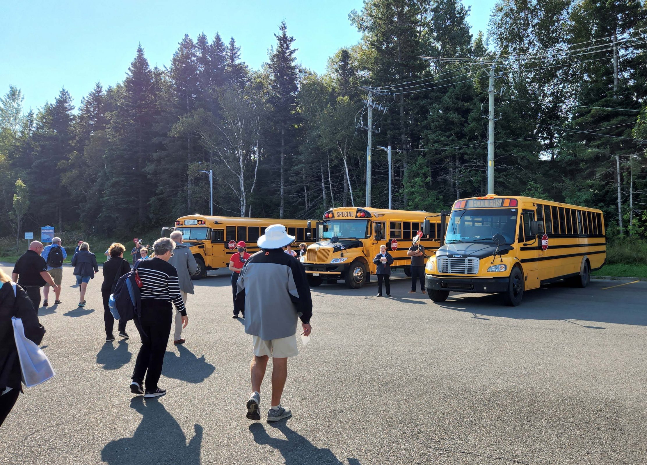
This morning, we transferred from the cruise ship to our hotel. We checked in and checked our luggage because it would be five hours before we’d have access to our room. During those five hours, we walked eight miles carrying our twelve-pound backpacks in the heat (80+ degrees).

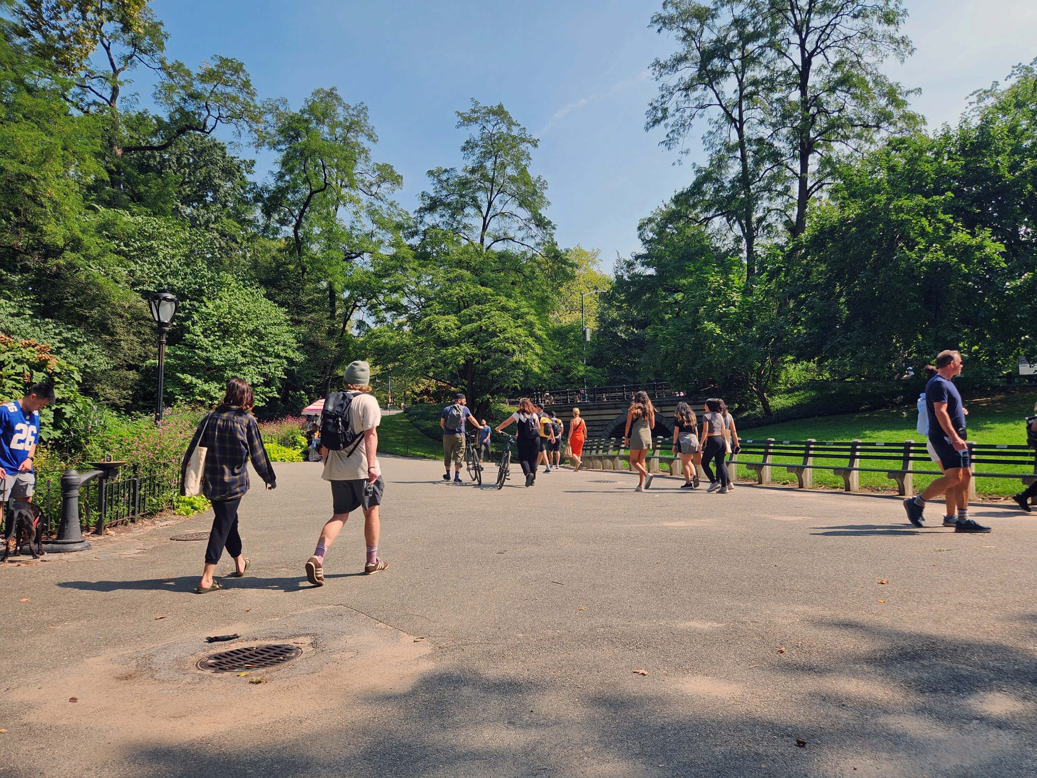
After a quick pass through Times Square for lunch (about two blocks from our hotel), we headed in the opposite direction to Central Park, where we spent most of the afternoon. We entered the park at Columbus Circle and walked past a playground on our way to the carousel. I thought I took a picture of the carousel, which is just to the left of this picture, but I guess I didn’t. The park has nice, wide walkways and also bike paths if you want to ride your bike instead of walking it like the couple in the center of the photo. I’m not sure we’d have found our way out of the park without our park map.

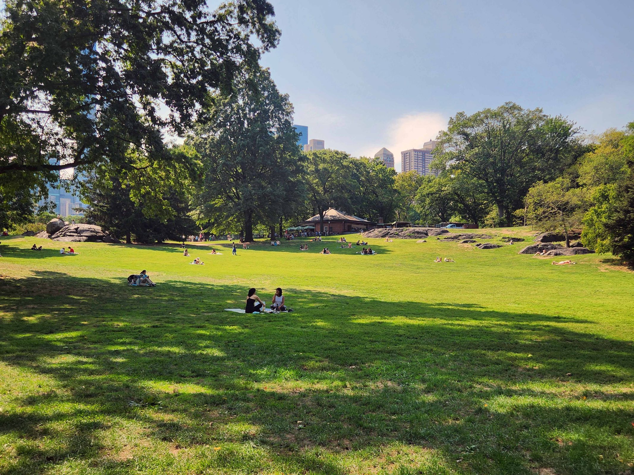
This is the Central Park Sheep Meadow where, yes, sheep used to graze. See those rocks sticking up out of the grass? Ted watches a lot of nature shows and told me that NYC used to be part of Pangea, with a mountain range as high as the Alps. Today, 450 million years later, the continents have shifted and the mountain range has been eroded by glaciers, etc. The mountain range now forms the bedrock on which Manhattan is built, and these rocks are the former mountain tops.

We also walked to the strawberry fields (forever), and the volleyball courts. I think we covered at least two-thirds of the park. Walking all those miles with our backpacks was making us hot and tired. so we walked back to the hotel where our room was finally available and we took a nap before going out to dinner: New York-style pizza and New York-style cheesecake.

Times Square was packed with people. It was pretty much “go with the flow or get out of the way.” Look at the photo to see how many people were waiting for a “walk” light at one of the four corners of this intersection.

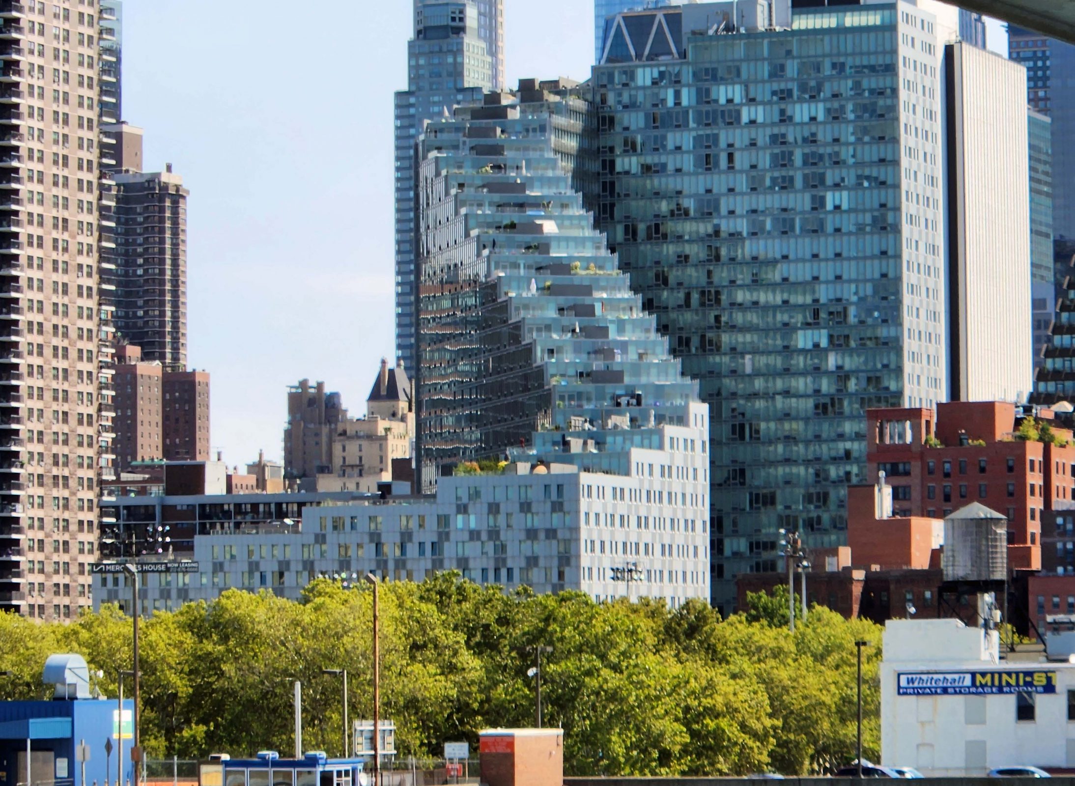
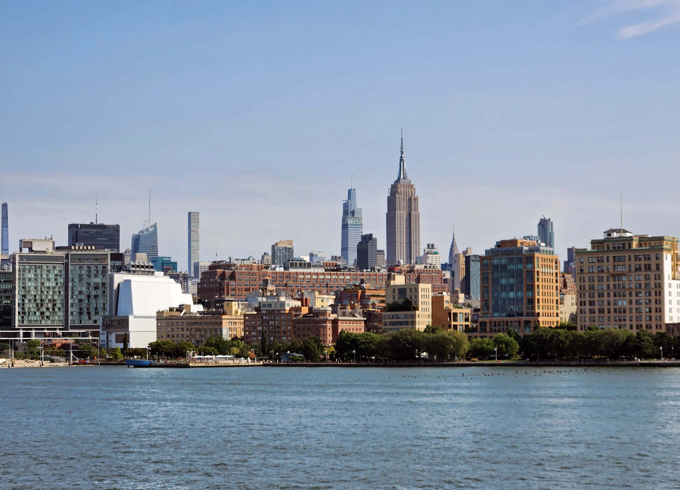
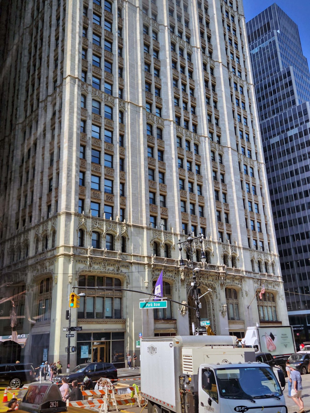
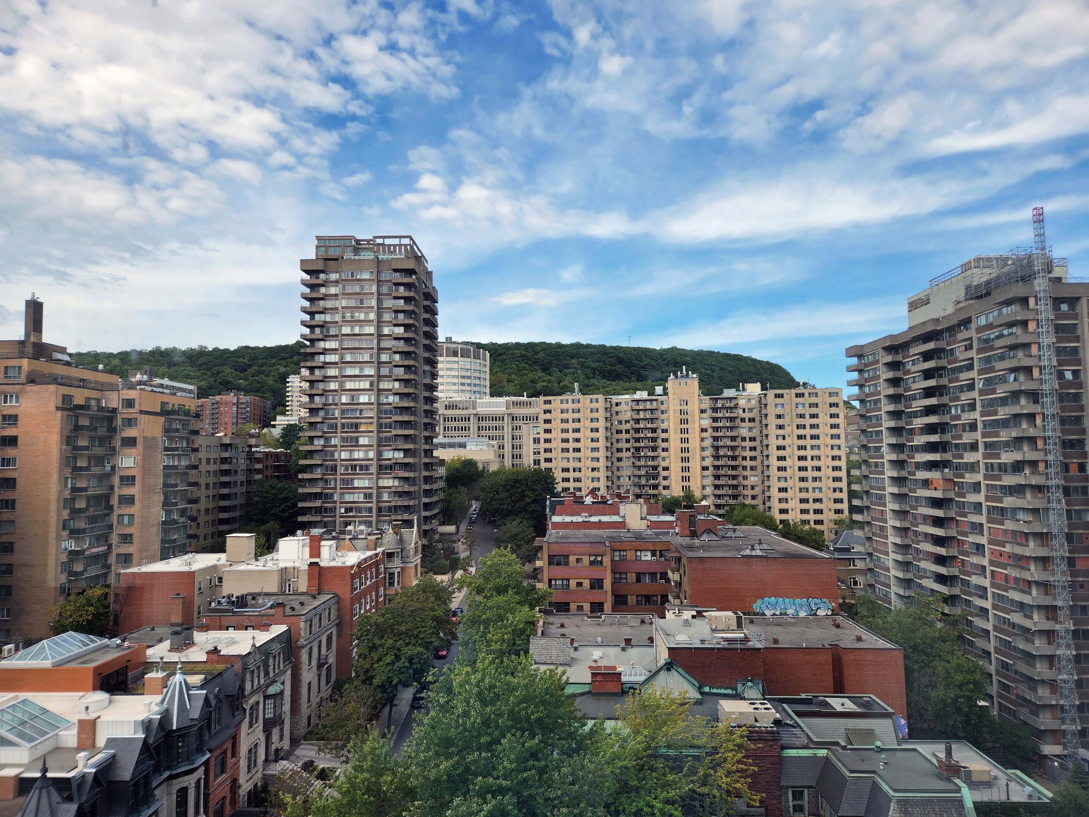
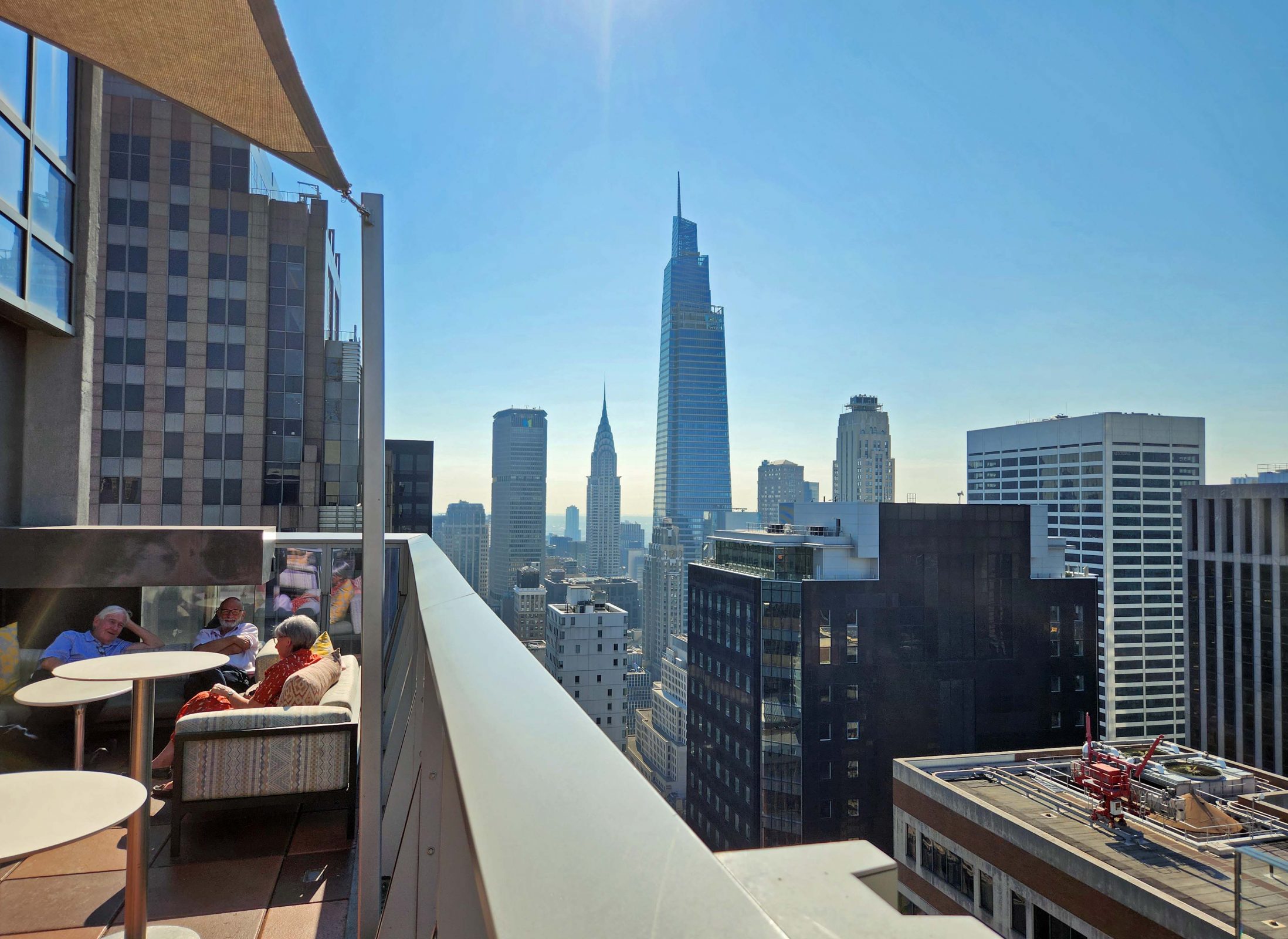
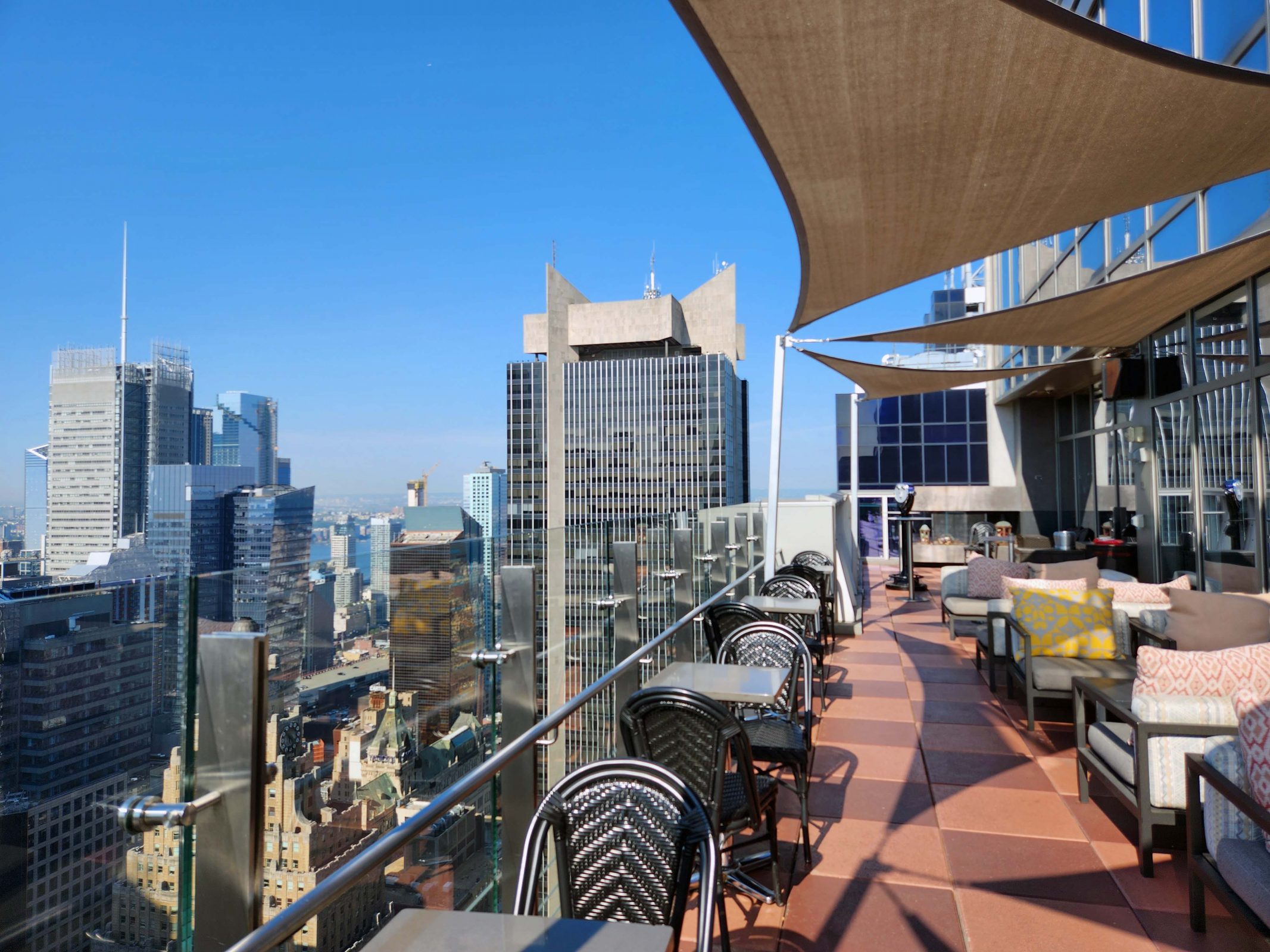
The next morning, we had breakfast at the top of the hotel with a great view of the city. A 1916 NYC zoning law demanded that architects create setbacks on tall buildings so that skyscrapers could still be tall, but would appear to be less bulky. The Chrysler Building (center, in the photo below) is an example of this. It rises more than 1,000 feet, but thanks to its slender tower (which gets progressively more narrow as it rises), it doesn’t feel overwhelming. Also, a more narrow top contributed to a more stable building. New zoning laws allow for more modern architectural styles, but if you look closely at the buildings in the two photos below and in the city, you’ll see that many of them have setbacks.

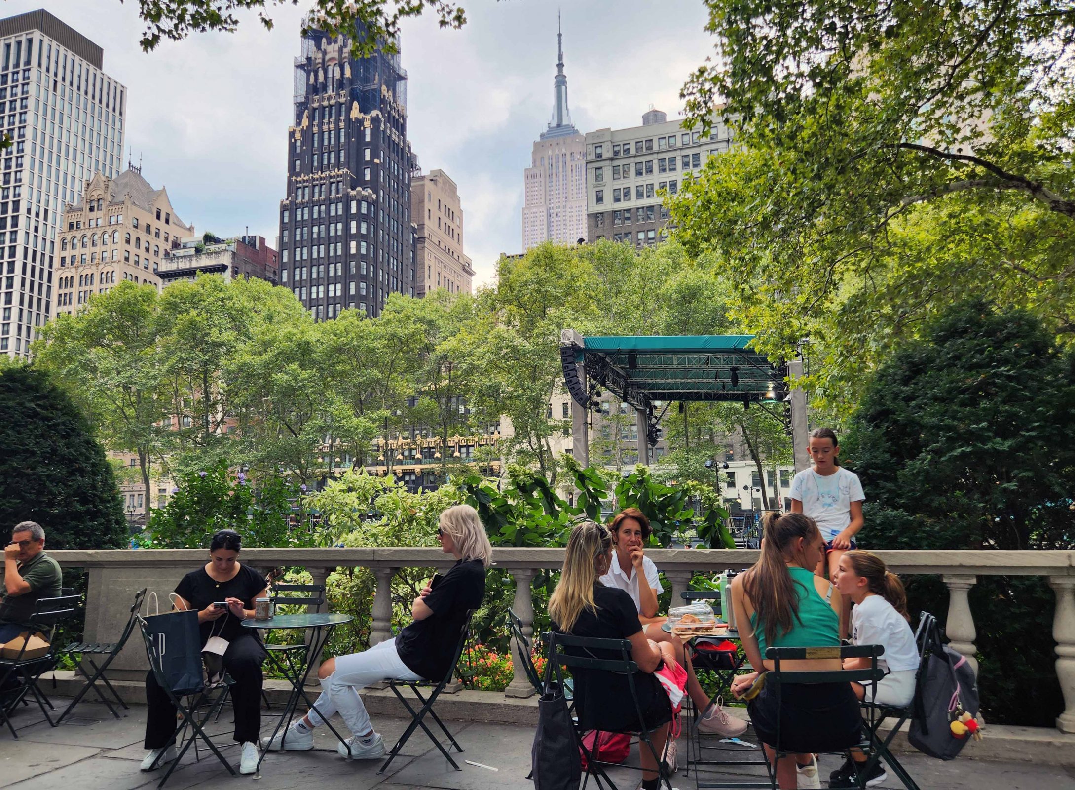
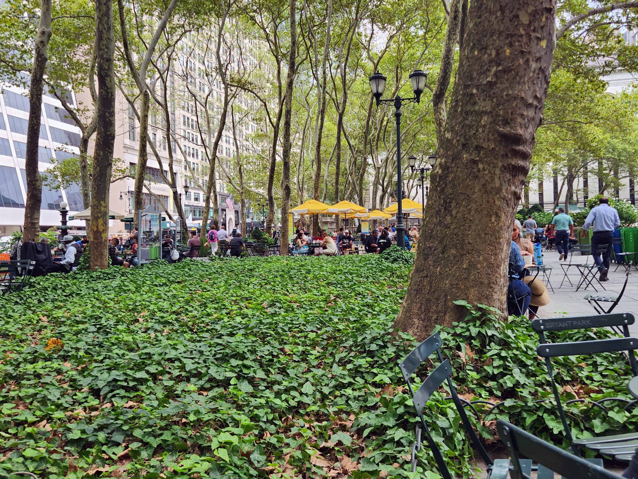
After breakfast, we walked around our hotel area. The hotel is within two blocks of Times Square and the theater district and just a little bit farther from the Empire State Building. We bought some deli food at Whole Foods and ate lunch in Bryant Park with a great view of the Empire State Building.

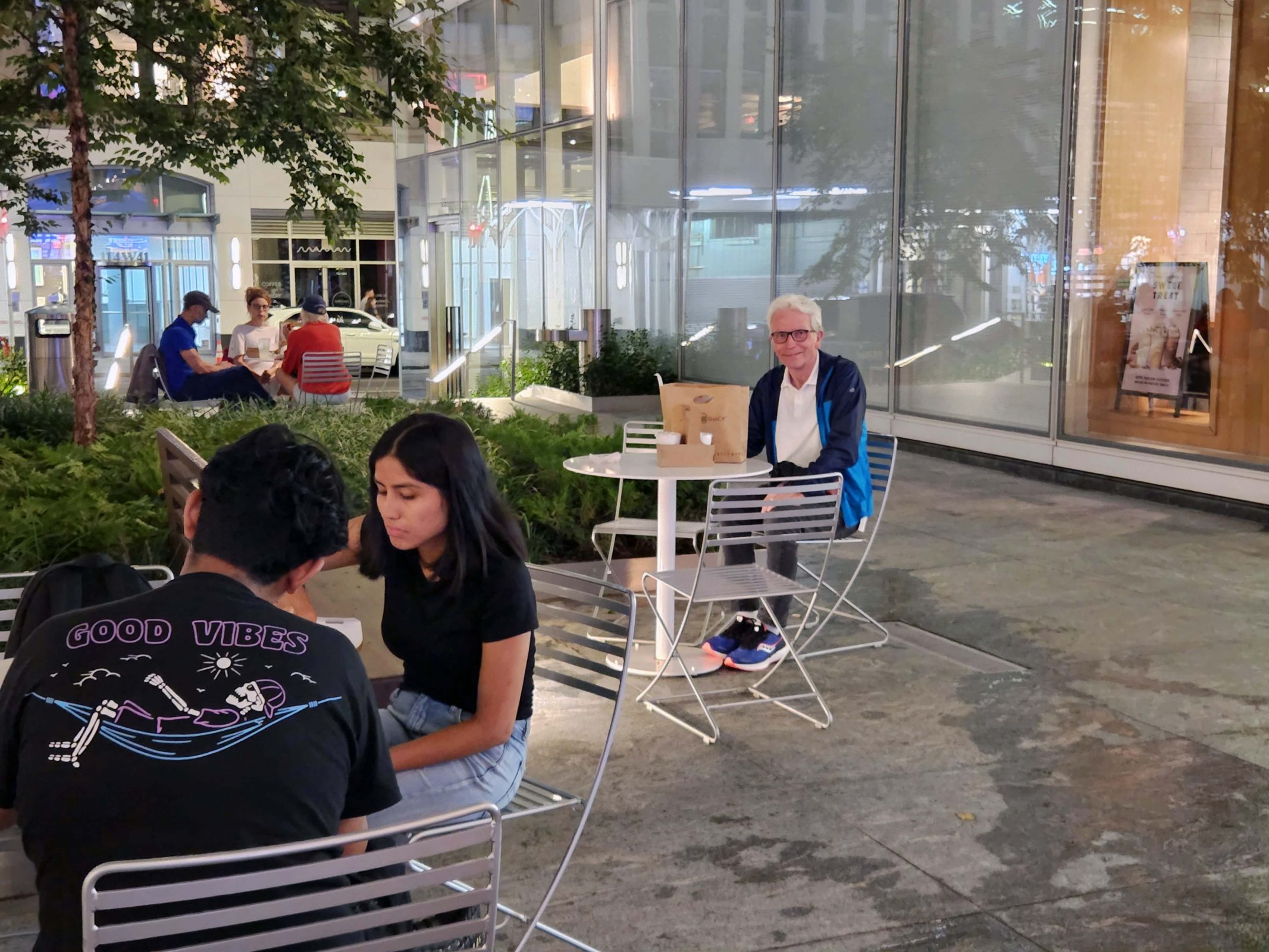
When we finished lunch, it started to rain, so we went back to the hotel and waited out the brief shower. Then it was back to walking around outside. We only walked five miles today instead of eight and we didn’t need to carry our backpacks, which made it more enjoyable. We started in the theater district. This street is a pedestrian street and has food courts. Times Square and the theater district really give your eyes a workout.

We found a little sidewalk park with a Shake Shack and had dinner there–after we dried the rain-wet table and chairs with napkins.

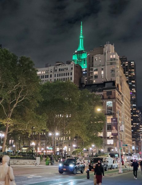
As we headed back to our hotel, we saw the Empire State Building lighted in the night sky. That’s Bryant Park again in the foreground.

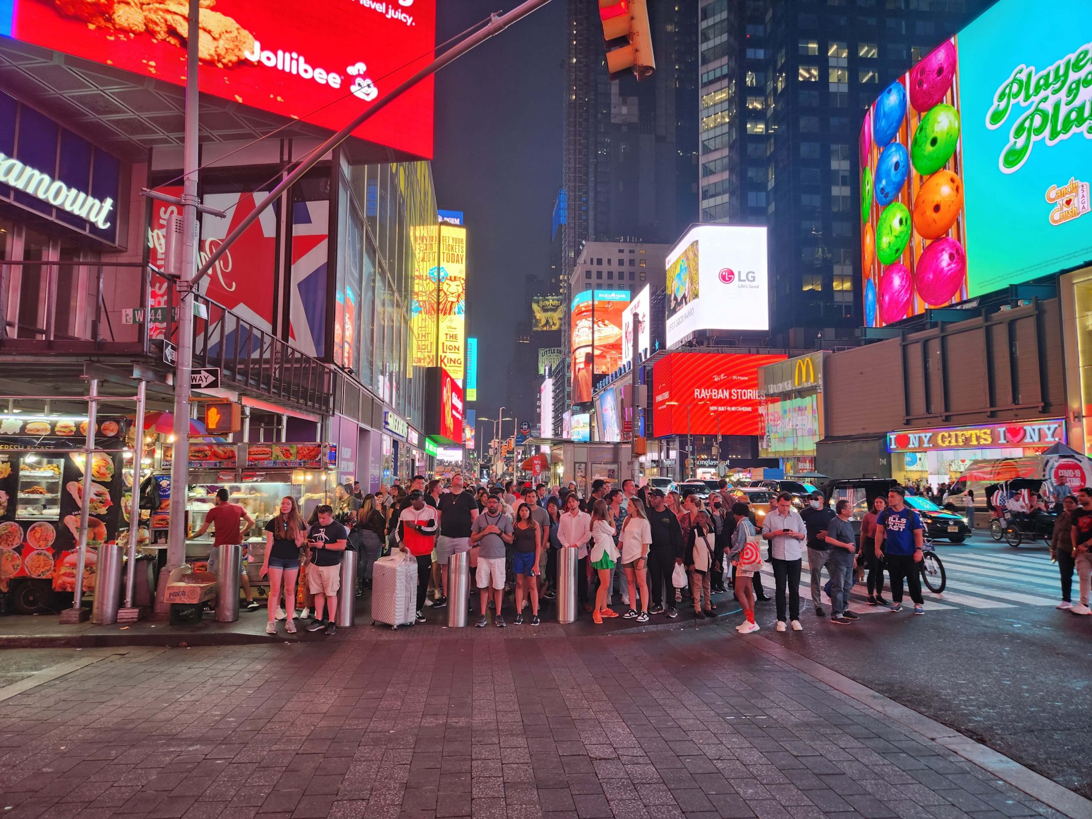
We walked through Times Square to get back to the hotel. Talk about light pollution! Not only are there countless lights, but they’re very bright and most of them include motion and constantly changing colors.

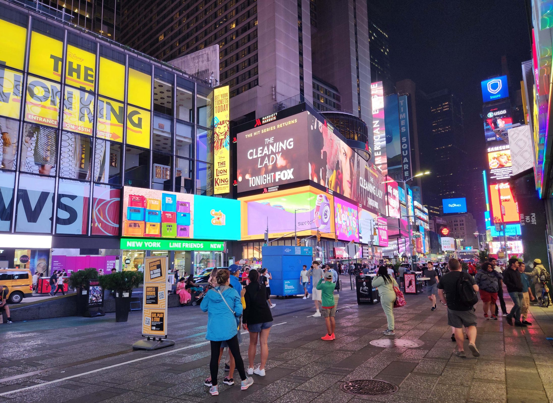
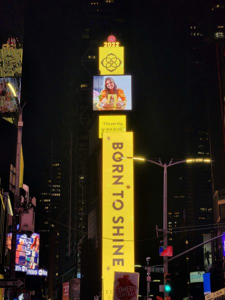
Here’s the icon of Times Square. At the top of the tower in the center, you can see “2022.” Above the numbers is a red ball. That’s the ball that drops on New Year’s Eve. The lights on the ball change color every few seconds, and so do all the pictures and colors on the tower.

There is definitely a unique energy in New York City and it’s an exciting place to be. Like the first time Ted and I were here (October 1971), we decided that, for us, New York City is the premier example of “It’s a great place to visit, but I wouldn’t want to live there.” It was fun, but we’re looking forward to going home tomorrow.

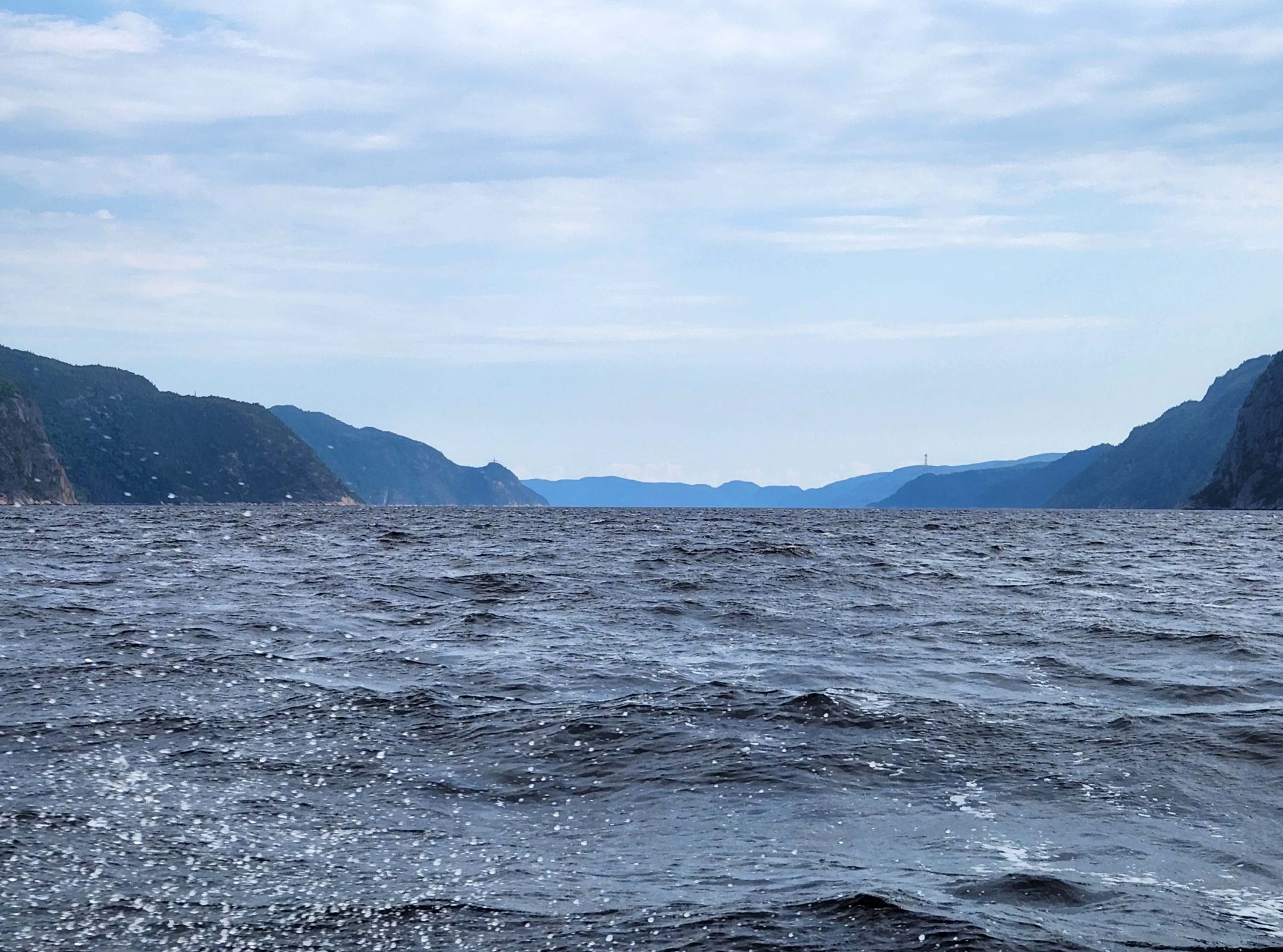
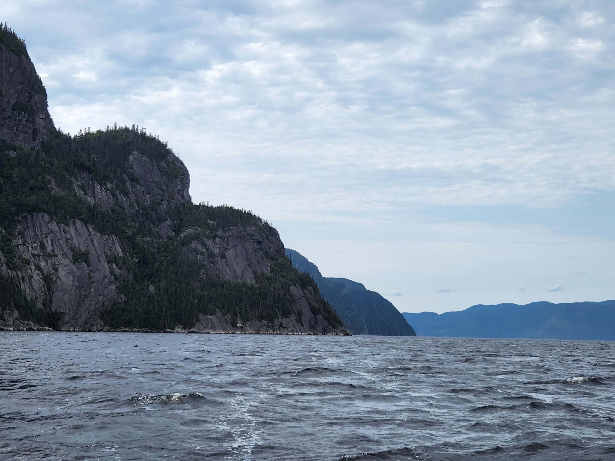
Author’s note: Our cruise ship is scheduled to leave New York City tomorrow for its return trip to Montreal. This will put it in Halifax, Gaspé, and Saguenay at the same time that Hurricane Fiona is expected to arrive in those cities. We assume the cruise will be cancelled and passengers will receive refunds. We were fortunate to have beautiful weather for our cruise.

It’s always a thrill for me to come back from an international trip and to hear the U.S. customs agent say, “Welcome home.” I hoped that, sometime, I could sail home through New York Harbor and pass the Statue of Liberty as a “welcome home” sign. Today, it happened. Bucket list check-off. It’s only mid-morning, but there’s already a long line of people visiting this New York City highlight.

Sailing through the harbor is a pretty approach to New York City. There are interesting buildings, . . .

. . . a variety of watercraft sailing everywhere in the harbor . . .

. . . and of course, the New York City skyline, featuring the Empire State Building and the Chrysler Building.

The cruise-included free tour of the city was a four-hour bus tour called “Manhattan Highlights.” The man who sat across from us on the bus had an interesting shirt, so I asked him if I could take a picture of it. He said “yes” and confessed that he doesn’t read music, so he doesn’t really get it. I do read music, and the shirt is right: those are difficult times.

The tour covered a lot of ground in Manhattan, including Greenwich Village, Wall Street, and Tribeca, as well as stops at Battery Park and the World Trade Center Memorial. Our tour guide was a native New York City resident and told us he has never driven a car. Why should he, he asked us, if he could take the subway anywhere he wants to go? Not to mention (although he mentioned it) that there are only 38 gas stations in all of Manhattan. Public transportation is obviously a hit. Our guide also clued us in to some city abbreviations: Tribeca is the tri-angle be-neath Ca-nal Street. Houston Street (pronounced HOW-ston) is a major east-west thoroughfare that separates NoHo (north of Houston) from SoHo (south of Houston). Broadway is the only straight north-south street that extends the entire 13-mile length of Manhattan Island. As we passed near the High Line Park, our guide mentioned that the High Line and the Staten Island Ferry are both still free.

As the bus drove through the city, I was amazed to see the number of bike lanes and the number of bikers using them. It was also surprising to me to see so many little parks between buildings. I always pictured Manhattan as closely-packed skyscrapers surrounding Central Park. Travel broadens the mind, right?

Like Boston, outdoor dining has continued in New York City since the COVID pandemic, and we saw a lot of little cafes like this one.

At one corner, we saw a pedicab. Our guide gave us a “tourist beware” warning that pedicab operators charge by the minute and that, since they do the pedaling, they control the number of minutes the ride will take.

We went past the original Macy’s store, which is 12 stories high with a footprint that covers an entire city block. We also passed the Woolworth Building (below), which has beautiful architectural decorations. The old joke is that the structure was built with nickels and dimes. Ha ha ha!

I love libraries and bookstores, and I wanted to applaud when I saw this sign on The New York City Public Library. A great way to make people want to read a book is to ban it. I would have loved to spend some time inside.

We saw an unusual space-saving parking lot. Our guide said this kind of lot actually gets the cars in and out very quickly.

Of course, the biggest Manhattan Highlight on this tour was the 9/11 Memorial at Ground Zero and we had a very long stop there so that we could take time to absorb everything. The new World Trade Center Building is 1776 feet tall (104 stories) to signify American independence. It’s a beautiful building.

Ladder and Engine Companies #10–the first company to respond to the attacks on the Twin Towers–are located kitty-corner from the 9/11 Memorial.

343 firemen died attempting to rescue people from the World Trade Center, so there are 343 trees in the memorial park. Each tree has a tag with the name of a fireman on it.

Only one tree survived the attack. It was moved and nurtured until the park was built, then replanted. It’s called the Survivor Tree. It is the first tree in the park to leaf out in the spring and the last tree in the park to lose its leaves in the fall.

One of the highlights of the park is the waterfall. The water flows into the center void as a metaphor of absence made visible. The void–like the absence–is never filled.

The names of the 9/11 casualties are engraved around the waterfall. Many names have flags, photos, flowers, and messages of love and remembrance.

The parkland around the memorial is beautiful and peaceful, making it conducive to reflection.

St. Paul’s Chapel is located directly across the street from the memorial. It is the only building in the devastated area that survived the blast with no damage.

At dinner tonight, we sat at a table with a man who worked six blocks away from the World Trade Center on 9/11. He said he didn’t realize the impact of the attack until he got home from work and saw the television footage.

Today’s bus tour was very interesting and the 9/11 Memorial is a very moving must-see. Tonight we’ll be packing our things to leave the ship and transfer to our Manhattan hotel in the morning.

It’s easy to walk Boston’s Freedom Trail: just follow the red brick line.

I walked the Freedom Trail with three friends when I was in college, but it was better walking with a guide who had stories to tell about everything along the way–for example, the Boston Massacre. The words “Boston Massacre” bring to mind a picture of British soldiers mercilessly slaughtering at least dozens of innocent American revolutionaries for no particular reason. Here’s the marker that indicates where the massacre took place.

Unlike my college friends and me, our guide had a copy of the leaflet printed after the massacre. The guide also knew the truth about the massacre, which my college friends and I did not. Basically, it was a beer brawl between some (mostly drunken) freedom fighters and some (also mostly drunken) British soldiers. Somebody pushed or shoved or said the wrong thing and guns went off. Five freedom fighters died. Tragic, but hardly a massacre.

Samuel Adams liked to incite political action, thrived on pandemonium and controversy, and didn’t mind making up an alternate truth for a more colorful effect. In addition, he especially liked to cast himself in the starring role of that action to advocate for his own political purposes and benefit. It was Samuel Adams who “suggested” that a leaflet about the “massacre” be printed, and he also “suggested” the text to be written on it. According to our guide, good old Sam maneuvered many other political actions in a similar way for his own benefit. Here’s a copy of the leaflet. No wonder people think it was an act of merciless aggression.

Our four-hour walk took us to many of the well-known historic sights in Boston. Here’s Paul Revere’s house; . . .

. . . this is the Old North Church; . . .

. . . and here’s Faneuil Hall. We walked through a cemetery near Faneuil Hall where lots of the famous Revolutionary era Americans are buried. (Check out the guy in the bright blue jacket. ♥)

This is the state capitol building. The dome was originally built of wood. Paul Revere plated it with copper, and later, it was covered in 24-karat gold. Boston has many buildings with gold domes and trim.

It was interesting to see so many Early American-style buildings in Boston and I enjoyed looking at the architecture along the Freedom Trail.

Just for fun, along the Freedom Trail, our guide pointed out two taverns with unique names. The first was called The 21st Amendment (repealed prohibition); the second was named Carrie Nation (a temperance advocate). When the guide asked the significance of the taverns’ names, everyone knew The 21st Amendment, but I was the only one who knew Carrie Nation. It wasn’t like Jeopardy!–there was no cash award–so on with the walk.

It was interesting to note how many Dunkin’ Donuts and Starbucks shops are in downtown Boston. They seemed to be on every corner and always near each other. On one street, we saw two Starbucks stores within 100 feet of each other! Is there a competition to see who can have the most restaurants?

Speaking of restaurants, like many cities, Boston offered outdoor dining during the COVID pandemic. It was so popular, that many of the restaurants have continued to offer it. Outdoor dining is one of my favorite things about Europe and I’m happy to see more of it at home. Note the Freedom Trail in the left photo below.

We left Boston in the late afternoon and cruised through the Cape Cod Canal. It’s a shortcut from Boston to New York City across the neck of Cape Cod. The homes and greenery were beautiful and there was a walking/biking trail along the shoreline, complete with walkers and bikers. Sometimes, people on the shore would call out a “hello” to us (everyone on the ship standing at their veranda railings) and we’d return their greetings. Maybe our passage through the canal seemed so idyllic because the air was quiet and still and the water was calm as the sun was setting.

In this photo, you can see the walking/biking trail.

We sailed under a railroad draw bridge. I made up that name–it doesn’t really draw apart; it rises. The tracks across the canal are raised for ships to pass and then lowered to the level of the railroad track that crosses the canal.

The houses and their settings are beautiful. The parking lot is at the end of the walking/biking trail.

This was my favorite house. I love all those windows. (If I could afford the house, I could afford to have someone else wash all the windows.)

The canal was a lovely end to a wonderful day. Tomorrow: a bucket list check-off.

Before leaving Halifax, customs agents came on board to verify all of our passports so that we could enter the U.S. again in Boston, our next port stop. On our way to Boston, I saw this pretty lighthouse on an island. I’m not sure where we are, but it’s safe to say it’s the Atlantic coast.

With the Viking cruise line, a city tour at each port of call is included with the cruise fare, so Ted and I usually take the tour. Today, it was an afternoon bus tour called “Panoramic Boston.” The weather was beautiful again, but my pictures are limited because we didn’t get off the bus very often. It’s hard to take pictures out of the bus windows or of things on the other side of the bus, but here goes.

Downtown Boston has a lovely street park called the Rose Kennedy Greenway Conservancy. Rose Kennedy is a big name in Boston. The Greenway is 1.5 miles long and runs down the center of the street. It is reminiscent of the Avenue des Champs d’Elysée in Paris. Within the Greenway, there are fountains, playgrounds, flower gardens, and a carousel. One of the flower gardens in the Greenway is a rose garden with 104 rose bushes–one for every year of Rose Kennedy’s life. I wish I could have taken more photos of the Greenway, but the only thing I captured was this piece of street art.

As we were riding through the city, I saw this restaurant and took a picture while the bus was stopped at a red light. Read the sign at the top, then check out the sign at street level. You have arrived at your destination. Cute, huh?

Trinity Episcopal Church, a National Historic Landmark, is the only church included on the American Institute of Architects list of the Ten Most Significant Buildings in the United States.* Like Montreal and Québec City, a significant percentage of Boston is built on land that was originally water. In addition, Boston is built on a swamp. To keep buildings from sinking, pilings are driven 30 feet into the ground below the water level where they stay wet and where bugs and air cannot rot them. Trinity Church is built on 4,500 such pilings. (Query: If cities keep taking dirt from the continents and putting it into the rivers and oceans, will the continents become low enough for the rivers and oceans to relocate inland, thus creating new, smaller continents?)

The church is built on a street corner. The Hancock Building, the tallest building in Boston, is across the street on the right side of the above picture. It reflects Trinity Church to create a metaphor of the old and the new in Boston. (You can see our tour bus in the lower left of the photo.)

Along our bus route, we had a quick stop at the start/finish line of the Boston Marathon where there are bronze sculptures of a hare and a tortoise to honor those who run in the marathon. The pillars, wall, and water feature behind the hare and the tortoise are a memorial to the casualties of the 2013 Boston Marathon bombing.

Today, we had an easy bus tour; tomorrow, we’re going to walk the Freedom Trail for four hours.

*The Ten Most Significant Buildings in the United States are: (1) Falling Waters (Allegheny Mtns., Frank Lloyd Wright); (2) the White House; (3) the Lincoln Memorial; (4) the U.S. Capitol; (5) the Guggenheim Museum (NYC, also Frank Lloyd Wright); (6) the Glass House (CT–also called the Johnson House by Philip Johnson); (7) Trinity Episcopal Church (Boston); (8) the Pentagon; (9) the Milwaukee Art Museum; and (10) the Smithsonian.

Yesterday, we had another sea day, cruising from Gaspé to Halifax. There was an unexpected five-hour delay in reaching Halifax because a passenger onboard had a medical emergency and needed to be taken to the nearest hospital along the way.

Today’s seven-hour shore excursion was a trip to Peggy’s Cove. I was unable to go, so Ted took pictures and told me the story. The tour bus passed a colorful Canadian village on the way to the cove.

Peggy’s Cove has the oldest lighthouse in North America. It is set on a scenic, but very rocky, shoreline.

Those rocks are dangerous, and this sign duly warns visitors of that fact. The message is pretty clear when it plainly states that “rescue here is unlikely” and encourages you to “leave here alive.” It reminded me of a danger sign we saw in Iceland.

While walking around on the rocks, Ted took a pretty picture of some Adirondack chairs and he saw a man playing a very low-toned horn of some kind.

Halifax was the nearest port to take the casualties of the 1912 Titanic disaster. The bodies of 250 Titanic passengers are buried here.

The Citadel is the highest point in Halifax, and is the site of Halifax Fort. The city of Halifax literally owes its existence to the Citadel, a large hill overlooking the easily defended harbor. Halifax Fort has defended the city since 1749, and continued to do so through World War I and World War II.

The tour bus continued to the Halifax Botanical Gardens. Sadly, the park was damaged in Spring 2022. Vandals climbed over the six-foot high fence surrounding the park and girdled 29 trees, which are now in danger of dying. Park workers have treated the trees, hoping to help them withstand the coming winter and to perhaps survive. Note that, in my absence on this tour, Ted took a picture of the statue of Diana. I can’t help loving that guy!

Today, we’re docked in the port of Gaspé (GAS-pay), Québec and we were up early for an all-day shore excursion to Bonaventure-et-du-Rocher-Percé (PER-see) National Park. (FYI, if your high school French is rusty, rocher-percé means “pierced rock.”)

There are four major cities along the St. Lawrence River: Toronto, Ottawa, Montreal, and Québec City. Our cruise began in Montreal, downstream from Toronto and Ottawa, so after seeing Montreal and Québec City, our remaining ports are small towns. Each small-town port has a claim to fame. Saguenay has a fjord; Gaspé has a rock. Small towns do not, however, have large tour buses, so today’s sightseeing began on a school bus. Our group of retirees joked about singing “The Wheels on the Bus” and other high school memories we had of riding school buses, but we all agreed that, at our age, a school bus is a hard, cramped, and uncomfortable ride for 90 minutes each way. We were good sports, though, and we had a very nice boat tour of the national park. (The boat was more comfortable than the school bus.)

On our way to the National Park (it’s actually a provincial park), we passed tiny, rural Canadian villages like this one. It looks scenic and peaceful, , doesn’t it?

As we were driving to the national park, our tour guide pointed out this rock formation. I had trouble identifying the facial profile of the First Nation chief until I zoomed in on it.

Percé Rock is at the tip of the Gaspé peninsula. Here’s a picture of the Gaspé harbor where we boarded our tour boat to see the national park, which consists of Bonaventure Island and Percé Rock. Percé Rock is 1,400 feet long, 300 feet wide, and 390 feet high. It weighs 5 million tons and is one of the world’s largest natural arches located in water. It loses about 300 tons of rock annually, due to wind and water erosion, and will disappear in approximately 16,000 years, so hurry if you want to see it. The two rock formations on the right are what’s left of Percé Rock.

Only one of Percé Rock’s arches remains. There were at least two arches, and some historical accounts mention three. The second arch collapsed “boisterously” in 1845. At low tide, it’s possible to access Percé Rock on foot for about four hours each day. Caution is advised because the rock has a tendency to collapse, dropping large segments into the water. At high tide, it’s possible for a small boat (e.g., canoe, kayak) to pass through the arch.

As we circled Bonaventure Island, we saw seals at play.

The park is a migratory bird sanctuary, and there are approximately 250,000 wild birds in the park. We saw thousands of these white birds and one bald eagle on Bonaventure Island.

There are about fifty houses on Bonaventure Island within the park, but only ten are inhabited.

Returning to the harbor provided a pretty view of the village. I wonder what it’s like to drive up and down that road (center of photo) from the lower houses to the upper ones during the Canadian winter.

Before leaving Gaspé, we had lunch at a local restaurant. Ted had salmon and I had fettucini. The portions were huge, including the piece of chocolate cake we had for dessert. Then, just because we were here, we did the same thing as everyone else and had our picture taken with Percé Rock in the background.

We’ve had beautiful weather so far on this cruise–sunny with temperatures in the 70s every day. Today was described as a “scenic sailing” day to view the beautiful fall colors along the St. Lawrence River. When we woke up and looked out of our window, this is what we saw. Since the trees aren’t showing much fall color yet, at least we didn’t miss that highlight of the cruise.

There’s no shoreline in sight, . . .

. . . we can barely see the water beneath us, . . .

. . . and it’s chilly outside.

The heavy fog continued all day and into the evening, and the outdoor temperature remained cool. It was a good day to relax onboard with coffee (Ted) and hot chocolate (me). While we were reading in the “living room” of the ship, servers brought champagne for everyone. It’s the first time I’ve enjoyed a glass of champagne while I read a book. Ted went to a lecture titled “Canada: The 51st State.” We tend to think that Canada and the U.S. are very similar to each other, but the speaker talked about the ways in which the two countries are different. Ted said the lecture was interesting and funny. After all the work we’ve been doing at home, it was great to have a day without planned activities, and we topped it off with chateaubriand and cherry strudel for dinner. Mmm, mmm good!

fjord [fee’ ôrd] noun

A long (65 miles), narrow (1.2-2.5 miles), deep (690 feet) inlet of the sea (St. Lawrence River) between high cliffs (490-1,150 feet), typically formed by submergence of a glaciated valley.

That describes the Saguenay (SAG-en-ay) Fjord in Québec, Canada, one of the most southerly fjords in North America. Ted and I had so much fun on the jet boat tour of the Waimakariri Gorge in the Southern Alps of New Zealand, that we signed up for the three-hour jet boat tour of the Saguenay Fjord without giving it a second thought. The Canadian fjord boat was jet-propelled, but far less exciting than the New Zealand ride. I think that might have been in deference to the marine life in the Saguenay Fjord. Instead of 50 mph, the fjord boat went about 10-20 mph and the pilot didn’t do a single 360-degree spin. Still, it was a very pretty ride.

At the beginning of our fjord tour, we sailed around a high bluff, on which the pilot pointed out a rock climber. This is a popular place for rock climbers, and the pilot told us it usually takes about three days to make the climb. The arrow in the photo below indicates the climber, about halfway up. I guess he has another day-and-a-half to climb before he reaches the top. I took the first picture on the way into the fjord and the second on the way back to the dock. The climber made some progress (check his position relative to the notch in the rock) while we spent our time in the fjord.

Part of the boat tour took us through a relatively open area. The pilot explained that, in this area of Canada, gravity moved the ancient glaciers from west to east toward the Atlantic Ocean. The direction of the glacier’s movement determined the positions of the high and the low bluffs along the fjord, so the east side of the fjord is sloped and the west side is steep. It’s interesting that, although the Saguenay fjord flows into the St. Lawrence River, salt water from the St. Lawrence River flows beneath the fresh water of the fjord. Ninety-three percent of the water volume inside the fjord is salt water.

The pilot took us right up to the face of this bluff. The arrow points to a cave at the water line.

It was a pretty boat ride, weaving our way around the bluffs and, eventually, back to the dock at the end of the tour. The fjord is a sanctuary for perigrine falcons. Now we’ve toured a Canadian fjord and a Norwegian fjord. They are equally scenic, but Canada was warmer than Norway.

Author’s note: Saguenay has a population of about 150,000. Ninety-five percent of the population speaks only French.

Québec City is one of only two walled cities in North America; the other is Campeche, Mexico. Although Québec City used to be known for its large number of banks and insurance companies, today there are no banks at all within the walled city–only ATMs. Neither are there any grocery stores within the old city walls–only convenience stores. Québec is the only Canadian province that uses French as its official language. More English is spoken in Montreal than anywhere else in the province, but there are laws in place to protect the French language within the province. Fluency in French is a requirement for getting a job in Québec. Under Bill 96, which became effective September 1, 2022, government agencies will have to use French exclusively in their written and oral communications, with few exceptions, and businesses will have to ensure the “net predominance” of French on signs that include more than one language. Ted and I took a four-hour walking tour of the old walled city–Vieux-Québec–and, thankfully, our guide spoke English.

Québec City is very steep. Stairs are everywhere to take pedestrians from one street up–or down–to the next. The shortest stairway in the city is 7 steps; the longest is 368 steps. The funicular provides an alternative to climbing those 368 steps. We started our walking tour by taking the funicular to the top of the bluff. From there, our tour went downhill–literally, not figuratively.

The funicular stops at the boardwalk, near the top of the bluff. Festivals and other events are held on the boardwalk. You can see a Canadian flag over the gazebo in the center of the photo and another higher flag to the right of that one.

From the boardwalk, we went up several short stairways to reach the Château Frontenac, one of Canada’s grand railway hotels built by the Canadian Pacific Railway. As we were climbing the stairs, we noticed that the flag was at half-staff. Queen Elizabeth II had just died. I was very young when she became Queen, but I remember watching her coronation on television. My family didn’t have a TV yet, but one of my mom’s friends did. That friend also had a daughter my age, and she and I were friends, just like our mothers. We had a ladies’ day, watching the pomp of the coronation. Like so many people today, Queen Elizabeth II was the only British monarch I remembered, and it was sad to see the flag at half-staff in memory of her.

The Château Frontenac at the top of the bluff is massive. The first photo shows the side of the Château that faces the “new” city; the second photo is a side view of the Château. In the second photo, you can see that the ground slopes upward at least four stories from one end of the Château to the other. Ted and I thought Montreal was hilly, but we hadn’t seen real city hills until we got to Québec! The third photo shows the floral butterflies in front of the Château.

We walked from the Château Frontenac past the Ursuline convent. Actually, we had to take our guide’s word for that. The Ursulines value their privacy and the convent is well-hidden behind other buildings, trees, etc. so we didn’t actually see it. The Ursulines were the first nuns to come to Canada and founded their convent in 1639. The sisters studied the native languages and then taught native children reading and writing as well as needlework, embroidery, drawing, and domestic arts. The Ursuline convent in Québec City is the oldest educational institution for women in North America.

We walked across the top of the bluff to the Citadel fort and arrived at a stone wall that was about three feet high. It didn’t look like much of a defense against enemies unless you looked over the edge. Here’s a photo of an apartment building at the base of the bluff below that low wall. The entrance on the right is at the level of the street on that side of the building; the entrance on the left is at the eighth floor of the building and has a short stairway up to the next street. Access to the inside elevator is for residents only; everyone else has to climb the stairs. The top of the bluff is higher than this building, so the three-foot-high wall at the top was probably sufficient for defense.

Much like our walking tour of Montreal, our Québec tour guide made comparisons between Montreal and Québec, but this time, Québec was always a little bit better than Montreal. I definitely sense some city rivalry going on.

We worked our way down the slope of the bluff and past some shops where I noticed railings along the sidewalk. Our guide told us that in spring and fall (wet, freezing), the sidewalks can be dangerously slippery for walking uphill and downhill, so the railings help prevent falls.

A little farther down this hill, our guide told us about tomorrow’s Grand Prix Cycliste de Québec–a bicycle race. The race is not point-to-point, but instead, requires 16 laps of 12.6 km (7.8 mi.) each for a total of 201.6 km (124.8 mi.). There are 4 climbs in rapid succession on each lap: the first climb is a distance of 375 m at a 10% average grade; the second is 420 m at a 9% average grade; the third is 190 m at a 7% average grade; and the last is 1,000 m at a 4% average grade. Repeat these 4 climbs 16 times. The finish is uphill. Here’s a view from the corner of one climb. It continues downhill to the right of the photo at an even steeper grade. Approximately 400 (crazy) racers are expected to participate tomorrow.

On our walking tour, we saw some pretty streets and plazas. And lots of stairways.

In the early days of British settlement in Canada, timber was a major export to Europe. It was difficult to sail an empty ship across the Atlantic to Canada, so the Scottish ships used yellow bricks for ballast, dumped them at the port when they arrived, and replaced them with timber for the return voyage. The Canadian settlers called the discarded ballast “Scottish yellow brick” and used it for buildings that still exist today, like the one in the center of the photo below.

When buildings are built of stone rubble, rounded corners add strength to the structure.

For centuries, Québec City residents filled in the St. Lawrence River to make more land. The wavy lines in this plaza and elsewhere in the city indicate areas that used to be river water.

The painting below looks very realistic in person; it has less depth in a photograph. When we saw it across the plaza, it was difficult to believe that the scene was flat. I took a picture of it from the side to prove it. You can tell by the second photo that the sidewalk I stood on to take the second picture was at the third floor of the building where the two men are standing on the balcony in the picture. Yes, steep hills and stairs.

At the end of our tour, there was a group stop at a pub for a much-needed snack. The snack included a glass of wine, sausage, shallots, and mustard caviar on some cracker-like bread. It was all good.

At sunset, our ship left port, heading toward our next stop: Saguenay. The Château Frontenac dominates the Québec City skyline.

Yesterday, we checked out of the hotel and moved into our stateroom on the cruise ship. The hotel lobby was a madhouse and the lines were long, but lunch was ready when we boarded the ship. The best thing about cruising: we unpacked our suitcases, put everything into drawers and on hangers, and won’t have to re-pack until we leave the ship 12 days from now.

We met three other couples at dinner and had a good time. The hostess who seated us asked me, “How are you?” “I’m fine,” I replied. “You look tired,” she said. “I am,” I responded. She smiled at me and said, “Check with me at the end of the cruise.” Her comment might not have been tactful, but it was true. Ted and I have been working 10-12 hours every day for the past three weeks to get ready for the interior house contractors, the exterior door contractor, the landscape designer, and the cruise! Yes, we’re exhausted, and we’re ready to get away and relax. “Respect,” the biopic movie about Aretha Franklin, was playing in the onboard theater after dinner, so we watched that and enjoyed the free popcorn before going to bed.

We slept in this morning and then took a three-hour walking tour of Old Montreal after lunch. The tour guide mentioned a number of things that are similar about Montreal and Quebec City. Not surprisingly, Montreal’s claim to fame was always a little bit better than Quebec City’s. For example, although Quebec’s total provincial population is about 8 million, the city of Montreal within the province has 4 million of those people, compared to Quebec City’s population of just over a half million people. City pride and friendly (I hope) rivalry was hard at work throughout the tour.

Montreal is on an island and, with those millions of people, there’s a scarcity of parking places. To make up for that shortage, the city has great public transportation and 700 km of bike trails. There are lots of underground walking tunnels as well, which I’m sure are a good thing in the winter. Our first stop was Notre Dame, a cathedral that is built entirely of wood (inside and out), but has been painted to look like the stone European cathedrals. It has a pipe organ with 7,000 pipes and 4 keyboards; seating for 3,000 worshippers; and a ceiling painted Virgin Mary Blue with 24k gold stars.

We took an elevator to the observation deck at the top of the Museum of Archeology and History and had a nice overview of the city and of the Crooked Bridge. The bridge’s real name is the Champlain Bridge, but it has three curves, so everyone calls it the Crooked Bridge. Within the museum, I saw an interesting early pencil sharpener. (The overhead light reflections were unavoidable.)

In the summer, pianos are placed in many places around the city. We saw at least a half dozen and there was someone playing every one of them. (The man in the left picture had just finished playing.)

We visited a huge business complex that is built underground and has two levels of multi-story stores and offices as well as three levels of subway tracks. Here’s a reflecting pool and a sculpture within the complex (upper photo, below). The lower photo faces the open (downhill) end of the building. There are subway tracks on each end of the complex and the guide told us the tracks on the other end (uphill) were underground but above this level of the building.

A lot of dirt had to be moved to build this structure and the excess dirt was used to fill the river and create an artificial island. The 1967 Montreal Expo/World’s Fair was built on that island. Most of the buildings were built as temporary structures for use only during the Expo, but the French and U.S. pavilions are still in use. The U.S. pavilion for space exploration now houses agencies focused on green energy and includes a biosphere. On another artificial island (also built with fill dirt), there is a Formula 1 racetrack. When there are no races, the track is used for skating, running, biking, track events, and even cars.

After our walking tour, Ted and I had some time on our own. It was hot, so we grabbed some more Cherry Garcia ice cream at another Ben & Jerry’s shop before re-boarding the ship to leave Montreal. On our way downriver, we saw Habitat 67, or what is called the “Cubes.” They were designed by a young architect in a competition to promote a “new” Montreal. His first model of the structure was built with Lego bricks. In 2012, Habitat 67 won the design competition to be Lego’s architectural set of the year. In general, four cubes make up a living unit. They are luxuriously furnished and can be rented for about $2,900 CD per month or purchased for roughly $1 million CD for a 1,000-1,200 square foot section. I found the first photo on the internet. The second photo is mine, taken as we left Montreal and headed for Quebec City, tomorrow’s destination.

Refreshed from a long night’s sleep, Ted and I explored Montreal today. We spent most of the afternoon walking around the Golden Square Mile–an area of older, elegant homes built at the foot and up the slope of Mount Royal. Today is the Labor Day holiday in Canada as well as in the U.S., so museums and other places were closed, but the weather was beautiful and so was our walk. We quickly discovered that Montreal is all about hills. We started at the foot of Mount Royal, where our hotel was located, looked at the mountain, and said we had no desire to climb to the top. The photo below is a view of Mount Royal from Old Montreal on the opposite side of the city from our hotel.

As we walked, we kept going up a block and over a block and eventually found ourselves at the foot of the final path that led to the park at the top of the mountain. We decided not to go for the summit, because we’d already been walking for about two hours and still had to walk all that way back to the hotel. The hills in Montreal are so steep that the foundation of one house was often higher than the rooftop of the house behind it.

Here are some of the beautiful houses we saw and one of the less steep streets we climbed.

The Montreal Museum of Fine Arts promotes street art in the city and we saw lots of it.

The colorful three-dimensional construction wall in the background of the left photo above is lighted at night (right photo below).

The artificial trees on the street and the artwork on the building in the photo on the right are tributes to curing breast cancer.

This lady looks like she wants to be an integral part of street art. (Or maybe she’s their mom, waiting to take them home.)

We saw these in an art gallery window. They’re two-dimensional paintings, not three-dimensional bookshelves.

All of our walking (another 5.5 miles) made us hungry, so when we saw a Ben & Jerry’s (it’s not far from Vermont to Montreal), we stopped for some Cherry Garcia ice cream–my favorite flavor. I don’t know if all the Ben & Jerry’s restaurants offer this, but the menu included a “Vermonster”: 4 scoops each of 5 flavors of ice cream with hot fudge, whipped cream, and cherries for $69.95 CD. It serves 4 or more people. With 20 scoops of ice cream, I would guess that more than 4 people usually share this treat. Ted and I each had less ice cream than the Vermonter offered.

We enjoyed spending the afternoon within the Golden Square Mile of “old” Montreal. Tomorrow, we’ll check out of the hotel and into our stateroom on the ship. The day after that, we’re going to take an organized walking tour of “new” Montreal.

The electrical work for our interior house update is finished. There are several large holes in the ceilings and walls for the drywall repair guy to fix, but the wiring is in and we have most of the new light fixtures. The others will arrive during the painting process and will be ready to install when the paint is dry. After the electrical team left the house, we had two full days (insert sarcasm here) to prepare for our 18-day cruise from Montreal Canada, down the St. Lawrence River, then down the eastern Canadian/U.S. coastline, and into New York City.

We had an early start for the cruise–we had to be at the airport by 5:00 a.m. for our flight to Charlotte, then to Montreal. That wasn’t the shortest route, but the airlines didn’t ask us for input when they planned their routes.

We were expecting something like the cartoon above, but our STL->CLT flight was called on time. We learned quickly that we shouldn’t be too confident. During the CLT->YUL boarding process, an oxygen mask dropped from its overhead storage for no apparent reason. A mechanic was called, but the mask wouldn’t retract and required a major repair. The plane was only half full, so the solution was to move the passenger from that seat to another seat with a properly working (and retracted) oxygen mask. That was a 30-minute delay and made our flight more typical of air travel these days. With the ArriveCAN app, passing through Canadian customs was a breeze. We collected our baggage and joined the Viking cruise folks, who took our group to our hotel. After checking in, Ted and I immediately took a three-hour nap, then hit the streets to explore Montreal and to look for some dinner.

We didn’t see a lot of restaurants in the immediate vicinity of the hotel, and we were only a few blocks from McGill University, so we asked some of the hundreds of always-hungry college students milling around where we could eat. A wonderful couple said they were just heading for the 3 Brasseurs, and invited us to go with them. What a place! In English, that’s the 3 Brewers and it was a brewpub. I think everything on the menu had beer in it somewhere: beer-battered fries, blueberry beer pie, beer buns (made with what’s left of the malt after brewing the beer), etc. We had such good burgers (“smothered in maple beer sauce”) and such a good dessert (caramel sauce-covered cinnamon rolls made with beer butter in the sauce), that we went back for a lunch pizza the next day. You might drool as you look at the photos of our caramel sauce cinnamon rolls and our pizza.

The Brasseurs also serve beer in a five-liter “Triton,” but only to groups of five or more people.

After dinner, we walked around for awhile (five miles clocked on my pedometer today) and then crashed in our room and slept for more than ten hours. We’ll be more alert tomorrow.