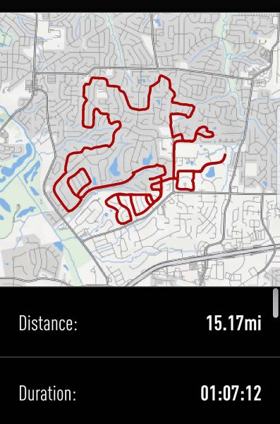
We are probably having our last weekend of summer weather with temperatures in the upper 80s, so Ted and I decided that today was the day to check the Centennial Greenway off our bike route wish list. Eventually, the Centennial Greenway will be 20 miles long, but right now, only 3.5 miles are finished.

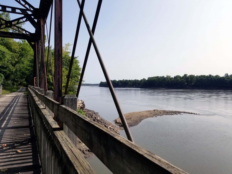
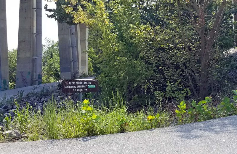
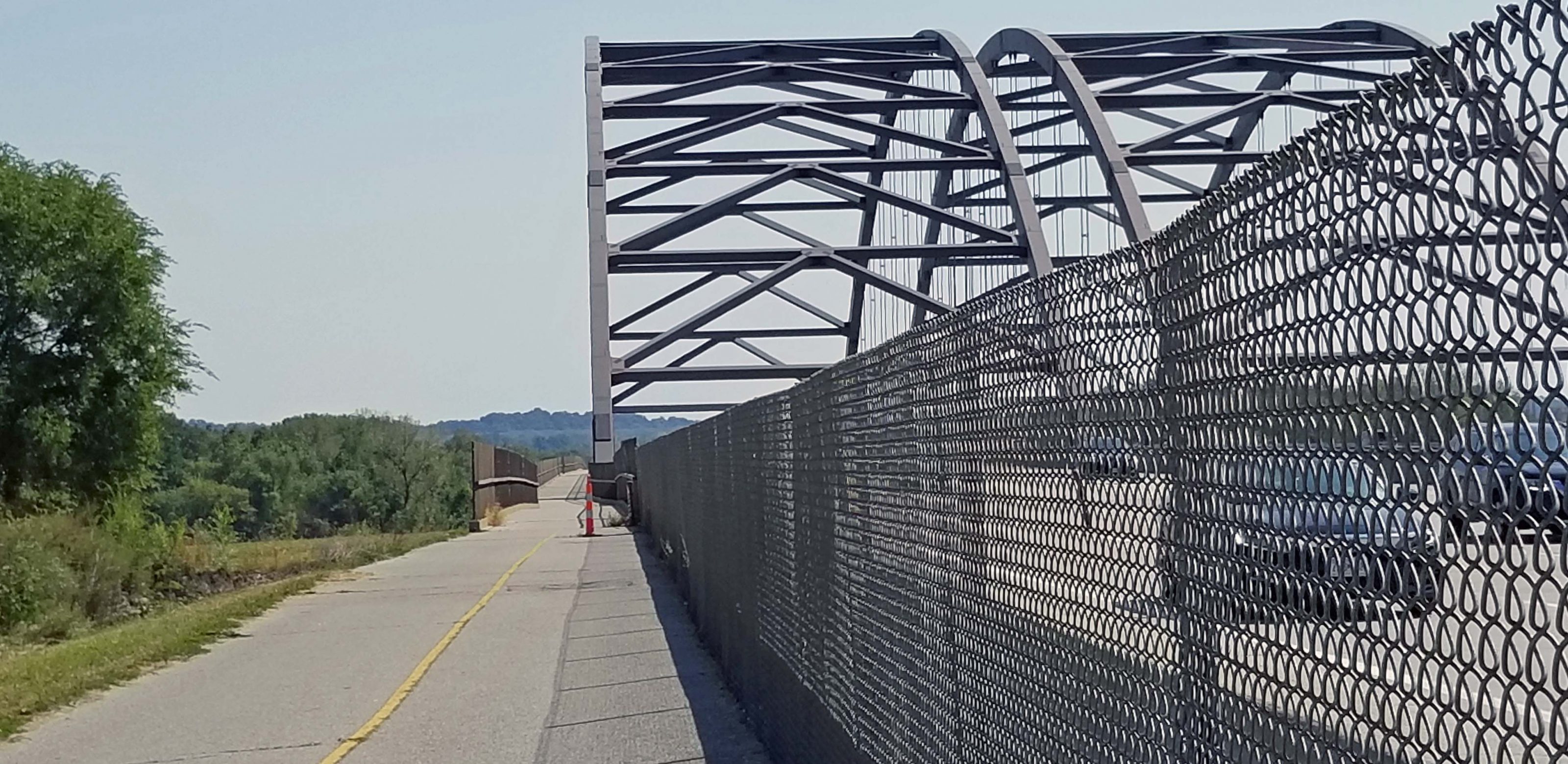
A section of the Centennial Greenway crosses the Missouri River via a separate lane on the MO Hwy 364 bridge. Hwy 364 connects St. Charles and St. Louis counties. On the St. Charles side, the greenway bridge connects to the Katy Trail; on the St. Louis side, it connects to the Creve Coeur Park Trail. The photo below shows the bike lane of the highway.

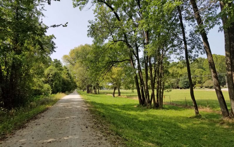
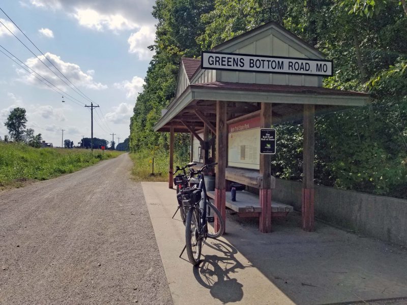
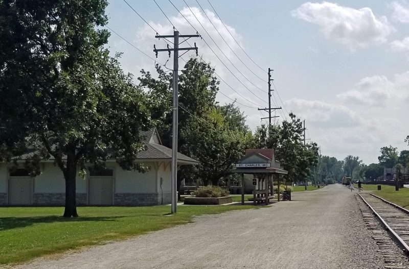
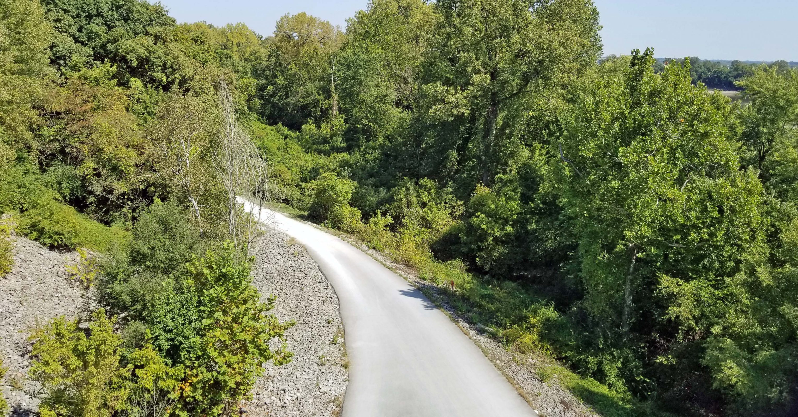
Since we parked near the Katy Trail trailhead, one of the first things we saw beneath the bridge was the Katy Trail.

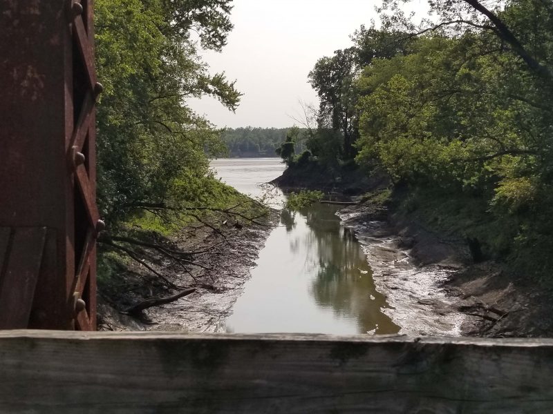
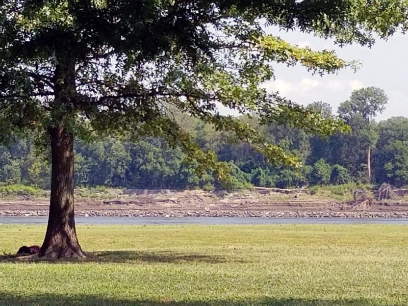
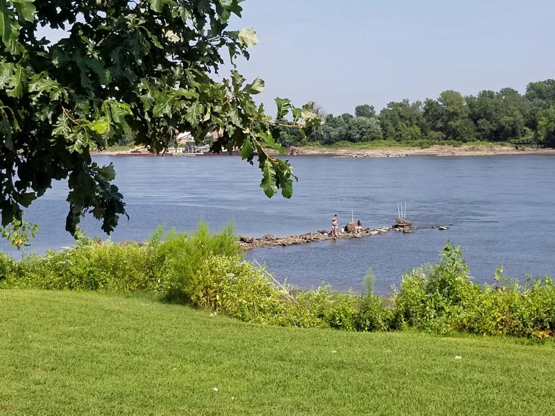
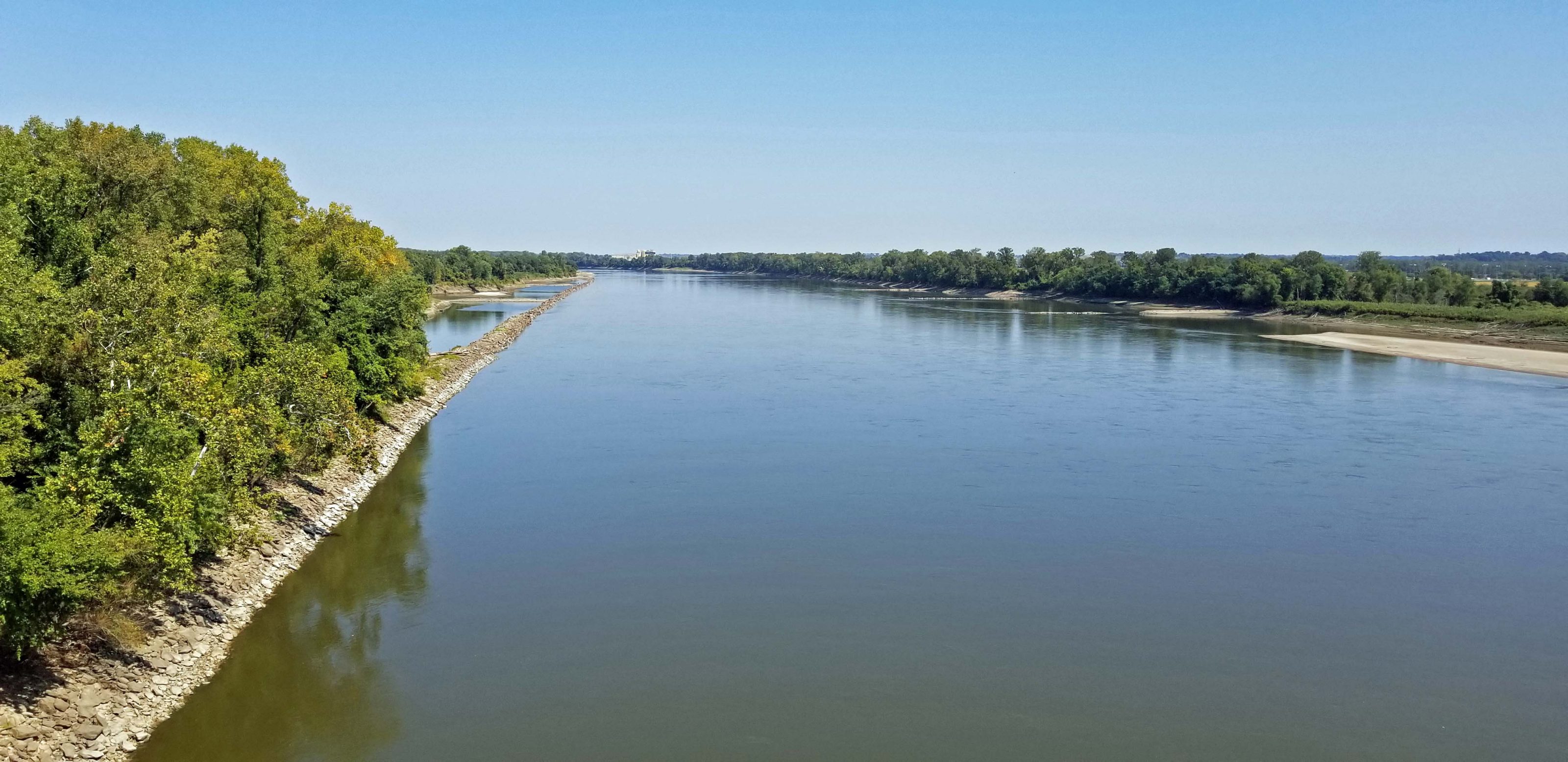
We haven’t biked across the Missouri River since the Great Flood of 1993 when we biked over the I-64 bridge to view the flooding of the Chesterfield Valley. The bridge and the St. Charles side of the river weren’t flooded, but the Monarch Levee on the St. Louis County side of the bridge failed and put the Valley under 20 feet of water. We couldn’t bike beyond the bridge. Today, you can see how low the river is. The breakwaters all show and there are visible sandbars. We need some rain.

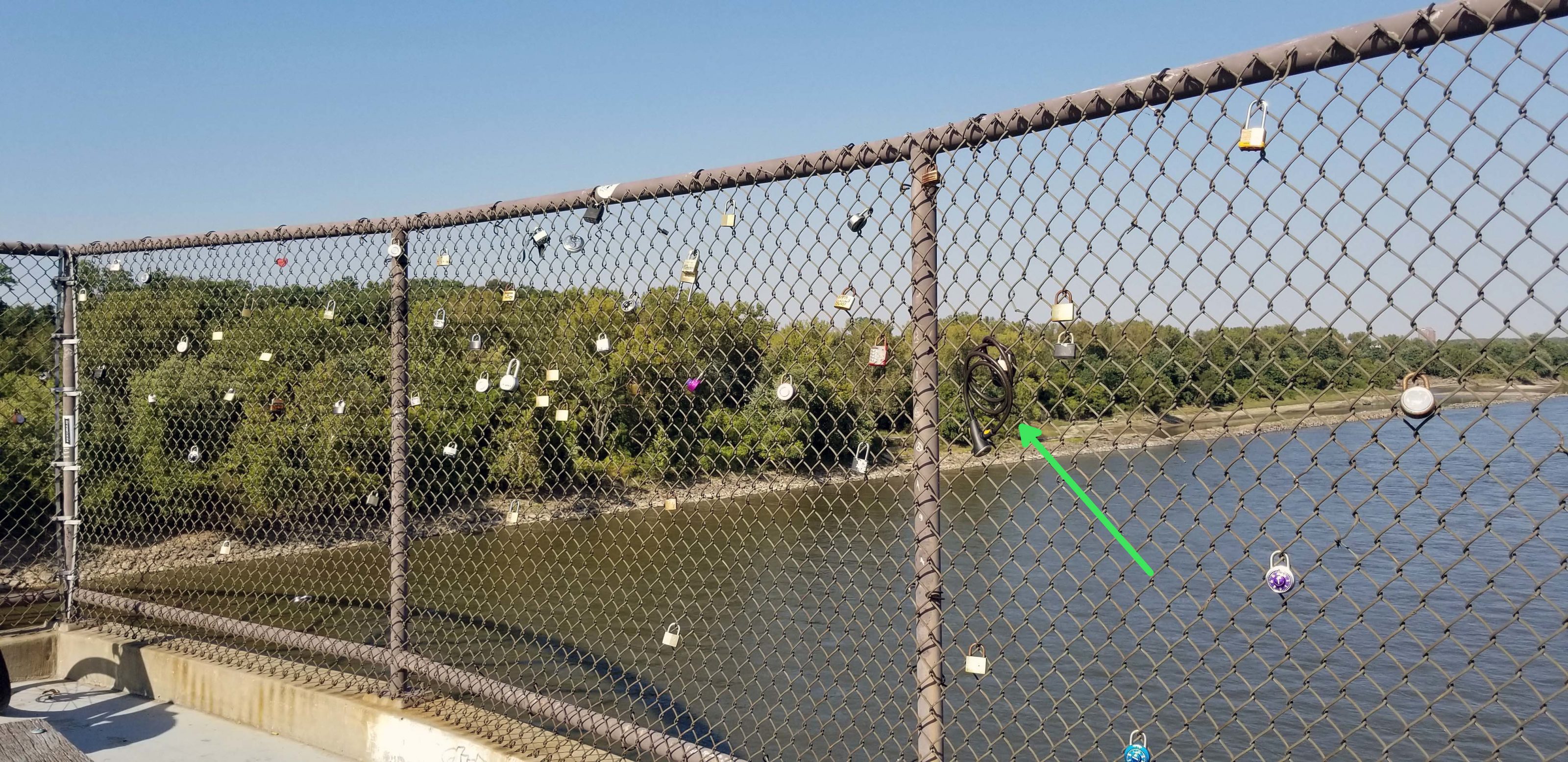
It doesn’t look like the “love locks bridge” in Paris, but this turnout on the bridge bike lane has a fledgling collection of locks. Is love stronger if you attach a cable bicycle lock to the fence instead of a simple padlock?

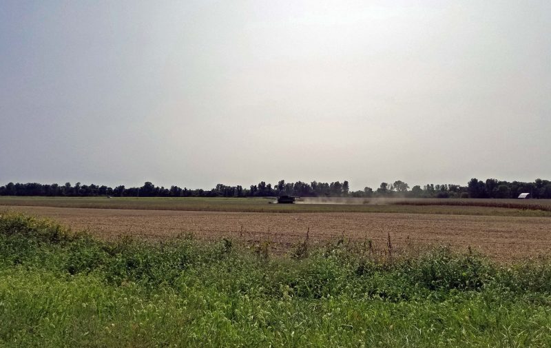
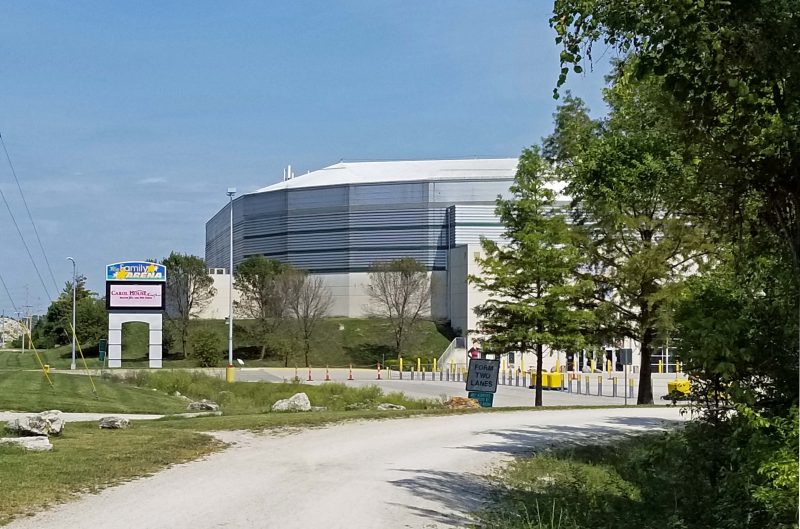
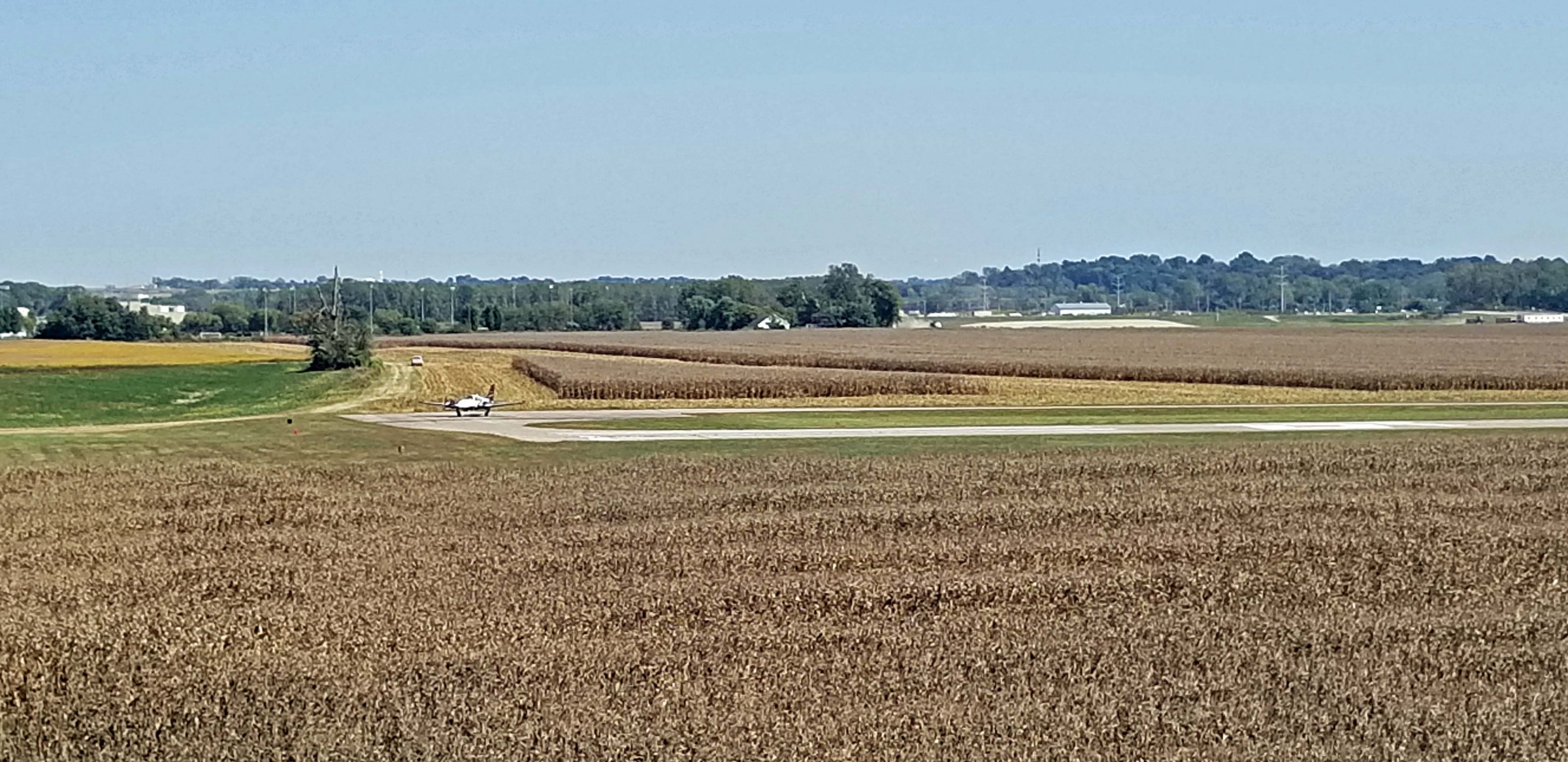
The first thing we saw in St. Louis County was the Creve Coeur Airport. There’s a small plane at the turn of the runway, preparing to take off (left center).

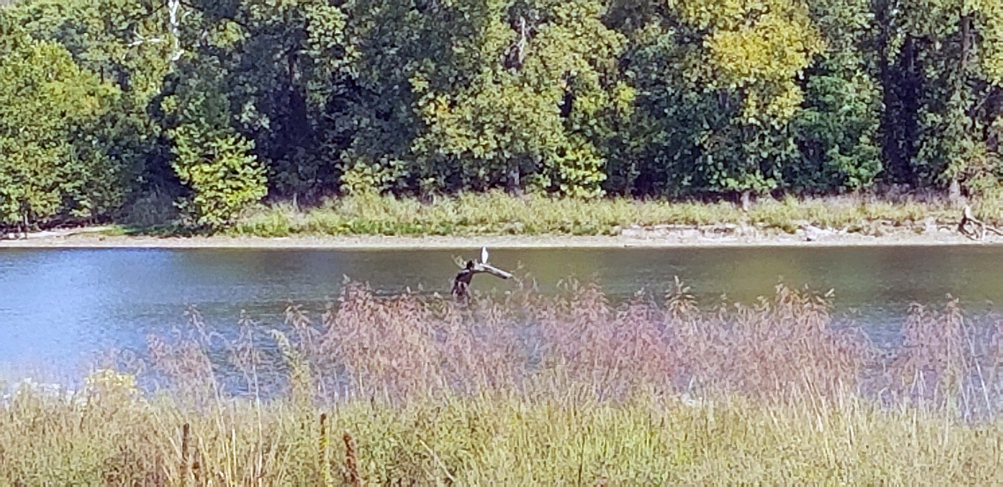
Creve Coeur Park is the largest park in St. Louis County and includes one of the largest natural lakes in Missouri. The lake is named–surprise!–Creve Coeur Lake. A large portion of the park is wetlands. (That sounds better than saying “A large portion of the park is swampland.”) The wetlands are used for conservation purposes, including the study of several kinds of waterfowl. We saw a large white waterfowl, but it was too far away to positively identify it. We think it was a crane. It’s sitting on the log sticking out of the water.

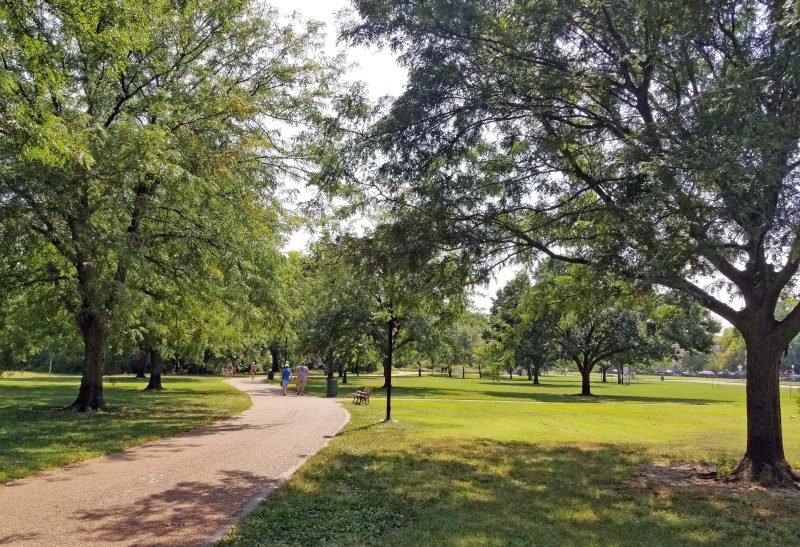
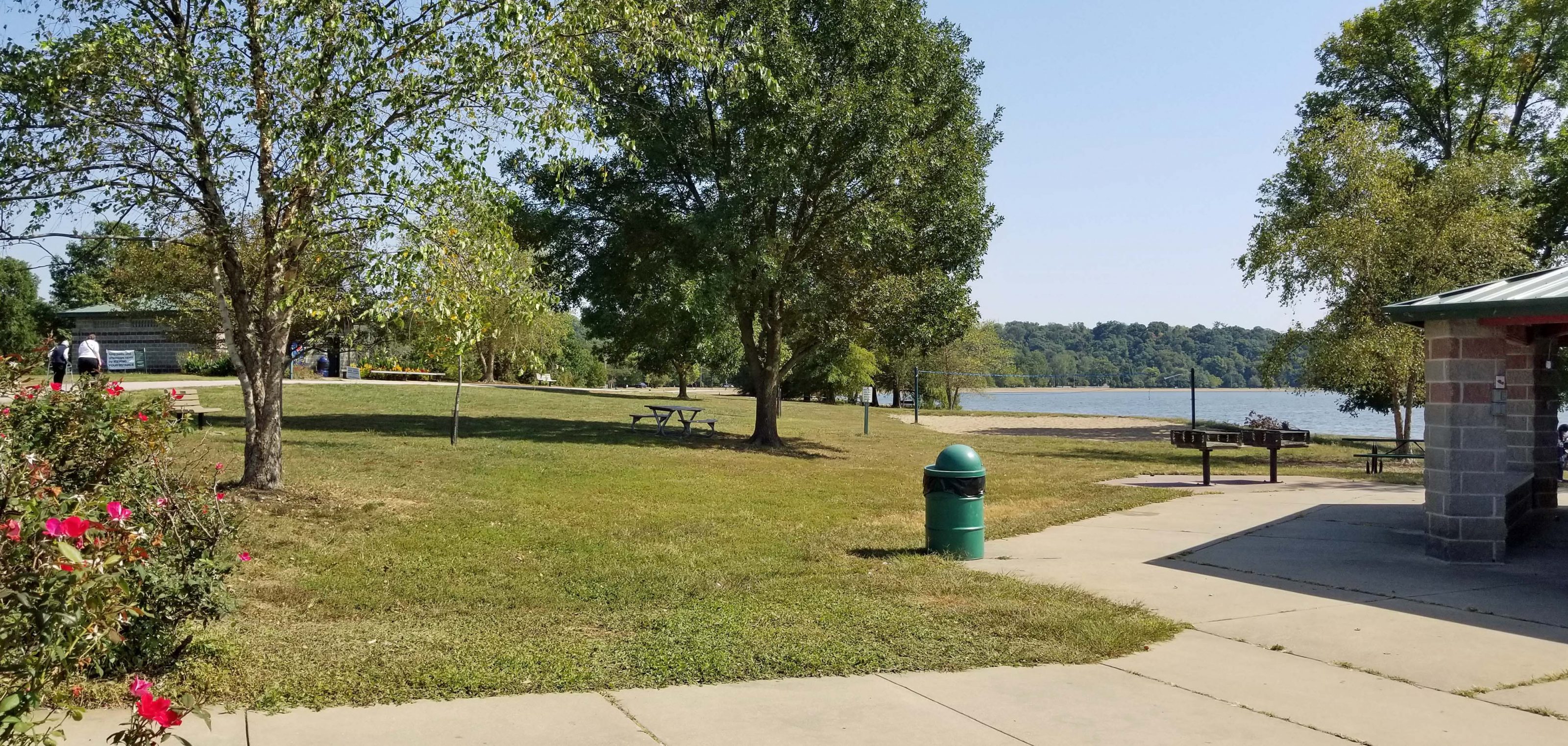
The park has a paved walking / biking trail, a playground, picnic pavilions, boat docks with canoe and kayak rentals, a sand beach (no swimming allowed), a variety of athletic fields (tennis, soccer, archery, and more), and a golf course. It is one of the most popular parks in the region and the Creve Coeur Park Trail is described as “heavily trafficked.” This is true. We did a lot of bobbing and weaving with our bikes and I felt like a stuck record when I kept passing walkers and saying, “On your left.”

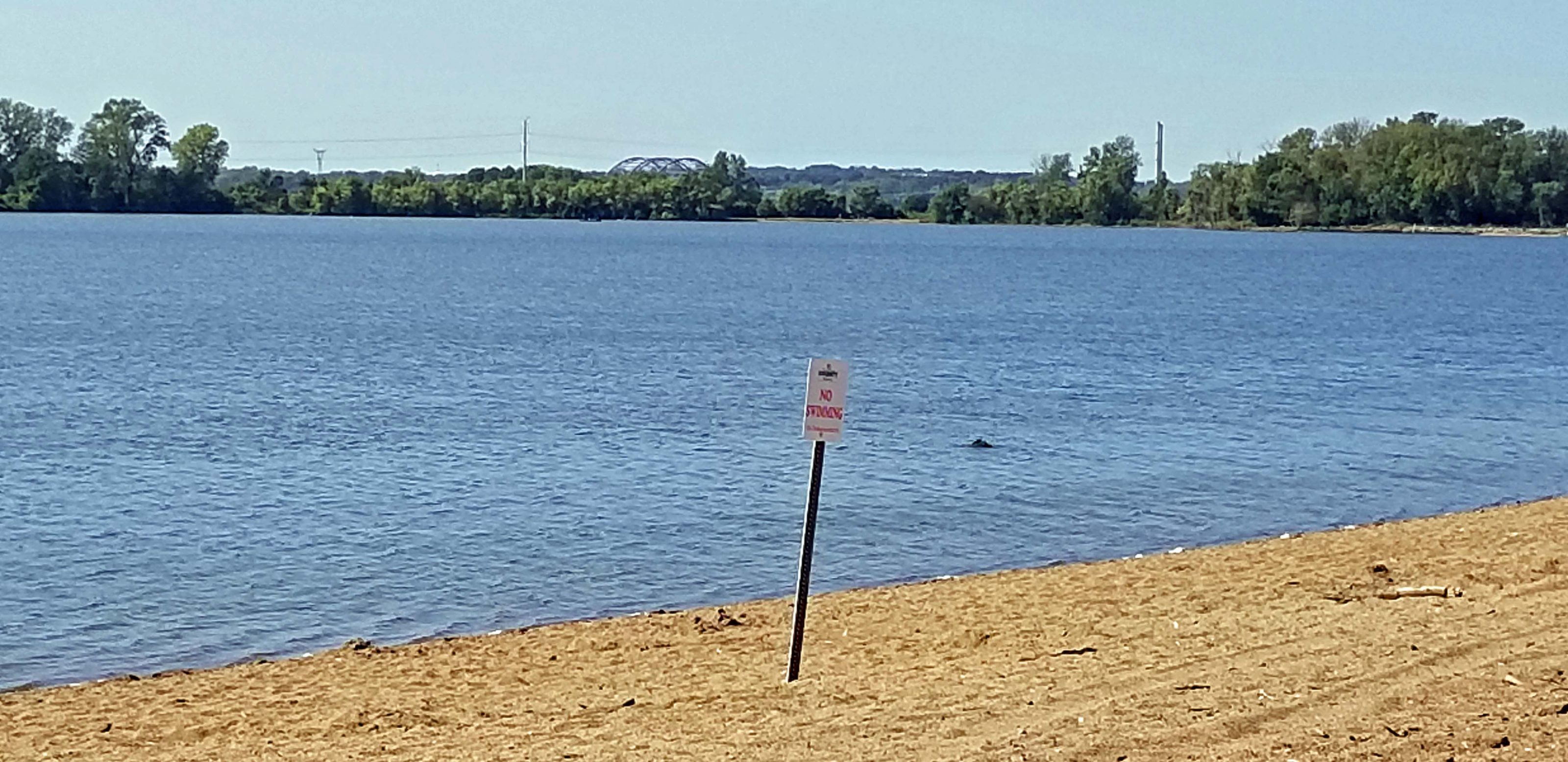
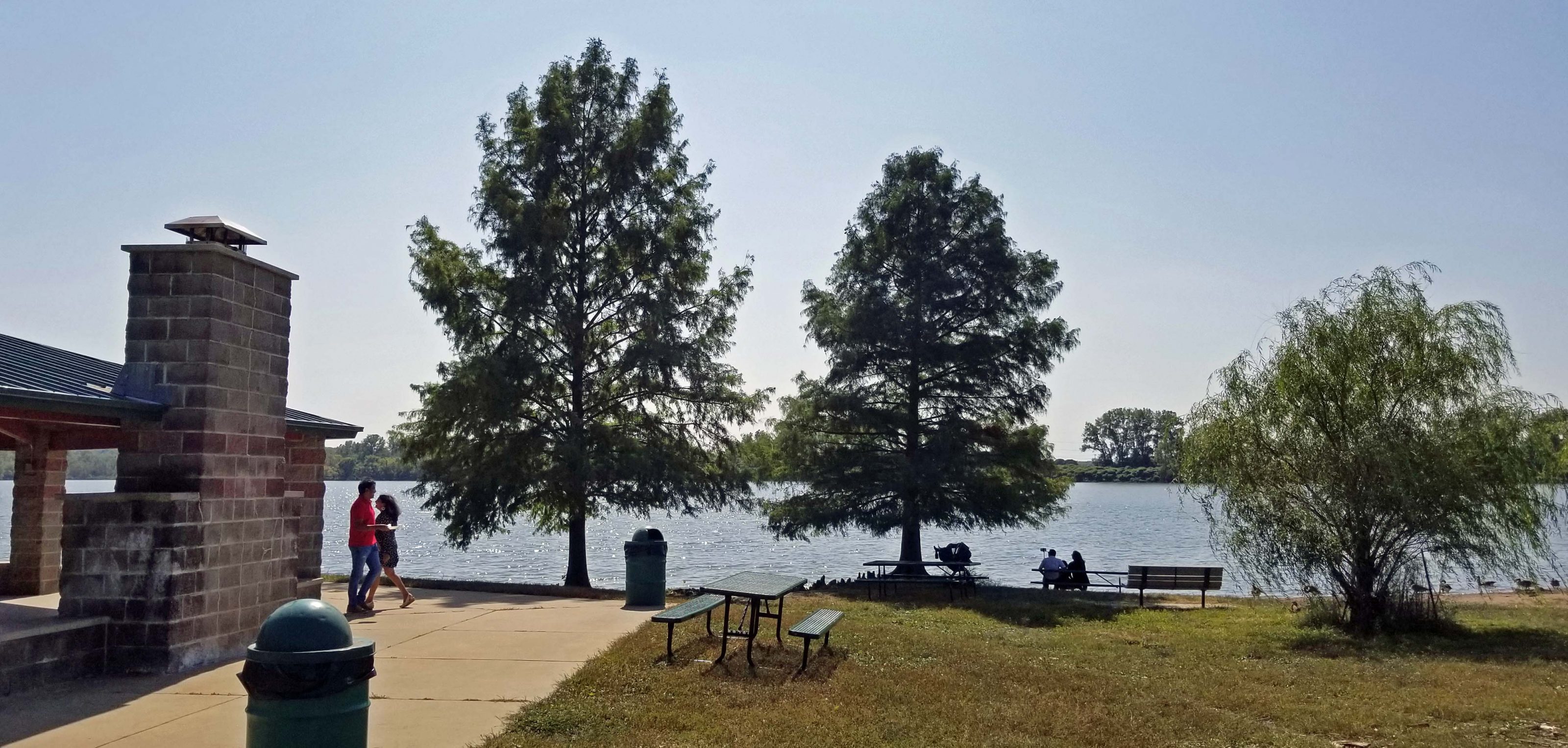
Here’s a view of the sand beach area (it’s called a beach, but swimming is prohibited) and the lake with the boat docks and rentals at the curve of the beach.

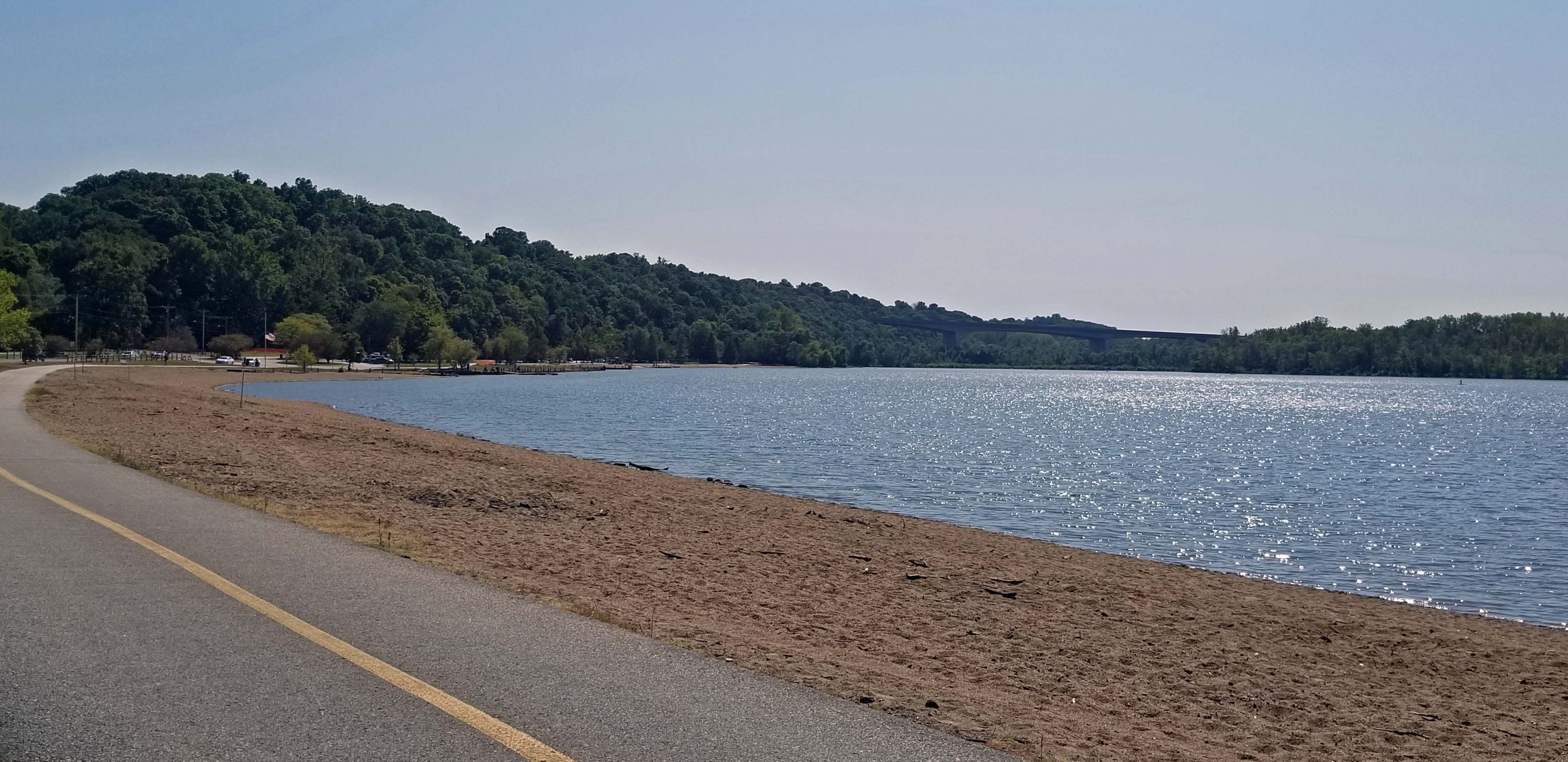
Looking in the opposite direction, you can see the Hwy 364 bridge we crossed in the distance (center) and the “no swimming” sign.

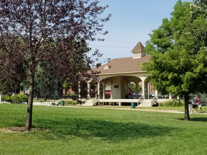
Picnic pavilions are scattered over this section of the park.

There are lots of park benches, so it’s easy to find a place to sit and look at the lake.

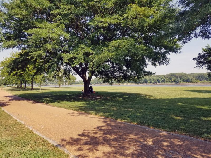
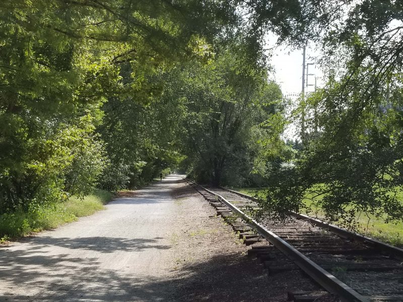
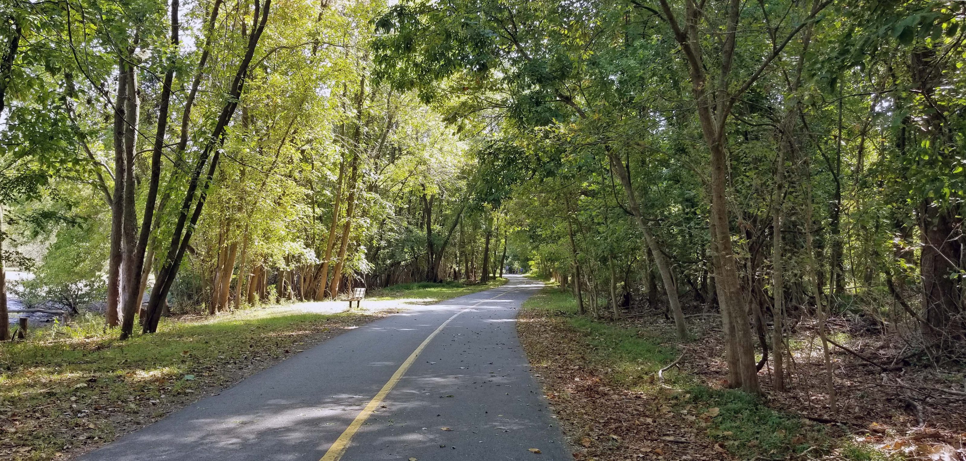
Except for the beach / picnic areas and the athletic fields, much of the trail that circles Creve Coeur Lake is wooded.

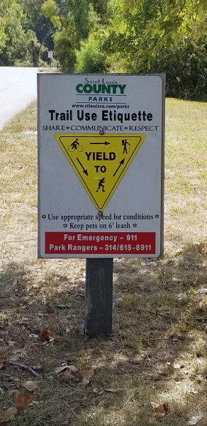
In case you don’t know, “Trail Use Etiquette” signs are posted along the trail.

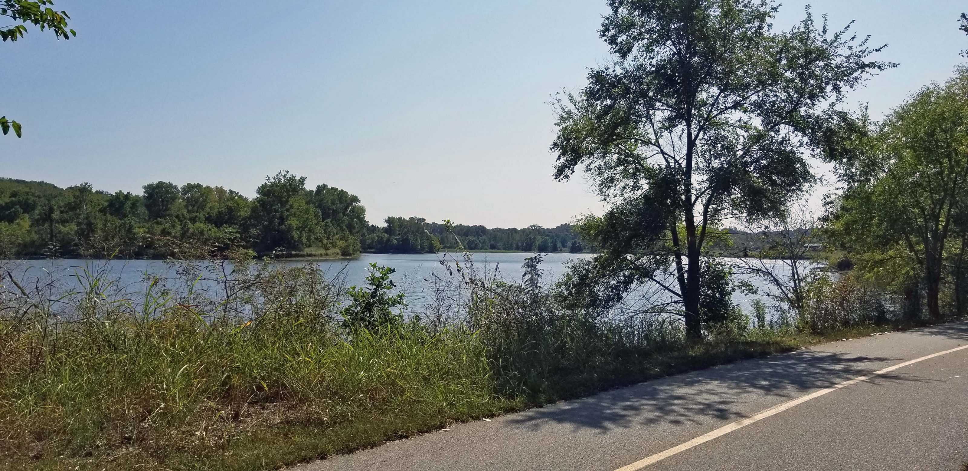
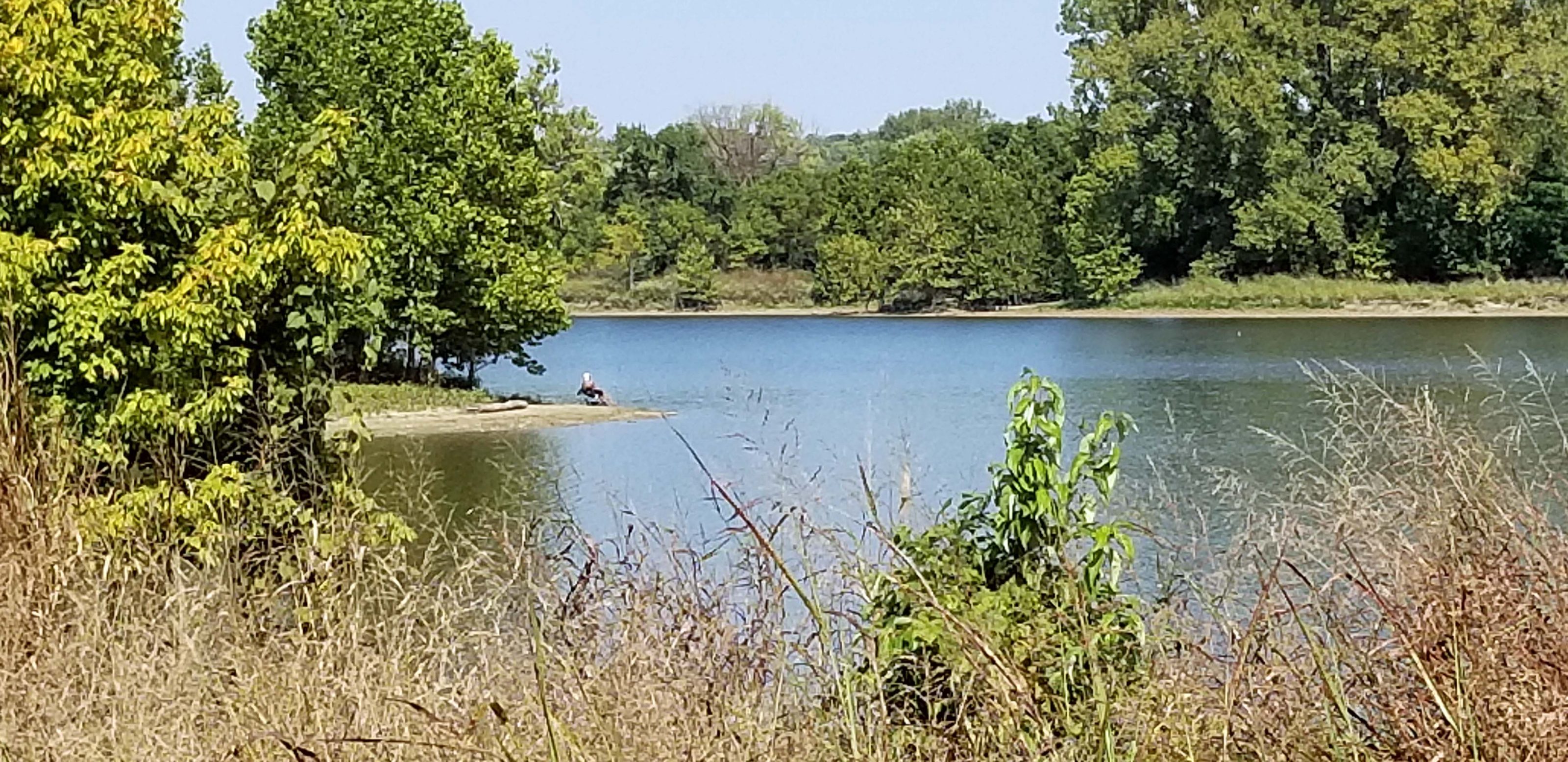
Mallard Lake is a smaller body of water adjacent to Creve Coeur Lake. When Creve Coeur Lake was dredged in 2003, Mallard Lake was added as a siltation lake to prevent the need for later dredging. I’m not sure what that means or how it works, but it sounds like a good idea. A trail circles Mallard Lake as well and it is far less crowded than the trail around Creve Coeur Lake. Here’s a view of Mallard Lake.

This lady brought a lawn chair and is enjoying the peace and quiet while she does some fishing in Mallard Lake.

When we finished circling both lakes, Ted and I headed back across the Missouri River to our car. We had a great 20+-mile ride and it was fun to cross the Missouri River via the bridge bike lane.

Next on the bike ride wish list: Cross the Missouri River via the bike lane on I-64 to bike the (rebuilt) Monarch-Chesterfield Levee Trail through the (formerly flooded) Chesterfield Valley.

I was scrolling through old photos for a project Ted and I are working on and found an interesting series of pictures. I don’t remember why, but one day in 1995, when Kathy, Thom, and Kari were all at home, we decided to take a picture of each of us with our cars. Maybe we were inspired by Jeff’s picture of his new car.

Ted had a 1987 Mazda RX-7. He was privileged to have the snazzy sports car. We loved driving it because it had a 49/51 weight distribution and was great on corners and curves. The stick shift added to the thrill. The car did not have a back seat–not even a mini back seat–so it had to be insured as a sports car, not a coupe. The curved back window on the hatch and the pop-up headlights were so cool!

I had a 1992 Toyota Camry that we bought when we needed space to get the kids and their stuff back and forth to college. That was before kids needed a U-Haul to tote all their college-bound stuff. The Camry had such a smooth ride, we used to get sleepy on long drives. We called it “the Camry effect.” My favorite feature was the moon roof.

Jeff bought a brand new 1995 Saturn when he graduated from college and got a full-time job with Hughes in Aurora, CO. This picture was taken in his Aurora apartment parking lot. He was excited that the purchase included a free car wash with every oil change. It was totaled when another driver pulled out in front of him, so he replaced it with another Saturn, which he drove for 13 years.

Kathy had (I think) a 1987 Toyota Tercel. I know it was a Tercel; I’m not sure of the model year. A deer hit her one time and left a minor dent on the hood. She taped a band-aid over it. She got amazing gas mileage (38 mpg?) with this car.

Thom also had (I think) a 1987 Toyota Tercel. Again, I’m not sure it was a 1987, but it was the same year and model as Kathy’s car in a different color. When he moved to Arizona, he packed it so full, that when he squeezed a can of Campbell’s tomato soup into the corner of the back window, there was no more empty space beyond the driver’s seat. I think Thom liked the car so much, he replaced it with another Tercel.

Kari got the cheapest car–a 1976 Chevy Impala with low mileage. Grandma Schroeder was no longer able to drive and Kari was her only grandchild (the youngest) who didn’t have a car of her own. Grandma generously gave her car to Kari as a gift. Grandpa Schroeder bought the car in 1976 because it was the last year Chevy was going to make such a big car. The 1977 Impala was about a foot shorter. This car had leg room beyond belief and a huge trunk! Kari drove the Impala for many years. When she finally gave it up, I think the car was probably looking forward to retirement.

Interesting note: Ted and I like driving a stick shift car and we always had one until 2011. Stick shifts have become hard to find and now require a special order. Technically, I can shift my 2011 car manually with the paddles on the steering wheel, but there’s no clutch and and it can’t choke, so that takes the fun out of shifting.

When we taught the kids to drive, we made them learn to drive both cars–the automatic shift and the stick shift. More than one of the kids was literally reduced to tears; all of them were frustrated and whined, “Nobody drives a stick shift. Why do I have to learn this?” Surprise! Jeff’s, Kathy’s, and Thom’s first cars all had a stick shift–by their own choice. I think Jeff and Thom still have stick shift cars. Grandma had an automatic shift. Sorry, Kari. At least your car was free.

Again, thank you, Aunt Ruth for scrounging the internet for humor to make us laugh. Aunt Ruth and I are both natural blondes, so we’re allowed to share dumb blonde jokes.

Ted’s and my bikes have a bluetooth app that allows us to follow our route on our cell phones. The app also collects data about the route, the elevation, the condition of our bikes, and lots more. A typical ride looks like this on the “My Ride” view:

The Katy Trail, however, is more linear. Yesterday’s Dutzow to Gore ride on the Katy looks like this:

The GPS on the app is pretty darn good. I zoomed the above map to show our turnaround point. The Katy has a ground limestone surface. Two paths (one in each direction) are harder packed from traffic than the center, so bikers avoid the looser gravel in the center. You can see two lines on our route–one on each side of the trail going in opposite directions. The place where the lines converge was a bridge (wooden planks, not gravel), where we tend to head for the middle.

Isn’t technology amazing?!

Today, Ted and I biked our next westward section of the Katy Trail and set a personal record: 42.87 miles round-trip. We started at Dutzow, where we ended on August 6, and headed for the Gore trailhead.

This part of the trail passes only two communities, so there are a lot of country scenes. There is also very little hiking / biking traffic on this part of the Katy so we had a pleasant, quiet, and mostly solitary ride today.

If you zoom in on the picture below, you can see black dots in the center. Those are Black Angus cattle, grazing between the trail and the road. We passed this point shortly after we started biking and, when we returned more than two hours later, I don’t think the cattle had moved. They were still grazing right where we left them. The same was true of a horse we saw standing at a fence beside the trail, still in the same place two hours later and still looking in the same direction.

Here’s a farmer harvesting his soybeans on a beautiful sunny day.

The next trailhead after Dutzow is Marthasville. It looks like a nice little village, but we had a distant goal, so we didn’t explore. We took a water break and moved on.

We passed the Caboose, a snack bar along the Katy. It doesn’t look derelict, but it does look deserted. Maybe closed for COVID this summer?

There are frequent over and under the road crossings on the Katy. Here’s an underpass that goes through the levee and beneath MO Hwy 47, as indicated by the sign on the right side of the underpass.

We’re still in the country. The corn is past its prime for human consumption, but the scene is pretty.

The Katy also passes over old railroad bridges. We rode across four of them on our route today.

The other community along this route is Treloar.

The information provided at the site was interesting to Ted and me. We learned that Treloar used to be called New Holstein. Ted grew up near New Holstein, WI. A year later, the town was renamed Treloar, after a man from Wisconsin.

The Katy Trail State Park is the longest state park and the longest rail trail in the nation. The trailhead depots all include a sign of pride.

Because the Katy Trail generally follows the Missouri River, we always have some pretty river views on our rides. Here’s what we saw from one of the railroad bridges we crossed. We haven’t had much rain lately, so the river is low.

Residents along the trail sometimes decorate for trail users. Today we saw pumpkins at a farm and a flowerbed surrounding one of the trail benches (no photo of that).

When I saw the sign for Lost Creek, my first thought was “We found it!” It flows under one of the railroad bridges into the Missouri River.

Ted and I picked Gore as our turn-back point today. It was 21+ miles from Dutzow, so we biked over 40 miles today–the farthest we’ve ever gone on a single ride. Our only regret was that we left some homemade cookies and apples in the car for a snack before heading home. We wished we had some cookies to eat at Gore.

If the weather holds, we’re hoping to make it another 20 miles west on the Katy this fall. That will take us about 15 miles past Hermann (McKittrick trailhead). Next year, we’re planning to pick up where we leave off this year and end our Katy Quest about 20 miles west of Columbia, MO. It’s a 90-minute drive to Columbia, and we don’t really want to drive farther than that for a bike ride. When the drive time exceeds the bike time, it’s time to do a multiple-day ride or find something closer to home.

“Where do you want to go today?” “I don’t know. I suppose the usual.”

After that in-depth planning session, Ted and I set off on our regular 15-16 mile bike ride that we call “the perimeter route.” We’ve biked this route at least twice weekly all summer, and it gets old. We take the outermost roads of 10 adjoining subdivisions, including ours, plus a few odd streets, just for the fun of it. The arrow points to our driveway, the starting point.

And yet, even on an old, familiar route, new things can happen. For example, one of the homeowners put out a cute display of rubber duckies. The big duck has a minion on its back.

Even better, we met someone. There’s a man along our route who waves at us every time we pass his house. He apparently sits on his front porch as often as we bike that route. The last time we saw him, I told Ted that if he’s outside the next time we ride by, I’m going to introduce myself and ask his name so we’ll both know whom we’re waving to.

The friendly man was outside working in his front yard this afternoon, so we stopped to introduce ourselves. He’s Floyd. Floyd Cline. Shocking! As soon as he said “Floyd” a little bell started going off in my head and when he added “Cline,” I recognized the house. He’s the father of Carrie Cline, one of Kathy’s best friends from her K-12 school years, and of Harvey Cline, who was in Kari’s grade. His response to us was “Are you the Schroeders? Do you still live on the corner in Park Charles?” Yes, and yes. We haven’t seen each other since Carrie and Kathy graduated from high school in 1991, so neither of us recognized the other. We spent some time chatting and catching up on what we and our kids are doing. Then Floyd went back to work in his yard and we continued on our bike ride.

Even when we ride the same old bike route, we have new adventures. The fun never ends.

I enjoyed listening to my favorite playlists on my iPod last April as I sewed face masks for Ted and myself. When I finished sewing, I cleaned up the project room and put everything away. Somewhere between the project room where I was listening to my iPod and the box in the kitchen where we keep our iPods and our device chargers, I lost my iPod.

It was unbelievable! Where could it go between (almost) literally, the top of the stairs and the bottom of the stairs???? Ted and I searched everywhere we could think of that he or I might have set it and then we searched in places that we were unlikely to set it. We looked under and behind furniture, in drawers, and in places I don’t remember throughout the house. No iPod.

When I went back to the project room to sew more masks for the family, I listened to music from Ted’s iPod. It was fine. The world kept turning. The sun kept shining. But it drove me crazy because I knew my iPod had to be somewhere in the house, and I couldn’t find it!

Tonight, I decided to change placemats for dinner because I’m tired of using the ones I’ve had out this week. I usually stack them on the shelf in pairs so I can grab two matching ones for Ted and me, but the blue ones I wanted were separated by several other place mats. I had to take the entire stack of placemats off the top shelf of the pantry so I could re-arrange them in pairs. When I got down to the blue one I wanted, I found my iPod! The battery was dead, but it’s rechargeable.

I was pretty excited about finding my iPod, but now it’s driving me crazy how, on its way from the project room to the charger box, it got stuck between the place mats on the top shelf of the pantry. 2020 is a weird year in so many ways!

Since we’re biking so much this year, Ted and I decided we should set a goal to ride all of the Katy Trail from its beginning to some point westward. We couldn’t ride the last two miles to the beginning of the trail due to trail repair, but we’ve now gone 44 miles from that point westward–and back, of course, for 44 more miles because there is no shuttle service to return us to our car. The entire trail (Machens where the trail is being repaired to Clinton near Kansas City) is 238 miles. There’s an organized 5-day summer bike ride from Clinton to St. Charles every year. Except this year, of course.

Today’s Katy ride was a fill-in to cover the 15 miles between the Busch Greenway and the St. Charles trailheads that Ted and I had not biked. It was another route with variety: river views, limestone river bluffs, farmland, subdivisions, and the big city of St. Charles.

We entered the Katy at the Busch Greenway trailhead and headed east. The first iconic trailhead depot we saw was Greens Bottom Road. I’ve always thought Greens Bottom was an interesting name. A shorter trail leaves the Katy at this point and goes to Greens Bottom Lake. We’ll try that route on another day. This depot is located on a very long, shade-free stretch of the Katy. It was hot today (mid-90s), so Ted and I were glad to get back into the shade of the river bluffs and the trees.

Suddenly, the views became citified. Here’s the St. Charles Family Arena where Ted and I saw performances by B.B. King and Frankie Valli.

It was fun to zip through this little tunnel / underpass. The trail must be more level along this 15-mile stretch than others we’ve biked because our average speed at the end of the ride was 15+ mph and it’s usually closer to 13+. We really moved along today. As Kari once pointed out, the Katy is a fairly easy ride, but you never stop pedaling. There are no steep hills to climb–and, therefore, none to coast down.

Here we are at the entrance to Frontier Park in St. Charles. It’s the Lewis and Clark (and dog) statue.

I’m glad we decided to bike from the Busch Greenway to St. Charles instead of going in the other direction. Frontier Park was a nice place to rest for a little while before we turned around for the second half of our ride. We enjoyed the shade and the peacefulness of the park and the Missouri River view. At the Busch trailhead, there’s nothing but a single park bench alongside the trail.

The river is low because the rain turned off about three weeks ago. After record rainfall all year, the weather has been very dry. The rivers were unusually high all summer until recently. Look at the opposite bank in the photo below. You can see a large log the river deposited at the top of the bank (center), as well as the grooves cut into the bank delineating the recent dropping of the water level to where it is now.

We biked the entire length of Frontier Park to the bandstand, our past starting point for our incompleted ride to the beginning of the trail at Machens. (Two miles to go after that section is re-opened.)

The river is low enough for the breakwaters to be visible. Some people are taking advantage of that to do some fishing.

We turned around and headed back through the park for our return trip.

Here’s the St. Charles trailhead marker for this entrance to the Katy Trail.

Just outside of Frontier Park, it’s a pretty ride between the trees on the riverbank and the original railroad tracks.

We biked past the Creve Couer trailhead that goes up to MO Hwy 364, which crosses the Missouri River. There’s a bike lane on the outside of the bridge that connects the Katy Trail to the Centennial Greenway in St. Louis County. That’s a greenway Ted and I want to ride–hopefully, sometime this fall.

There’s a similar bridge / bike crossing at the I-64 bridge that connects the Katy trail with the Monarch Levee trail in St. Louis County, another place Ted and I want to bike this fall. The Monarch Levee was the most severe of the levee failures during the Great Flood of 1993. That levee failure put the Chesterfield Valley under 20+ feet of water. Some damage to trees is still visible.

Yup. My bike looks like I rode it thirty miles on the Katy Trail. I have a clean-up job on my agenda.

But before we clean the bikes (lower right corner of the photo), Ted and I need to cool off in the pool. It was another great bike ride.

My readers know that Ted and I have been doing a lot of biking this year. We like biking on the greenways and on the bike trails, but most of the time we bike around our neighborhood. People along our most frequent route recognize us and one guy calls us his “neighborhood bikers.” It’s easy to put on 10-20 miles without crossing a major secondary road or a highway, but some variety would be fun. Kari and Dylan agreed, so we decided to bike each other’s routes for a change of scenery.

Last week, I went biking with Dylan. It was nice to ride through McNair Park, go into downtown St. Charles, and ride along the Missouri River instead of seeing the same old, same old on my usual rides. His route has a lot of hills. The original name of St. Charles wasn’t Les Petite Côtes (The Little Hills) for nothing.

In exchange, Kari and Dylan came over to check out our route. It, too, has a lot of hills. That’s why Ted and I like our ebikes so much. Although our route has a limited variety of scenery, it goes through ten subdivisions circling ours and includes a Sikh Temple.

We all agreed that the change of route and scenery was fun. Kari has biked the Dardenne Greenway with us, and she suggested we ride there next time. Dylan hasn’t been on that greenway yet and we all think he’d enjoy it. Until then, here are the happy biking buddies. Notice that Dylan is now taller than I am. That leaves only Teddy and Sefton still shorter than their grandma.

This sad story begins on July 29, 2020–the day I took the picture below.

Ted and I noticed lots of leaves dropping from our sugar maple tree in July. When we looked up, we saw that the leaves on some of the branches were turning brown–not something we expected during mid-summer, especially with all the rain we’ve had this year. If you look closely at the picture above, you’ll see some of the leaves turning brown. I took a picture of the tree right away so I’d have a good memory of it before it got worse. So many leaves dropped so quickly (below), Ted had to rake the lawn before mowing it.

We called Russ, an arborist, who diagnosed the tree as fatally ill with a wilt disease and probably some weaknesses resulting from storm damage (ice, wind) several times over the years. While he was talking with us, leaves fell like large brown snowflakes. Russ said he’d never seen a tree deteriorate that fast. Because of all the tree removals he had already scheduled, Russ’s company couldn’t come until yesterday. I guess it isn’t my imagination that wherever I go this year, someone seems to be taking down mature trees.

The tree removal crew showed up right after 6:30 a.m. and got to work. They powered up the cherry-picker and Doug climbed in, took it up, and fastened pulleys in upper branches of the tree. Then he strung rope through the pulleys for the guys below to pull, guiding the branches safely down. (See the guy in the center of the picture.) Sometimes the guy pulling the rope would walk it around the tree’s trunk to wind it tighter and keep it from slipping when a large branch fell. Compare how the tree looks to only 35 days ago in the first picture.

Notice what a pretty color the leaves have turned (below). I called the arborist two days ago to ask if there’s a chance the tree will live because it’s so nicely colored. Unfortunately, he said, that’s a definite sign it’s dying because the other maples in the area are not even beginning to show fall colors. As cut branches fell, the dead leaves created colorful showers.

When the branches from the driveway side of the tree were stripped, one of the guys re-wound the rope in the rope-holder bucket. I wondered why he was doing that. Didn’t they need to use the rope to safely bring down the branches on the other two-thirds of the tree? They picked up some of the larger branches and laid them out as shown below. Ted suggested that maybe they were going to build a little fort. Instead, they sat on the branches and had a smoke break.

When Doug moved the traffic cones to block the street in front of the tree and then cut out a wedge at the base of the tree on the street side, the light dawned on me: they were planning to drop the rest of the tree across the street. They only cut off the other branches to avoid damage to our driveway and other plantings. Notice the split down the trunk where the tree twisted from wind storms and from the weight of ice storms over the years. In the picture below, Doug’s chainsaw is nearly all the way through the base of the trunk. Going . . . going . . . going . . .

Timberrrrrrrr!!!!

And it’s over. The log “fort” was a bridge to cushion the blow of the tree hitting the ground. I have to admit that I got a little bit choked up when the tree fell. This was one of the first of three trees we planted in our yard in 1980. At one point, for some unremembered reason, we talked about removing it, but Jeff pleaded with us to keep it because it was his favorite tree. Doug estimated the height of the tree at 50-55 feet. So sad.

The tree also landed right on the wedge Doug cut. He told me that was unintentional.

The guys got to work, cutting the fallen tree into manageable pieces, then hauling them to the mulcher. Doug, on the left, is the senior member of the team; the guy on the right is the junior member. He wasn’t allowed to use a chainsaw and was limited to picking up branches, feeding them into the mulcher, re-winding the rope, raking leaves, etc. The guy in the middle helped with everything except getting into the cherry picker bucket.

Things were going well until they weren’t. Doug smelled diesel fuel and found a leak in the pump line. The guys shut down the mulcher and had a little conference. Turning off the motor stopped the leak. It also stopped the work. The crew quickly covered the leaked fuel with sawdust and leaves to absorb it. The two junior members of the crew took the mulcher back to home base to exchange it for a working model. That took about 90 minutes. Doug had to stay with the tree because it was still blocking the road and wasn’t completely cleaned up. (Safety and liability, I assume.) You can see the pile of leaves and sawdust in the road. It looks inert, but it’s busily absorbing diesel fuel.

Break time while we wait for a different mulcher.

Our lilac tree also died this year and Ted recently uprooted it. I asked Doug if he’d mind running the lilac tree through his mulcher. He told us to bring it out. It looks so small compared to the sugar maple.

While waiting for the replacement mulcher, Doug got to work on the magnolia tree. Because it grew in the shadow of the sugar maple, the side next to the sugar maple didn’t fill out as well as the side next to the driveway. Doug evened it out. He took the cherry picker up for a bird’s eye view of the tree’s shape and then he went to work.

The tree is smaller now and Doug said it won’t bloom next year, but it should grow faster and more evenly since it now stands alone.

The clean-up work resumed when the guys came back with a working mulcher. They totally cleaned up our lawn and the street and even went across the street to clean up Jim’s lawn and driveway where a lot of leaves had fallen.

When they left, this is all we had of the tree. They told us the crew with the forklift would probably arrive later today, and definitely this week. They were here in less than 30 minutes.

The tree company has a good thing going. Their trucks advertise that they also sell firewood and mulch. They charged us to take down the tree, then they took away a truckload of mulch from shredding all the branches, and now they’re taking away big logs that will make firewood for them to sell. It’s kind of a commercial version of The Giving Tree. Hopefully, this contributes to reducing the cost of tree removal.

Here goes some of the firewood-to-be on the forklift. Up on the fork, then down into the truck.

The guys cut the stump lower for grinding (stump grinder approaching from the left) and that’s when I saw what an interesting shape the tree trunk had.

The stump grinder guy needs lots of patience. The equipment moves very slowly into position. The blade is speedy, but he has to move it slowly over the upper edge of the trunk, then slowly back, then drop it a bit, and then repeat–over and over until he gets all the way through the stump. It took him about 30 minutes to grind our stump. It looked like a boring, but dangerous job. When he finished, he very slowly directed the machine back to his truck.

The forklift returned to the scene of the damage to pick up the piles of mulch created by the stump grinder. From the stump, into the truck, and then for sale as mulch.

The guys raked everything smooth before they left. You can see our neighbor, Jim, watching the fun from his garage.

When the yard, the street, and the neighbors’ yards were clean, the crews left this for us.

Here’s our new look.

While the tree crews were working, Ted and I were sitting in the driveway watching them. Neighbors and strangers stopped to tell us how sorry they were to see this tree go. Several mentioned what a beautiful tree it was and how much they’ve enjoyed it every fall. One lady even said she always thought the fall colors of the tree perfectly complemented our house. After 40 years of watching our sugar maple grow and turn color, we’ll never see it again. I’m glad I took this October picture last year.

Yesterday was Sky’s birthday. He invited us to join him and the family for dinner and the evening. What do you buy a 17-year-old boy? Sky sent us a list of things he likes and–surprise!–that’s what we bought for him.

We had a delicious dinner followed by birthday cake made and frosted by Sky and June. Kari cut a piece of cake to hold the candles so that when Sky blew them out and possibly spread germs and spit on the cake, the rest of us would be COVID-safe. She couldn’t get all the candles on one piece, so she had to cut another.

The closely-spaced candles created quite a blaze of light. The spacing also made it easy to blow them all out on the first try. When Sky took the candles out to eat the cake, it looked like it was perforated to break into small pieces.

The evening included a tour of Sky’s room and his presentation of the new computer he received for his birthday. He says a full PC set-up will make his online school work easier to do than a Chromebook or a laptop. There’s a definite theme to his room. Check out the background picture on the PC monitor and items on the shelves. Sky explained that the bed is messy because the table on which he keeps all those items was pressed into service for dinner.

We finished the evening with two rounds of “Between Two Castles,” a board game of Dylan’s in which players help design castles for Mad King Ludwig. It was fun and easy to learn.

Here’s our almost-all-grown-up grandson. Happy birthday, Sky.

I was looking for a photo and found this while I browsed. It’s from Christmas 2003 and I think all that green stuff was from Kathy and Annette. Go Pack!