My favorite radio personality on Sirius XM radio is Phlash Phelps.  He’s been everywhere in the U.S., although he admits he’s still “missing” sixteen parishes in Louisiana.  He plans to visit them within the year.  Last year, he visited all 50 states because it was his 50th birthday year.

People call in to the show and say, “Hi, Phlash!  I’m calling from Themiddleofnowhere.”  Phlash will respond with something like, “That’s right near Youneverheardofthisplace and they’ve got a 50-foot tall sculpture of a salt shaker made out of stainless steel margarita glasses in the town square.”  Of course, this is a little bit of hyperbole but, seriously, he knows something about every two-bit town the people call from–and it’s always something interesting.  I know there’s probably a few-second delay on the phone call being broadcast to prevent trouble with the FCC, but it doesn’t sound like Phlash takes time to look up the city and its attractions before airing the conversation.  Sometimes I’ve googled the attractions he talks about because I think Ted and I might like to see them.  Every one I’ve googled has been real.

Unfortunately, Phlash messed up yesterday.  The caller was from Duluth, MN and Phlash immediately asked if the caller was planning to drive U.S. 61.  Phlash mentioned that the highway begins in Duluth and has some spectacular views of Lake Ontario.  Oops!  Duluth is on Lake Superior.  It’s the first time I’ve been tempted to call in to a radio show, but I got out of the car and had lunch with my friend instead.


Tonight’s TV news included a report about Puerto Rico in the aftermath of hurricane Maria.  Mr. Dumbclutz told us that about half the population of the island is without “pot”-able water.  Uggghhh!  Wouldn’t you think that if the word was unfamiliar to him, he might have looked it up or asked a friend how to pronounce it?  Maybe he should watch Jeopardy! more often.  The show often has a category titled “Potent Potables”–pronounced poh’-tent poh’-tah-bulls, not paht-ent paht’-ah-bulls.

Ted and I just finished updating our master bathroom and our powder room.  Except for the paint color, they don’t look much different because we chose the same materials and colors, but we added new sinktops; new sink faucets; a new 35 x 60-inch mirror over the master sink; a new shower stall with a low-entry base; new shower doors; different, more useful built-in shelving/storage in the shower; and a higher shower seat (the last crew set it at 14 inches–way too low).  The different paint color required new towels and throw rugs and different pictures on the walls, so the rooms look different to us, if not to everyone else.

The contractor told us to paint before the crew arrived.  Then they could simply finish with touch-up painting and we wouldn’t have to paint around the new things.

Master painter at work.


While the crew was working, we moved to our upstairs “apartment” to be out of their way.

We had a large bedroom, . . .

. . . a full bathroom, . . .

. . . and even a sitting room with lots of books to read.


The construction mess wasn’t too bad.  The two-man crew covered all the floors, beginning at the outside door, and they also brought in an air cleaner to pull construction dust out of the air.

The powder room didn’t need much work–only a new sinktop and faucet.

The master bath was a bigger mess.  The crew needed to rip out the shower stall. . .

. . . and the sinktop.  The blue thing is the air cleaner.


We like the results.  Now everything looks fresh.

The master bathroom before. . .


. . . and after.


The powder room before. . .

. . . and after.

Imagine my surprise when I turned on my PC after returning from our vacation and it kept freezing on me.  It worked fine before we left!  I worked with it through two days, trying to figure out why it was performing in what I called a “freeze and thaw” cycle.  It didn’t act like a virus, so I wondered if my motherboard was going bad.  The PC is nearly seven years old, and I’ve already replaced the network card, so I called my tech wizard, Jeff.  His diagnosis was the same.  We agreed that for not that much more than the price of the motherboard, I could have a new computer and avoid going down the path of replacing one part at a time.

I hadn’t planned to spend my weekend installing and loading a new computer, but sometimes you have to pull on your Big Girl Panties and do the crummy job.  The set-up and loading went smoothly; it just took awhile to get everything loaded, the backup data transferred, and everything personalized.

The new tower is about one-third smaller than the old one and has 4 TB of storage.  That should be sufficient.  I went for a 27-inch monitor with a curved screen and it really is easier to see the entire screen when it curves.  I love it!

Best of all, everything worked the first time.  Snaps for me.  (cf “Legally Blonde 2”)

Now that we’re home from our Midwest Adventure Trip, it’s time for Ted and me to start thinking about our October/November trip to the Southwest.  We plan to visit several national parks, and want to hike park trails whenever possible.  We’ve noticed in the past that going up and down mountain trails always makes our legs hurt because we’re more used to walking in our suburban neighborhood.  We wondered if trekking poles would help take some of the strain off our legs.  We went to our family outfitter, REI (Thom and Katie both work for REI), got some expert advice, and purchased trekking poles.


It will be about three or four weeks before we find out if the trekking poles alleviate some of our leg strain.  Meanwhile, we’re practicing for the mountain hikes by walking up the steepest hill in our subdivision–the road beside our house.

Last week, Kathy and I met in Columbia for a girls’ day out.  We like to do that whenever we can make it work with both of our schedules.  It’s about a 1.5-hour drive for each of us and we get to spend an entire day together.  We always have a good time and have never yet run out of things to talk about.  We’ve got the routine down:

(1)  Meet around 10:30 a.m. in Columbia at the intersection of I-70 (my road) and US 63 (her road) where there’s a big Bob Evans/Steak ‘n’ Shake parking lot.  We leave one of our cars in the parking lot for the day.

(2)  Eat lunch or breakfast, whichever seems right.

(3)  Browse through the downtown stores in Columbia.  Sometimes we actually purchase something, but most of the time, we just look at things.  This time, our browsing led us to an interesting T-shirt.  (We didn’t buy it.)

(4)  After purchasing some hand-dipped gourmet chocolates at the Candy Factory downtown, go to the Columbia Mall food court for a beverage to accompany the chocolates and a few hours of talking.

(5)  Select a restaurant for dinner and a few more hours of talking.

(6)  Return to the car in the Bob Evans/Steak ‘n’ Shake parking lot around 9:30 p.m. and leave for our respective homes.

One of our favorite dinner spots is Shakespeare’s Pizza, a family-owned pizza parlor.  Shakespeare’s is always busy, and recently expanded into a huge space.  That was our choice for this girls’ day out.

While standing in line to order our pizza, we had time to read the “Pool Rules.”

The yellow brick road is present in all of the 6 dining rooms and leads patrons to the rest rooms.  When it’s necessary, just follow the yellow brick road.

We ate in the first dining room this time, but I think it might be the noisiest.  You can see that Shakespeare’s is a happening place.

After another great day together, it’s time to head home.  The time always goes too fast for us.

In one of my MAT (Midwest Adventure Trip) posts, I questioned why there were hay bales in the ditches in the Dakotas.  Mutzie, my sister-in-law, must have read my blog right after I posted that, and she clarified the question for me.  To quote her:

Yes, in the prairie states the hay in the ditches is harvested.  I don’t know if the state charges for the right to do that or not.  Those hay bales don’t come cheap.

Thanks, Mutzie.  I try to learn something every day, so I’m good for today.

I had surgery to correct three hammer toes on my right foot in March 2016.  Although the swelling went down, shoes are often a little too tight on my right foot, so I decided to have Aaron, the shoe repair man, stretch the toe boxes of several right shoes a little wider.  I was surprised to see that Aaron has a new lamp in his shop window.  It’s wearing a right shoe.

Anyone who watched TV during Irma’s attack on Florida and the Florida Keys saw a lot of stupid weathermen standing outside in unsafe high winds to make their reports.  Even social media lit up with criticisms of this behavior, asking the weathermen to practice safety when reporting on storms like Irma.  Shortly after Irma left the country, I found this cartoon.

We arrived in Longmont and were happy to see Jeff, La, Kyra, and Zaque.  Kyra will be leaving on September 13 for her 18-month mission in Bakersfield, CA.  To celebrate, Jeff and La took all of us to Kyra’s favorite restaurant, Benihana, for a farewell dinner.  Jeff has told us many times how much they like this restaurant, so Ted and I were eager to see what it’s like.  (Remember the trail mix lunch in Cheyenne?  We were ready for dinner.)

There were six of us, and Benihana seats tables of eight, so two other people were seated with us.  The six of us ordered the filet mignon; the other two people ordered salmon.  I mention this because you can tell which food is going where in the pictures below.  If there are only two of an item, that’s what the other people ordered.  Everyone gets many of the same side dishes, so there are eight of some things.

The first course (vegetables) included the onion volcano.  I’ve got to try this at home!

This man had sharper knives than I’ve ever seen.  He has to cut the food to chopstick size and his knives slid right through everything, from the zucchini to the steak.  Here he’s stirring the chicken cubes he cut.

And now, the main course–our steaks.  It was so much fun to watch him cook and to smell everything, then have it served piping hot.


On Saturday, none of us wanted to do much of anything, so we relaxed at home.  I found an interesting lamp in the room where Ted and I sleep and asked La about it.  She said her mother made it for her.

La’s doll lamp.

Look what La’s mom used for the lamp base: a weighted Clorox bottle.  You never know what women put on under their clothes to look good.


Sunday was church day and it was special because it was Kyra’s last Sunday and she was scheduled to give a 20-minute talk to the congregation about her upcoming mission.  She had worked on the speech a lot before we arrived and she also spent several hours Friday night and Saturday polishing it and timing it so it would be just right.  The speaker ahead of her went over his allotted time, but Kyra was told to use her full twenty minutes anyway.  Her talk was excellent.  She has a gift for personalizing what she says and it’s always interesting to hear the personal side of people’s stories.  Church worked up an appetite, though, so when we got home, it was time for a snack.


At 4:00, we headed back to church for Kyra’s setting apart service.  This rite set her apart as a missionary and she will have to follow missionary rules from this point forward.  Only family and close friends attend the setting apart, and Ted and I were honored to be present.  I asked Jeff ahead of time if this was a photo op celebration or if it was reverent and without pictures.  He said “reverent” (no surprise to me), but I brought my phone along anyway.  After the prayers and congratulations, the man who conducted the service (I don’t remember his title) smiled at all of us and asked, “Does anyone want a commemorative photo?”  I produced my phone and he took a group picture of us.


Knowing what a busy and important day this would be, La had a beef roast in the crockpot.  Combined with fresh seasonal corn on the cob, we had a delicious dinner and then sat around talking and playing games.

Sheephead has become a favorite of Zaque’s and Kyra’s.  They must have some Wisconsin blood in them.


At one point, we found ourselves talking about rewards and punishments parents use with their children.  Jeff’s family started talking about the “bucks” the kids used to get for good behavior that could be redeemed for privileges.  Naturally, that required digging out some souvenir bucks.

Zaque tried to duplicate the expression on his childhood 10-buck.

Kyra’s grown-up smile is the same as her little girl smile.

Alex is still in Peru, but we included his bucks in our discussion.  When she was little, Kari would have called these recollections “rememories.”  I’ve always liked that word.


Much too soon, it was bedtime and our time together was over.  Ted and I plan to leave at 5:30 am; Jeff and Zaque will be going to seminary at 6:00 am; and Kyra’s missionary rules say she should get up at 6:30 am.  It looks like only La can sleep in tomorrow morning.  We said good-night and good-bye to each other before going to bed.  Jeff was up and dressed when Ted and I were ready to leave, so he wished us a safe trip and we were on our way.  This MAT was one of our best trips ever.  (But we say that after every trip.)

The sun rose as we drove eastward from Denver.

Our next destination is dinner tonight in Longmont, CO with Jeff’s family.  We had several activities planned for this afternoon in Cheyenne, but when we learned we could cover a lot more in a 90-minute trolley tour, we opted to do that instead.  Unfortunately, the trolley was scheduled to leave ten minutes after we found out about it.  That meant we didn’t have time for lunch, so we bought some trail mix at the depot gift shop and looked forward to dinner with Jeff’s family.

Wyoming is very proud of its women.  (Yes!)  It was the first state to give women the vote and there are tributes to women in many places throughout the city–enough to be noticeable.  Below are some of the highlights of our trolley tour, including another sculpture of another woman.

The State Capitol and the depot face each other from opposite ends of Capitol Avenue.  The Capitol building is being renovated, so only a small portion of it is visible for photographs.

The governor’s mansion is also being renovated, but less extensively than the State Capitol.

The city has a boot theme, so there are decorated cowboy boots scattered around the downtown area.

Bob Dylan has fans in Cheyenne.

A sculpture of another strong woman.  This one is titled “No Turning Back.”


The picture below shows a sculpture of Lane Frost, a rodeo rider.  According to his mother, Frost seemed interested in rodeo when he was only five months old.  He won many rodeo championships on the Professional Rodeo Cowboys Association (PRCA) circuit.  In 1987, Frost rode Red Rock, the Bucking Bull of the Year.  Red Rock had unseated 309 riders before Frost rode him successfully four out of seven times.  In 1989, Frost’s dream of riding in the Cheyenne Frontier Days came true, but it was his last ride.  After a 91-point ride, he was hit in the back by the horns of another bull and died of internal injuries and broken ribs.

Lane Frost on Red Rock


The tour guide told us an interesting story about four Wyoming women.  A wealthy man in Cheyenne had four daughters and wanted them to live close to home after they married.  To achieve this end, he built four identical houses–one for each daughter and her family–next door to his own house.  As parents learn, children find their own ways.  All four girls married wealthy ranchers and moved away from Cheyenne.

These look like nice houses, but seriously, who wants to live next door to Mom and Dad after they get married?


The tour was interesting and we enjoyed Cheyenne, but it was time to leave to see our children and grandchildren, and then go home.  The MAT is nearing its end.

Our Cheyenne motel was named “Little America.”  We had never heard of Little America, but Ted arranged all of our hotels and thought it looked like a good place to stay.  We followed the GPS instructions and found it.  My first thought was, “Oh no!  Motel 6 would be a giant leap upward!”  I didn’t say anything because I didn’t want to hurt Ted’s feelings, but the only things visible at the driveway with the Little America sign were dozens of semi-trailer trucks and a Sinclair gas station.  I assumed the hotel was behind the gas station and was a haven for the truckers.  In fact, Little America was far behind the gas station and is classified as a four-star hotel / resort.  Whew!  Ted chose very well.

We unpacked and asked the concierge to recommend a nice Italian restaurant.  She recommended Losteria Mondello, a family-owned restaurant with a pizza carry-out section in front and dining rooms in the back.  We were surprised to be the only diners at 7:00 pm.  The waitress told us they were really busy in the pizza area until 6:00, when people left to go home and watch first NFL game of the season on TV.

Our dinner was excellent and, being the only diners, so was the service.  When our salads arrived, a man who’d been sitting at a nearby table with a laptop (and whom we assumed was the owner) came over to our table and informed us that he sings in the dining room on Thursdays, Fridays, and Saturdays.  Since it was Thursday, he moved a few feet away, and began serenading us (authentically) in Italian.  It was another restaurant first for us.  He sang another song during our main course.  Since he sings on Thursdays and performed for only the two of us, would he have sung to an empty room to fulfill his job responsibilities?

In the morning, we headed for downtown Cheyenne to see, among other things, what is described as one of the most beautiful train depots in the country.

The depot now houses a railroad museum and restaurant.

The model of the depot shows the entire building.  Union Pacific donated the depot to the city of Cheyenne.

The floor of the waiting area in the depot features a scale map of the railroad’s route from Omaha, NE to Promontory Summit in the Idaho Territory.  Tables were set up for an event, so I couldn’t get a picture of the entire map.

The waiting area of the depot–including the tables for the upcoming event that cover most of the railroad map.

There are several topical sculptures outside the depot.

This is titled “Hard to Leave.”

Women are more optimistic.  This is titled “A New Beginning.”

The first floor of the museum seems to include every word ever written about every train that ever rode the tracks.  It is probably of more interest to someone who worked with the railroads or is passionate about them for some other reason.  Upstairs, however, there are exhibits with less text to read.  For example, we saw this calculator.

This calculator can count into the duodecillions.  That’s a 1 with 39 zeroes after it.

Ted’s and my favorite exhibit was the scale model train that occupied about half of the second floor (originally the baggage room of the depot).  The literature describes the model as “one of the world’s most popular and loved narrow gauge model railroads.”  It is an HO scale of the Clear Creek Lines of the Colorado and Southern Railway and took the builder 30 years to complete.  He handcrafted everything–the trains and the scenery.

The model runs in and out of six bays like those in the picture, beginning at the darkened doorway in the background and running continuously to the foreground of the picture.  A stairway beside the third bay allows visitors to see the model at its scaled higher elevations.

As we were leaving the depot to have lunch, we learned that a 90-minute trolley tour was departing from the depot in ten minutes.  Coming up:  a trolley tour.

[Query:  Does the title sound like a children’s book?]

One of Ted’s and my goals for this vacation was to take time to enjoy some National Scenic Byways.  We drove two of them today as a slower alternate to driving I-80 to Cheyenne.

The Snowy Range Scenic Byway (aka The Great Sky Road, aka WY Hwy 130) runs from just south of Saratoga to Laramie, Wyoming.  It crosses the Medicine Bow Mountains and the Snowy Range.

Verification that we are on the Snowy Range Scenic Byway.

We stopped at the Libby Flats viewing tower (elev. 10,653 ft.) along the way.

I can affirm that the “ferocious winds” part is true.  It was very windy here.

Medicine Bow peak is 12,013 feet high and the Snowy Range Pass is at 10,847 feet.  It was a gorgeous route to drive on a sunny day.  The pictures below show a little bit of the scenic beauty of this route.

On the east side of Laramie, we saw an unusual sight.  Over a few miles, we saw numerous houses that leaned to the east.  What would cause that?  Wind?  Earthquake?  All of the houses appeared to be inhabited, but they definitely leaned.

At Laramie, we picked up the Happy Jack Road (aka WY Hwy 210), another alternative to I-80.  Happy Jack Road begins in the mountains, then passes through ranchlands and forests on the plateau.  It is sometimes described as a road in the middle of nowhere.  For Ted and me, it was another beautiful drive on another beautiful day.

What’s a great way to start your day?  How about in a natural hot spring like, say, in Saratoga, Wyoming?  That’s what Ted and I did today.  The Hobo Hot Springs are located in Saratoga on the banks of the Platte River.  Indian tribes would lay down their weapons to partake of the healing waters in peace.  I’m convinced that if we all had more time in a hot spring or under the hands of a masseuse, none of us would have the energy or the desire to pick up our weapons afterward.

We didn’t actually go to the Hobo Hot Springs because our hotel conveniently had private pools fed by the hot springs.

There is a Native American chessboard in the hotel’s pool courtyard. The big hot pool is within the fenced area.

Each tipi has a hot spring pool inside. The water in these pools is about 120 degrees.  That’s probably great in winter, but it was too hot in today’s warm weather.

Here we are in the hot pool.  This big pool is about 105 degrees.  Wonderful!


While we were enjoying the warm water and getting a relaxing start to our day, other people gradually joined us at the pool.  We all had a good time chatting together.  They were all local people–you can buy a membership to this pool area through the motel–so they recommended that we have lunch at the Wolf.  We didn’t have a better idea, so we promised we’d do it.  While we were at the Wolf, one of the couples we’d been talking to at the pool arrived and sat at a table beside ours.  It felt like having old friends in Saratoga.

Here’s one of the light poles on Saratoga’s main street.  The fine print says “Where the trout leap in Main Street.”  Saratoga is also a hot spot for rainbow trout fishing.

The main street isn’t very long–about twice this, on both sides of the street.  It’s definitely a Western town.

Our lunch venue–the Hotel Wolf Restaurant.  It was easy to find in the downtown area.

The Wolf is a bit more genteel than Buck’s.  Once again, we had delicious food and met friendly people.

There is apparently an “upper crust” in or near Saratoga.  There were at least 30 private jets at this airport.


Now we’re off to Happy Jack.  Check the next blog for more information.

After enjoying Sheridan, we spent the day driving to our next destination:  Saratoga, WY.  About 40 miles from Saratoga, we stopped in Rawlins for dinner.  Rule of the road:  when in doubt, choose the restaurant with the most vehicles parked outside.  Hands down, that was Buck’s.

First clue that this is going to be an interesting experience:  The gas pumps on the overhang and at the door.

Buck’s outdoor seating. This is the entire area.

This is the first thing you see inside the door.  The front half is–appropriately–on the other side of the wall.

Do you think the menu is big enough?  We each had one and we needed the four-top table to have room to read them.  Everything was in bucks, as in “Buckilicious pizza, 10 bucks.”

The food was hot and delicious.

Lots of napkins available on the handy tableside pipe.

Have you ever seen a mounted animal head made out of corrugated cardboard?  Buck’s has several varieties of cardboard animal heads.

The last stop before leaving.  I can honestly say that I’ve never before had the opportunity to watch an old classic TV show in the bathroom–and there were two TVs in here.  Check out the baseboards.

Ted and I needed some snack food, so our first stop today was at the grocery store in Lovell, WY.  One wall inside the store displays photos of Lovell citizens who served in WWII.

The center section is framed in gold cord and has a gold star for the Lovell soldiers who died in the war.


With our fortified food supply, we headed for Alt US 14–the Bighorn Scenic Byway.  Although it extends from the South Dakota-Wyoming border on the east to the eastern gate of Yellowstone National Park, we only drove the section from Lovell to Sheridan, crossing the Bighorn Mountains.

You can see the haze from the Montana wildfires in the upper half of the picture, but the drive was so scenic, the haze didn’t interfere with the pleasure of taking this route.

This is a view of the Granite Range.  We crossed the Granite Pass at 9,033 feet.


We had lunch in Sheridan, described as “one of  Wyoming’s hidden jewels” offering “new west culture and Old West hospitality.”  We can’t disagree.  It was a charming town and, without even getting into its cultural activities (we only stayed for lunch and some walk-around time), it wasn’t hard to find the new west/old west contrasts.

On our way to lunch, we saw evidence of Old West hospitality.

Cowboy, bucking bronco:  Old West.

Cowboy Cafe where we ate:  Old West and great food.

Dining room of the Cowboy Cafe.  The waitress was super-friendly.  Notice that whatever you need is already on the tables:  water glasses, pitcher of water, napkins, straws, silverware (white packages in the black wire canister), and condiments.


Walking around for about an hour after lunch showed lots of evidence of new west culture in Sheridan.  Every intersection in the main downtown area has four sculptures–one on each corner.  Some streets also have sculptures mid-block.  Some of the sculptures were donated to the city and some are for sale.  The least expensive one I saw was $3,200.

A “history of Sheridan” mural. One of the characters on the far end of the mural is the first schoolteacher.

“Great minds think alike.”

“Where Imagination Roams”

“Broke Everything but My Word.”

“Wyoming Spring” (Did you notice the Tin Man sculpture in the background?)

This is Ted’s and my favorite:  “Second Star to the Right.”


Wyoming also has a sense of humor.

Sure, “WY not Wyoming?”  (Another slogan we saw in town.)

There must be a lot of bugs in the world.  Multiply the number of vehicles on the road each day by the number of bugs we collect on the front of our car and on our windshield each day, and you’d think bugs would have been eradicated long ago.

Today, we spent nearly four hours at Little Bighorn Battlefield National Monument, the site of Custer’s Last Stand.  Before starting the self-guided auto/walking tour, we listened to the Ranger Talk.  The park ranger was a gifted story-teller.  No one in the audience whispered, checked their cell phones, or left–we were all spellbound by his story.  Luckily for my readers, I’m going to write the short version.

The United States signed a treaty that granted the sacred land of the Black Hills region to the Sioux forever, with the promise that no white man could trespass on that land–except the railroad.  Indians were allowed to hunt outside the reservation, but could not live outside the reservation boundaries.  Unfortunately for the Sioux, gold was discovered in the Black Hills and the “no trespassing” clause was disregarded by the whites.

As increasing numbers of whites began to settle in the area, Sitting Bull, Crazy Horse, and a few other chiefs were dissatisfied with the reservation situation and the many broken promises made by the white people.  The chiefs wanted nothing more than to live their traditional way of life.  With the growing tension between the Indians and the whites, the chiefs encouraged their people to take a stand.  Increasing numbers of renegade Indians began living outside the reservation, encouraged by Sitting Bull and Crazy Horse.  The U.S. Army ordered all “hostile” Indians in Montana to return to their reservations or risk being attacked.  Sitting Bull and Crazy Horse ignored the order and urged other tribes to unite with them to meet the white threat.  As a result, more than 10,000 Indians gathered in a camp on the Little Bighorn River.

Military scouts found evidence of the Montana Indian settlement and Gen. George A. Custer was ordered to find Sitting Bull’s camp and to block the Indians’ retreat into the Bighorn Mountains.  Past experience had shown the U.S. Army that Indian villages were usually small and that, when attacked, the Indians tended to flee.  Eager to repeat his recent military triumphs, Custer ignored the scouting reports and chose to launch an immediate attack on the village instead of waiting for reinforcements.  He divided his troops into three battalions:  one made a direct assault on the village; the second was sent in a sweeping arc to cut off any fleeing Indians.  Custer’s own battalion moved along the bluffs above the village.  The remaining 215 soldiers were left to guard the supply wagons.

When the first battalion found itself under attack by a large force of warriors, Custer realized the scouting reports had not been exaggerated.  He ordered his troops to regroup, but all three battalions were under attack by about 3,000 braves.  Within an hour, every man in all three battalions was dead.  The soldiers left behind to guard the supply wagons managed to fight until the Indians withdrew the following day.  The fact that any of these soldiers survived was solely due to the timely arrival of the reinforcements.

The Little Bighorn monument where Custer’s battalion fought.  Headstones are placed where identified soldiers were found.

The plaque at the monument.

Looking the other way from the monument in the direction of the oncoming Indian charge.

The Little Bighorn River flows along the path indicated by the trees.

Indian headstones are made of red granite.  They are also placed where the bodies were found. The Indians carried many of their dead away from the battleground for traditional burials, so there is no accurate count of their casualties.

This is the memorial to the Indian warriors who fought at Little Bighorn.  Its purpose is to promote peace among all people.  It’s hard to see, but the center of the photo shows the Spirit Warriors sculpture.  The inner circular area of the memorial is open.  The opening in the circle’s wall frames the white monument in the first picture above when visitors look from the Spirit Warriors toward the foreground of the picture.

The Indian memorial is called “Peace through Unity.”  Its inner walls have panels for each of the five tribes that fought in the battle.  Each panel has a list of the tribe’s dead and words of peace.  Some have pictographs as well.

The Sioux plaque, with Chief Sitting Bull.

The Spirit Warriors sculpture.  It is directly opposite the gap in the wall (photo above) through which water continually trickles, representing tears for the fallen warriors and soldiers.

Custer National Cemetery was established at the site of the battle.  It was filled to capacity by 1886.

North and South Dakota are flat, flat, flat.  Montana is not.  What a relief to see some bumps on the landscape!  Even better, it’s not windy.

From Glendive, MT, we followed the Yellowstone River on I-94, pausing at a rest stop with a beautiful view.  While we were enjoying the view and our last Dakota scotcheroo, two bald eagles swooped down to within 20 feet of our heads, circling in their search for food.  Not finding anything tasty near us, they glided farther away, where they continued hunting and were joined by a third bald eagle.  It happened too fast to take a picture, but they were close enough that I could see their eyes.

The Yellowstone River, flowing past the rest stop.


Our next destination was Pompey’s Pillar, a National Monument in Nibbe, MT, east of  Billings.  Lewis and Clark were here, too–or at least Clark was.  On their return trip, they split into two parties and took separate routes to add to their knowledge of the territory and to be certain there was not an easier way to cross the continent to the Pacific.  Lewis retraced the northern route on the Missouri River and Clark went south along the Yellowstone River.  Clark’s party stopped at Pompey’s Pillar on July 25, 1806.  According to Clark’s journal, he named the formation after Sakakawea’s child whom Clark had nicknamed “Pompy,” meaning “Little Chief.”

The sandstone pillar, on the bank of the Yellowstone River, is 150 feet tall and approximately an acre in area at its base.  There are Native American petroglyphs carved into the rock, as well as signatures of others who stopped here.

Pompey’s Pillar as seen from the road to the exhibit.  The Yellowstone River is behind it.  It’s certainly an easy landmark to spot if you’re traveling by river.  There is a stairway on the river side to climb to the top of the pillar.


We spent so much time at Makoshika that we arrived too late to pay the $7 per car entry fee at Pompey’s Pillar.  Because the park is open until sunset, a walk-through gate beside the main entrance was still open.  It looked like a mile from the gate to the monument, so we started walking.  On our way, four cars passed us, leaving the park.  Each car was driven by a park ranger in uniform; each ranger waved at us on his way home.

The exhibit features walkways representing the Missouri and Yellowstone Rivers with “islands” of plantings along the way.

The Missouri River is flowing in the right center of the picture (it looks like a path winding through the trees).  It joins the Yellowstone River (left side, behind the tipi) behind the island of trees in the center foreground and they flow together as the Missouri River where I’m standing to take this picture

This is a replica of a double canoe, similar to those Lewis and Clark used on their expedition.

Clark’s signature and the date he arrived are in the center of this piece of the pillar.  Look for the “W.”  He signed as “W.Clark” and included July 25, 1806 beneath his name.

The Yellowstone River flowing past Pompey’s Pillar.


After dinner, we stopped to fill the gas tank and saw a row of Tesla chargers.

Come here when your car needs an energy boost.

North Dakota, the focal point of our MAT (Midwest Adventure Trip) is behind us.  We had breakfast this morning at Penny’s Diner in Glendive, MT.  We try to eat in local (not chain) restaurants and we’ve been in some unusual and interesting local restaurants.  Whether odd or charming, all of the eateries have had good food and friendly people.

Penny’s Diner offered us something we’ve never seen before:  walls decorated with pictures of every Miss Montana–67 in all.  You know how clothes and hairstyles often indicate the decade in which a picture was taken?  Well, this is apparently not true of beauty queens.  Except for being blonde or brunette, all the Miss Montanas looked alike–pretty complexions, good teeth, long hair, crowns, similarly-cut formal dresses showing nothing below the shoulders, and similar poses.

Miss Montana over and over and over again.  More photos adorned the other walls.

We chose sweetheart waffles for breakfast. They were just like the ones we had in Norway last summer.

After breakfast, we went to Makoshika State Park just outside of Glendive.  To the Lakota Indians, Makoshika meant “bad earth.”  It is the western side of the North Dakota Badlands.  We debated visiting Makoshika because we thought it would be the Badlands Revisited.  It wasn’t.

In addition to its spectacular badlands, the park has fossil remains of dinosaurs, including tyrannosaurus, triceratops and thescelosaurus.  Dinosaur fossils are found only below the K-T boundary.  K is the abbreviation for the Cretaceous period and T is the abbreviation for the Tertiary period.  Between these two periods, dinosaurs and many other species vanished from the earth.

There is a ten-mile long road (gravel after the first half-mile) that takes visitors through the park, with trails to hike at various points along the road.  Erosion patterns vary enough to make Makoshika a different kind of mysteriously fascinating scenery than that in the North Dakota Badlands.  In Makoshika, we could walk closer to the formations and even touch them.  We also learned to recognize the K-T boundary, coal seams, and other features of the landscape.  We were both glad we voted “yes” for this state park.

The uppermost prominent black line on the large formation is the K-T boundary.

Erosion is weird.  For proof, look at the precariously projected rock near the center of the picture.

The narrow dark lines showing on these rocks are coal seams.

Eroded rocks with wider, rounded tops are called “cap rocks” (center).

This area of the park features black buttes.

More black buttes, this time with a natural bridge in the center of the picture.

From a distance, we wondered if the buttes are mud or rock, because they look like both.  Up close, we learned that what looks like mud is mud; what looks like rock is rock.  It’s the best of both worlds.  You can crumble the soft, dusty mud in your fingers.

Having been to the Medora Musical, it was time to see Medora’s other highlight and our original reason for putting Medora on our itinerary:  Teddy Roosevelt National Park in the North Dakota Badlands.  But first, breakfast.

There really was no decision to make:  We’re going to TR National Park and one of us is named Theodore, so we ate at Theodore’s in the Rough Riders Hotel.  The hotel is named for the volunteer cavalry unit led by Teddy Roosevelt, and is historically charming.

Surprise!  Look whose bust is on the mantel.

The architecture is beautiful throughout the hotel.

Check out Theodore’s themed menu offerings–Teddy’s Favorite, Rough Rider Benedict, Bully Breakfast Sandwich, and Custer’s Last Sandwich.

Ted and I have flown over the Badlands, but we’ve never before had boots (or sandals) on the ground.  The Badlands were carved by intense weather patterns and experience significant erosion every year, exposing new layers of sediment and revealing new fossil beds.  The ground in the Badlands includes deep sinking sand, steep slopes, dry loose soil, and slippery clay–qualities that make it difficult to farm, develop, or travel across.  At the same time, these qualities make the landscape mysteriously beautiful.

Teddy Roosevelt came to the Dakota Territory to hunt bison in 1883, fell in love with the area and, by the end of his 15-day trip, had purchased a ranch on the Little Missouri River about 35 miles north of Medora.  Roosevelt often referred to it as his “home ranch.”  According the the National Park Service, Roosevelt’s love for this area helped shape a conservation policy that we still benefit from today.

It was hot today, and the wind was very strong.  This was a high, exposed rock, making it necessary to brace my feet to avoid being blown off-balance while I took this picture.

The projecting red rocks on the side of this butte look out of place.

Continuous erosion exposes a variety of sediment and rock layers.

These red rocks in the Painted Canyon were beautiful in the sunlight.

There is vegetation in the Badlands, but it’s not a friendly habitat for humans, although we saw a bison, a wolf, and scores of the ever-present prairie dogs.  Although inhospitable, this unique landscape and habitat is fascinating and aesthetically appealing.  Below are some overviews of the variety of scenery in the Badlands.

Today started with our noses.  Ted and I went outside to get into the car, looked at each other, and said, “Do you smell smoke?”  The air was more hazy than it’s been, so we concluded we were actually smelling the smoke from the Montana wildfires.  North and South Dakota are very windy, which probably helps the smoke move along.  We haven’t had a calm day since we arrived in South Dakota a week ago.  In fact, the standard Dakota joke is the tourist asking, “Does the wind always blow like this?” and the resident responding with either, “No, sometimes it’s worse” or “No, sometimes it blows from a different direction.”  (P.S.  We had a message from Kathy saying Kirksville had a strange color of air all day and a very red sunset from the Montana fires, so the westerly winds must have been unusually strong today.)

After enjoying the Enchanted Highway, we arrived in Medora and spent some time walking around this small North Dakota city.  Think of it as Branson, MO, with only one show (the Medora Musical), so on a much smaller scale.  The entire downtown area can be walked in 30 minutes, including some time for browsing in the stores.  Actual shopping would, of course, take longer.

There was live music on a street corner, and we were hungry for a snack, so we bought a scotcheroo (the ever-present Dakota treat) and enjoyed the show for awhile.

School has started, so it looks like an old folks crowd.  How can we possible qualify for that designation????  Can you picture Ted in suspenders?

We were assured that parking would be plentiful at the Musical, but the crowd would be large, so we should arrive at the venue no later than 5:00.  The Pitchfork Steak Fondue didn’t start until 5:30, so we had time to look around and to browse in the gift shop.

Perhaps souvenir outfits for us to purchase and wear in Missouri.

We are in the North Dakota Badlands. The dining area is to the left. This is about half the sidewalk for the dinner line, but the line extended far beyond the sidewalk’s end.

Promptly at 5:30, the Coal Diggers began playing music in the dining area and a PA announcement directed us to begin lining up as indicated by the painted footprints on the concrete.  We weren’t too far from the front of the line.  The line you see in the background of the photo below became increasingly crowded and extended beyond the building in the upper right of the picture.  As we ate, we watched the steadily moving line, and we didn’t see the end of it for an hour.

At this point, we were directed to form four lines for the buffet tables.

12-ounce pitchfork steaks, ready to be cooked.

The Coal Diggers kept us entertained, but had to leave early. They also perform in the Musical and had to move their instruments and change clothes.

Here’s Ted in one of the buffet lines.

The food was plentiful and delicious, and included dessert.

The Medora Musical is BIG in ND. This bride and her entire wedding party had the wedding reception at the Pitchfork Steak Fondue and the Medora Musical.

The Medora Musical is advertised as the “rootin’-tootinest, boot-scootinest show in all the west!”  It was very family-oriented and positive.  There was lots of patriotism and the theme was “we’re all in this together, so we need to do the right thing.”  It’s a timeless message.

Medora.  Just like Hollywood. The amphitheater is set on a bluff of the Badlands. You can see the seats in the right center of the picture. Three lo-o-o-ng escalators are needed to get the crowd down to the seating area. The escalators were reversed at the end of the show to take us back up.

The Coal Diggers are in the gazebo, now in their show costumes. The Medora Singers are onstage.  Note the live horses pulling the stagecoach and entering from the right.

Every few weeks, the Musical changes its featured act.  We saw a comedian, who was really funny.  Previous headliners this summer included a music/ circus/ juggling act, a comedian/ magician/ balloon artist, and an acrobatics group.  At one point in every show, all children 12 and under are invited to come onstage.  At that point, the cowboy in center stage (above) talked about how all of us can be superheroes, just by doing the right thing.  After the kids went back to their seats, the onstage players talked about the first time they’d been on this stage.  They were all under 12 and got hooked on the Musical.

Here are the kids onstage. They are striking their superhero poses.

Thanks to all the North Dakotans who asked if we were going to Medora and to my curiosity to find out why they cared, Ted and I had a wonderful dinner with 900 of our new friends and enjoyed a light-hearted outdoor performance on a beautiful summer evening.

Today, we headed for the southwestern corner of North Dakota to see the Enchanted Highway.  Even if it’s just a state road running through a rural area, the name “Enchanted Highway” creates a sense of anticipation, doesn’t it?  This kitschy treasure extends from Gladstone to Regent and showcases seven large metal sculptures placed beside the road.  The sculptures are placed at irregular distances miles apart and on both sides of the highway.  The placement of the sculptures and the distances between them contribute to the anticipation of discovering them one at a time while driving.  The excitement builds!   Miniatures of each sculpture are available at the gift shop in Regent.

Note:  There is apparently a lot of scrap metal in the Dakotas.  (See Porter Sculpture Park and the W’eel Turtle.)

Before arriving in Gladstone, we saw an enchanting (?) sculpture along I-94.

We’ve seen a lot of wheat and sunflowers, but not many dairy cattle.  This sculpture might have a deeper meaning.

Now, prepare to be enchanted.  Here we go:

The adventure begins with “Geese in Flight” near Gladstone.

“Deer Crossing.”  You’ll notice that each sculpture is very logically named.  There’s nothing mystical about these, and probably no deeper meaning to any of them.  The premise seems to be “Enjoy them as they are!”

“Grasshoppers”

“Fisherman’s Dream.”  To see the scale of these sculptures, notice the man in the red shirt standing on the right of the boat on the left side of the picture.

“Pheasants on the Prairie.”  Several families were keeping pace with us on the highway.  The kids all loved climbing on the sculptures.

“Tin Family”

Thus ends the Enchanted Highway.  Ted and I were both smiling as we continued on to our next destination:  the North Dakota attraction of Medora.

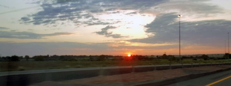
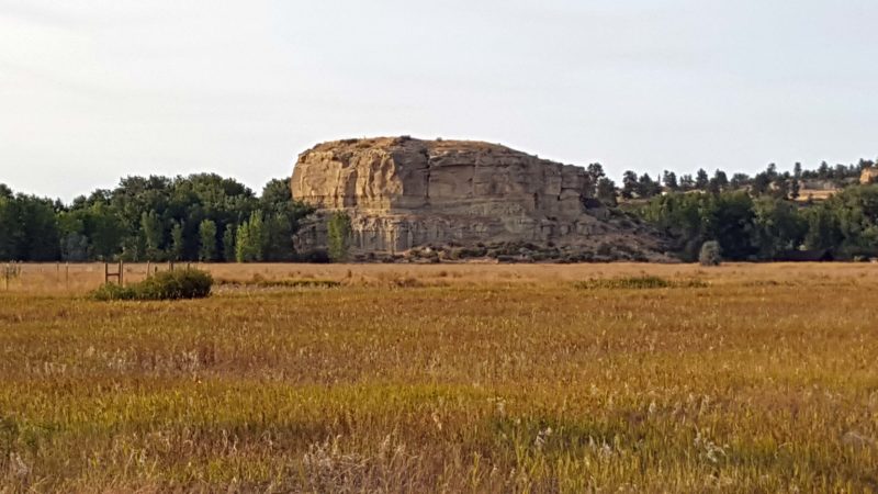
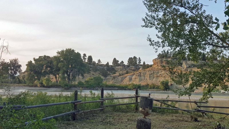
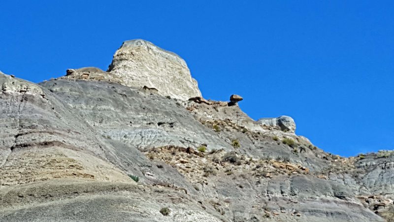
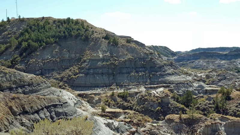
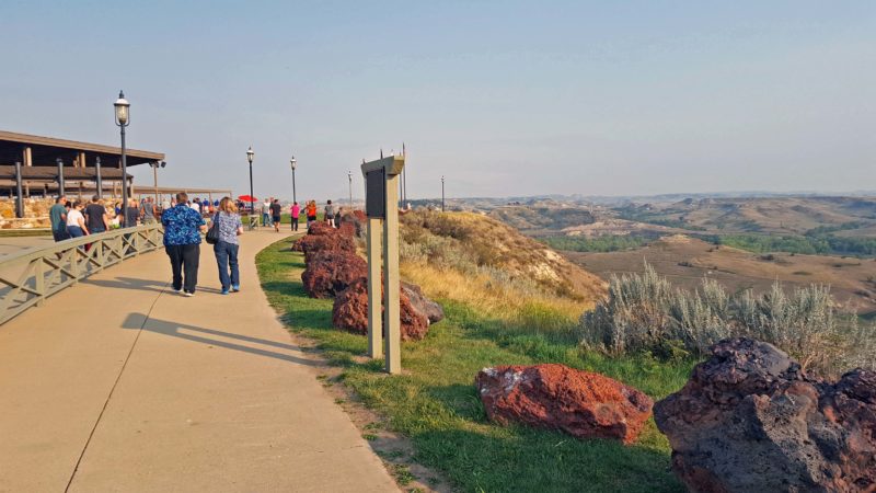
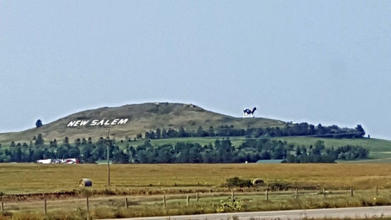
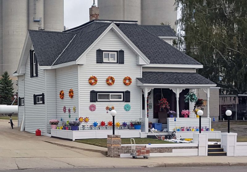
The title above is the city slogan (there are T-shirts for sale), as well as a clue to the pronunciation of the city’s name.  As we drove to Minot, we couldn’t help noticing the smoke from the Montana wildfires.  We’ve seen hazy skies, smog, and red sunsets from the smoke every day, but on some days–like today–the smoke is thicker.

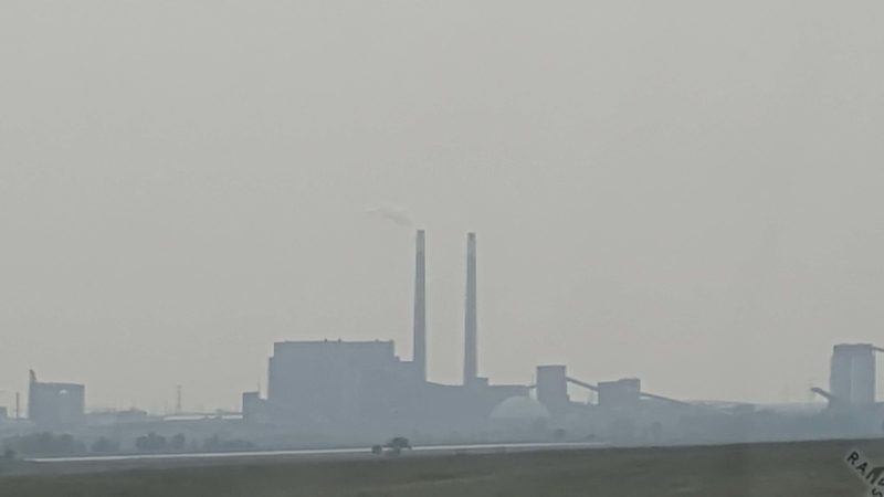
We passed this smoke-shrouded factory along the way to Minot.

We spent about two hours at the Scandinavian Heritage Park in Minot.  (Ya, shore, ve vere dare.)  I thought the Wisconsin northern accent was strong, but it can’t compare to the folks in the Dakotas.  Dakotans all sound like the Canadian professional hockey players on TV.  They are also very friendly and like to talk.

We saw signs for ticket purchases, so we thought we needed tickets to this venue and went into the gift shop to purchase them.  Discussion with the extremely friendly and talkative staff provided the information that a major festival is coming up in about a week and tickets are required for some of the festival events, but not for the park.

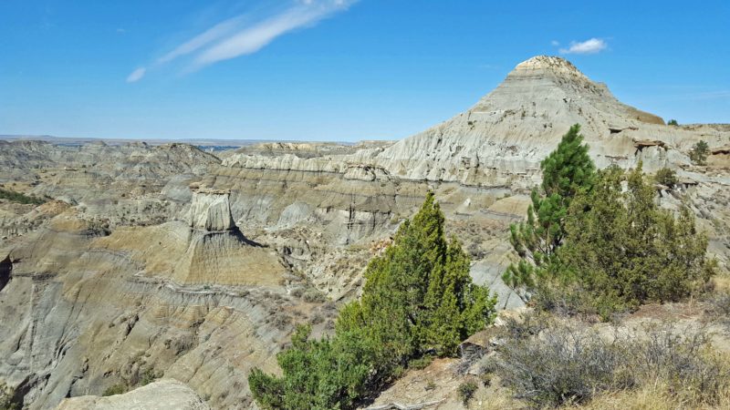
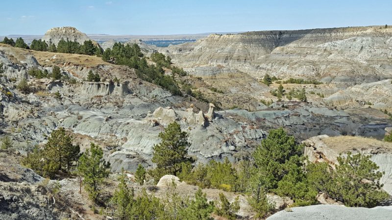
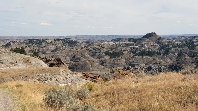
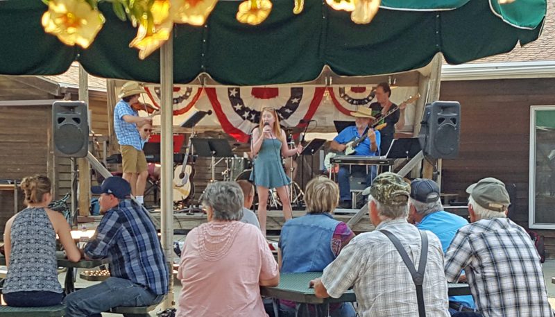
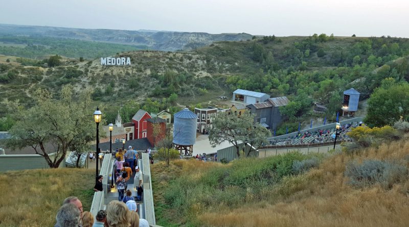
While we were talking with one of the ladies, she asked if we’re going to Medora.  Everyone in North Dakota seems to want to know if we’re going to Medora.  No one ever asks if we’re going to Bismarck or to Rugby or to Fargo.  They only want to know if we’re going to Medora.  The answer is “yes.”  We are going to visit the North Dakota Badlands in Theodore Roosevelt National Park, and the park’s entrance is at Medora.  It seemed logical to respond to the repeated query by simply saying, “Yes, we are.”

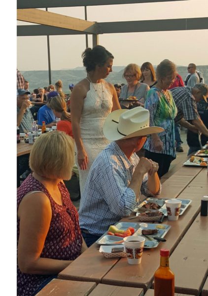
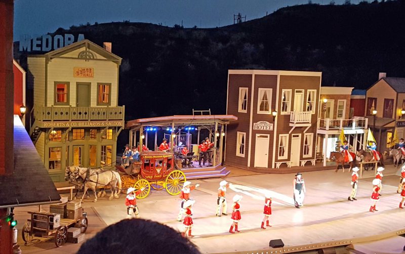
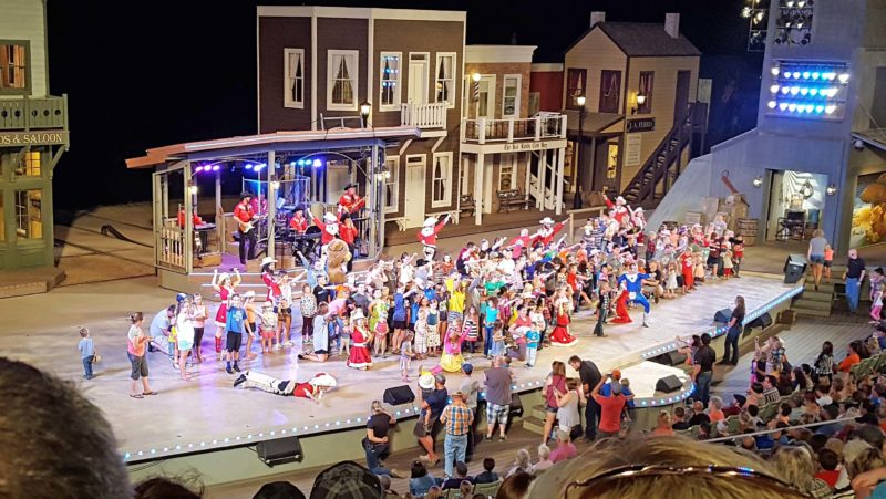
We will be in Medora tomorrow, so I decided it was time to find out why so many people care if we go there.  Well, the chatty lady was eager to tell us that the music festival in Medora has a performance every summer night, and this is the last week of performances.  The show is brilliantly named the Medora Musical and includes a Pitchfork Steak Fondue.  It is apparently a Big Deal.  (Note:  What else could we do?  When we arrived at our hotel, we went online and bought tickets to the Pitchfork Steak Fondue and the Medora Musical.  Now we know where we’ll eat dinner and how we’ll spend tomorrow evening.)

But back to Minot.  The gift shop was quite interesting and the ladies wanted to make sure we took pictures of the trolls and the stuffed buffalo.

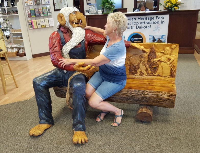
Scandinavians have a troll tradition.  We saw trolls everywhere on our Viking Homelands cruise last summer.  They supposedly bring good luck, up to a point.  I hope I haven’t reached that point.

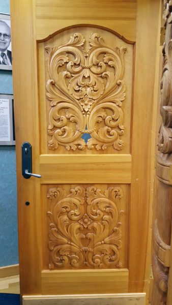
This is one of several beautifully hand-carved doors in the gift shop.

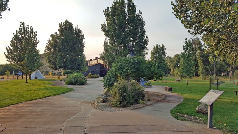
After our lengthy conversations with the gift shop staff, Ted and I started our walk around the grounds.  There is a display of the flags of the five Scandinavian countries, as well as a granite map of the Nordic countries.  A walking path takes visitors to all the buildings, monuments, and statues in the park.

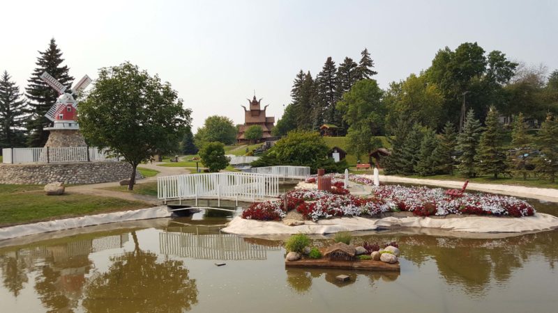
Here’s an overview of part of the grounds with the Gol Stave Church in the background.

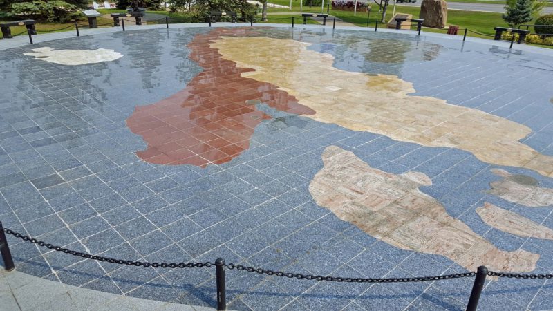
This is the granite map, showing Iceland, Norway, Denmark, Sweden, and Finland (hard to see–it’s green in the upper center).

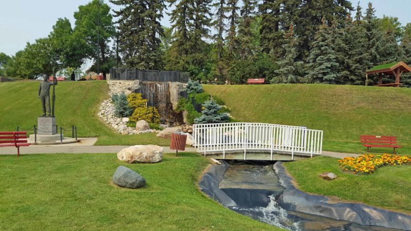
This is another section of the beautiful grounds.  The buildings are scattered throughout the park.

We were peeking into one of the reconstructed log houses when a man who’d been sitting outside the house joined us and started telling us all about the house.  (The North Dakota men apparently like to talk as much as the women.)  He was very informative and we learned a lot about the early pioneer way of life.

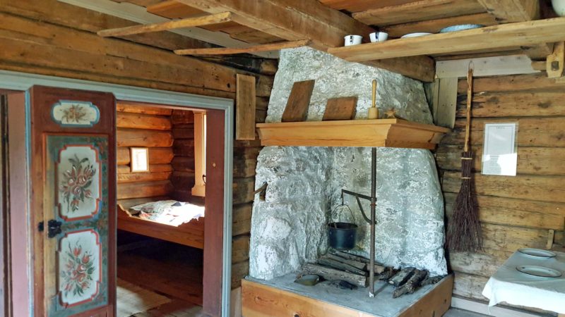
The bars across the ceiling joists in the upper left are for drying clothes in front of the fire in the winter.  Notice the rosemaling on the door panels.

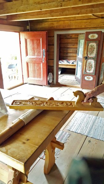
Need to whip some cream? A handy modified pine (?) tree branch quickly rolled back and forth between your hands will do the trick.

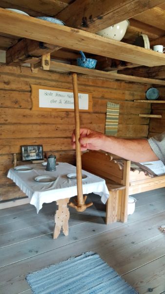
The ironing mangle had an interesting story to go with it.  Part 1:  To iron, place your wrinkled garment on the wooden roller.  Then grasp the mangle with both hands–one on each end.  Exert pressure on the mangle while moving it back and forth across the roller to smooth out the wrinkles.  Part 2:  If a young man was courting a woman and was interested in marrying her, he made an elaborate mangle and left it on her doorstep.  If the mangle was gone the next time he walked by, he was in luck; if it was still on the doorstep, he needed to keep looking for a wife.

This is prettier than my steam iron, but I’ll stick with steam.

The Gol Stave Church is the focal point of the park.  It is built without a single nail, and everything about its design is symbolic.  I can’t remember it all, but the inside is built in three sections–the sanctuary, the nave, and the altar–to represent the Holy Trinity.  The four large posts supporting the roof represent the four Gospels. The front door is narrow so that only one person at a time can enter, thus making it impossible for the Devil to come into the church.  A covered porch surrounds the church and provided a place to leave rifles before entering the sanctuary.  There is a gatehouse beside the church, through which people enter for services.  You go into the church through the gatehouse for the first time at your baptism; you go out of the church through the gatehouse for the last time after your funeral.

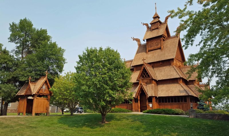
The Gol Stave Church.  The gatehouse is on the left.

The Dala (Dalecarlian) horse is a traditional Swedish carved, painted statuette, mostly used as a toy for children.  Dala horses have distinguishing features common to the locality of the site where they are produced, but the most common and widespread one is painted bright red with a harness in white, green, yellow, and blue.  In modern times, the Dala horse has become a symbol of Sweden.

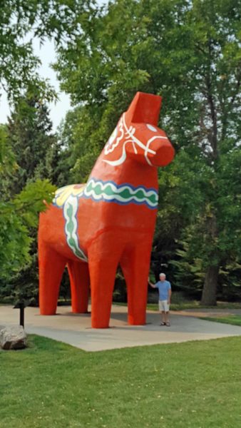
This Dala horse is 27 feet tall.  Ted is 6 feet tall.

It wouldn’t be a Scandinavian park without a statue of a Scandinavian hero.

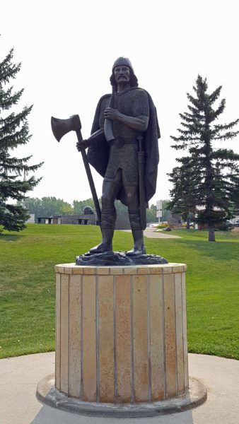
Guess who.  Why, it’s Leif Erikson, the Norse explorer from Iceland!  He was the first known European to discover continental North America, and he did it nearly four centuries before Christopher Columbus.  Definitely worth a statue.

Before leaving the park and driving to our next destination, we naturally used the rest rooms.  There was something different in this ladies’ room.

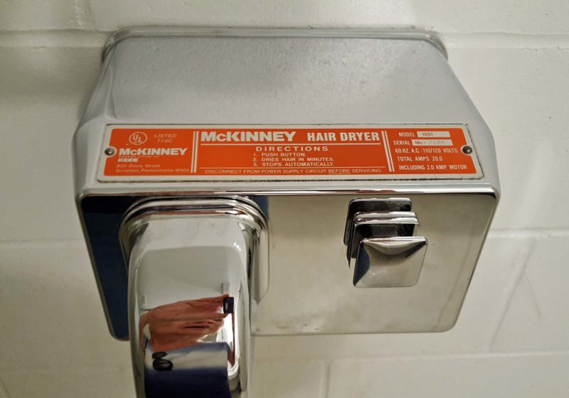
Yes, a hair dryer. With no towels or hand dryer, I admit that I dried my hands with the hair dryer.

After visiting the International Peace Garden, we spent the night in Rugby, ND.  Rugby has the distinction of being the geographic center of North America.  That made it imperative that we plant ourselves in the middle.

It’s Ted and me–right in the middle of North America!

In case you’re wondering how far it is to Acapulco, Neah Bay, WA, the Arctic Circle, or Lubec, ME.

The funny part?  The geographic center of North America is in the parking lot of this Mexican restaurant.  It’s just to the left of the picture.

Rugby has a population of about 2,800.  We had lunch at what appeared to be a small local restaurant in this small city.

We thought this was it, but there were three more larger dining rooms behind the wall with the “Cafe” sign, plus a huge banquet hall running the length of the building behind the four dining rooms.  We arrived around 11:30.  At noon, people started pouring in and two dining rooms were in use by the time we left.  Where do people come from to fill all these dining rooms?

We heard another customer discussing what to order.  He said he wanted dinner (noon meal), not breakfast (served all day).  I haven’t heard of eating “breakfast, dinner, and supper” since we moved out of Wisconsin.

The “supper” menu on the whiteboard included chicken “hot dish”–another northern favorite.

As we drove out of town, we found Rugby kitsch.  Yup!   We’re definitely having a kitsch-y trip.

Wherever we go in North Dakota, there are bales in the ditches along the highways.  Do they actually harvest the ditches or do they just wait that long to cut the grass?