North Dakota, the focal point of our MAT (Midwest Adventure Trip) is behind us. We had breakfast this morning at Penny’s Diner in Glendive, MT. We try to eat in local (not chain) restaurants and we’ve been in some unusual and interesting local restaurants. Whether odd or charming, all of the eateries have had good food and friendly people.
Penny’s Diner offered us something we’ve never seen before: walls decorated with pictures of every Miss Montana–67 in all. You know how clothes and hairstyles often indicate the decade in which a picture was taken? Well, this is apparently not true of beauty queens. Except for being blonde or brunette, all the Miss Montanas looked alike–pretty complexions, good teeth, long hair, crowns, similarly-cut formal dresses showing nothing below the shoulders, and similar poses.

Miss Montana over and over and over again. More photos adorned the other walls.
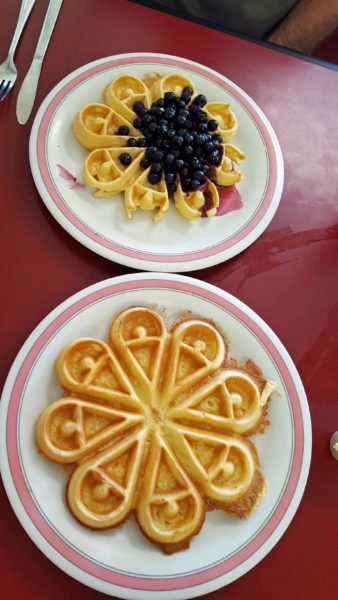
We chose sweetheart waffles for breakfast. They were just like the ones we had in Norway last summer.
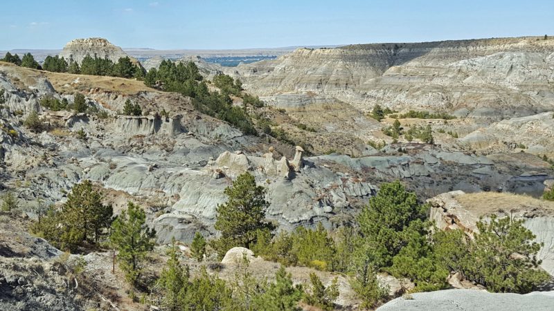
After breakfast, we went to Makoshika State Park just outside of Glendive. To the Lakota Indians, Makoshika meant “bad earth.” It is the western side of the North Dakota Badlands. We debated visiting Makoshika because we thought it would be the Badlands Revisited. It wasn’t.
In addition to its spectacular badlands, the park has fossil remains of dinosaurs, including tyrannosaurus, triceratops and thescelosaurus. Dinosaur fossils are found only below the K-T boundary. K is the abbreviation for the Cretaceous period and T is the abbreviation for the Tertiary period. Between these two periods, dinosaurs and many other species vanished from the earth.
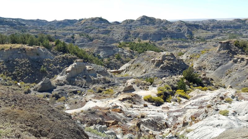
There is a ten-mile long road (gravel after the first half-mile) that takes visitors through the park, with trails to hike at various points along the road. Erosion patterns vary enough to make Makoshika a different kind of mysteriously fascinating scenery than that in the North Dakota Badlands. In Makoshika, we could walk closer to the formations and even touch them. We also learned to recognize the K-T boundary, coal seams, and other features of the landscape. We were both glad we voted “yes” for this state park.
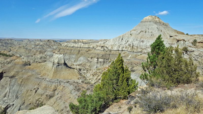
The uppermost prominent black line on the large formation is the K-T boundary.
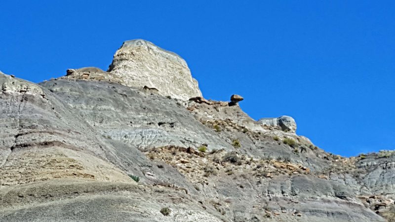
Erosion is weird. For proof, look at the precariously projected rock near the center of the picture.
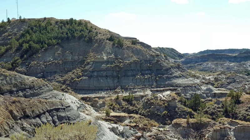
The narrow dark lines showing on these rocks are coal seams.
Eroded rocks with wider, rounded tops are called “cap rocks” (center).
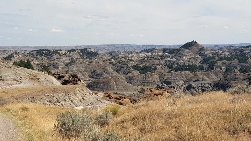
This area of the park features black buttes.
More black buttes, this time with a natural bridge in the center of the picture.
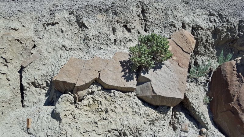
From a distance, we wondered if the buttes are mud or rock, because they look like both. Up close, we learned that what looks like mud is mud; what looks like rock is rock. It’s the best of both worlds. You can crumble the soft, dusty mud in your fingers.