Today, we’re docked in the port of Gaspé (GAS-pay), Québec and we were up early for an all-day shore excursion to Bonaventure-et-du-Rocher-Percé (PER-see) National Park. (FYI, if your high school French is rusty, rocher-percé means “pierced rock.”)
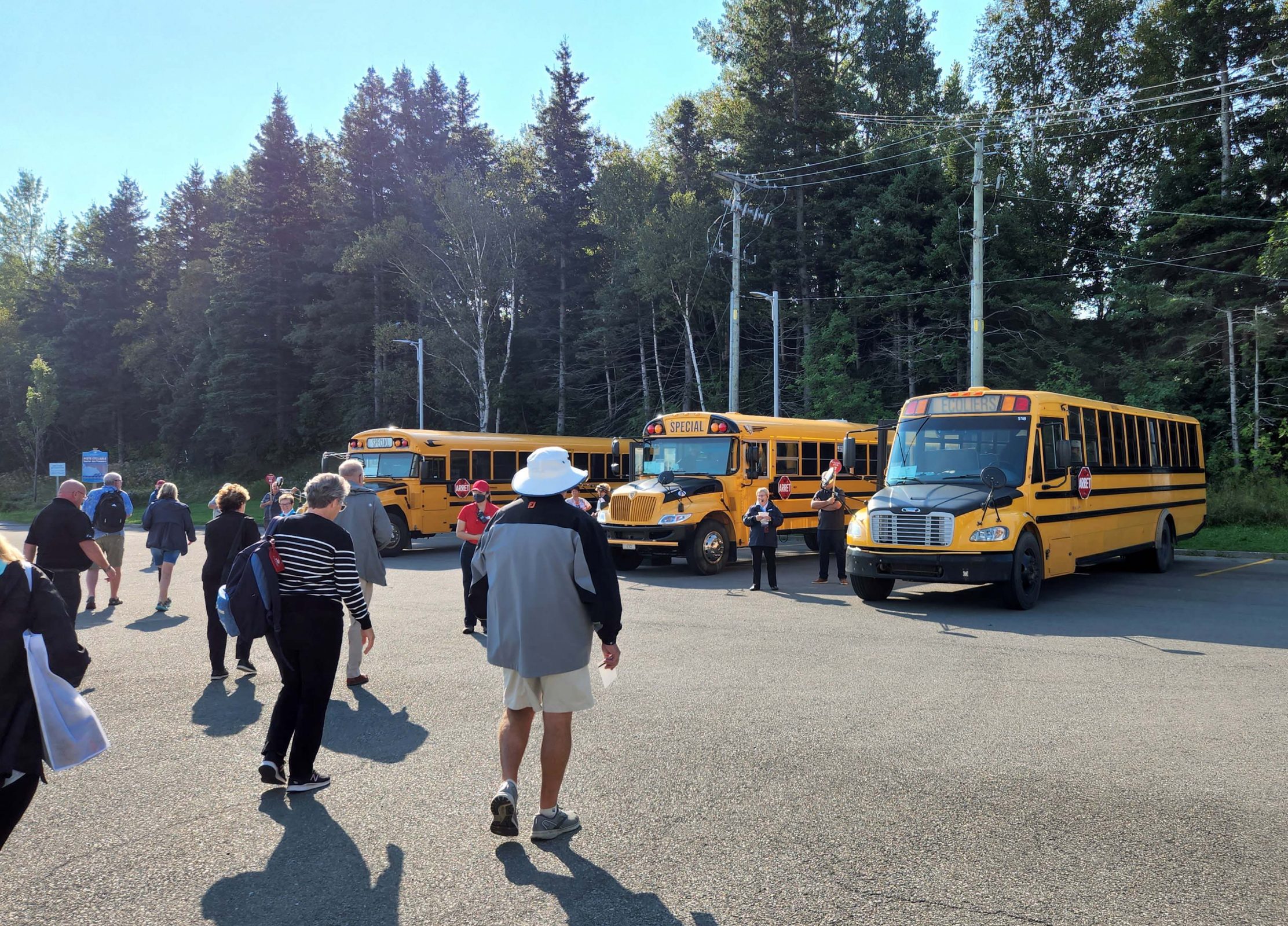
There are four major cities along the St. Lawrence River: Toronto, Ottawa, Montreal, and Québec City. Our cruise began in Montreal, downstream from Toronto and Ottawa, so after seeing Montreal and Québec City, our remaining ports are small towns. Each small-town port has a claim to fame. Saguenay has a fjord; Gaspé has a rock. Small towns do not, however, have large tour buses, so today’s sightseeing began on a school bus. Our group of retirees joked about singing “The Wheels on the Bus” and other high school memories we had of riding school buses, but we all agreed that, at our age, a school bus is a hard, cramped, and uncomfortable ride for 90 minutes each way. We were good sports, though, and we had a very nice boat tour of the national park. (The boat was more comfortable than the school bus.)
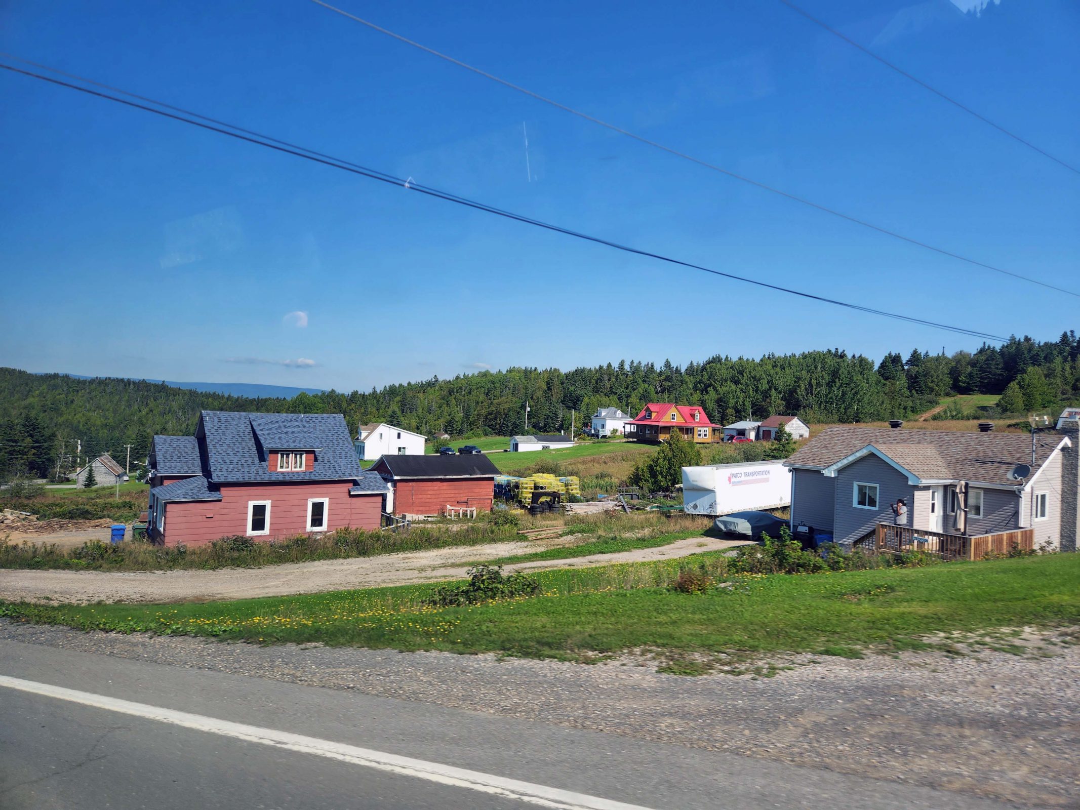
On our way to the National Park (it’s actually a provincial park), we passed tiny, rural Canadian villages like this one. It looks scenic and peaceful, , doesn’t it?
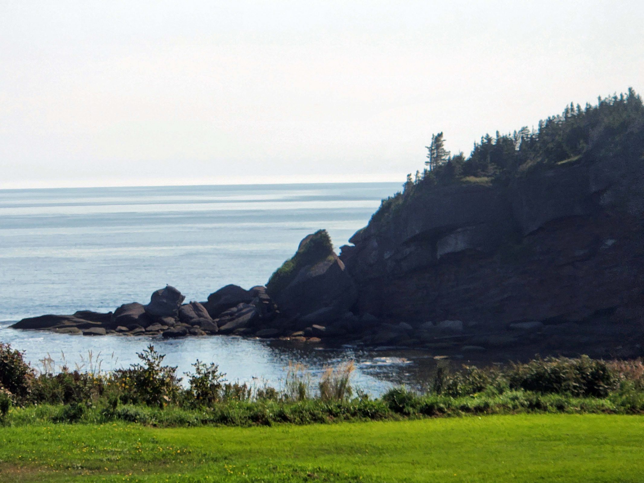
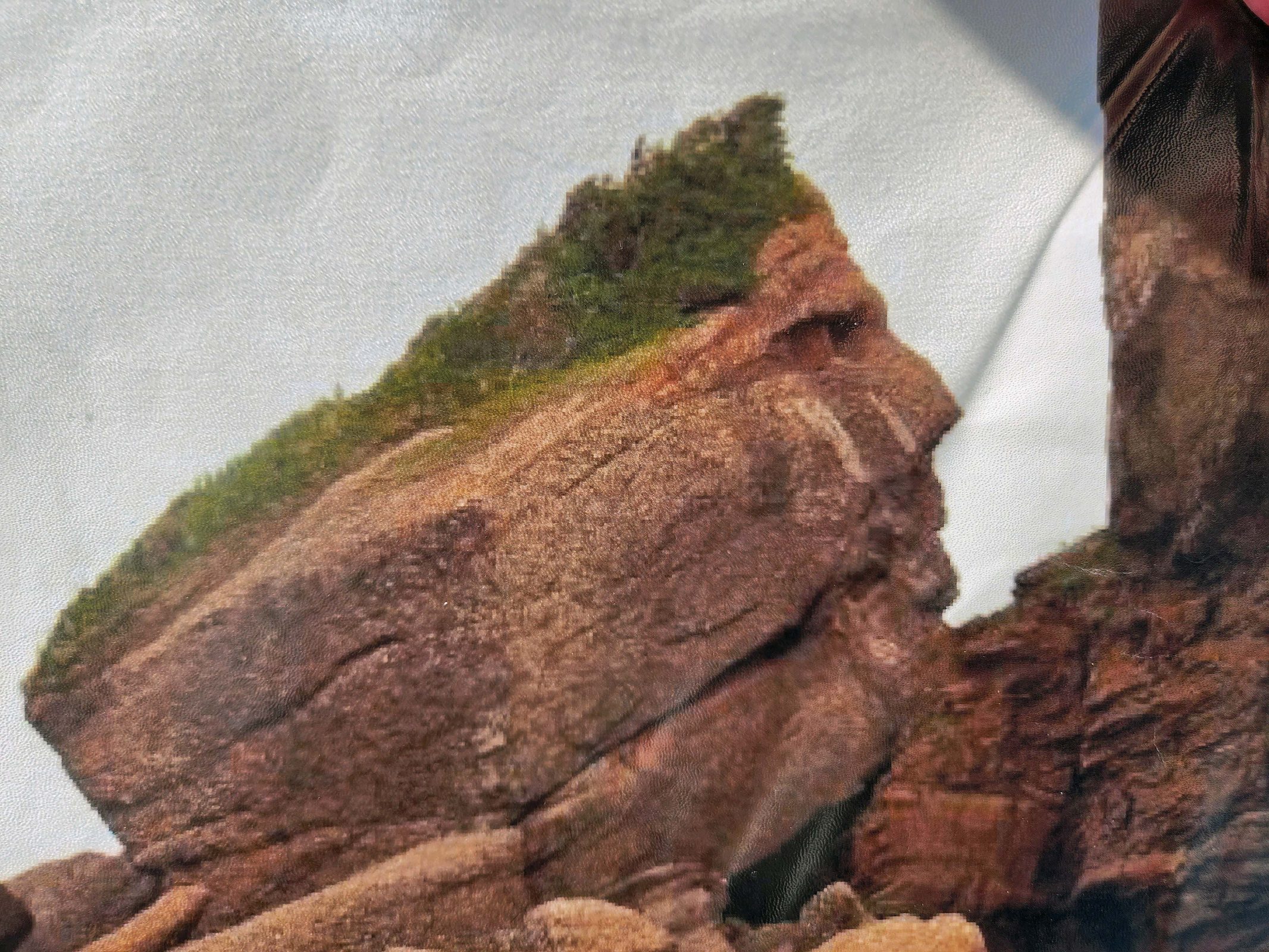
As we were driving to the national park, our tour guide pointed out this rock formation. I had trouble identifying the facial profile of the First Nation chief until I zoomed in on it.
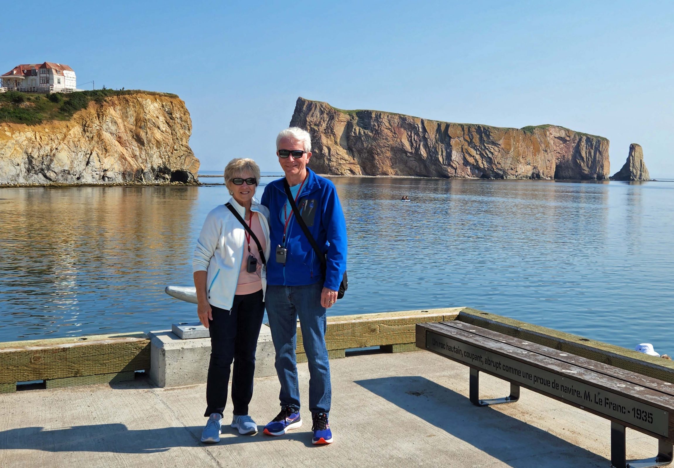
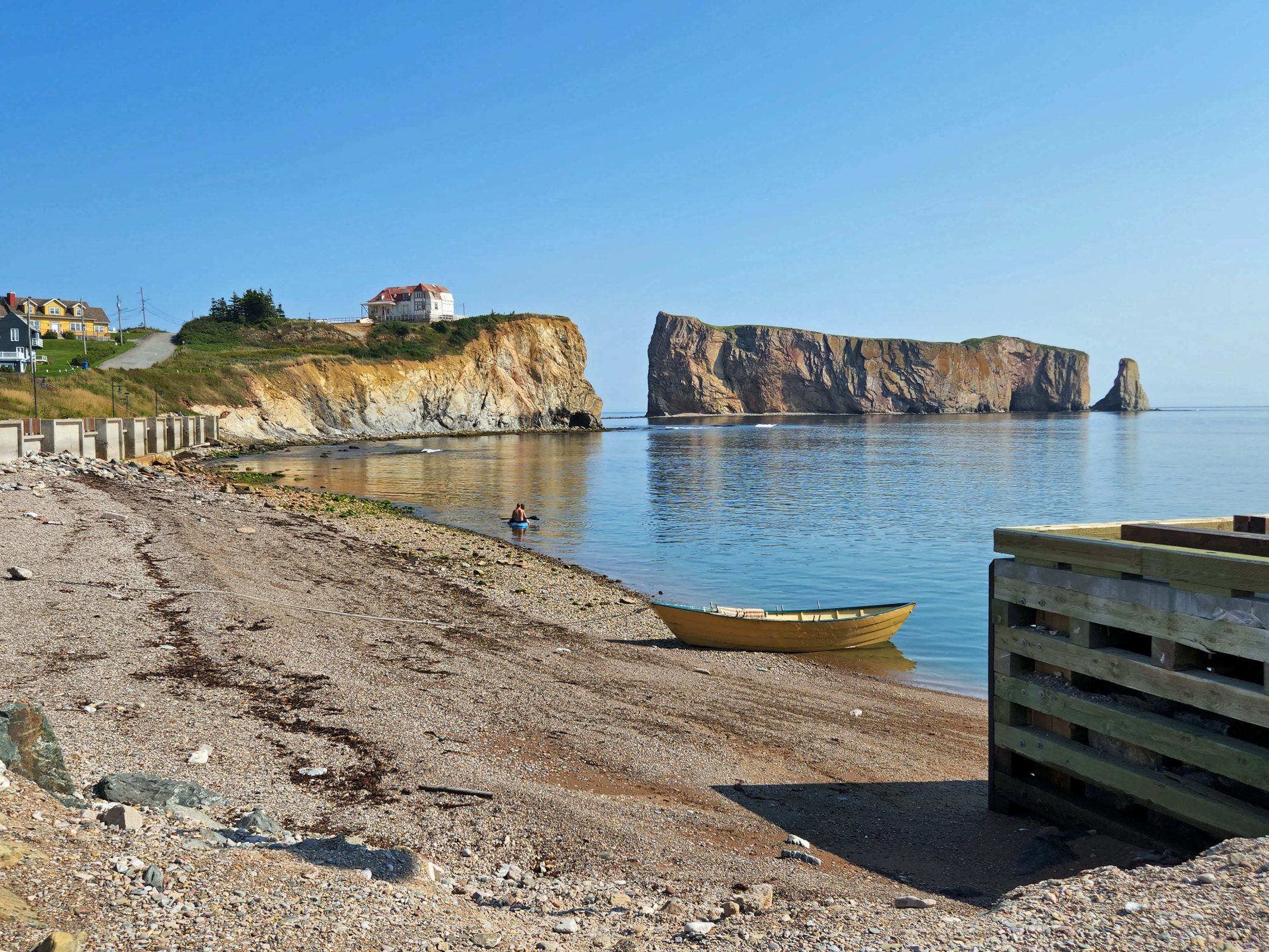
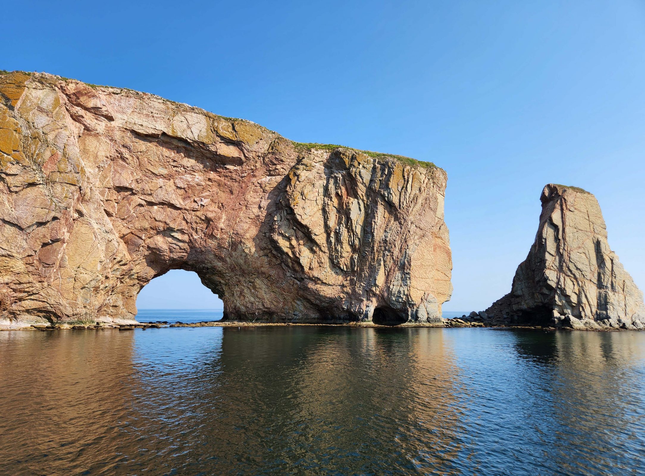
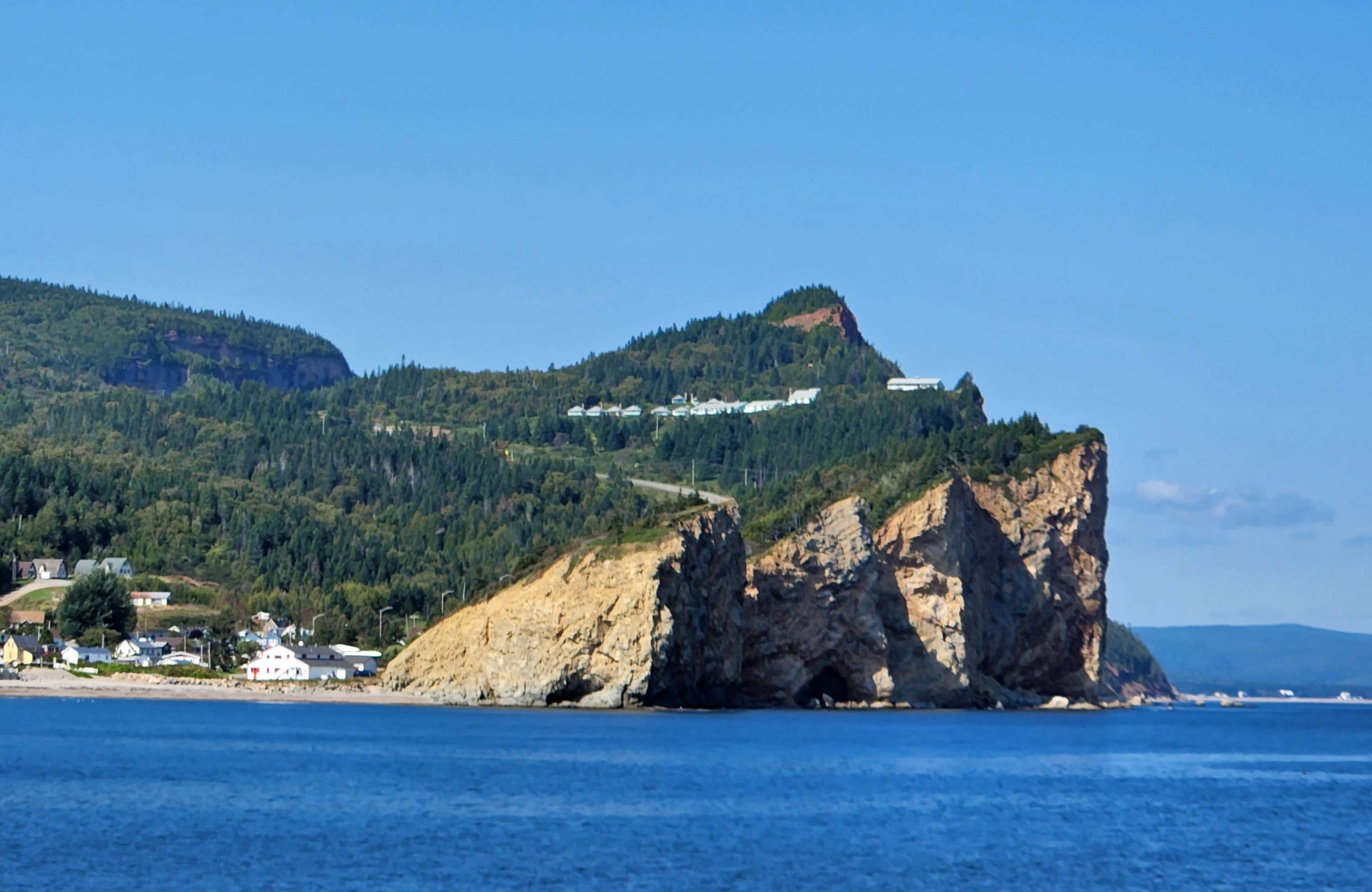
Percé Rock is at the tip of the Gaspé peninsula. Here’s a picture of the Gaspé harbor where we boarded our tour boat to see the national park, which consists of Bonaventure Island and Percé Rock. Percé Rock is 1,400 feet long, 300 feet wide, and 390 feet high. It weighs 5 million tons and is one of the world’s largest natural arches located in water. It loses about 300 tons of rock annually, due to wind and water erosion, and will disappear in approximately 16,000 years, so hurry if you want to see it. The two rock formations on the right are what’s left of Percé Rock.
Only one of Percé Rock’s arches remains. There were at least two arches, and some historical accounts mention three. The second arch collapsed “boisterously” in 1845. At low tide, it’s possible to access Percé Rock on foot for about four hours each day. Caution is advised because the rock has a tendency to collapse, dropping large segments into the water. At high tide, it’s possible for a small boat (e.g., canoe, kayak) to pass through the arch.
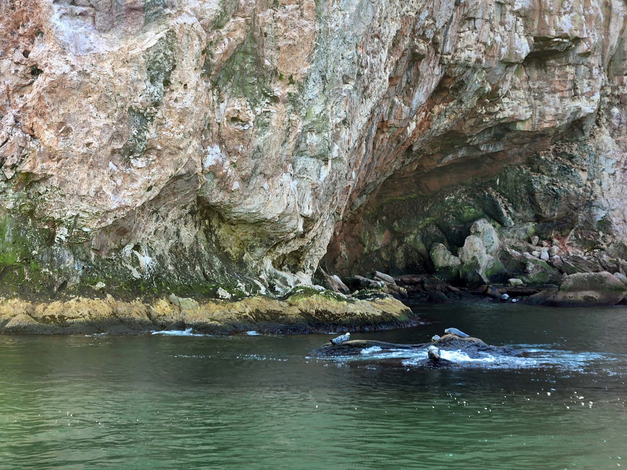
As we circled Bonaventure Island, we saw seals at play.
The park is a migratory bird sanctuary, and there are approximately 250,000 wild birds in the park. We saw thousands of these white birds and one bald eagle on Bonaventure Island.
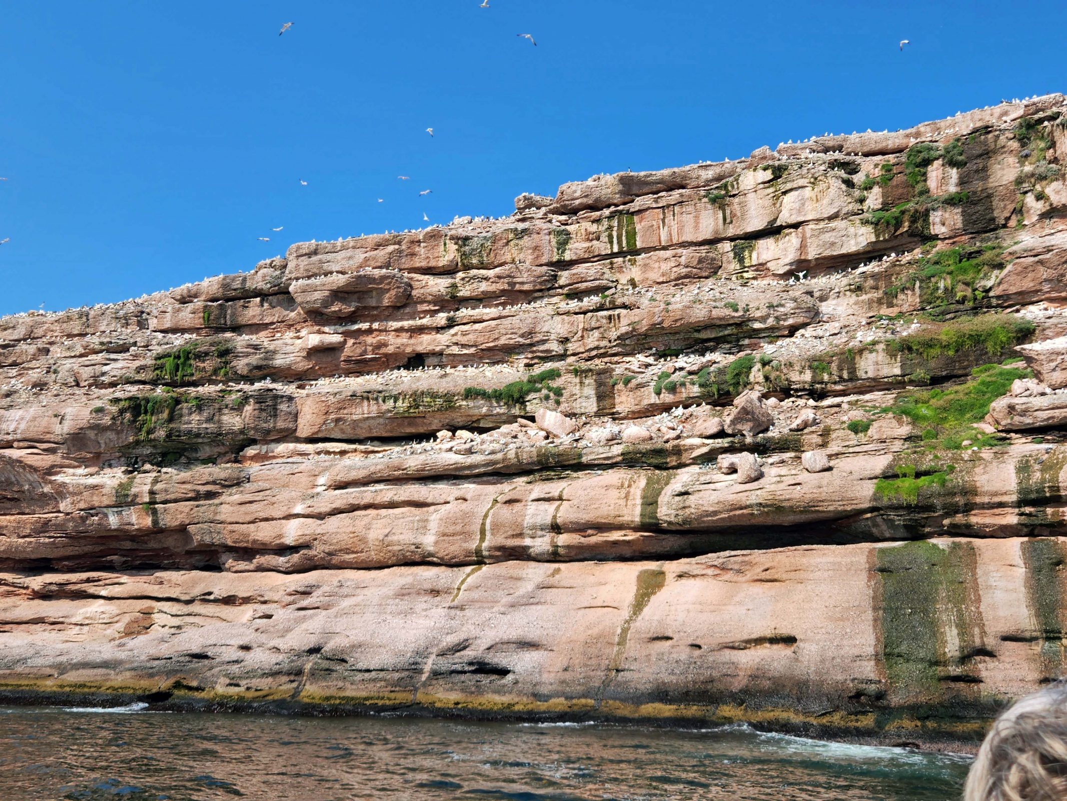
There are about fifty houses on Bonaventure Island within the park, but only ten are inhabited.
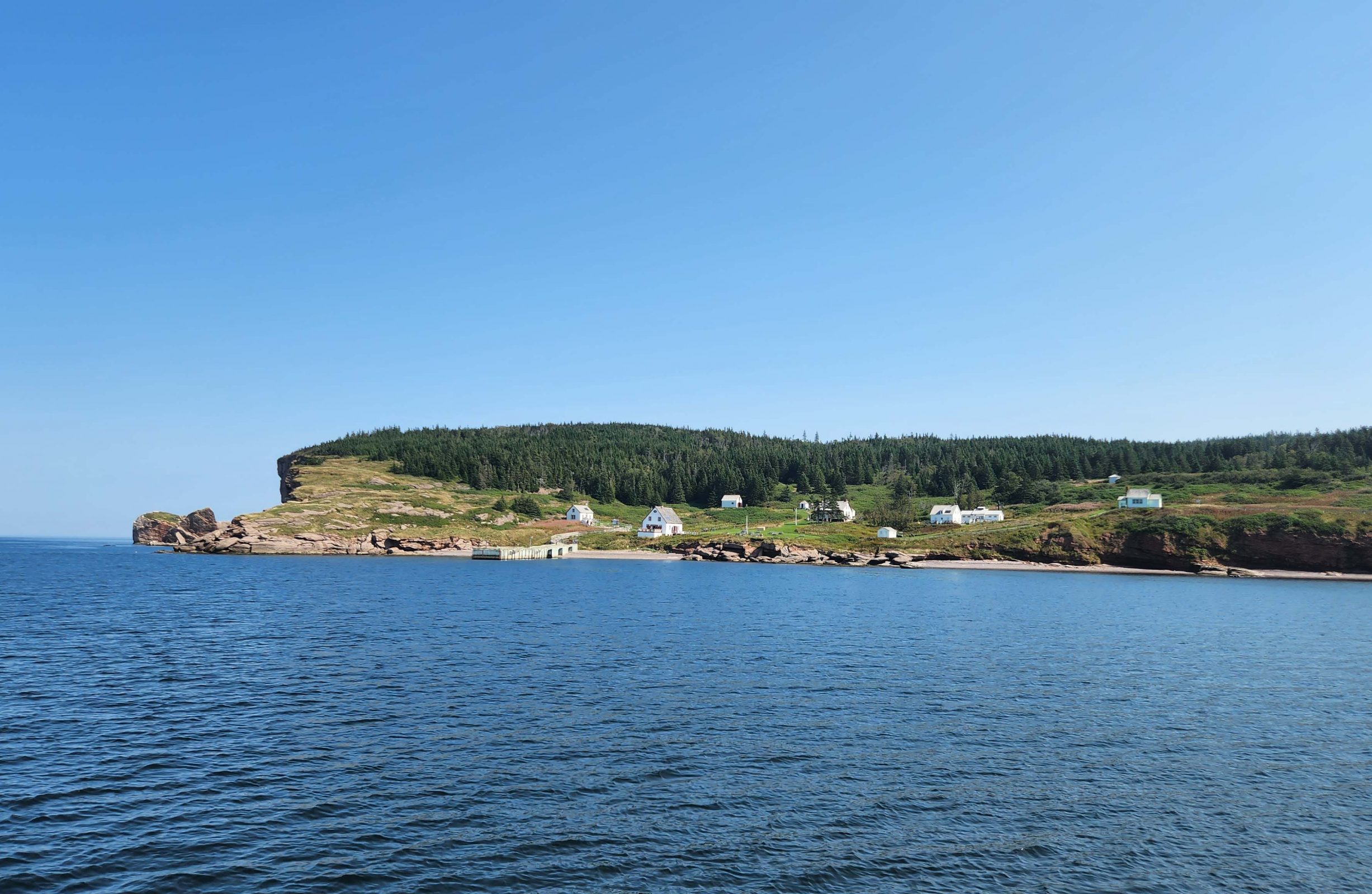
Returning to the harbor provided a pretty view of the village. I wonder what it’s like to drive up and down that road (center of photo) from the lower houses to the upper ones during the Canadian winter.
Before leaving Gaspé, we had lunch at a local restaurant. Ted had salmon and I had fettucini. The portions were huge, including the piece of chocolate cake we had for dessert. Then, just because we were here, we did the same thing as everyone else and had our picture taken with Percé Rock in the background.