Category: Travel

But maybe not.  Today, Ted and I set a record for walking:  18.25 miles.  After that, my pedometer broke.  Really.

We started the day with an omelette (French food in France) for lunch and then headed for Notre Dame.  On the way, we passed some green box-like things along the sidewalk and thought they were dumpsters for nearby apartments.  We were so-o-o-o wrong!

Top left: The boxes had legs that allowed them to fit over the concrete abutment along the sidewalk. Top right: From the front, they looked like dumpsters, but the front edge and top were constructed to be lifted to form . . . voilà! . . . (lower center) little sidewalk shops.

Because of the recent fire at Notre Dame, visitors cannot enter the cathedral, but there was still a crowd all the way around it on the sidewalks.  It was a sad sight, and the crowd was more somber than exuberant.

Here’s the classic view of the front of Notre Dame. The cathedral is located on an island in the Seine River.
The two rear towers and most of the roof were completely destroyed by the fire.

Our next stop was the Pantheon.  It must be one of the highest points in Paris, because we walked uphill all the way from Notre Dame.  There were pretty views of the Eiffel Tower and of Notre Dame from the Pantheon. 

The Pantheon was built in 1744 because King Louis XV wanted to dedicate a prestigious building to Geneviève, the patron saint of Paris. In 1791, the monument was turned into the national Pantheon. Its crypt enshrines great men and women of France, including Victor Hugo, Voltaire, Émile Zola, Jean Moulin, and Marie Curie.

The Pantheon is in the Latin Quarter of Paris, so we walked around the neighborhood for a little while.  Since it was still early, we headed downhill and across the Seine to the Bastille.  We found the site, in spite of extensive road construction in the area, and were surprised to see that not even a remnant of the Bastille exists.  It felt like the Fourth of July without the Liberty Bell to visit.  The Bastille prison was pretty much destroyed after the French Revolution (no one felt warm and fuzzy about preserving it), and the site is now the home of an opera house.

The ultramodern building in the center is the opera house on the site of the former Bastille. There is no Bastille to be seen, although many streets and buildings in the neighborhood have “Bastille” in their names.

Time was passing, and our feet were getting tired, so we headed back to the hotel.  The sky became increasingly overcast and looked more and more like rain.  It took us a long time to cover the distance (or maybe it just seemed like a long time because we’d walked for so long), but we made it to about 30 feet from the hotel door before it started to sprinkle.  The shower didn’t last long, so we rested our legs and feet and went out later to feast on beouf bourguignon for dinner.  Yummy! (“Beef stew” sounds so much better in French.)

Again:  18.25 miles of walking in one afternoon!  Whew!

Note:  We’ve ordered vanilla ice cream twice in France.  Although it was called “vanilla,” it was French vanilla both times.  But of course, n’cest pas? 

This morning, Ted and I took the Eurostar from London to Paris.  We did that in 2016 and the high-speed train was a great experience.  We had first-class tickets, so we were served a lovely French lunch—with wine, of course.  We enjoyed the relaxing two-and-a-half hour ride through the French countryside.

Unfortunately, getting onto the train was far less enjoyable.  The London train station was crazy busy.  Maybe all those tennis and cricket fans were leaving town today.  The signage was terrible and, although we remembered the process from last time, it was difficult to find where “over there” was in such a big station with so many people crammed together.  When we got to the check-in line, we were told there were too many people waiting on the platform, so check-in would be delayed for the later trains.  First, we were delayed for ten minutes, then ten more, then ten more, . . . Finally, we were allowed to get in line.  Surprise!  One ID/passport check wasn’t sufficient; everyone had to do that part twice. 

It was a relief to find ourselves next in line to go through the gate that would allow us to take the escalators to the platform, but the relief was short-lived.  The electronic gate didn’t recognize Ted’s ticket and wouldn’t let him through.  A helpful attendant took him around the gate, and we proceeded to our train.  It took more than 90 minutes to get checked in and to arrive on the platform, and we had only ten minutes to spare before our train left.  Whew! Just breathe. . . .

The transfer from the Paris depot to our hotel went smoothly.  We unpacked a few things in our room and went immediately to the Tuilleries across the street to enjoy the park and to relax.

Thankfully, Ted and I had five hours of sleep on the plane, because London was hectic when we arrived. It was the last day of the Wimbledon championships and also the final match of the World Cup cricket championship between England and New Zealand, neither of which has ever won before. Traffic was horrible, and the sidewalks were packed. London won the cricket championship, so there was a lot of yelling and cheering in the streets all evening.

When we got hungry for dinner, the concierge told us there were restaurants on the street alongside the hotel. We turned the corner and guess what the first two restaurants were: McDonald’s and Five Guys! The others were local, and we chose one of those.

One day we ate dinner in an historic restaurant about two blocks from our hotel. It was called “Byron,” and the manager told us the entire building is “protected” and cannot be changed. The huge (18″ x 18″) ceiling beams, the stamped metal ceiling, the marble wall panels, the huge mirrors, and the mosaic floor are all more than 240 years old. It’s amazing how late Europeans eat. The restaurants are still packed at 10:30 p.m. and going strong with no sign of closing any time soon.

Note: On the menus, salads are described as “assorted leaves.”

This little shop was on the street with the restaurants. It was about the size of two kiosks at the mall.
As usual, we did a lot of walking. It’s unusually warm in London (low 80s), and we wanted ice cream one day, so we stopped at a gelato shop that featured “rose” ice cream cones in your choice of flavors. We chose vanilla and strawberry.
We walked to Buckingham Palace to see how far it was (about a mile) so we’d be in time for the changing of the guard in the morning. Here are some of the Palace gardens. Ted thought he saw the Queen deadheading flowers so they’d look nice tomorrow.
When we returned to the hotel after dinner, we saw that the hallway and stairway were lined with candles. Very pretty, and romantic too.

The changing of the guard at Buckingham Palace occurs at 10:45 every morning. What a disappointment! We arrived about 15 minutes early and found a place to stand right in front. And there we stood, watching police on horses and bicycles riding back and forth to make sure no spectators breached the barriers. Around 11:00, a marching band of guards arrived from our left and got through one song (not Sousa, and not “Stars and Stripes Forever”) before entering the palace gates and disappearing from sight. About 15 minutes later, another band came from our right and did the same thing. Another 15 minutes later, a troop of eight guards arrived, stepping smartly, so we thought they must be the “new” guys. They also disappeared inside the fence. Finally, another 15 minutes later, both bands came marching out and went to our left and to our right. That was it! The show was apparently all about watching the police riding in circles.

Here’s the band coming from our left.
This is Buckingham Palace, and it’s what we saw for most of the 75 minutes we were there for the changing of the guard. You can see other people lined up around the open space, and the police in the neon yellow vests.
The next day, we walked to the London Tower Bridge. It was more fun than the changing of the guard.
On our way back to the hotel, we stopped at the Tate Modern Museum. It was interesting to see the modern art, even though we don’t want any of it in our house. This is a tower built of antique radios and speakers and titled “Babel.” I looked for a radio like I had in my bedroom when I was growing up, but didn’t see one.
On our last evening in London, we walked along the Thames and saw this bike counter beside the bike lane. It displayed the number of bicycles that went by each day and also the total for the year. We were there around 10:00 p.m. and it indicated 6,653 bikes had passed in the past 22 hours. The annual number was in the hundreds of thousands.

One evening, as we walked along the Thames on the Queen’s Walkway, we were passed by some bicycles. We knew they were behind us because they rang their bells and because their headlights projected “BIKE” in green letters on the path ahead of us. Cool!

We were surprised at how many shopkeepers spoke English as a second language in London–and at only an intermediate level. In non-English countries, we’ve often had a clerk call an English-speaking person to help us, but England is the home of English, so we expected at least store managers to speak fluent English. It’s definitely a one-world society these days.

Our last stop before returning to our hotel was a pretty view of lighted buildings and the London Eye (the Ferris wheel) across the Thames. It was so peaceful, we just sat on a park bench for awhile and enjoyed our last evening in London.

Ted and I flew to London at dinner time, with our arrival in London scheduled for just before lunch the next day. While we were waiting to board our flight, I had a little blast from the past when I saw one of my ESL teachers and his wife. We had a nice chat and learned they are going on from London to Budapest.

Last year, Ted and I decided that, for our next long flight, we’d spring for business class. As a result, we flew upscale to Europe today. Not only did that put us into Zone 1 boarding, but since we regularly fly in the main cabin, we felt like little kids opening Christmas gifts when we took our seats.

First, I stowed my back pack in my own overhead storage bin. Then I had to make room to sit, because my seat held a full set of bedding: mattress pad, quilted blanket, and pillow. There was even a pair of slippers in case I needed to get up during my sleep time.
There was a chilled bottle of water at each seat, and we were immediately offered a choice of beverages. I chose orange juice. Then we were given dinner and breakfast menus to make our meal choices. We also selected a wake-up time.
There were lots of comfort adjustments (4 separate menus), including a seat massage.
The complimentary toiletries bag included a toothbrush, toothpaste, sleep mask, ear plugs, a glass-cleaning cloth, soap, and even a pair of socks.
Dinner was served as soon as we reached a safe altitude. Note that dinner included a tray-sized white tablecloth. This was the first course . . .
. . . and here’s the main course. Everything was delicious! My choice of beverage was (free) wine. The breakfast was equally attractive and good. No disposable dishes or plastic wrap in sight!

With the nice blanket and the comfortable pillow in hand, I dropped my seat to the completely flat position, adjusted the mattress firmness, and actually slept soundly from the time I finished dinner until my breakfast wake-up call five hours later. Of course, it was a full breakfast, so Ted and I weren’t hungry when we arrived in London.

Wow! If flying were always like this (like it used to be years ago, with comfortable seating space, reasonably good meals at no additional cost, and free checked luggage), there would be far fewer grumpy passengers. The only downside was that it was lonely. Business class is, by definition, designed for people who want to work with minimal distractions while they fly. Although Ted and I had adjoining seats, we were physically too far apart to talk to each other during the flight. Still, we’re actually looking forward to our nine-hour overseas flight home instead of dreading the discomfort of the main cabin for that long.

Note: Not everyone in business class has class. The guy across the aisle from me took off his pants and slept in his boxers. I couldn’t believe it when I saw him do that.

Today was our last day in Hawai’i. We’ve had such a good time and are feeling so relaxed that we hate to leave. At the same time, it will be good to be home again.

The day started with some leftover scattered light showers from last night, which cleared by lunchtime. As usual, we ate lunch at an outdoor restaurant. When the skies clouded over again, we decided it was a good time to print our boarding passes and pack our suitcases so we could go back outside when the sunshine returned. That was a good plan, and it gave us time to spend nearly two hours at our hotel pool. It was another relaxing afternoon.

The resort torch lighters run (yes, run) around the resort about half an hour before sunset, lighting the tiki torches that line the walkways. While we were sitting along a walkway waiting for the torch lighter, I was admiring how beautiful it is here–at the resort and in Hawai’i.

The foliage is beautiful everywhere we look.
The fountains, the palm trees, and the sunlight on some outdoor table umbrellas provided another pretty sight.
The torch lighter was right on time. I took this picture of him lighting one of the tiki torches.
He literally ran on to light the series of torches down the walkway.

After the torch lighting, it was time to return to our balcony to view our final sunset on this perfect vacation.

The sailboats were gathered for the nightly viewing and the cloud bank was above the horizon for a change.

Ted and I enjoyed our Saturday evening dinner at the Bali Restaurant so much, we decided to go there again for our final meal in Hawai’i.

The restaurant advertises its “oceanfront dining,” and this was the ocean view from our table. Our waiter told us we had the best table in the house, and I’m sure we did. What a gorgeous dinner setting!

Our airport pick-up time is 5:25 a.m. tomorrow. Our flight to LAX boards at 7:18 a.m. and we’re scheduled to arrive at STL at 10:36 p.m. local time. It’s been a wonderful week, and we’re looking forward to our next visit to Hawai’i. Next time, we’re going to Maui, because we’ve been told we’re “Maui people.” Aloha, Hawai’i.

As usual, Ted and I chose an outdoor restaurant (not hard to find) for lunch today.

I wish the weather in St. Louis was always this pleasant for outdoor eating.

After lunch, we decided to take a walk on the sidewalk that runs for several miles along the oceanfront. We saw some interesting sights.

This is the sidewalk–right along the beach.
The rules are different at the beach. At this Dairy Queen, it’s “No shoes, no shirt, service.”
It’s a surf-mobile! You can carry one more if you put it underneath the chassis.
On our walk, we learned that the people we see bobbing on the sand bar are taking surfing lessons. The lesson is over and these surfers are heading back to shore.
We had a beautiful view of Diamondhead. It doesn’t look that far away, but it’s about three miles from here to there.
Even getting change at the ABC Store was fun.
When we returned to our room, it was time to sit around the pool for awhile. I took this picture of Ted from our balcony.
We had intermittent rain showers for several hours, so there wasn't any visible sunset to watch today.

We had intermittent rain showers for several hours, so there wasn’t any visible sunset to watch today.

After dinner, Ted and I decided to sit at the outdoor Tapa Bar, listen to the live music, and enjoy some mai tais. Thanks to the rain showers, there was a cool wind and the temperature dropped to 66 degrees,* so we didn’t stay long, but it was fun for a little while and the mai tais were delicious–lots of pineapple, lime, and orange flavor, with some rum for fun. Oh yes, the music was good too.

*On our way to the resort from the airport, our cab driver told us that when the temperature goes below 70 degrees, he starts looking for his boots. I hope he found them today.

Tonight we went to the resort’s Starlight Luau. The event was on a rooftop, but it was cloudy and not starlit. There was no refund for that, however, so the show went on.

Here we are, ready to luau.
The buffet had many local Hawai’ian selections and everthing was delicious. This time, Ted was brave enough to try the purple poi dinner rolls.
The master of ceremonies gave us directions for the buffet procedures, introduced the performers, and even sang. I kept thinking of Don Ho, although Don was much better.

A rectangular piece of cloth about one yard wide and two yards long can be wrapped and knotted in a variety of ways to create at least eight different garments for men and women that range from swimsuits to semi-formal wear (in the tropics, not in New York City). The models showed us the results of the various wrapping and knotting techniques. Amazingly, the cloth rectangles are for sale in the resort shops.

The performers showed us dances from each of the six Polynesian nations: Tonga, Tahiti, Samoa, New Zealand, Fiji, and Hawai’i. The colors of their clothing indicate which country they represent, but I can never remember which is which. The first picture below is Hawai’i. I remember that because “Don Ho” told us the hula is found only in Hawai’i and the women’s skirts are not made of grass; they’re made of tapa leaves.

The highlight of the luau was definitely the fire dancers. Before performing, they hung protective netting around the stage to prevent audience injuries in case one of the fire swords went astray. Ted and I have seen fire dancers before, but this was the first time we saw a pyramid-type dance formation.

We had a very enjoyable evening. The food was good, and the performance was fun. On our way back to our room, we had an added bonus.

We came upon an open garage door with a large figure inside the storage area.
Apparently, there are times the resort needs a huge sumo wrestler figure as a prop.

In Hawai’i, the fun never ends.

Today, Ted and I went to the top of Diamondhead. This is the most popular hiking trail in the state of Hawai’i. It’s 0.8 miles one way and rises 560 feet in elevation, beginning on a paved state park sidewalk, but quickly giving way to a worn, lava rock trail and stairs.


We’re heading for the high point in the center of this photo. If you zoom your screen, you’ll discover blurry objects that resemble people at the top.
Here’s Ted on our way up. You can see people and the cut trail above him.
This is a good view of the Diamondhead crater. Before it started raining in the distance, we could see Molokai in the upper right.
This is what we walked on most of the way.
We paused for a moment to enjoy the views before making the final push to join the crowd at the top.
Just in case we didn’t notice that there’s nowhere higher to go but into the sky, the sign tells us we’re at the end of the trail.
Here’s Honolulu from the peak of Diamondhead. The arrow on the left points to the USS Arizona Memorial at Pearl Harbor. The arrow on the right points to our hotel tower (one of eight) at our resort.
The views from the top are magnificent.
I think I can see New Zealand on the horizon. We’ll be there next December.
The hike up wasn’t bad, but going down was easier.
We enjoyed every minute of our time on Diamondhead this morning.

What did we do today in Hawai’i? Actually, not much of anything, and it was wonderful!

As we have every morning of our visit, Ted and I sat on our balcony sipping hot chocolate and coffee and admiring the view. We both enjoy the way the ocean’s color changes with the distance from shore and the depth of the water.

Just above the trees, you can see a brownish tinge in the water. There’s a good-sized sandbar out there and a lot of people stand on it and bob up and down with the waves.

After awhile, we got hungry and went to lunch. While we were eating, the restaurant manager came over to our table to tell us he could not only see, but “feel” that Ted and I were very much “in sync” with each other and that it was a “beautiful thing.” He also told us that the next time we come to Hawai’i, we should spend our time on Maui because we are “definitely Maui people”–whatever that means. Obviously, we are so relaxed, it shows.

After lunch, we spent a big chunk of the afternoon in our bathing suits on the beach and in the ocean water. I didn’t want to leave my camera/phone unattended onshore while we were in the water, so I don’t have any pictures of this. (No great loss for my readers.)

Then it was time to watch the sun set. It’s weird, but the sky has some cumulus clouds overhead most of the day with a clear horizon. Every day, however, as sunset approaches, a cloud bank appears on the western horizon and partially obscures the setting sun just before it drops behind the ocean. It happened again today.

Except for the clouds on the horizon, the sky was perfectly clear.

We had dinner reservations at the resort’s four-star restaurant, which had a dress code of “beach casual.” The sign asks for no swimwear, shorts, tank tops, or flip-flops, with collared shirts and closed-toe shoes preferred. We learned on our last visit to Hawai’i that an aloha shirt is considered dressy and an aloha shirt with a lei counts as formal, so Ted wore one of his aloha shirts. I wore casual pants (not jeans) and a nice top, but I only brought sandals for shoes, so I wore open-toed shoes and was admitted without any comment from the hostess. The man at the table beside ours was wearing shorts and a T-shirt, but I think he was the only one to seriously test the guidelines. The food and service were outstanding and we ranked them as the second-best we’ve ever had. (The best was in Taos, NM on our Fall 2017 trip to the Southwest.)

Here’s Ted and the view from our window table. It’s an open-air restaurant (of course!) so there is no outside wall–only a very nice ocean view and a soft, warm breeze every now and then.

And that was it for today–lunch, beach time, and dinner. Yes, we’re really relaxed.

Ted and I have reached a state of complete relaxation, and it feels wonderful. With no specific daily plans and no “at home” tasks to do, we’re just enjoying ourselves moment by moment. Today we took a walk in the downtown area, discovered we can watch the sunset from our balcony, went to the resort’s Friday night fireworks show, and finished the day with some ice cream.

We saw this mural while we were walking this afternoon.
Here’s today’s sunset as seen from our balcony.

The resort has a ten-minute fireworks show on Waikiki Beach every Friday evening, beginning at 7:45 p.m. I’m positive they shot off an hour’s worth of fireworks during those ten minutes–the bangs were less than a second apart and the sky was ablaze with color for the entire show. The crowd was huge. Ted and I aren’t official crowd estimators, but we’re certain there were more than a thousand people sitting on the beach for the show, and that’s not counting those who watched from their hotel balconies.

The crowd is gathering for the fireworks show.

After the show, the restaurants had a second rush. (The first rush was just after the 6:36 p.m. sunset.) It was a beautiful night to eat outdoors. As usual.


When the fireworks crowd left the beach, several young men arrived and played with fire.

Ted and I went out for ice cream. This girl is making the waffle cones and bowls. She just rolled the waffle cone on the countertop and is reaching for a paper holder for it. These are fresh waffle cones!

We found some chairs and enjoyed the tropical evening air while we ate our ice cream. It was another relaxing day, and I’m looking forward to more of the same tomorrow.

After only a few hours of sleep, Ted and I were up again before sunrise yesterday. (I can’t believe I did that two days out of three!) We were at the airport by 5:30 a.m., ready to fly to Hawai’i.

We had a four-hour flight to Phoenix, a two-hour layover, then a seven-hour flight to Honolulu. The flights were both on time and uneventful, unlike our Hawai’ian trip last year. We arrived at 4:30 p.m. Honolulu time (8:30 p.m. St. Louis time) and were able to enjoy walking around the resort for a little while in the daylight, then eat dinner outside before going to our room and nearly falling into bed. We were fine all day, unless we stopped moving–then we realized how tired we were.

After a long night of sleep, we had a wonderful time today and spent most of it outside in the mid-70s sunny weather. In contrast, Kari texted us that her kids had a snow day today. I bet they had as much fun as we did–with different weather.

We always like to learn things about the places we visit, so we usually plan what we’re going to do each day. This time, however, relaxing sounded so good, we didn’t plan anything except to do whatever we feel like doing. Today we felt like spending some of the morning on our balcony, sipping coffee (Ted) and hot chocolate (me), looking at the Pacific Ocean, and relaxing until we were hungry for lunch.

This is the view from our balcony. We stayed in the Rainbow Tower (left) last January. It’s nice to have a view of the rainbow mosaic this time.
We ate lunch outside to enjoy the weather.

After lunch, we decided to explore (i.e., compare) the resort across the street from ours. (We like ours more.) After that, we walked to the Ana Moana shopping mall, less than a mile away. We had no shopping to do, but it gave us a destination. It’s the largest mall in the state of Hawai’i, with over 300 stores on three levels and an unusual range of shopping choices–everything from Target and Old Navy to Dior and Harry Winston (the real designer stores, not outlets). Surprisingly (to us), there was no food court. Later in the afternoon, we went to the beach.

Diamond head isn’t too far from our resort. We’ll be going to its top while we’re here.

We stayed at the beach to watch the sunset. The crowd of spectators begins to gather around 6:00, then dissipates after the sun goes down. There is no twilight in the tropics; after sunset, it’s dark within thirty minutes.

Sunsets over the ocean are beautiful.
After the beach crowd and the sunset crowd left, this beachcomber came out to hunt for buried treasure.
This is the pool and hot tub below our balcony. That’s a decorative design on the pool bottom, not a swimming serpent.

We had a very relaxing day and we’re loving the sunshine and warm weather. I’m so glad we’ll get to do it again tomorrow. It’s a tough job, but . . .

In December, Ted and I tried to book flights to Hawai’i as our consolation prize for needing to cancel our trip to Bali, Australia, and New Zealand. The only available seats in both directions were either in first class or on flights that required an overnight layover on the West Coast. We decided to spend the winter in St. Louis.

For no particular reason, I suggested to Ted last night that we check again to see if we could go to Hawai’i later in the spring. What a surprise! There were lots of flights with the overnight West Coast layover, but there were also two flights available in each direction in February, with lots of empty seats, and with no overnight layover!!! We looked at each other and said, “Shall we book them?” The answer was “yes,” so we are going to Hawai’i after all, departing on February 27.

There were no empty frequent flier seats available nine weeks in advance of our trip, but more than one-third of the main cabin is available five weeks later. Hmmm. Methinks the airline must hold the frequent flier seats back, hoping to sell them at full price. When the plane doesn’t fill up, they later make seats available. Ted and I don’t care. We’re excited to be going to Hawai’i in four weeks.

Ted and I spent ten months of 2018 looking forward to our six-week trip to Bali, Australia, and New Zealand.  In preparation for leaving on November 26, we did our Christmas shopping and gift wrapping in October, had a few holiday lights strung in the front yard by early November, and had selected a lot of the summer clothes we planned to pack . . . when we learned we would be canceling the trip.

I experienced some digestive problems for most of the year and was hospitalized for the problem in June.  The symptoms continued to worsen, which led to the inevitable series of specialists and tests, culminating with three specialists agreeing that my best option for a long-term solution was surgery.  I was given the choice to delay the surgery until after the trip, but I knew I wouldn’t enjoy myself and it seemed foolish to spend the money on the trip, only to spend my time in pain in my room or in a foreign hospital.  Ted and I decided to cancel the trip, and we filed the travel insurance claims for a full refund.  We plan to re-schedule the same trip for next winter.

None of the doctors knew exactly what the surgeon would discover, which was a little scary to me.  Not knowing what to expect, Ted and I put our travel plans on hold but agreed that, depending on what kind of follow-up treatment I needed, our “consolation prize” for canceling the six-week Bali-Australia-New Zealand trip would be a shorter trip to Hawai’i as soon as I was well enough to travel.  The surgery went well and my recovery is progressing as predicted by the doctors, so Ted and I sat down last night to book our Hawai’ian getaway.

Unfortunately, it quickly became obvious that if we want to go to Hawai’i during the Missouri winter, we need to book our flights months, not weeks, in advance.  We planned to use our frequent flier miles to go back and forth and found that, except for a single first-class flight, the only remaining seats require an overnight stay between the connecting flights in both directions.  (No airlines go directly from St. Louis to Hawai’i.)  We have the miles we need to fly business class, but neither of us has enough frequent flier miles to go first class.  As he put the travel books back on the bookshelf, Ted sadly remarked that “Maybe it’s a sign we should stay home this winter.”


Plan A for November 26, 2018:  Plane tickets from St. Louis to Bali.


Plan B for November 26, 2018:  Movie tickets at our nearby mall.


This was a disappointing change for Ted and me, but not life-changing.  My successful surgery will have a far greater impact on my life.  We’ll go to Bali, Australia, and New Zealand next year.

I’m so excited!  Ted and I booked our 50th anniversary trip–three major European cities (London, Paris, and Rome), and a river cruise that includes France, Luxembourg, Germany, and Switzerland.  We’ll fly from St. Louis to London on July 13, 2019.


We’ll have three days to sightsee in London before taking the Eurostar train to Paris.


After six days in Paris (aaahhh, Paris!), including a special anniversary dinner (restaurant TBD), we’ll join a 12-day Paris-to-Zermatt (Switzerland) cruise.  After the cruise, we’ll spend four days in Zürich and Geneva.  One of the things we’ll do while we’re there is take a beautiful train ride for a wonderful view of the Matterhorn.


Then we’ll fly from Geneva to Rome, and will spend four days in Rome.


On August 8, we’ll fly home to St. Louis.  Happy, happy 50th anniversary to us!


P.S.  This exciting trip will follow a wonderful resort weekend with all of our children and grandchildren in the St. Louis area.  We can’t think of a better way to celebrate this upcoming milestone than with our entire family at home, followed by dinner in Paris–and some other travel to go with the dinner.

I can’t wait to go back to Hawai’i for so many reasons.

The Cook (Norfolk) pines are everywhere along the coasts.

The albizia trees are some of my favorites.  When they reach about 15 feet in height, they grow wide at the top.  Their nickname is “the Lion King tree.”

This is a “sausage tree”–so named because of the shape of its fruit.

I love the open-sided restaurants and other buildings.

One restaurant had sugar packets personalized for individual islands.

There was a corkscrew beside the ice machine at the resort.

Aloha shirts are everywhere–even on the rest room signs.  (Sorry about the blurred men’s sign–I was rushing.)

Good times every day with the love of my life.

And more good times.

Aloha, Hawai’i.  I can’t wait to see you again.

Every day, after our stateroom on the ship was cleaned, there was a towel animal waiting for us.

Dinosaur

Dog

Elephant with beach towel

???  Animal missing here.  I used one of the towels before I remembered to photograph it in its previous life.

Monkey hanging from a shelf

Shy rabbit

Today’s excursion was the Grand Circle Tour.  The route took us from Honolulu across the island to the east coast of O’ahu, then up that coast and halfway across the northern coast before heading south again and back to Honolulu.  We were on the Kamehameha Highway most of the day.

Our first stop was the Nu’uana Pali Lookout, a 400-foot high cliff overlooking the eastern coast of O’ahu.  There was a lot of bamboo growing at the lookout point.  Our guide said there’s not much need for bamboo spears any more, so most of the bamboo on the islands is protected, and most of what is used becomes fishing poles.  The winds often blow at 80-100 mph at this lookout but today, the wind was only blowing at about 60 mph–we didn’t have to hold on to anything to keep from falling over, but walking into the wind was a challenge.

Kamehameha’s army dropped enemy soldiers over this cliff.  Some soldiers voluntarily jumped to their death because they didn’t want to be ruled by Kamehameha.

At least it was a warm 60 mph wind.


Our next stop was the Buddhist Bhyodo-In Temple.

The temple is beautifully set with the mountains at its back and an ocean view in the front.

To ring the temple bell, pull the log back, then let it go to strike the bell–a circle marks the spot.  Ringing the bell drives the evil spirits away.

We had to remove our shoes to enter the temple.  Inside we saw this Buddha figure.

Koi fish are plentiful in the streams around the temple.  The black swans are native to Australia.


Our lunch break was at the Kualoa Ranch, a site sacred to native Hawaiians from the 13th to the 18th century.  Hawaiian chiefs trained their sons in this sacred place and, in respect, ships dropped their sails when they passed this area.  The first 622 acres of the ranch were purchased in 1850 from King Kamehameha III for $1,300.  The ranch now includes about 4,000 acres.  Sugar cane crops were not successful here, so the Kualoa mill closed in 1870.  The ruins of the original sugar mill can still be seen along the Kamehameha Highway.  In 1941, the U.S. military occupied the land and used it for the Kualoa Airfield.  After World War II, the property was returned to the descendants of the original owner.  They decided to develop it as a nature preserve.

We had a tram tour of the ranch.  Naturally, it’s beautiful, but it’s too big for a photo.  Here’s a view from where we ate lunch.

The pandanus tree is planted along shorelines to break the wind and to provide shelter from storms.  Because of the appearance of its trunk, it is also called the “screw pine.”  The trunks are mostly hidden by the leaves, but look closely at the tree trunk in the left center of the picture to see some of the screw appearance.

This exotic-looking bird joined us for lunch.   Perhaps a member of the jay family?


We had a wonderful drive up the east coast to the north coast of O’ahu.

At many places like this, we would see a car parked on the side of the road while its occupants were swimming in the ocean.  There seems to be plenty of room for everyone to enjoy a private beach whenever they want to.

Just another awesome view, south of the Kualoa Ranch.

Look at that rainforest vegetation!  This side of the island averages more than 130 inches of rainfall annually.

Near the Kualoa Ranch, you can see Chinaman’s Hat Island (left of Ted) and Turtle Rock (far left of Ted) in the ocean.  You can see Ted and me too!

The Hawaiian beaches are out of this world!  It’s heavenly for a Pisces like me.  The two people in the left center have the beach to themselves.

This is the fruit of the lipstick tree.  When the sac is cracked open, it releases a red dye for lips and/or clothing.

There were high surf warnings out for the north shores of the island in the past few days.  Yesterday, the waves were 30 feet high; today they are only about 10-12 feet high.  Use the surfers as scale figures.

Pineapple is a major crop in Hawai’i, but there are no pineapple canneries.  The fruit is shipped to California for canning.  Note: we don’t know those two girls in the foreground, but they look like they’re enjoying themselves.

It’s very yellow in the Dole pineapple store.

We saw a demonstration on how to cut a pineapple and we learned how to tell when a pineapple is ripe.  (All the eyes are the same size; it “gives” about 1/16″ when squeezed; it doesn’t smell too sweet; the bottom is not pink.)

Spam is the state food of Hawai’i, due to the lack of raised meat on the islands.  Every year, there is a Spam Jam in Honolulu with competitions for the best Spam recipes.


Again, Ted and I had a wonderful day.  I’m beginning to be sorry it’s almost time to go home.  Am I becoming an Island Girl?

On our way to the Polynesian Cultural Center, we passed through Laie, O’ahu, the home of Haman Kalili to whom the shaka sign is attributed.  Kalili lost the three middle fingers of his right hand while working in the Kahuku Sugar Mill.  One part of his job was to signal that all is well, so the machines could be started.  Today’s shaka sign resembles what Kalili’s hand looked like when he signaled “ok” with his missing fingers.

Laie–home of the shaka and proud of it.  Is the sign mounted on a replica of the machine that cut off Kalili’s fingers?


When showing the shaka, the folded side of the hand faces the recipient and the wrist is waggled.


The Hawaiian islands and the surfing culture around the world picked up the symbol as a way to say “hang loose” or “that’s cool,” but it has come to mean more than that and is now a symbol of the “Aloha spirit”–a coordination of the mind and spirit to think and express good feelings toward others.  It reflects reverence, solidarity, compassion and friendship, and is a sign of respect and mutual understanding for the recipient.  The current mayor of Laie, O’ahu used the shaka as the iconic symbol of his campaign–and he won.

Today is the official Martin Luther King Jr. holiday, so Honolulu started the day with a parade.

There were a lot of marching/walking groups, cars with politicians and beauty contest winners, and Polynesian dancers.

The Hari Krishna had a large float.  Members of the group walked alongside the float and handed out bananas to parade watchers.  Remember when the Hari Krishna handed out flowers at airports?

Our excursion bus picked us up in front of the hotel along the parade route.  The Polynesian Cultural Center (PCC) is on the opposite side of O’ahu from Honolulu, but the drive isn’t as far as mainlanders like us might think.  We had to take two of the three interstate highways in Hawai’i:  I-1 and I-2.  (Guess what the third one is numbered.)  Without traffic, the drive would have been about an hour.  People from the eastern side of O’ahu regularly commute to Honolulu for work.  The scenery all the way is gorgeous, like all of Hawai’i, but this is my favorite scenery photo of today’s trip.

It’s a breathtaking view.  If you think it looks familiar, you might have seen Jurassic Park.

Ted and I had purchased all-day PCC tickets that allowed us to explore the park on our own, eat lunch on our own, partake of the the buffet dinner (included in the ticket price), and watch the closing performance.  Well, the guide on the bus earns his salary, because I think he talked everyone on the bus with basic ($90) tickets (most of us) into upgrading at an additional cost of about $150/couple.  Is this built into the experience?  A cynical person would say “yes.”  Here were the advantages of the upgrade:

(1) The park is open from noon until 6:00 p.m.  The evening performance begins at 7:30.  (2) If you order lunch in advance instead of eating on your own, your order (choose 1 of 3 meals) will be called in from the bus and you will be able to enter the restaurant and eat immediately upon arrival at the park, allowing more time to enjoy the exhibits.  (3) Paying for a tour guide will assure that you arrive at each of the six Polynesian “villages” at the time of their main performance.  (4) The included buffet dinner is served at 4:00 p.m.; the bare-bones luau begins at 4:45 p.m.  It takes more than a full day to see everything in the park, so either of these two options cuts deeply into the visitors’ time at the exhibits.  (5) The Ali’i Luau Buffet (upgrade) is served at 6:00 p.m., allowing visitors to spend maximum time at the exhibits, and it includes a performance with the meal.  It ends just in time to be seated at the 7:30 p.m. evening performance.

Ted and I were not aware of the time constraints of the basic all-day tickets, so we caved to the marketing ploy and upgraded.  Having done that, would we do it again?  Absolutely!  It was well-worth the price to have lunch waiting, see all six cultural performances, and enjoy the full luau experience before ending the day with the evening show.  The PCC’s web page has a brief overview of some of the things we saw in the Polynesian villages.  It’s a video, so it shows the quality of our day better than my still photos do.

We’re ready to begin our guided walk through the PCC.

We each received a lei when we entered the PCC.  I think they’re made of kukui nuts.

There are six island nations in Polynesia, so the PCC is divided into six villages with each village featuring one nation:  Hawai’i, Tonga, Tahiti, New Zealand (Aotearoa), Fiji, and Samoa.  Each nation has a representative color, but I don’t remember which is which except that Hawai’i is blue.

This building is part of the New Zealand (Aotearoa) village.  There was a speaker to tell us about NZ, followed by a dancing performance.

In the Parade of Colors, members of each nation perform a native dance on a platform canoe.

The dances of each nation are similar, but individually distinctive.

The canoe goes under a bridge when it enters/leaves the lagoon, so the dancers have to finish their performance in time to duck.

This might have been the Tonga village.  We witnessed a (fake) wedding ceremony.

At the close of the ceremony, the bride and groom are draped in a single wedding cloak to symbolize that they are now one.

There were cultural lessons at each village, including hula lessons and warrior dance lessons.

The warrior dances and the drumming were spectacular at this village.  Three men from the audience were chosen to participate and they were good enough at repartee and mimicking the performers to try out for the show.

Poi is made from the taro plant.  Taro is a purple root plant that is crushed to make a bland, but extremely healthy paste.  Poi contains no allergens, it’s safe to feed it to two-week-old babies, and it’s also good for the elderly or sick who cannot digest more complex foods.  It doesn’t spoil, but it becomes more acidic as it ages.  Its nutrients are believed to be one reason for the beautiful Hawaiian complexions.

The luau was in another open-sided building.  I love this climate!

That purple thing on my plate is a poi dinner roll.  It was delicious, but Ted decided to pass on purple food.

There were more cultural dances during dinner . . .

. . . including a fire dancer.

Honeymooners and those celebrating anniversaries were invited to come onstage and dance.  The guy in the blue shirt was picked as the best dancer.  When the MC asked his spouse if the man was a good dancer, she replied, “Oh, yeah!”  He had a lot of endurance and did a decent imitation of a hula too.

We got a flower lei at the luau.  Now we’re ready for the evening show.

The evening performance is called Ha:  Breath of Life and was excellent.  It began with the birth of a child, then progressed through the stages of the child’s life:  learning to hunt from his father, becoming a man, choosing a wife, and having a child of his own.  The ending affirmed the theme of Ohana Falls–life is an endless cycle of birth and death.  It was very moving and uplifting.

Today in St. Peters, Missouri.

Bundling up and hunkering down.


Today in Honolulu, Hawai’i.

Wearing shorts and sandals while eating dinner in a restaurant with no exterior walls.

Pearl Harbor is north of Honolulu on the west side of O’ahu.  Early on December 7, 1941, a private at Kahuku on the north point of the island noticed some blips on his radar screen, so he called his commanding officer and reported his observation.  On that day, twelve B-17s were approaching Hawai’i from California, intended for use in the Philippine Islands.  The private was not supposed to know about the B-17s, so the commanding officer told him not to worry about the radar blips.  In fact, the blips were Japanese bombers approaching Pearl Harbor.

To save fuel, the B-17s were flying with skeleton crews and no ammunition.  When they saw fighter aircraft coming to meet them, the pilots assumed they were American planes and were happy to have an escort to the landing field.  When the “friendly” planes started firing at them, the B-17 pilots thought it was a military drill.  When the “friendly” planes started strafing the aircraft lined up on Hickam Field at Pearl Harbor, one of the B-17 pilots thought “Somebody’s going to the brig for using live ammunition!”  Unfortunately, the event was the Japanese attack on Pearl Harbor, which brought the U.S. into World War II.

Pearl Harbor is now a National Historic Landmark as well as an active military base.  Ted and I visited the site today.

The entrance to the Pearl Harbor memorials has the USS Missouri (“Mighty MO”) as its focal point and 50 U.S. flags lining the walkway.  The Missouri was built 108 feet wide so it could pass through the 110-foot wide Panama Canal.  From keel to top, it is 20 stories tall.  Walking around on the battleship gives visitors a chance to experience how massive it is.

Here’s a view of the Missouri from the Arizona memorial.  The white markers signify the places at which other U.S. battleships were sunk by Japanese bombers.

This is one of the mess halls on the Missouri.

Surprising to me, but necessary if you think about it–a dental office on board a battleship.

The sailors referred to their tight sleeping quarters as “coffin racks.”

Flags for all 50 states fly on the quarterdeck of the Missouri.  They are arranged in order of their entry into the Union.

At the beginning of our tour of the Missouri, each visitor was asked to say where they were from.  Ted and I said “Missouri” and the tour guide responded with “Welcome to your ship.”  We found the Missouri state flag on the quarterdeck.  It’s the last visible unfurled flag on the right in the picture above this one.


The USS Missouri was the site of the surrender of the Empire of Japan which ended World War II.  The ceremony lasted 23 minutes and included high-ranking personnel from each of the Allied nations.  Playing all his power cards to intimidate the Japanese, Gen. Douglas MacArthur, Supreme Commander for the Allies, had 3,000 uniformed U.S. military men on board for the ceremony and over 200 warships in the harbor surrounding the Missouri.  When everyone was assembled on deck, MacArthur pulled one more power play and made the assemblage wait a full two minutes for him.  When the formalities were complete, 1,000 military planes performed a ceremonial flyover above the Missouri.

During the surrender ceremony, the deck of the Missouri was decorated with this 31-star American flag that had been taken ashore by Commodore Matthew Perry in 1853 after his squadron of “Black Ships” sailed into Tokyo Bay to force the opening of Japan’s ports to foreign trade.  The flag was displayed with the reverse side showing because it was so fragile that the conservator at the Naval Academy Museum had sewn a protective linen backing to one side to help prevent the fabric from deteriorating, leaving its “wrong side” visible.  The flag was displayed in a wood-framed case secured to the bulkhead overlooking the surrender ceremony.


A shuttle boat takes visitors from the Pearl Harbor pier to the USS Arizona memorial in the harbor.

The Arizona Memorial does not touch the water.  It is a Navy tradition that those who die in service remain on eternal assignment, so the memorial hovers above the sunken battleship to protect the ship and the resting place of the 1,102 servicemen who are entombed in the wreckage.

The sunken Arizona is visible from the memorial building.

This wall includes the names of the servicemen who died on board the Arizona in the Pearl Harbor attack–the greatest death toll ever on a U.S. warship.  Only 229 bodies were recovered.

The guns of the battleship Missouri are symbolically aimed over the Arizona Memorial to protect the sunken ship and the entombed servicemen.  The Arizona was the first ship to be sunk by the Japanese, beginning the U.S. involvement in World War II; the Missouri was the battleship on which the Japanese Instrument of Surrender was signed to end World War II.


In addition to the Arizona memorial and the battleship Missouri, the Pearl Harbor memorials also include the USS Bowfin–a World War II-era submarine, and the Pacific Aviation Museum–two hangars housing World War II planes.

This looks like a control tower–probably because it’s on an airfield–but it’s actually a water tower.  It was prominently featured in the movies Tora, Tora, Tora and Pearl Harbor.

This is a popular piece of art.  We saw a larger version of it in Key West last spring.

This is a B-25 like my dad piloted in World War II.  He told me once that when he looks back at these planes, he wonders how the pilots ever had the nerve to fly them over the ocean.


The Purple Heart is the oldest military decoration in the U.S., going back to George Washington’s “Badge of Military Merit.”  After 1942, the Purple Heart was presented only for being wounded in combat.  The name of this medal is derived from purpleheart wood–the only wood used for building artillery carriages in the American Revolution.  It is stronger than oak and is the only wood capable of withstanding the constant stress of repeated firing.

Freedom isn’t free.  It’s a cliché, but it’s true.

Today, our ship docked in Honolulu.  The cruising part of our Hawaiian vacation is over, and we were in the process of disembarking when the ship went on lockdown because an alarm went off.  It was soon discovered that a piece of luggage had fallen over and triggered the alarm.  Since there was no clear and/or present danger, the disembarkation process was resumed.  [Author’s note:  Maybe alarms should be located above the height of a suitcase.]  We got off the ship and took a cab to our resort.  The man who checked us into our room said we’d just missed the half hour of panic.  “Why, what happened?” we asked.

Well, if it’s not a drill, what is it?  Let’s see what the U.S. Pacific Command has to say.

And then came the explanation. 

Really?  I can’t even overwrite a computer file or photo without telling my computer at least twice that I really, really want to overwrite the file, but an incoming missile alert can be sent with a single click?  Well, the good news is that Ted and I didn’t know anything about this, so we stayed very calm.  Sometimes, it’s less stressful to be ignorant.

Moving on with our day, we took our luggage up to our room.

On the way to our room, I heard squawking and saw two parrots in trees on the resort grounds.  We’re not in Missouri any more!

We got a free upgrade to a small suite, which was lovely.  The shower stall alone was nearly as big as the entire bathroom on the cruise ship, and the bathroom suite was only a little smaller than our ship stateroom.  We could definitely spread out in here.

The two balconies in our suite had water views.

The resort is huge.  It has eight high-rise towers of rooms, lots of shops and restaurants, several pools, open seating areas, etc. and all of it is right on Waikiki Beach in view of Diamond Head.  We needed a map to get around, and spent some enjoyable time discovering the amenities available to us.

Here are two of the eight towers of rooms at the resort.  There are people on the beach and you could swim or rent paddleboats in this little pool of ocean water.

As we explored the resort, we saw an appropriate door stop at a shoe store.

This is a shopping/restaurant area of the resort along one of the entrances.  One of the things I noticed everywhere we went was that there is a lot of shade.  Add an ocean breeze, and it’s wonderfully comfortable outside–even in January.

We were assigned to the Rainbow Tower.

It’s a big resort, but it was easy to find our room–just look for the rainbow.  There’s another rainbow mosaic on the opposite (ocean) side of the tower.

The Rainbow Tower is iconic.  It was built in 1969 and its focal point is 2.5 miles away on the ocean side.  It was purposely set at the beach along the flight corridor of HNL airport to welcome visitors to Honolulu.  The two rainbow mosaics on the building each have 16,000 glazed tiles that were hand-painted.  They form the world’s largest ceramic-tile mosaics at 286 feet high and 26 feet wide.

Here’s a close-up of the tiles.

The Rainbow Tower is stunning at night.

We spent the entire day relaxing, walking around the resort, sitting on the beach, and just enjoying the warm January weather.  It was a nice change from being on a timetable for our daily cruise excursions.  We loved the excursions, but it was easy to spend a day relaxing without a schedule.  As we were meandering, Ted and I saw a T-shirt that described our day:  “Could you be more Pacific?”

The sunsets behind the palm trees over the Pacific seem magical.

The Na Pali Coast State Park spans 17 miles of the North Shore of Kaua’i, and is rated by National Geographic as one of the 50 most beautiful places in the world.  Na Pali literally means “the cliffs.”  This area is a sacred place that includes beautiful beaches, waterfalls, deep and narrow valleys, rugged terrain, and cliffs that rise 4,000 feet above the ocean.  The park is inaccessible to vehicles.  A day-hike trail goes through the park, but doesn’t provide the panoramic views of the park’s beauty that can be seen from the sea or from the air.  The best views of the coastline are from the sea.  (Think about it:  Coast.  Sea.)

Kaua’i was settled hundreds of years ago by Polynesian navigators who were followed by Tahitian migrants.  After Captain James Cook landed in Kaua’i in the late 18th century, other western settlers followed.  Western diseases killed the native population, and the last known Hawaiian natives to inhabit the Na Pali Coast were sighted in the early 20th century.

Our ship cruised slowly past the Na Pali Coast, giving us two hours of viewing from our stateroom balcony.  There’s little I can say about how beautiful this cruise was.  My amateur cell phone camera photos will need to do their best.

Here are some of the people whose staterooms were on the other side of the ship.

Our first view of the north coastal mountains.

We cruised from 4:00 p.m. until sunset, and my pictures show the changing colors as the sun drops lower in the sky.

There were high surf warnings out for the north shores of the islands.  You can see waves crashing on the beaches.

As the sun gets lower, the red color of the rocks is highlighted.

At one time, about 200 Hawaiians lived in this valley.  They were, by necessity, totally self-sufficient, and supported themselves with farming, fishing, and a little bit of trading with other islands by canoe.

This location was used in “The Descendants” movie.  There wasn’t any human action in the scene–only the scenery.

Clouds begin to form as the air cools at sunset.

The red volcanic rock is a beautiful contrast to the green vegetation, the blue water, and the white waves.

The sun is setting over the Pacific as we sail beyond the state park area.  You can see the Hawaiian islands of Ni’ihau (center) and Ni’hoa (right) on the horizon below the clouds.

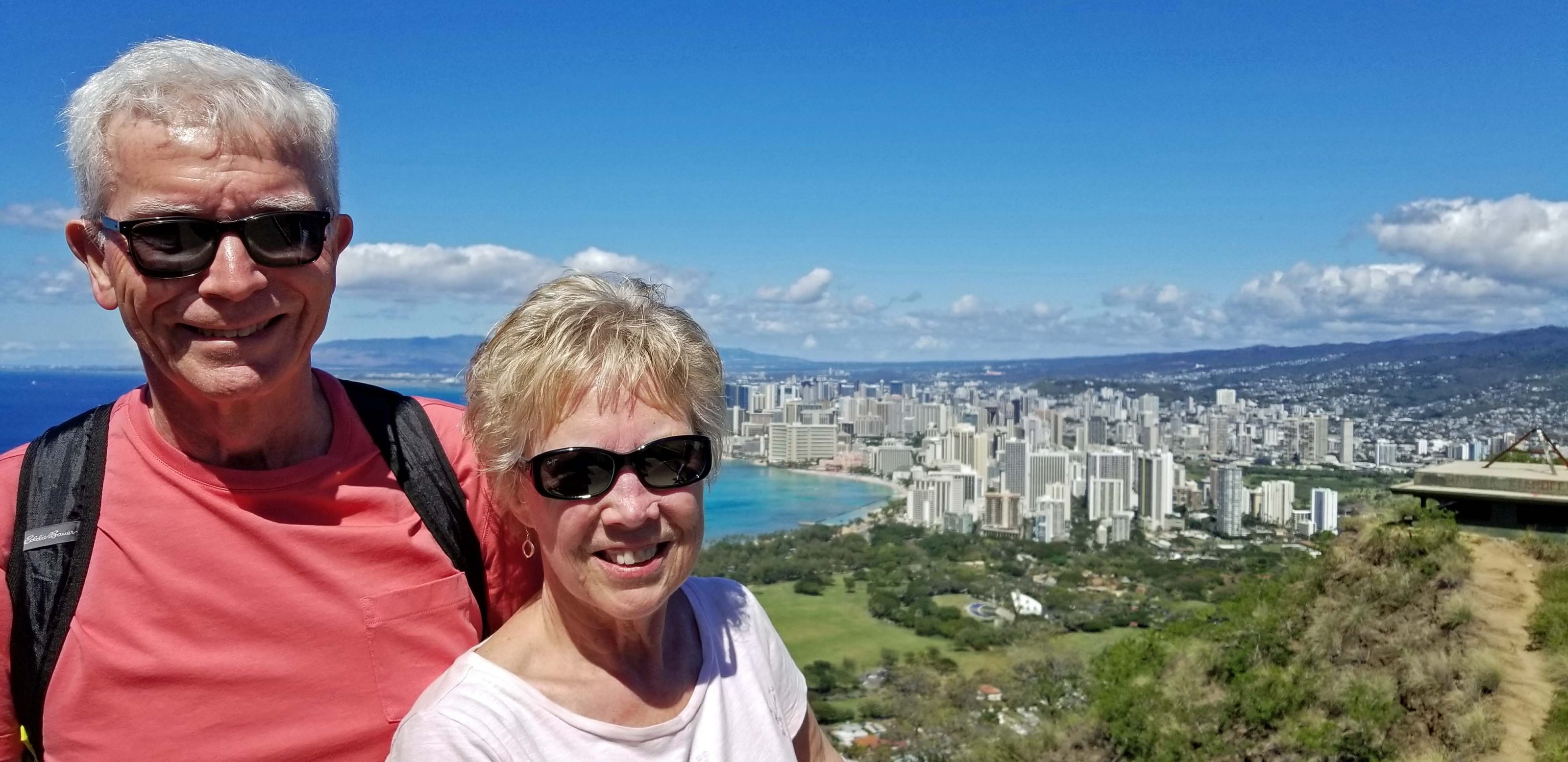
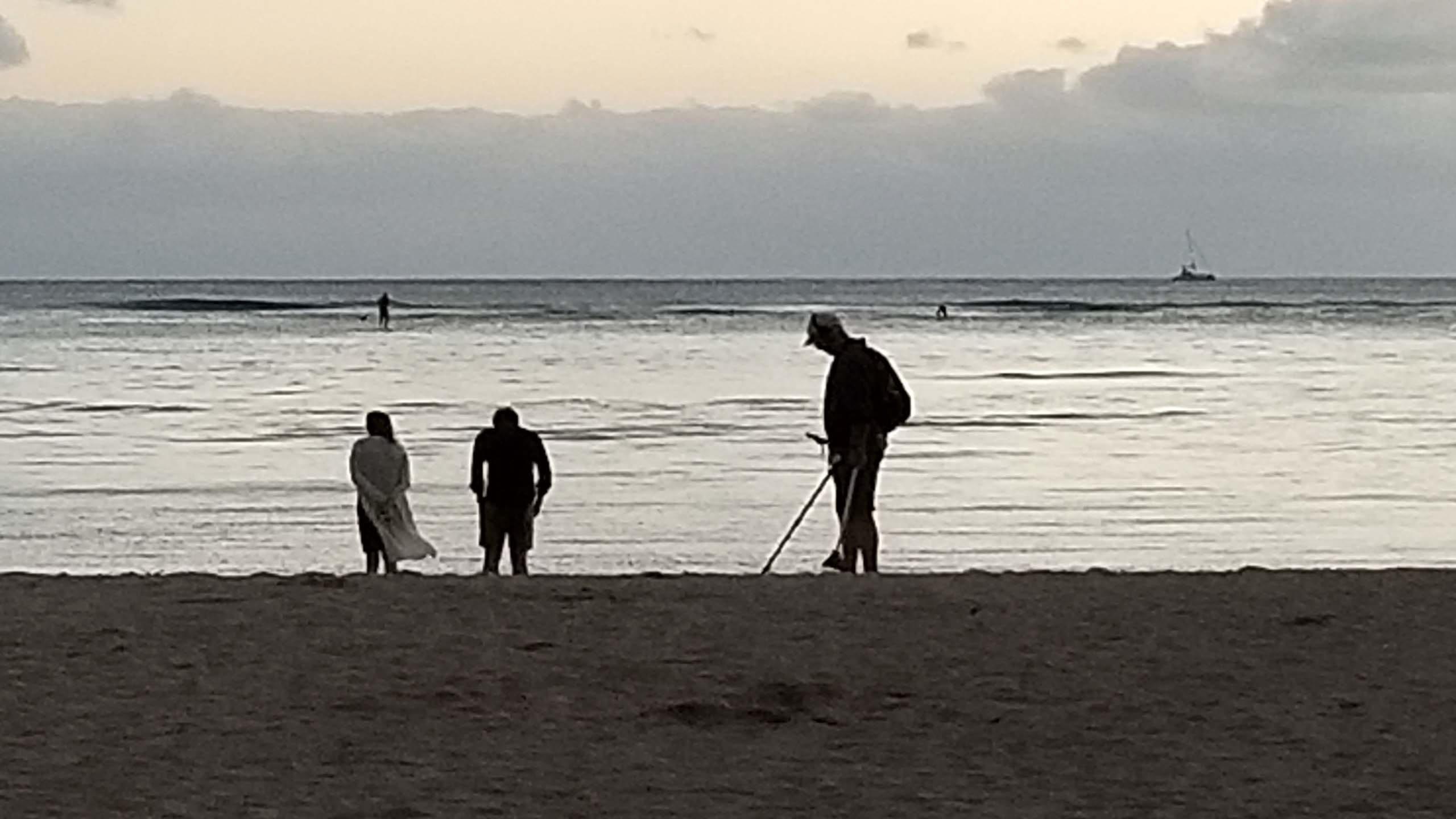
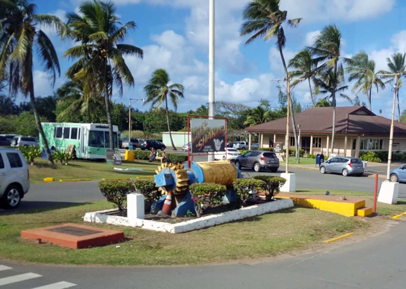
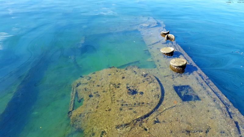
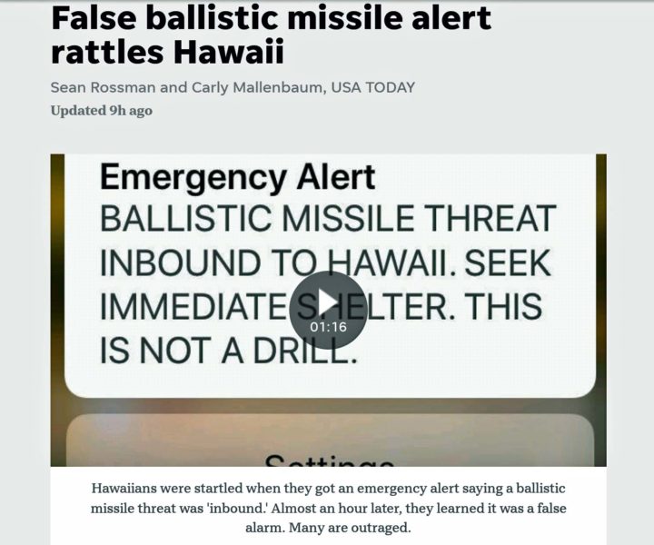
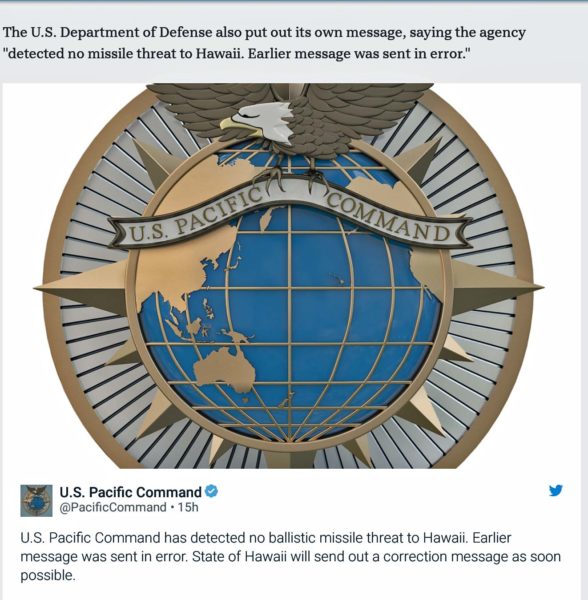
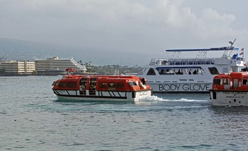
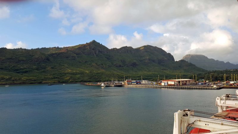
Today, our ship docked at Nawiliwili, Kaua’i.  I asked our excursion guide how to pronounce the name of the city.  He replied, “It’s actually nah-villy-villy.  A lot of people say nah-willy-willy, but it willy doesn’t matter.”  (A local, joke, I’m sure.)  [Author’s note:  Hawai’i is also properly pronounced ha-vy-ee.]

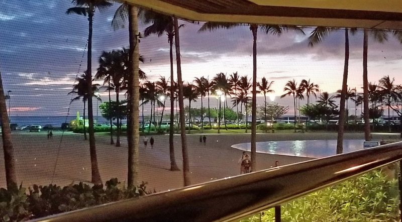
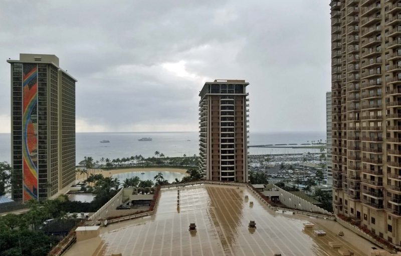
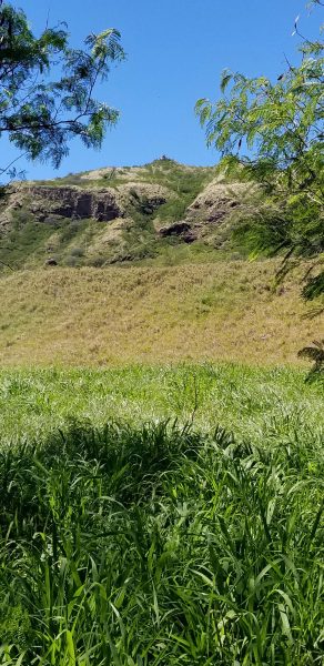
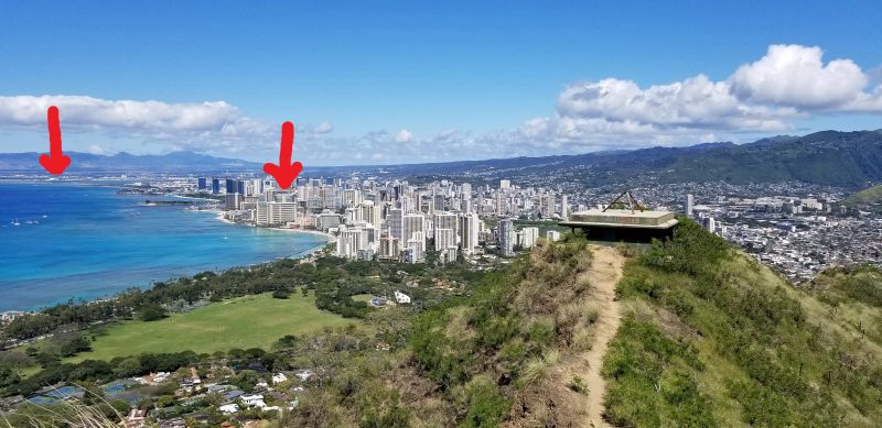
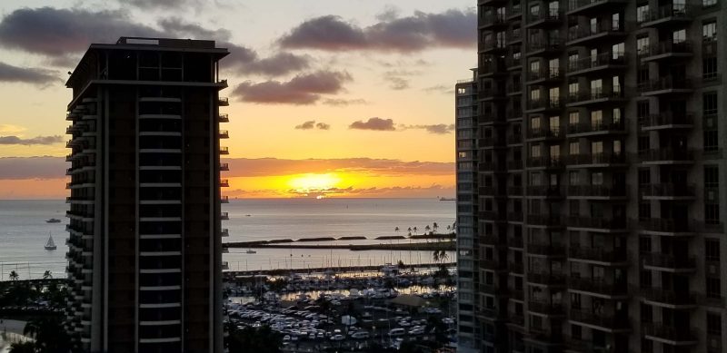
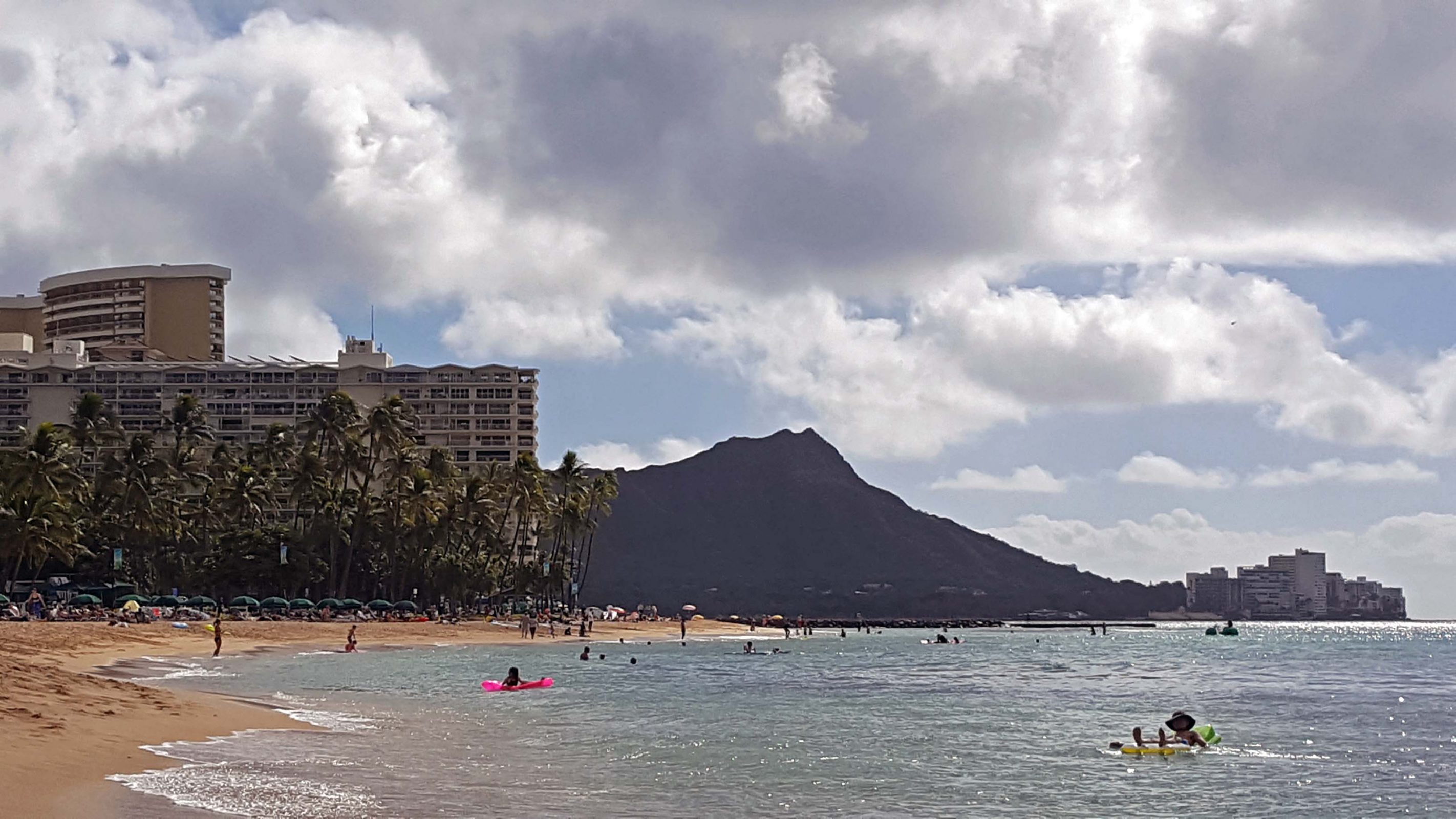
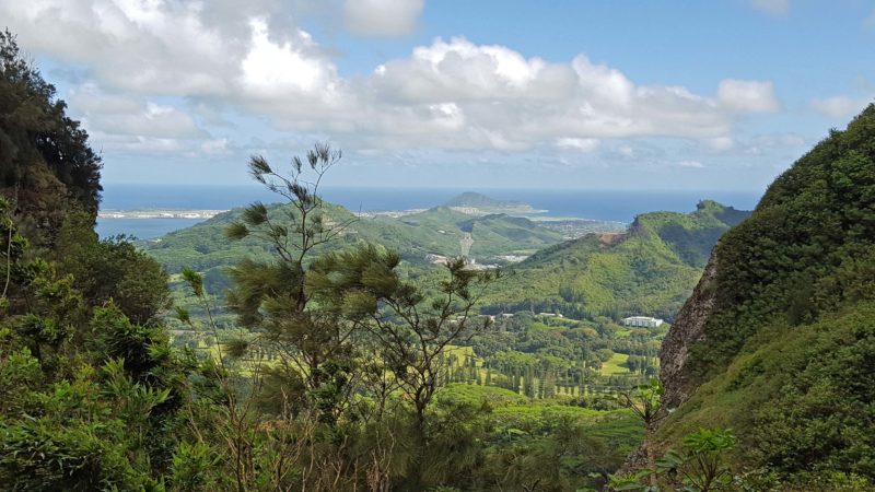
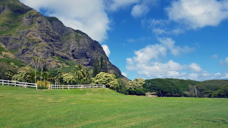
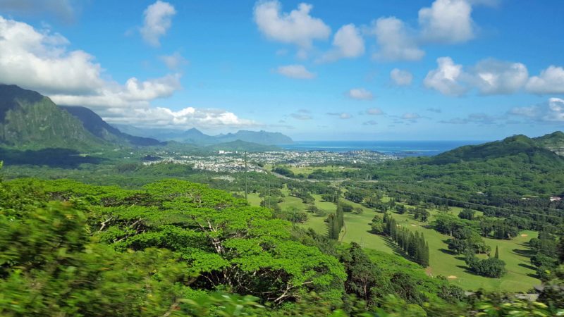
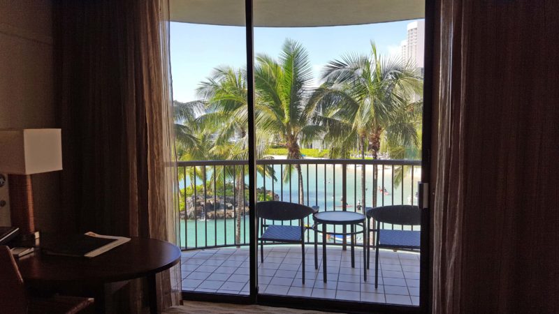
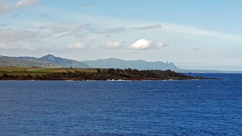
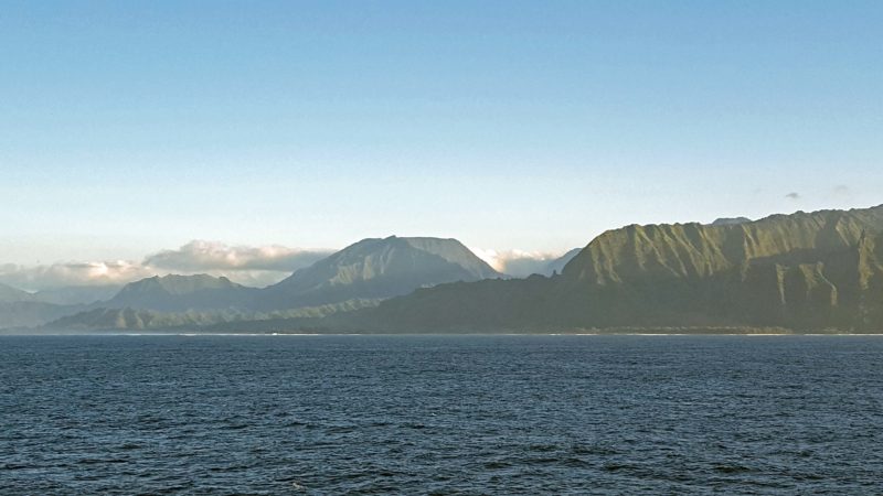
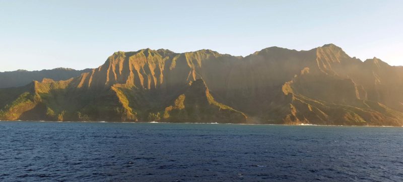
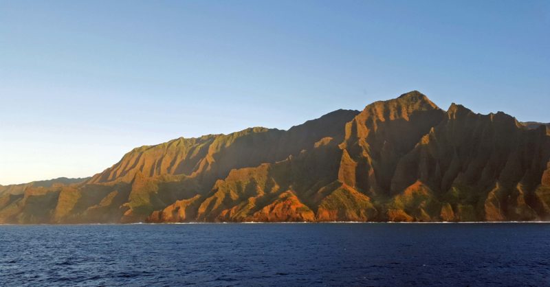
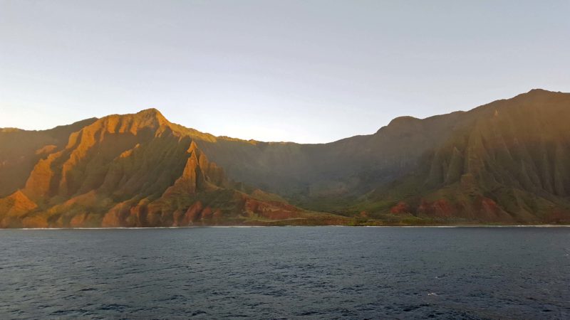
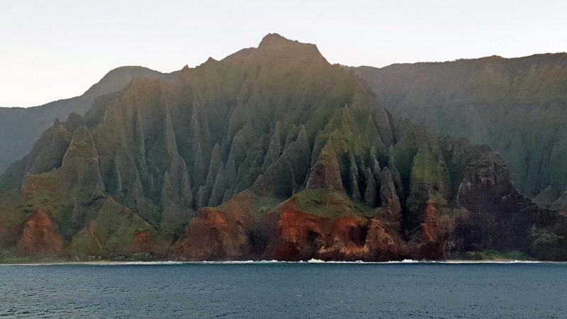
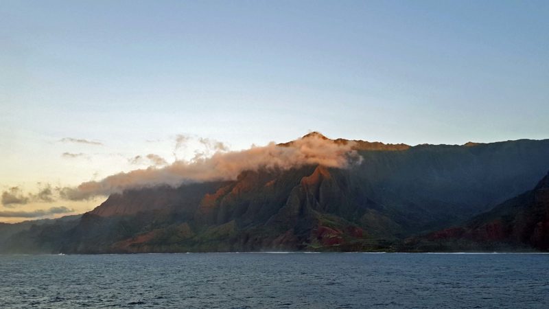
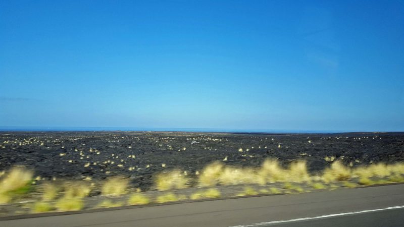
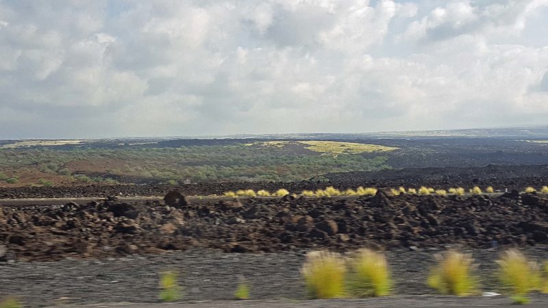
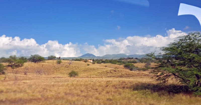
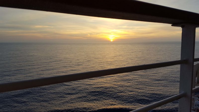
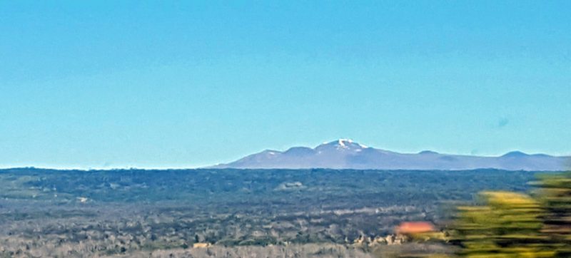
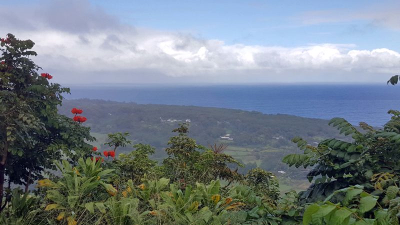
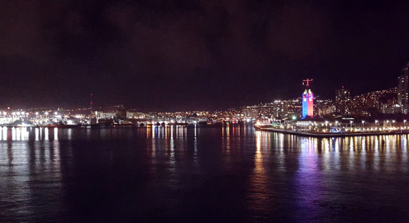
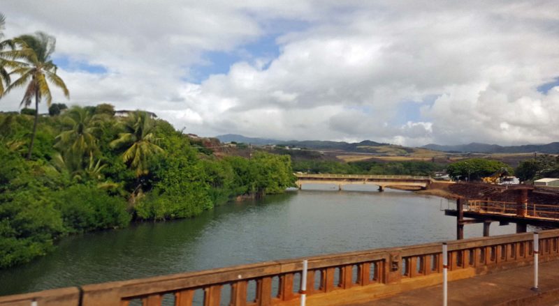
This was our wake-up view this morning.  There are similarities in the four islands we’ve visited, but each is a very unique place to visit and explore.


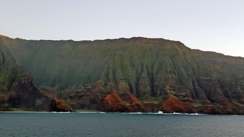
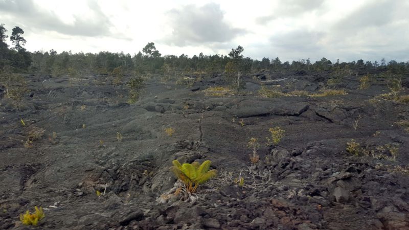
Kaua’i is called the “garden isle.”  It is the oldest of the Hawaiian Islands and has soil.  The volcanoes on Kaua’i are inactive and the island is now in the erosion stage.  It becomes slightly smaller with each rainfall, so in 5-6 million years, it will be no more than an atoll.  At least there’s time for Ted and me to come back before that happens.  The average annual rainfall at Kaua’i’s mountaintops is 460 inches; at sea level on the western (dry) side of the island, it’s 2 inches.

Hawai’i has 13 of the 15 microclimates, which I found very interesting.  It lacks the extreme cold and the extreme hot microclimates.  Within almost any 15-minute drive on our tours, we see weather changes–warmer or cooler, rainy or sunny, calm or windy.  When it rains, the rain never lasts very long–maybe 5 minutes–but it rains repeatedly, and it never stays sunny very long in the wet areas like the rainforests.  It never stays rainy very long either.

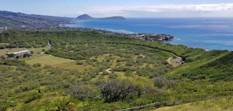
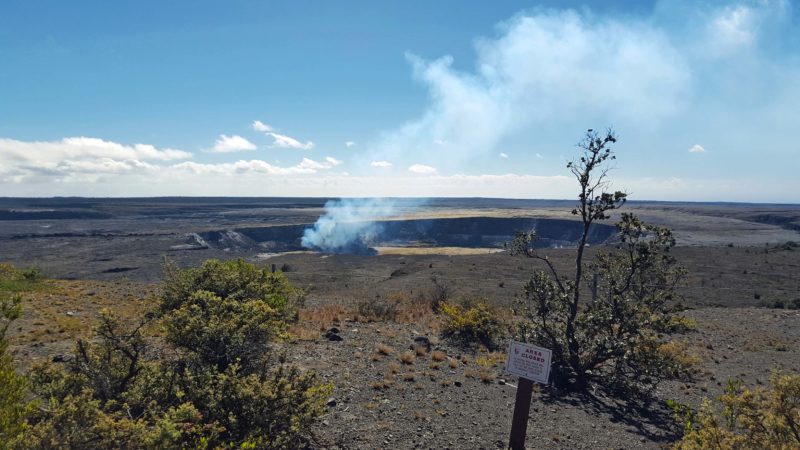
Today’s excursion was titled “The Best of Kaua’i” and took us first to Waimea Canyon, “The Grand Canyon of the Pacific,” on the west side of the island.  The canyon is at 3,600 feet elevation, so we went through some microclimates to get here from our sea level dock.

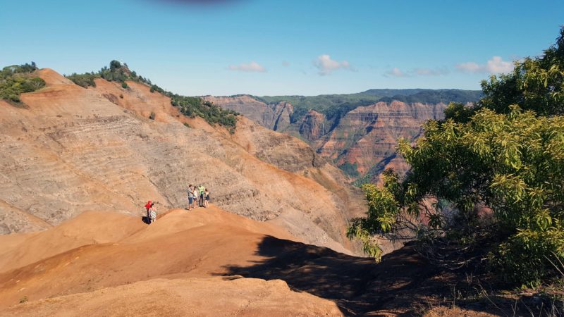
Waimea Canyon is colored by the red and brown exposed volcanic rock mingled with the blue and green tropical vegetation.

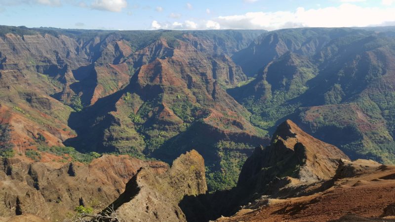
The canyon is 10 miles long, one mile wide, and 3,000 feet deep.

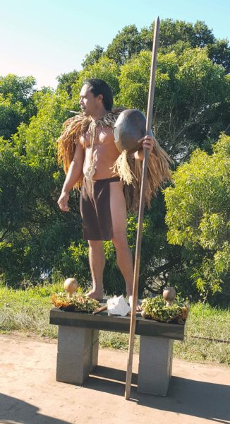
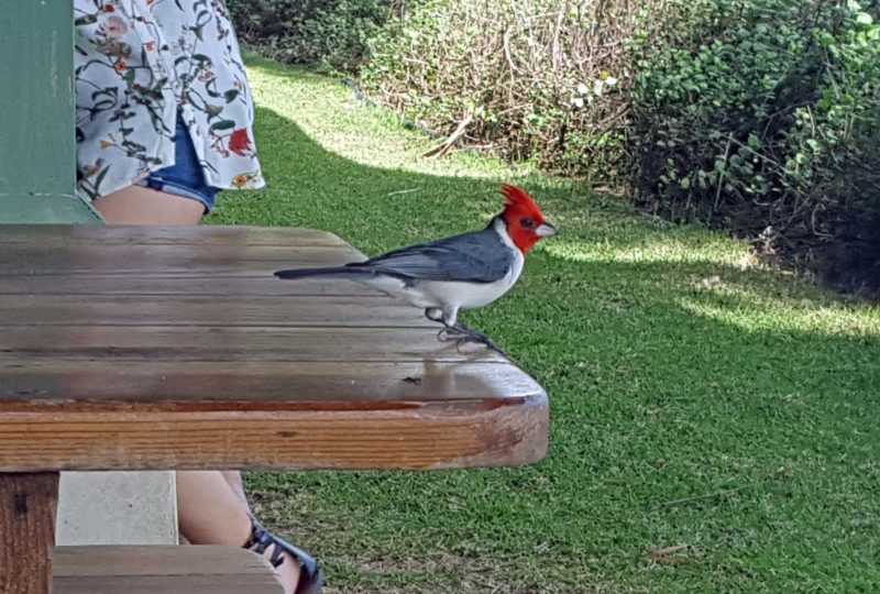
This Hawaiian man at the Waimea Canyon State Park gave us a lot of information about the Hawaiian culture.  Hawaiian life is based on the islands’ name:  Hawai’i.  Ha = breath of life; wai (vi) = fresh water; and i (ee) = creator.  These are the three things needed to live simply.


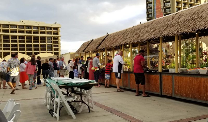
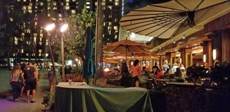
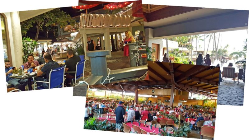
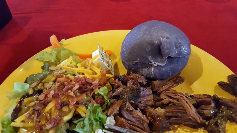
From Waimea Canyon, we drove southward along the western coast and stopped in Koloa for a delicious Hawaiian lunch at a local restaurant.  One of the things I enjoy about Hawai’i is the open-air buildings, like this restaurant.  There is a roof and there are interior walls, but no exterior walls.  The roof is needed to protect people and furnishings from the sun and rain, but the air is so pleasantly warm that it’s nice to have a breeze and unnecessary to have exterior walls–even in the winter.

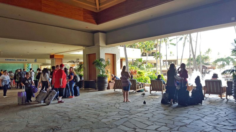
I don’t have a picture of the restaurant, but this is the check-in desk at our resort.  It had no exterior walls or doorways.

The white patch on the right is ocean spray from Spouting Horn, a small blowhole on our drive along the coast.


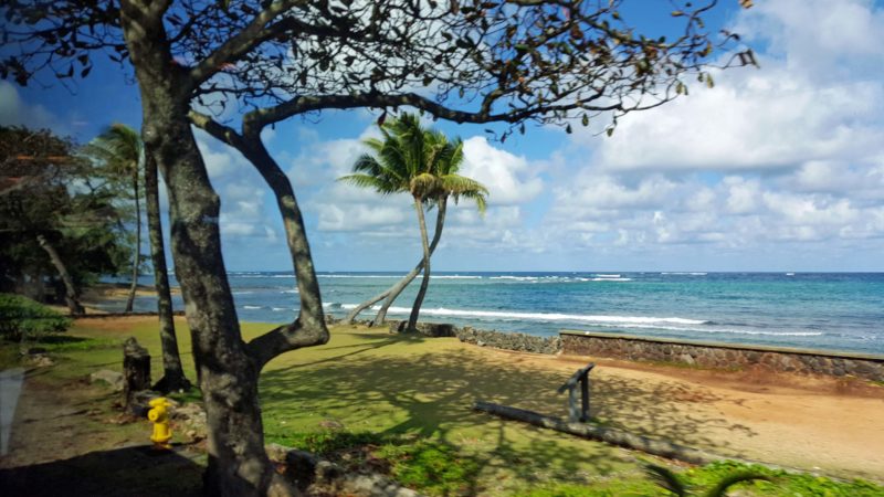
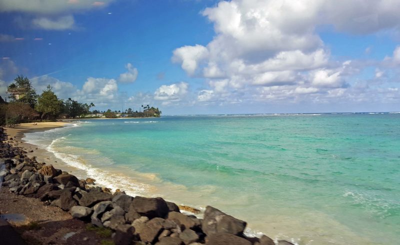
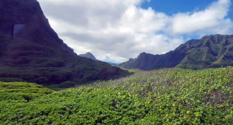
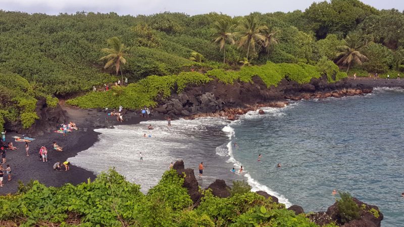
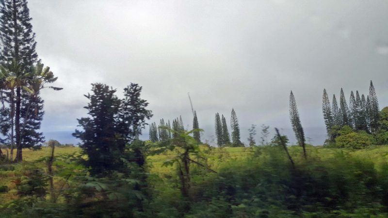
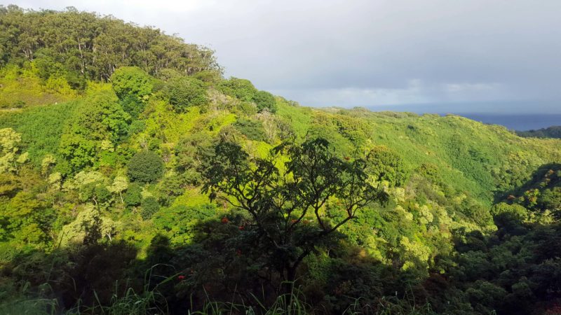
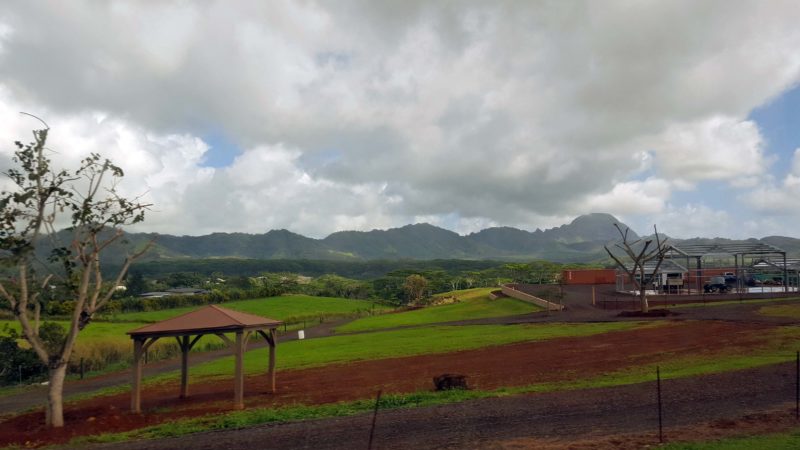
After lunch, we headed for the Fern Grotto on the east side of Kaua’i.  Along the way, we had a variety of beautiful scenery.

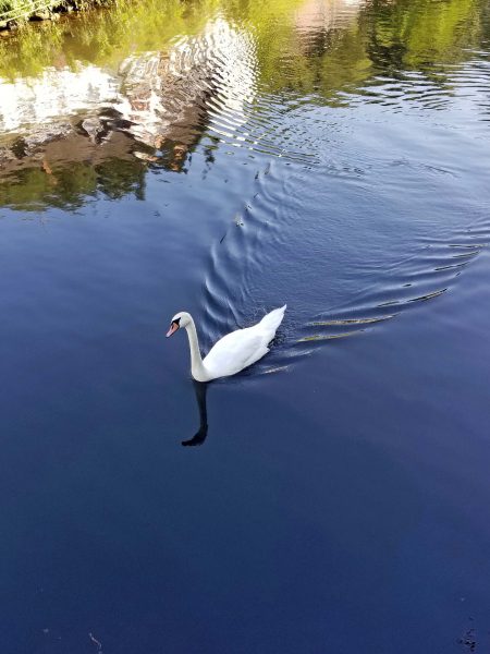
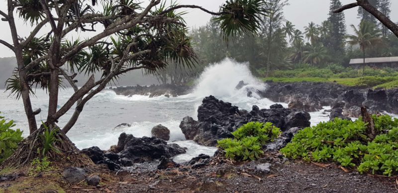
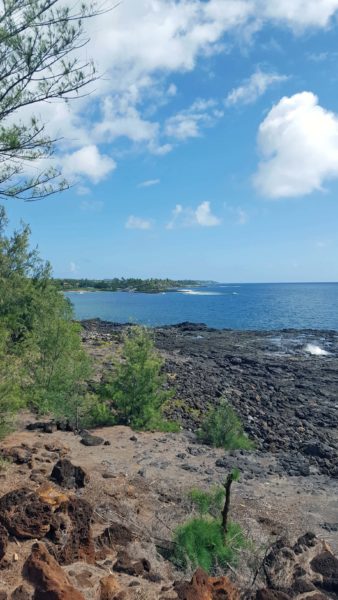
There’s so much water in Hawai’i and it’s all beautiful.

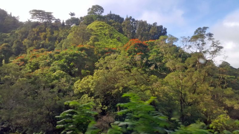
Here you can see ooa (dark clouds, rain) coming over the mountains.  They are probably dropping some of the 460 inches of annual rainfall.  The red soil is volcanic.  The tree on the right that looks dead is actually in its winter stage and will become green in spring.  There aren’t many deciduous trees in Hawai’i.  In fact, I didn’t see any bare trees except for this type.

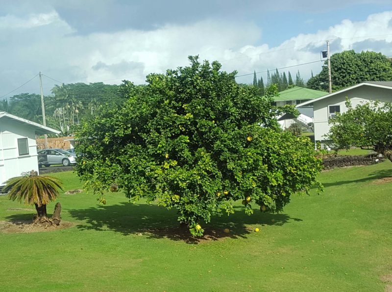
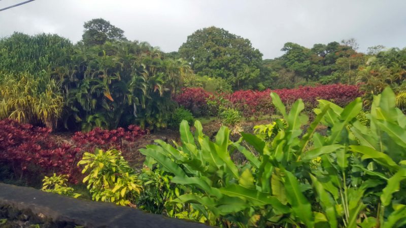
Kaua’i has soil, so crops can grow.  In one field, I saw corn with tassels–in January!

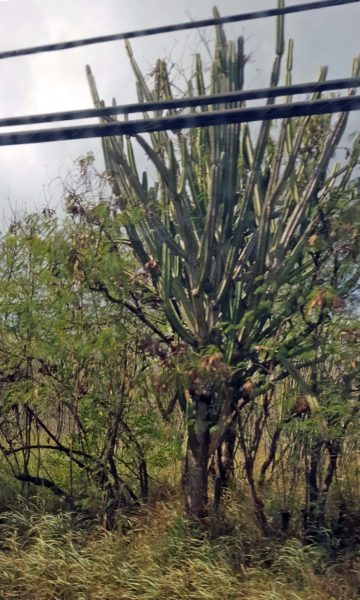
I couldn’t believe it when I saw this saguaro cactus today–on the dry western side of the island, of course.  A woman who lived on Kaua’i collected cactus plants and brought the saguaro to the island.  She had the largest collection of cactus west of the U.S. mainland.  The saguaro is not protected here as it is in the mainland Southwest.

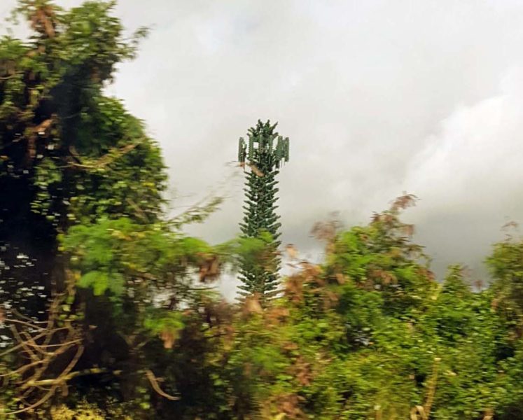
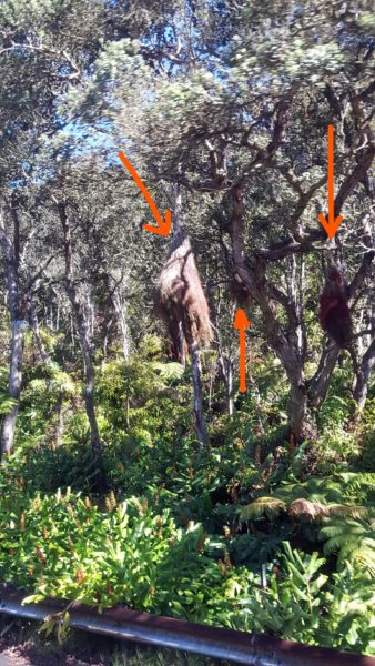
Local residents refer to this as the “Verizon tree.”

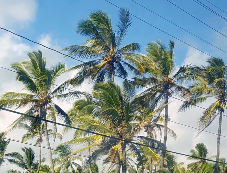
These are obviously coconut palms.  (Duh!)


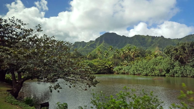
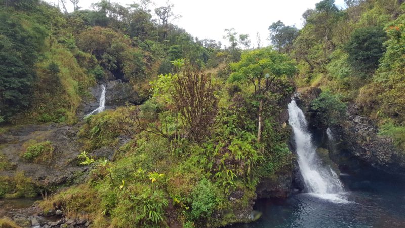
We had some pretty stops along the Wailua River on our way to the Fern Grotto.

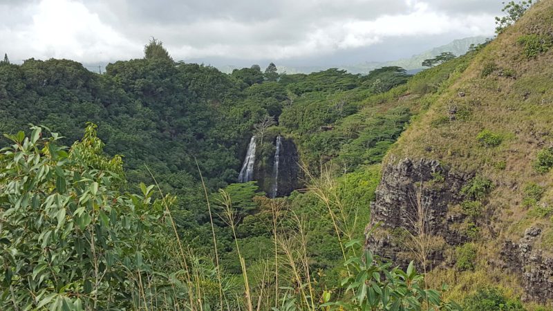
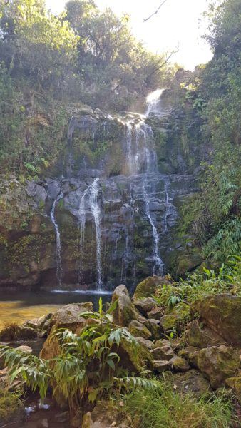
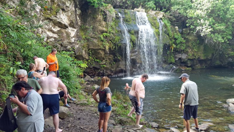
There were waterfalls, of course.

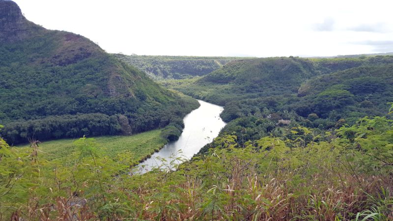
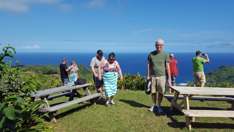
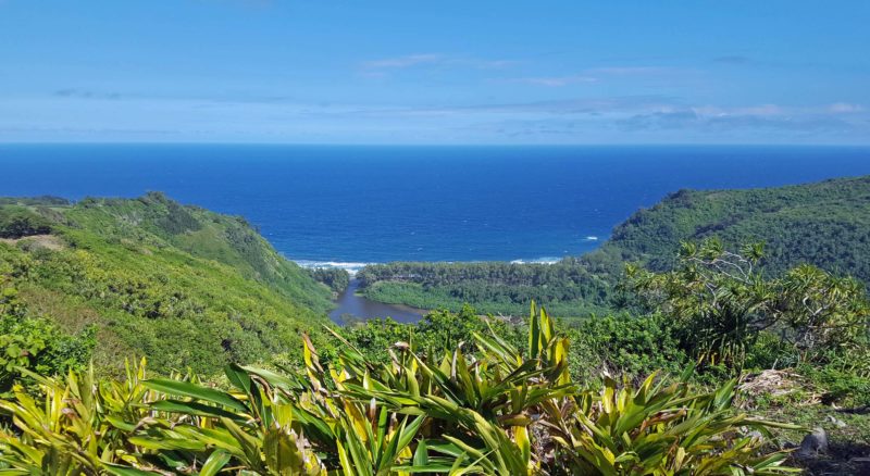
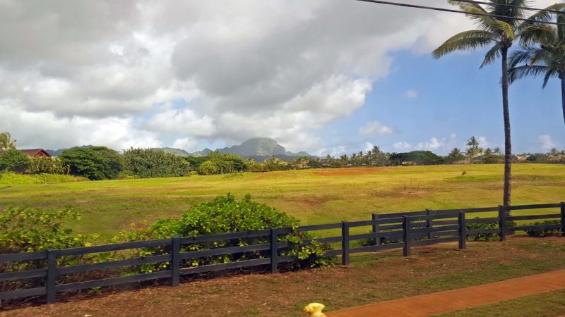
At another stop, we had a pretty view of part of the river valley.


Kaua’i is sometimes referred to as “chicken island” because there are so many wild chickens here.  There are chickens on the other islands too, but not as many.  The Polynesians brought chickens to the islands for food.  The chickens have no natural predators and are protected on state and federal lands.  Anywhere else, it’s legal to catch–but not to shoot–chickens to eat.  Not many people hunt chickens, however, because going to Safeway is much easier.  We stopped on our drive to the Fern Grotto for what our driver called liki-liki (leaky-leaky)–Hawaiian slang for a rest stop. 

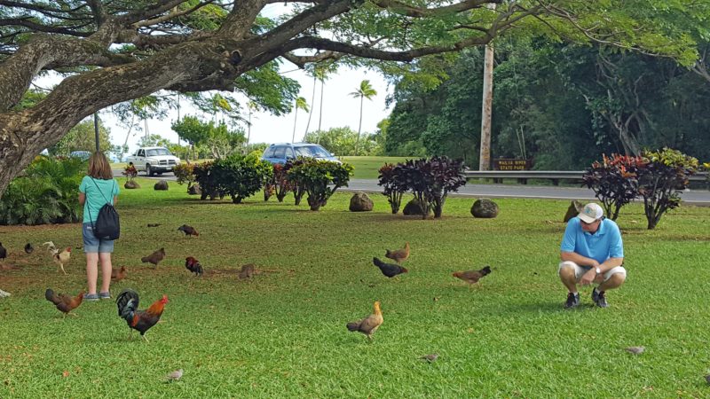
The chickens like to gather in the tourist areas, and there were a lot of them at this liki-liki stop.  I didn’t see any all-white chickens on any of the islands; most were red or brown.


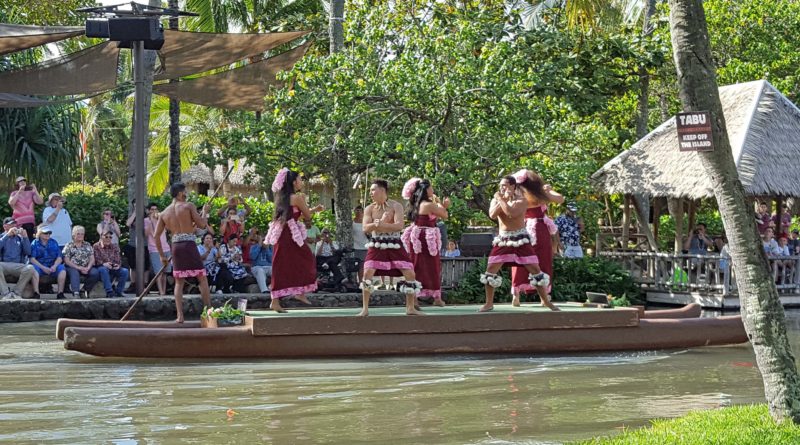
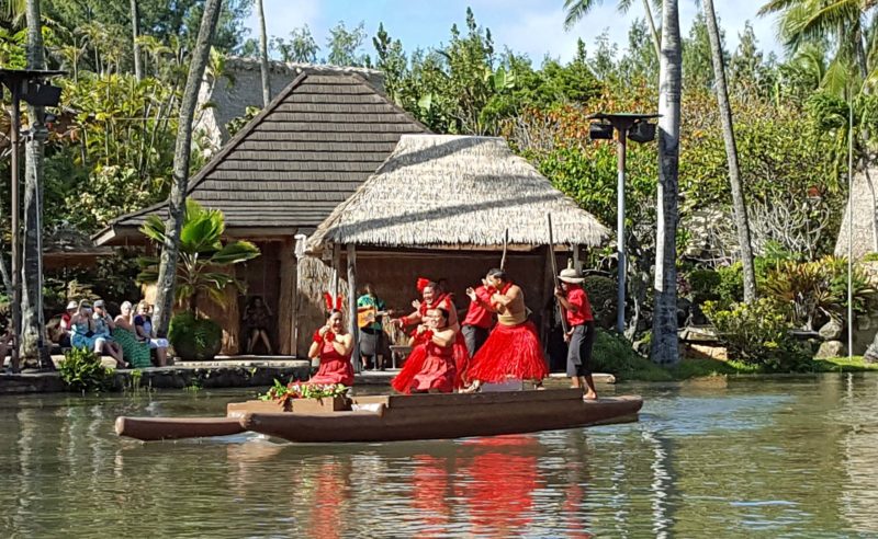
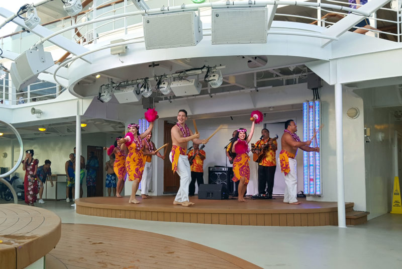
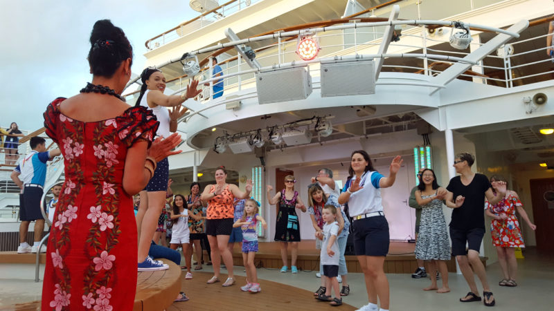
When we got closer to the Fern Grotto, we boarded a riverboat and had a nice little cruise, complete with Hawaiian music and dancing.  We learned today that ukelele is properly pronounced oo-kah-lay-lay.  It was named by Hawaiians who saw someone playing the instrument.  The audience was mesmerized by how quickly the musician’s fingers moved over the frets.  Trying to find an appropriate Hawaiian name for the instrument, they settled on uke (oo-kah), which means “fleas” and lele (lay-lay) which means jumping.  The musician’s fingers moved like jumping fleas.

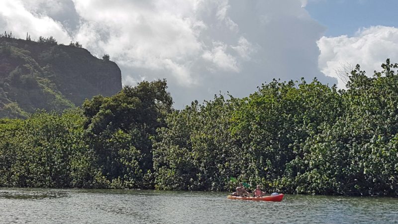
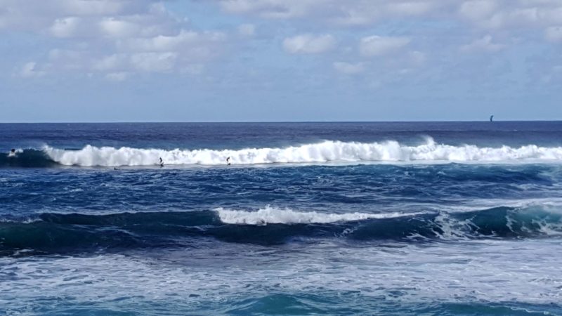
There were a lot of people on the river in kayaks and canoes.


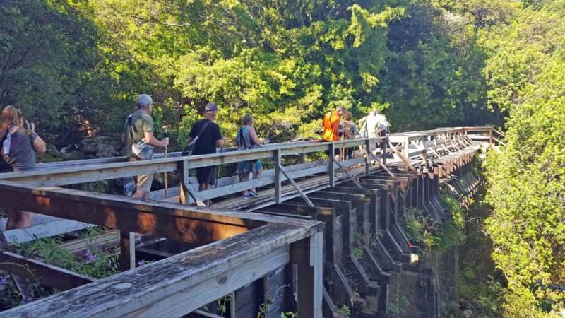
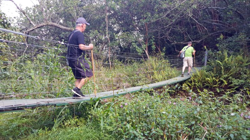
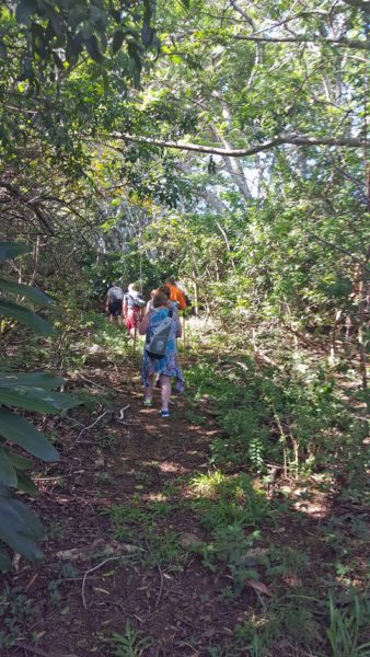
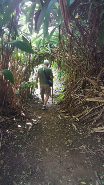
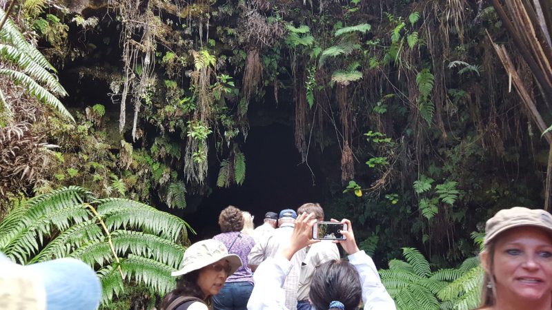
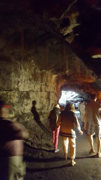
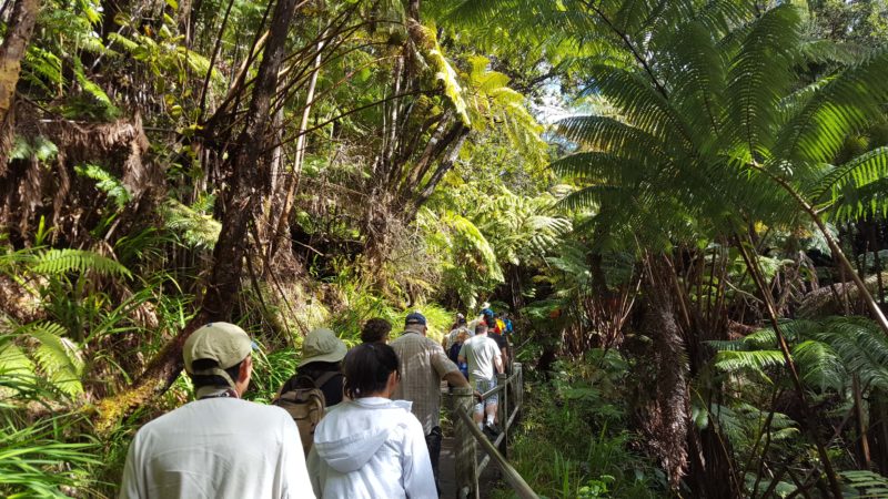
We had a short walk through a rainforest (we’re on the east side of the island now) to the Fern Grotto.

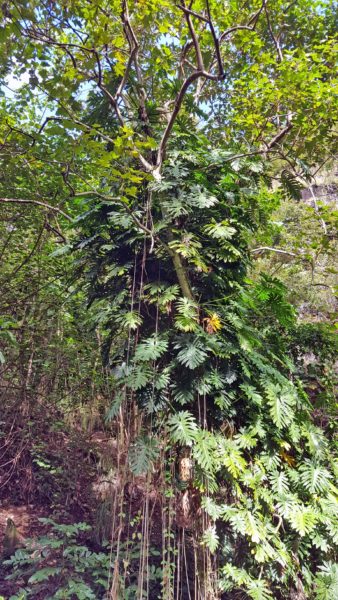
This is a philodendron overgrowing a tree trunk.  The leaves are huge, and it’s just one of many vines doing this.

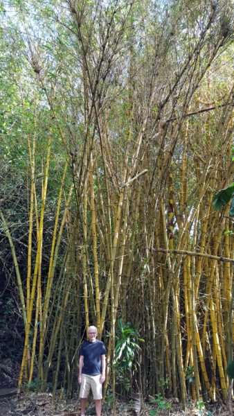
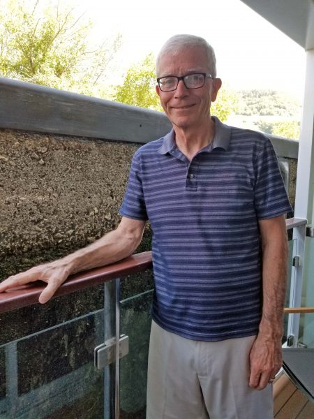
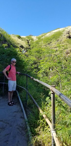
Here’s one of the groves of bamboo in the rainforest . . . and of course, my trusty scale figure–Ted.
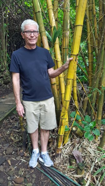
This is big bamboo!

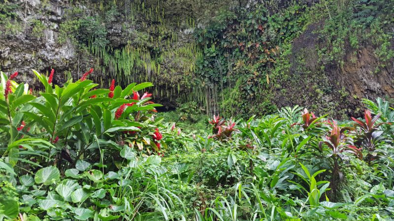
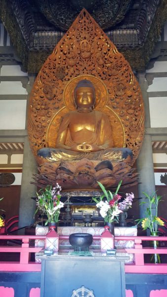
This entire volcanic rock wall is covered with ferns and has water dripping and running over it.  It was a beautiful and peaceful place.  It used to be sacred ground and is frequently used as a setting for weddings.


Before closing, I have to share something our driver told us.  The Hawaiian word for cattle is pipi (pee-pee) and the Hawaiian word for appetizer is pupu (poo-poo).  The driver suggested that the next time we go to our butchers, we ask for some pipi-pupu (beef appetizers).

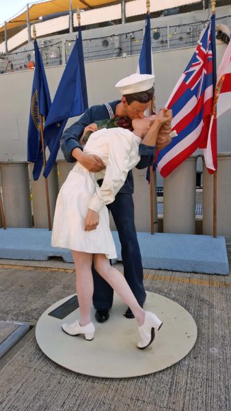
To quote Jeff’s blog about his visit to Hawai’i, it was another day in Paradise.

Before boarding the tender to return to the ship, Ted and I had some time to explore a small area of Kona.

Quinn’s couldn’t get beachfront property, so they named their restaurant accordingly–“Quinn’s Almost by the Sea.”

Wal-Mart isn’t within walking distance of the dock, but there’s money to be made from the tourists.  To capture that market, the store provides a free shuttle from the dock to its retail site.  We saw a similar K-Mart shuttle at another port.

This is Ted’s destination birthday trip, so the girls gave him gift money for his birthday with instructions to spend it in Hawai’i.  Today, he bought some aloha shirts. This is Shirt #1 . . .

. . . and this is Shirt #2.  Jeff also bought aloha shirts on his Hawaiian vacation in August.  Now he and Ted can break them out together next summer.


The onboard entertainment this evening was a comedian who kept us laughing constantly for an hour.  Did you know that people in Dubai don’t like the Flintstones?  But people in Abu Dhabi do.  (Hee hee!)  In one part of the program, the comedian mocked the stateroom bathrooms.  He commented on how small the shower stall is and mimicked trying to move his arms upward, turning around, and bending over, while muttering, “Hmm, this is going to call for some decision-making.  Aww, I’ll just wash that part when I get home.”  He followed up by saying this is the first time he’s been able to take a shower, brush his teeth, and use the toilet–all at the same time.  When we returned to our stateroom after the show, Ted and I decided to take some photos to illustrate this.

Here’s the shower stall. Ted has about an inch to spare for moving his arms.  Luckily, neither of us dropped anything while showering, because bending over would indeed be tricky.

It looks like it’s true that you could shower at least part of your body while brushing your teeth and, if necessity required it, you might be able to use the toilet at the same time.


Yes, we’re having fun, fun, fun.

Kealakekua Bay (pronounce each vowel), is about 20 miles south of Kona on the Big Island, and is believed to be the place where Captain James Cook arrived in 1778.  He was searching for a northwest passage to England and stopped in Hawai’i, seeking shelter from the winter months.  I can tell you from experience that Hawai’i in the winter has a much nicer climate than England in the summer!

Yesterday, our excursion took us to four of the five volcanoes that formed Hawai’i; today, we were on the fifth one.  We were able to see vog–volcanic smog.  It makes sense if you think about it:  the active volcanoes on Hawai’i are always spewing smoke that contains ash so, logically, there are a lot of ash particles in the air, making the mountaintops look hazy.  Kona is most famous for its coffee.  It has the perfect climate to produce eight million pounds of coffee per year.

Hawai’i’s beaches have a variety of sand colors, including white, black, and green.  I liked the black sand beach on Maui, and wanted to see a rare green sand beach, but it wasn’t on our excursion itinerary.  Green sand beaches exist only on Hawai’i and in the Galapagos Islands, Guam, and Norway.  Ted and I will have to see a green sand beach on our next trip to the islands.  In the Hawaiian Islands, nearly all the shoreline is public.  Isn’t that a great idea?  I hate that, on the U.S. mainland, hotels, resorts, and beachfront property owners can claim beaches as their private property!

Kona means “leeward side” in Hawaiian, meaning it’s on the west side of the island.  (Remember the easterly trades.)  While Volcanoes National Park on the east side of the island gets over 100 inches of rain/year, Kona gets fewer than 10 inches.  Although Hawai’i is more than twice the size of all the other Hawaiian Islands combined, it is the least populated island per square mile.  Most people on Hawai’i live in Hilo and along the Kona coast (properly called the Kohala-Kona coast because Kona is technically a district, not a city).  Kona’s harbor was too small and shallow for our ship, so we had to dock offshore and take a tender to the city.

The tender was launched from our ship.  As a tender (aka shuttle), it can carry 97 people; as a lifeboat, it can carry 150 people.  It is stocked with food and survival items, and feels a lot safer and more comfortable than the lifeboats in the “Titanic” movie.


Anyone with some knowledge of Hawai’i has heard of King Kamehameha.  Kamehameha was born as Halley’s Comet passed over.  The comet was interpreted as a sign that a boy child of great power would be born and that he would be a “slayer of chiefs.”  To protect him from assassination by other less powerful chiefs, Kamehameha was sent as a child to live in isolation with his aunt and uncle on another island.  Meha means “lonely.”  The Hawaiian language repeats words for emphasis, so Kamehameha means “very lonely”–a description of his childhood.  Kamehameha was an imposing person.  His actual shoe size is known and, from that, he is estimated to have been at least seven feet tall.

Like all young Hawaiian men of his time, Kamehameha trained to become a warrior.  He witnessed Captain Cook being clubbed to death and saw the British Brown Bess muskets in action.  He decided to master the use of the British modern weaponry, unite the islands, and prevent any other foreign power from conquering them in the future.  He was the first chief/king to unite the islands, each of which previously had its own chief and government, but it was not a peaceful unification–he defeated the other chiefs in battles, beginning with his cousin who was also a chief.

We had a wonderful excursion today to the Secret Falls of Kohala.  (Of course, if there are excursions to the falls, they are no longer a secret.)  It was over an hour’s drive to the trailhead, so we had a chance to see some of the evolving landscape of Hawai’i.  It reminded Ted and me of Iceland–another “new” landscape that is visibly evolving.

This is an area that has been “recently” covered by fresh lava, so it is nearly completely barren.

This lava surface is older.  Grasses and plants are becoming more prolific.

This is an “old” part of Hawai’i and has real soil that can support trees and shrubs.


The first part of our ride to the trailhead was on paved roads in a nice, 15-passenger van (there were only 12 people in our group, plus the guide).  The first hint of change was when we parked at a rest stop and the guide handed out backpacks, water, trekking poles, and sunscreen.  (Ted and I already had all of those things–except the trekking poles–with us, and so did a few of the other people.)  Then he directed us to a 6-wheel drive vehicle that we’d need for the off-road part of the drive.

My first ride in an OTR vehicle.

Here’s our cozy group, ready for adventure.

There were dangers as we drove first on a gravel path, then on mud tracks, and then across open land, including pastures.

Part of the gravel path.  The driver had to get out to open and close some gates along the way.

The hike included this bridge over a part of Alexander and Baldwin’s aqueduct.

Later on, there was a narrow suspension bridge.

This is a level part of the trail we hiked.  The forest became denser and the trail became steeper as we worked our way upward to the Secret Falls of Kohana.

You can see that this area of the trail would become overgrown rapidly if it weren’t cut back regularly for hiking groups.

Here are the Secret Falls.  There were several waterfalls along the trail, but this one was my favorite.  It is also called Ohana Falls.  “Ohana” means family.  The falls begin as one, then branch into many–like children and grandchildren.  At the bottom, all the members re-unite in a single stream, and the family cycle is repeated.

The next waterfall included a nice pool for swimming.  About half of our group got in the water, but I abstained.  I wasn’t eager to swim in water colder than 65 degrees.  I’ll do it if Ted and I come back in the summer.

Our reward for the hike was a hilltop picnic.

It’s hard to imagine a better lunchtime view.  In the movie “The Descendants,” this is the pristine piece of land the family considered selling.

When we returned to the ship after a wonderful day outdoors, Ted and I enjoyed the sunset over the Pacific from our stateroom balcony.

Getting ready for our excursion

Today was the first of our two days on Hawai’i, the Big Island.  Surprisingly, Hawai’i is only 36 miles from Maui and you can easily see Maui from the northwest shore of Hawai’i.  Our excursion today took us to Volcanoes National Park, and to a rainforest, an orchid nursery, and a macadamia nut plantation.  We were hoping to see Kilauea’s flowing lava in the park, but learned that a large part of the park is currently closed.  Kilauea is Hawai’i’s biggest tourist attraction.  Its name means “The Spewing,” and it has erupted every day since 1983.  The volcano is currently acting like it might produce a major eruption, so the flowing lava can only be viewed from a distance at sea right now.  The rainforest, orchids, and nuts were safe for visitors.

Before leaving for the park, we had to gather in the ship’s theater to get our transportation instructions, etc.  The lady telling us what to do was pretty amusing, considering it was 8:00 a.m.  We were cautioned that Hawai’i has very strict agricultural rules.  If we want to take macadamia nuts (or any other food purchase) home, we cannot open the packaging (seriously).  The speaker warned us that if we are buying nuts as a gift for someone at home, it might be safer to have them shipped, since no one wants to receive a nut that used to be chocolate-covered.  She told us that, except for those who requested a vegetarian lunch, the box lunches are all the same–last night’s leftovers.  We were told that we’d be back at the ship around 3:30–except for those who signed up for the Volcano Sacrifice Tour.

On our way to the buses, I asked a driver if Hawaiians actually wear aloha shirts or if that’s part of the uniform for those who work with tourists.  He told me he retired to Hawai’i with two dozen business suits and quickly learned that an aloha shirt is considered dressy; if it’s tucked in and accompanied by a lei, it’s formal.

Things I learned today

(1) If there is a tsunami, we should return to the ship.  We are safest at sea during a tsunami.  (2) The Hawaiian Island chain is 1,500 miles long, and extends to Midway Island.  Kaua’i is old and in the erosion phase; Hawai’i is young and still growing.  The entire chain is moving northward.  At one time, Kaua’i was located where Hawai’i now exists.  (3) Captain Cook was killed and cooked on Hawai’i.  Hawai’i is geologically young and its scarce soil must be used for food.  It’s impossible to dig a grave in lava rock, so bodies are cremated.  (4) The “cleaner fish” is endemic to Hawai’i.  It has an extra fin on its belly that acts as a suction cup.  The fish uses the fin to clean other fish and will do the same to people in the water.  These fish are sometimes used in spas for pedicures, etc.  (5) Breadfruit can be cooked just like potatoes–boiled, fried, mashed, etc.  I had some with my lunch one day and it tastes like potatoes, but just a little sweeter and creamier.  (6) Macadamia nuts ripen at different times on the trees, then fall to the ground when they are ripe.  They must be picked up by hand before they begin to rot on the ground, and that’s what makes them so expensive.  (7) Five volcanoes built Hawai’i.  Kilauea is the most active; Mauna Loa is the most massive; and Mauna Kea is the tallest–in Hawai’i and on earth.  It rises 33,476 feet above its ocean floor base.

Photo gallery

This is a breadfruit tree.  Breadfruit are a little larger than grapefruit.

Some of the orchids at the orchid nursery.  Hawai’i is well-known as the Big Island, but all the islands also have nicknames.  Hawai’i’s nickname is The Orchid Island.

These orchids are huge.  I should have included my hand in the picture for scale.  They are gorgeous!

We were allowed to view this crater.  Look closely–it’s a crater within a crater.

The Hawaiian Islands were built by shield volcanoes.  Shield volcanoes have more flowing lava, rather than the kind that shoots rocks high into the sky.  That’s why this lava looks smooth.  It’s not–it’s like glass and will scrape your skin if you fall on it.

Plants are beginning to erode this lava to form soil.

This is the beginning of a lava tube.  During eruptions, lava repeatedly flows in this path, cutting away the bottom and sides and leaving residue at the top.  Eventually, the residue meets on the top and forms a tube.  Eruptions can send multiple plumes of lava upward through a lava tube to the surface.

Here’s an entrance to a quarter-mile long lava tube.  The longest known lava tube on Hawai’i is 32 miles in length.

This lava tube is lighted inside, so we could find our way through it.

Hilo is on the east side of Hawai’i, so it’s in the rainy part and gets 120 inches of rain annually.  We walked through a rainforest during our excursion today.

This tree can move itself if it doesn’t like where it’s growing or if conditions change. The large brown lumps indicated by the arrows are roots.  Eventually, the branch to which they are attached will fall, and the roots will begin to grow a tree where they land.  The process can be repeated by the tree as needed.

You have to be at a distance to see Mauna Loa (“Long Mountain”), so this picture isn’t great, but–hey!–it’s Mauna Loa, the world’s densest and most massive mountain, comprised of 10,000 cubic miles of iron-hard lava.  It rises 30,085 feet from its ocean floor base–not quite as high as Mauna Kea.

Ted and I wanted to take the excursion to Lahaina (the city of royalty) today, but the ticket agent told us she’d sold the last two tickets just five minutes before we came to her desk.  We took that to be a sign that we should have a vacation day today, so we spent the day relaxing.  Lahaina translates to “hot sun” because it is always very hot there.  We stayed cool(er) instead.

We took some time to explore the ship and found out there is an “upscale” restaurant upstairs from the restaurant where we ate dinner last night.  The stairway to the upstairs restaurant is inside the downstairs restaurant, so you have to enter one to get to the other.  The downstairs restaurant is casual and allows shorts; the upstairs restaurant requires trousers and button-down shirts for men and dresses for women.  The dress code upstairs doesn’t seem to be enforced, because we saw men eating in shorts and women wearing jeans.  The most surprising thing was that the menu in both restaurants is exactly the same!  We even recognized some of the staff from the downstairs restaurant working in the upstairs one.  I don’t get the “upscale” part about wearing different clothes to eat the same food served by the same people.

The ship’s dock site was a five-minute walk from downtown Kahului, so we walked to the mall for lunch and checked out the area a little bit.  Then it was back to relaxing poolside.  We enjoyed live music, beverages, and ice cream, and had a pleasant afternoon in the warm Maui sunshine.

Here’s the main pool area on the ship.

The band and singer are onstage at the left.  The arrow shows where Ted is taking it easy today.  The empty chair at his side is mine.

We were told it was a good day because the clouds lifted enough to see Mt. Pu’u Kukui, one of Maui’s volcanoes.

A bit of Maui weather

Hawai’i is called the “rainbow state” and it’s easy to see why.  I lost count of rainbows sometime after seven today.  I think nearly every place on earth claims that “if you don’t like the weather, wait a day and it will change.”  In Hawai’i, change “a day” to “five minutes.”  The rain comes and goes quickly and repeatedly throughout the day.  Annual rainfall on Maui ranges from 10 inches to over 400 inches–and that’s within a 15-minute drive!

The Hawaiian Islands were formed by a north-south range of volcanic mountains.  Weather in Hawai’i is influenced by the eastern trade winds, so storms approach from the east and move westward.  As a result, more rain falls on the eastern side of the islands as the clouds move westward over the mountains, making the western side of the islands much drier.  It looked odd to see trees leaning to the west as a result of constant winds.  In the Midwest, the wind blows them to the east.

A few Maui facts

(1) The Apollo astronauts trained on Maui’s Haleakala Volcano because it is high, cold, and resembles the surface of the moon.  (2) Maui is indeed the home of “Maui wowee.”  (3) Until 1926, there was only ship access to Maui.  Motor vehicles were rare on the island before the 1940s.  (4) Hana is a very important shipping port for pineapple.  The Maui Gold pineapple is trademarked and very sweet.  I don’t like pineapple very much, but Maui Gold is unbelievably good!  (5) The yellow bamboo that grows in the Hawai’ian islands is so strong, the Chinese use it for scaffolding.  (6) Few people live on Maui, and most of the island has no electricity or water system.  The “shopping area” in one part of Maui is a single fruit stand.  Conditions are even more primitive deeper in the rainforest.  There are not enough children on the island to support a school, so children are home-schooled or they board on another island.

A bamboo house in the rainforest.


A little Maui history

[This is a long story, so I’m going to greatly condense it.]  The chief of Maui was good buddies with a sugar cane plantation owner (I forgot his name).  As a result, that plantation owner got a lot of political favors from the king and had the biggest sugar cane plantation on the island.  Alexander and Baldwin (yes, of Baldwin pianos) had the second and third largest sugar cane plantations, but no political favors.  Alexander and Baldwin looked at all the rain in the mountains and at their dry sugar fields in the lowlands (see the first paragraph, above) and decided they could use gravity to bring water down both sides of the mountains to supply water for people and for sugar cane everywhere on the island.

In 1876, Alexander and Baldwin proposed a plan to the king:  they would build a 17-mile-long aqueduct to move the water and they would complete it in 18 months.  If they were successful, all other plantation owners would pay them for water rights.  The king and his buddy agreed to the plan because they didn’t think this could be done in 18 months.  When Alexander and Baldwin failed to meet the deadline, the king would confiscate whatever was completed, finish it, and collect the water rights himself.  Surprise!  Alexander and Baldwin completed the aqueduct with about a week to spare, collected the water rights money, and then became the richest sugar cane plantation owners on Maui.  Today, no sugar cane is grown in the Hawaiian Islands.  Sugar beets replaced cane, and the last sugar cane was harvested two years ago.

Why is this story important?  Because the Road to Hana–a popular tourist attraction–was the original path Alexander and Baldwin cut through the jungle and rainforest to build their aqueducts.  The aqueducts are visible all along the Road to Hana and still carry water down from the mountains.

A lot of Maui pictures

The rainbow eucalyptus shows its colors especially well when it’s wet (every day).

Twin waterfalls.  There are so many waterfalls in Hawai’i, they’re not locally remarkable.

A black sand beach, formed by eroded black volcanic rock.  Look!  It’s warm enough for people to swim in the ocean in January!

Hawai’i was formed by shield volcanoes.  Shield volcanoes form lava tubes.  Here’s the entrance to a lava tube at the black sand beach.

Inside the lava tube.

The other end of the lava tube at the black sand beach.

Because ship’s masts often broke in storms, Captain James Cook introduced the Cook (Norfolk) pine to the coasts of the islands, where they would be accessible to ships’ crews.  Cook pines grow very straight and tall, so they could be used as replacement masts.  Unfortunately, they tend to break near the joints where the branches grow, so they are only a temporary fix.  These Cook pines are all leaning toward the west.

Unbelievably thick vegetation everywhere!

Beautiful rainforest plants.

The red flowers on the trees are African tulips.  In some places, there are so many, it looks like red leaves in the fall in the Midwest.

Vegetation that grows wild enough to cover cars.  I verified three cars in varying stages of overgrowth.  (You can barely see the front wheel cover of the third car.)  There might be a fourth car on the far right.

A beautiful overlook and the next shower (and resulting rainbow) moving toward us–from the east, of course.

The waves thunder when they come into this cove.

Wind surfers on the north shore of Maui.

Waking up to Hawai’i

Ted and I have finally checked off our 50th state.  We’ve talked about going to Hawai’i for about five years and we’re here at last.  It’s January, there’s a winter weather advisory out for St. Peters, and we’re wearing shorts and sandals.  Life is definitely good.

It’s Diamond Head!  We’re really in Hawai’i!

Beach umbrellas in the warm sunshine of Waikiki.

Ted’s and my feet in the Pacific Ocean at Waikiki Beach.  Aaahhh!  (Mine are the shaved legs.)


All aboard!

After lunch, we had a little time to explore the resort and then we needed to board the ship for our Hawaiian cruise.  The cruise offers two days on each of four islands–Maui, Hawai’i, Kaua’i, and O’ahu–and seemed like an easier way to travel between islands than spending time at airports.  We’ll only need to unpack once, and the captain will transport us in the evenings while we enjoy onboard entertainment and sleep.

It’s Hawai’i, so it’s time for a piña colada while we wait to set sail.

Poolside entertainment to amuse us before we leave port.

A hula lesson onboard to get us in a Hawaiian mood.

Leaving Honolulu and heading for Maui.

Ready to relax and to live on “island time.”

The airport

Because of our flight delay to Honolulu, Ted and I had time to explore the DFW terminal.  We found some interesting things.

Hungry?  Have some bacon.


This guy stood at the door of a store that sold “dermatologist approved” cosmetics.  If this is the dermatologist who approved them, choose a different brand.


We ate lunch at a 60s retro restaurant.  Our tabletop advertised Pan Am’s new Strato Clipper planes and bed-length “Sleeperette” easy chairs that allowed all passengers to recline and sleep on long night flights–at no additional charge.  For an extra $10, you could have a sleeping berth.  There were also complimentary cocktails, a midnight snack bar, and a “hearty hot breakfast” onboard.  Those were the days!


The flight

The initial information about our flight delay to Honolulu was sketchy.  After we finally boarded our plane at 4:00 pm–five hours later than scheduled–the pilot gave us a more detailed version over the intercom.  Because of the bomb cyclone on the East Coast, there was only one Boeing 777 plane at DFW–and that plane had a major maintenance problem that could not be fixed in a single day.  All the other available 777s were delayed at East Coast airports.  As a result, we had to wait until the flight from Miami arrived in Dallas.  Not only did we have to wait until the plane was cleaned after its flight to Dallas, but because we were going to fly over the Pacific, the plane needed an additional safety inspection.  It’s always something, isn’t it?  At least we had a safe plane, but that’s about all I can say that was good about the flight.

[Whining section here]  I’m pretty sure American Airlines squeezes in several additional rows of seats on their 777s, because I barely had room for my legs between my seat cushion and the seat back ahead of me.  The section of the main cabin in which Ted and I were seated was very cold–so cold that, every time a flight attendant walked past our seats, the attendant said “Whew!  It’s cold over here!” and kept on walking, presumably to a warmer section of the plane.  When a passenger asked if the temperature could be raised, the flight attendant said it would warm up in a couple hours.  Gee, thanks (and no, it didn’t).  We needed our jackets and the airline blankets to prevent frostbite and I was still shivering.  Eventually, it was mealtime and we were offered a “snack meal”–the soggiest, coldest wrap I’ve ever seen.  The dough on my wrap was disintegrating because it was so wet!  It came with a cookie and a cold beverage.  We were not even offered additional food for purchase (not that it would have been any tastier).  This was our sustenance while we were in the air for 8.5 hours.  Compare this to our overseas experience on KLM where we had lots of leg room, were served a choice of three delicious hot meals and an additional large snack, were offered three beverage runs that included free wine, and enjoyed it all in a comfortable cabin.  Ted and I decided we will never never never fly American again, except to use up the miles we’ve accrued on some short flights.  [End of whining section]  

I nearly forgot to mention that Ted and I had a comparatively good experience on the flight.  About three hours into the flight, the flight crew issued an intercom request for anyone with “medical training” to please report to a crew member.  A few minutes later, the request was changed to “We need someone with an M.D. or an O.D.”  Someone on the flight was feeling worse than cold, cramped and hungry.


The happy ending

It was 75 degrees when we got off the plane in Hawai’i.  We felt like zombies after our 3-4 hours of sleep and the long, uncomfortable day of travel, so we checked in at the resort, ordered a meal at a resort restaurant (it was only 8:30 in Hawai’i), and went to bed.  Tomorrow will be a better day.

Ted set the alarm for 5:00 a.m. today so that we would have time to purchase a beverage at the airport before boarding our 8:00 a.m. flight to Dallas.  After getting through security and the 20-minute beverage line, we took our hot chocolate (me) and coffee (Ted) to the gate, waited 15 minutes, and boarded our plane.

The flight was uneventful and on time, which was good, because we only had 45 minutes to get to the gate for our flight to Honolulu.  Our first priority was to find a schedule board to get the gate number.  Good news:  we were only two gates away.  Bad news:  our 10:55 connecting flight is delayed until 3:00 p.m.!!!  There was an apparently major mechanical problem with our plane.  The working plane will leave the hangar at 1:00 and will arrive at the gate at 2:00.  We’ll board at 2:30, leave at 3:00, and arrive in Honolulu at 7:30, Honolulu time.


Allowing for the time zone change, this will be 15.5 hours after we left St. Louis and 18.5 hours after we got up with only a few hours of sleep.  Then we’ll have to claim our baggage, take the shuttle to the resort, and check into our room.

It’s good that we’ll be on a safe plane, and it’s good that it will be warm in Honolulu, but I don’t think we’ll be using Plan A–spend the afternoon at the beach.

Last night, as Ted and I were putting things together for our trip to Hawai’i tomorrow, we came across the term “water shoes.”  We didn’t know what they were, so we looked them up on Google.  A quick glance told us they would be perfect for several of the day excursions we’ve planned in Hawai’i.

The next step was to Google “water shoes st louis mo.”  This morning, I called the indicated sporting goods and shoe stores.  Only REI had water shoes in January.  Even better, they had a pair in Ted’s size and one in my size.  Jenny apologized for not having any of the second brand they carry for us to look at.  Don’t worry, Jenny.  We’re happy we found what we want in time to put them in our suitcases tonight.

Ted and I were going through our pictures from our Southwest trip and I found one I meant to blog.  It’s a picture of an awesome chocolate fountain at a candy shop in the Bellagio Hotel in Las Vegas.  Go ahead–salivate!

We left Jeff’s house this morning and headed for the Monument Rocks (chalk cliffs) near Oakley, KS.  Last night, we set our alarm an hour early to compensate for the change to CST and to allow daylight time for viewing the Monument Rocks.  Jeff and La asked when we’d be getting home, and we told them we were planning to spend today and two more days in Kansas, arriving home Friday night (this is Wednesday).

Some of the chalk cliff formations.  (Thank you, Google.)


We stopped in Colby for lunch, at the turn-off to Oakley . . . Maybe it was because the weather was cold . . . Maybe we’ve been traveling too long . . . Maybe we’ve spent too many years driving directly east and west on I-70 when we visit Jeff’s family . . . Whatever it might have been, Ted and I suggested to each other that maybe we should just go home.  We calculated what time we’d get home (around midnight because we hadn’t left Jeff’s house as early as usual), decided we could live with it, and hit the road.

We had a wonderful trip around the Southwest.

…States visited:  9  (Missouri, Oklahoma, Texas, New Mexico, Arizona, Nevada, Utah, Colorado, Kansas)

…Miles driven:  6,070

…Days away from home:  31

…Time zone changes:  6 (CDT to MDT in New Mexico; MDT to MST in Arizona–they don’t do daylight time; MST to PDT in Las Vegas–a 2-hour time difference; PDT to MDT in Utah; MDT to MST in Colorado–daylight savings time ended; and MST to CST in Kansas.)  At one point, we were so unsure of what time it was and which devices were showing the correct time, that I actually called the hotel desk to ask what time it was so we could set our alarm for the correct time!

…Significant sites visited:  10 national parks; 5 national monuments; 3 national sites (VLA, Hoover Dam, Kitt Peak Observatory); 2 state parks; and 1 UNESCO World Heritage Site.

…Highlight of the trip (if we have to choose only one):  the mass ascension of 550 balloons at the Albuquerque Balloon Fiesta.

…Fun we had:  infinite.

Following our Royal Gorge Route train ride, Ted and I returned to Pueblo, where we are spending the night.  Pueblo’s Riverwalk and Historic District were a 5-10 minute walk from our hotel, and we had plenty of time to explore them–a little.  It was Sunday afternoon, and not much was open, but it was good to be outside and getting some exercise, even though it was only 42 degrees.

Pueblo’s Riverwalk is not in the San Antonio Riverwalk class, but it was pretty.  It looks like it might be a new development, so maybe it needs some time to attract more businesses along the Arkansas river.

Here’s another view of the Riverwalk.  They’re hard to see in the shadows, but on the left walkway, there’s a couple walking.  The lady is wearing a red jacket.  Now look in the previous picture and find the lady in the red jacket.  Same lady.  That couple was walking in the opposite direction as we were, so we saw them coming and going both ways.

I’m not sure of the reason for this mural, but it was fun to identify the people depicted by the artist.

Nearby was another mural including the omnipresent Southwest chili pepper.  We see them depicted everywhere, including on personalized license plates and in souvenir shops.

Here’s a view of the main street through the Historic District.  There were some architecturally beautiful buildings in this area.

This sculpture was near our hotel (the building in the far left center of the photo).


We enjoyed Pueblo’s Riverwalk and Historic District, but were ready to come indoors to warm up after an hour in the 40-something temperature.  We decided to relax in the hotel’s seating area with a cup of hot chocolate.  These are the good times!

Today, Ted and I took a two-hour train ride through the Royal Gorge.  Trains always run along the rivers in the bottoms of canyons, so I didn’t have to worry about heights.  The Royal Gorge Route Railroad is a “heritage railway”–one that preserves railway scenes of the past.  The route follows the Arkansas River between the 1,000-foot tall granite cliffs of Colorado’s grandest canyon, and is described as “America’s most spectacular rail journey.”  When Teddy Roosevelt rode this route, he called it “the trip that bankrupts the English language.”

The Royal Gorge Route departs from the Santa Fe Depot in Canon City, CO.

The first car of the train is named “Theodore Roosevelt.”  Each of the 10-12 cars had a different name.

Here’s that good-looking couple again!  We had tickets for a vista dome car, so our views were wonderful.

There was an open-air car for unobstructed viewing.  The train moved slowly, so it was a safe ride, but it got cold in the shadows between the canyon walls.

This is the Royal Gorge Bridge–955 feet above us.  We could see people walking on it and looking over the sides.

The holiday village is ready for the Santa Express in December.

Can you see the man’s face in the center near the top of the canyon wall?  He is called “The Guardian of the Gorge,” and his name is Cliff Rock.

We saw about a dozen whitewater rafters navigating the Arkansas River.

Near the top center, look for the red dot.  That is three joined cable cars crossing the Royal Gorge.


We just managed to squeeze this enjoyable two-hour activity into our trip.  The train schedule is down from four runs daily in the summer to one run each on Saturday and Sunday, and next weekend is the last trip until spring.  For Ted and me, it was another highlight of the wonderful vacation we’re having in the Southwest.

Ted and I started our day with a visit to the Taos Pueblo and ended the day in Pueblo, CO–in other words, we went from pueblo to Pueblo.  (Insert groan here.)

The Taos Pueblo is over 1,000 years old.  It is a UNESCO World Heritage Site, and is an active, living community, not a reproduction of pueblo life.  All of the pueblos belong to the community, but the homes in the pueblos belong to individual families.  Living in the pueblo means having no modern amenities–no electricity or running water.  Residents usually have a propane stove for cooking and heating.

In 1847, the Taos Pueblo revolted against the U.S. Military and won.  The Taos Pueblo people have never been conquered, and have maintained their culture and tradition.  Tiwa is the native Taos Pueblo language.  It is an oral language and could disappear quickly, so the tribal elementary schools teach Tiwa and English.  Tribal high schools require an additional foreign language, so tribal members are fluent in at least three languages.  The Spanish brought Catholicism to the tribe, and the church in the pueblo is Catholic, but tribal members also practice their native religion.  Yesterday, we were unable to visit the Taos Pueblo because the tribe was celebrating a native religious holiday.

Here is a portion of the wall that surrounds the Taos Pueblo.  It was originally 13 feet high for protection.

The white arch is the entry to the churchyard.  This is a Catholic church.  Only the far end of the building (crosses on the roof) is the church; the other part is pueblo homes.  More homes are in the right background.


There are currently four resident families in the pueblo, numbering about 25 people, but there are another 1,500 tribal members living on tribal land outside the pueblo.  As long as they are living outside the pueblo wall, they may have a modern lifestyle.  Tribal members pay federal taxes, but they have their own tribal government.  Most people use their pueblo home as a second home:  they live outside the pueblo walls, but return to the pueblo for religious holidays and community events.  Many of the homes are shops, selling food and handmade items to tourists.

This is the largest building in the Taos Pueblo, and has five levels.  Each doorway is a separate home.  The homes are small–about 12 feet square with low ceilings.  Food is prepared in adobe ovens or on propane stoves.  The adobe walls in all the pueblo buildings are 3-5 feet thick to keep the interior cool in the summer and to keep it warm in the winter.

Originally, pueblo homes had no doors.  Ladders were used to climb up to the roof and then to climb down into the home through a “skylight.”   This provided protection from intruders.  Today, the homes have doors cut into them.  Many are painted blue to ward off evil spirits.

This is a view through a series of drying racks.  Meats and vegetables are hung on the upper crossbars to dry and preserve for future use.

Adobe ovens are used for baking.  Cedar wood is burned inside for about an hour to heat the oven.  Then the wood and ashes are removed, the to-be-baked goods are put inside, and the door is covered.  The inside baking temperature is 300-400 degrees, and each oven can hold 25-30 loaves of bread.

The center structure is another multi-story pueblo.  Smaller pueblo homes surround it.  To grasp the size of the pueblo homes, subtract 3-5 foot thick walls from the exterior measurement.  The stream in the foreground comes directly from the mountain and is untreated, but it is so clean that it can be used for everything–washing, cooking, bathing, etc.

The center building with the bell tower was the original pueblo church.  The U.S. Military destroyed it during an attack, believing that the pueblo residents were hiding in it.  (They had actually hidden in the mountains.)  The original churchyard area is now used as a cemetery.  There is an oven in the center of the picture and pueblo homes on the left and right.


After our visit to the Taos Pueblo, Ted and I had lunch at a microbrewery in Taos.  Local restaurants are always interesting.  This one had a “painting” made of beer bottle caps.

I apologize for the blurring, but you get the idea of how creative a beer-cap artist can be.


Ted and I have been driving scenic roads whenever we can.  Today, we followed New Mexico SH64.  It was curvy, mountainous, and beautiful.  I think our average speed was under 40 mph, but we were in no hurry and the views were worth it.  Part of the highway was named the “Enchanted Circle Scenic Byway,” and quite a bit of it was the historic Santa Fe Trail as well.

Winter is getting closer, and it’s becoming a challenge to find fall colors on the trees.  Picture yellow-gold leaves on these trees.

Here’s a village nestled in a valley.

To quote Sting, “Heavy cloud, but no rain” to spoil our views on SR 64.

The Santa Fe Trail continued on I-25.


After visiting Roswell, NM and Hooper, CO–two sites where large numbers of people have reported sightings of UFOs, Ted seems to be getting into the mood.  He thought he saw a UFO in the sky today.

Oh, those funny meteorologists!

Ted and I are back in New Mexico today.  Can you believe that, after waiting so many years to check New Mexico off our “states visited” list, we’ve been in the state twice on the same road trip?!

On our drive to Taos, NM today, Ted and I drove over the Rio Grande Gorge Bridge.  There’s a parking lot at one end of the bridge, sidewalks along both sides of the highway, and an overview area on each side in the center of the bridge.  We parked and headed for the overview areas.  Ooops!  As soon as the bridge left solid land and went over the gorge, my knees felt weak and I had to focus on looking at the sidewalk and the road–I couldn’t look down, because the gorge is so deep.  I stood with my back to the view and checked out the more distant view across the bridge.  Ted had to take the pictures again, just like at the Black Canyon of the Gunnison.

Keep in mind that Ted couldn’t get the top and the bottom of the gorge into the same picture.  Also, it’s always a lot farther to the bottom than a photo makes it appear.  This gorge was very deep–800 feet.


When we arrived in Taos, the first thing we noticed was the traffic.  A two-lane highway runs through the city and it was clogged in both directions.  We picked a place to eat based on the large number of cars parked in front, and had a nice lunch.  Then we put our car in a public parking lot and set out on foot to explore this colorful and quaint town that seems to epitomize the architecture of the Southwest.  Taos is a popular skiing destination and also a cultural center.  The streets are lined with art galleries.

This is the city square.  It is surrounded by adobe shops, of course and, like all city squares, traffic goes one way around it.

Here’s a little corner of shops in the historic district of downtown Taos.

I found an unusual interpretation of the pictographs on the hand dryer in a rest room.

This guy seems to have a permanent parking spot on the main street of Taos.  Honk if you agree.

The weather was very nice, so Ted and I stopped at a cafe in the historic district and enjoyed an afternoon snack outdoors.


What a lovely surprise at the end of the afternoon when we checked into our hotel.  Ted finds hotels through his AAA travel books and through Google, so we’re never sure exactly what they will be like, except that they’re clean and have basic amenities.  Sometimes we find out the hotel is geared toward hunters (signs advising guests not to clean game in the room), and sometimes they’re more luxurious than we expected.  Our Taos hotel is 0.4 miles from downtown–walking distance–and encompasses nine acres!  It’s very Southwestern in style and has beautiful grounds and luxurious rooms.  We have a jet tub and a fireplace in our room, and there’s not a game-cleaning rag in sight.

This is the view toward the entrance where the valet met us.

Guest rooms are clustered in small buildings scattered all around the property.  Here are some rooms with a view of the Secret Circle of plantings and water features.

This is a view of the section of the grounds called the Mountain Green.


We had hoped to visit the Taos Pueblo today, but it is closed for a ceremony.  The Pueblo is an inhabited, active community, and people in town told us that, yes, every now and then they close for some private event.  They are re-opening at 8:00 tomorrow morning, so we’re going to stop on our way to Pueblo, CO.