Ted and I want to take a St. Louis-themed hostess gift to our Australian friends when we visit them in January 2020. Of course, the iconic symbol of St. Louis is the Gateway Arch, and the Gateway Arch gift shop has the best selection of model arches, so we spent the afternoon exploring the new visitors’ center.
The Gateway Arch underwent a five-year makeover from 2013-2018 at a cost of $380 million. The tram and parts of the visitors’ center were open during construction and could be accessed by temporary paths bordered by plywood walls. The entire facility re-opened on July 3, 2018. Over 100 acres of the grounds were updated and now include more access paths to the Arch; a viewing platform overlooking the Arch grounds and the Mississippi River was added; and a land bridge was built over I-44 to provide safer pedestrian access to the Arch from the downtown area. The makeover also added 46,000 additional square feet of space for the visitors’ center, including a major expansion and update of the Arch museum. The Gateway Arch was upgraded from a National Memorial to a National Park in 2018. Woo-ee! Ted and I have not been to the Arch since the work was completed, so we explored it today.
We approached the Arch from the north, which gave us the opportunity to check out the Arch and the river from the new viewing platform.
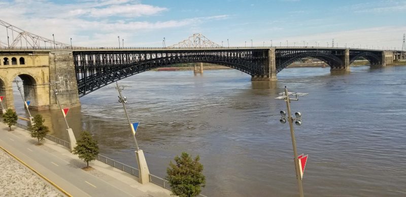
From the viewing platform, we could see the Eads Bridge, a National Historic Landmark.* We could also see how unusually high the Mississippi River is for this time of year. There’s a parking lot beside the visible street all along the downtown riverfront, but it’s entirely under water now.
*The Eads Bridge was a construction marvel when it opened in 1874. It was the first bridge to cross the Mississippi River south of the Missouri River; its central arch was the longest rigid span ever built (520 feet); it had the deepest underwater foundations of any bridge in the world (100 feet below the water surface); and it was the first large-scale application of steel as a structural material.
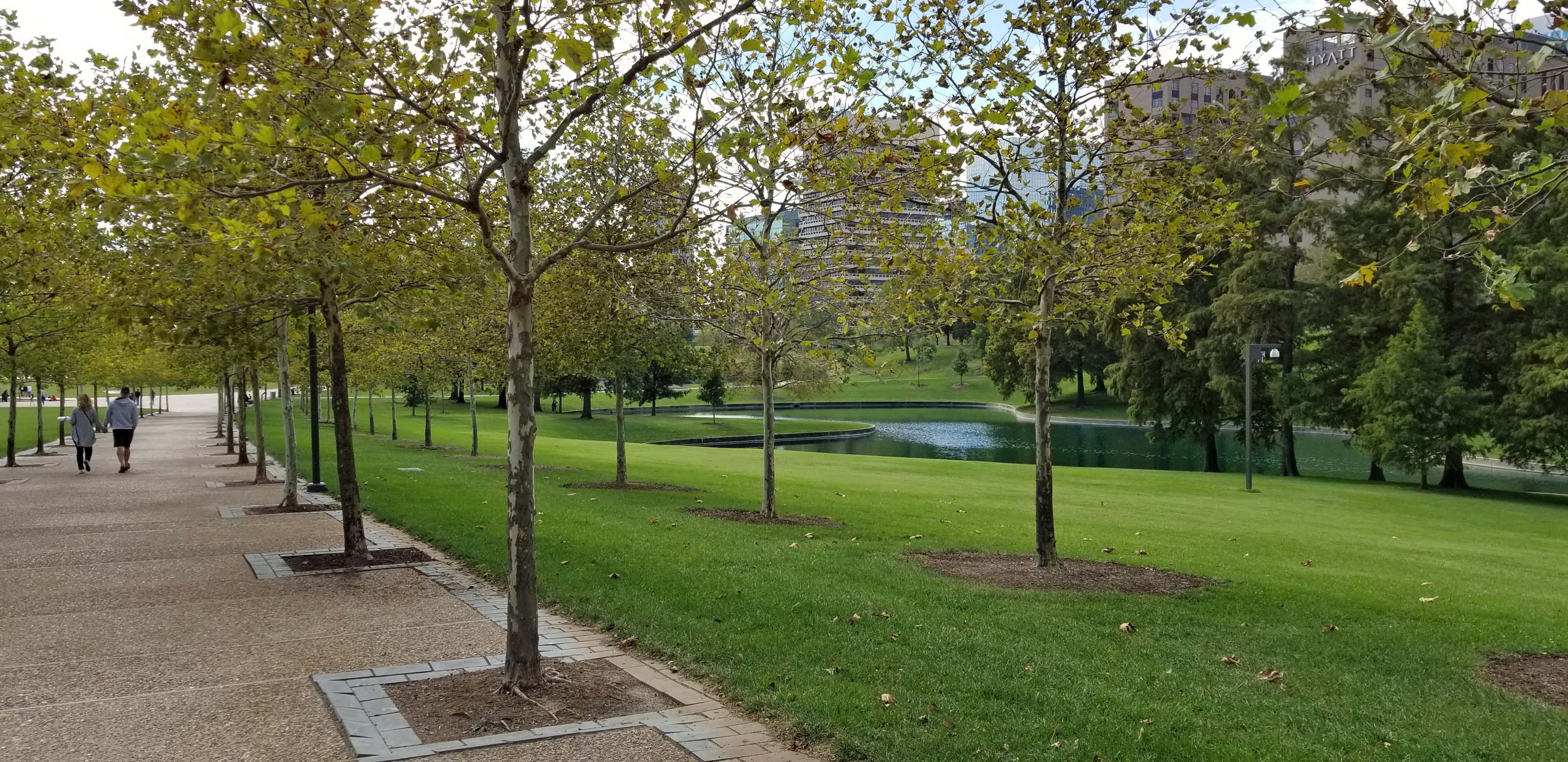
All of the park grounds had a makeover. It’s a pretty park with lots of shade for the summer.
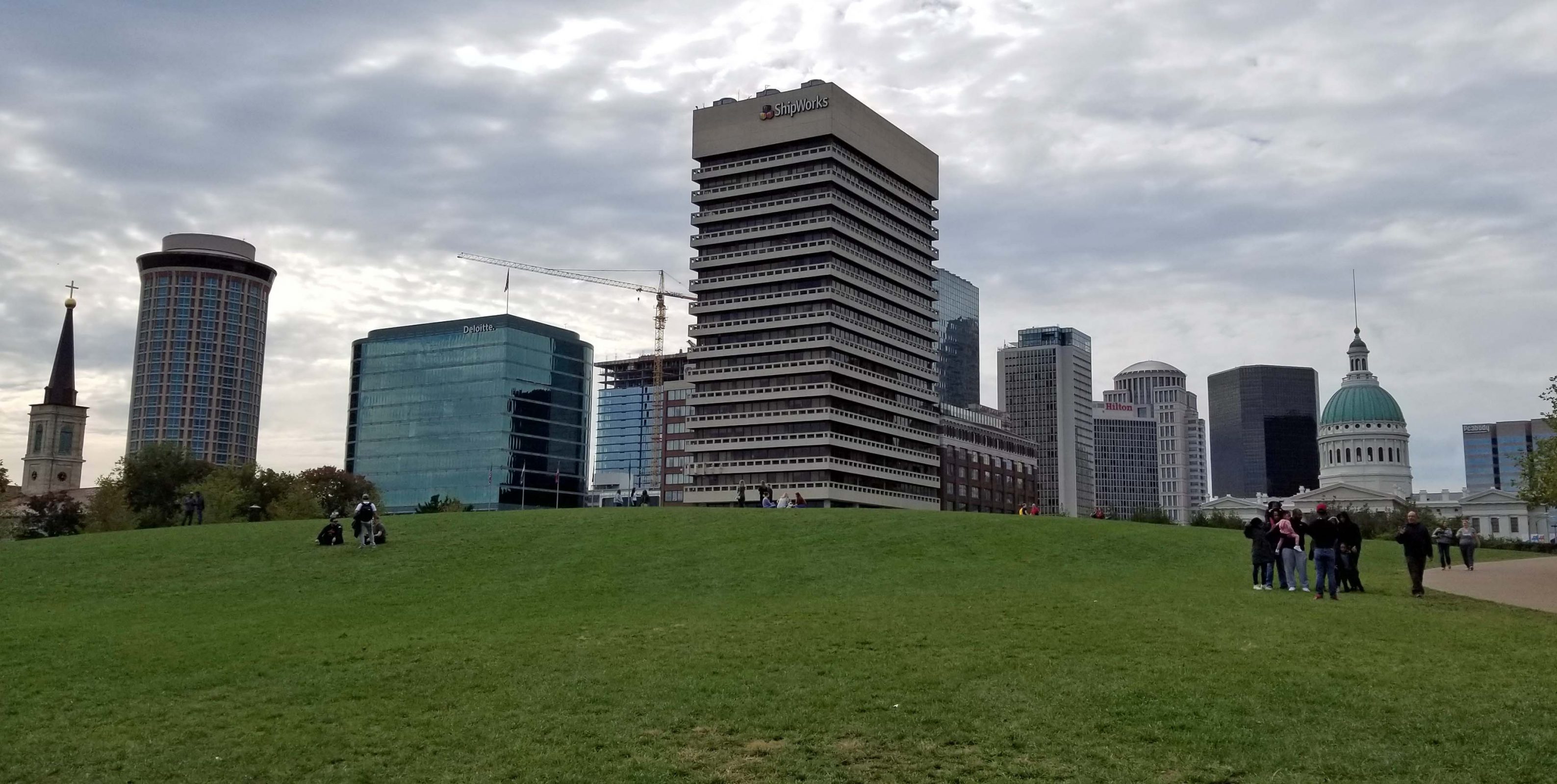
From the viewing platform, we approached the visitors’ center from behind. It’s underneath the Arch (not visible here) beneath the grassy hill in the photo foreground.
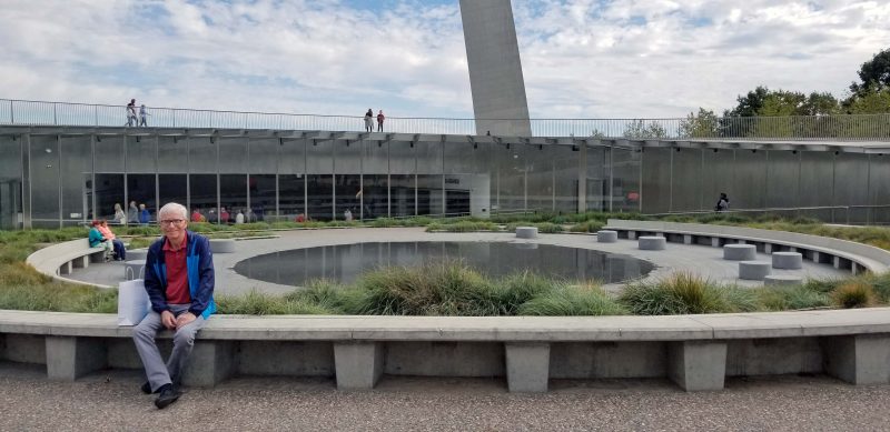
Here’s the visitors’ center from the front. Seating is abundant–maybe not for the summer crowds, but there’s lots of grass to sit on when the benches are full. There’s also a walkway that goes around and over the visitor’s center, with nice views of the river and the city skyline. Check out that good-looking guy on the bench.
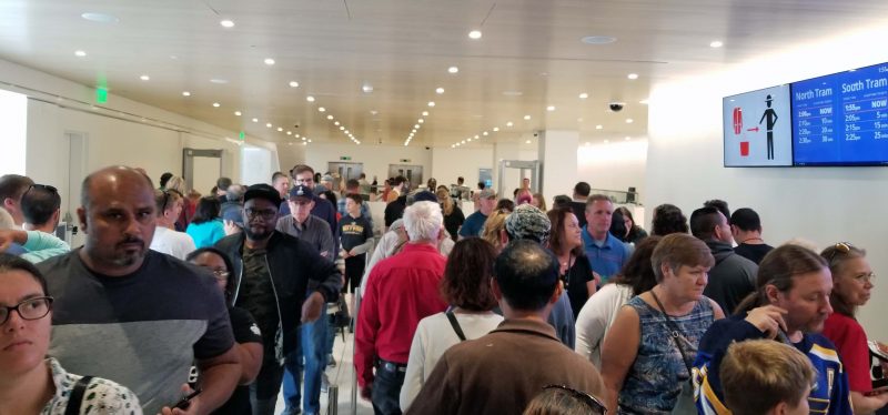
Getting into the Arch is now just like passing through airport security except we could keep our shoes on–no belts or jackets, empty pockets, all electronics in the bin, etc. It’s not the heavy tourist season, but we had to weave back and forth six times to get through the line. Our goal is the far background of the photo.
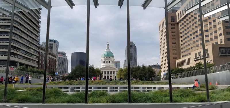
The inside view from the lobby windows nicely frames the Old Courthouse–the site of the Dred Scott decision in 1857.
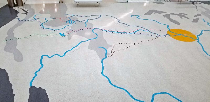
The terrazzo floor of the mezzanine is covered with a map of the United States, showing major rivers (blue lines) and the westward exploration trails (dotted lines) that began in St. Louis (yellow circle) and literally made the city the “Gateway to the West.” The map is the mezzanine floor so, yes, you can walk on it.
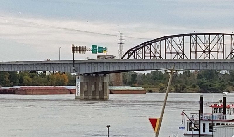
Before leaving, I took a picture of the Poplar Street Bridge, which has a flood gauge (white painted rectangle) on one of its piles. The bottom of the white rectangle is flood level. Notice how close the river is to flood level this year, when it’s usually very low in fall and winter.
I found this picture of the Arch visitors’ center online. Isn’t it pretty from above?
It was fun to spend a sunny fall day exploring the “new” Gateway Arch, and yes, we found a model Arch to take to our Australian friends.