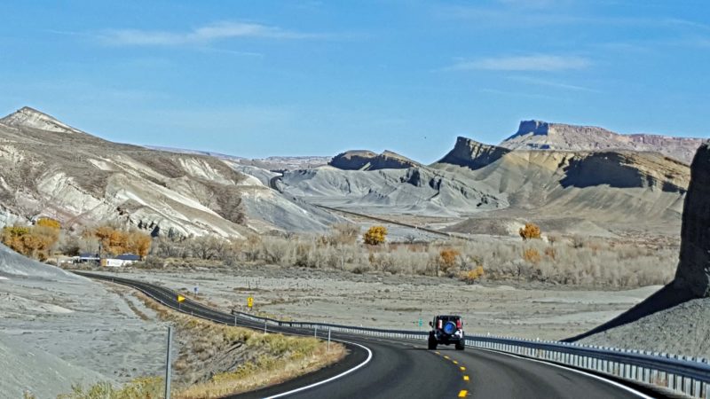
Capitol Reef National Park was today’s trip highlight. To reach the park, we had to drive Utah Scenic Byway 24–not a hardship. After leaving the park, we drove Scenic Byway 95 to get to Moab for tomorrow’s hiking in Arches and Canyonlands National Parks. Basically, it’s the old “you can’t get there from here” thing if you want to go east from Capitol Reef to Moab, because there are no east-west roads through the rocks and canyons. To get 100 miles east of Capitol Reef, we took Scenic Byway 95 130 miles southeast, then Utah SH 191 125 miles northeast to Moab. It was a beautiful drive so, again, no hardship. Scenic Byway 95 was dedicated in 1976, so it is also called the “Bicentennial Highway.” Whatever its name, it was a pretty drive.
Here’s a typical scene from Scenic Byway 24.
Near the end of Scenic Byway 24, we drove through Luna Mesa. These pictures show how easy it was to name this area.
Scenic Byways 24 and 95 meet at Hanksville, UT. Since it’s the intersection of two state highways, there are three gas stations at the corner. This one was the most interesting.
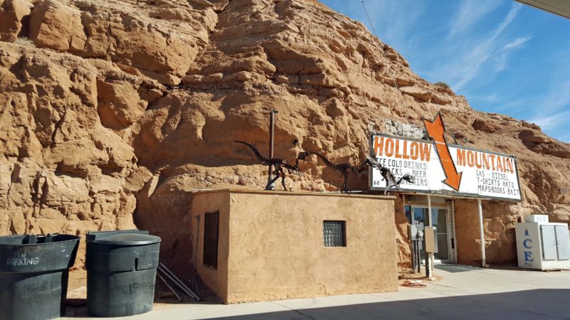
The owner had a convenience store-sized hole blasted into this rock formation and built his store inside the rock.
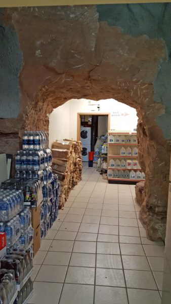
There’s a rock wall separating the store from the rest room area–probably for structural support. The attendant told me they never heat or cool the store because the rock provides good insulation. All they need is a fan to keep the air circulating.
After the Hollow Mountain gas station, we started our journey on Scenic Byway 95.
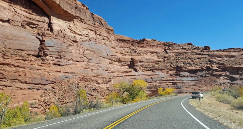
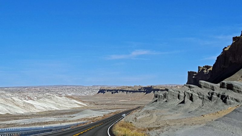
We saw this curved wall of rock along Scenic Byway 95.
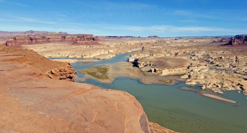
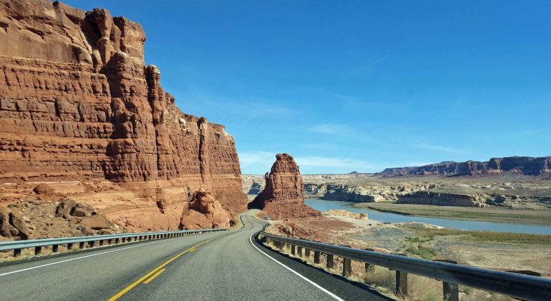
This is Lake Powell, a reservoir on the Colorado River in Utah’s Glen Canyon. We are at a turnout on Scenic Byway 95. The road then goes downward to the left, around rock formations and mesas, and eventually crosses the bridge you can only see if you zoom the photo and look hard for the blur. The bridge is silver and it’s at the far end of the visible water. It took us about a half hour to get from this point to that bridge.
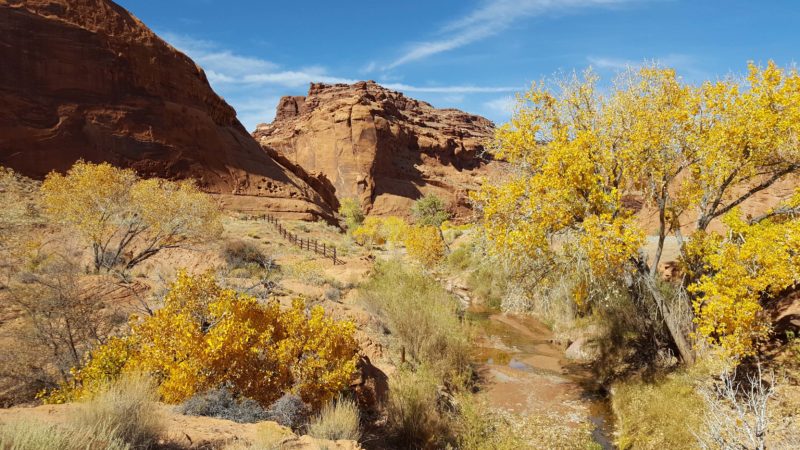
Glen Canyon was probably the prettiest part of the scenic byways today. Here’s a scene from a rest stop in Glen Canyon on Scenic Byway 95.
At this point, it was probably highway construction that created a pillar beside the large rock. An arm of Lake Powell is on the right.
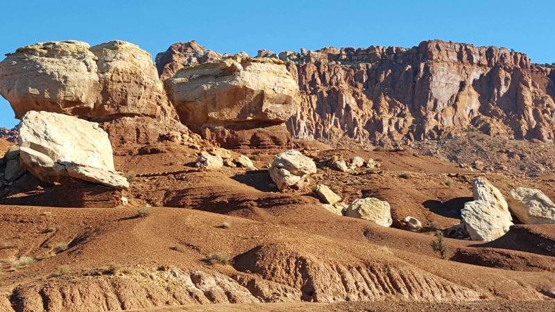
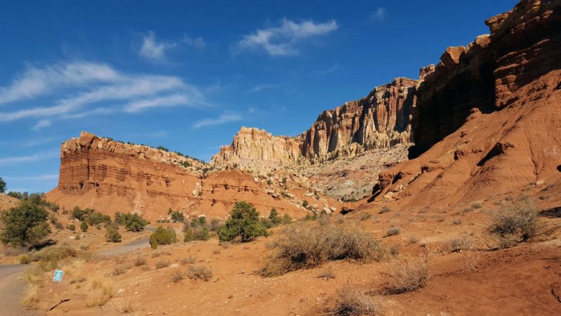
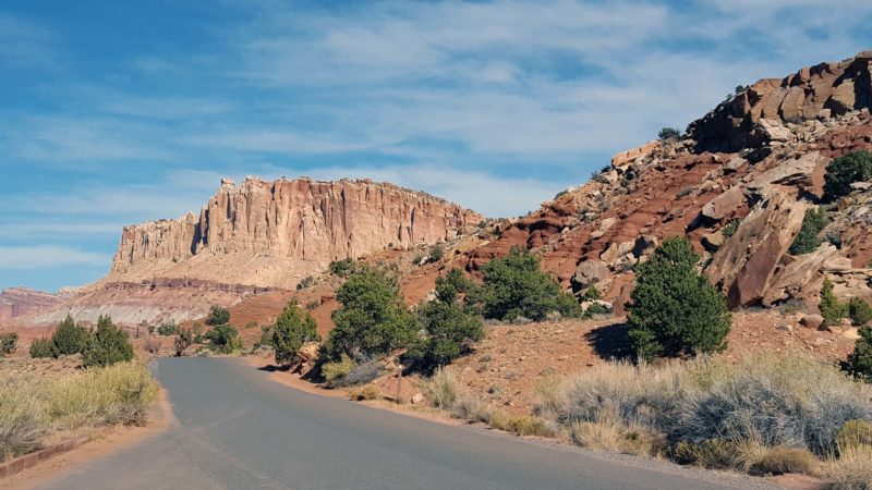
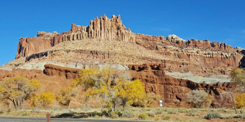
Capitol Reef is a beautiful national park. I learned that it was formed by a huge mountain-building event. The rock to the west of the buried fault was uplifted 7,000 feet higher than the rock to the east of the fault. As layers of strata accumulated on the rock, the pressure of the overlying strata folded the rock layers over the fault. Erosion exposed the strata, and the result is the rock formations we see today.
Ted and I narrowed our photos of the day down from nearly 100 to the ones you see in this post. Every rock formation in the park and along the byways seemed worthy of a photo, even though they all shared many common characteristics. I don’t know the names of the rock formations (or if they have names), but I believe the first one below this paragraph is called “Capitol Dome,” for obvious reasons.
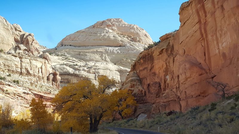
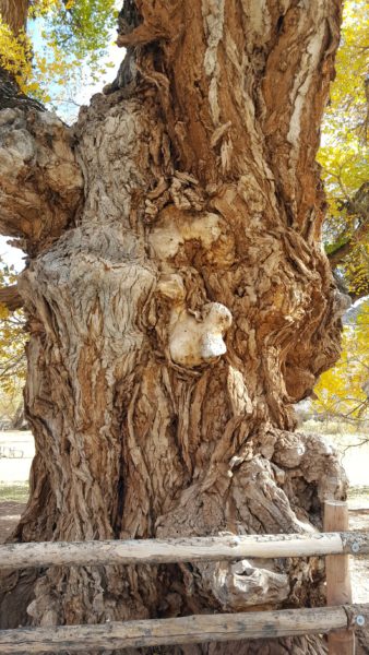
We saw an interesting tree as we were driving through the park. I assume that, given the altitude and the color of the leaves, it’s a member of the aspen family, but I’m not a botanist. Maybe one of my attentive readers can provide positive identification of the tree genus. I noticed it because the bark was unusually formed.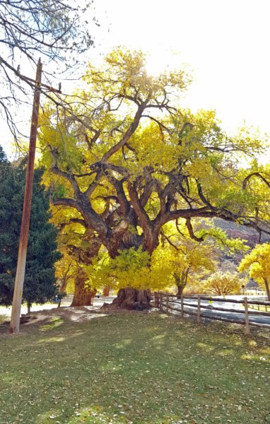
Ted and I have now visited three of Utah’s Mighty 5®: Zion, Bryce, and Capitol Reef. Tomorrow, we’ll visit the last two: Canyonlands and Arches. We visited the first three in the early 2000s, but have never been to the last two. The weather looks great for the hikes we’ve planned for the next two days.