We continued on Route 66/I-40 from Oklahoma City to Amarillo, TX today. We all know from our grade school geography that Texas is at the southern end of the Great Plains, and my blog readers know that Ted and I were at the northern end of the Great Plains when we visited the Dakotas in late summer. The southern Plains look a lot like the northern Plains.
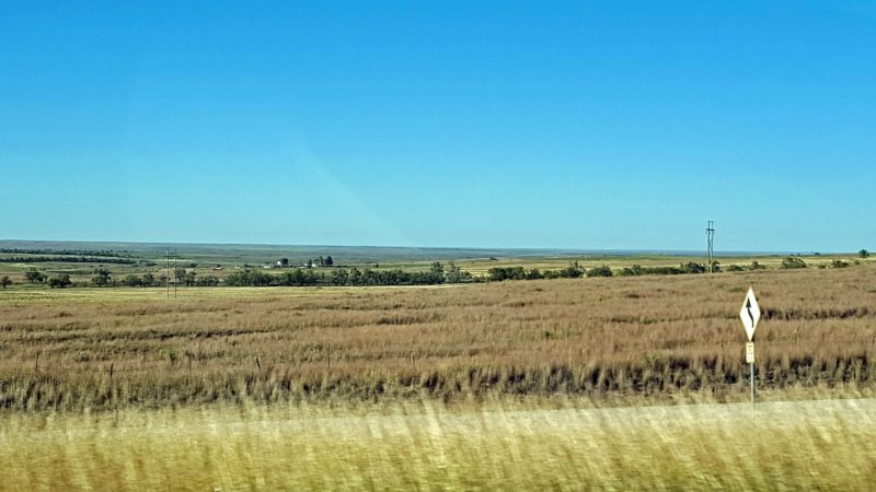
This is about 100 miles east of Amarillo. I think I can see South Dakota in the distance.
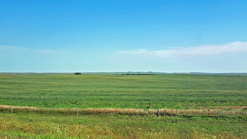
This is what the South Dakota Great Plains look like. Or is this another photo of Texas? (Answer: It’s really SD.)
We weren’t planning any stops on our way to Amarillo and didn’t expect to see much of interest except the Great Plains. Unfortunately (or maybe fortunately), we discovered that Oklahoma has no rest areas along I-40 westbound for the 144 miles from Oklahoma City to the Texas state line, and the first rest area in Texas is 40 miles west of the state line. Needless to say, we stopped. What a good decision.
We had a chance to visit one of the best rest areas we’ve ever seen. (Kansas has a good one too, on I-70 eastbound, with a Kansas History Museum inside.) The scenery changed abruptly from Great Plains flatness to deep gullies and small canyons just before the rest area.
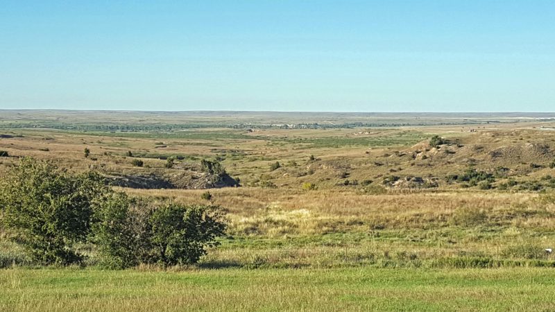
We went from the scene above to this kind of landscape. Beyond the rest area, the gullies became longer and deeper, like small canyons.
The rest area is constructed as a tornado shelter (no big shock in the Texas panhandle) and included an interesting display of the history of the Texas Panhandle, from the free range to barbed wire which ended the free range, to the Dust Bowl years, through the oil years, and into the green energy years as the Panhandle moves to wind energy. We learned that the Panhandle is the windiest place in Texas and we traveled westward through many miles of wind farms.
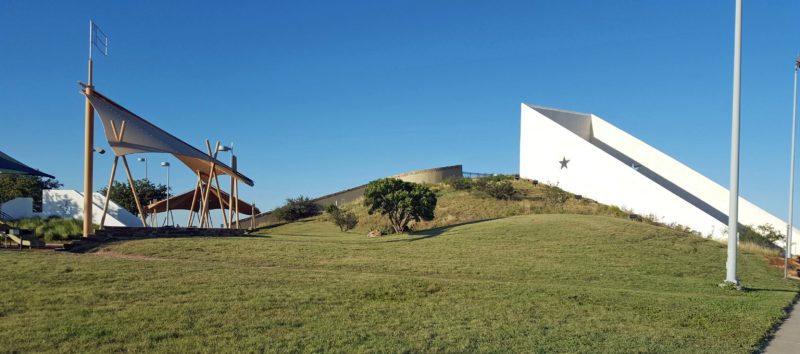
This is the highway-facing side of the rest area/tornado shelter building. The visitor space is all under the ground level. The metal flag above the picnic shelter has a Lone Star in it. Notice the star cut out of the building wall.
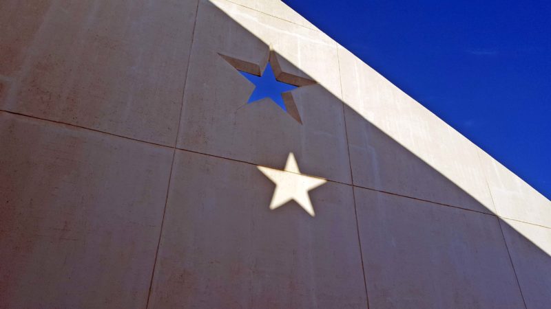
The white area at the top of the wall is sunlight; the dark portion is shadow. The white star is sunlight shining through the cut-out star in the wall (see the photo above). The blue star is sky, showing through an identical cut-out on the opposite wall.
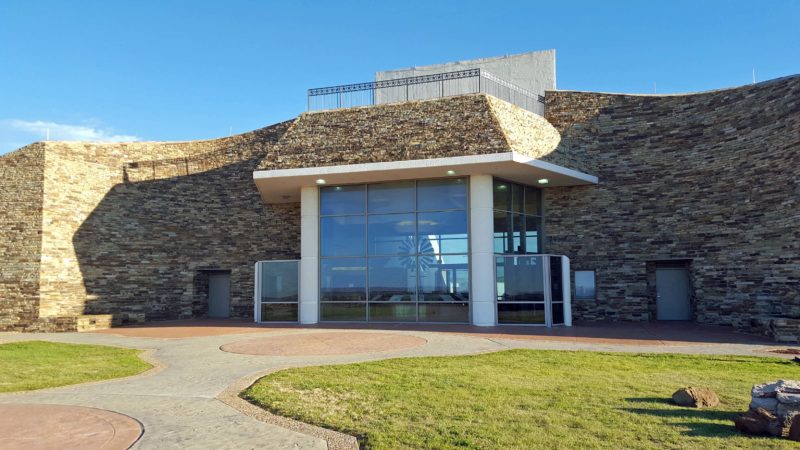
This side of the building looks like the front, but is facing away from the highway. Tornadoes will come from across the highway, so the earthworks that protect the rest area building need to be on that side. You can see through the inside of the building to the space between the “star walls” on the highway side.
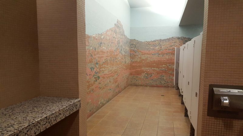
The rest rooms have mosaic decorations and are marked as tornado shelters. That’s probably why the baby-changing table on the left and the walls of each toilet stall are made of granite.
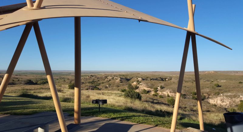
Here’s the view from the picnic tables. You might be able to see that the grill in the lower left center is shaped like Texas.