
Optimism
The normal high and low temperatures for St. Peters at this time of the year are 61 and 42 degrees. The weather forecast, however, is predicting high temperatures between 28 and 49 degrees for the next ten days and lows below freezing for six of those ten nights. Up to two inches of snow is forecast for tomorrow.
So today we bought a new liner for our pool and set up a pool opening date to have it installed. . . . And that’s how you define optimism.

March 20
I love having my birthday on the first day of spring–even if the wind chill was 24 degrees when I got up this morning. Google and Snoopy are celebrating with me.


Birthday weekend
Kathy and Annette came for a weekend visit to celebrate my birthday. When they arrived, we headed to Pizza Hut to meet Kari’s family. The boys had not planned to join us for lunch, because they thought we were going to have something like grilled cheese at the house. When they heard we were going out for pizza, they announced that “Pizza Hut trumps grilled cheese” and immediately found time in their busy schedules to join us.
I saw the kids less than two weeks ago, and Sky was almost taller than I am. Today, when I saw him, I was looking up into his eyes just a little bit. I now have four grandsons taller than I am and three more who are growing quickly.

The girls, Ted, and I spent the afternoon catching up with each other while the kids played, and then we had a birthday dinner with gifts and cake.
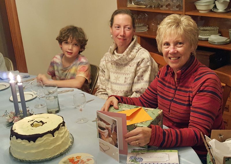
The woman who has it all: family, birthday gifts, and a perfect Vienna Torte.
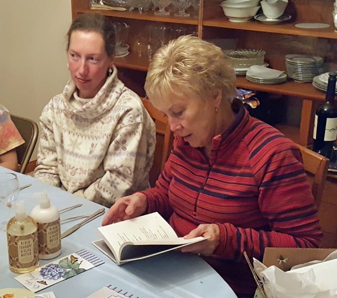
Kari’s family gave me a book I can’t wait to read and a voucher for a lunch date with Kari. That means there’s some quality mom-daughter time coming up soon. The hand soap and lotion are from Kathy and Annette.
When I was about 11 or 12, my Aunt Shirley gave me a pretty bisque porcelain flower pot with hand-painted raised flowers on one side. I could never get anything to grow in it, but I love it. Some time ago, I gave it to Creative Kathy and asked her to think of a way to make the flower pot pretty to display. She filled it with flowers to match those on the pot.

With a table runner Kari made, the enhanced flower pot is a perfect spring centerpiece for the kitchen table.
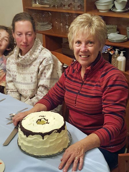
The big finish for the birthday dinner was the perfect Vienna Torte I made yesterday. Yum!
Teddy (left) is in a state of supreme happiness anticipating the cake. He came back later and asked for a second piece. Of course, Grandma said “yes.”
The weekend was over too quickly. Now I’m looking forward to my remaining birthday lunches / dinners with friends and with Ted–two down and five to go. I love my birthday season!
Vienna Torte secret revealed
My favorite birthday cake is Vienna Torte–a recipe from my grandmother. It’s a chiffon cake with a custard frosting. My mom always made it for my birthday, and I started making it after Ted and I were married.
I never have trouble making a great chiffon cake, but it’s always a challenge to achieve the right texture for the custard frosting. Grandma’s Vienna Torte frosting recipe tells me to cool the custard and then to “add powdered sugar, butter, and vanilla.” That’s what Mom did and that’s what I’ve done every time I made the cake. A few times, it has turned out perfectly; most of the time, the custard is runny instead of fluffy. It firms up in the refrigerator and tastes fine, but its unpredictable consistency is frustrating.
This year, I decided to see if Google had any ideas related to custard frostings. I searched “frosting recipes with custard and butter and powdered sugar” and–surprise!–found several. They weren’t exactly like Grandma’s, but I found four that required cooking a custard, letting it cool, and then combining it with butter and powdered sugar. Each of the online recipes, however, directed me to first whip the butter; then to whip it with the powdered sugar; and then to add the custard to the butter/powdered sugar mixture and whip it. I have always done the opposite: added the other ingredients to the custard.
Using Grandma’s recipe and following the online whipping directions produced a perfect custard frosting! Maybe that’s what Grandma did all along and she just didn’t write it down for herself and/or future generations. After all these years, I can finally make stress-free Vienna Torte for my birthday.
I have to go now so I can do my happy dance.

Wx Radio Wednesday
Today, Ted and I went shopping for groceries and had the opportunity to observe Channel 4’s “Weather Radio Wednesday.” In early spring (pre-tornado season), Channel 4’s weather team visits a different metro area location each Wednesday from 3:30-6:30 pm. This Wednesday, they were at our local St. Peters grocery store. They had weather radios for sale, and were also available to program weather radios to sound alerts for the metro area county of the user’s choice.

The line to reach the Weather Radio Wednesday team stretched the length of the store aisle, and then curved another 8-10 people around the corner.

Two weather team members (blue shirts) covered the weather radio sales and programming.

Channel 4’s chief meteorologist (on the right in a blue shirt with a Channel 4 logo patch) did public relations duties with the crowd and also broadcast his 5:00 pm and 6:00 pm weathercasts from this location.
This was a popular event. I heard the store manager say it was like Christmas, with people cruising the parking lot, looking for a place to park. Ted and I can verify this, as we needed to park on the perimeter of the parking lot. Thankfully for us, the grocery-purchase lines were much shorter than the weather radio line.
Grandma’s stuff
In The Proposal, Betty White (the grandma) gives Sandra Bullock (the soon-to-be granddaughter-in-law) a necklace that has come down through the family. When Sandra protests, Betty insists that grandmas love to give their things away because it means they’ll still be around in some way after they die. This is true.
A few years ago, I gave Kyra, my only granddaughter (as she likes to remind us), a few pieces of my jewelry. I wasn’t sure if she’d wear them or not, but I hoped she would at least treasure them as a memento of me.
Kyra is currently serving on a mission for her church in Bakersfield, CA. She sends a weekly email message and always includes some photos about what’s going on in her life. Today, as I was scrolling through the pictures she sent, I recognized a necklace from me on her neck.
Yes, grandmas love to give their things away. They love it even more when they see their granddaughters enjoying those things.

This is me at three years old. Check out the necklace. I’ll bet my mom made that skirt and blouse. The decorative bow in my hair that matches the skirt is definitely her touch, and she loved to do detailed sewing like the blouse.

Here’s Kyra. Check out her necklace. Beautiful girl, treasured necklace, and a little tear of happiness in grandma’s eye.
The color purple

Today’s Google doodle features William Henry Perkins, a British chemist and entrepreneur who accidentally discovered the first synthetic dye. In 1856, when he was just 18 years old, Perkins was trying to synthesize quinine to treat malaria. His experiment failed and, instead of quinine, his beakers were filled with a dirty brown sludge. When he cleaned the beakers with alcohol, the sludge became a bright, rich purple dye that he called mauveine. A long chain of chemical advances resulted in a bright, inexpensive synthetic color available to the masses. Thanks to Perkins, we don’t have to smash roots and berries to have colorful clothing.
Google, m&ms, and me
In its apparently never-ending quest for health, happiness, and statistics, Google studied consumption of its employees’ favorite candy: m&m’s®. Organic figs, nuts, and other healthy snacks were placed in clear containers; m&m’s® were put into opaque containers. After seven weeks, the 2,000 Google employees in the New York office consumed 3.1 million fewer calories in m&m’s® form. That was the equivalent of nine vending machine-size bags of m&m’s® for each of the 2,000 employees in the seven-week period!
I have only minimal will power when it comes to m&m’s®, so I rarely buy them. If, however, they are placed in front of me (e.g., at an event or given as a gift for, say, my birthday), I give myself permission to eat them. Kathy and Annette gave me a vending machine-size bag of m&m’s® for Christmas as well as an opaque container for them. After we took down the Christmas tree, I put the little bagful of m&m’s® into the container and set it on the kitchen counter in plain sight. (This was a gift, so my rules gave me permission to eat the candy.) Google’s research is right: That little bag of m&m’s® lasted more than a week. The letters on the container are far less tempting than those colorful little chocolate bits in an open dish, and I pour fewer pieces into my hand than I grab from an open bowl. Go, Google!
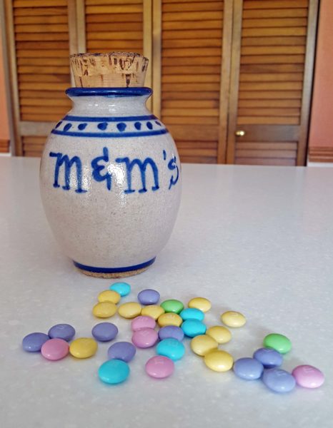
I bravely purchased an 11-ounce bag of Easter m&m’s and put the little pastel temptresses into the opaque jar. After more than two weeks, nearly half of the bag’s contents is still in the jar, even with “Chocoholic Ted” helping me eat them.
Zzzzzz
Dr. William Anthony, a Boston University professor, wanted to spotlight the health benefits of napping. In 1999, he selected the Monday after the change to daylight saving time to celebrate National Napping Day. He knew that after losing an hour of sleep, people would already be in nap mode.
To celebrate, thank Dr. Anthony and treat yourself to a 20-minute nap today.

Three-day limit
Ted’s and my Pilates class meets Monday and Wednesday mornings. The previous session ended Monday, March 5 and the next session doesn’t begin until Monday, March 12. Without that Wednesday class, we had a full seven days without Pilates, our only specifically scheduled exercise. The weather has been cold, gray, and gloomy and Ted and I have been reading some very good books. We decided to live on the edge and take a whole week off from exercise. The plan was to just take it easy, and don’t accomplish much for a week. After all, what’s retirement for if you can’t do stuff like that?
I made it three days. By the fourth day, I felt like such a slug, I had to get out and walk at least two miles. Ted held out until the next day, and we’ve exercised every day since then. We didn’t see any walkers going past our house today because the weather is that bad, but we were out there, raising the bar for everyone else.
Right after Russia launched Sputnik in 1957, our schools were participating in the President’s Physical Fitness Program–also launched in 1957. (Coincidence? I think not.) Maybe all that “beat the Russians” exercise in grade school successfully conditioned Ted and me to get up and get out, and spoiled us for inactivity.
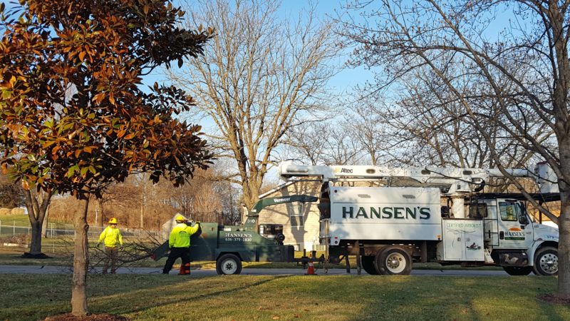
Chainsaws at work
Ted and I were working in the back yard last week and noticed that one of our redbud trees wasn’t looking good. It’s been failing for several years, and we had a major limb cut out of it a few years ago. Last week’s inspection revealed the base of the tree looking so rotted, we were afraid a spring wind storm would blow it over. It would then hit (1) our storage shed; (2) our pool fence; or (3) our neighbor’s sunroom windows. Every option would require a repair. Ted called the tree company and they came to the house today, chainsaws in hand, to remove the 31-year-old tree.

Men at work. They cut the main limbs away, one by one. Two guys held a rope around the soon-to-fall limb while the third guy cut it off with his chain saw.

The final limb bit the dust, guided just to the left of the neighbors’ sunroom, and is lying on the ground. No more redbud tree; no broken windows.

This is the rot Ted and I saw at the base of the tree last week. The other side of the trunk looked the same.

The inside of the tree was mostly rotted away at the base, and the space was filled with leaves. Squirrels at work?

When the cutter sliced the trunk into pieces that could be carried to the truck, the slices broke into chunks instead of holding together as a single unit. The cutter’s comment: “That’s not good.” He said it was a good thing we had the tree removed, because it was definitely going to fall down very soon.
The last step: recycle. The tree is now mulch and is ready to enrich the earth from whence it came.
SpaceX
This gorgeous photo was taken by Malcolm Denmark, a Florida Today photographer. It shows the launch of the SpaceX Falcon 9 rocket at Cape Canaveral early this morning. Ooh, aah.

An English major’s life
My brother Tom sent a cartoon to my siblings and me and it reminded me of some related cartoons I’ve saved over the years.

English majors always try to be grammatically correct, . . .

. . . they can be challenged when looking for employment, . . .

. . . and they sometimes find the perfect niche. Thanks, Tom.
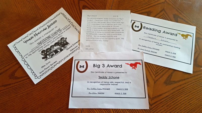
And the winner is . . . Teddy!
Kari was notified that Teddy would be receiving three awards at school today, so she invited Ted and me to attend the assembly. Each classroom teacher gave awards for subjects taught in that classroom. Special subjects included art, music, computers, etc. in addition to reading, writing, math, and the Big 3–given to one student in each class for being a safe, respectful, and responsible learner. We were very proud of Teddy.
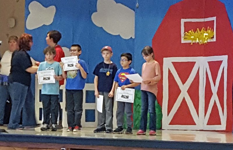
In the special subjects category, Teddy received a music award. He’s on the far left.

Next was the classroom reading award. He’s on the right in the back row.
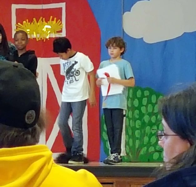
Teddy’s third award was the Big 3. Kari said the teacher told her Teddy is the most mature child in her classroom. (Check it out. The boy on Teddy’s right is wearing a shirt that says “Fossil Fuel” and has a picture of a dinosaur riding a motorcycle.)

The Big 3 includes a medal in addition to the certificate. Here’s our winner.
Today was also Hat Day at school. Most of the hats were cute, but not remarkable. Some kids went for the extremes.

A Beefeater, perhaps?
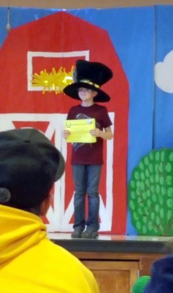
World’s largest hat?

No hat, but the boy in the middle wore a three-piece suit and a tie for the event. He looks bored here, but he was excited about his award and was glad-handing everyone. Future politician?
Back at Kari’s house, we celebrated all these certificates with fresh-baked raisin bread and fresh caramel-frosted chocolate cupcakes.
Meanwhile, outside in Kari’s driveway, the Camry lives on. Ted and I bought the Camry in March 1992. It wouldn’t die, and we got sick of driving it, so Ted replaced it with a 2003 Solara and we gave the Camry to Kathy. In December 2017, Kathy bought the Prius from us and gave the Camry to Kari. Those Toyota cars just won’t quit!

It’s so much fun to live close to one of our kids’ families so we can regularly be a part of days like this.
Meow!
Ted and I are currently in the process of working with our travel agent to plan our Australian trip. With that in mind, check out this drawing one of Ted’s friends sent him.

The rough outline of our trip has us traveling from late November into early January. The itinerary gives us two days in Bali to recover from jet lag; a 15-day cruise from Bali to the northern and eastern Australian coasts, ending with two days in Sydney (part of the cruise); and then immediately continuing with a 15-day cruise (same ship, same stateroom) along the eastern side of New Zealand, ending with two days in Auckland. Then we’ll fly to Sydney to spend 3-4 days with our Australian friends, Mark and Tracey, whom we met on our 2015 European river cruise. After that, we’ll go back to winter in St. Louis.
Go, NWS!
Thank you, National Weather Service, for observing meteorological seasons, making today the first day of spring. I love spring!

Wow!
With all the hoopla about Hamilton, Ted and I said that when the show comes to St. Louis, we’ll go. The time is now. Hamilton will be playing at the Fabulous Fox Theater in St. Louis from April 3-22. I went to the Fabulous Fox website to buy tickets today.

Tickets are $80-$500. Ok, we knew they’d be high and we would have gone as high as $150 each, depending on the seats. So I clicked to select tickets and got this message.

So that’s why people are tuning in to Channel 4’s 4:30 a.m. newscast–they’re hoping to win the two tickets Channel 4 is giving away every day. Next step: Stubhub. Look at what I found on that website.

Yes, $175 was the lowest and $1,642 was the highest price for a single ticket. Sheesh! My conscience has a problem paying $100+ per hour (plus the service fees) for a theater performance. Just to compare, I checked the prices in New York City and they run the same. These prices made me wonder how much Hamilton earned as Secretary of the Treasury. I couldn’t find a dollar amount, but I found this tidbit (editor needed–again!–for the fourth and the last line).
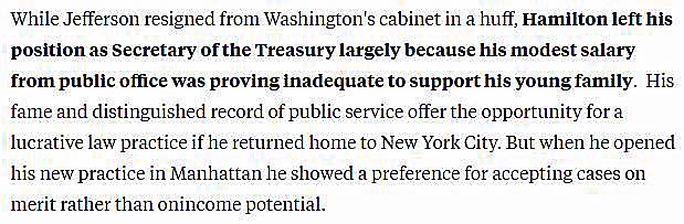
Hamilton’s salary might have been modest, but tickets to see his story aren’t! I wonder how early we’d have had to buy tickets to find any of those $80-$500 tickets available directly from the Fox. In a few years, Hamilton will probably be playing at the St. Louis Municipal Opera (Muny)–our wonderful outdoor theater–and tickets will be more reasonably priced. And then there will be the movie. Meanwhile, Ted is going to record the 4:30 a.m. Channel 4 newscast. Maybe we’ll get lucky!
Editorial comment: I think it’s sad that only wealthy people can afford to attend events like theater performances, major league sporting events, and concerts. Not only do we have a wide disparity in annual income in our country, but prices like this are fostering a wide disparity in educational and cultural experiences as well.
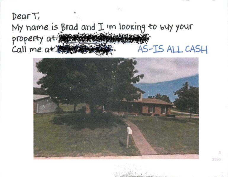
Surprise!
Today we received a postcard in the mail from Brad. We didn’t even know we were interested in selling our house, but it sounds like Brad is ready to move into the closing process with T.
Google Earth hasn’t been to our house for awhile. We had this tree removed in 2012. It was in its death throes for about three years before that, with a skimpy cover of under-sized leaves.
There you go again!
It’s been awhile since I found a reporting error that irritated me enough to share it, but it happened again today. The article was published in the aftermath of the school shooting in Parkland, FL. In the following excerpt from the news article, the author erroneously identifies two of the three generations mentioned.

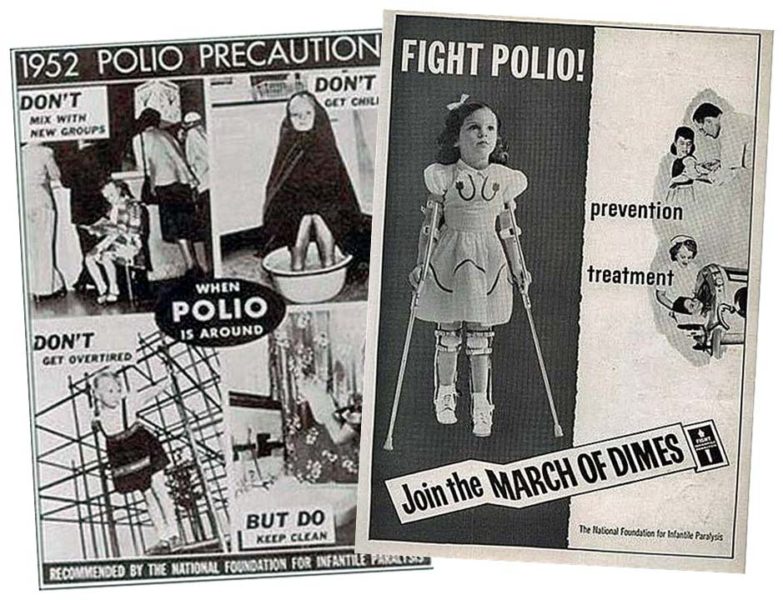
Just as their grandparents feared polio . . .
Dr. Jonas Salk’s polio vaccine was developed in 1953 and was available for public use in 1955. Dr. Albert Sabin’s oral polio vaccine was available for use in 1961. I was vaccinated with both. A local drugstore provided the injections, and I remember going there after church on Sundays for the series of three injections. I also remember taking the pink oral vaccine dropped onto sugar cubes. It was from 1916 until the 1950s that polio was an annual summertime threat in one part or another of the United States. The worst U.S. polio epidemic occurred in 1949, claiming 2,700+ lives. I was two years old that year, and my oldest brother was an infant. It was my parents–“Generation Columbine’s” great-grandparents, born just before and during the 1920s–who feared polio throughout their lives, especially for their children, including Ted and me. I don’t remember being afraid of polio, but I know that large public gatherings were avoided during the summer months and public swimming pools were often closed during the 1940s and 1950s to prevent the spread of polio. I do remember my 4-H club collecting money from the good citizens of Hingham for the March of Dimes to support the fight to eradicate polio.
. . . and their parents feared nuclear war, . . .
Six of my eight grandchildren were born after the 1999 Columbine school shooting. (Alex and Kyra were born in 1997 and 1998, respectively.) Their parents are my children, born between 1972 and 1978. The Berlin Wall fell in 1989 when Jeff was 17, and the Cold War was lukewarm long before that. The parents of “Generation Columbine” did not live in fear of nuclear war; it was their grandparents–Ted and me–who were afraid Khrushchev would hit the nuclear button at any moment. In the 1950s–my elementary school years–some public buildings had fallout shelter signs on them, indicating that those buildings could protect us from nuclear fallout in the event of an atomic war. (Hah!) I doubt if “Generation Columbine’s” parents ever saw one of these signs.

In summary, there is a “Generation Columbine” and there were generations who feared polio and the Cold War. The author of the article named one of the three groups correctly, but he is off by a full generation for two-thirds of his main idea. Aarrgghh! Don’t journalists have to check their facts before publishing? Don’t they use proofreaders? Apparently not.
Hey, Dad!
My dad loved Hostess Twinkies, and my mom packed one in his lunch every day. I’m pretty sure Twinkies have negative nutritional value and an expiration date of “when the world ends.” I wonder if Dad would have appreciated this treat for Easter dinner.

This is so cool!
Go, Elon Musk! Of the 500,000+ objects of space junk orbiting the earth, the Tesla driven by Spaceman is way cooler than the old satellites and spent rocket boosters up there. The best part of the launch might have been the return of the reusable booster rockets to the launch pad. Wow!

An English major’s work is never finished. Notice that, even in cartoons, there’s a need for a good editor.
Closing the (Face)book
I gave up Facebook at least six months ago. I didn’t delete my account, but I quit trolling through my news feed regularly. I was never a very active participant on Facebook–about 50 posts since I joined in 2010. I think my last post was in March last year, and then I changed my profile picture in November. I probably check my news feed once a month or less. After 5-10 minutes of reading, I’m bored, so I close the (Face)book. My Facebook activity ended the evening I caught myself thinking, “I’m so tired, I just want to go to bed, but I still have to check my Facebook news feed.” Really??? I quit cold turkey that night, and I have never missed it.
I thought I was a brave individual, breaking away from the herd, but that was before I read an article earlier this week that said twenty-some percent of Facebook users use the app less than they did a year ago. Reasons include the increasing presence of fake news and partisan politics, as well as what was described as “Fakebook”–people posting photos of their new cars, their exotic vacations, and tributes to their unbelievably wonderful family members (gag!). Apparently, this makes readers feel inadequate because their own lives aren’t that (pun intended) picture perfect. I like my life, so that wasn’t my reason for backing off; I just got tired of reading the same stuff from the same people every day. If anyone seriously wants me to know what s/he is doing on a given day, give me a call or send me an email!
Having said all that, on my once-per-month troll of my news feed, I found this cute picture posted by a friend. He didn’t mention where it was from, but he has a young grandchild, and this is the kind of humor kids that age love. The occasional post like this is why I haven’t deleted my FB account. Yet.
Magic tulips
Ted knows that winter is my least favorite season, and he also knows how much I look forward to spring. He has established a tradition of bringing me budding bulbs each year as soon as they are available in the stores so that I have spring flowers before the weather is really ready for them. This year, he brought me some powerful, magic tulips.

It was winter when I put the tulips in the window this morning . . .

. . . and by afternoon, the snow was gone. Magic!
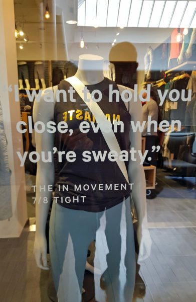
True love
Ted and I went out to our Valentine’s Day dinner last night to avoid the two-hour restaurant waits tonight. This afternoon, we went to a movie for a Valentine’s Day date. As we were walking out of the mall, we saw this sign in an athletic wear store. It’s a strong “I love you” Valentine’s Day message.
What cute kids!
I was reading some of Jeff’s old blog posts and came across this picture of Jeff and Kathy with my brother Denny’s kids, Cheryl and Eric. Jeff always makes fun of the clothes he’s wearing in his childhood pictures–and he did so in his blog post–but that’s what was in style at the time. I once spoke with a young clogger, dressed in her clogging outfit with a can-can under it to hold out her skirts. When I told her my friends and I all wore can-cans in grade school, her response was, “You actually wore these in public????” What will today’s young people say when they look back and see themselves with their pants hanging below their hips?
But back to the cute kids . . .
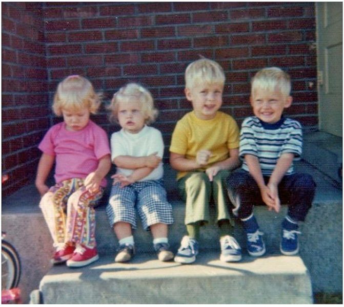
I’m guessing the ages, but the kids from left to right are Kathy (3), Cheryl (2), Jeff (4) and Eric (4).
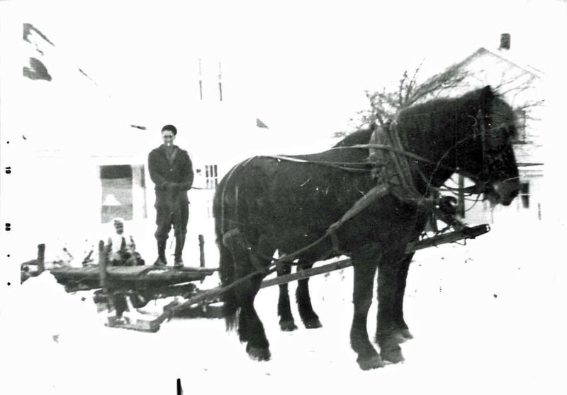
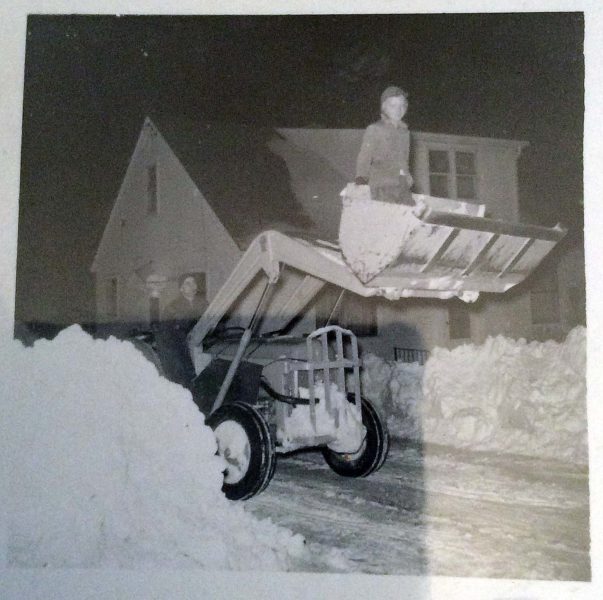
Oh, those Wisconsin winters
My brother Tom lives in a western suburb of Chicago. With the heavy snow hitting Chicago this week, Tom sent some childhood pictures to family members.
That’s me, bundled up and sitting on the sled the horses are pulling. I was three years old at the time. Dad told Mom to take a picture because it would likely be the last time he ever drove a team. As I recall, the horses and sled belonged to my great-uncle Phil, who lived about a mile from us, but Tom doesn’t remember Uncle Phil having horses, so I could be wrong. On the other hand, Tom wasn’t born until two years after this photo was taken, so Uncle Phil might have sold the horses before Tom joined the family, making this the last time my dad could drive his team.
This is Tom at age 6, standing high in a front tractor scoop (tractor driven by my dad). In those days, we got a lot of snow in the Wisconsin winters–look at those snowbanks!–so this wasn’t overkill when the driveway needed to be cleared. Note: Dad could drive (and fix) just about anything!
Perspective matters
During the past week, St. Peters has has three winter weather advisories for snow (0.5-1.0 inches each time) and sleet/freezing rain (up to 0.1 inch each time). In spite of the advisories, the snow went north of us and the freezing rain went south. This is what we accumulated on the ground.

After the first advisory, the forecast <1 inch of snow fell, but the ground was so warm, the snow didn’t even stick to concrete surfaces.

Yesterday’s advisory brought us about a half-inch of sleet–which stuck only to the concrete surfaces. Check the road. Luckily (insert sarcasm here), the streets were treated to the point of being white and the plow went over them several times.
The snow that went north of us made it to my brother Tom’s house in the western Chicago suburbs.

Not only local weather alerts, but this snow made headline news on CNN and elsewhere.
The forecast “verified,” as Ted would say, and Tom emailed the following information to me:
[Saturday, Feb. 10] We pushed about 8″ of snow since Thursday. A little more may be coming tonight – or maybe not.
[Sunday, Feb. 11] We got about another 4″ of snow. The weather guy said we tied a record with 9 consecutive days of accumulating snow. The last date was in 1905 or something like that.
This reminded me of a cartoon I saw during the January “bomb cyclone” on the East Coast.

Fun in Pyeongchang

These two impersonators were quickly removed from the opening ceremony at the 2018 Winter Olympics. “Kim” made a statement to the press:
“We wanted to surprise everyone and bring world peace and then we’re being escorted out by security guards, which I think is really unfair,” the Kim impersonator said. “Doesn’t everyone want peace?”
Sacramental lunch?
One of Ted’s and my favorite lunch restaurants often has a waiting line for seating. As an alternative to waiting for a table to become available, the restaurant has what it calls a “community table.” The community table seats ten and almost always has vacant chairs. If you don’t want to wait in line, you can usually be seated immediately at the community table where you get the same food, the same service, and a chance to meet new friends.
Today, while Ted and I were waiting for a table, we heard a server offer an incoming party the opportunity to be seated at the “communion table.” I don’t think so–unless it offers forgiveness of sins, as well as bread and wine, with lunch.
Princess Bride or Princess Fried?


Life-changing
I saw this at Biltmore last spring. Of course, every woman knows this is true, . . .

. . . but do you think Cinderella pictured shoes like these? These pictures were part of an historical shoe exhibit at our Hawaiian resort.
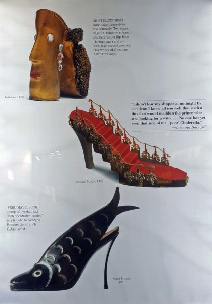
The center shoe symbolizes Cinderella, who ran down the palace staircase and lost her glass slipper/shoe. The 6″ high tiki head carved on the clog heel is pretty eye-catching too. How long do you think the heel on the fish shoe will last?
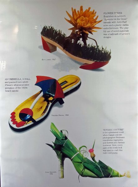
The top sandal is called “Splendor in the Grass.” The bottom one uses every part of a leek. Check out its bulb toe.
A lesson from the past
One of my Christmas gifts from Kari was Booker T. Washington’s autobiography, Up from Slavery, first published in 1901. Kari hastily told me that she knows I’m not fond of autobiographies. (She’s right. In my opinion, it takes a lot of ego to believe that people are so interested in learning about your life that they’ll pay to read about it, and I usually find autobiographies to be very egotistical.) Kari followed up by telling me it’s a really good story and a quick read. She was right again.
Booker T. Washington was born a slave in 1856–just before the Civil War–and was a young man during the Reconstruction period. All his life, he was determined to get an education, and managed to work his way through the Hampton Institute in Hampton Virginia. The Hampton Institute was founded and headed by General Samuel Armstrong, a commissioned officer in the Union Army. Armstrong is best remembered for his work as an educator, helping the freed slaves to become educated, not only in academics, but through technical and industrial training as well. Washington adopted Armstrong’s teaching methods and philosophy in his Tuskegee Institute in Tuskegee, Mississippi. There was no greater admirer of General Armstrong than Washington, and the values Armstrong modeled are still applicable today. In his book, Washington writes:
From [Armstrong’s] example, . . . I learned the lesson that great men cultivate love, and that only little men cherish a spirit of hatred. I learned that assistance given to the weak makes the one who gives it strong; and that oppression of the unfortunate makes one weak. . . . [Armstrong] was too big to be little, too good to be mean. (Washington, pp. 96, 104)

Booker T. Washington, American educator, 1856-1915
It’s spring!
Look what I saw outside today. “It must be spring!” said the woman who dislikes winter. Pay no attention to that man on TV who forecast snow for later this week.

The end . . . for now
I can’t wait to go back to Hawai’i for so many reasons.
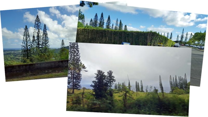
The Cook (Norfolk) pines are everywhere along the coasts.

The albizia trees are some of my favorites. When they reach about 15 feet in height, they grow wide at the top. Their nickname is “the Lion King tree.”
This is a “sausage tree”–so named because of the shape of its fruit.
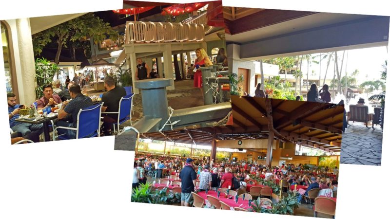
I love the open-sided restaurants and other buildings.

One restaurant had sugar packets personalized for individual islands.

There was a corkscrew beside the ice machine at the resort.

Aloha shirts are everywhere–even on the rest room signs. (Sorry about the blurred men’s sign–I was rushing.)

Good times every day with the love of my life.

And more good times.

Aloha, Hawai’i. I can’t wait to see you again.
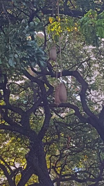
Towel tricks
Every day, after our stateroom on the ship was cleaned, there was a towel animal waiting for us.

Dinosaur

Dog

Elephant with beach towel
??? Animal missing here. I used one of the towels before I remembered to photograph it in its previous life.

Monkey hanging from a shelf

Shy rabbit
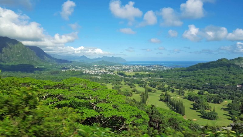
O’ahu Grand Circle Tour
Today’s excursion was the Grand Circle Tour. The route took us from Honolulu across the island to the east coast of O’ahu, then up that coast and halfway across the northern coast before heading south again and back to Honolulu. We were on the Kamehameha Highway most of the day.
Our first stop was the Nu’uana Pali Lookout, a 400-foot high cliff overlooking the eastern coast of O’ahu. There was a lot of bamboo growing at the lookout point. Our guide said there’s not much need for bamboo spears any more, so most of the bamboo on the islands is protected, and most of what is used becomes fishing poles. The winds often blow at 80-100 mph at this lookout but today, the wind was only blowing at about 60 mph–we didn’t have to hold on to anything to keep from falling over, but walking into the wind was a challenge.
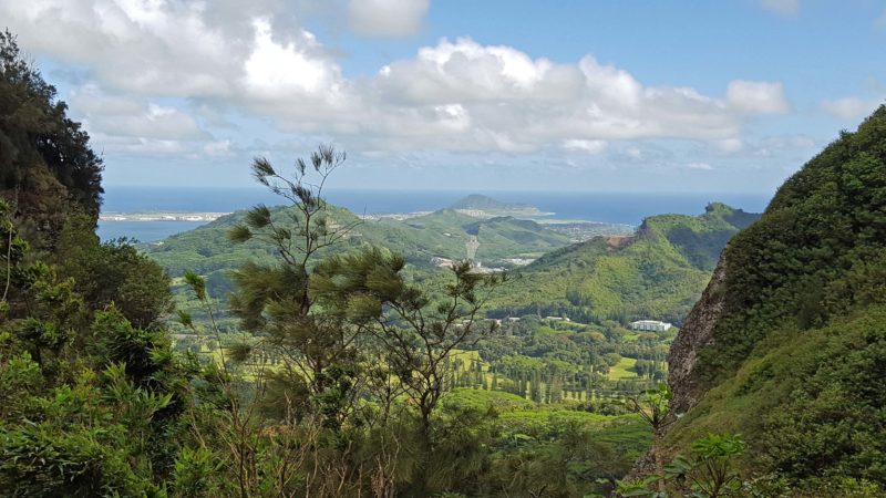
Kamehameha’s army dropped enemy soldiers over this cliff. Some soldiers voluntarily jumped to their death because they didn’t want to be ruled by Kamehameha.

At least it was a warm 60 mph wind.
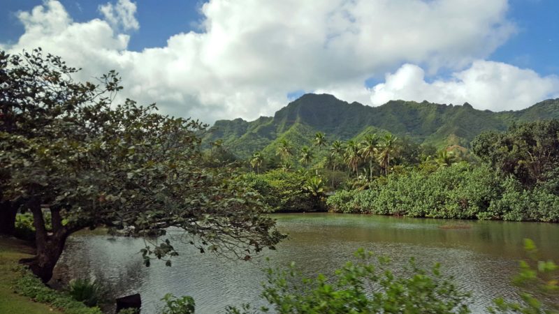
Our next stop was the Buddhist Bhyodo-In Temple.
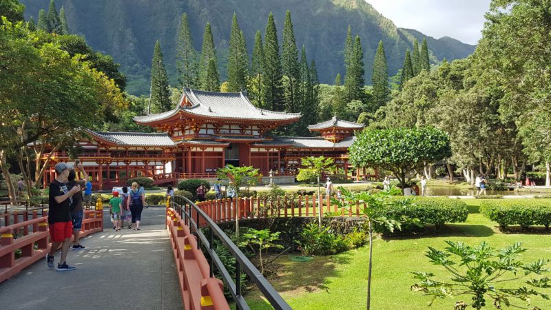
The temple is beautifully set with the mountains at its back and an ocean view in the front.

To ring the temple bell, pull the log back, then let it go to strike the bell–a circle marks the spot. Ringing the bell drives the evil spirits away.

We had to remove our shoes to enter the temple. Inside we saw this Buddha figure.
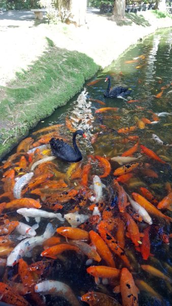
Koi fish are plentiful in the streams around the temple. The black swans are native to Australia.
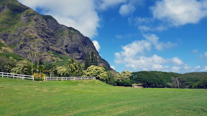
Our lunch break was at the Kualoa Ranch, a site sacred to native Hawaiians from the 13th to the 18th century. Hawaiian chiefs trained their sons in this sacred place and, in respect, ships dropped their sails when they passed this area. The first 622 acres of the ranch were purchased in 1850 from King Kamehameha III for $1,300. The ranch now includes about 4,000 acres. Sugar cane crops were not successful here, so the Kualoa mill closed in 1870. The ruins of the original sugar mill can still be seen along the Kamehameha Highway. In 1941, the U.S. military occupied the land and used it for the Kualoa Airfield. After World War II, the property was returned to the descendants of the original owner. They decided to develop it as a nature preserve.
We had a tram tour of the ranch. Naturally, it’s beautiful, but it’s too big for a photo. Here’s a view from where we ate lunch.

The pandanus tree is planted along shorelines to break the wind and to provide shelter from storms. Because of the appearance of its trunk, it is also called the “screw pine.” The trunks are mostly hidden by the leaves, but look closely at the tree trunk in the left center of the picture to see some of the screw appearance.
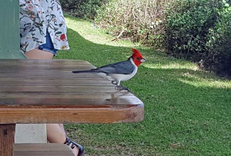
This exotic-looking bird joined us for lunch. Perhaps a member of the jay family?
We had a wonderful drive up the east coast to the north coast of O’ahu.
At many places like this, we would see a car parked on the side of the road while its occupants were swimming in the ocean. There seems to be plenty of room for everyone to enjoy a private beach whenever they want to.
Just another awesome view, south of the Kualoa Ranch.
Look at that rainforest vegetation! This side of the island averages more than 130 inches of rainfall annually.

Near the Kualoa Ranch, you can see Chinaman’s Hat Island (left of Ted) and Turtle Rock (far left of Ted) in the ocean. You can see Ted and me too!
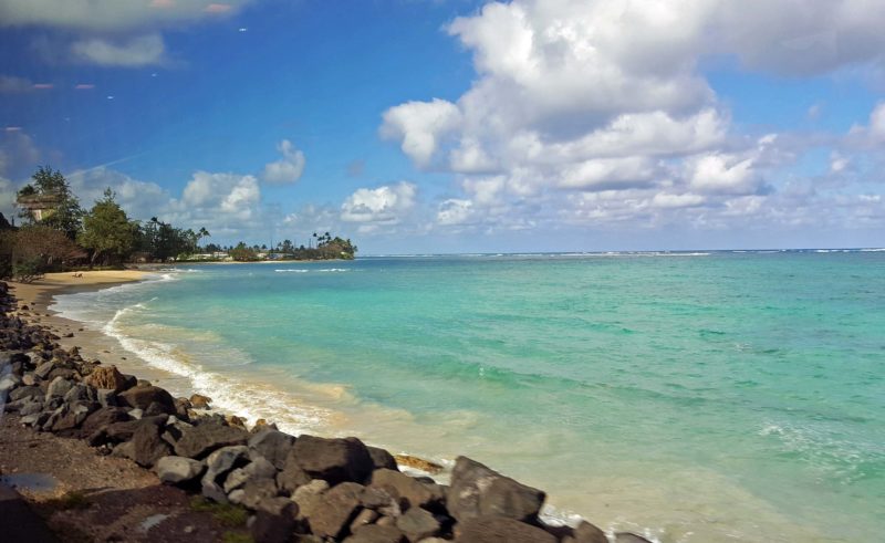
The Hawaiian beaches are out of this world! It’s heavenly for a Pisces like me. The two people in the left center have the beach to themselves.
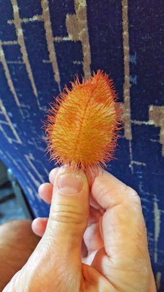
This is the fruit of the lipstick tree. When the sac is cracked open, it releases a red dye for lips and/or clothing.

There were high surf warnings out for the north shores of the island in the past few days. Yesterday, the waves were 30 feet high; today they are only about 10-12 feet high. Use the surfers as scale figures.
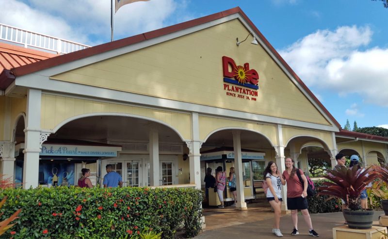
Pineapple is a major crop in Hawai’i, but there are no pineapple canneries. The fruit is shipped to California for canning. Note: we don’t know those two girls in the foreground, but they look like they’re enjoying themselves.
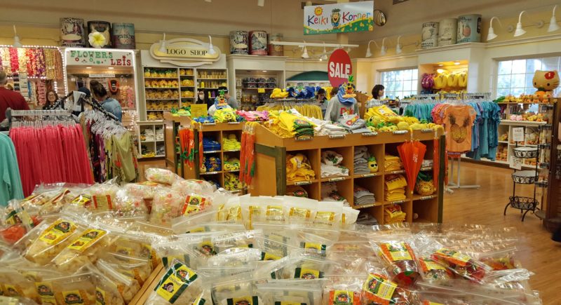
It’s very yellow in the Dole pineapple store.
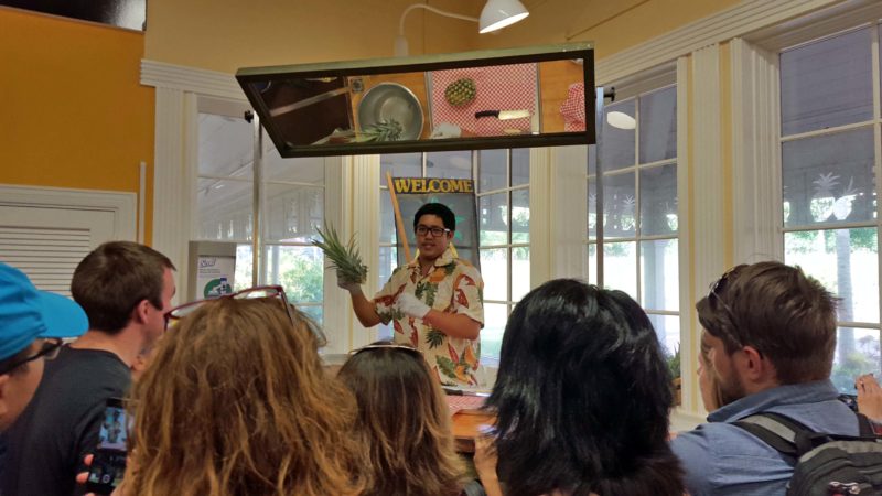
We saw a demonstration on how to cut a pineapple and we learned how to tell when a pineapple is ripe. (All the eyes are the same size; it “gives” about 1/16″ when squeezed; it doesn’t smell too sweet; the bottom is not pink.)

Spam is the state food of Hawai’i, due to the lack of raised meat on the islands. Every year, there is a Spam Jam in Honolulu with competitions for the best Spam recipes.
Again, Ted and I had a wonderful day. I’m beginning to be sorry it’s almost time to go home. Am I becoming an Island Girl?
Shaka!
On our way to the Polynesian Cultural Center, we passed through Laie, O’ahu, the home of Haman Kalili to whom the shaka sign is attributed. Kalili lost the three middle fingers of his right hand while working in the Kahuku Sugar Mill. One part of his job was to signal that all is well, so the machines could be started. Today’s shaka sign resembles what Kalili’s hand looked like when he signaled “ok” with his missing fingers.
Laie–home of the shaka and proud of it. Is the sign mounted on a replica of the machine that cut off Kalili’s fingers?

When showing the shaka, the folded side of the hand faces the recipient and the wrist is waggled.
The Hawaiian islands and the surfing culture around the world picked up the symbol as a way to say “hang loose” or “that’s cool,” but it has come to mean more than that and is now a symbol of the “Aloha spirit”–a coordination of the mind and spirit to think and express good feelings toward others. It reflects reverence, solidarity, compassion and friendship, and is a sign of respect and mutual understanding for the recipient. The current mayor of Laie, O’ahu used the shaka as the iconic symbol of his campaign–and he won.
PCC
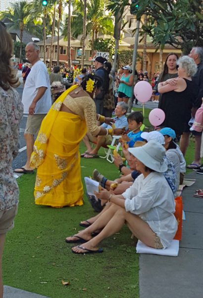
Today is the official Martin Luther King Jr. holiday, so Honolulu started the day with a parade.

There were a lot of marching/walking groups, cars with politicians and beauty contest winners, and Polynesian dancers.
The Hari Krishna had a large float. Members of the group walked alongside the float and handed out bananas to parade watchers. Remember when the Hari Krishna handed out flowers at airports?
Our excursion bus picked us up in front of the hotel along the parade route. The Polynesian Cultural Center (PCC) is on the opposite side of O’ahu from Honolulu, but the drive isn’t as far as mainlanders like us might think. We had to take two of the three interstate highways in Hawai’i: I-1 and I-2. (Guess what the third one is numbered.) Without traffic, the drive would have been about an hour. People from the eastern side of O’ahu regularly commute to Honolulu for work. The scenery all the way is gorgeous, like all of Hawai’i, but this is my favorite scenery photo of today’s trip.

It’s a breathtaking view. If you think it looks familiar, you might have seen Jurassic Park.
Ted and I had purchased all-day PCC tickets that allowed us to explore the park on our own, eat lunch on our own, partake of the the buffet dinner (included in the ticket price), and watch the closing performance. Well, the guide on the bus earns his salary, because I think he talked everyone on the bus with basic ($90) tickets (most of us) into upgrading at an additional cost of about $150/couple. Is this built into the experience? A cynical person would say “yes.” Here were the advantages of the upgrade:
(1) The park is open from noon until 6:00 p.m. The evening performance begins at 7:30. (2) If you order lunch in advance instead of eating on your own, your order (choose 1 of 3 meals) will be called in from the bus and you will be able to enter the restaurant and eat immediately upon arrival at the park, allowing more time to enjoy the exhibits. (3) Paying for a tour guide will assure that you arrive at each of the six Polynesian “villages” at the time of their main performance. (4) The included buffet dinner is served at 4:00 p.m.; the bare-bones luau begins at 4:45 p.m. It takes more than a full day to see everything in the park, so either of these two options cuts deeply into the visitors’ time at the exhibits. (5) The Ali’i Luau Buffet (upgrade) is served at 6:00 p.m., allowing visitors to spend maximum time at the exhibits, and it includes a performance with the meal. It ends just in time to be seated at the 7:30 p.m. evening performance.
Ted and I were not aware of the time constraints of the basic all-day tickets, so we caved to the marketing ploy and upgraded. Having done that, would we do it again? Absolutely! It was well-worth the price to have lunch waiting, see all six cultural performances, and enjoy the full luau experience before ending the day with the evening show. The PCC’s web page has a brief overview of some of the things we saw in the Polynesian villages. It’s a video, so it shows the quality of our day better than my still photos do.

We’re ready to begin our guided walk through the PCC.

We each received a lei when we entered the PCC. I think they’re made of kukui nuts.
There are six island nations in Polynesia, so the PCC is divided into six villages with each village featuring one nation: Hawai’i, Tonga, Tahiti, New Zealand (Aotearoa), Fiji, and Samoa. Each nation has a representative color, but I don’t remember which is which except that Hawai’i is blue.
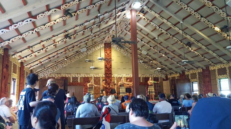
This building is part of the New Zealand (Aotearoa) village. There was a speaker to tell us about NZ, followed by a dancing performance.

In the Parade of Colors, members of each nation perform a native dance on a platform canoe.

The dances of each nation are similar, but individually distinctive.

The canoe goes under a bridge when it enters/leaves the lagoon, so the dancers have to finish their performance in time to duck.

This might have been the Tonga village. We witnessed a (fake) wedding ceremony.
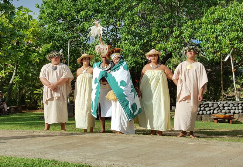
At the close of the ceremony, the bride and groom are draped in a single wedding cloak to symbolize that they are now one.
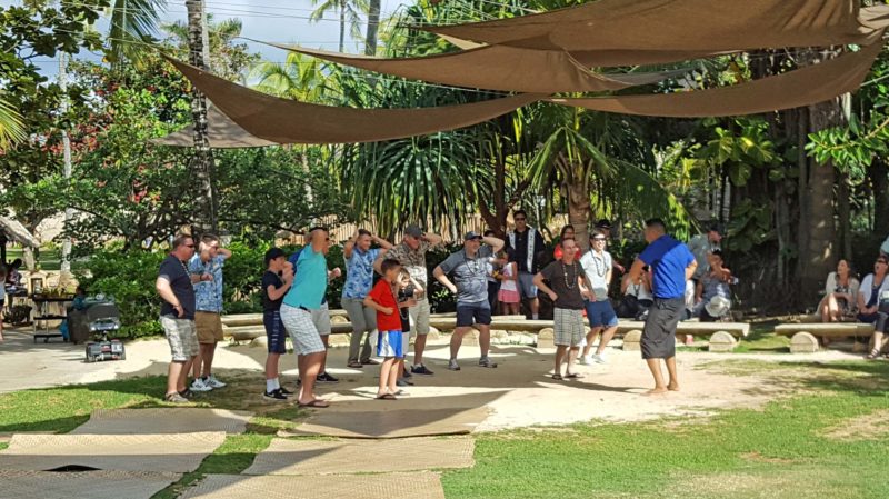
There were cultural lessons at each village, including hula lessons and warrior dance lessons.

The warrior dances and the drumming were spectacular at this village. Three men from the audience were chosen to participate and they were good enough at repartee and mimicking the performers to try out for the show.
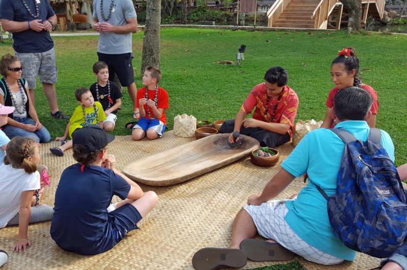
Poi is made from the taro plant. Taro is a purple root plant that is crushed to make a bland, but extremely healthy paste. Poi contains no allergens, it’s safe to feed it to two-week-old babies, and it’s also good for the elderly or sick who cannot digest more complex foods. It doesn’t spoil, but it becomes more acidic as it ages. Its nutrients are believed to be one reason for the beautiful Hawaiian complexions.
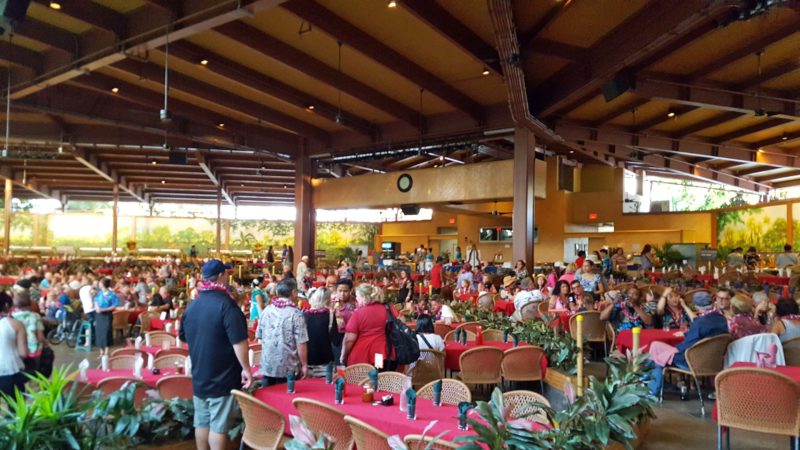
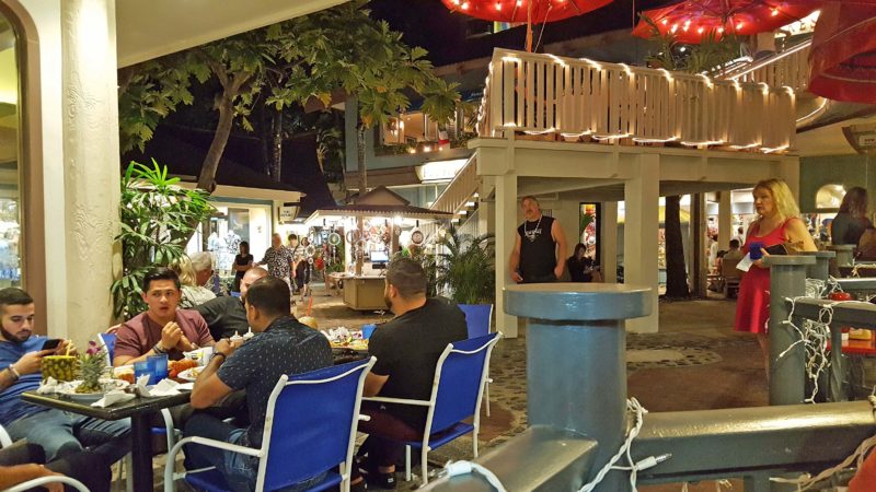
The luau was in another open-sided building. I love this climate!
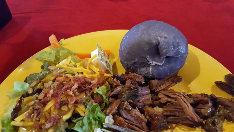
That purple thing on my plate is a poi dinner roll. It was delicious, but Ted decided to pass on purple food.
There were more cultural dances during dinner . . .
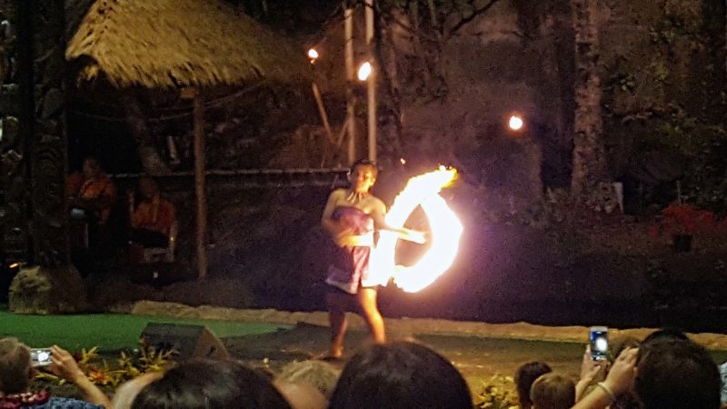
. . . including a fire dancer.

Honeymooners and those celebrating anniversaries were invited to come onstage and dance. The guy in the blue shirt was picked as the best dancer. When the MC asked his spouse if the man was a good dancer, she replied, “Oh, yeah!” He had a lot of endurance and did a decent imitation of a hula too.

We got a flower lei at the luau. Now we’re ready for the evening show.
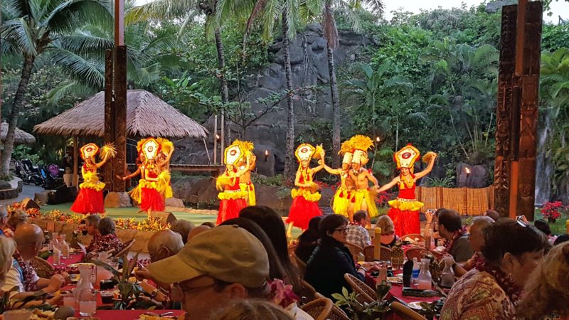
The evening performance is called Ha: Breath of Life and was excellent. It began with the birth of a child, then progressed through the stages of the child’s life: learning to hunt from his father, becoming a man, choosing a wife, and having a child of his own. The ending affirmed the theme of Ohana Falls–life is an endless cycle of birth and death. It was very moving and uplifting.
Compare/contrast
Today in St. Peters, Missouri.

Bundling up and hunkering down.
Today in Honolulu, Hawai’i.
Wearing shorts and sandals while eating dinner in a restaurant with no exterior walls.