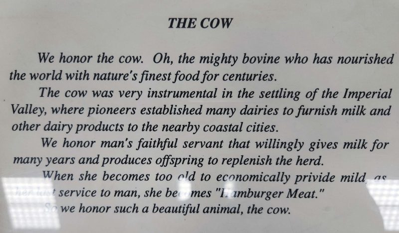
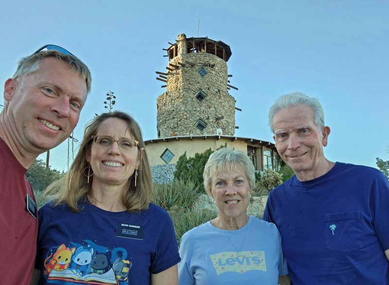
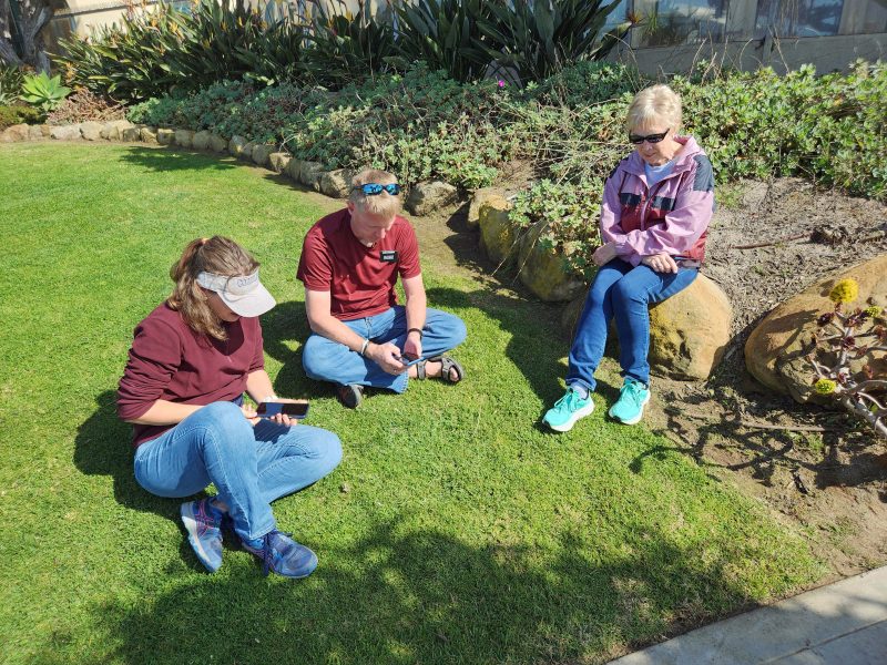
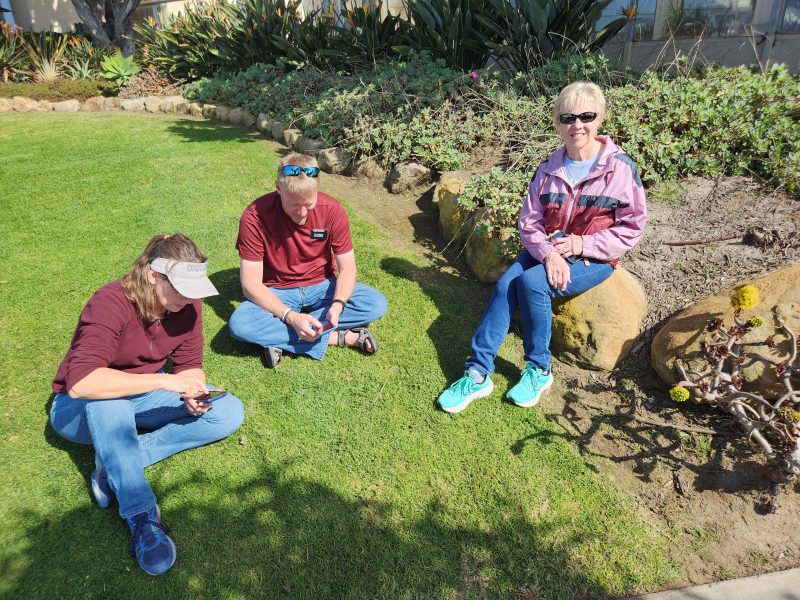
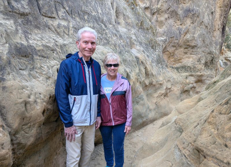
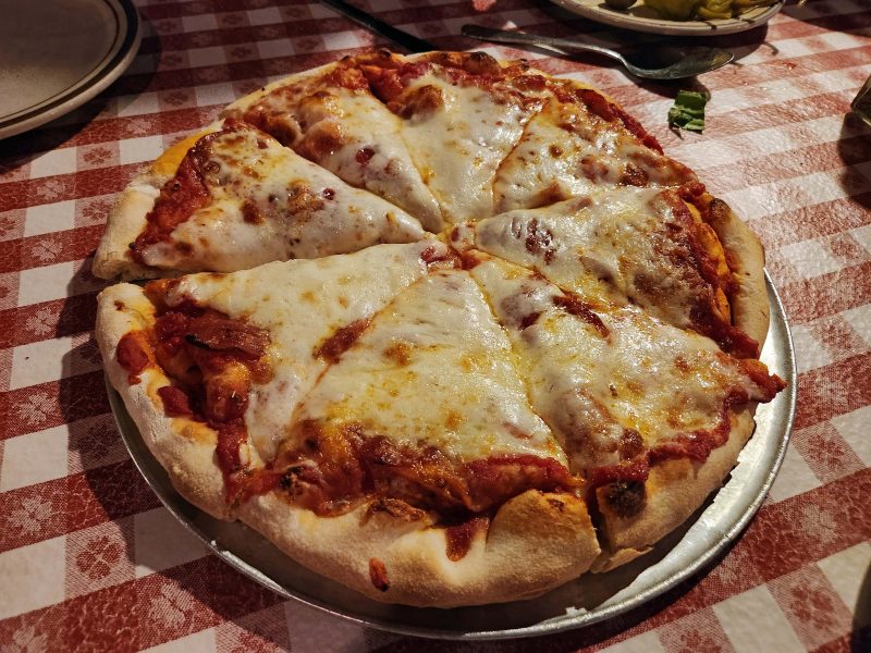
Today, after Jeff and La returned from church, the four of us had a lengthy and interesting discussion related to solving several national and world problems. Jeff has a unique idea for getting rid of daylight saving time (in which no daylight is actually saved) as well as standard time. Ask him about it.

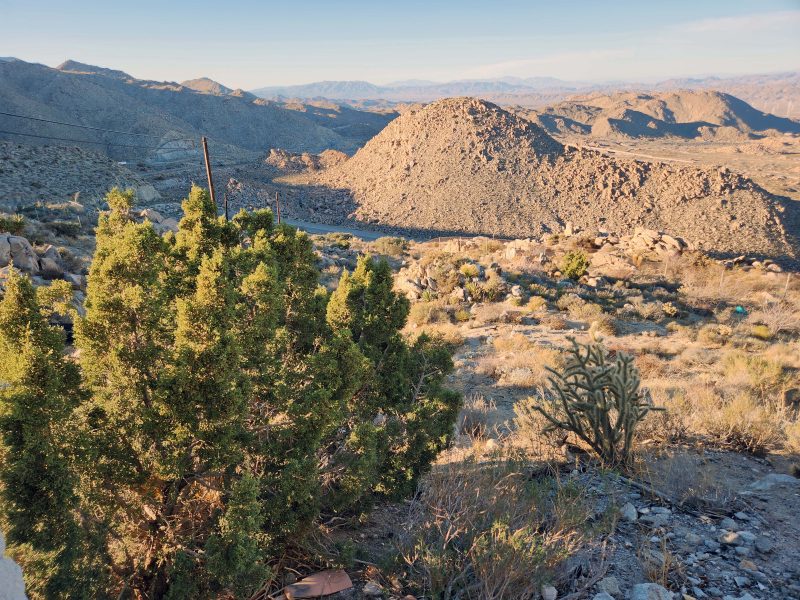
When we felt the world was in order, we had lunch and headed for Salvation Mountain.

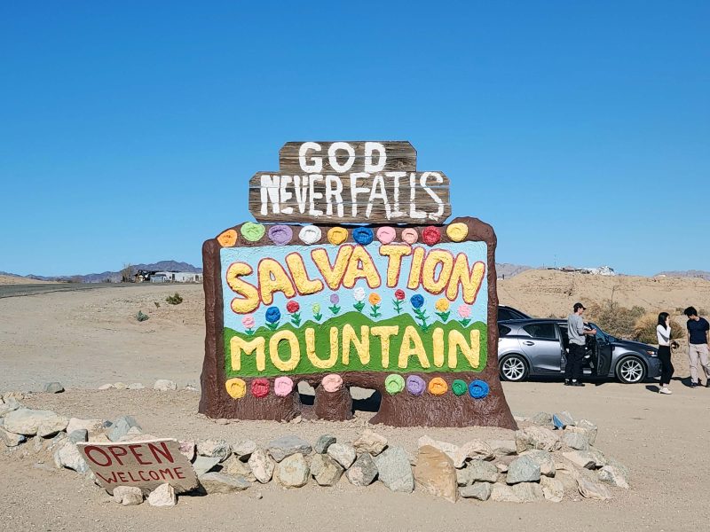
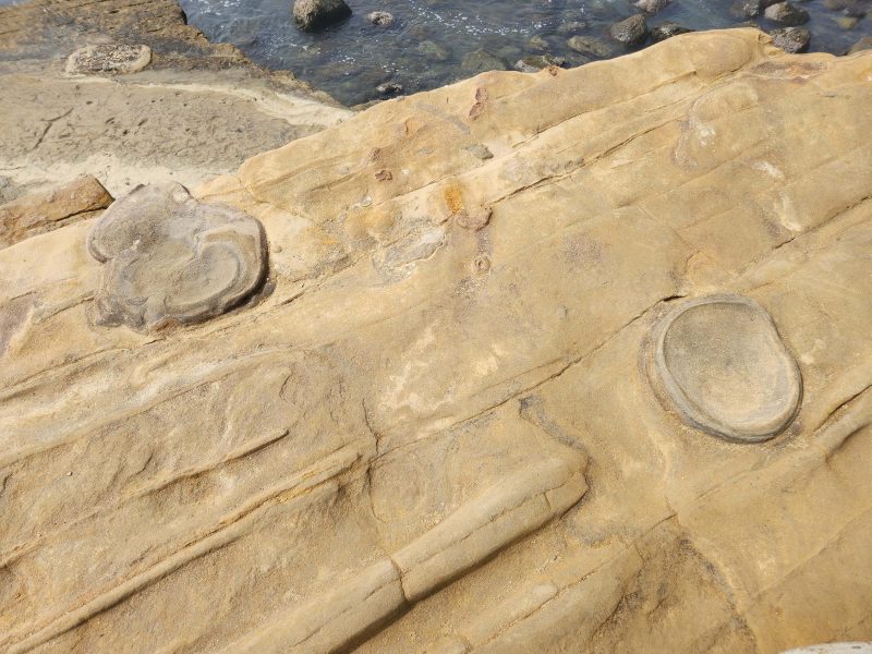
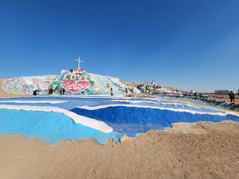
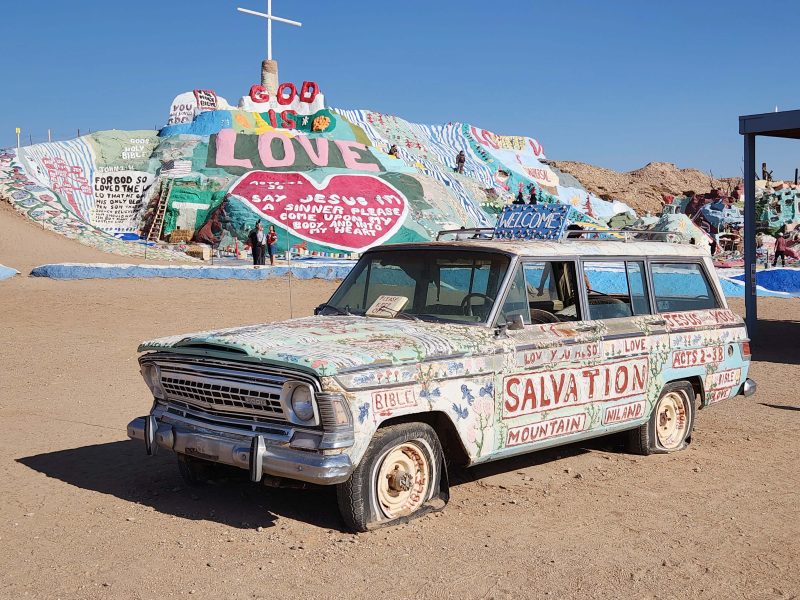
According to the handy brochure, Leonard Knight began creating Salvation Mountain in 1989 in Niland, CA, near Slab City. His building materials included adobe clay, straw, tree limbs, tires, windows, and lots of colorful paint. All of these items were found lying in the desert or at the local dump. Leonard’s plan was to paint the mountain twice a year, hoping the thick layer of paint would keep the site in good condition so that many people could see it for many years. (That explains the plethora of paint cans around the displays.) Perhaps not surprisingly, Leonard’s first mountain collapsed. As he began rebuilding it, he proclaimed, “No God, You build it.” Today, we saw the result.

In 1994, Imperial County attempted to have the mountain torn down, but members of the art community all over the United States and around the world united to save the monument. In 2001, Salvation Mountain was designated a National Folk Art Site; in 2002, it was named a National Treasure in the Congressional Record; and, in 2007, it was featured in the film Into the Wild. Leonard believed people need to start loving God more. He often said, “Love is universal. Love God, love one another, and just keep it simple!”

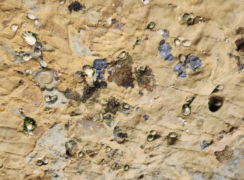
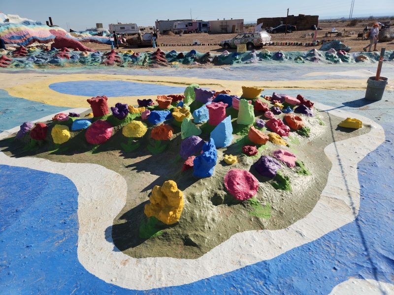
Salvation Mountain is a colorful sight in its brown desert surroundings. Notice the waterfalls, the rivers, and the Sea of Galilee.

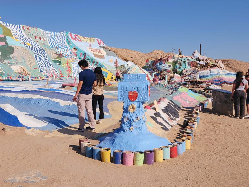
I don’t know how much mail God gets, but here’s a mailbox for it. The lumpy multi-colored blob on the right is the museum.

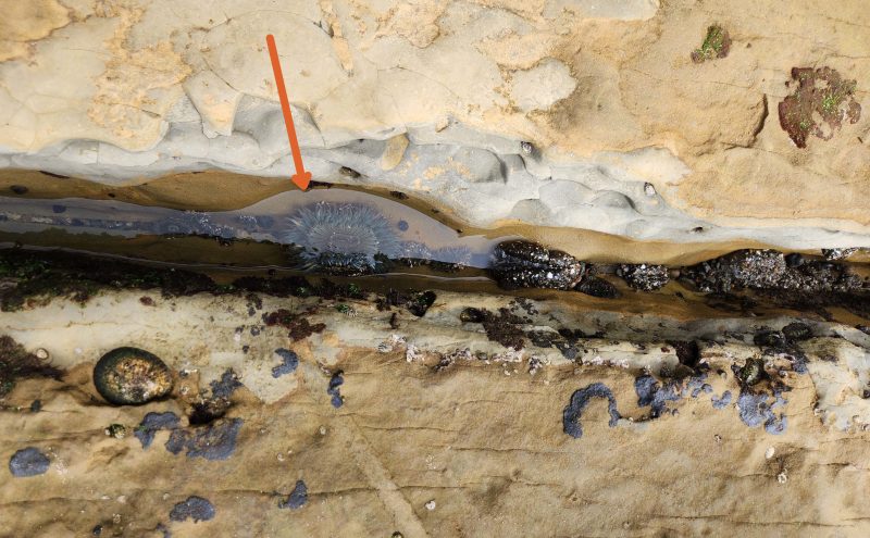
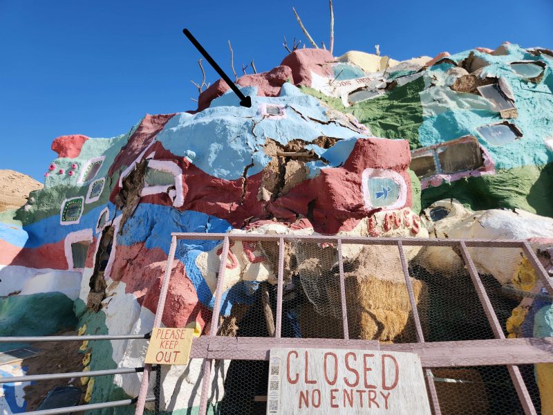
This is a close-up of the museum entrance. It’s closed because there is a danger that the top is going to cave in. The arrow in the photo points to one of many cracks in the dirt structure. If you look, you’ll see several more cracks. There are plans to repair the museum and to re-open it, but Salvation Mountain is dependent on donations and volunteers and cannot be repaired at this time. A public charity, Salvation Mountain, Inc., was established to continue maintenance on the site. No government aid is accepted.

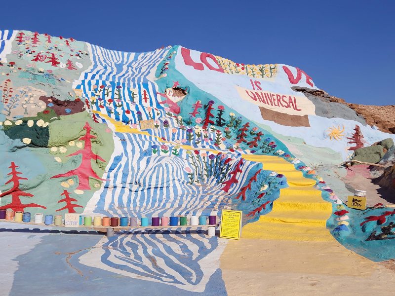
You can “follow the yellow brick road” to the top of the mountain. Jeff and La went all the way to the top via this route.

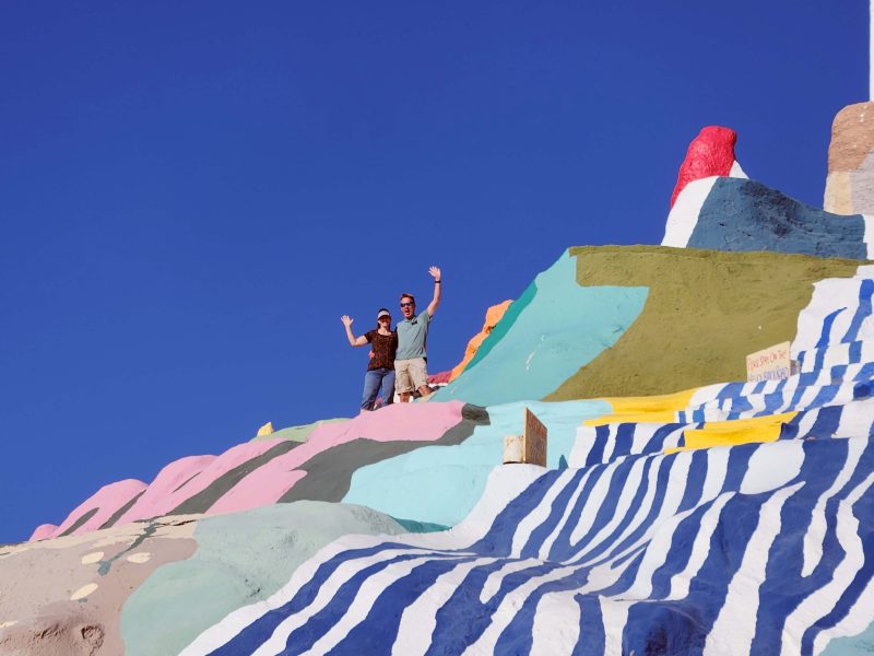
I made it across the first river before the edge of the yellow brick road came too close to the edge of the mountain for my comfort. I wasn’t in a Jack and Jill tumbling mood, so I chickened out and backtracked. I don’t like to be at the edge of high places unless there’s a large, firm platform under my feet with a protective railing around me. Luckily, on the other side of the mountain, there was a more gently ascending dirt trail to the top. Ted accompanied me to the top via that less scary route.

The Salton Sea was visible from the top of the mountain. It’s the flat, narrow light blue streak running across the upper center of this picture. The Salton Sea is a shallow, land-locked, highly saline lake that lies on the San Andreas Fault. In the 20th century, it was a resort destination, but contamination from fertilizers and clouds of toxic dust, plus evaporation, caused die-offs of fish and birds in the 1980s.

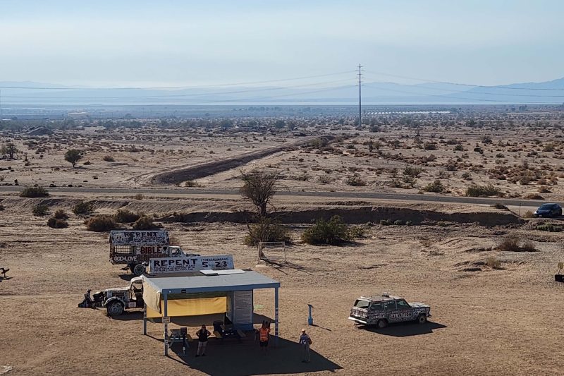
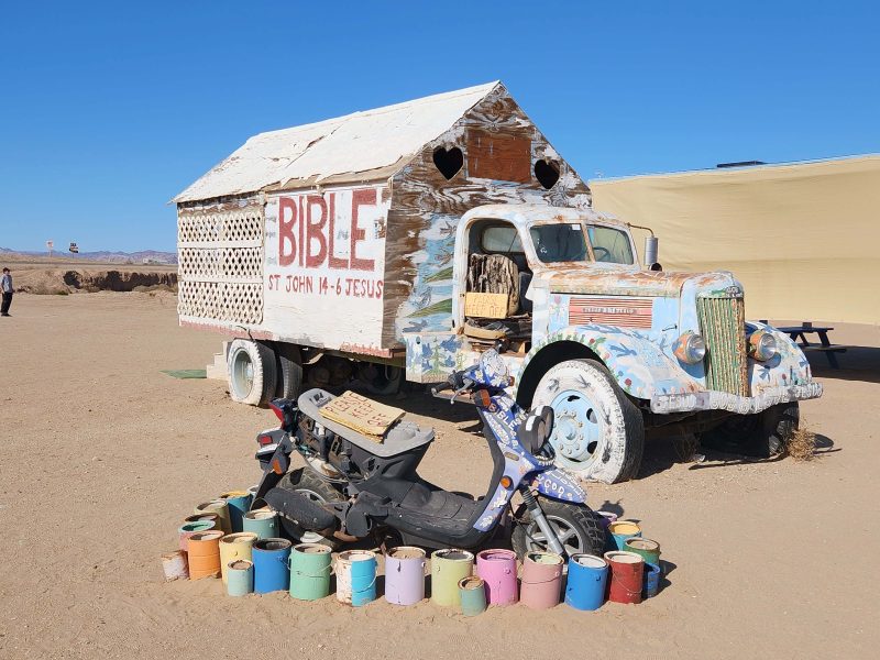
There are a number of vehicles–cars, trucks, farm machinery, a boat, etc.–on the grounds. All of them (except the boat) have flattened tires and all of them are colorfully painted with scriptural messages.

This is a view of Slab City, a community adjacent to and north of Salvation Mountain. Slab City took its name from the concrete slabs that remained after the World War II Marine Corps Camp Dunlap training camp was torn down. The community is known for attracting people who want to live outside of the mainstream society (i.e., off the grid).

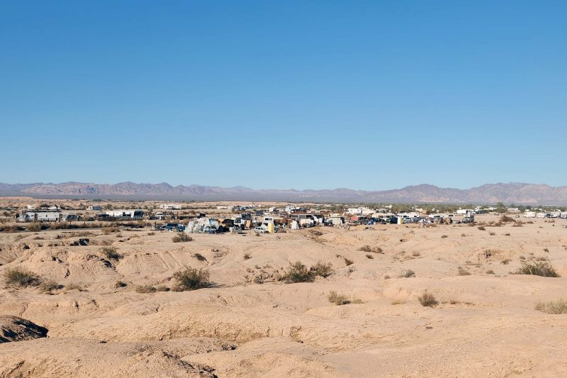
The trailers and campers behind Leonard’s “flower garden” in this picture might be a southern suburb of Slab City. Some of the volunteers who maintain Salvation Mountain live here.

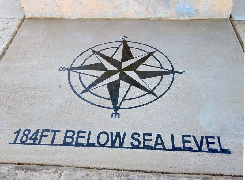
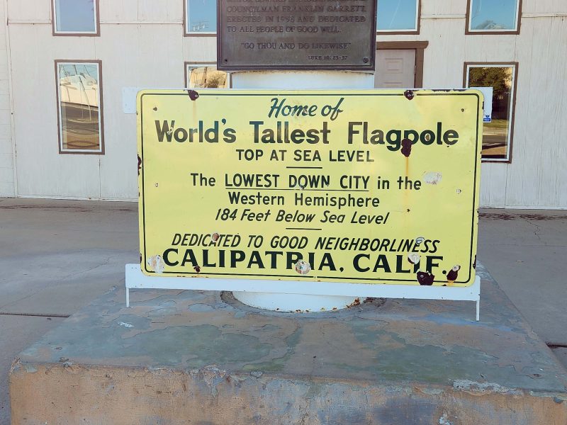
On our way back to El Centro, we stopped in Calipatria, a “low-down” town. At 184 feet below sea level, it is the lowest incorporated town in the Western Hemisphere. (Badwater Basin in Death Valley National Park is lower at -282 feet, but no one lives there.) The local joke in Calipatria is that its residents have to pray harder because they are closer to hell.

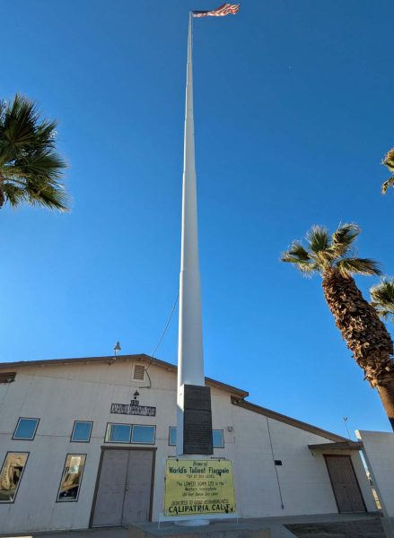
Calipatria’s claim to fame is its freestanding flagpole, at one time, the World’s Tallest Flagpole. At 184 feet tall, its flag flies at sea level. It can be seen from as far as three miles away and, as the sign says, it’s “Dedicated to good neighborliness”–a kind and friendly ideal.

Note: Calipatria’s flagpole is no longer the tallest flagpole in the world. Currently, the world’s tallest flagpole is 662.57-ft. tall and was built in Cairo in 2021. The 400-ft. tall Acuity Insurance Flagpole in Sheboygan, WI is now the tallest flagpole in North America. It is also one of the world’s tallest free-standing flagpoles.

Calipatria’s flagpole has an interesting backstory. The flagpole was built to honor Takeo Harry Momita and his wife, Shizuko Helen Momita. The Momitas were a Japanese-American couple who lived in Calipatria. They and their three children had been incarcerated at the Poston War Relocation Center in western Arizona during World War II under Executive Order 9066 signed by President Franklin D. Roosevelt. The order imprisoned 120,000 people of Japanese descent–two-thirds of whom were American citizens.

When Mrs. Momita was killed in a car accident and Mr. Momita was hospitalized for injuries he sustained in the accident, Calipatria residents operated his pharmacy for him and collected $500 for Mrs. Momita’s funeral. Mr. Momita said his wife would not want an elaborate funeral. Instead, he offered to donate an additional $500 of his own savings toward something the city wanted but could not afford: a flagpole reaching up to sea level.

The story made national news and donations poured in. President Richard Nixon sent a flag that had flown over the U.S. Capitol, and Pacific Southwest Pipe Co. of Los Angeles offered to erect the flagpole at cost (about $10,000).

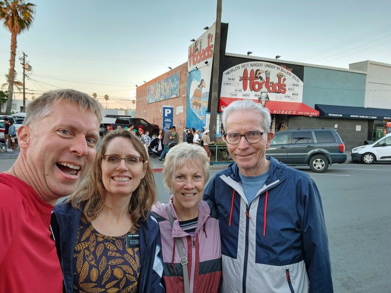
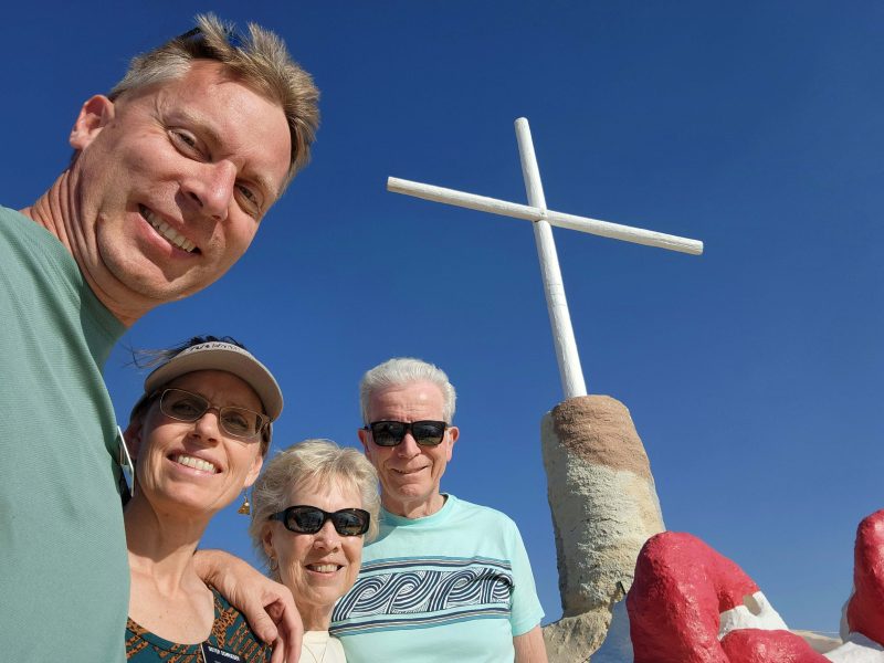
What a nice way to end our visit with Jeff and La. In the past five days, they took us to all the interesting places I’ve been writing about and they were outstanding tour guides. We had lots of good times together, good food wherever we ate, good family time, and loving hospitality. It was great to spend this time with them.

It was exciting to arrive in El Centro and to see where Jeff and La are living for a year. The temperatures in San Diego were in the upper 60s and low 70s, but in El Centro–located in the Colorado Desert (part of the Sonoran Desert) in the Imperial Valley, and 42 feet below sea level–the temperatures were in the 80s. I loved it! The Imperial Valley is very flat because it used to be an inland sea. I guess that explains why the area is now below sea level. 🙂

We spent the morning playing games. Jeff and La introduced Ted and me to “Cover Your A$$ets,” which was a fun game. We plan to buy it for ourselves after we get home. We went out for a late lunch at one of Jeff and La’s favorite local restaurants, Burgers & Beer. It was a hopping place, even after the usual lunch hour. Our server was very nice, and the food was delicious. Fortified by our burgers and fries, we headed for Pioneers’ Museum, about an hour’s drive away.

An important factor in the permanent settlement of the Imperial Valley was the building of one of the most impressive irrigation systems anywhere in the world. This made the area one of the most productive farming regions in California, with an annual crop production of over $1 billion. Pioneers’ Museum celebrates the many ethnic communities that settled in this area and made it the community it is today.

We arrived at the museum only an hour before closing, so the ticket master (the only person on duty) allowed Jeff and La to enter for half-price, which was the same as the senior discount for Ted and me. It’s an interesting museum. We each went our own way to look at the things that interested us in the one hour remaining before we had to leave.

This is a player piano. You can see the music scrolls above the pedals. Wouldn’t it be nice to have decorated pianos like these today? (I’m not sure, but the second picture might be a spinet harpsicord with horizontal strings.)

This car was part of a display about the people who came to the Imperial Valley during the Dust Bowl years. The yellow object on the right is a gas pump from the 1930s.

Here is a beautiful piece of tapestry. I think I’d enjoy making something like this, although I’d choose a different design.

Compare this to the cash registers we see in stores today. Which to choose: cash register beauty or computer speed?

There were two cabinets filled with hatpins. This is one group of them in one of the cabinets. Women in the late 1800s and early 1900s carried hatpins for protection against men who harassed them. (That might still work, judging by these hatpins.) Using hatpins as weapons led some cities to pass laws limiting the length of hatpins. You probably can’t get any of these past security at the airport today.

When I entered the second floor of the museum, this cabinet was directly ahead of me. My first thought was, “I’ll bet it’s a sewing machine cabinet.”

I carefully opened the top and there it was–the drop-down sewing machine hidden in the cabinet when it’s not in use.

The first sewing machine I bought had a drop-down cabinet. I had the cabinet retrofitted for my new sewing machine, but the new model is too large to fit the cabinet if it’s dropped. I store the sewing machine in a closet and set it in the cabinet when I use it.

This antique sewing machine is like the one my mother had when I was a young child. Mom started teaching me to sew when I was nine years old. (I made a sleeveless yellow blouse). She must have replaced her treadle machine before that because I only remember sewing on her electric Singer sewing machine (exactly like the one I bought as shown in the link above), never on her treadle machine. Note the photographer, trying to get the perfect shot.

Holtville, CA, in the Imperial Valley, is known as the “Carrot Capital of the World” because of its annual Carrot Festival and its large carrot harvests. The multi-day festival is held in late January or early February and includes a parade, a carnival, cook-offs (of carrot-based foods, I assume), and other activities. Also included in the festival is the crowning of the Carrot Queen, the Princess, and the Junior Princess, as well as the crowning of the Citizen of the Year. Here are an historic photo of a carrot harvest and photos of festival memorabilia.

As we were driving home from the museum, we passed an open semi trailer truck nearly overflowing with a load of carrots. Really.

Another display that interested me was the picture brides. Most of the picture brides were Japanese, Okinawan, and Korean. Their pictures were paired with husbands selected by a matchmaker, similar to the concept of mail-order brides. Picture brides were often poor and hoped that marriage would provide economic prosperity for them, allowing them to send money back home to their families. It was not unusual for picture brides to be educated at the high school or college level, and thus more emboldened to seek out new opportunities abroad. By 1920, over 10,000 picture brides had arrived in the United States, and over 15,000 arrived in the then-territory of Hawai’i.

This photo shows a picture bride with her husband.

You can read the story about another couple below. They exchanged pictures of themselves with each other (corner pictures), and when the match was deemed satisfactory, they were married by proxy. The woman said that, at first, she was disappointed when she met her husband because he was much older than he looked in his picture. They settled in the Imperial Valley and were married for 50 years until the man died in 1964.

Coming around a corner in the museum and seeing a Holstein cow caught me by surprise. Even more surprising (and kind of funny) was the accompanying tribute to “The Cow” (below).

Before we left the museum, Jeff found himself in the Holtville Jail. He managed to escape and drove us home, where we took a late afternoon walk around the neighborhood.

Our last sightseeing stop today was the Desert View Tower on our way to Jeff and La’s apartment in El Centro. Jeff and La notice the tower when they drive back and forth to San Diego, and they’ve been curious about it.

The 70-foot tall tower was built in the 1920s and was dedicated to the pioneers and to the highway and railroad builders who opened up this area. At first, it served as a roadside advertisement for a restaurant and bar located on the old road across from the tower. It currently houses a museum, has a hurricane (aka observation) deck on its upper level, and is listed on the National Register of Historic Places.

The museum is described online as a “collection of unique trinkets that you can purchase.” That’s exactly what we saw on the first floor. There were two older men sitting inside the tower on the first floor. They were very talkative as we walked around the circular room looking at the trinkets. None of the trinkets appealed to any of us and neither did the $6.50 per person admission fee to climb to the hurricane deck, so we walked around outside a little bit. There was, indeed, a desert view.

The cacti around the building were pretty in the late afternoon sunshine.

Are these desert wind chimes?

Here we are, ready to leave the historic Desert View Tower to go to Jeff and La’s house where we made individual mini pizzas for dinner. It was another day of fun together.

Jeff and La have tried several times to stop at La Jolla (pronounced “la hoya”) Beach to see the sea lions, but have been unsuccessful. The problem is parking. Only street parking is available within a reasonable walking distance, and lots of people want to see the sea lions. As a result, Jeff and La have never found a parking place and have gone home disappointed. Until today. Maybe Ted and I were good luck charms because we found a parking spot very close to the beach and here we are, happily at La Jolla Beach with the sea lions.

That’s Jeff standing at the sidewalk railing. It’s pupping season for the sea lions, so humans are not allowed on the actual beach at this time.

That lumpy dark line along the shore is a gathering of sea lions. When you watch the video, look at the right one-fourth of those sea lions. You’ll see a mama sea lion waddling out of the water with her pup behind her, then heading back into the water to follow her pup who wanted to play some more before sunbathing.

These sea lions have picked a prime spot for sunbathing. During the time we were here, you could see that the tide was going out because the rock in the photo below emerged from the water. As the water level dropped, more sea lions headed for this rock, but these had the best (i.e., highest, driest) spots for lying in the sun.

All those black things on this piece of rock are barnacles. The arrow points to a tern. He was pecking at and eating the barnacles.

It was interesting to see so many sea lions and pups go in and out of the water and roll around on the rocks, so we stayed to watch them for quite a while. Then it was lunchtime. Jeff and La pulled out their cell phones to search for a nearby restaurant. It looks like I’m hoping and praying that they find somewhere to eat soon.

When I realized Ted was taking a picture of us, I looked up and smiled.

My prayers (?) were answered. We headed for one of Jeff’s favorite sandwich places and a new restaurant for Ted and me: outdoor dining at Cheba Hut. I told Jeff I prefer warm sandwiches, and he assured me that Cheba Hut toasts their sandwiches. It was the first time I’d ever had a warm PBJ. Yes, even the PB and J were warm! Good food for good times!

Before leaving our San Diego hotel this morning, Jeff posed with the restaurant’s giant waffle.

Our first sightseeing destination today was Annie’s Canyon Trail, which includes a loop through a slot canyon. The trail has a sign warning hikers that some of the trail is very steep. As we set off to explore the canyon, we hoped the steep part was the steps at the highest point of the trail. The photos below might look as if we’re deciding which way to go, but there was only one way through the canyon. We were just looking around and taking some pictures before moving forward again.

Ah, now we’re getting to the “slot” part of the slot canyon.

Unfortunately, my injured ankle is not yet completely healed. Walking on the uneven rock on an increasingly steep upward slope was making my weakened ankle hurt. I was having fun and wanted to see the rest of the canyon and the view from the top, but as the pain became worse and the trail became steeper, I decided I’d rather turn around than aggravate my ankle and miss out on the fun for the rest of the day and maybe even the next day because of continued ankle pain.

Turning around might be the smart thing to do for me and for those who discover that the slots are too claustrophobic for them, but it isn’t easy. As you can see in the photos, much of the trail is only one person wide and is essentially a “no passing” zone. That meant that, as I went down, other people needed to find a wide space, plaster themselves against the canyon walls, and wait for me wriggle past them on my way downward before they could continue upward. I was grateful that they were all very nice about it. I apologized for their inconvenience and got lots of “No problem” and “Don’t worry about it” responses, accompanied by smiles. Ted and Jeff both chose to go back down with me, although I was fine with the idea of going by myself while they enjoyed the rest of the hike. That left La to complete the loop trail by herself and then tell us about it later.

At the end of the loop, the trail continues along a marshy area. We saw this pretty flowering tree.

As we were admiring the view from the trail, we noticed an osprey sitting on a dead tree branch. One of the other people looking at the osprey noticed that he’d caught a fish. It’s the silver strip under his feet on the branch. A man in the crowd mentioned that where there’s one osprey, there are always two and, sure enough, his mate came back, circled, and cawed back and forth with him a bit before she flew away. I think she was telling him she could do without the crowd of people watching and would be back later after we’d all gone away.

The fish wriggled under the osprey’s feet for a few minutes. When it was still, the osprey enjoyed his lunch. It was kind of sad to watch the fish die and then be eaten, but that’s how all animals survive, right?

After a pretty hike with a survival-of-the-fittest ending, we headed for a happier experience with nature. Coming up: La Jolla Cove.

Our last tour stop of the day included a beautiful drive over the Coronado Bridge to Coronado Island, with a pretty offshore view of San Diego. Coronado Island is the home of the historic four-star Coronado Hotel, a rare surviving example of an American architectural genre: the wooden Victorian beach resort. It is the second-largest wooden structure in the United States. (FYI: The largest is Tillamook Air Museum in Tillamook, OR.) The Coronado Hotel was designated a California Historical Landmark in 1970 and a National Historic Landmark in 1977. The 1959 movie Some Like It Hot–starring Marilyn Monroe, Tony Curtis, and Jack Lemmon–was filmed here, highlighting the hotel.

In case you’re wondering, in summer, the lowest room rates begin at $500. In addition, there is a $50 resort fee, a $15 per day Historic Preservation Fund fee, and a $75 per day valet parking fee if you arrived in your private car. Rates drop as low as $350 for rooms in the off-season. Question: Which part of the year is the off-season in sunny, warm San Diego?

These colorful surfboards stood outside the hotel. I hope those hotel fees allow you to use a hotel surfboard without an additional charge.

There was a (sand-covered) sidewalk along (guess what?!) Coronado Beach, so we followed it for a short way and passed this lifeguard station.

It was late in the afternoon, and the sun was shining over the ocean.

I’m guessing that a motorcyclist had fun doing a wheelie here on the beach.

On our way back to the car, I noticed this beachcomber. I hope he found a little treasure to brighten his day.

We ended our day with dinner at Outback to celebrate Jeff’s and La’s February birthdays. Happy birthday to both of you. ♥♥

After our pizza lunch at Phillipo’s, Ted and I and our tour guides, Jeff and La, headed for Balboa Park. This park is one of the oldest sites in the United States dedicated to public recreational use. It housed the 1915-16 Panama-California Exposition and the 1935-36 California Pacific International Exposition. What a beautiful place! The architecture is awesome, and the park setting is perfect for it. The park and its buildings were declared a National Historic Landmark and a National Historic Landmark District in 1977, and were placed on the National Register of Historic Places.

This building houses the San Diego Museum of Art, which features European, Asian, American, and Latin American art. It is best known for its collection of Spanish Old Master paintings.

Here’s a close-up of the sculptures over the main entrance to the art museum. The three central sculpted figures are Spanish Old Master painters Diego Velázquez, Bartolomé Esteban Murillo, and Francisco de Zurbarán–perfect choices for this museum.

This building includes the Visitor’s Center and restaurants, as well as banquet and wedding venues.

We didn’t go into these buildings, but I admired the decorative sculpting on them.

The park includes this large, unique greenhouse with a variety of plants on display.

As we walked around the park grounds, we saw this Southwestern museum. It’s name translates to “Cultural Museum of the People.” With permission, I took pictures of some of the art on display.

I don’t know the purpose of this building, but it’s definitely “eye”-catching! (Insert groan here.)

I am not knowledgeable about art movements and/or styles, but I’m sure these concrete picnic tables and benches represent a specific artistic period. I thought they were interesting to look at, but are they comfortable? Notice that no one is sitting on any of the benches.

Finally, here are the four of us, enjoying Balboa Park on a warm, sunny February day in San Diego.

Our first sightseeing stop with Jeff and La today was the Cabrillo National Monument. I’ve never heard of Cabrillo, but I’ve learned that Juan Rodriquez Cabrillo led the first European expedition to explore what is now the west coast of the United States. His contemporaries considered his expedition a failure, but Cabrillo’s writings provided a glimpse of the west coast of North America from a newcomer’s perspective.

Later Spanish explorers used Cabrillo’s records to navigate the Pacific. They learned from Cabrillo’s expedition that a wide, slow current flows from north to south along the Pacific coast of North America. Although this current provides a quick way to reach North America from Asia, it is nearly impossible to travel north, as Cabrillo and his crew found out.

There was heavy ocean fog when we arrived at the monument site. We were on a bluff at the edge of a peninsula, but we couldn’t see the water.

Here we are at Cabrillo National Monument, . . .

. . . and here’s the larger-than-life statue of Cabrillo, including fog in the background. La, Jeff, and Ted are standing on the left of the statue.

The historic Old Point Loma Lighthouse is near the statue of Cabrillo. It was one of the first eight west coast lighthouses to be constructed by the U.S. government. At 422 feet above sea level, its light could be seen from both the ocean and the bay sides of the peninsula.

We drove down the bluff to the beach to see tide pools. It was still a little bit foggy when we arrived.

I love watching the ocean waves. Watch the white cap of the back wave move from left to right as it approaches the shoreline.

This isn’t a good beach for swimming, but it’s picturesque.

I took a geology course in college and learned about sandstone, so I knew the rocks at this beach were sandstone. These circular formations, however, fascinated me. Professor Google told me they are masses of mineral matter, usually cemented by iron oxide. They form in the sandstone layer and appear as rounded shapes when the surrounding rock erodes.

I thought these blocks of strata were interesting too.

The layered appearance of this sandstone is what I’m more familiar with. Jeff stands triumphant on the top of this bluff.

Jeff, La, and I are looking for sea life in the tide pools on this rock.

We found a wide variety of sea shells embedded in the rocks.

The arrow in this photo indicates a living, moving amoeba in a tide pool. I think the black objects to the right of the amoeba are barnacles.

These black circles look like shiny rocks, but look closer. They are pools of water. When you realize that, you’ll notice the upper edges of the holes the water is in; the reflections of those edges on the surface of the water; and–especially in the pool in the lower right–the smaller stones and sea life in the bottom of the hole beneath the water.

Here we are, having a good time at Cabrillo National Monument Beach.

After Cabrillo, it was time for lunch. We went to Phillipo’s for pizza and salads. Does this make you think a slice of pizza would be good right now?

We all enjoyed it.

Outside of Phillipo’s, there was a chair on the sidewalk large enough to hold three of us. It begged us to climb aboard for a photo op, so we did. We did not need to hold anyone liable (see the warning on the front of the step to the chair).

Wouldn’t you know it?! The day before Ted and I were scheduled to leave home to visit Jeff and La in warm and sunny San Diego, we had snow during the day and overnight. It was only 3 inches–nothing like the big January storm–but Ted cleared the first 2 inches from our driveway and sidewalks late in the afternoon, and the last inch in the early morning (7:00 a.m.) before we left for the airport. The roads on the way to the airport were slushy and a little slippery, but not too bad. The forecast low at our house today was 0 degrees; the forecast high in San Diego today was 68 degrees. Yes! I’m ready for some warm weather!

We boarded our plane on time, but then sat at the gate for about 90 minutes waiting for “paperwork,” as the pilot described it. It could have been stressful, but the pilot and co-pilot came into the cabin, and they and the flight crew chatted casually with the passengers. Those who were tired of sitting (and knew there were 3+ hours of sitting coming up on the flight) stood in the aisle and talked with each other. It was kind of like a pre-flight social hour (-and-a-half)–much better than 200+ grumpy people due to a flight delay. We kept Jeff and La posted on our status so they wouldn’t be waiting 90 minutes at the airport for our delayed arrival.

After Jeff and La picked us up, our first stop was Ocean View Beach. Yes! It was wonderful to see sand, sunshine, and the Pacific Ocean instead of snow!

The most interesting thing at the beach was a grassy area filled with people who (apparently spontaneously) played music and did acrobatics. I took some videos of them. In this one, watch the woman in the center of the picture (wearing a pink leotard) as she flips above the man. You can hear the drums if you turn on the sound.

In this video, another woman holds a man’s hands and does a handstand over his head.

Finally, here’s a tightrope walker. Several people tried the tightrope; this guy did jumps and, at times, stood on one foot.

When we finished walking and watching on the beach, we headed for a nearby farmers’ market. The palm trees were a clue that we weren’t in cold (today) Missouri.

There were a lot of colorful vegetable, fruit, jewelry, and floral displays at the market.

Then, it was time for lunch. We went to one of Jeff and La’s favorite San Diego restaurants: Hodad’s.

Hodad’s definitely has atmosphere. The walls are covered with license plates, and the benches are covered with stickers and more license plates. Each of us was given a souvenir sticker when we left the restaurant. Does the surfboard table say “California” to you?

We found a Missouri license plate on one wall.

I’ll bet that you can find the “ELVIS” license plate without an arrow.

Here we are, waiting for our delicious food. We had burgers, fries, and shakes–an All-American Hodad’s lunch.

On our way back to the car, we saw these pretty bird of paradise flowers. Our first day with Jeff and La was fun. And warm!

In the reading I’ve done over the past several months, I’ve found some ideas that I found very thought-provoking. The first three are rather bleak; the last three are more positive.

This quotation is taken from FDR’s January 1937 Second Inaugural Address during the Dust Bowl years:

I see one-third of a nation ill-housed, ill-clad, ill-nourished. . . . The test of our progress is not whether we add more to the abundance of those who have much; it is whether we provide enough for those who have too little.

Franklin D. Roosevelt

In 2022, Louisiana had the highest state poverty level at 18.2 percent and our national poverty rate was 11.5 percent. We still have a long way to go to properly care for “those who have too little,” even while the wealthiest people become increasingly wealthy and legislators look for ways to decrease poverty-directed support programs such as Head Start, free school lunches, Medicaid, SNAP qualifications, etc.

~~~~~~~~~~~~

This paragraph comes from a Jodi Picoult book. I don’t remember which one, but I think it might have been Great Small Things.

Start with the sentence The unborn baby is a person. Replace the words unborn baby with the words Immigrant. African-American. Trans woman. Jew. Muslim.

Jodi Picoult

Ted and I have traveled in 36 countries and have been in all 50 of the United States. While each destination is unique, the one thing we have found that they all have in common is that people are the same wherever we go. Every individual is a person with whom we have more commonalities than differences.

This was made very clear to me when I worked with one of my professors as a graduate assistant. He was involved in a project to develop community schools in the poorest areas of St. Louis City. At those meetings, I heard people say that living in a poor neighborhood (most would call that area a ghetto) was an advantage because you could afford to buy a home. Combined with that, they wished their neighbors would keep their homes and yards neat so the neighborhood would look nicer. Parents were adamant that they didn’t want their teenage sons to be killed by or because of drugs, and they prayed their daughters would not become pregnant in high school. These values clearly align with those in the most expensive neighborhoods.

~~~~~~~~~~~~

In Percival Everett’s 2024 book, James, there is a paragraph where James discusses truth and lies. Pay attention to the last sentence.

, , , “But dey was stealin’ from dem folk. Tellin’ lies lak dey was. He weren’t neber no pirate.”

“Yes, but them people liked it, Jim. Did you see their faces? They had to know them was lies, but they wanted to believe. What do you make of that?”

“Folks be funny lak dat. Dey takes the lies dey want and throws away the truths dat scares ’em.”

Percivall Everett in his book “James.”

Yes, we all do that. Sometimes it doesn’t matter; sometimes it matters a lot.

~~~~~~~~~~~~

In her 1992 poem, “The Summer Day,” Mary Oliver says:

Tell me, what is it you plan to do / with your one wild and precious life?

Mary Oliver

I’ve never thought of my life as wild, but I love the way Oliver makes me feel like my life can make a difference and that I should not waste it.

~~~~~~~~~~~~

Gilbert K. Chesterton makes the same point.

The most extraordinary thing in the world is an ordinary man and an ordinary woman and their ordinary children.

Gilbert K. Chesterton

I think the majority of us feel there is nothing outstandingly special or important about our everyday lives, but Chesterton feels differently about us. When I think about it, he’s absolutely right.

~~~~~~~~~~~~

Finally, just to simplify your literary life, I’ll close with the words of John Gardener.

There are only two plots in all of literature: (1) A person goes on a journey; and (2) A stranger comes to town.

John Gardener

Now I’m wondering if our lives have only those same two plots. My journey through life has brought me much–love, family, friends, happiness, sadness, education, fun, skills, experiences, and so much more.

The strangers I’ve met have all been interesting in one way or another–sometimes positively, sometimes negatively. Some of them have been important to me for a relatively short period of time; others are lifelong friends. Nearly all of them have added to my experience and to my life’s journey.

I think Gardener is right: our lives and our stories are shaped by those two plots.

I have some wonderful friends, and I’m glad we express our feelings for each other. Recent friendship messages have warmed my heart.

Liz and I met at work and became friends in the middle 1990s. Our friendship has become more meaningful over the years because we know that we can trust each other with our deepest feelings and opinions and receive judgment-free support in return. As co-workers, we had adjoining offices, and because we worked in the same division, we often attended the same conferences at the Lake of the Ozarks–a three-hour drive away. We always looked forward to the drive time together because it was an uninterrupted block of three hours in each direction when we could share laughter, troubles, and everything in between. At Liz’s retirement party, I was talking with one of her friends and the lightbulb came on for her. She said, “Oh! You’re Liz’s Lake friend!” This is Liz and me. (Liz is the taller one.)

Last September, I was able to see my friend, Eileen. We had adjoining dorm rooms during our freshman and sophomore years in college and have been BFFs since then. I faint at the sight of blood, but Eileen, a nursing student, convinced me to give blood at a campus blood drive. I did it, and when I got back to the dorm, I knocked on Eileen’s door. When she opened the door, I proudly told her I had given blood without fainting–and fainted at her feet! Does that make us blood sisters? After our September 2024 visit–55 years later–Eileen sent me this message. (Note: we both look much younger–check the photo of us in the link–than these ladies.)

This sentiment describes me and these two friends–even though none of us has ever been in legal trouble.

English is a weird language. I enjoy the weirdness, so I’m taking this opportunity to present some of my favorite English weirdos.

I’ve posted this one before, but I thought it would be fun to include it with a set of other weird examples.

Brown’s son joined Brown’s company, so Brown decided to change the name of the company to “Brown and Son” and to have a new sign made for the shop. When the sign maker showed Brown the new sign, Brown complained, “It’s too crowded. There should be more space between Brown and and and and and Son.

From Steve, who sent this to me

This one came from Jeff.

I don’t remember where I found this one. It will make sense if you read it correctly.

All the faith he had had had had no effect on him.

Unknown

Jeff also sent me this weird, but grammatically correct, sentence. I think you’ll agree that the correct use of a comma clarifies the meaning.

I posted this English spelling rule a long time ago. Mandy, one of my office co-workers back in the day before I retired, sent this to me. In case you’ve forgotten, the rule says “I before E, except after C, or when sounded like A, as in neighbor or weigh.” Mandy imagined this mug filled with beige caffeine. Weird.

Moving on from weird English grammar and spelling rules, let’s go to the trivia question of the day on a recent local news broadcast: Which English word has the most definitions? It’s not something I ever wondered about, so I didn’t have a clue. The answer on the program was “set.” I went to Professor Google to verify the information and got these responses.

Well! That was inconclusive! I dug a little deeper and found this.

How many definitions can you give for “run” and/or “set”?

If all of these weird English grammar and spelling examples are too confusing, just follow this advice.

Mike and Mary Jane like history and so do Ted and I, so we had an “historic” day together. We met for lunch at Blueberry Hill, a St. Louis landmark restaurant and music club that opened in 1972.

Blueberry Hill has rooms for eating, for parties, and for weekly live musical performances. One of the rooms is named the Elvis Room; another is named the Duck Room in honor of Chuck Berry’s duck walk. Chuck Berry, the first person inducted into the Rock & Roll Hall of Fame, inaugurated the Duck Room and played 209 consecutive monthly concerts there–doing his duck walk, of course. Many famous musicians have played at Blueberry Hill, and the walls have hundreds of framed pictures of the owner with each of them, as well as with four U.S. presidents.

The owner of Blueberry Hill started collecting things as a child and displays his collections in (again) hundreds of showcases throughout the building. His collections feature every kind of pop culture memorabilia imaginable, including Howdy Doody, the Simpsons, Chuck Berry, Star Wars, jukeboxes, lunch boxes, toys, and more.

Today, the four of us came to Blueberry Hill for lunch. We plan to come back on another day to explore the restaurant’s museum-like rooms and displays. You can’t always get a level photo with a selfie, but Mike managed to fit all of us in his picture.

These are the walls in one of the restaurant’s rooms.

Here’s a wall in the room where we were seated. In case you missed it, I added an arrow to the picture of Elvis for your convenience. 🙂

The St. Louis Walk of Fame honors people from the St. Louis area who were either born here or who spent their formative or creative years here. The more than 170 honorees are from all walks of life and areas of achievement and have made major contributions to the city’s cultural heritage. The Walk of Fame sidewalk passes Blueberry Hill, so we saw some of the stars as we entered and left the restaurant. Below are stars for Chuck Berry (musician), Bob Costas (sportscaster), and Stan Musial (baseball player).

Our primary destination today was the Missouri History Museum, housed in the original 1913 Jefferson Memorial building. The memorial was constructed with proceeds from the 1904 St. Louis World’s Fair and stands at what was the main entrance to the fair. This was the first national monument to Jefferson. (Why would St. Louis build the first monument to Jefferson? Think Louisiana Purchase.)

A replica of Charles Lindbergh’s Spirit of St. Louis airplane hangs over the atrium area. The original airplane is housed in the Smithsonian National Air and Space Museum in Washington, D.C. and is one of that museum’s most popular attractions.

Our main interest at the museum today was the updated 1803 Louisiana Purchase Exposition, commonly referred to as the 1904 St. Louis World’s Fair exhibit. (The Exposition wasn’t finished in time for its scheduled 1903 opening.) The fair was held from April 30-December 1, 1904. The model of the fairgrounds in the photo below is built on a 1:400 scale. The fairgrounds covered 1,200 acres of the present-day 1,300-acre area of Forest Park, with the Palace of Agriculture alone covering approximately 20 acres. The fair featured over 1,500 buildings connected by 75 miles of roads and walkways. Over 19 million people attended the event.

Many of the fair exhibits focused on themes of racism and imperialism. This 2024 update of the museum’s exhibit includes information about those themes, rather than “sweeping them under the rug” and focusing only on the entertainment, new consumer goods, and architecture featured at the fair.

Here are some statistics about the 1904 World’s Fair.

There have been many claims that the ice cream cone was invented at the 1904 World’s Fair, but that’s not true. Several places claim that invention in the late 1800s, but the 1904 World’s Fair greatly contributed to the popularity of the ice cream cone.

Ted and I saw a wall like this in North Dakota. Just as in North Dakota, these stories and comments were fun to read.

So what makes St. Louis unforgettable? Read on to discover four writers’ opinions.

History can be fun. We all had a great time enjoying Blueberry Hill, a bit of the St. Louis Walk of Fame, and the Missouri History Museum.

Ted has been in a clean-up mood and has gone through all kinds of things in our storage room, including old photos. He found these two, and the memories they brought us were so-o-o-o good.

Kyra looks like she’s about three years old in this picture. I sent her a copy of the photo and she mentioned that she has some strange-looking bangs. I think it’s a rite of passage for toddlers to cut hair. Hopefully, they don’t run with the scissors.

I think this picture was taken in 1995. Ted and I took Kathy and Kari on a road trip that included Sleeping Bear Dunes National Lakeshore in Michigan.

I don’t know where the other photos of that trip are, but maybe Ted will find them. I found these images online for any of my readers who have not been to Sleeping Bear. The lake is 450 feet below this sand dune. Look at the tiny people on the dune for a perspective of its size. The girls and I went down to swim in the lake.

This is how we went down to the lake. If you take long steps, the drop is so steep that each forward step + gravity = a lot of distance downward. The airborne time gives a sensation of flying, so getting to the lakeshore was a blast. Climbing back to the top was harder, although we saw some cross-country teams running up the dune for practice. I know we went other places on this trip, but Sleeping Bear is the only one I remember.