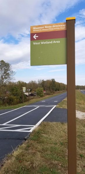
Ted and I started today’s bike ride on the Busch Greenway approach to the Katy Trail, then followed the Katy for less than a mile before going up the ramp to the bike lane on I-64 to cross the Missouri River. On the St. Louis County side of the river, we entered the Monarch Chesterfield Levee Trail, a portion of the Missouri River Greenway system.
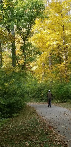
It was a beautiful fall day for biking.
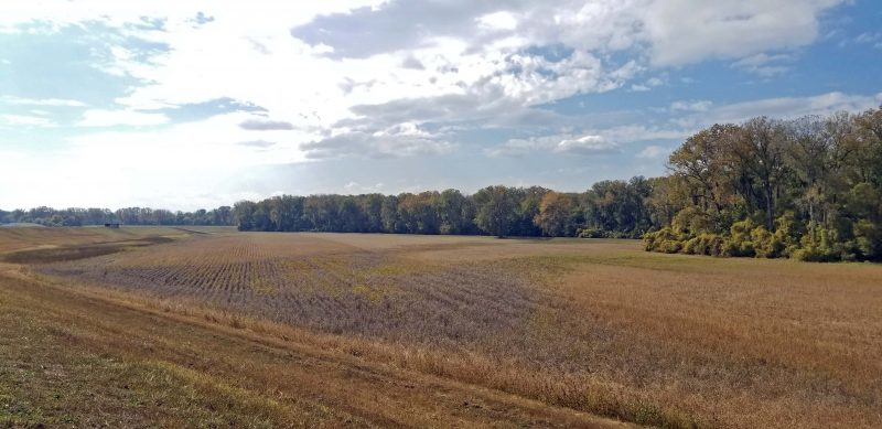
The levee views were kind of blah, since most of the crops are harvested, and the trees have not yet reached their peak colors. Even so, it was nice to ride along the top of the levee for 23 miles.
Almost immediately after entering the trail, we were surprised to see a small cemetery alongside the bike path
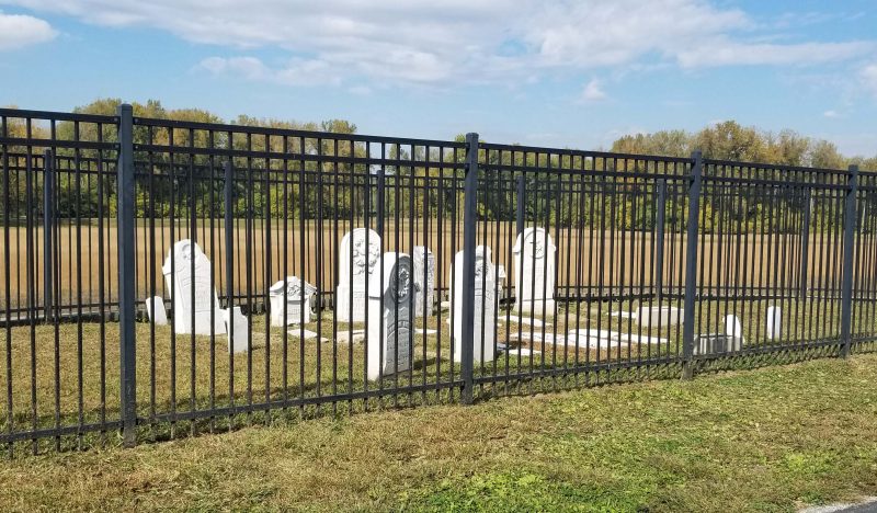
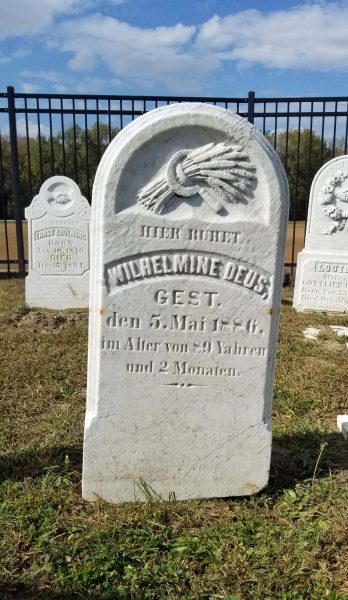
The headstones were engraved in German. This woman’s age was even given in months–89 years and 2 months.
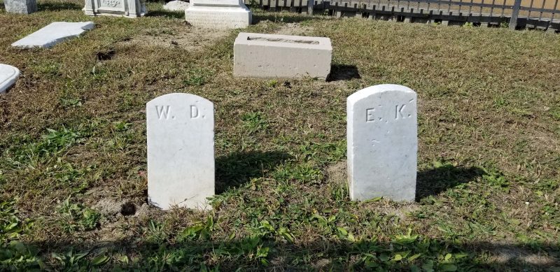
These two markers were the epitome of simple.
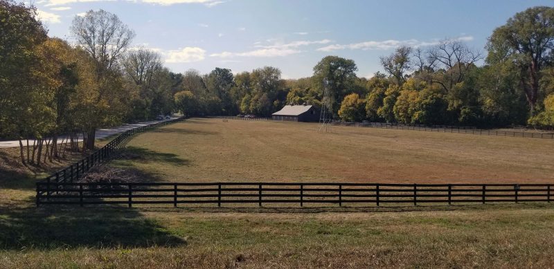
We joined the levee trail near the middle of its length. Eventually, the trail will make a ring around 1,200+ acres and we’ll be able to bike in a circle. For now, we biked along the arm to the right, then back to cover the other arm, and then back to the Katy trailhead in the center. At one end of the levee trail, we saw a scenic barn and windmill. The windmill is on the right side of the barn. It doesn’t show well from this angle.
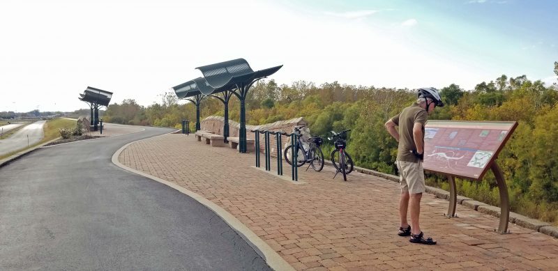
About halfway down the other arm we stopped at a rest stop. It looks like it’s supposed to provide some shade, but it didn’t. The high temperature today was 87 degrees, so a little shade would have been nice.
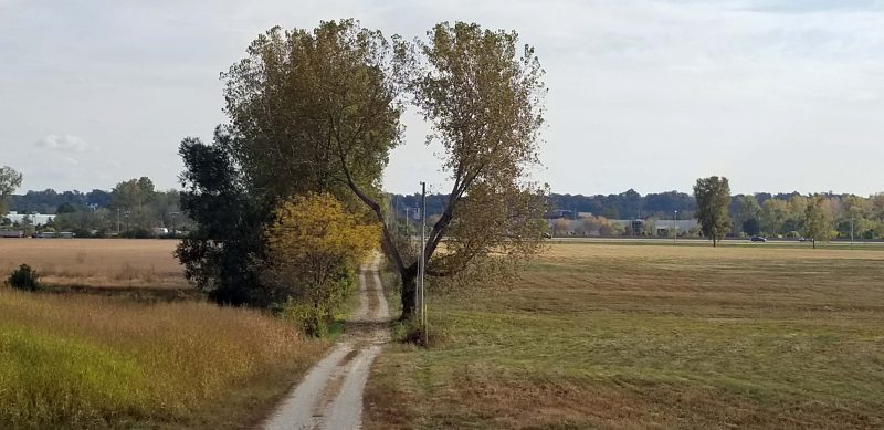
When I saw this tree, I couldn’t help thinking that it’s begging for someone to kick a ball through it and yell “Score!”
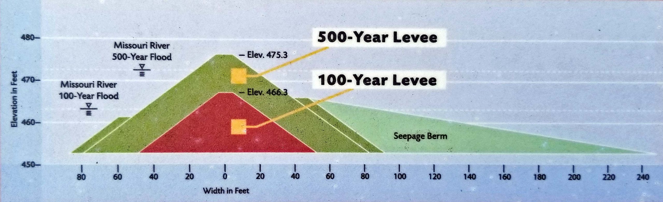
This bike ride was a bit of a “remember when” ride. The Monarch Levee was one of 1,000 levees that failed during the Great Flood of 1993. Its failure resulted in 15-20 feet of water covering the Chesterfield Valley and making US 40 (now I-64) impassable through the Valley for months. Note: At one point in 1993, Missouri was “a state divided.” The Missouri River runs across the state and every bridge crossing was flooded except the I-70 bridge in St. Louis County and a bridge in Kansas City. It was literally impossible to cross the Missouri River to travel north and south across the entire state except near the Kansas and Illinois state lines.
After 1993, the original 100-year levee was replaced with the 500-year levee we biked on today. After the Great Flood of 1993, the City of Chesterfield offered a tax incentive that made the Chesterfield Valley a mecca for retail. This idea has become a model for other cities to develop floodplains. I assume all those retailers hope to make enough money between now and the next levee failure to cover their future losses.
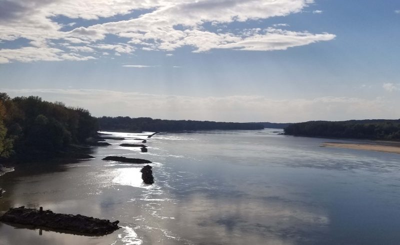
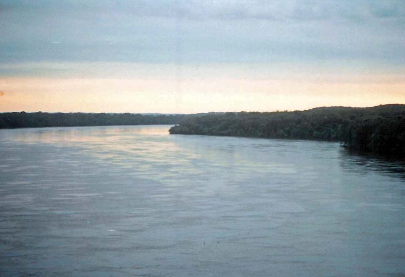
Just for fun, I looked up some of our 110 mm Instamatic 1993 pictures to compare them with our bike ride today. Here are two views of the Missouri River from the I-64 bridge. One was taken today, after weeks of very little rain; the other was taken in 1993 during the flood. See if you can tell which is which. Ted and I remember looking down from the bridge deck in 1993 and being amazed at how rapidly and powerfully the water was flowing and how much large debris it carried.
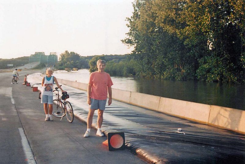
Today, Ted and I rode our bikes across the Missouri River in the bike lane on the bridge, safely protected from the eight traffic lanes crossing the river. In the summer of 1993, it wasn’t a problem crossing the bridge on the roadway because the highway was closed. The dry road surface ended in St. Louis County shortly after crossing the bridge. That’s Ted on his bike and Kari bravely standing in the middle of the highway, excited about the lack of traffic.
We biked across the bridge several times in 1993. It was a kind of tourist attraction for bikers and walkers. The commuter parking lot on the St. Charles County (western) side of the bridge was filled with cars equipped with bicycle carriers. The river in flood and the extent of the floodwaters were amazing sights. Also, it was just fun to bike on a closed / empty highway across a major river. The photo below shows how far we could go on the eastern side of the bridge. Notice the barriers trying to keep the water off the available roadway.
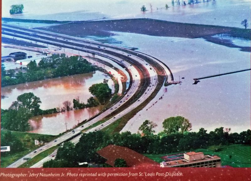
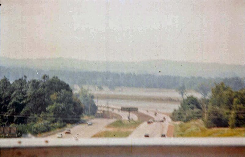
The photos below were taken from the eastern side of the Chesterfield Valley. Both pictures were taken after the floodwaters receded far enough to open US 40 (now I-64). Picture 15-20 feet of floodwater covering the highway. The upper photo was taken by a newspaper photographer from a helicopter; the lower one was taken by me from the side of the roadway.
Like other sightseers, Ted and I drove across the Valley when the highway opened to gawk at the floodwaters and the damage. Unfortunately, only a few hours after the highway was opened and only a few minutes after I took my photo, MODOT began putting barriers across the entrance ramp to the highway because the water was rising again. Ted and I had to take the long way home over I-70 instead. The highway remained closed for several more weeks.
Thankfully, we didn’t have any drama like that today–just one more enjoyable bike ride.